


Top 4 Highest Mountains in Honduras

Honduras is a South American nation in Central America. Guatemala, El Salvador, Nicaragua, the Pacific Ocean, and the Caribbean Sea around the nation. Honduras ... read more...has a total of 2098 named mountains. The mountain ranges dominate much of Honduras, with tiny lowlands bordering the beaches. La Mosquitia, a completely undeveloped rainforest rich in biodiversity, is located in the northeastern area. Honduras' lowlands have a tropical climate, although higher elevations are frequently regarded as moderate. Cerro Las Minas, at 9,347 feet, is the tallest and most visible peak. Below is an article that summarizes information about the top 4 highest mountains in Honduras
-
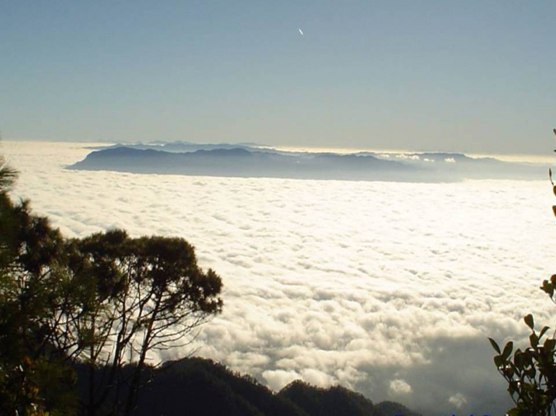
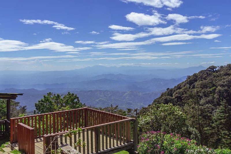
Cerro Las Minas is Honduras' tallest peak. Cerro Las Minas is situated in the rocky and extremely secluded Lempira Department in the country's west. The Celaque National Park in Honduras was established in 1987 to protect the mountain and the surrounding 266 square kilometers (65,730 acres).
The Celaque National Park covers 66,700 acres (270 km2) and has elevations ranging from 1,000 to 2,849 meters above sea level. Celaque's terrain is quite rough. Two-thirds of the region has a slope higher than 60 degrees. The Park is classed as a cloud forest, with a mean precipitation of 1600 mm at lower elevations and 2400 mm at higher elevations. To the locals, "Celaque" translates to "box of water." Celaque's nine rivers provide water to 120 nearby settlements, including the district center of Gracias. Celaque has high biodiversity and is home to jaguars, pumas, ocelots, and the endangered Bolitoglossa Celaque, which can only be found in the Celaque mountains.
Height: 2849 m
Location: Lempira Department, Honduras
travelagenciesfinder.com 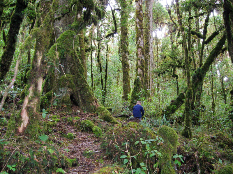
travelagenciesfinder.com -
The Santa Bárbara Mountain National Park (PANAMOSAB) is located in the same department, northwest of Lake Yojoa and 13 kilometers east of Santa Bárbara. With a height of 2,744 meters above sea level, PANAMOSAB is Honduras' second tallest peak after Celaque. Furthermore, it is Central America's biggest limestone hill. It is also the primary source of water for Lake Yojoa; it is foggy most of the year and receives around 3000 mm of rain, making it one of the wettest locations in the nation.
This mountain is a protected natural area with an average of 70 fern species, 90 orchid species, and more than half of the country's bird species. PANAMOSAB is an excellent location for bird viewing. Because the topography of PANAMOSAB is rocky and rich in natural resources, there are several kinds of animals and plants that are peculiar to the area, including multiple species of lizards, several of which are vulnerable or endangered.
Height: 2744 m
Location: northwest of Lake Yojoa and 13 kilometers east of the city of Santa Bárbara.
travelagenciesfinder.com 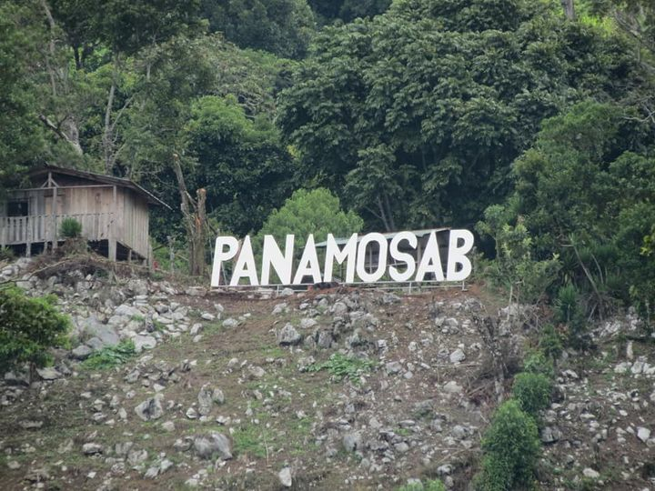
travelagenciesfinder.com -
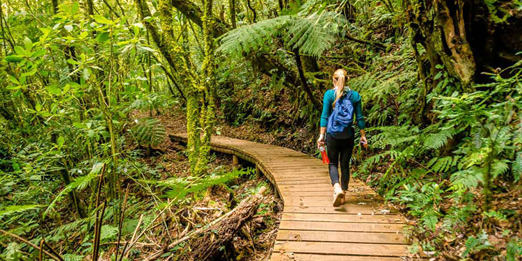
Cerro El Pital is a high mountain peak on El Salvador's border with Honduras. The road to the peak is completely unpaved and is located within the Reserva Biologica El Pital. It is one of El Salvador's most popular tourist destinations, having tremendous biodiversity throughout a large altitudinal range and numerous endangered species of flora and wildlife. The cloud forest is home to some of the country's rarest vegetation and wildlife, including quetzals and other endangered species.
Cerro Pital is stunning and pleasant. There are redheads and even people with blue eyes since centuries of Spaniards were secluded here, and it is so charming to see freckles in the center of the El Salvadort highlands, and the people are very nice and modest. The spectacular natural beauty that makes Cerro Pital one of the most beautiful sites in the world is, nevertheless, the most awe-inspiring aspect.
Height: 2730 m
Location: the border of El Salvador and Honduras
elsalvador.com 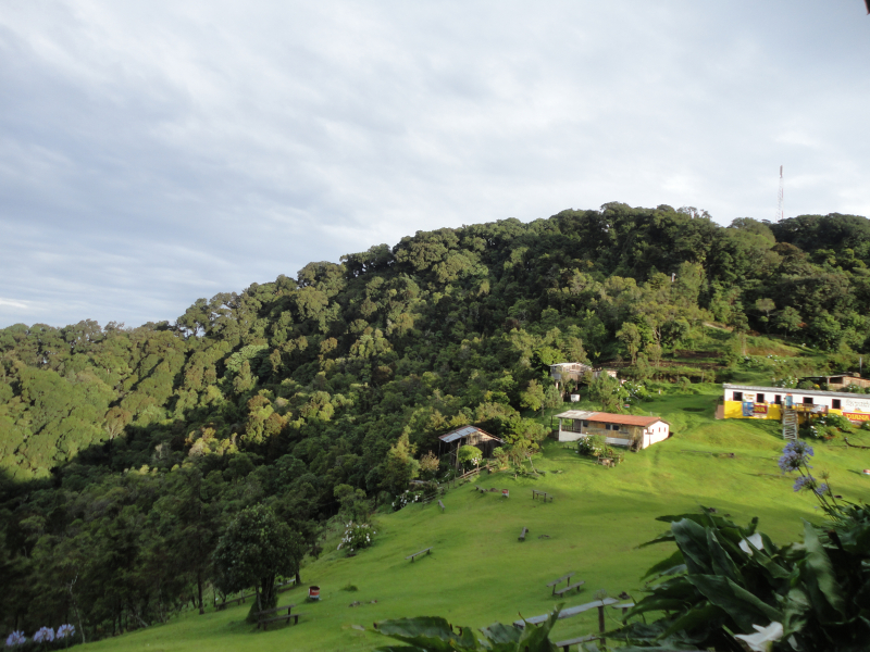
elsalvador.com -
Pico Bonito is a peak in the municipality of El Porvenir, near the seaside city of La Ceiba in Honduras. It is located inside the Mesoamerican Biological Corridor. The Pico Bonito National Park Foundation (FUPNAPIB), a non-profit non-governmental organization founded as a legal body in 1993 by National Congress Law 192-93, is in charge of managing this protected territory. There is now a co-management agreement in place between the State Forest Administration (AFE-COHDEFOR) and FUPNAPIB, which formalizes the latter organization's work. This region is particularly popular for birding, rafting, kayaking, and hiking, and several tour companies provide transportation, excursions, and hotels.
The territory of the park ranges from a few meters above sea level to 2480 m, therefore, Pico Bonito is located in several natural areas, which vary depending on the altitude. The Aguan Valley is overgrown with a humid tropical forest, montane forest (called cloud) grows taller, and on the other side of the park, trees and shrubs typical of dry forests grow. grow in a drier area.
Height: 2450 m
Location: Pico Bonito, Honduras
tripadvisor.com 
tripadvisor.com


