Top 4 Longest River In Zambia

Zambia is a landlocked country located at the crossroads of Central, Southern, and East Africa, though it is more commonly referred to as South-Central Africa. ... read more...Zambia is one of Africa's most water-rich countries, with three major rivers, several significant tributaries, and numerous minor rivers, as well as extensive natural lakes and the massive Kariba dam. In this article, Toplist introduces you to the 4 longest rivers in Zambia
-
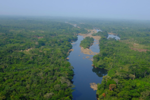
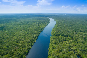
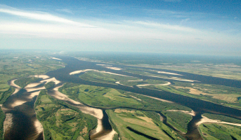
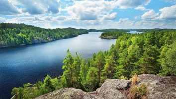
With a flow of 1,500,000 cubic feet of water per second, the Congo River (previously known as the Zaire River) is the longest river in Zambia and the world's second most voluminous river. It is Africa's second-longest river, after the Nile, and the world's ninth-longest river, draining a basin of over 4 million square kilometers (1.5 million square miles), or 13% of Africa's landmass.
The river is perhaps most known for its historical significance. The river and surrounding jungle have long been regarded to be the mysterious country of pygmies, mythological monsters, horrific epidemics, and cannibals, dubbed "the heart of darkness" by Joseph Conrad. It's a territory made famous by Stanley and Livingstone's explorations, and notorious for its cruelty and bloodshed in the past: the days of the Arab slave and ivory trade, its lengthy history of tribal warfare, colonial atrocities, and its tumultuous current.
Though it begins innocently enough in the savannas just south of Lake Tanganyika, the river is as stormy as its past. The river gradually widens and speeds up until it reaches the "Gates of Hell," a 75-mile canyon of impenetrable rapids. The river resurfaces as the Lualaba or Upper Congo, surrounded by rich tropical rainforest. The river crosses the equator twice throughout its passage through the rainforest. The Congo's catchment drains both the Northern and Southern Hemispheres, hence it does not experience the seasonal changes in water levels as other large rivers do. Stanley Falls, a 60-mile series of rapids, marks the end of the Upper Congo.
Length: 4700 Km
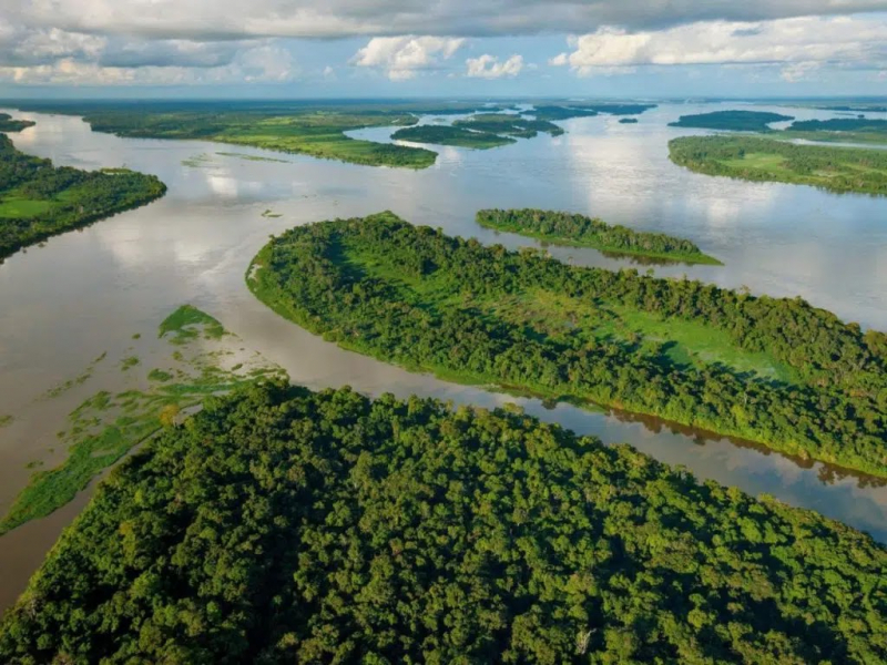
Photo: Tourcounsel 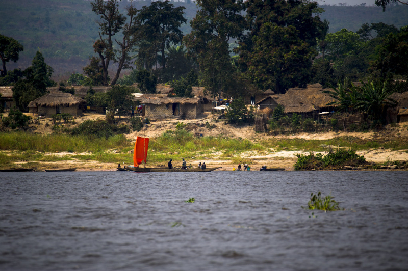
Photo: Flickr -
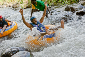
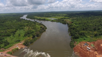
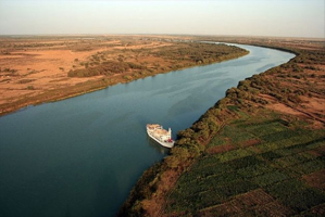
The Zambezi is Africa's fourth-longest river, the continent's longest east-flowing river, and the continent's largest river flowing into the Indian Ocean.
It forms the border between Zambia and Zimbabwe for roughly 500 kilometers, thundering over the Victoria Falls and through the tight, deepening Batoka Gorge, giving a magnificent playground for white-water rafting, kayaking, river boarding, and jet boating.
Its special importance comes from the fact that it is less developed in terms of human habitation than other rivers, and many places along its banks have even been designated as protected areas. On the Zambian side, the Lower Zambezi National Park, and on the Zimbabwean side, Mana Pools National Park, flank the river. This section of the Zambezi River sustains one of Africa's most important wilderness areas, since it supports a varied range of animal, birds, and fish species.
Many of the river's calmer stretches are home to hippos, Nile crocodiles, and monitor lizards. Birds such as herons, pelicans, egrets, and African fish eagles can be found in huge numbers. Many huge species, like as buffalo, zebra, giraffe, and elephant, can be found in the riverine woods.
Several hundred fish species live in the Zambezi, some of which are indigenous to the river. Cichlids, which are frequently fished for food, as well as catfish, tigerfish, yellowfish, and other large species, are all important species. The bull shark is sometimes known as the Zambezi shark from the river it lives in, but it may be found all over the world.
The river ends its voyage through Mozambique and out towards the Indian Ocean, having given power, food, and transportation for countless people, as well as a habitat for untold numbers of wildlife.
Length: 3540 Km
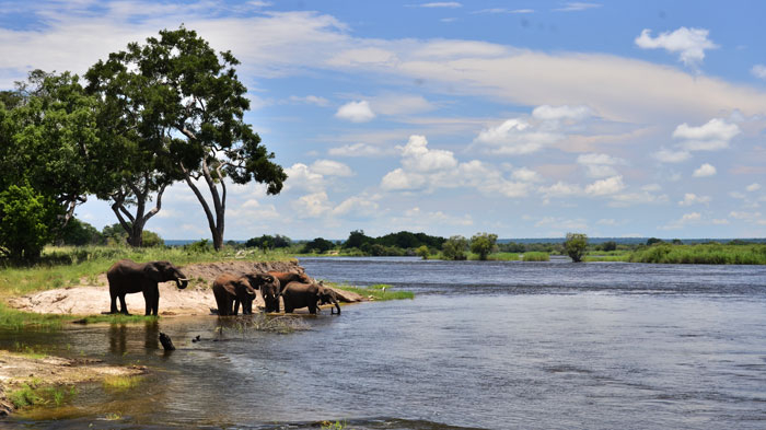
Photo: Victoriafalls-guide 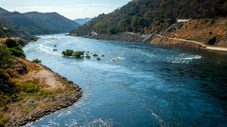
Photo: Worldbank -
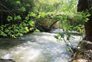
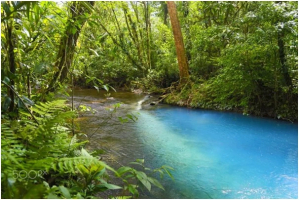
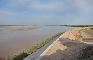
The Kafue River supports one of the world's most diverse wildlife ecosystems. It is a significant tributary of the Zambezi, and it is the most central and urban of Zambia's major rivers, as well as the longest (approximately 960 km) and it is in 1st the longest rivers in Zambia. The Kafue River rises about 1350 meters above sea level on a relatively flat plateau immediately south of Zambia's border with the Democratic Republic of Congo, 120 kilometers north-west of Chingola in the Copperbelt Province.
The river begins as a trickle from the swampy dambos (the Munyanshi Swamp is a tributary) and, with little slope to speed up river flow, meanders sluggishly south-eastwards, acquiring the character of a mature river within 50 kilometers. cean. During the rainy season, the area receives about 1200 mm of rain, and the river's channel soon reaches 100 meters wide, with a floodplain of fluvial dambos 1-2 kilometers wide. However, before reaching the Copperbelt towns, the river loses its large floodplain, the channel narrows to 30-40 meters, and the river meanders less, ending up in a small valley only 40 meters below the surrounding plateau. It passes through the fringes of Nchanga and Kitwe, as well as the Copperbelt settlements of Chililabombwe, Chingola, and Mufulira.
The Hippo Pool, a famous picnic location north of Chingola, has been designated as a national monument. Water is diverted from the river in the Copperbelt to irrigate small farms and market gardens. It shifts course to the south-west near Kitwe, flowing through woods and flat rock areas, which it floods in the wet season, but keeps to a 50-meter-wide channel in the dry season. In a swampy floodplain with oxbow lakes and lagoons, it subsequently builds intricate meanders and a maze of channels. It flows 20 kilometers west of the Lukanga Swamp's permanent section, which fills a circular depression and drains into the Kafue through a channel.
Length: 960 Km
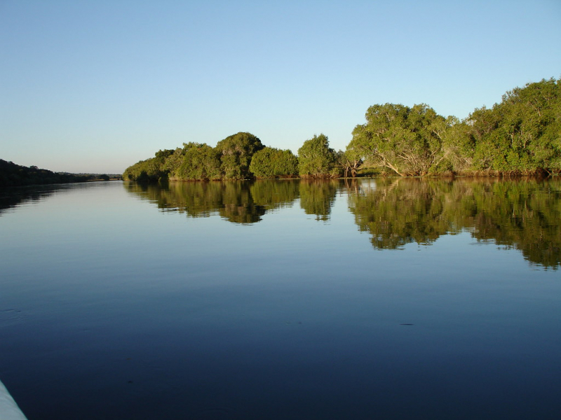
Photo: Flickr 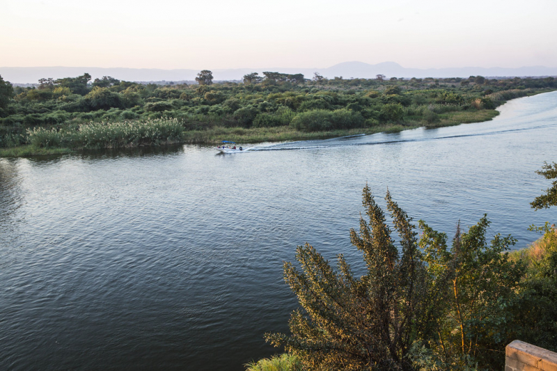
Photo: Flickr -
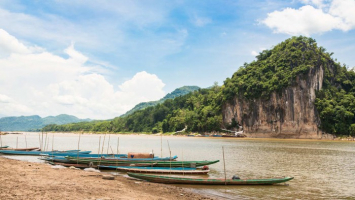
The Luangwa Valley is one of Africa's most important wildlife sanctuaries, having world-renowned concentrations and diversity of game and fauna. With herds of antelope sheltering under thorn trees or wandering the plains, predators lurking in the shadows, and primeval drama in every valley, this is the panorama of the 'Real Africa.'The 'Valley' is located at the end of the Great Rift Valley, a geological rift that stretches from the Red Sea to East Africa's coast. This explains East Africa's stunning escarpment beauty as well as the African Lakes.
When the Rift reaches Zambia, it splits into two arms: one to the east contains Lake Malawi, while the other to the west becomes the Luangwa Valley, which runs over 700 kilometers and has an average width of roughly 100 kilometers.
The Muchinga Mountain range marks the western boundary of both the Valley and the parks. A comparable, though less well defined, escarpment can be found to the east. The valley floor is nearly a thousand meters lower than the plateau above it.
The Luangwa River runs through the valley's heart, fed by dozens of sand rivers that wash down during the wet season. When in flood, the Luangwa carves a complex path down the floor, eroding the outer bends and depositing silt within the loops. The river eventually takes a new path, allowing the old one to silt up and generate 'ox bow' lagoons. These lagoons are vital to the riverine zone's ecology and contribute to the area's high carrying capacity.
The environment is breathtaking in its rugged grandeur, with thick vegetation and a beautiful riverine forest that is green all year near the Luangwa River and its many tributaries. The North and South Luangwa National Parks flank the river's western banks, divided by the 30km Munyamadzi corridor. Between the two main parks, to the east, lies another small and underdeveloped park called Luambe. The Lukusuzi National Park, located east of the floodplain on the rocky uplands, is also undeveloped, but plans are in the works.
Length: 770 Km
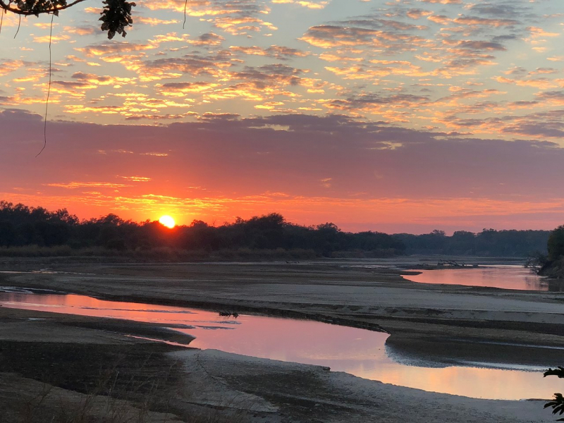
Photo: Tripadvisor 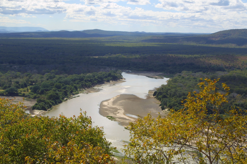
Photo: Wikipedia