Top 6 Most Famous Border Walls
Although border walls have existed since antiquity, they have attracted particular attention in the twenty-first century due to a sharp rise in their ... read more...prevalence. In the twenty-first century, some walls were constructed to denote national sovereignty and others to prevent unanticipated riots or illegal immigration. However, the majority of old walls were constructed for security, to avert conflict, or to defend one's nation. The walls now serve as monuments to the valiant pasts of several peoples. Here is a list of some famous border walls in the global for you.
-
Ur-Nammu built the Sumerian empire, which Shulgi thereafter solidified. In general, the empire was divided into Sumer and Akkad, Elam, Subartu, and Amurru. Shulgi's son Amar-Sin ascended to the throne in 2046 BC, and he ruled for eight years while enjoying divine favors. Elam and Akkad both acknowledged the importance of ancient culture and religion, which served as the foundation for the Sumerian era of rule.
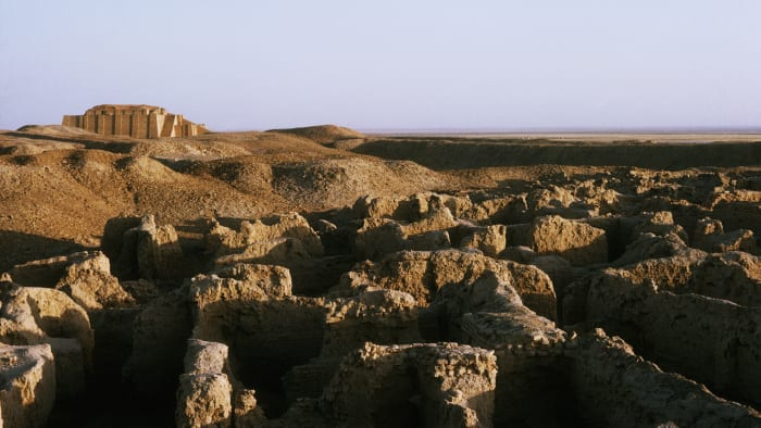
The world's oldest civilization is also one of the earliest to have constructed a protective wall. The Amorites, a group of nomadic tribesmen who had been invading Mesopotamia, were kept out by the gigantic, fortified barrier built by the ancient Sumerian kings Shulgi and Shu-Sin during the 21st century B.C. In what is now Iraq, the "Amorite Wall" is thought to have covered a distance of more than 100 miles between the Tigris and Euphrates Rivers. Although it may have been the first substantial rampart to be constructed outside of a city, the Sumerians were only able to repel their foes for a short period of time.
By the time of Shu-successor, Sin's Ibbi-Sin, hostile invaders had either breached the wall or were moving around it, and Sumer was under siege from both the Amorites and the nearby Elamites. Around 2000 B.C., the city of Ur was destroyed, and the Sumerian civilization started to disappear.
Source: History 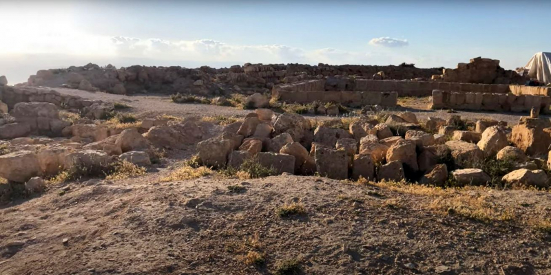
Source: History -
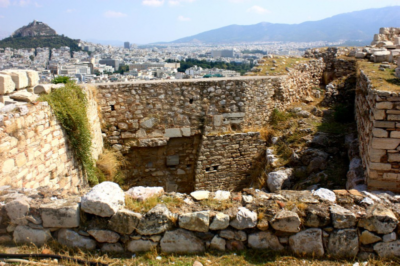
One significant military weakness hampered Athens, one of the most potent cities in ancient Greece, which was located around four miles from the sea. The Long Walls that the Athenians built in the fifth century to connect their town and harbor were three in number, according to the long-held and still widely accepted theory. These Long Walls consisted of two outer walls that extended to the northern and southern sections of the harbor fortifications, respectively, and an intermediate wall that ran longitudinally in the space between the outer pair.
This theory is supported by evidence that initially seems to be quite compelling. In support of his claim, Harpocration cites a passage from Aristophanes in which three walls are also referenced. These three walls are known as the Northern, the Southern or Middle, and the Phaleric one, respectively. A passage from Thucydides that makes reference to a Phaleric wall and then to "Long Walls," which are likely to be the Northern and Southern walls of Harpocration, seems to imply the same number of walls, making a total of three walls.
When finished, these "Long Walls" formed a triangle of land that was impregnable to siege and enabled the city to readily restock from the sea, which was also watched over by the powerful Athenian navy. During the Peloponnesian War with Sparta and her allies, the fortifications made Athens virtually impregnable; yet the city was ultimately compelled to submit after its navy was routed at sea. The infamous Long Walls are allegedly destroyed by the triumphant Spartans while flute girls play joyous music in the background. The walls were later restored, though, and they stood until the Roman general Sulla destroyed them in 86 B.C.
Source: Archaeology 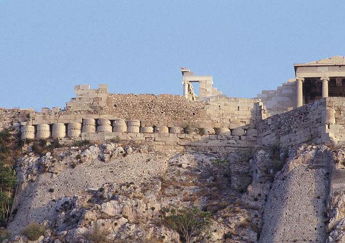
Source: Archaeology -
The Great Wall of Gorgan, located in the Golestan Province of northern Iran, was constructed between 420 and 530 AD and remained in use until the 7th century. During this time, the Sassanian dynasty of the Persian Empire fought a number of conflicts near its northern boundary, first against the Hephthalites or White Huns and afterwards the Turks. There are 38 forts lining the over 200 km long Great Wall of Gorgan. It might even connect to the Tammisheh Wall, a more compact defense structure with an eerily similar pattern. Both walls used substantial burnt bricks that had the same size and form, were bordered with earth banks and ditches that were fed by canals, contained batteries of nearly identical brick kilns, were fortified similarly, and extended from the Alborz Mountains to the Caspian Sea. The Gorgan and Tammisheh Walls, along with the accompanying forts, undoubtedly made up the same defensive structure, whether or not they were components of a unified barrier.
Canals had to be drilled along the defensive barrier's path in order to facilitate construction projects and supply the water required for brick production. Water for these canals came from supply canals that crossed the Gorgan River via qanats. The Gorgan Wall's and the associated canal's need to follow a natural gradient is proof of the hydraulic engineers' extraordinary abilities. The presence of standardized-design barracks across the forts suggests that the Sassanian army was well-organized. The Gorgan Wall and the related ancient military structures are a singular testament to the Sassanian Empire's military organization and architectural prowess. They said in explaining the Empire's geographic range from Mesopotamia to the west of the Indian Subcontinent as well as how successful border defense aided the Empire's internal wealth and long life. These structures have global relevance due to their size, historical significance, and sophistication.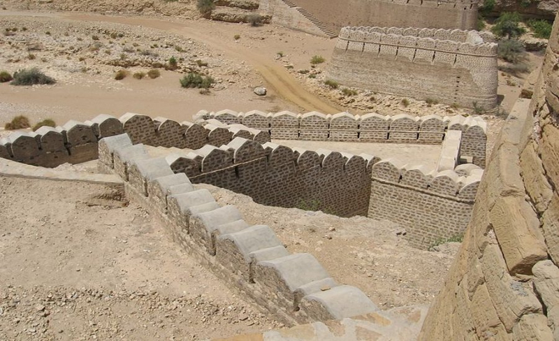
Source: ancientpages.com 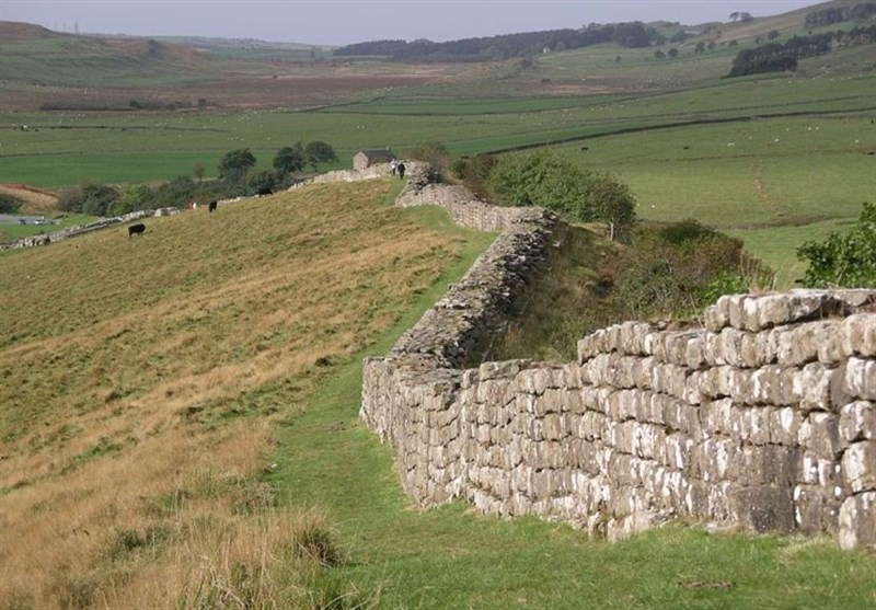
Source: ancientpages.com -
Sections of older defenses were brought together in 220 B.C. under Qin Shi Huang to create a unified defense structure against incursions from the north. The Great Wall was still being built when the Ming dynasty (1368–1644) came into power, making it the biggest military edifice in the world. Only its architectural significance rivals its historical and tactical relevance.
The Great Wall, which has a total length of more than 20,000 kilometers, was continually constructed on the northern frontier of the nation from the third century BC to the seventeenth century AD as the major military defense project of succeeding Chinese Empires. The Great Wall starts at Shanhaiguan, Hebei province, in the east, and finishes in Jiayuguan, Gansu province, in the west. Its basic structure is made up of fortifications and passes along the Wall, as well as walls, horse trails, watchtowers, and shelters on the wall.
The Great Wall in ancient China is a reflection of interactions and clashes between agrarian and nomadic civilizations. It gives major physical proof of the powerful military might and national defense capabilities of the central empires of ancient China. It is also a remarkable example of the exceptional military architecture, technology, and art of the time. As the nation's emblem for maintaining the safety of the state and its citizens, it has unrivaled significance.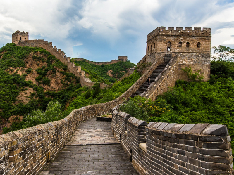
Source: 10adventures.com 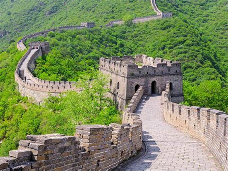
Source: 10adventures.com -
Since Constantine the Great established Constantinople as the new capital of the Roman Empire, the city has been surrounded and guarded by a series of defensive stone walls known as The Walls of Constantinople. Today, Istanbul is located in Turkey. They were the final great fortification system of antiquity and one of the most intricate and complicated systems ever constructed, having undergone multiple expansions and adjustments throughout its history.
The fortifications that initially protected the fledgling city from attack from both land and sea were constructed by Constantine the Great. The famed double line of the Theodosian Walls was constructed in the fifth century as the city expanded. Even though the other parts of the walls were less ornate, they were nearly impregnable to any besieger from the Middle Ages when well-manned. During sieges by the Avar-Sassanian coalition, Arabs, Rus', and Bulgars, among others, they rescued the city and the Byzantine Empire with it. The defences became susceptible with the introduction of gunpowder siege guns, but the walls could be repaired in between reloads and cannon technology was not advanced enough to conquer the city on its own. After a two-month siege, the city finally surrendered on May 29, 1453, under the weight of the Ottoman soldiers' overwhelming numbers.
The walls were mostly kept intact for most of the Ottoman period, but as the city grew beyond its medieval boundaries in the 19th century, some sections started to be torn down. Many portions of the walls survived and are still standing today despite the lack of upkeep. Since the 1980s, a significant restoration initiative has been under progress.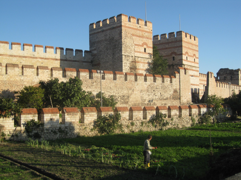
Source: istanbul.com 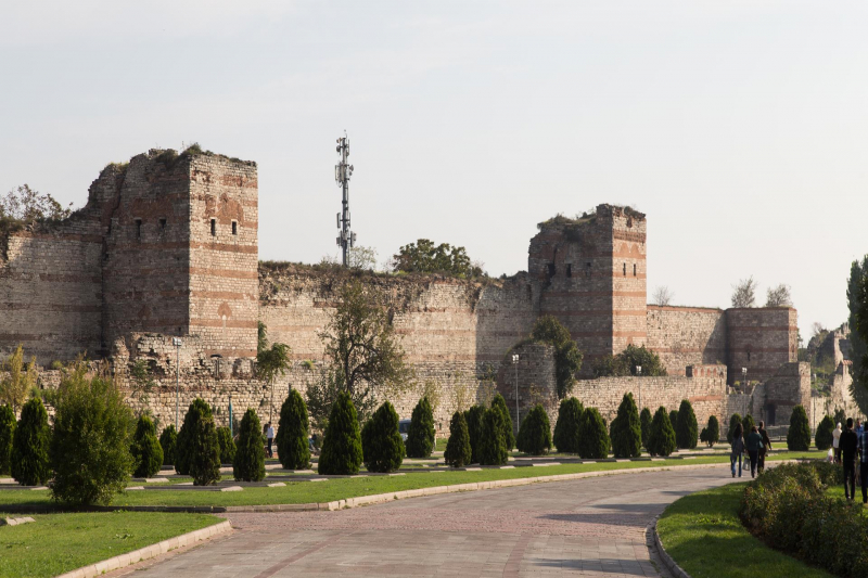
Source: istanbul.com -
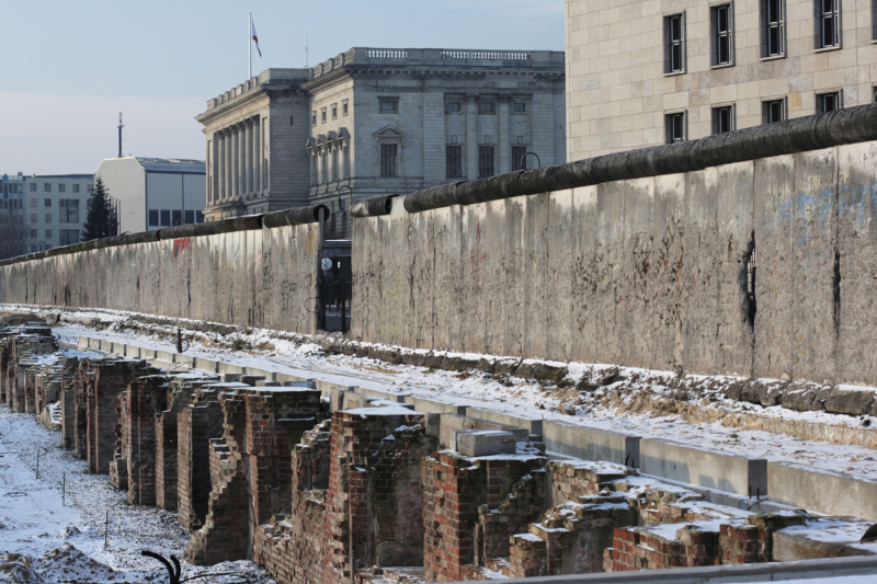
For almost 30 years, Berlin was a divided city, with a wall cutting through the center of the city. East and West Berlin were separated by the Berlin Wall from 13 August 1961 until 9 November 1989. There are still remnants of the Wall, its memorial sites, and its relics scattered around the city today. These include the East Side Gallery, the Berlin Wall Memorial in Bernauer Strasse, the Berlin-Hohenschönhausen Memorial, a former Stasi detention facility, and the lush Mauerpark. However, the Berlin Wall's remnants can also be seen in less accessible locations like Berlin-Spandau, Berlin-Reinickendorf, or the Cathedral Cemetery.
Even a second row of cobblestones along some Berlin streets designates the path of the Berlin Wall. A fantastic method to ride your bike along the Wall's path is to use the Berlin Wall Cycle Route. The path traverses the city in a manner similar to that of the Berlin Wall. The full cycle path extends over 160 kilometers around West Berlin following the former GDR border.
Source: alumni.northeastern.edu 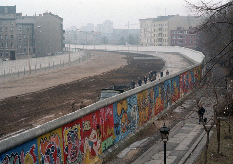
Source: alumni.northeastern.edu


