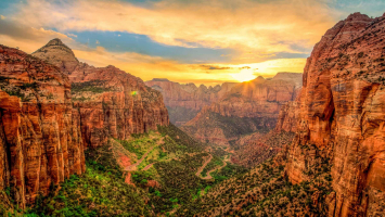
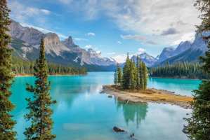
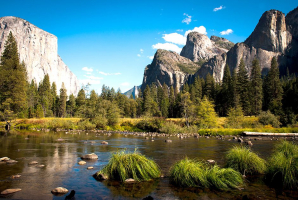
Top 15 Best National Parks in Europe

Europe is home to some of the world's most charismatic and cultured cities. However, the continent is endowed with an exceptional variety of natural landscapes ... read more...that draw visitors from all over the world. Many of these sites have become national parks, preserving their beauty for everyone to explore and enjoy, from the glacier-carved fjords of Norway to the sun-baked gorges of Greece. Let's discover the best national parks in Europe.
-
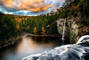
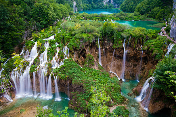
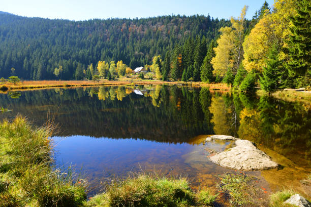
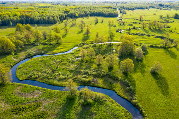
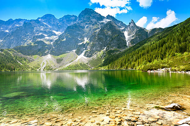
Plitvice Lakes National Park is Croatia's most well-known national park, and it is on the UNESCO World Heritage List. It is a popular tourist site all year and a must-see for any Croatian visitor. It is well-known for its system of cascading lakes, which connects sixteen beautiful lakes by cascades and waterfalls. The park is really stunning. The primary attraction of the park is its sixteen lakes, which are separated into two sections - Gornja jezera (Upper Lakes) and Donja Jezera (Lower Lakes), as well as numerous waterfalls and cascades.
Located in Lika and bounded by the mountains Mala Kapela, Medveak, and Gornja Pljeevica, the National Park covers an area of just under 30 thousand hectares (about 300 square kilometers), including forests (14 thousand hectares), water, meadows, pastures, and scattered hamlets (Rastovaa, Poljanak, Jezerce, and Plitvica). It is home to eleven different forest ecosystems, including beech, fir, spruce, and pine species. Bears, wolves, otters, wild boars, skunks, squirrels, rabbits, foxes, and other bird species may also be found in the park. Plitvice Lakes National Park was established in April 1949, recognizing the area to be of great natural beauty. That was Croatia's first National Park. Later on, in 1979, Plitvice was put by UNESCO on the of World's cultural and natural inheritance.
Worldpackers has 34 fantastic hosts in Croatia, all of them are located in the country's most gorgeous settings. Most destinations are within a 4-hour drive of the Plitvice Lakes. The nearest volunteering opportunity to the lakes is in the little village of Vojnic, where you may take part in an intriguing permaculture project and demonstrate your farming, gardening, or cooking abilities. You can reach the famed national park in less than an hour from here, making it ideal for a day trip!
Location: Lika-Senj County, Karlovac County, Croatia
istockphoto 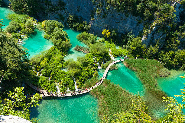
istockphoto -
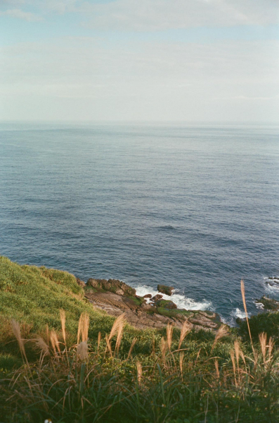
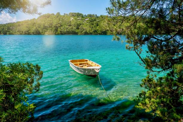
One of Croatia's most stunning national parks is located on the island of Mljet in the country's south. Mljet National Park will provide you with landscapes that will stay with you for the rest of your life. It is ideal for individuals looking for a one-of-a-kind experience. The National Park covers over a third of the island's surface, spanning 5400 hectares and incorporating a marine region 500 meters off the shore. It has a particularly rich flora and wildlife, but it also has a significant cultural past, with countless archeological treasures that will please history buffs.
The National Park contains one of the best-preserved forests of its type in the Mediterranean (90% of the island is covered in forest), as well as several indigenous flora and fauna species protected by law. Many different varieties of snakes are reported on Dalmatian islands, however snakes on Mljet have declined since the introduction of the little Asian mongoose in 1910. On November 11, 1960, the Northwestern portion of the island of Mljet was named a national park, making it the Mediterranean's oldest maritime protected area.
Veliko and Malo Jezero (Large and Small Lake) are two saltwater lakes that spread for more than 4 kilometers. Both lakes are surrounded by shady trails where you may stroll or ride while taking in the breathtaking environment. Sv. Marija (The Isle of Saint Mary) is a tiny island in the center of the large lake that is home to an old 12th-century Benedictine monastery that has been converted into a restaurant. Boats sailing from both sides of the large lake may easily reach the little island. Electrical trains may also be used to explore the region around the two lakes, which is perfect for families with children.
The park may be reached through two villages: Polae and Pomena. Although there is no official entry, these are the locations where tickets, brochures, and maps can be obtained. Pomena is only a 10-minute walk from Malo Jezero and a 20-minute walk from Mali most (a little bridge from which you can take a boat to Sv. Marija islet). Polae is around 45 minutes' walk from Malo jezero. Although automobiles are not permitted in the park, you may rent a car and drive about the island that is not part of the National Park.
Location: Road 120, Mljet Island 20226, Croatia
istockphoto 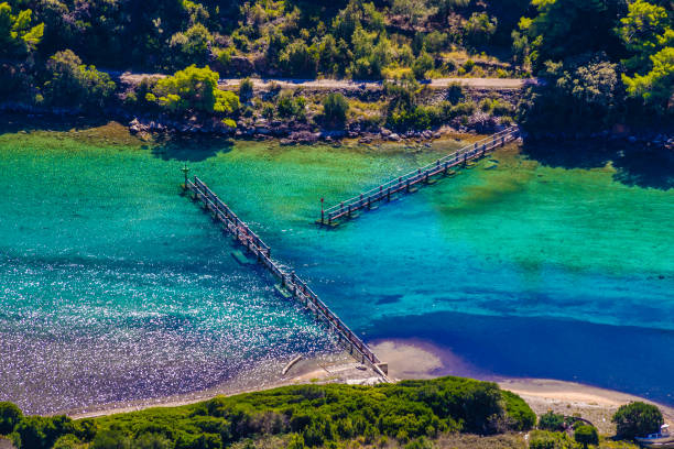
istockphoto -
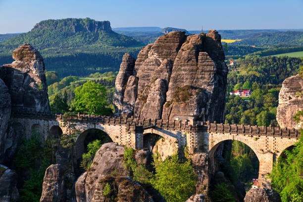
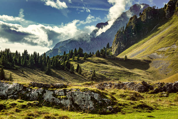
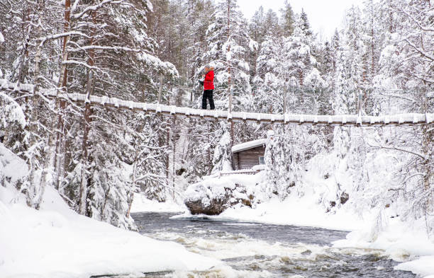
If you wish to go trekking in the European highlands, Germany may be a terrific place to visit. Saxon Switzerland is a great hiking and climbing paradise, as well as one of Europe's best national parks. The Elbe Sandstone Mountains' strange rock formations have their own unique appeal that is just waiting to be found. "Bastei" is the most well-known rock feature in Saxon Switzerland. From its vantage point, you may experience a one-of-a-kind panorama with views of several landmarks such as the Lilienstein and the Königstein. Another attraction is the 76-meter-long bridge that passes through the beautiful rocks and provides a spectacular view of the mountains.
The park contains a diverse range of ecosystems, including steep ravines, flowery and grassy meadows, moors, plateau mountaintops, and an abundance of woods. In comparison to much of Europe, the national park has portions of the forest that are devoid of human interaction. The city in stone is one of the park's centerpieces. Sandstone cliffs, mesas, gorges, and spires combine to form a "city" of stone. There are now 250 miles (400 km) of hiking trails and 31 miles (49.9 km) of cycling paths. The possibilities for climbing are nearly limitless.
This magnificent national park is easily accessible by rail from Dresden. To get to Saxon Switzerland, you may also take a bike excursion along the Elbe Cycle Path. Did you know that Dresden is a fantastic destination to stay since it has so much to offer visitors? There are intriguing ancient buildings, a wealth of history, thrilling museums, dynamic culture, and a thriving party scene. Worldpackers works with wonderful hosts in Dresden who are eager to meet you. For example, you may assist paint a hostel or labor at the reception desk in exchange for free lodging and a rental bike to explore Saxon Switzerland on your own.
Location: Sächsische Schweiz-Osterzgebirge, Saxony, Germany
istockphoto 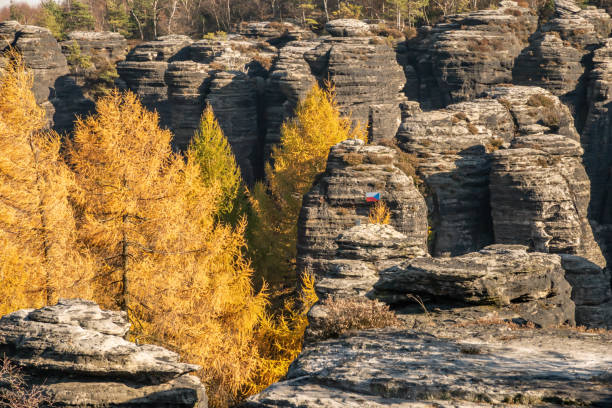
istockphoto -
The Bavarian Forest National Park, also known as Bayerischer Wald in German, is located on Germany's southeastern border with the Czech Republic. The protected forest joins the Sumava National Park in the Czech Republic to form Central Europe's biggest protected continuous forest. The Bavarian Forest on the German side is 93.50 square miles (242.2 square kilometers) in size and was created as Germany's first national park. Spruce trees, European silver fir, European beech, Norway spruce, mixed mountain forest, highland forests, and water meadow spruce woods make up the forest.
The national park is situated between the Danube River and the Bohemian Forest in the hills. The scenery is mostly composed of small granite and gneiss hills that are covered and surrounded by lush vegetation. The Bavarian Forest national park has three important peaks, the tallest of which is GroBer Rachel at 4,767 feet (1,453 m). Lusen at 4,505 feet (1,373 m) and GroBer Falkenstein at 4,281 feet (1,305 m) are the other two summits. Popular creatures in the Bavarian Forest National Park include the lynx, bear, and wolf, who are the forest's principal predators. Deer, European bison, beaver, and otters are among the other mammalian species.
On 320 kilometers of well-marked hiking routes, you can experience unspoiled nature firsthand. The Great Arber and the Great Rachel are two of the region's most popular summit climbs. Frauenau is a tiny village located practically immediately in the Bavarian Forest. In the winter, you may assist locals on their tiny farm and care for small hedgehogs at the hedgehog rescue center. This is the ideal location for reconnecting with nature.
Location: Webseiten des National parks, Freyunger Straße, 294481 Grafenau, Germany
istockphoto 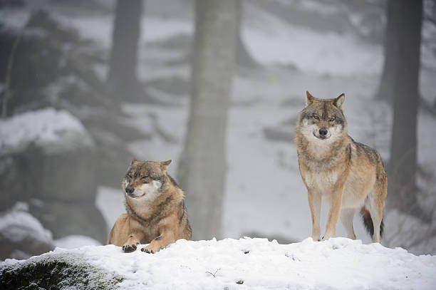
istockphoto -
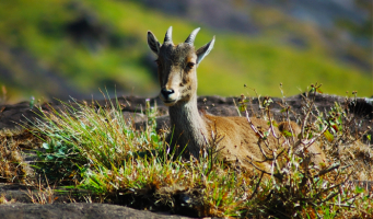
The Swiss National Park in the Engadine is all about nature. All of this is available in an area of more than 170 square kilometers. Everyone can have a pleasant time thanks to the 80 kilometers of hiking pathways, natural trails, and excursion locations for children and families. The Swiss National Park, established in 1914, is the Alps' oldest. In the interest of nature protection - tourists are not permitted to leave the hiking pathways - you may view ibexes, chamois, marmots, bearded vultures, and golden eagles in the wild, as well as a plethora of other wild creatures.
The visitors' center in Zernez features an interactive display on the National Park, as well as temporary seasonal exhibitions on nature-themed subjects, an information desk, and a shop. You may immerse yourself in the wildness of the National Park by participating in one of the many tours available. Excursions for children and families allow even the youngest children to discover our surroundings via play, with the Champlönch children's trail, which can be used in connection with the GPS-enabled iWebpark software, being particularly popular.
Humans are essentially passive spectators in the Swiss National Park, making the spectacle all the more spectacular! Only once in recent history has Homo sapiens acted actively: 105 years ago, when nature enthusiasts established the first national park in Central Europe, a watershed moment in conservation history. Today, this spectacular reserve in Switzerland's easternmost corner, with its 100 km of pathways and nature trails, provides visitors of all ages with the opportunity to watch true wildness in action.
Location: Engadin, Switzerland
istockphoto 
istockphoto -
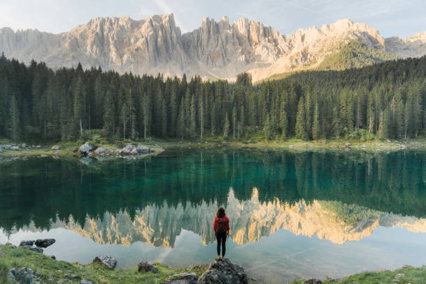
The Belluno Dolomites National Park, which stretches from the Cismon valley to the Piave valley, was established in 1990 to protect this zone of tremendous natural importance, which has long been recognized for the beauty of its distinct flora and fauna. As a result, the decision was made to safeguard its 32000 hectares of "outstanding natural scenery" from winter sport development (hotels, ski-lifts, etc).
The region is currently a world-class national historic site were nature reigns supreme. The great variety of the environment impresses one the most, owing to its 'inaccessible' location on the boundaries of the south-eastern Alps, which saw the creation of glaciers in prehistoric times (the last disappearing over 10000 years ago). The park includes sections of middle and high-range mountains, including the summits of the Schiarà, Sass de Mura, Pavone, and Pizzn. Aside from its natural beauty, the area is blessed with a rich and diversified culture: the little towns facing the Piave valley (Feltrino and Bellunese) differ from those in the Val di Zoldo, which have dramatically different features.
There are significant differences between the Tre Cime di Lavaredo and the Bellunese Dolomites, which are known as the "pale mountains" due to the color of the rockface. Invigorating plateaux and perilous rockfaces are the haunts of golden eagles, birds practically legendary for their elegance, noble and magnificent flying through the heavens, and species rarity. The highest and most difficult to reach zones, of course, enthrone the most desired natural environs, yet the valley bottom and other regions accessible to non-expert climbers nevertheless present a magnificent landscape rich in streams and flora. Summer is the greatest season to visit, when their floors are abundantly carpeted with flowers.Location: Province of Belluno, Veneto, Italy
istockphoto 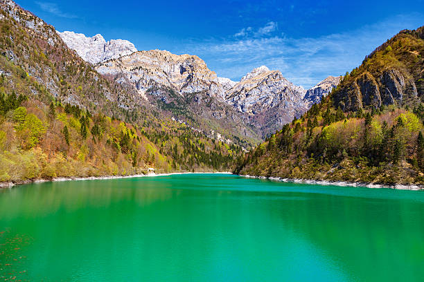
istockphoto -
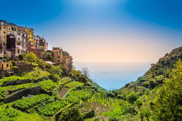
Cinque Terre National Park, also known as Parco Nazionale delle Cinque Terre, is located in the province of La Spezia in northern Italy. It is Italy's smallest national park, with only 14.9 square miles (38.6 sq km). This UNESCO World Heritage Site is unusual as a national park due to its small population of roughly 5,000 permanent people. Corniglia, Manarola, Monterosso al Mare, Riomaggiore, and Vernazza are among the towns where the residence may be located.
The park is also unusual in that it combines together agricultural, cultural, historical, natural, and visual value under the banner of Cinque Terre National Park. With how these cities are carefully integrated into the steep edges of the cliff, one might say that it also reflects vision and innovation. Each of these five communities is linked by pathways that go along the seashore. These pathways allow access to the diverse vegetation that occurs, which includes Aleppo pine, corks, chestnut, samphire, rosemary, thyme, lavender, and a variety of succulents. The fauna of Cinque Terre National Park is not well recognized, yet it is present. The peregrine falcon and seagull are two birds to keep an eye out for, and if you're lucky, you could also encounter weasels, badgers, foxes, martens, and wild boars.
If you wish to tour the Cinque Terre region, you may stay at a farm in Pisa (just one hour away). On your days off, look after truffle trees, olive trees, and walnut trees, and tour lovely Italy! Check out the comprehensive Italy travel guide for more information on additional Italian national parks and Italy's most beautiful spots in general.
Location: Discovolo Street, 19017 Riomaggiore, La Spezia, Italy
istockphoto 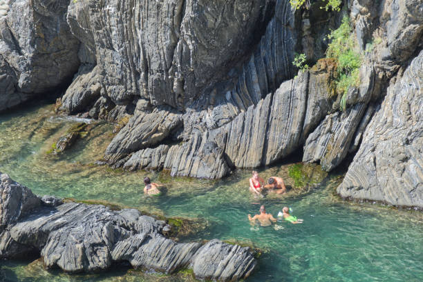
istockphoto -
Peneda-Geres National Park is a national treasure in northern Portugal that many tourists are unaware of. It is a meeting spot of nature and modern tourism. Peneda-Geres National Park, a UNESCO Biosphere Reserve, contains about 700 km2 of protected terrain with scenic mountain routes, river beaches, and ancient communities like as Geres. The Peneda-Geres National Park is divided by four mountain ranges: the Peneda, Geres, Amarela, and Soajo. Peneda-Geres National Park has a lot to offer every type of tourist, from bathing in the lagoons among the mountain ranges to exploring some of the greatest hiking paths in the country and eating the native cuisine. Make sure to pack comfortable hiking shoes and dress in layers with a bathing suit at hand, you never know when you’ll find a beautiful waterfall!
The Peneda-Gerês National Park is located in the country's far north, close to Spain. Porto is a fantastic site to start your journey because it is just one hour from here to the natural reserve, which was established in 1971. There are around 15 different treks ranging from moderate to tough. The biosphere reserve is a must-see for nature enthusiasts since there is so much to see: forests of meter-high ferns, breathtaking waterfalls, charming river valleys, and little mountain settlements. You could even see deer or mountain goats if you're lucky. In Porto, Worldpackers has 8 hosts ranging from local guesthouses to surf hostels. Here you can help out for a few hours a day and have a great time in Peneda Gerês National Park on your days off.
Location: Vilar da Veiga 4845, Portugal
istockphoto 
istockphoto -
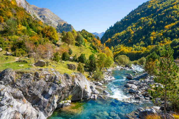
Another excellent national park in Europe is the Ordesa National Park. It is located in the Pyrenees, in the Aragón area of northern Spain. Since 1997, the national park and the mountain massif Monte Perdido have been designated as UNESCO World Natural Heritage sites, and the ecosystems that coexist in the Pyrenees' oldest national park could not be more diverse: barren rock formations, deep ravines, green valleys, dense forests, and colorful flora and fauna. The 3,355-metre-high Monte Perdido is the highlight, with a demanding but rewarding ascent.
Aficionados of high mountains will enjoy a unique national park in Spain to the north of Huesca, in the Aragonese Pyrenees: Ordesa and Monte Perdido. It unfolds like a scenario from a movie, with four valleys (Aisclo, Escueta, Ordesa, and Picuan) and one summit, Monte Perdido, where diverse ecosystems coexist. A natural wonderland with meadows, massive woods, amazing canyons, glaciers, eternal snow, and a unique karstic terrain built over thousands of years.
There are many hosts in northern Spain that would appreciate your assistance. Volunteer at a quaint Tarragona hostel, as a vegan cook in Manresa, on an organic farm in Artieda, or as an English instructor for children in Navarra. You may easily take a day trip to Ordesa on your day off.
Location: Pyrenees of Huesca, Spain
istockphoto 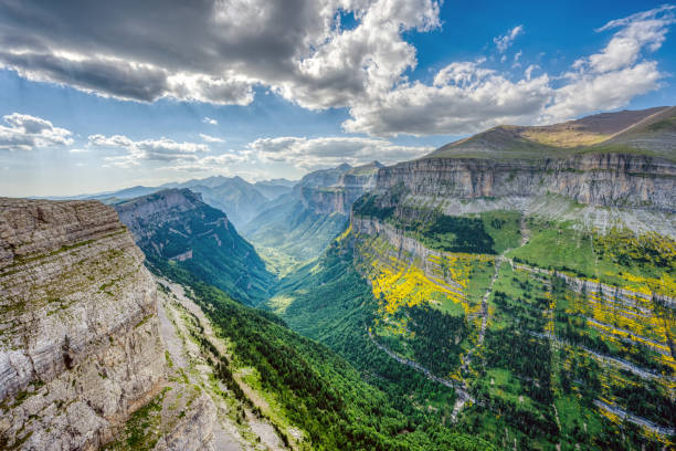
istockphoto -
Finland's unspoiled wildness and beauty may be felt high up in northern Europe. The country has 40 national parks in total, with Oulanka Park being one of the most remarkable. The hiking trails range in length from half a kilometer to 82 kilometers. They go through gently flowing water and dramatically roaring waterfalls, and the variation fascinates every hiker. You may also explore the beautiful scenery by boat, white-water rafting, or mountain biking.
The force of water may be seen in the rough scenery of the Karhunkierros Trail. The varied route alternatives and hanging bridges of Oulanka National Park will lead you to some of Finland's most stunning waterfalls. Even experienced wildlife photographers will be challenged by the leaps of wild brown trout, dives of European dippers, the endless splendor of the aapa mires, and the exquisite calypso. The enormous wilderness of the Paanajärvi National Park may be located on the Russian side of the border, proving that nature knows no state boundaries.
The national park is little over two hours away from Rovaniemi, the capital of Lapland. Rovaniemi is not just the final metropolitan area before the Arctic tundra takes over, but it is also Santa Claus' official hometown. Worldpackers allows you to work at a tiny travel business in town and immerse yourself in a world you never knew existed.
Location: Liikasenvaarantie 157, 93900 Kuusamo, Finland
istockphoto 
istockphoto -
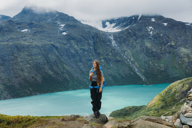
Norway is another country with a large number of national parks, with 37 in total. The national park Jotunheimen, located near Oslo and Bergen, is home to the country's highest peaks and is unquestionably one of the greatest national parks in Europe. The entire area is crisscrossed by towering mountains and massive glaciers, making the visitor feel quite tiny. Words cannot express how stunning the view is.
Jotunheimen presents nature at its best, with over 250 mountains reaching about 2000 meters in elevation, including the 2469-meter-high Galdhpiggen. Hike, ride a bike, climb, or ski. Listen to waterfalls and flow with rivers. Camp wild and free, spend the night sleeping within the park's wooden huts, cabins, and lodges, or build a fire in a suite at Herangtunet, a boutique hotel near the Besseggen at Gjendesheim. Walking across the famed Besseggen ridge with Beitostlen nearby, you can touch the sky at the Home of the Giants.
Fly with eagles from the powerful Galdhpiggen, or simply rest on your back in the lush meadows of this natural gem surrounded by charming Lom, the green hills of Gudbrandsdalen, medieval Valdres, the waters of the Sognefjord, and the everlasting ice of the Jostedalsbreen glacier. So, observe and be observed by the plentiful animals. Experience Europe's wildest nature's freedom, beauty, Zen, and mysticism. Come meet the seasons and listen to the pounding heart of Norway at Jotunheimen. The heart of Norway, Jotunheimen National Park, beats between Oslo, Bergen, and Trondheim.
Location: Vågå, 2680 Jotunheimen, Norway
istockphoto 
istockphoto -
The Soomaa National Park is a wetland region in the counties of Pärnu and Viljandi. Visitors may be most familiar with Soomaa for its great flood, or the so-called fifth season, in which water from melted snow or strong rainfall floods the lower woods, roads, and even yards. If you're driving from Pärnu to Soomaa, make a stop at the mysterious Tori Hell. Stop at the ancient Riisa Study Trail on your way to the Soomaa National Park Visitor Centre, which is accessible to both explorers in wheelchairs and hikers with baby prams.
Visitors to Soomaa can participate in normal, canoe, and snowshoe treks; beavers are a common subject for wildlife viewing trips. The Beaver Trail, which begins at the Soomaa National Park Visitor Centre, is wheelchair and baby pram accessible. Soomaa, commonly regarded as the capital of Estonian primeval environment, has five significant wetlands. Traditional land cultivation has transformed the meandering river's banks into a variety of river flood-meadows and woodland meadows. Soomaa is part of the European wilderness network because of these undisturbed places. Soomaa is a sanctuary for both little and large birds and animals. Elk, deer, wild boar, lynx, wolf, and bear live in these woodlands, while beavers create aquatic landscapes.
Soomaa is home to grouse and golden eagles; mash borders are capercaillies' playgrounds, while vast mash fields are filled with the cooing of black grouses. More humid woodlands are home to woodpeckers and a variety of owls. Charadriiformes, great snipe, and corncrake live in flood-meadows. Soomaa's human population history extends back to the Stone Age. The traditional aspen logboat, the creation of which may be learnt in Soomaa, reflects the historic and attractive essence of this location. The Soomaa National Park is part of the PAN Parks network of protected areas dedicated to the preservation of wildness.
Location: Viljandi, Estonia
istockphoto 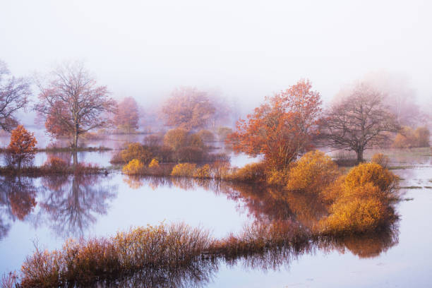
istockphoto -
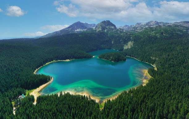
The Park is located in a broad mountain region in the northwestern portion of Montenegro, encircled by rivers Piva and Tara, and has 23 peak summits that rise over 2300 meters. The park spans 39000 acres and contains 82 kilometers of Tara Canyon at an elevation of 1600 meters above river level.
Durmitor's area is the most significant component of the Dinara Mountain range, with high peaks, dense forests, and deep canyons. The Canyon of Tara is Europe's biggest, with approximately 1500 species of vegetation and 130 species of birds. The Park has 17 glacial lakes and Bobotov kuk, Montenegro's highest peak (2522 m). There are eight historic monuments in the neighborhood of Abljak due to a significant conflict that occurred in WWII. Other historic sites and monuments may be found in the Park's southern and northern sections. Although not completed, archeological investigation is revealing Mesolithic era evidence.
Montenegro is renowned as the "Pearl of the Balkans" and is a popular tourist destination. Nonetheless, the country is still a hidden gem among European locations, and there are currently several Worldpackers volunteer opportunities. You could wish to look into volunteer opportunities in Tivat, Polje, Ulcinj, Podgorica, and Ljesevici, which are all approximately 2-3 hours away from the reserve.
Location: Dinaric Alps, Montenegro
istockphoto 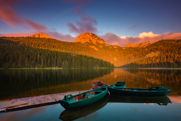
istockphoto -
It is a modest national park by European standards, with a total size of 211,000 square kilometers. Despite this, its Alpine flair and lush terrain attract a record number of tourists each year - between 2.5 and 3 million. Endangered animal species found in the park include the Tatra chamois, marmot, bear, lynx, wildcat, and wolf. The Tatra National Park lies in southern Poland's Maopolska Province and borders the Slovakian Tatra National Park. In 1993, both of these rare places were designated as UNESCO biosphere reserves.
The cable train atop Kasprowy Wierch, built in 1936, is one of the most popular tourist attractions in the Tatra Mountains. It is Poland's oldest such structure and the world's 60th. Its topmost station is located near to Poland's tallest meteorological observatory (1987 meters mamsl). Rysy, at 2499 meters above sea level, is the highest peak on the Polish side of the Tatra Mountains and Poland's highest summit. Zakopane, located at the foothills of the Tatra Mountains, has a diverse choice of accommodation options as well as an exceptional skiing infrastructure.
Here you can find not only the highest mountain in Poland, the Rysy, but also other rocky peaks and sapphire blue mountain lakes. The little town of Zakopane is an excellent starting point for trips to the Tatra Mountains, and it is consequently very popular with Poles. With Worldpackers, you may have a real experience in Zakopane while learning about Polish landscapes and culture.
Location: Tatra Mountains, Tatra County, Lesser Poland Voivodeship, Poland
istockphoto 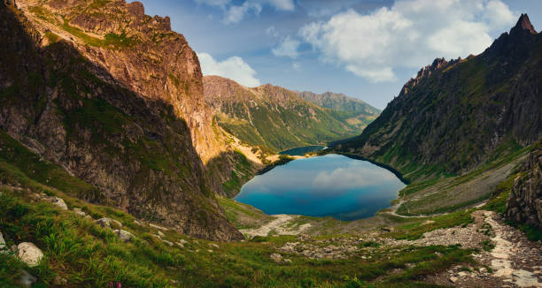
istockphoto -
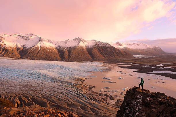
Vatnajökull National Park in Iceland is one of the top national parks in Europe and should not be ignored on our list. You will enjoy visiting this nature reserve, which resembles a collection of all of Iceland's natural treasures and enchants tourists with outstanding panoramic, geological, and botanical sensations. This European national park gets its name from its massive glacier, Vatnajökull, which means "water glacier" in Icelandic. Despite the fact that a substantial portion of the national park is beneath the icecap of the glacier Vatnajökull, its landscapes are diversified, owing mostly to the interaction of volcanic activity and glacier.
Few other sites on the planet display the influence of such a diverse variety of natural events as Vatnajökull, which was formed by the combined forces of rivers, glacial ice, volcanic and geothermal activity. With the exception of the Mrdalsjökull glacier, nothing in Iceland receives more precipitation or has more water drain to the sea than the south side of Vatnajökull. In fact, so much water is presently stored in Vatnajökull that it would take almost 200 years for the Icelandic River with the largest flow, lfusá, to transport this amount of water to the sea.
Many towering, spectacular mountain ridges line the south side of Vatnajökull, with outlet glaciers sliding between them into the lowlands. The glacier's southernmost reaches encircle the central volcano Raefajökull and Iceland's tallest mountain, Hvannadalshnkur. The verdant oasis of Skaftafell, sheltered by high glaciers, overlooks the black sands deposited to the west by the river Skeiará. These sands are largely made up of ash from the numerous eruptions of Grmsvötn volcano, which is carried to the shore by glacial floods or jökulhlaups.
Location: Skutustaðahreppur, Nordhurland Eystra, Iceland
istockphoto 
istockphoto