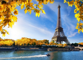
Top 12 Best Hiking Destinations in Europe

The finest treks in Europe are those that showcase the continent's incredible natural beauty. It might refer to anything from mountain treks to beach strolls. ... read more...Europe is made up of over 40 countries, each with its unique culture, topography, and natural beauty. There are ten main mountain ranges in Europe, which, combined with the 100 smaller mountain ranges, account for over 20% of the continent's landmass. There are a lot of mountains and hikes to select from. Now, let's find out the best hiking destinations in Europe.
-
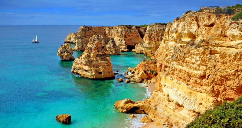
Lagoa is without a doubt the most beautiful municipality in the Algarve. The Chapel of Senhora da Rocha, the beach of Cova Redonda and the beach of Carvoeiro, both named the most beautiful beaches in Europe, the fishing town of Ferragudo, the lighthouse of Alfanzina, the cliffs of Marinha, the Albandeira beach, and the caves of Benagil are all located in this little corner of paradise. Seven Hanging Valleys Trail is a 7.4-mile lightly frequented out and back trail situated in Armaço de Pêra, Algarve, Portugal, with a waterfall. The route is open all year and is popular for hiking, walking, and nature walks. This trek is stunning, memorable, one of Europe's most beautiful walks, and suitable for people of all ages.
For casual hikers, the trek might begin in Marinha and conclude in Carvoeiro. A breathtaking and unspoiled natural environment greets you. The Lagoa municipality prioritizes environmental stewardship and provides wonderful experiences to visitors from all over the world. The paths and beaches are spotless. You can see the animals and flowers, as well as gorgeous birds and even little bunnies. You may also stop and rest on the many beaches of Lagoa, which are reputed to be among the most beautiful in the world. Bring water, a snack, and sturdy shoes, and depart early in the morning, if possible, to avoid walking during the warmest hours. To visit all of these iconic tourist destinations in Algarve, you may stay in outstanding hotels like as the Vila Vita Parc with its spa and direct beach access; we also recommend staying at Suites Alba Resort & Spa and the cheap vacation village Rocha Brava Village Resort.
Location: Lagoa, Algarve, Portugal
Difficulty level: easy
Duration of the trip: 3-5 hours
istockphoto 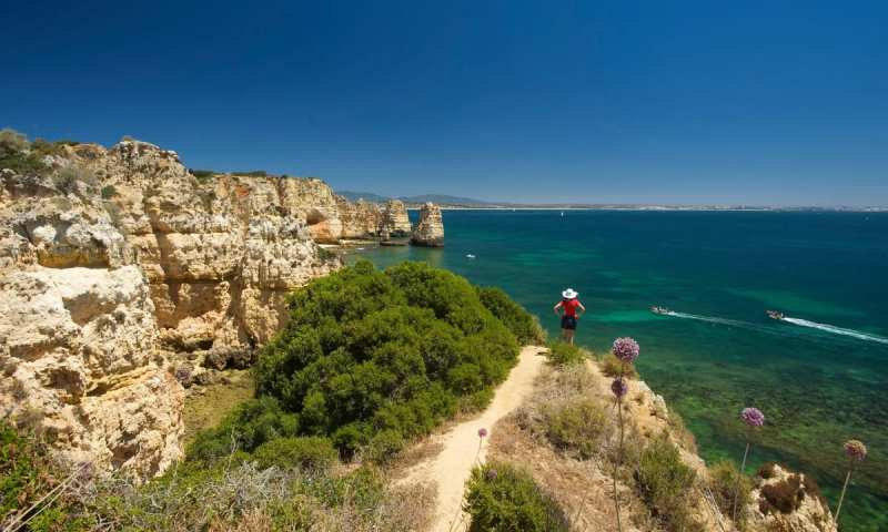
istockphoto -
Walking or trekking around the Plitvice Lakes is simple and well-organized. There are around eight distinct walking/hiking routes that range in length from two and a half to eight hours. The majority of the itineraries include stops at Veliki Slap (Great Waterfall) and Sastavci in the Lower Lakes, and some include a boat ride across Kozjak Lake. Longer routes/path, beginning at Entrance 2, include visits to Upper Lakes and the Veliki Prstavac waterfall, while track K is the longest and covers hiking throughout the entire park. The trails are properly designated, so you won't get lost if you stick to them.
There are also various "you are here" maps/signs along the pathways to double-check that you are on the proper track. It's a good idea to keep to a set path so you know where you are and how far you have to go to get to the next spot. This is especially crucial if you are visiting Park on a day trip and need to return to your transportation at a specific time. Each path is described and mapped below.
The best method to go there is to arrange a ticket to Zadar airport, a hotel in Zadar at the greatest price, and a rental vehicle. The Plitvice Lakes are approximately a 1.5-hour drive from Zadar. Choose your journey after you've arrived. To fully appreciate the grandeur of these sceneries, we recommend hiking this trek in the spring or summer.
Location: Croatia
Level of difficulty: medium
Duration of the trip: 4-5 hours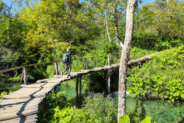
istockphoto 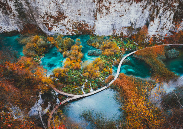
istockphoto -
El Camino del Rey in Malaga, once renowned as the most perilous trek in the world, reopened in 2015 with a new, secure boardwalk anchored along the 100-meter steep cliffside. Anyone who can endure the vertigo that follows along the jaw-dropping trail can now access it. If you plan on going on a hiking date to Camino del Rey, make sure to inform your date if they have vertigo before scheduling so you don't ruin their first date. The stunning Desfiladero de Los Gaitanes canyon is well worth testing your limits. Because the two-hour trip is generally flat, it is suitable for persons of all fitness levels.
Before you may visit El Camino del Rey, you must purchase tickets in advance and provide a printed copy of the ticket to the control cabin. You may either order a general ticket for 10 Euros, which includes admittance and the obligatory helmet, or a guided tour for 18 Euros, which includes the mandatory helmet. English and Spanish are spoken by the guides.
Take the train to El Chorro, where the Camino del Rey route concludes. As you exit the train, buses leave every 30 minutes towards the El Kiosko Restaurant, where you must begin your trek. You may board a train from Malaga's Maria Zambrano train station. You may also take the train from Granada or Seville to Antequera-Santa Ana and then change trains to El Chorro (22 min). It is strongly advised to drive there from anywhere other than Malaga, Antequera, or any station on the Malaga-El Chorro railway line.
El Camino del Rey may be hiked all year, although, if possible, avoid the warmest months of July to mid-September. Despite the fact that much of the trail is in the shade, it may be quite hot, and there are no places to cool down throughout the walk. The remainder of the year provides pleasant strolling temps; simply dress appropriately. Early winter mornings, in particular, can be frigid. When hiking El Camino del Rey, no large backpacks are permitted, therefore a simple day pack with water and layers of clothing will suffice if you travel during the cooler seasons.
Location: Malaga, Spain
Level of difficulty: medium
Duration of the trip: 3-4 hours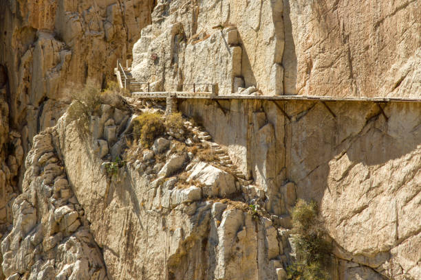
istockphoto 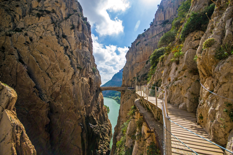
istockphoto -
The Kjeragbolten hike is one of the world's most magnificent hikes. If you're planning a trip to Norway and like hiking, Kjeragbolten should be at the top of your list! Kjeragbolten lies in the south of Norway. Lysebotn, the nearest town, is about 15 minutes away by automobile. You may fly from Oslo to Stavanger and then drive to the start of the Kjeragbolten walk. You may also drive to Lysebotn from Oslo, a 500-kilometer excursion that takes 7.5 hours.
Most people stay in Stavanger to do this climb. Stavanger and the car park are two and a half hours away. It's a beautiful trip, and there's no need to take a ferry along the way. The hike's starting point is ygardstl. There is a vehicle park (for a cost of 300 NOK), restrooms, and a restaurant on site. Enter "Kjerag parking" on Google maps to reach the trailhead. If you don't have a car, you may take a bus from Stavanger to the start of the Kjeragbolten trek (from roughly mid-June through the end of September). It takes 12 hours to travel round trip.
The hike should only be attempted during the summer months, from June 1 to September 30. During the winter, the road is closed owing to snow, making the hike risky. Snow may blanket the roads and trails until the end of May. The Kjeragbolten walk is 12 kilometers long and climbs 570 meters. Allow 6 to 8 hours to complete the round-trip trek. It is feasible to beat the 6-hour time estimate if you are a quick hiker.
Location: Norway
Difficulty level: high
Duration of the trip: 6 hours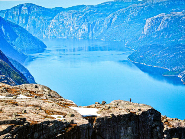
istockphoto 
istockphoto -
The climb from Pico do Arieiro to Pico Ruivo is the most well-known hike on the Portuguese island of Madeira. Hikers will go over small passages, up and down frightening stairs, and into gloomy tube chambers on this tunnel route. It is an adrenaline-fueled endurance challenge with steep inclines that cause considerable quad and calf burning on the walk. If you are willing to take on the task, it will be the highlight of your trip to Madeira.
The hike's entire distance is 11 kilometers round trip (return trip). The trek may be finished in 3-4 hours, depending on how long you take to relax and enjoy the views from the Pico Ruivo top around the halfway point. The over 1000m elevation on the return journey makes this path fairly tough. It is, nevertheless, highly technical, with many steps, uneven surfaces, dark tunnels, and other things that make it a little more difficult. A normal hiker will find it safe and challenging, but nothing out of the ordinary. If it is your first hike in a while, prepare to enter the pain cave.
There are several options for getting to Pico do Arieiro, which serves as the starting point for the Pico do Arieiro to Pico Ruivo trek. The most apparent option is to drive up in your automobile, but don't worry if you don't have one. Your Pico do Arieiro morning fantasy is still alive and well. One of the reasons it is so popular is because it is only 30 minutes by driving from Funchal to the parking lot. The prominent dawn sight is about a 2-minute walk from the parking lot. When the sun rises at 7:30 a.m. in August, you may get out of bed just before seven a.m. and still see the nicest sunrise in Madeira without breaking a sweat!
Location: Portugal
Level of difficulty: medium
Duration of the trip: 5 hours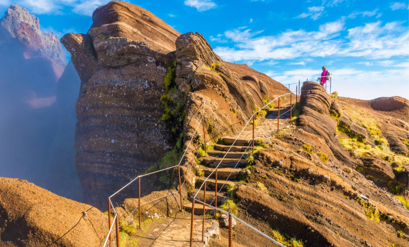
istockphoto 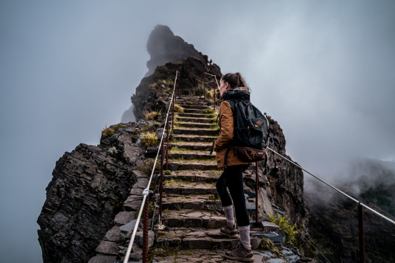
youngwildfree.be -
Besseggen is one of Norway's most renowned mountain walks, with over 30,000 hikers enjoying the stunning view from the ridge each year. The ridge is generally covered in snow and ice throughout the winter, and it is often snow on the ridge until the middle of June. When the boats on Lake Gjende are running, the best time to hike Besseggen is from mid-June to mid-October.
The trek up Besseggen takes six to eight hours, including breaks, and is only suitable for experienced hikers. The ridge is both windy and steep, so if this is your first experience trekking in the Alps, you might want to select an easier route. It is critical to prepare oneself before beginning your mountain trek to have a positive experience. We recommend that you have at least two days available to enhance your chances of good weather.
We recommend that you attend a guided trek if you are unskilled or uncertain about undertaking the excursion. A skilled guide may transform a terrible day into a spectacular one. Every year, hikers activate rescue efforts. To avoid becoming one of them, prepare thoroughly for the trek and attend a guided trip if you are inexperienced. Even though sun and fine weather are forecast, the weather might change fast. Check the weather forecast before you go, and make sure you are prepared for changeable conditions. Hiking should be avoided if the forecast calls for high winds, heavy rain, or fog.
Location: Norway
Level of difficulty: very high
Duration of the trip: 7-9 hours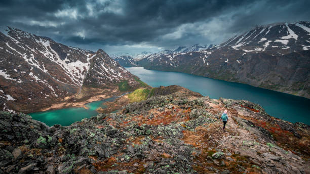
istockphoto 
istockphoto -
The Skye Trail is a well-known but little-traveled trail that runs the length of the ancient Isle of Skye. The 127-kilometer unmarked route traverses the most stunning terrain on the island, from the Trotternish Ridge to the Cuillin mountain range. There are no waymarks throughout the route, and several areas do not even have a trail. However, if you hike the path from north to south in seven days, you will be escorted by an expert guide who is extremely familiar with the terrain.
The Fairy Pools, located at Glenbrittle at the foot of the Black Cuillins, are stunning crystal-clear blue pools on the River Brittle. These well-known pools attract people from all over the world because they provide excellent 'Wild Swimming' for anyone daring enough to enter the frigid water. For the less daring, these lovely Fairy Pools provide for great photo opportunities. The trek to the pools follows the same path both ways. The whole return distance to the first large waterfall and pool is 2.4km, with an average duration of 40 minutes to complete the hike (with no stops). Most visitors will spend some time exploring the many pools as they make their way up the river from the first waterfall.
The Old Man of Storr is perhaps the most renowned and busiest trek on the Island. The 'Old Man' is a massive granite pinnacle that stands tall and can be seen for miles. The Storr, as part of the Trotternish ridge, was formed by a large ancient landside, leaving one of the world's most photographed vistas. The Storr walk follows the same way up and down, beginning and ending at the same location (the carpark). It is 3.8 kilometers long and takes an average of 1 hour 15 minutes to complete (with no stops).
Location: Scotland
Level of difficulty: medium
Duration of the trip: 1-2 hours
istockphoto 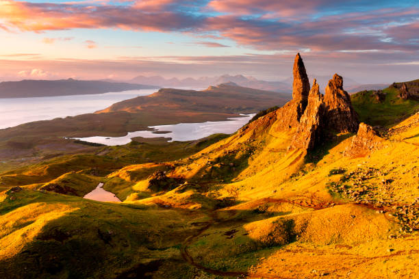
istockphoto -
Slovenian tourism is linked with Lake Bled. Why? Because it's a lovely glacier lake with really tremendous cultural and natural dimensions. Lake Bled, located on the fringes of the Julian Alps, provides an unforgettable family vacation. And, being set in the midst of the natural grandeur of the Alps, it is no surprise that treks and walks are the most natural thing to do when visiting Lake Bled.
From Slovenia's capital, Ljubljana, you may hire a vehicle or take a bus (12 euros) to one of the country's most prominent attractions: Bled Lake. You may add 14 euros to your budget and take a boat ride to the little island in the center of the lake if you like. You'll have to pay an extra 6 euros to enter the church on this little island and ring the happiness bell. It's a tourist trap, but it's entertaining and inexpensive. Otherwise, you may hire a bike in Bled or stroll about and explore the woodlands of this stunning Slovenian resort.
It won't take you long to go to the top of the hill overlooking Bled Island, where you may get a stunning view of this one-of-a-kind site in the globe. Please inquire at the Bled Tourist Information Centre, which is located on the lakeshore adjacent to the Bled Casino. We recommend that you book your hotel in Ljubljana, but you can also book a hotel in Bled for one or two nights at the best price guaranteed. Book your finest Slovenian activities, such as water rafting on the Sava River near Bled.
Location: Slovenia
Difficulty level: easy
Duration of the trip: 1 hour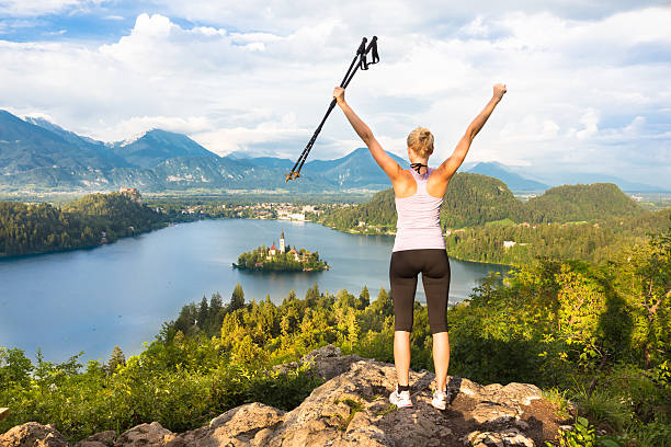
istockphoto 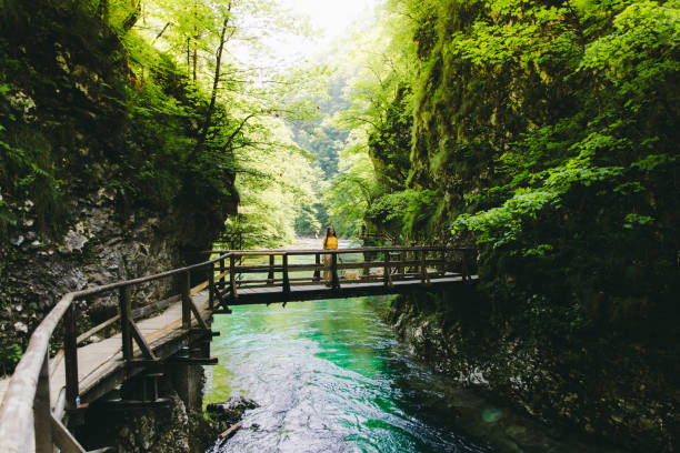
istockphoto -
The GR20 is a stunning long-distance trek that traverses the French island of Corsica. It is regarded as one of Europe's most difficult long-distance paths. The 112-mile (180-kilometer) track runs from north to south across the Mediterranean island, beginning in Calenzana and terminating in Conca. The route is divided into two sections. The rough rocky northern section, which runs from Calenzana to Vizzavona. This stretch will challenge you with frequent steep ascents and plunge descents.
The southern section, which runs from Vizzavona to Conca, is the simpler section of the path, although it is not as beautiful as the northern section. You may tackle any of the two sections or the full climb from Calenzana to Conca. The path may be done in any way; however, it is most commonly done from north to south. It is recommended that you trek northwards to avoid congestion. The path is divided into 16 parts and snakes its way across the hilly core of Corsica's jagged granite spine. Although the landscape is difficult, the pathways are clearly marked with red and white rectangles on rocks, boulders, and trees. Although the path is well-marked, it is nevertheless strongly advised that you use a map to prevent getting lost. The time required to complete the trek varies greatly from hiker to hiker, but on average, hikers should allow 11-16 days.
When arranging your journey, allow for an extra day or two in case of bad weather. You might also want to add a few more days to appreciate the rich culture and history of the many communities, as well as spend time relaxing on the lovely beaches. Along the route, mountain cabins known as refuges provide modest shelter as well as the ability to purchase food and drink. These refuges are typically made up of one huge dormitory that sleeps between 25 and 50 people. You may also be able to sleep in a tent near one of the refuges; this alternative is also somewhat less expensive than sleeping in the actual refuge.
Location: Corsica
Level of difficulty: Extreme
Duration of the trip: 16 days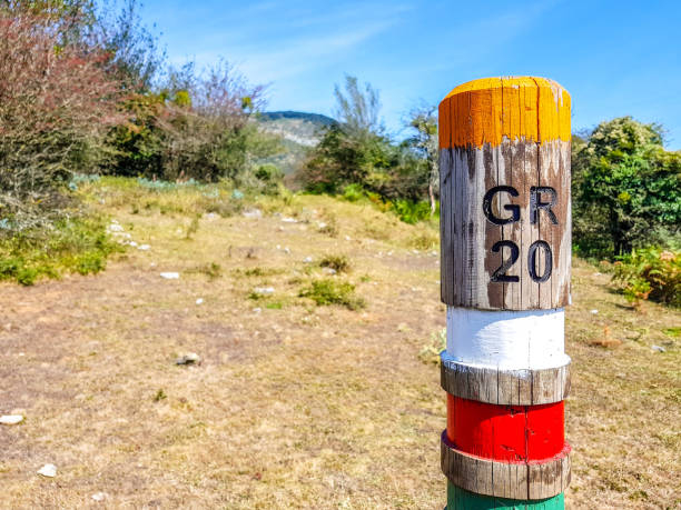
istockphoto 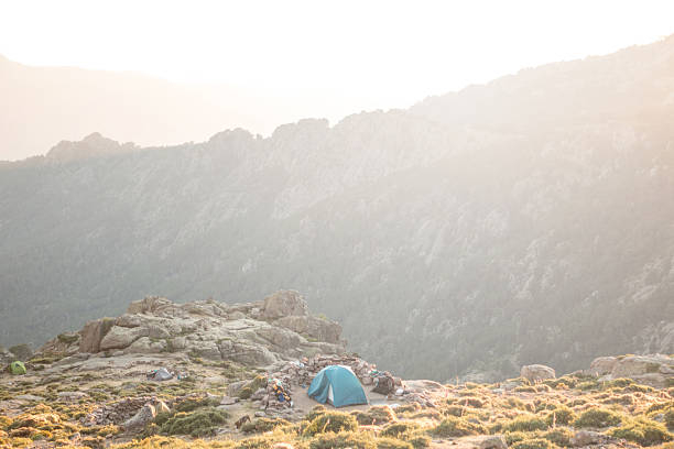
istockphoto -
Three roads make up the Mullerthal trail. The number one path is ideal for individuals who like to walk through forests and farms. The second path is perfect for people who want to view spectacular rock formations, while the third way is ideal for those who want to gaze at lovely castles. You can select your own route or take all three. Hiking into the cracks of the Luxembourg sandstone, through woodlands, sun-drenched valleys, and along little watercourses - the magnificent world along the Mullerthal Trail offers all of these opportunities.
If you enjoy trekking among forests and rock formations, the Mullerthal region is for you. It is also known as "Little Switzerland" since it is located on the border between Luxembourg and Germany. The landscape is distinguished by primeval woodland, wild rock formations covered in various species of moss, meandering roads close to little streams, and gorges through which you may stroll. A beautiful area to spend a few days trekking.
The full Mullerthal walk is 112 kilometers long. These 112 kilometers are separated into three circular paths of 38, 37, and 37 kilometers in length. Remember that everyone's speed is different. It is up to you to determine how many kilometers you can walk every day and how much time you can spend in this area. Echternach is the most easily accessible town in the Mullerthal area by public transportation. It serves as the principal transportation/tourist center and is also Luxembourg's oldest town. You may take a bus from Luxembourg's capital to Echternach. You may be able to take an additional bus to your ultimate destination, depending on where you are staying.
Location: Luxembourg
Difficulty level: Medium
Duration of the trip: 8-10 days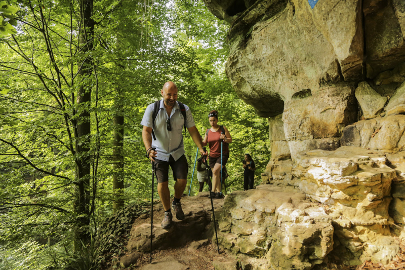
diariesofmagazine.com 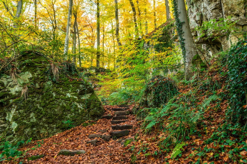
diariesofmagazine.com -
The Olomana Trail is one of the top treks on Oahu if you want an adrenaline rush and a difficult climb! The hike ends with three peaks that provide some of the greatest views on the island. It's not for novices, but if you're prepared for a challenge, it's well worth it. The Olomana Trail, sometimes known as "Three Peaks", comprises of basic bouldering and rope-assisted climbing. This will be an enjoyable and hard hike for you if you are in decent physical shape.
There are hundreds of paths in the Dolomites that may be completed in four hours or three weeks. A 5–6-hour path is a nice place to start for novices. We propose that you hike the "Three Peaks Hiking Trail" to see some of the most iconic parts of this UNESCO World Heritage site. Book your Dolomites hotel at the best price for a 5-star stay and enjoy Europe's most picturesque hiking paths.
The trip to the first peak is the most relaxed, a pleasant stroll through the forest with some tough, steep rock climbs towards the finish that elderly parents may struggle with. Most people halt at the summit of the first mountain. The daring climb to number two. The tricky material is found on the way down from peak one to peak two. The walk starts by descending down some high cliffs. There are numerous tattered old ropes linked to loosen tree roots to help the fall. Several times, you must rely on these ropes and hope for the best as you descend, dangling over steep cliff edges and enormous drop-offs.
At peak three, the cliffs grow much narrower, and the drop offs become lethal. A couple passes demand superb footwork and scrambling abilities, and one bad grip or slide might send you over the edge. You round another steep turn and come at the final push as you reach the summit of peak three. It appears to be a miniature replica of the Matterhorn. The last ascent is a straight up a small cliff 30 feet high, with just another torn rope to rely on.
Location: Dolomites, Italy
Difficulty level: Easy
Duration of the trip: 5-6 hours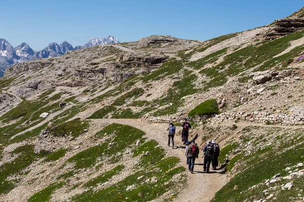
istockphoto 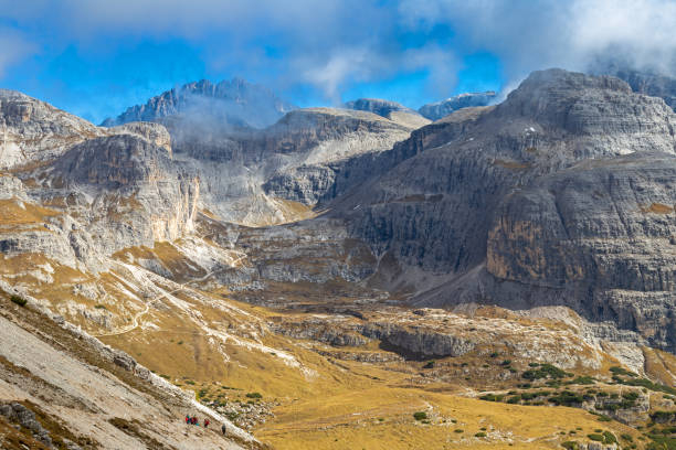
istockphoto -
For good reason, Trolltunga is one of Norway's most popular treks. The journey concludes with the Troll's tongue, a small sliver of rock ideal for imaginative photography. This is a hike that should be on your bucket list. Trolltunga is one of Norway's most popular treks. The major purpose for completing this trip is to pose for pictures on Trolltunga (the Troll's Tongue), although the route is gorgeous from start to end. Trolltunga may be the highlight of a hiker's trip to Norway. Many hikers consider this to be one of their favorite hiking experiences. Perhaps you will as well.
The Skjeggedal parking serves as the trailhead for Trolltunga. The hike's first ascent is the most difficult. Before the landscape levels off, there is 1 km of steady, hard ascending on stone stairs and gravel pathways. Instead of the rough route, there were previously ancient funicular tracks here that you could climb. Taking pauses along the road is one of the secrets to having a nice trip. From this height, you enjoy breathtaking panoramic views of Norway.
After climbing the granite cliff, the trail mostly levels off. There are a few little ascents, but nothing very tough. It will be a much more enjoyable (and safer) experience if you stay near Trolltunga, at least for one night. The best way to explore this part of Norway is by vehicle. A rental car allows you to take your time, stop and appreciate the scenery (this region of Norway is stunning!), and visit little villages and off-the-beaten-path places.
Location: Norway
Difficulty level: Medium
Duration of the trip: 10-12 hours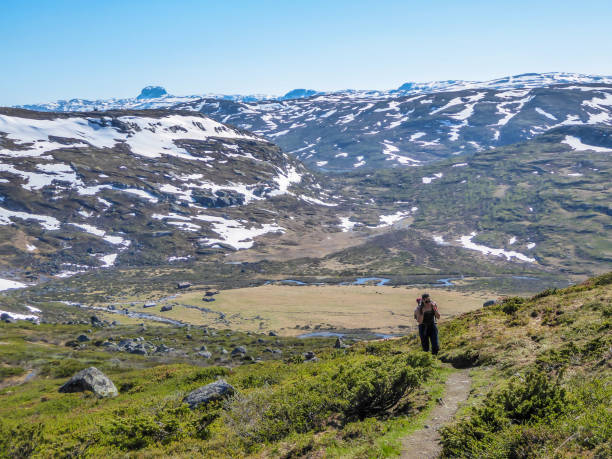
istockphoto 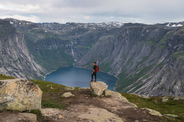
istockphoto