Top 5 Best Tourist Attractions in Micronesia
The Federated States of Micronesia is an island nation in the Pacific Ocean, northeast of Papua New Guinea, consisting of hundreds of small islands divided ... read more...into seven territories. Let's find out the Top 5 Best Tourist Attractions in Micronesia below!
-
Nan Madol is the highlight of many travelers' Micronesian journeys. Nan Madol was a venue for ritual activities as well as the dwellings of monarchs and servants. It was erected during the Saudeleur dynasty and was a major political, social, and religious institution. It is erected on the tidal flats and reef off the southeastern edge of Pohnpei and consists of 92 artificial islets.
The lagoon city is made up of a collection of small artificial islands connected by a network of canals. The site core, which is surrounded by stone walls, covers an area of 1.5 km long by 0.5 km wide and has roughly 100 stone islands. The name Nan Madol refers to the canals that crisscross the ruins and means "between." According to Gene Ashby's book Pohnpei, An Island Argosy, the ancient name was Soun Nan-leng. The wrecked metropolis is known as Atlantis, the eighth wonder of the world, or the Venice of the Pacific, and is one of today's major archaeological mysteries.
Hexagonal columns were produced naturally by wide basalt pillars up to 7.5m (26ft) long. They were quarried from Pohnpei Island and rafted to the site, where they were arranged horizontally around the islets as retaining walls, giving rise to the 'Venice of Micronesia.' Temples, burial vaults, meeting houses, bathing facilities, and ponds for turtles, fish, and eels were built on the flat surfaces. The priests and rituals were in the eastern side of Madol Powe (Upper Town), while the administrative section was in Madol Pah (Lower Town).
Location: Temwen Island, Federated States of Micronesia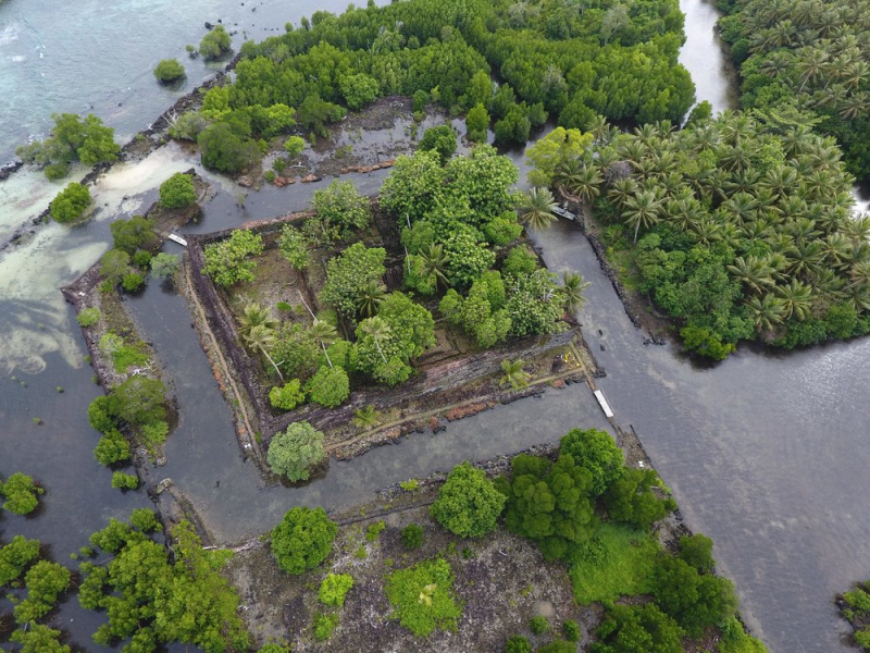
csrmfoundation.org 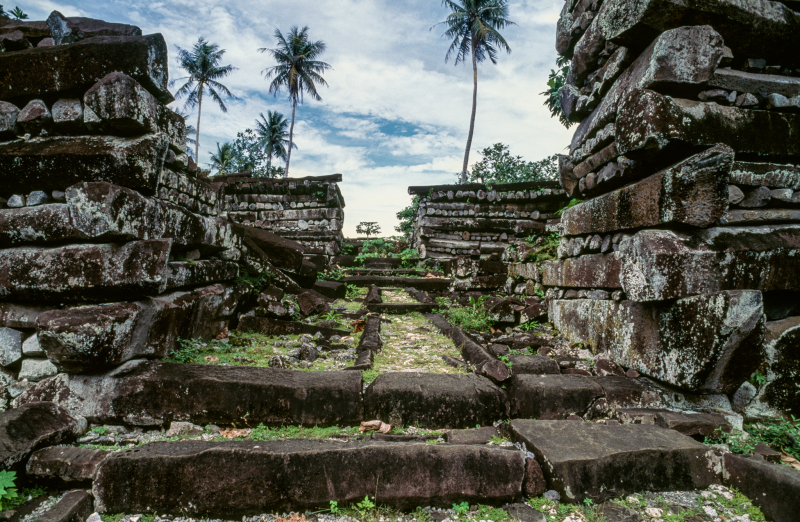
csrmfoundation.org -
Yap Islands, previously Guap Islands, are an archipelago in the Federated States of Micronesia's western Caroline Islands. Within a coral reef, the archipelago consists of the islands of Gagil-Tamil, Maap, Rumung, and Yap (also known as Rull, Uap, or Yapa). Yap, the largest island, is densely forested and includes a central range of hills rising to Taabiywol, 568 feet (173 meters). Throughout the year, temperatures are pretty consistent. The average monthly temperature is in the low 80s Fahrenheit (about 28 degrees Celsius), while the average yearly rainfall is around 120 inches (3,000 mm). Yap state's capital, Colonia, is located on Yap Island's east coast.
Yap Island, the main island of Yap Proper, has a tiny capital, Colonia, that surrounds around Chamorro Bay and offers sea views almost everywhere. Visit the Ethnic Art Town, which celebrates and preserves local art, or walk to the nearby village of Balabat to see the stone-money bank. The historic German Cable Station, erected in 1905 to connect Shanghai with Guam and the Philippines, is not far west of the airfield; nearby are two Japanese Zeroes, their wings astonishingly undamaged. Bechiyal, in the north, is a welcoming coastal community with Yap's oldest faluw (men's house).
Location: Caroline Islands of the western Pacific Ocean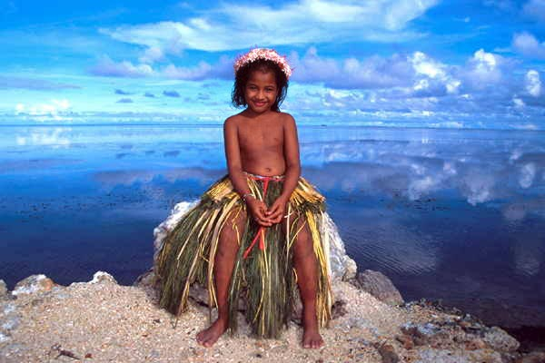
dxnews.com 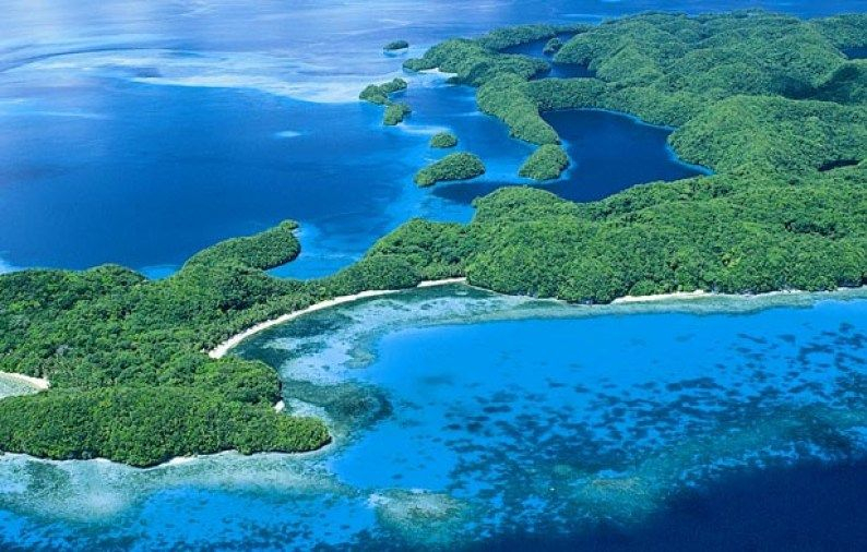
pinterest.com -
At the mouth of the Skeena River, one of North America's main salmon superhighways, Lelu Island and the neighboring underwater zone known as Flora Bank are located. Flora Bank has the highest abundances of juvenile salmon (25 times higher) than any other habitat sampled in the Skeena River estuary. Its fertile eelgrass flats offer food and cover for up to a billion young Pacific salmon and steelhead as they acclimatize to the saltwater environment each year, making it the most important salmon-rearing habitat on Canada's west coast.
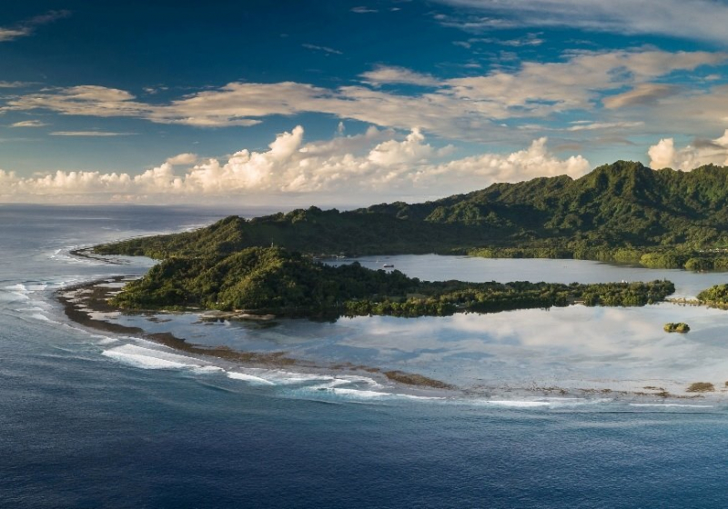
A magnificent walled city for Kosraean royalty was erected between the 13th and 14th centuries on Lelu Island, which is connected to the larger island of Kosrae by a causeway. The ruins of Lelu, which include burial mounds and homes, are concealed beneath deep tropical vegetation, in the kind of remote location you'd expect to find after hiking hours through the jungle. The high chiefs' residences, two royal burial mounds, a few religious compounds, and countless massive walls made of huge hexagonal basalt logs stacked like a log cabin may still be seen. The complete story is told on-site placards.
Location: North Pacific
.facebook.com 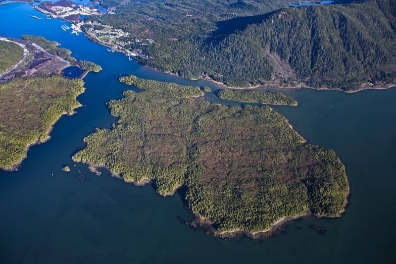
.facebook.com -
Truk Lagoon (officially Chuuk Lagoon) is a central Pacific atoll located 1,800 kilometers northwest of Papua New Guinea. It is located in Chuuk State, Micronesia, and is regarded as one of the world's top wreck diving spots. The wrecks can be explored from either a liveaboard or a land-based resort, and diving Chuuk Lagoon is a highlight of many recreational and technical divers' careers.
Scuba diving at Truk Lagoon is most known for its 60+ World War II wrecks, easily making Chuuk Lagoon one of the best wreck diving destinations in the world. Truk Island was a Japanese Naval Base during WWII due to its strategic position. Today, the shipwrecks of Truk Lagoon are home to a diverse range of marine life, including soft corals and small schools of fish. Some of the wrecks are fairly deep, with bottoms ranging from 100 to 150 feet (30 to 45 meters), making Chuuk Lagoon a great technical diving location.
Location: Papua New Guinea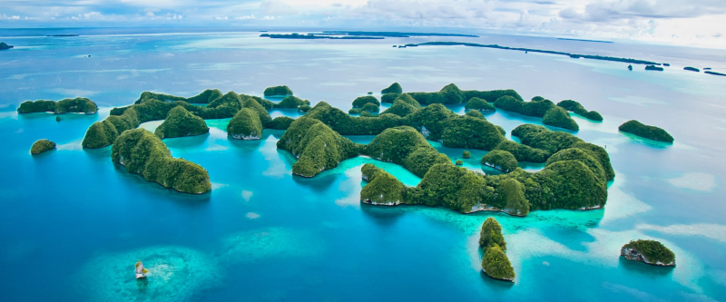
liveaboard.com 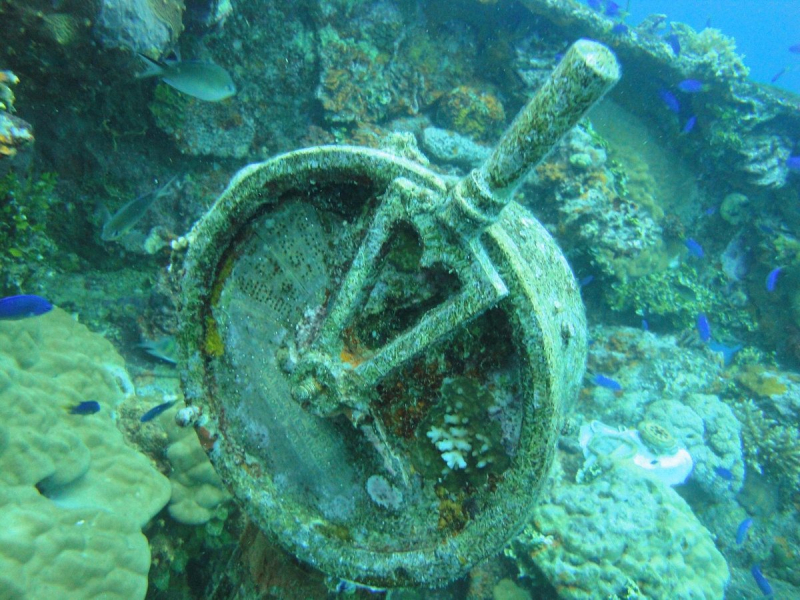
liveaboard.com -
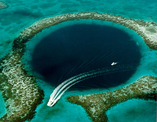
The Great Blue Hole is a world-class diving site for recreational scuba divers who want to explore a variety of marine life, including tropical fish and magnificent coral formations, while diving in crystal-clear waters. Nurse sharks, large groupers, and numerous varieties of reef sharks, such as the Caribbean reef shark and the Blacktip shark, can all be found in these places (Carcharhinus limbatus).
Dive trips to the Great Blue Hole are usually full-day excursions that include one dive in the Blue Hole and two more dives on neighboring reefs. The Great Blue Hole, located off the coast of Belize, is a massive underwater sinkhole. It's located at the middle of Lighthouse Reef, a small atoll about 100 kilometers (62 miles) from Belize City's mainland. The hole is round in shape, measuring about 300 meters (984 feet) in diameter and 125 meters (410 feet) in depth. The Great Blue Hole, the world's largest natural creation of its sort, is part of the broader Barrier Reef Reserve System, a United Nations Educational, Scientific, and Cultural Organization World Heritage Site (UNESCO).
Location: Lighthouse Reef, Belize
travelmag.vn 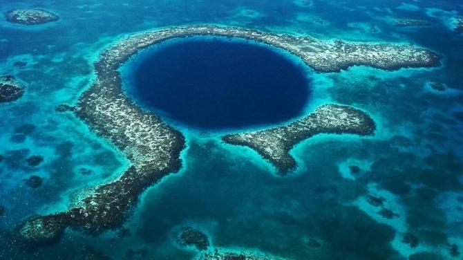
travelmag.vn


