Top 10 Best Hikes in The UK

The finest treks in the UK are a hotly debated topic. Britain may not boast the world's tallest mountains, but it does offer some of the most magnificent ... read more...landscapes, from the rough marvels of Snowdonia to the famed splendor of the Scottish Highlands. Every hiker in the UK has a favorite hiking path, typically for personal reasons. However, if you're searching for some notable UK hiking routes to add to your bucket list, here are some of the greatest treks in the UK. Let's discover the best hikes in the UK now.
-
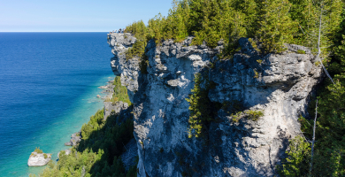
This massive wall, which stretches for 73 miles in northern England, is one of Britain's most stunning historic structures. Hadrian's Wall was named after the Roman emperor who commissioned its construction (between AD 122 and 128). Its primary intention was to isolate the Romans from the "barbarian" Picts of Scotland. For most of its length it is close to the remains of Hadrian's Wall, the defensive wall built by the Romans on the northern border of their empire. This is now recognised as part of the "Frontiers of the Roman Empire" World Heritage Site. Its 84-mile trail is lined with historic towns, forts, and intriguing museums.
The Hadrian's Wall Path is accessible to anybody who is physically fit, and the path is pretty straightforward. The most challenging segment is the 23-mile (37-kilometer) stretch between Chollerford and Birdoswald, with several brief rises and descents. The path is well-marked, and it's worth thinking whether you'd want to walk it from east to west, in the direction the wall was originally built, or west to east, which is advised for better weather. Because the Trail is delicate and can get muddy in bad weather, the optimum time to hike it is between May and October. The Trail and Hadrian's Wall are quite popular throughout the summer months, especially in July and August.
Location: Acomb Fell Farm House Acomb, Hexham NE46 4RS
istockphoto 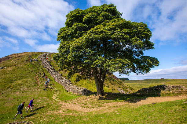
istockphoto -
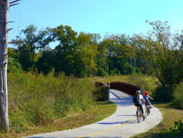
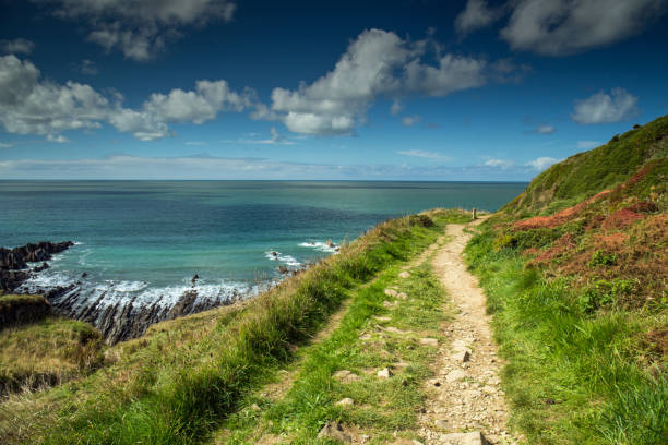
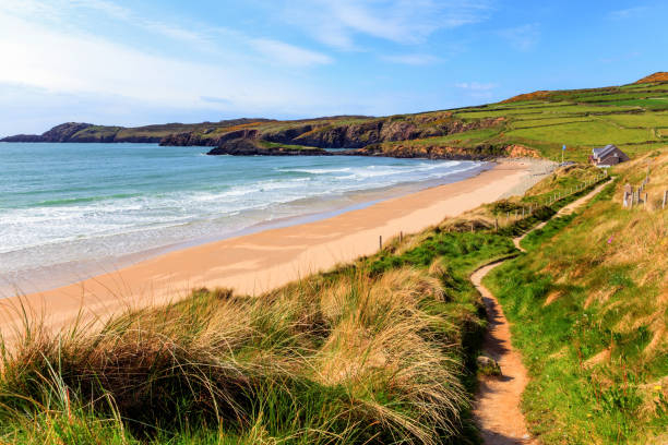
The South West Coast Path, a 630-mile trek along England's south west peninsula, is possibly the ultimate challenge for long-distance hikers in the UK. It begins in Minehead, Somerset, and goes over the Exmoor shoreline before continuing down the North Devon coast into Cornwall. It follows the whole coastline of Cornwall, crosses the Tamar River, and continues into Devon. Following the south coast of Devon, it then follows the Dorset shoreline until arriving at Poole Harbour.
As a National Trail, the South West Coast Path is marked with an acorn all the way around. In addition, there are enormous memorial markers at significant sites along the path, including Minehead (the starting point), Porthallow (the mid-way), and South Haven Point (the end). All of which provide an excellent opportunity for a photograph! There are also a number of way signs along the path that indicate how far you are from each end of the trail. Although most walkers choose to walk the Path in an anti-clockwise orientation from Minehead to Poole, there is no reason why it cannot be walked in the reverse direction.
Cornwall has a lot of isolated beaches. Even in high season, you might be able to enjoy the sea all to yourself. Walk four kilometers around The Lizard, the mainland's most southernmost point. Continue to Housel Bay, which has turquoise sea and light sand and is peaceful even in the summer. The stroll provides spectacular coastal views and the opportunity to observe anything from wildflowers to dolphins playing in the ocean below.
Location: S W Coast Path, Ilfracombe EX34 9QG
istockphoto 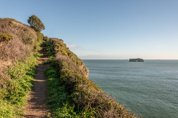
istockphoto -
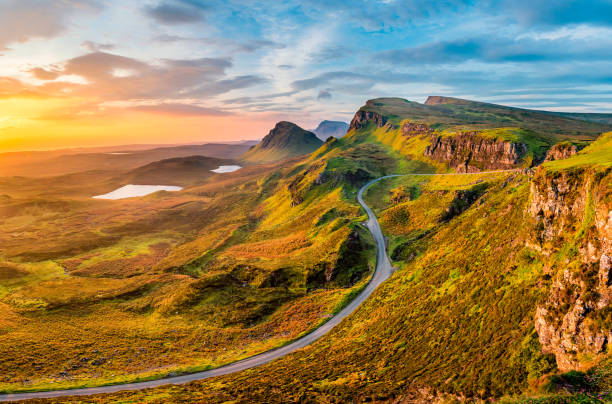
This is an important walk for any photographer since it travels through some of Scotland's most stunning vistas. It is part of the Trotternish ridge and was constructed by a large landslide that created steep cliffs, concealed plateaus, and rock pinnacles. Bring your camera and a clear day. The Quiraing walk is a loop that takes you back to the same spot (the carpark). It is 6.8 kilometers long and takes an average of 2 hours to complete (with no stops). The Quiraing is located in the 'Trotternish' district of Skye to the north. The walk begins in either of the settlements of Staffin or Uig, which are connected by a single track road.
This trek is not appropriate for all weather situations. It is not advised in windy or hazy circumstances because it takes you close steep cliffs (low visibility). The parking is at the highest point of the single track road, 5.5 miles from Uig and 2.5 miles from Staffin. It is 21 miles from Portree and will take around 30 minutes to drive. The parking lot is small and fills up rapidly in the summer; you may need to travel further down the road to locate a place. The trek begins in either Staffin or Uig and offers breathtaking views of the islands of Raasay and Rona. From the top of a cliff, you can gaze down on the people below. After that, refuel at Staffin's Columba Centre with Scottish chowder and handmade treacle bread.
Location: Quiraing Viewfield Road, Portree IV51 9ES
istockphoto 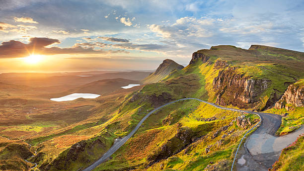
istockphoto -
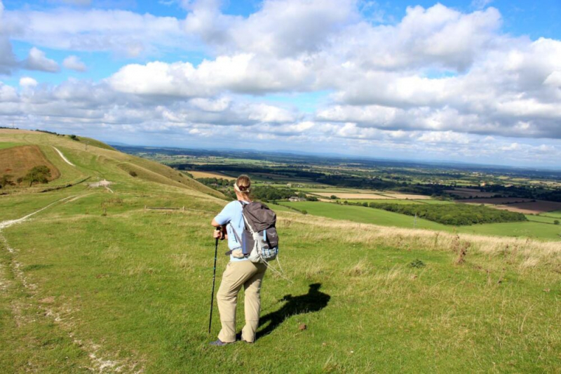
The 100-mile South Downs Way is a quintessential British walk, complete with wildlife, white cliffs, and watering holes. That's how it landed on our list of the finest treks in the UK! It's also included in our list of the greatest treks in London. If it's on this one, it makes sense. The route begins in Winchester, England's first capital, and winds through picturesque countryside until it reaches the undulating chalk cliffs of Eastbourne. The entire easy-to-follow route takes about eight days to hike.
The hike is best done from west to east, but it can also be broken up into shorter sections. Just remember to stay well away from the cliff edges when traversing them! There is no barrier and regular landslides. The Seven Sisters Country Park, the Amberley Working Museum, and Devil's Dyke are among highlights along the journey. It is also peppered with fantastic pubs, such as the Bull in Ditchling, which is a great place to rest tired feet.
Old Winchester Hill is an amazing stone age hill fort with bronze era barrows within. In the summer, it is also one of the greatest sites to witness chalk grassland alive with flowers and butterflies. Clayton's Jack and Jill windmills used to grind maize farmed on the downs and now provide wonderful views of the Sussex Weald to the north and the English Channel to the south, while the stunning chalk cliffs of Beachy Head welcome tired tourists at the conclusion of the road.
Location: South Downs, Southern England
istockphoto 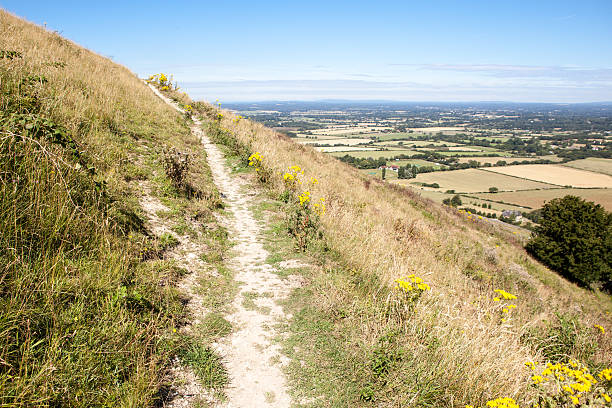
istockphoto -
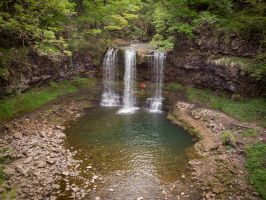
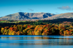
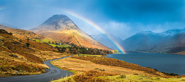
Scafell Pike is the tallest and most visible peak in England, rising 978 meters above sea level. It is part of the Southern Fells and the Scafell massif and is located in the Lake District National Park in Cumbria. Scafell Pike is one of a horseshoe of high fells, open to the south, surrounding the head of Eskdale, Cumbria. It stands on the western side of the cirque, with Scafell to the south and Great End to the north. This ridge forms the watershed between Eskdale and Wasdale, which lies to the west. Scafell Pike, England's tallest peak, may be reached in a variety of methods. So, it's a little arrogant to include it as the finest trek in the UK. But no matter whatever route you take, reaching the peak is a fantastic sensation. You'll be on top of the world.
A multitude of hikers generally gathers at Wasdale, in the western portion of the Lake District, to take the quickest route to the summit. There is, however, a lesser-known route to the 977-metre-high top. If you don't want to follow a throng, start from the more picturesque and less busy north side, which begins at Seathwaite (or Borrowdale for a longer hike). This nine-mile track, known as the "Corridor Route", snakes through the valley beneath granite cliffs and through ravines before reaching Scafell Pike's summit boulder field.
Location: Lake District National Park
istockphoto 
istockphoto -
This is a six-mile circular trek that begins and ends at the Beddgelert footbridge. It passes through some of the most beautiful scenery in Snowdonia, from the tranquil waters of Llyn Dinas to the majestic Aberglaslyn Gorge, with the wild Glaslyn River rushing across the trail. You'll cross the rusted pulley systems of Sygun and Cwm Bychan's historic copper mine workings. Plus, if the weather is nice, you'll get a good view of Yr Aran, Lliwedd, Siabod, and Snowdon on your way down. Back in Beddgelert, reward yourself with a pint of genuine ale at the Tanronnen Inn.
Pass through a gate near the toilet facility and turn left for Aberglaslyn. Walk up into the trees, then turn right to follow the river upstream. This fisherman's trail follows the slope of the Aberglaslyn gorge. When negotiating this section of the trail, notably the stone buttress over the river, extreme caution is advised. Continue until you reach the railway lines and be cautious when crossing: the Welsh Highland Railway service runs along this route between Caernarfon and Porthmadog. Cross the railway line and take the first left onto the bridge to cross the river, then take the first right towards Beddgelert and continue upstream. Don't miss the diversion on the left as you approach Beddgelert to visit Gelert's tomb from the famous Welsh folklore. See if you can find Gelert's distinctive bronze sculpture nearby.
Location: A4212, Blaenau Ffestiniog LL41 4TR
istockphoto 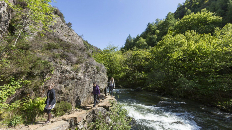
istockphoto -
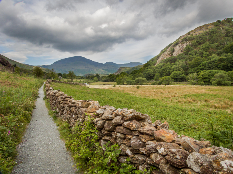
The Coast to Coast pathway in England is made up of hundreds of existing footpaths, bridleways, minor roads, and other rights of way that span the country from St Bees in Cumbria to Robin Hood's Bay in North Yorkshire. Thus, the Coast to Coast path is a network of paths constructed by Alfred Wainwright rather than a single trail. Although hikers refer to it as the Coast to Coast Path, it is more correct to call it the Coast to Coast Walk.
Despite the fact that the path has not been designated as a national trail, it is the most popular long-distance walk in the United Kingdom, and probably the globe. The path offers beautiful and unique scenery as well as a glimpse of England's ancient history; it allows you to walk in the gentlest of the Lake District mountains, see the best of the Yorkshire Dales, and walk up and down the rolling hills of the North York Moors while learning about England's ancient and pre-industrial past.
This 192-mile walking path connects England's east and west coasts. It was created in 1973 by British fellwalker and writer Alfred Wainwright, best known for his Lake District guidebook. He kept a tally of those who finished his trek behind the bar in Whitby. Needless to say, this has been depleted. From St Bees Head on the Irish Sea to Robin Hood's Bay on the North Sea, the route winds its way. You'll pass through the Lake District, the Yorkshire Dales, and the North York Moors on your journey. Three national parks on one hiking trail!
Location: Northern England
istockphoto 
istockphoto -
The West Highland Way is a walker's paradise, winding along shorelines, through thickets of forest, mountain passes, and wide glens, with new scenery at every turn. You'll be well prepared to embrace the Scottish Highlands with a few necessary goods and important knowledge. The West Highland Way is generally traveled from south to north, which eases you in with smoother and gentler southern portions before the path progressively gets more difficult as you head north. There are a few things to consider while planning your trip along the West Highland Way.
The West Highland Way is popular between spring and fall, with the peak season beginning in April and lasting until early October. May is traditionally the most popular month, owing to the delicate balance of elements that might affect your travel, such as weather and midges. Spring brings not just spectacular development of new life, but also some unexpected weather. While the highlands might be pleasant and bright on occasion, they are also prone to blustery days and spring rains. It's too early in the year to encounter midges as the valleys and landscapes begin to come back to life. If you're searching for new wildflower blooms, May may be a wonderful time to walk the West Highland Way as the temperature rises and the weather becomes reasonably dry and clear - ideal for admiring the stunning vistas.
When one considers walking 96 kilometers, it might be a little intimidating. However, thousands of people visit the West Highland Way each year, many of them are first timers who come to experience this wonderful long-distance path. While the path is well-marked and well-worn, the terrain may be rough in spots, and while the West Highland Way is not technically difficult, it does need some stamina. If you wish to train for the West Highland Way, it's advisable to start modest and progressively increase your fitness.
Location: Mugdock Road, Milngavie G62 6PL
istockphoto 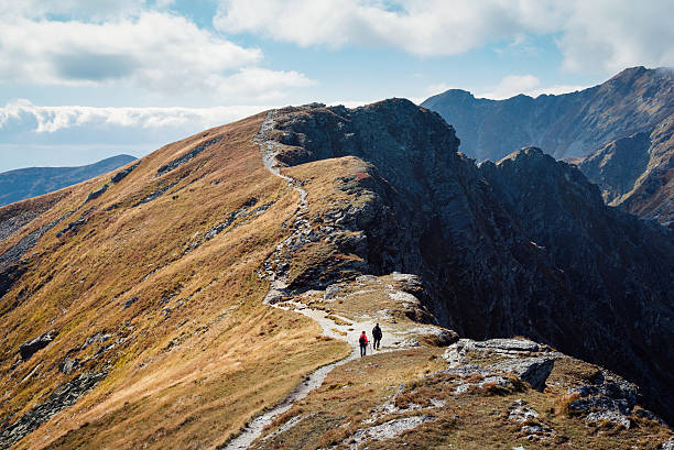
istockphoto -
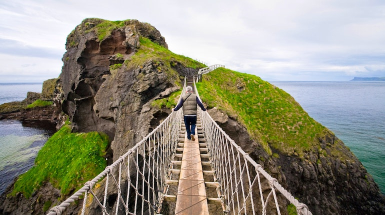
From the Carrick a Rede Rope Bridge to the Giants Causeway, the Causeway Coast Walking Route is 16 kilometers long and one of Ireland's most spectacular and diverse coastal hikes. It is both stunning and unmissable, and completing it allows you to see two of Northern Ireland's most popular tourist sites, the Giants Causeway and the Carrick a Rede Rope Bridge. This moderate 16-kilometer walk takes in a range of picturesque sites and points of interest, including strolling on beaches, across rocks, and along cliff top roads.
This walk is the most picturesque portion of the official Causeway Coast Way Walking Course, which covers 53 kilometers from Portstewart to Ballycastle and follows the overall route of the Causeway Coastal Scenic Drive from Belfast to Derry. The breathtaking trek follows the coastline all the way to the Giants Causeway, bringing you face to face with the North Atlantic. This stunning, sea-sprayed hike features some of Europe's best coast vistas. The Giant's Causeway, with its ancient basalt columns, is supposed to be the remains of a causeway built by a fabled Irish giant.
Travel west from the Carrick a Rede car park and drop into the overflow parking lot, then onto the grassy cliff walk at the far end. Follow this trail for about 1 km until turning right into the road at a tiny church. This route will take you to the picturesque Ballintoy Harbour, where Game of Thrones episodes have been filmed, including Theon Greyjoy's arrival back in the Iron Islands, admiring his ship, the Sea Bitch, and seeing his sister Yara for the first time.
Location: 44 Causeway Road, Bushmills BT57 8SU
istockphoto 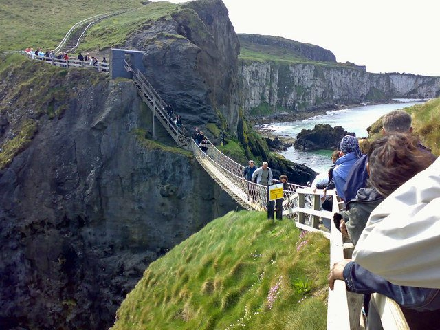
istockphoto -
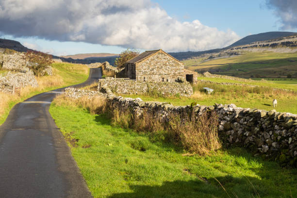
The Yorkshire Dales have some of the greatest walking in the country. Ticking off the three tallest mountains in the vicinity is a tremendous accomplishment that may be completed in a single day. These peaks are part of the Pennine range and surround the head of the Ribble Valley in the Yorkshire Dales National Park. The path is incredibly picturesque, with breathtaking vistas of the Yorkshire countryside. The Yorkshire Three Peaks Challenge is a 24-mile round with over 1,600m of climbing that takes you up and over Pen-y-Ghent, Whernside, and Ingleborough.
While it only lasts one day, this task should not be underestimated because the terrain is quite varied, with some severe ascents and descents. Participants may expect to traverse nearly a marathon distance on foot in a short of hours. This thrilling and gratifying journey will take you across the iconic Yorkshire Three Peaks in just 12 hours. All three hills have stunning vistas and unique geology, such as Pen-y-two Ghent's separate sills - the lower is limestone, the top gritstone. This is the walk for you if you want a challenge but don't have much time.
Location: 58 Market Place, Yo17 7 Malton
istockphoto 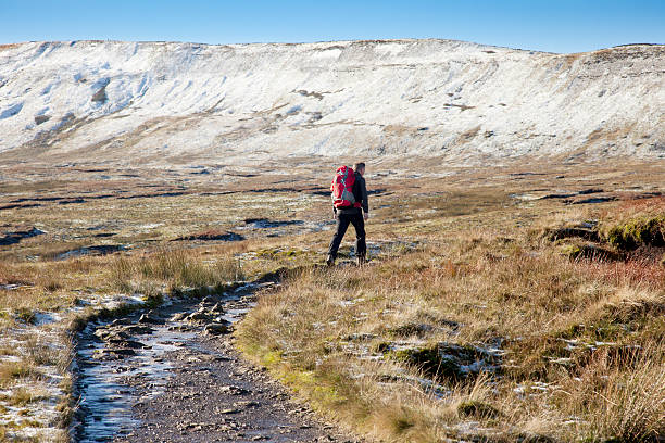
istockphoto