Top 10 Best Hikes in Austin, TX

Austin is well-known for its restaurants and nightlife, but it also has a strong relationship with nature. Every neighborhood has access to a network of hiking ... read more...trails that stretches north to south and east to west, allowing residents to quickly leave the city when they need to. From some of the greatest swimming holes and waterfalls in the area to truly magnificent shows of spring and summer flowers, there's something for everyone to explore on foot, bike, or in a stroller. Let's check out the Best Hikes in Austin, TX below!
-
Austin's Ann and Roy Butler Hike and Bike Trail is a distinctive feature of the city. This 10-mile trail borders downtown and spans both sides of Lady Bird Lake, and is named after a former mayor and his wife. For the majority of the paved trail, you can see the city skyline as well as the beautiful waters of Lady Bird Lake.
Every year, millions of people use the Butler Trail to cycle, run, and stroll. The trail connects to a number of riverfront sites, including Zilker Park, where the Austin City Limits music festival takes place. Other attractions along the Butler Trail are Auditorium Shores and Deep Eddy Pool. The Butler Trail Boardwalk, located on the south side of Lady Bird Lake and east of Congress Avenue, is a great place to visit. This mile-long concrete and steel boardwalk features viewing areas, public art, and thousands of LED lights. The Boardwalk is accessible from places like Blunn Creek and International Shore.
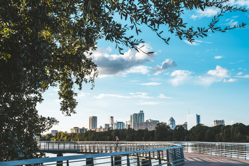
Ann and Roy Butler Hike and Bike Trail 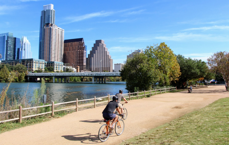
Ann and Roy Butler Hike and Bike Trail -
Located in Covert Park, Mount Bonnell is one of the highest points in Austin at 781 feet! The peak is named for George Bonnell, who served as Commissioner of Indian Affairs for the Texas Republic.
Within city limits, Mount Bonnell offers one of the most panoramic views of the region. Although the hike to the top of Mount Bonnell in Covert Park is short, the 102 limestone stairs that lead to the top make it feel like a workout. Mount Bonnell, at 775 feet, is one of the city's highest natural viewing sites. The Texas Hill Country, the Austin skyline, and, most notably, Lake Travis on the Colorado River are all visible from the top. Mount Bonnell has a spectacular western view, you can see spectacular sunsets atop the summit. Because of these spectacular views, the evening is a popular and typically crowded time to visit. Mayfield Park's peacock-infused grounds offer 26 acres of walking trails nearby for an additional adventure.
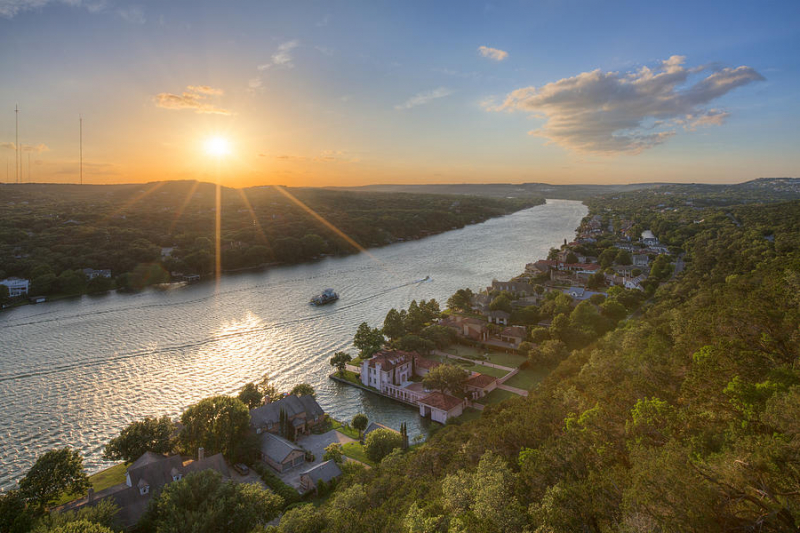
Mount Bonnell, Covert Park 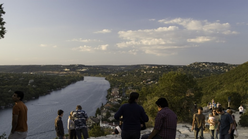
Mount Bonnell, Covert Park -
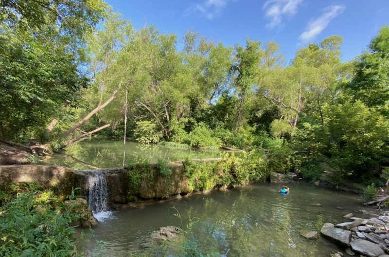
This greenbelt stands out among the others in south-central Austin. Barton Creek Greenbelt offers a range of different activities in addition to a beautiful flat path through natural settings. Opportunities to rock climb, swim, and mountain bike may be found along the whole 12-mile stretch of the Barton Creek Greenbelt system.
The Barton Creek Greenbelt has several access sites. At Zilker Park, the greenbelt begins near Barton Springs Pool. Swimming and wading are only possible in Barton Creek when the water level is high. Aside from that, people enjoy trekking along the dry creek bed. Cambell's Hole and Sculpture Falls are two more popular attractions on the Barton Creek Greenbelt. Another popular trailhead is the Twin Falls access site, which has parking along the highway. You'll drop along Barton Creek, through steep rock walls, and into beautiful woodland from here. Sculpture Falls is about 1.25 miles from the trailhead, while Twin Falls is a short hike from the trailhead.
Barton Creek Greenbelt 
Barton Creek Greenbelt -
The Turkey Creek Trail, located northwest of the city, is a favorite spot for dogs to run free. This 2.5-mile trail in Emma Long Metropolitan Park, about a 30-minute drive from downtown Austin, allows pets to run free. The trail starts at the end of City Park Road and swings around in a lollipop shape.
This 4.5-kilometer out-and-back trail takes an average of 1 hour and 6 minutes to complete this fairly difficult route. Because this is a popular hiking and trail-running destination, you'll almost certainly run across other people while exploring. As it follows the banks of Turkey Creek, the trail crosses it several times. These crossings are usually simple to manage, however, they might be difficult if the water level is high. Hikers can use mile markers along the path to stay on track.
Turkey Creek Trail, Emma Long Metropolitan Park 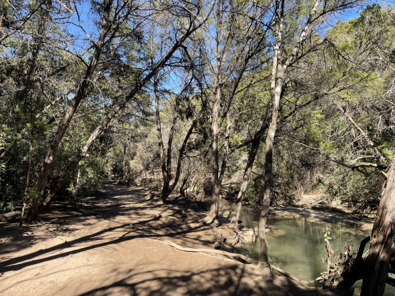
Turkey Creek Trail, Emma Long Metropolitan Park -
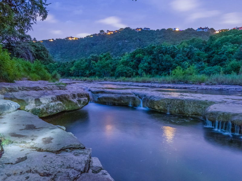
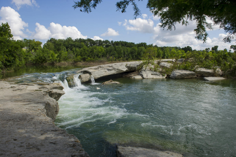
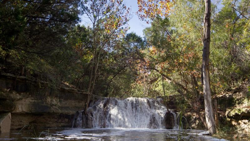
McKinney Falls State Park is a natural getaway within city limits, located ten miles southeast of the Texas Capitol. Camping, hiking trails, and one of Texas' greatest waterfalls may all be found in this large state park.
McKinney Falls State Park has over nine miles of trails, with the Onion Creek Hike-and-Bike Trail acting as the main connection between them all. The Onion Creek Trail, which includes a stretch at Upper Falls on Onion Creek, circles the park in just under three miles. When the weather is nice, Upper Falls is a favorite site for swimming and fishing. The trail has a hard surface and is appropriate for hiking, biking, and stroller-pushing. The Onion Creek Trail has several extensions, including a northern trail network that passes through Lower Falls and the McKinney Homestead.
Onion Creek Hike and Bike Trail, McKinney Falls State Park 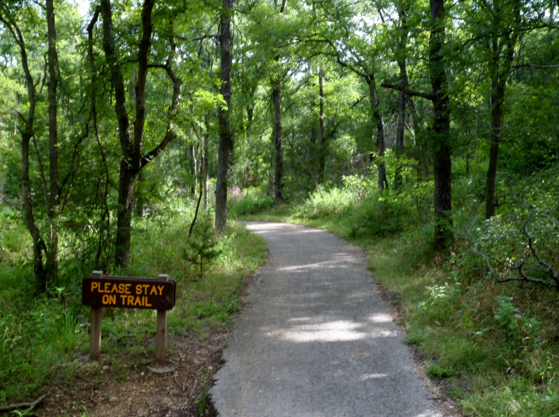
Onion Creek Hike and Bike Trail, McKinney Falls State Park -
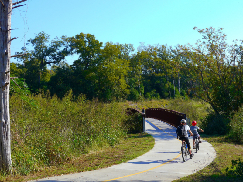
The Southern Walnut Creek Trail is a haven for nature lovers. This beautiful twisting and turning maze of trees and foliage, located in East Austin, is the city's newest recreation resource for hikers, joggers, and bikers. From Govalle Park to Johnny Morris Road, Southern Walnut Creek stretches over seven miles north. The trail will be extended by a dozen miles in the future and will connect to more neighborhoods in North Austin.
Southern Walnut Creek Route consists of 10-foot wide concrete paths designed to suit a range of users and spans more than 7.3 miles of multi-use trail that runs through woods, flatland, soft hills, and water. It's also a walking path for dog walkers and strollers. The trail follows the banks of Walnut Creek and offers scenic views with minimal elevation gain. The walkway is lined with public benches and water fountains, as well as other access points.
Southern Walnut Creek Trail 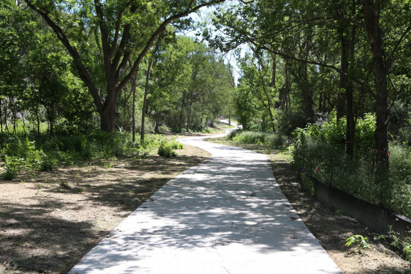
Southern Walnut Creek Trail -
This wilderness area is part of the larger Balcones Canyonlands Preserve, which is about a 10-mile drive from downtown Austin. Wild Basin, unlike other parts of the Balcones Canyonlands, enables visitors to tour the woodland environment on their own. Within its 227 acres, Wild Basin Wilderness Preserve has almost 2.5 kilometers of hiking trails.
Wild Basin's trails are open from sunrise to sunset. The trail system is divided into many loops, each having its own set of sights to see, such as waterfalls and scenic overlooks. St. Edwards University's Wild Basin Creative Research Center, which is located within the park, serves as a visitor center. On the second Saturday of each month, the creative research center also hosts public guided hikes.
Wild Basin Wilderness Preserve 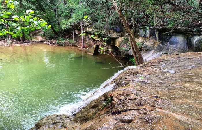
Wild Basin Wilderness Preserve -
The Canyon Trail, which is part of the larger River Place Nature Trail, is a tough hiking trail in northwest Austin. The 2.3-mile path has many wood stairs as well as steep elevation changes. Hikers who want to do an out-and-back trip will have to ascend nearly 1,300 feet, which will leave their legs sore. The Canyon Trail's lush forest and stunning views provide a great distraction while climbing.
The Panther Hollow Trail and Little Fern Trail are two more popular trails in River Place Nature Trail. Panther Junction connects both paths to the Canyon Trail. The Panther Hollow and Little Fern Trails are each about a half-mile long and include a gentle slope and wide path. These two trails are the most popular for families at River Place Nature Trail.
Canyon Trail, River Place Nature Trail 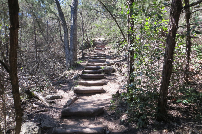
Canyon Trail, River Place Nature Trail -
St. Edward's Park, located in Austin's northwest corner, is a peaceful getaway into nature. The park is a popular family destination with shaded hiking trails, stunning cliffs, and creek playgrounds. At the park's entry, visitors will find several trail junctions, several of which are also popular with local mountain bikers. When you first arrive, it's a good idea to take a picture of the trail map. Although the park is not large enough to get lost, the trail network may be difficult even for frequent visitors.
Two popular routes stand out as the most popular to explore among the network of trails: the Creek Trail and the Hill Trail at St. Edward's Park offer two different views of the natural region. The Creek Trail leads north along Bull Creek for a two-mile round trip. When the rain levels are high, this well-shaded corridor is brimming with flora and features such as waterfalls. The Hill Trail in St. Edwards is more challenging, as it rises up the park's limestone cliffs. Hikers at the top of the Hill Trail will be rewarded with a spectacular overland view of Bull Creek.
Creek and Hill Trail, St. Edward's Park 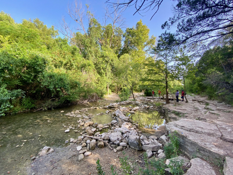
Creek and Hill Trail, St. Edward's Park -
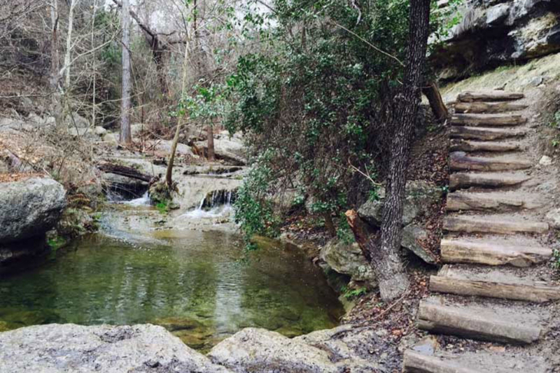
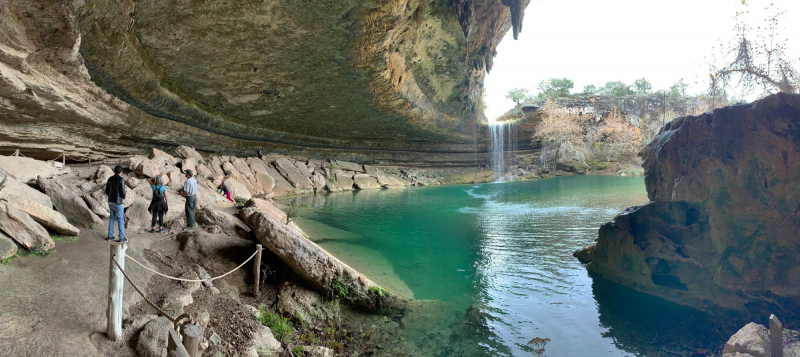
The Travis County Commissioner's Court certified Hamilton Pool Preserve as a preserve in 1990, making it a historic swimming hole. The stunning waterfall and Hill Country cave at the trail's end, on the other hand, are well worth the effort.
Hamilton Pool Preserve is a popular hiking and outdoor attraction and is one of the best day excursions from Austin. To avoid overcrowding, the Preserve needs reservations. The quarter-mile trail is steep, making it difficult to travel in rainy weather. Wet weather has an impact on Hamilton Pool, and the preserve may close the pool after a heavy downpour. The greatest time to hike to Hamilton Pool is when the weather is hot and sunny. When swimming is permitted, the natural grotto is a great site to visit.
Hamilton Pool Preserve 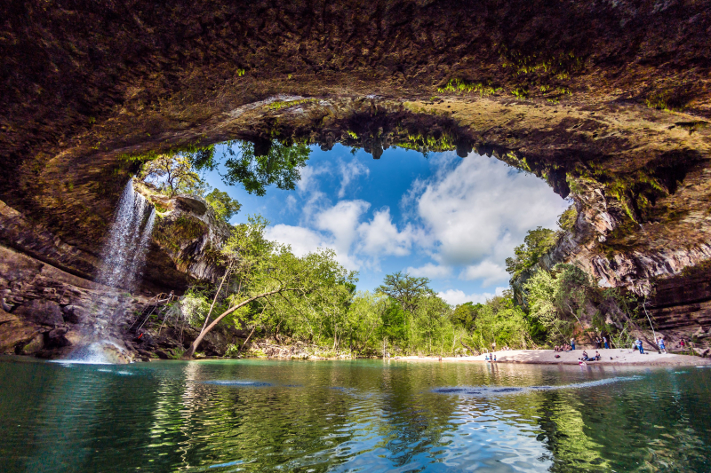
Hamilton Pool Preserve