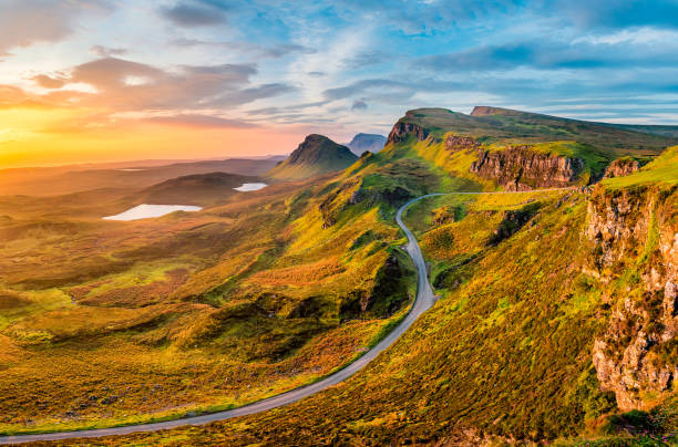
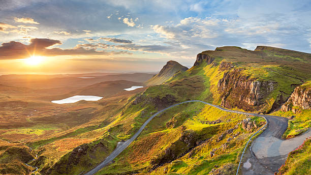
The Quiraing


This is an important walk for any photographer since it travels through some of Scotland's most stunning vistas. It is part of the Trotternish ridge and was constructed by a large landslide that created steep cliffs, concealed plateaus, and rock pinnacles. Bring your camera and a clear day. The Quiraing walk is a loop that takes you back to the same spot (the carpark). It is 6.8 kilometers long and takes an average of 2 hours to complete (with no stops). The Quiraing is located in the 'Trotternish' district of Skye to the north. The walk begins in either of the settlements of Staffin or Uig, which are connected by a single track road.
This trek is not appropriate for all weather situations. It is not advised in windy or hazy circumstances because it takes you close steep cliffs (low visibility). The parking is at the highest point of the single track road, 5.5 miles from Uig and 2.5 miles from Staffin. It is 21 miles from Portree and will take around 30 minutes to drive. The parking lot is small and fills up rapidly in the summer; you may need to travel further down the road to locate a place. The trek begins in either Staffin or Uig and offers breathtaking views of the islands of Raasay and Rona. From the top of a cliff, you can gaze down on the people below. After that, refuel at Staffin's Columba Centre with Scottish chowder and handmade treacle bread.
Location: Quiraing Viewfield Road, Portree IV51 9ES