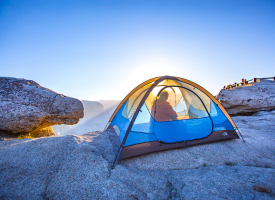
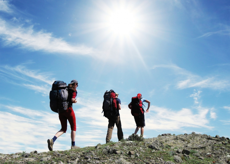
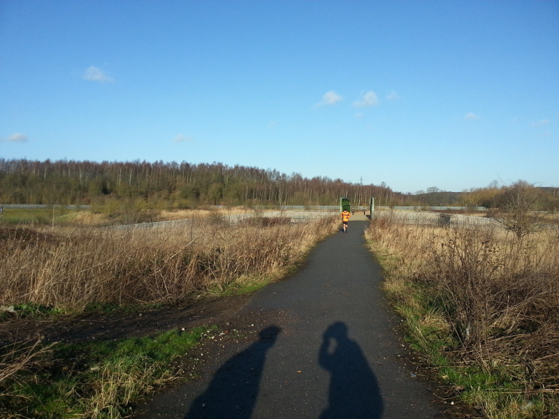
Top 15 Best Hikings Near New York City

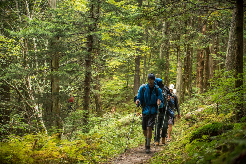
New York City's summer and fall seasons can have a certain allure, especially given the city's limitless opportunities for getaway. For those seeking for a ... read more...little fitness to go along with their rural escape, there are several hiking paths available thanks to New York's and New Jersey's wealth of state parks (it has the second most in the nation, after California). All of them are close enough to warrant a day trip from New York City—a few hours by train or vehicle in the Hudson Valley. Here are some of the Best Hiking Near New York City. Now get dressed for trekking and head out.
-
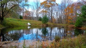
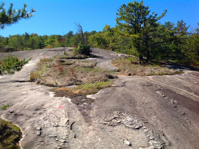
One of the most beautiful hikes near New York City, it offers hikers a lush trail throughout the year because of the surrounding big pine trees. Gertrude's Nose is located inside Minnewaska State Park Preserve and starts at the Millbrook Mountain Trail. It is unquestionably one of the top treks in the Hudson Valley.
This difficult but rewarding track takes hikers through a variety of difficult terrain, including steep slopes and plateaus, frequent cliff ridges where rocks must be climbed up and down, some gentler wooden sections, and portions along a cliff above rock formations. But fear not—there are many breathtaking panoramic views to inspire you in between summits.
Gertrude’s Nose trail will be marked with vivid aqua blazes close to Trapps Road Bridge, letting you know you've arrived. Once reaching the bridge, proceed up a rock trail and along rock faces until you reach Skytop Tower. Don't worry; you'll soon come across a sign instructing you to pause and take in the scenery before traveling another 3.5 miles to the crossroads that will take you to the top of Millbrook Mountain.
In order to get to Gertrude's Nose, keep walking along Gertrude's Nose Trail while keeping an eye out for red blazes as you gradually descend a hillside and pass under some power lines. Retrace your steps until you reach the intersection with the Millbrook Carrigaeway, then take the Millbrook Trail to the Coxing Trail before returning the way you came. Additionally, there is a $15.00 day use fee at this park, like with all the best treks nearby NYC.Location: High Falls, NY
Distance: 6.7 miles
Difficulty: Moderate
Route: Loop
Elevation Gain: 1,141 feet
Distance from NYC: 87 miles or a 2 hour and 10 minute drive.Rating: 4.8/5.0, 5656 Alltrails reviews
https://theotherhudsonvalley.com/ 
https://www.pinterest.com/ -
One of the best hikings near New York City that is intensive with a capital "I" is Breakneck Ridge. But that makes sense given that the climb's name is rather menacing and gives the impression that the journey won't be a simple stroll through the woods. Note that a significant amount of the hike involves scrambling over rocks. It's just not simple. Finding the route up might be challenging at times. Then go to Grand Central and board a Hudson Line train to Cold Spring station if you're an experienced hiker who's up for a little challenge. You may then take an Uber from here to the trailhead after the journey, which should take around an hour and a half.
You should then begin your journey at the southern Breakneck Trailhead and go counterclockwise. The Newburgh Beacon Bridge, Bannerman's Castle, and Storm King Mountain can all be seen from above while hiking on one of the best paths close to New York City thanks to this.
This hike also includes a lot of rocky terrain. Make careful to wear the proper footwear because many of the areas will make you feel more like you are rock climbing than hiking. Prepare for some nearly vertical rock scrambling before admiring some of the region's most stunning views of the Hudson Valley. The harder parts of Breakneck Ridge can be avoided if you'd like by taking a bypass trail. Don't forget to climb all the way to the top of the fire tower at the summit.
Location: Cold Spring
Distance: Between 2.5 and 4 miles
Difficulty: Difficult
Route: Loop
Elevation Gain: 1,250 feet
Distance from NYC: 63 miles or about an hour and a half drive.
Rating: 4.8/5.0, 941 Alltrails reviews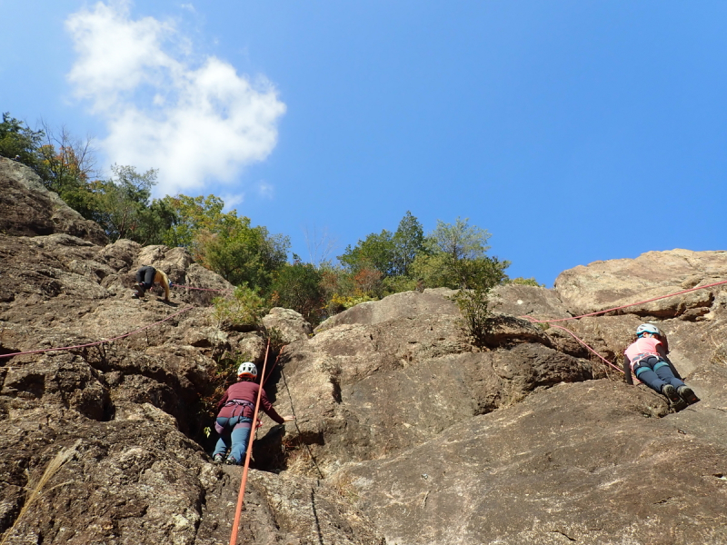
https://meeting.hatenablog.com/ 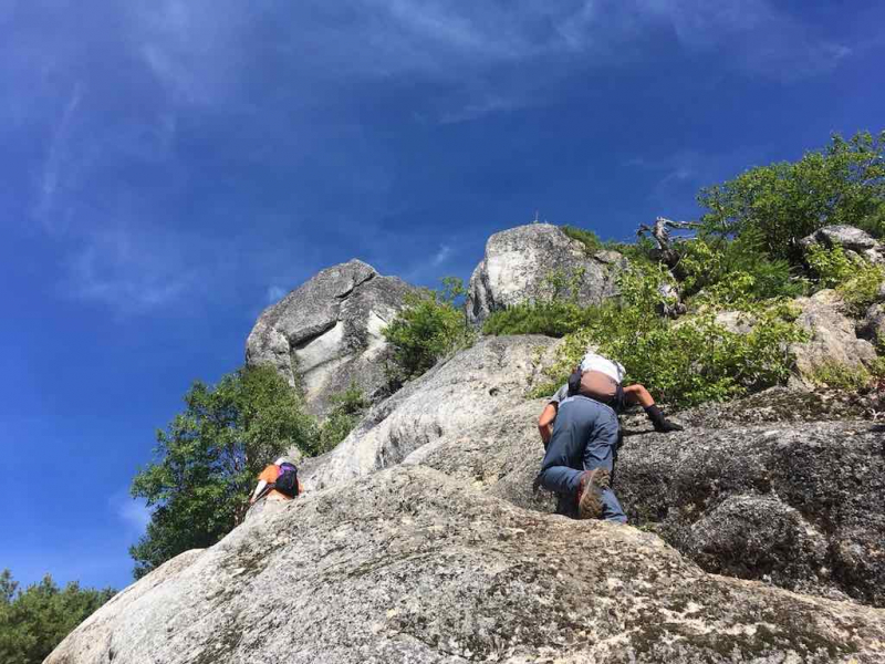
https://goalp.com/ -
You'll enter the heart of the Hudson Highlands State Park Preserve on this moderately difficult hike - Bull Hill Loop - at Cold Spring and pass by a beautiful nearby waterfall. Views of the Hudson River, the Cornish Estate Ruins, Storm King Mountain, and Bull Hill's summit are just a few of its numerous pleasures. At least four hiking routes start in the town of Cold Spring, New York, including Bull Hill. Additionally, this trail eventually joins up with a Breakneck Ridge trail (mentioned above). A Hudson line train runs from Grand Central to Cold Spring station, making it one of the best hikes close to NYC that is very simple to reach.
After that, when you've reached the preserve, begin at the Little Stony Point parking area and turn right onto the Washburn Trail. Just after the route meets with the Undercliff Trail, you'll continue on an ancient road and come to some lovely vistas. A rocky area awaits you just before the summit, where you may take in even more breath-taking views, this time of the Hudson River.
Continue to the top, then follow the Washburn Trail to return. You will be led along a dilapidated road that ends at the intersection of the North and Nelsonville trails. At the next intersection, turn left onto the Brook Trail and then another left onto the Cornish Trail. One of the best hiking routes near NYC, this one will take you past the remains of an old Cornish farm, where you can turn left to return to where you started.
Location: Cold Spring
Distance: 5.4 miles
Difficulty: Moderate
Route: Loop
Elevation Gain: 1391 feet
Distance from NYC: 62 miles or just under a two hour drive.
Rating: 4.7/5.0, 4098 Alltrails reviews
https://www.flickr.com/ 
https://www.bermanzi.co.za/ -
One of the best hikings near New York City is the Lake Minnewaska Loop Trail, which is found in the Minnewaska State Park Preserve. Consequently, a $15 day-use fee is required to access this route, which is unfortunate. However, once you arrive, the hike around Lake Minnewaska's perimeter is simple and incredibly beautiful. It's ideal to use the Lake Minnewaska Loop Trail between April and October, so try to get there early to beat the crowds.
A 3.1-kilometer circular route can be found close to Kerhonkson, New York. It takes 49 minutes on average to accomplish what is typically thought of as an easy route. Since hiking, cross-country skiing, and birdwatching are all fairly popular activities in this region, you can run into other people while exploring. Additionally, be careful where you're going because there are many forks in the route that might easily divert you from the main path. But it's a well-paved trail that will lead you past charming wooden bridges and to some of this incredible preserve's best views.
Get the Empire Card if you're going to Minnewaska State Park Preserve so you can access a lot of the best hiking trails close to NYC for nothing. The length of your hike is also determined by the parking lot you use. You can either go back or keep exploring the several trails that circle the lake from there. The months of April through October are ideal for hiking Lake Minnewaska Loop Trail. Dogs are permitted, but they must be leashed.
Visit Mountain Brauhaus before returning home for some German fare and beverages in a welcoming cabin-like environment. Even hot cider and mead are available. Alternately, go to Rough Cut Brewing Co. for some delicious brews and delectable fare. or visit both! Because they are close by stops.Location: Kerhonkson, NY
Distance: 1.9 miles
Difficulty: Easy
Route: Loop
Elevation Gain: 259 feet
Distance from NYC: 96 miles or a little over a two hour drive.Rating: 4.7/5.0, 2162 Alltrails reviews
https://appalachiantrail.org/ 
https://hiking.photos/ -
One of the all-time favorite parks in the state is Mohonk Preserve, and Bonticou Crag Trail is one of the best hikings near NYC that can be found there. Take a Hudson line train from Grand Central to Poughkeepsie station, then take an Uber from there to get here from NYC. Just be aware that it takes a while to get from Poughkeepsie to the park. Have a friend pick you up and drive you there if you can. In any other case, proceed to the parking lot for the Mohonk Mountain House and pay the guard shack's $15.00 day-use fee. Once you've parked, take the Crag Trail and follow the red blazes past a meadow before crossing Spring Farm Road and entering the woods.
As you approach a slightly complex intersection, turn softly to the left onto Bonticou Road. After that, you'll encounter a rock scramble and descend by following the red Bonticou Ascent Path blazes. Keep going straight and get ready for some more daring jumping up the track to the summit. Enjoy the lovely views, then descend the yellow route (to the right) and enter the pine forest. Following a right turn onto the Northeast Trail with a blue blaze, you'll eventually make a left turn onto Clearwater Road with a red blaze.
Take a little detour and continue on the Table Rocks Trail from here to reach Table Rocks. In order to avoid falling into any chasms, be sure to stop here and enjoy the scenery. Return the way you came and turn onto Farm Road after following the blue blazes. Once past a pavilion, go straight ahead and be sure to stop at the aptly called "Million Dollar View" on your left since it is quite spectacular. Points awarded if you visit during sunset on one of the top hikes nearby New York City - Bonticou Crag Trail. This climb requires some boulder hopping and is at times fairly steep. Therefore, neither dogs nor young toddlers are intended for use with it.
Location: High Falls
Distance: 2.3 miles
Difficulty: Moderate
Route: Loop
Elevation Gain: 488 feet
Distance from NYC: 87 miles or a 2 hour and 10 minute drive.Rating: 4.7/5.0, 1665 Alltrails reviews
https://www.langbruck.at/ 
http://www.hikeformentalhealth.org/ -
Anthony's Nose is a moderately challenging climb that is located directly over the river from Bear Mountain State Park. It is unquestionably one of the most well-known, top hikes close to NYC. Therefore, this incredible climb will be a genuine treat if you're looking to go trekking in the vicinity of New York City. As you go to the summit in a zigzag pattern, you start with a sharp slope of vertical rocky stairs. The trail becomes a flat, tranquil oasis after roughly half a mile of ascent, continuing for another half mile till reaching the peak. After all, it offers breathtaking views of the Bear Mountain Bridge and the Hudson Valley Highlands.
Additionally, you can go here in approximately an hour by taking a Hudson line train from Grand Central to Peekskill station, making it the perfect day excursion from NYC. Take an Uber from the train station to the trailhead on Route 9D. You can find it by searching for "Anthony's Nose" on Google.
Is this the toughest climb on this list of the top hiking trails close to New York City? No, although it does have a challenging half-mile part with a sizable amount of elevation gain, so you should be ready for that. The journey to the top is otherwise rather relaxing. Simply arrive early (or visit on a calm weekday morning) to avoid the hordes of New York City day-trippers. Anyone driving here will need to park on the side of the road because Anthony's Nose is no parking available. While you're here, you may hike the Appalachian Trail as well because the two cross paths.
Visit Tarrytown's Farmer & the Fish eatery on your way home. Amazing food is served everywhere! Alternatively, eat some lobster rolls at one of the many seafood establishments in the area that have a view of the brand-new Tappan Zee Bridge.Location: Garrison, Hudson Valley near the Bear Mountain Bridge
Distance: 1.9 miles
Difficulty: Moderate
Route: Out and Back
Elevation Gain: 675 feet
Distance from NYC: 52 miles or an hour and fifteen minute drive.Rating: 4.6/5.0, 2995 Alltrails reviews
http://femmeaufoyer2011.blogspot.com/ 
https://wheninyourstate.com/ -
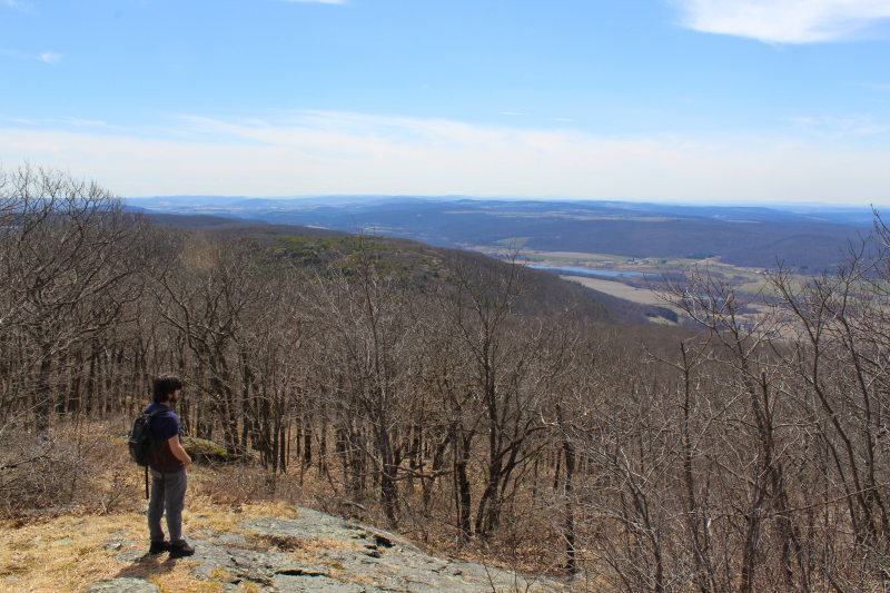
This 5.8-kilometer circular route - Storm King Mountain Trail - may be found close to Cornwall-on-Hudson, New York. It can be considered as one of the Best Hiking Near New York City. It requires an average of 2 hours and 12 minutes to finish and is typically regarded as a moderately difficult course. Since jogging and hiking are fairly popular activities here, you can run into other individuals while doing your exploration. This is undoubtedly one of the most well-known hikes near NYC on this list because of the amazing outdoor sculptures and art center there. If you're planning to hike close to New York City, don't miss this trail because it also provides keen hikers with expansive views of Breakneck Ridge.
Therefore, if you're up for a moderately challenging, art-filled endeavor, head to the trailhead through a tiny side street off of Bayview Avenue. After discovering one of the best walks close to New York City, you will next travel through a number of ledges on your way to Butler Hill and Storm King Mountain's summits. So even while this hike occasionally feels like a drag, it's still rather straightforward and not too difficult, especially if you go the other way around.
Near Route 9W, there is a picnic spot with parking. Storm King Mountain Trail climbs steeply through a rocky terrain and ascends to Storm King Mountain's summit. Views of the Hudson River and the lovely river valley it has carved out are available from here. The months of March through November are the optimum for hiking this trek.Location: Cornwall
Distance: 4. 4 miles
Difficulty: Moderate
Route: Loop
Elevation Gain: 1,200 feet
Distance from NYC: 63 miles or about an hour and a half drive.Rating: 4.6/5.0, 1041 Alltrails reviews
https://photographsandtravelling.blogspot.com/ 
https://www.pinterest.com/ -
To get to Pine Meadow Lake and the Conkins Crossing Trail, take the Pine Meadow Trail. Before returning to Pine Meadow Trail, this will lead to Suffern-Bear Mountain Trail. Since hiking is highly popular in this region, you can run into other hikers while doing your exploration. The months of April through October are ideal for hiking this trek. Dogs are permitted, but they must be leashed.
This hike is located in Harriman State Park and is another one of the top hiking trails nearby NYC. It is easily accessible by train (take a Port Jervis line train from Penn station to Sloatsburg station) and a fantastic choice if you're searching for a less strenuous hike with breathtaking scenery.
This hike will therefore begin at the Reeves Meadow Visitors Center, where you may then join the Pine Meadow Trail. Continue along Stony Brook and Pine Meadow Brook, then circumnavigate the lake either in a clockwise or anticlockwise direction. To rejoin the Raccoon Brook Hills Trail and Pine Meadow Trail as you approach the loop's conclusion, turn right onto Pine Meadow Lake Woods Road. If you want to break up the monotony on one of the best walks near NYC in terms of scenery, you can use the Kakiat Trail and continue on from there to the Stony Brook Trail.
There is a severe lack of parking at Pine Meadow Trail. A few parking spaces are available at the equestrian center, or you can park at the start of the road that leads there and walk to the trailhead from there.
Location: Sloatsburg, NY
Distance: 10.0 miles
Difficulty: Moderate
Route: Loop
Elevation Gain: 1,171 feet
Distance from NYC: 50 miles or an hour and 15 minute drive from NYC.Rating: 4.4/5.0, 648 Alltrails reviews
https://sykepleien.no/ 
https://nilsmora.com/ -
One of the best walks nearby NYC is the Suffern-Bear Mountain Trail, which is DEFINITELY NOT for the weak of heart. Therefore, be ready for a strenuous, 20+ mile trek through Harriman State Park (near Suffern) and into Bear Mountain State Park by bringing lots of water and excellent hiking shoes. Considering how well-hidden the trailhead is, you'll also need to exercise extra caution when trying to locate it. Therefore, to access the route, simply park at a nearby restaurant and walk towards the bridge.
Following the yellow blazes will lead you to this location, where you will encounter numerous steep ascents and descents that will put you close to cliff edges and to a particularly challenging section about halfway through at the Pyngyp. Spend the night at one of the lean-tos at Stone Memorial or Big Hill if you can and complete this path over the course of a weekend. After that, you'll arrive at Bear Mountain, where you may have a short drink before taking the train back to the city.
Suffern-Bear Mountain Trail is typically regarded as a difficult route and requires an average of 12 hours and 10 minutes to finish. Although this is a well-known trail for backpacking, camping, and hiking, you can still find some peace and quiet during the slower periods of the day. The route is lovely to explore at any time of the year and is open all year. Dogs are permitted, but they must be leashed.You can always break it up into five to fifteen mile chunks that are quite lovely if you don't want to hike the entire thing in one day. You can also take the bus (Shoreline Bus from Port Authority to Suffern) from New York City to this location and then walk from Bear Mountain to the Metro-North station at Manitou to return to Grand Central at the end of the Suffern-Bear Mountain Trail.
Location: Suffern, NY
Distance: 23. 2 miles
Difficulty: Difficult
Route: Out and Back
Elevation Gain: 5,196 feet
Distance from NYC: 41 miles or about an hour drive away.Rating: 4.4/5.0, 249 Alltrails reviews
https://www.plancorones.it/ 
https://www.flickr.com/ -
Some of the nicest treks in NYC may be found at the Blue Mountain Reservation, which is situated in northwest Westchester County. The Blue Mountain Summit Loop is one of the top trails in this area. You will pass through some of the park's most picturesque areas on the six-mile journey. Despite being one of the most popular treks in the area, if you arrange your trip correctly, you can find some quiet. The ideal season to hike this trail is from April through October. The outdoors is the ideal place to be, thanks to the pleasant weather and lush foliage.
Consider taking this 5.3-km circular path close to Buchanan, New York. The Blue Mountain Summit Loop takes an average of 1 hour, 33 minutes to accomplish this route, which is typically regarded as moderately difficult. Along the journey, there are ruins, brooks, marshes, rock outcroppings, views, and numerous trail adjuncts. Once on the walk, you can stop at two Hudson River viewing sites and pass a peaceful pond. Make sure to stop at the Peekskill Brewery on your way back to the train to reward yourself for overcoming the climb.
Dogs are permitted, but they must be leashed. The opportunity to view a lot of animals is one of the best things about this walk. You are sure to see something, whether it be deer, birds, or squirrels. Additionally, there are many places to stop along the journey. On a hot day, you can cool down by dipping your toes in streams and brooks. There is lots of free parking available off-season.
Location: Westchester County
Distance: 6miles
Difficulty: Moderate
Route: Loop
Elevation Gain: 777 feet
Distance From NYC: 48 milesRating: 4.4/5.0, 255 Alltrails reviews
https://minkara.carview.co.jp/ 
https://www.hikingme.com/ -
Arden Point and Glenclyffe, which is one of the best hikings near NYC, takes you on an easy loop through one of the Hudson Valley's most well-liked parks and is tucked away in Hudson Highlands State Park. The best place to start a hike near New York City is the Arden Point entry. From here, you can reach the trailhead and find a blue-blazed woodland path that will take you across a short bridge over a stream.
After traveling for about half a mile, turn right, cross the bridge, and proceed to Arden Point by following the blue trail markers. Once you reach a red-blazed route with a stone wall in your way, turn right into it. This trail will lead you to the water's edge where you can enjoy a stunning view of West Point and the Hudson River. Before continuing up the red-blazed trail to a picturesque viewpoint above the Hudson River, take in the breathtaking sights here. Continue on this path until you reach a bridge, which you will then cross before turning right onto the Marcia's Mile track, which is marked with white blazes.
Enter the woods, turn right at the fork, and proceed up some stone stairs to the Glenclyffe Loop, which is marked with red blazes. You can pause at the gazebo you'll see up ahead to take in the breathtaking views. Continue along the trail into a valley after passing over a rocky outcropping. A sign for the Garrison Institute will eventually be reached when the trip continues along Beverly Dock Road and passes by two ponds.
When you arrive, turn left into the paved entrance road and go along Marcia's Mile, passing a pond on your right as you do so. At some point, take a right turn back onto the road you were on. You'll come to a bridge, but don't cross it; instead, go straight ahead onto the blue-blazed woods road to return to your starting point. Another excellent hiking path that is close to New York City and is reachable by train is Arden Point and Glenclyffe. From Grand Central, simply take a Hudson line train to Garrison station.
Location: Garrison
Distance: 3. 8 miles
Difficulty: Easy
Route: Loop
Elevation Gain: 278 feet
Distance from NYC: 62 miles or an hour and a half by car.Rating: 4.3/5.0, 1128 Alltrails reviews
https://www.flickr.com/ 
https://www.tripsavvy.com/ -
Lake Skenonto Loop is one of the best hikes close to NYC that is easily accessible by rail, and it is situated in the awe-inspiring Harriman State Park. In order to get to Tuxedo station, go to Penn Station and board a New Jersey Transit train. Once you arrive, you can quickly stroll the half-mile to the trailhead (off Grove Street), where you can then take a leisurely stroll around one of New York's best lakes.
Yes, there are a few hilly and rocky stretches. So make sure to include a map and hiking boots. Overall though, Lake Skenonto Loop is a really easy climb that most people should have no trouble completing. You'll also follow the cool blazes onto the Ramapo Dunderburg trail as you enter the park and start hiking close to New York City. Eventually, you'll stop for lunch close to Parker Cabin Mountain (just before the Triangle Trail) because there are some amazing overlooks nearby because this is where you'll find Parker Cabin Mountain. When you reach Lake Skenonto, you can continue around the lake and along one of the top hiking paths in New York by continuing along the blue Victory Trail.
Lake Skenonto Loop takes an average of 3 hours, 52 minutes to accomplish this route, which is generally regarded as moderately difficult. The ideal time to hike this trek is from April through October. Additionally, avoid swimming in the lake to avoid receiving a fine. Although this trail is used frequently for jogging, hiking, and backpacking, you can still find some peace and quiet during the slower periods of the day.Location: Tuxedo Park, NY
Distance: 8.1 miles
Difficulty: Moderate
Route: Loop
Elevation Gain: 1,505 feet
Distance from NYC: 45 miles or a one hour and 15 minute drive.Rating: 4.2/5.0, 88 Alltrails reviews
https://www.flickr.com/ 
https://americanhiking.org/ -
Take the 4 train all the way from Grand Central to Moshulu Parkway station to enjoy one of the best walks close to NYC. Because this is where you'll find Van Cortlandt Park, the 1,146-acre, eternal park of the Bronx. And fortunately for you, the John Muir Nature Trail is located on this trail and is a short five-minute walk from the subway.
Simply enter at either Broadway and Mosholu Avenue or Van Cortlandt Park East and Oneida Avenue and proceed through three ecologically distinct woodlands (from east to west). Eventually, the Northeast Forest's Sweetgum, red oak, and tulip trees will be reached, followed by a frog-filled swamp and the Croton Woods. The Old Croton Aqueduct and the Northwest Forest's hickory trees are also located here.
The average time it takes to complete the trail is three weeks. The main hiking season typically lasts from July through September; at this period, the majority of last year's snow has mostly melted but no new snow has yet to accumulate. Runners, trail riders, pack trains, and backpackers are the main users of the trail, but it is also utilized by day hikers and backpackers.The John Muir Hut, the only shelter along the trail, is available for hikers to stay in on Muir Pass. Additionally, the John Muir Nature Trail's northern section has a number of resupply spots that are close by (Tuolumne Meadows, Reds Meadow, Vermillion Valley Resort, Muir Trail Ranch), allowing hikers to start out with a lower food load and readily leave the trail if difficulties occur.
Location: Bronx, NY
Distance: 3.9 miles
Difficulty: Easy
Route: Out and Back
Elevation Gain: 301 feet
Distance from NYC: About a 45-minute subway ride away from Midtown.Rating: 4.2/5.0, 57 Alltrails reviews
https://www.kyuka.ch/ 
https://www.urlaub-bramberg.at/ -
Take the George Washington Bridge to New Jersey and enter Fort Lee Historic Park, a truly magnificent 33-acre, cliff-top park with views of the Hudson Palisades and Burdett's Landing, in order to reach this wonderful path on the list of the finest hikes nearby NYC, Carpenter’s Loop. Access the Carpenter Loop trail and walk it all the way to the Hudson River and the Englewood Cliffs, even though this park is home to a ton of really cool things, such a reenactment of a Revolutionary War military camp. You can park in the Boat Basin and then walk along the Hudson River while observing the George Washington Bridge in front of you by following the white-blazed Shore Trail.
After that, pass via a pedestrian tunnel to reach Ross Dock. Take a set of stone steps on your right to Carpenters Trail by keeping to the right along a paved road. From here, continue on the trail until you reach the bluff's summit. Before going left onto the Long Path, pause to take in the expansive views of the Hudson River.
Then proceed along the Long Path until you come to a gas station and a wooden bridge that spans a nearby brook. The Englewood Cliffs are visible when you reach St. Michael's Villa after continuing on this walk. After leaving the Long Path, turn right and follow the yellow Dyckman Hill Trail blazes to continue your hike close to New York City. Enjoy a relaxing stroll by a number of waterfalls before descending the trail till you reach the parking area. If you enjoy history, visit the visitor center to find out everything there is to know about the Revolutionary War's impact on Carpenter’s Loop.
Location: Fort Lee, NJ
Distance: 4.0 miles
Difficulty: Easy
Route: Loop
Elevation Gain: 341 feet
Distance from NYC: 19 miles or about a 45-minute drive from downtown Manhattan.
Rating: 4.0/5.0, 105 Alltrails reviews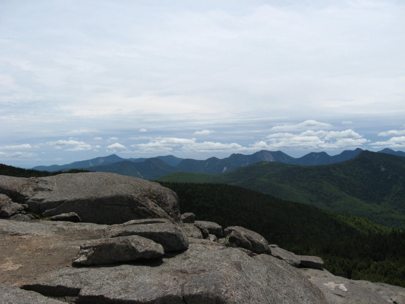
https://www.pinterest.com/ 
https://www.onlyinyourstate.com/ -
A train travel to Yonkers is the perfect solution if you want a simple and quick excursion. Why? The Old Croton Acqueduct Trail begins there. The Old Croton Aqueduct Trail, which was first finished in 1842 and spans a significant area of the Bronx and Westchester county, is a well-defined, simple-to-follow multi-use path that walkers, hikers, runners, and bikers can use to get away from the hustle and bustle of the city. During your hike, stroll by Lyndhurst Castle, the old aqueduct, and many other antique structures. This can be seen as one of the Best Hikings Near New York City.
Since it was originally created to provide fresh drinking water into the city, Old Croton Aqueduct Trail in New York City is actually so iconic that it is now listed on the National Register of Historic Places. Therefore, start at the New Croton Dam and proceed through the 21 ventilators that are now the only remnants of the ancient aqueduct if you want to enjoy one of the best walks close to NYC for yourself. The town of Crotonville will be reached after around three miles, and Ossining will be reached after another two miles. There are numerous exit locations along the 26 miles of the trail that end at Van Cortlandt Park in the Bronx, so feel free to leave whenever you please.
The Headless Horseman, Sleepy Hollow, the Tappan Zee Bridge, Lyndhurst (a gorgeous Gothic Revival mansion), the Keeper's House, and other significant route highlights are just a few of the highlights. From Grand Central, simply board a Hudson Line train, and get out at any of the stops between Greystone and Ossining. Be cautious as well because a lot of the trail crosses major roads where cars do not stop for pedestrians.
Location: Bronx/Yonkers/Yorktown
Distance: 26.5 miles (from Van Cortlandt Park/Hancock Avenue in Yonkers to Croton Dam Road at the New Croton Dam in Yorktown)
Difficulty: Easy:
Route: Out and Back
Elevation Gain: 300 feet.
Distance from NYC: 15 miles or about a 40 minute drive if you start in Van Cortlandt Park in the Bronx.
Rating: 4.0/5.0, 2 Alltrails reviews
https://www.pinterest.com/ 
https://traditionalfloats.blogspot.com/