Top 10 Best Place To Hike In The US

Is there anything more alluring than taking a good chunk of time off of work, updating all of your exploring equipment, perhaps justifiably splashing out on a ... read more...new tent, and then driving to any one of the most beautiful national parks in the world, being surrounded by stunning natural beauty and having nothing but the sound of nature to accompany you, setting out on a personal journey of discovery. Well, you're where you need to be. Toplist has got you covered with roundup of the very best places to hike in the US, including must-do canyon descents, gorgeous walks along the ocean, hikes through fields of vibrant foliage, and much more.
-
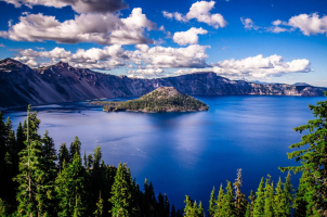
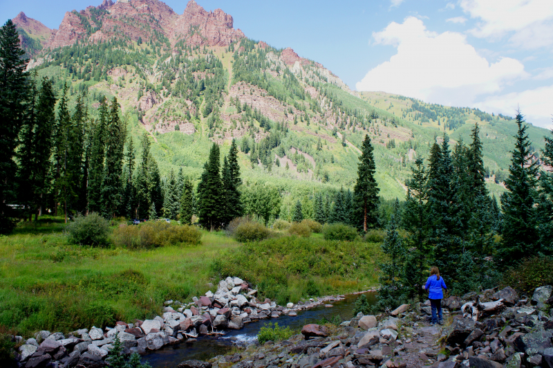
Starting at Maroon Lake, the West Maroon Trail ascends through aspen woods to Crater Lake. This is one of the best place to hike in the US. At the Crater Lake fork, go the left. Following the lake, the trail briefly follows a creek before entering a forest. You will go across a field of rocky scree after leaving the trees. In just over three miles, there will be the first stream crossing. The path ascends through willow and forest before coming to another stream crossing in a wide meadow. The trail ascends gently through willows and tundra after crossing. The pass is visible in the distance, and this area is fairly open. This delightful walk, which links Aspen and Crested Butte, is at its best in July when wildflowers are in bloom. Along the 10-mile trail, abundant larkspurs, violets, blue columbines, and white thimbleberries spray color. It also features some of the most breathtaking views in the Rockies.
Switchbacks and a lengthy traverse that leads to the West Maroon Trail's summit at the top of the Pass are used to continue the trail's steep ascent. On a clear day, the vistas are breathtaking. The trail descends on the opposite side of the pass to the East Fork Creek Trail and Schofield Park before continuing on to Crested Butte or Frigid Air Pass.Length: 32.8 km
Elevation: 1,645 m
Level: Easy to Moderate
https://liveandlethike.com/ 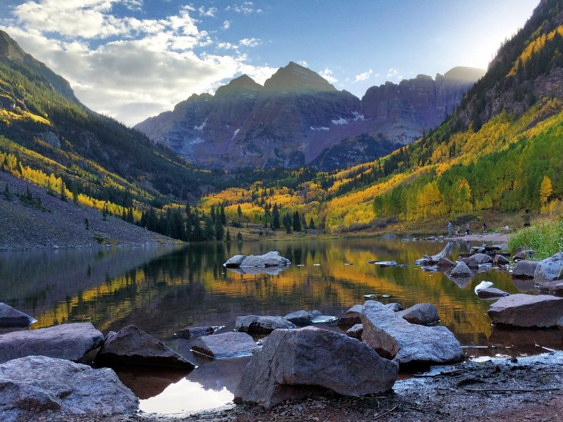
https://www.hikingproject.com/ -
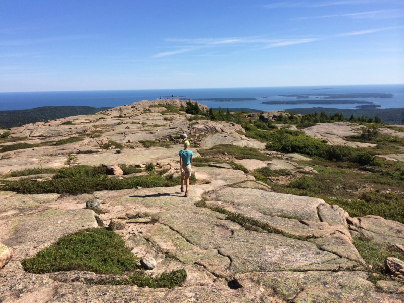
Penobscot Mountain, the fifth-highest peak in Acadia, is the spectacular north-south mountain that sits opposite of Pemetic Mountain in the Jordan Pond/Bubbles pantheon, with its steep and exposed cliffs looking down on Jordan Pond from the west. The Spring Trail provides a challenging and energizing climb with breathtaking alpine views Penobscot Mountain. Additionally, individuals willing to prolong the trip can hike further north to the taller nearby Sargent Mountain (the 2nd highest peak in Acadia).
To ascend Sargent Mountain's 1,373-foot summit, you must squeeze between stones as you scale Penobscot Mountain, descend to Sargent Pond, and then climb past the tree line. The expansive view spans nearly the entire Down East Coast and has water on three sides. This circle trek offers easy access to three of the stunning carriage-road bridges as well as crossing multiple carriage roads, which is a bonus for bridge hunters. This is one of the best place to hike in the US.
Nearly 3.7 miles south of the exit for the Cadillac Mountain Summit Road on the Park Loop Road is the Jordan Pond North parking area. The road is two-way in this area. The tiny Jordan Pond House parking lot also offers a limited amount of parking. (Summer afternoons see a lot of fill-up and congestion in both lots.)Length: 9.0 km
Elevation: 391 m
Level: Easy to Moderate
https://www.nrcm.org/ 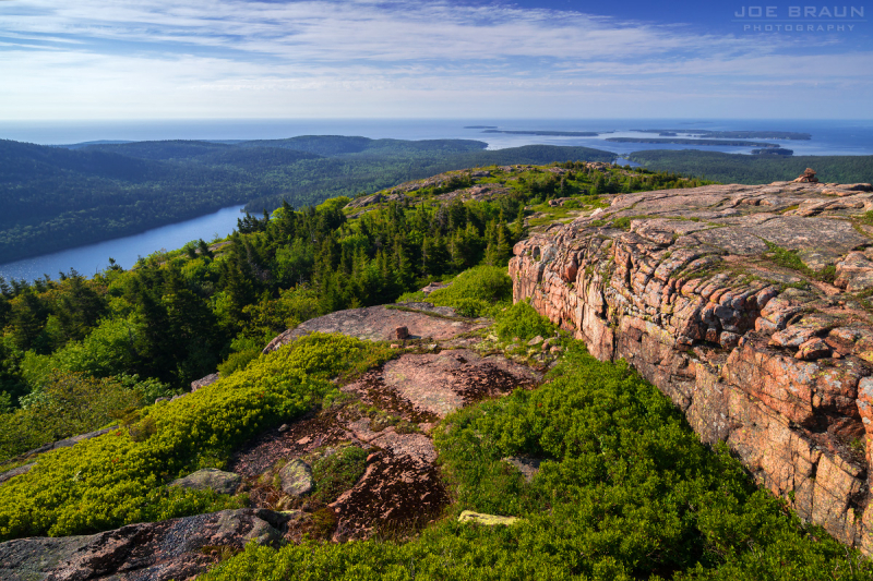
https://www.citrusmilo.com/ -
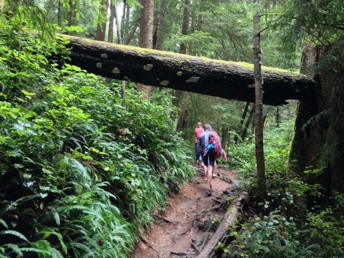
Just south of Seaside is the trailhead for the Tillamook Head. The climb ascends more than a thousand feet above sea level through an old-growth Sitka spruce/hemlock forest, with its highest point being close to Clark's Mountain's top, which is completely covered in trees. There are only sporadic ocean views, such as from a location close to Hikers Camp that offers a view of the Tillamook Rock Light. Additionally, a radar station from World War II had stood in this region. Indian Beach, where Captain Clark of the Lewis & Clark Expedition remarked that there had once been an Indian settlement, marks the route's end.
William Clark, who had just completed an extensive journey across the continent, ascended Tillamook Head in 1806 and "beheld the largest and most pleasant vista which my eyes ever scanned." Follow the footprints of Lewis and Clark from the hamlet of Seaside to Ecola State Park to discover what so mesmerized him. Through old-growth forest, the 6.3-mile trail ascends more than 1,000 feet, providing breathtaking views of mountain ranges protruding into the Pacific. In the winter and spring, keep an eye out for deer, eagles, and gray whales that are migrating. You will see Cannon Beach and its well-known basalt rock formations as the trail descends toward Indian Beach.
The farthest point the Lewis and Clark expedition traveled was 20 miles south at Tillamook Head, where they went hiking in quest of whale blubber, not at the mouth of the Columbia River. In Ecola State Park today, a portion of the Oregon Coast Trail follows the explorers' path to Tillamook Head, a stunning 1,000-foot bluff that provides views of rocky islands. The path passes a vista that even Captain Clark gasped at in awe.Length: 6.3 miles
Elevation: 1350 feet
Level: Moderate
https://modernhiker.com/ 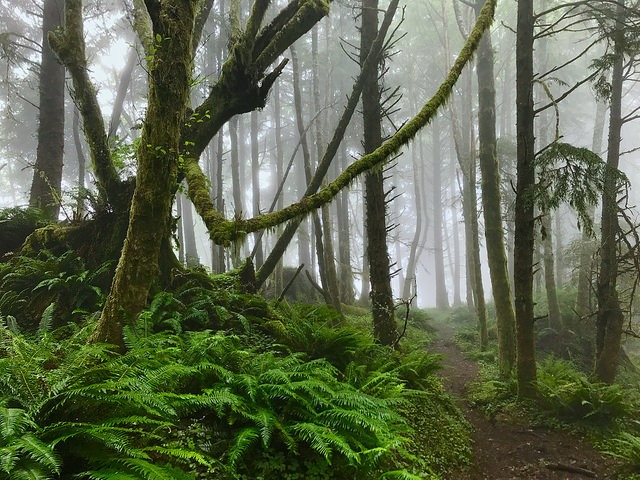
https://thatoregonlife.com/ -
The Superior Hiking Trail, or SHT for short, is a 310-mile (500-km) long hiking trail in northeastern Minnesota that for the majority of its length follows the rocky ridges overlooking Lake Superior. This is one of the best place to hike in the US. The path passes through birch, aspen, pine, fir, and cedar forests. Boreal woods, the Sawtooth Mountains, trickling brooks, gushing waterfalls, and an abundance of wildlife are all visible to hikers. 602 feet (183 meters) above sea level marks the path's lowest point, and 1,829 feet (557 meters) marks its highest. The footpath is only meant to be used for hiking. The trail is off-limits to horses, mountain bikes, and motorized vehicles. Many people utilize the trail for long distance trekking, and 94 backcountry, no-fee campsites make this possible.
The 296-mile Lake Superior ridgeline hike, which runs from Duluth to the Canadian border, is the longest in the Midwest. It ascends bluffs that are 1,000 feet above the lake and descends into forested river valleys, with the potential for seeing moose, bears, and beavers along the way. Wild berries are abundant in the summer, while maple trees burn in the fall. The 18-mile route from Silver Bay to County Route 6 is a wonderful introduction, traveling by a number of small lakes, birch trees, and cliffs with expansive vistas of Lake Superior. Even though this is a well-liked path for camping, birding, and trekking, you can still find some peace and quiet during the slower periods of the day. The months of May through September are ideal for hiking this trek.
Length: 456.6 km
Elevation: 10,525 m
Level: Easy to Moderate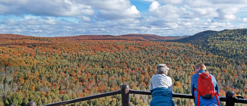
https://www.wildernessinquiry.org/ 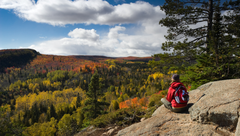
https://57hours.com/ -
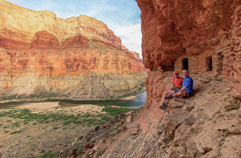
On the North Rim of the Grand Canyon National Park, which is situated in the U.S. state of Arizona, there is a poorly maintained hiking trail called the Nankoweap Trail. From the trailhead at Saddle Mountain to Nankoweap Creek and then to the Colorado River, the Nankoweap trail travels 14 miles and descends 6,040 feet. The trek into the Canyon is thought to be the toughest one. Since there is no water along the 11 miles between the trailhead and Nankoweap Creek, hikers must carry and store water.
This trail offers jaw-dropping rewards despite being one of the Grand Canyon's toughest walks. It was first built by geologist J.W. Powell in the 1880s and descends 6,000 feet over the course of 14 miles from the north rim to the Colorado River. Switchbacking through sandstone cliffs, steep redwall limestone, and descending yellow shale down to Nankoweap Creek and the river is tough for the faint of heart.
There are plenty of opportunities for birdwatching, camping, and trekking along this trail, and you probably won't run into many other people. With the canyon spreading out before you and echoing with the scream of rapids, this isolated campsite is one incredible place to stay. But then you have to go back and climb those 14 miles. The months of May through October are ideal for hiking this trek.Length: 13.9 mi (22.4 km)
Elevation: 6,040 ft (1,840 m)
Level: Hard
https://www.grandcanyon.org/ 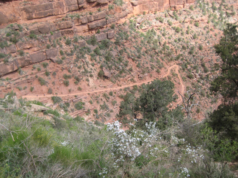
https://www.fatpacking.com/ -
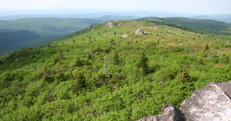
The summit of Mount Rogers, in Virginia, United States, is 5,729 feet (1,746 m) above mean sea level, making it the state's highest natural point. About 6.45 miles (10.38 km) west-southwest of Troutdale, Virginia, the crest divides Grayson and Smyth Counties in Virginia. The Lewis Fork Wilderness contains the majority of the mountain, and the entire region is a part of Mount Rogers National Recreation Area, which is a division of the Jefferson National Forest. This is one of the best place to hike in the US.
The Appalachian Trail can be followed southbound for 3.5 miles (5.6 km) to a blue-blazed trail that leads to the summit, which is covered in trees and marked with four National Geodetic Survey triangulation station disks. This is the easiest way to reach the top from Grayson Highlands State Park. The region is particularly well-liked with hikers.
The Blue Ridge Mountains' southwest region, close to the North Carolina border, contains the tallest peak in Virginia, rising 5,728 feet, which is Mount Rogers. It is a 412-mile climb to the top that begins at Massie Gap in Grayson Highlands State Park and partially follows the Appalachian Trail. You enjoy expansive views the entire route because the most of it goes through rocky fields, with the exception of the peak, which is covered in a thick spruce-fir forest. The fact that wild ponies graze on mountainside meadows along the entire trek is the nicest part. Even though this is a well-liked path for camping, birding, and trekking, you can still find some peace and quiet during the slower periods of the day. The walk is most enjoyable from February through October. In some places, dogs are allowed off-leash.Length: 20 km
Elevation: 740 m
Level: Moderate
https://visitabingdonvirginia.com/ 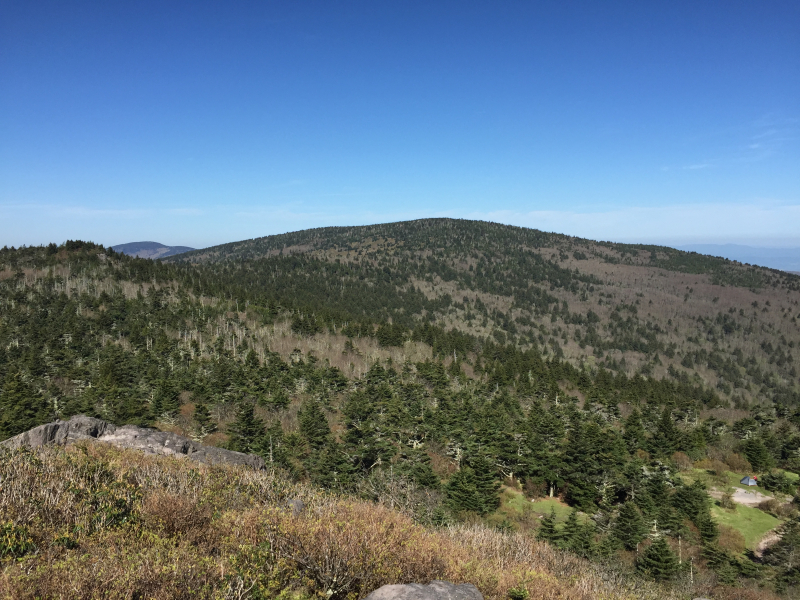
https://en.wikipedia.org/ -
Observation Point is a Navajo Sandstone formation that rises to a height of 6,507 feet (1,983 meters) in Zion National Park in Washington County in southwest Utah, United States. Observation Point, which rises 2,100 feet (640 meters) above the canyon floor and the North Fork of the Virgin River, which drains precipitation runoff from this viewpoint, is located at the northern end of Zion Canyon. A well-known 8-mile round-trip trek ascends to the peak from the Weeping Rock trailhead along Zion Canyon Road. The Great White Throne, Cathedral Mountain, Angels Landing, and Cable Mountain may all be seen as neighbors from this location. The U.S. Board on Geographic Names formally adopted this geographic feature's name in 1934.
The eight-mile roundtrip journey in Zion National Park that ascends 2,000 feet from the canyon floor to an overlook on the rim is the most breathtaking. The trail winds steeply along smooth rock, explores the small Echo Canyon, and borders the cliff-like White Cliffs. It is carved into the sandstone wall. The reward for the effort is a panoramic view of the canyon, including Red Arch Mountain, the Great White Throne, and Angels Landing, from Observation Point, which is at a height of 6,508 feet. Since hiking is highly popular in this region, you can run into other hikers while doing your exploration. The months of April through October are ideal for hiking this trek. Dogs must stay at home because this trail is off-limits to them.
Length: 11.3 km
Elevation: 214 m
Level: Moderate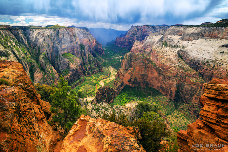
https://www.citrusmilo.com/ 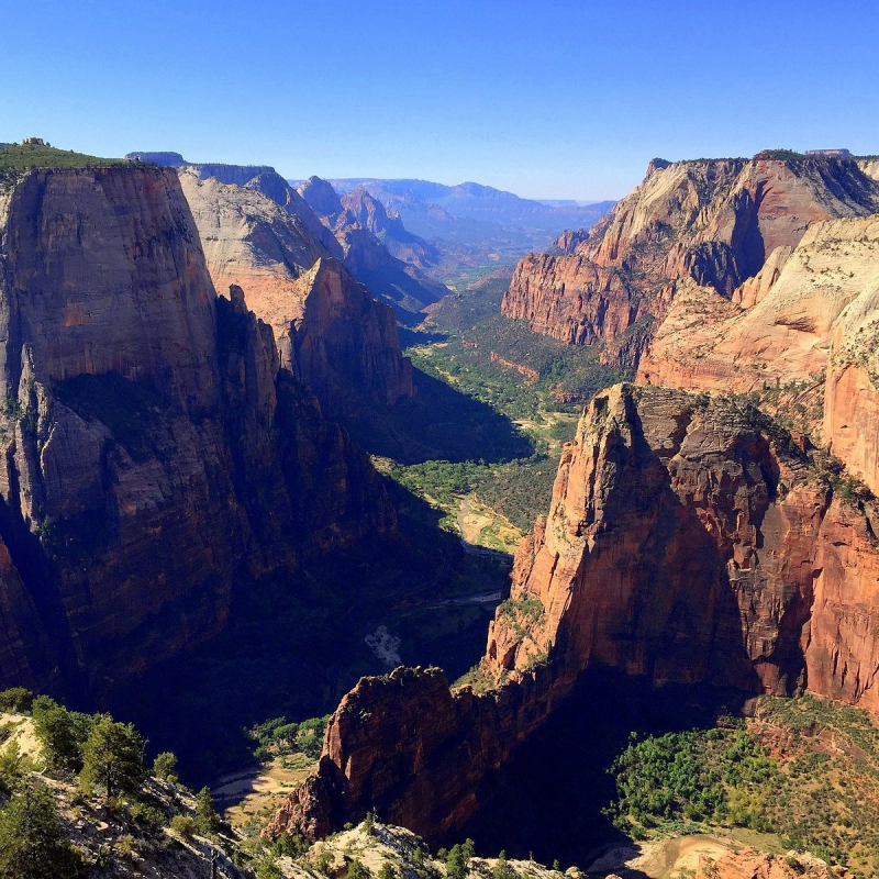
https://www.tripadvisor.com/ -
This is one of the best place to hike in the US. The Tongue Mountain Range Routes are a collection of hiking trails that may be found in the Adirondack Mountains of New York's Tongue Mountain Range, a subordinate range. The trails' combined length of 25 miles (40 km) ranges from leisurely strolls along Lake George's coast at the foot of the mountains to strenuous ascents of mountain peaks in the range.
First Peak, French Point Peak, Fifth Peak, Five Mile Mountain (highest point in Town of Bolton), Huckleberry Mountain, and Brown Mountain are the six summits that make up the Tongue Mountain Range along the ridge. Brown Mountain, Huckleberry Mountain, and Five Mile Mountain are all included in the Five Mile Mountain path. For overnight camping, Fifth Peak and Brown Mountain both have lean-tos. Both open, exposed rock outcrops and woodland sections are traversed along the path. The trail ascends and descends 1,258 feet (383 m). From Clay Meadow, other routes lead to First Peak, French Point Peak, and Fifth Peak, which are located in the southern section of the range.
The Adirondack Mountains, Lake Champlain, and the Vermont Green Mountains may all be seen from the trail. You can chill off in the water at sunny Montcalm Point, the Tongue's tip, after a workout scrambling up and down three 1,500-foot summits while walking north to south. Within the boundaries of the New York Department of Environmental Conservation-designated sites, camping and burning are permitted along the Tongue Range Trails. Specific laws are upheld, and leave no trace principles are promoted. Above 4,000 feet in height, camping and fires are not allowed (1,219 m). The months of April through October are ideal for hiking Tongue Mountain Loop. Dogs are permitted, but they must be leashed.
Length: 40 km
Elevation: 960 m
Level: Moderate
https://www.northcountrypublicradio.org/ 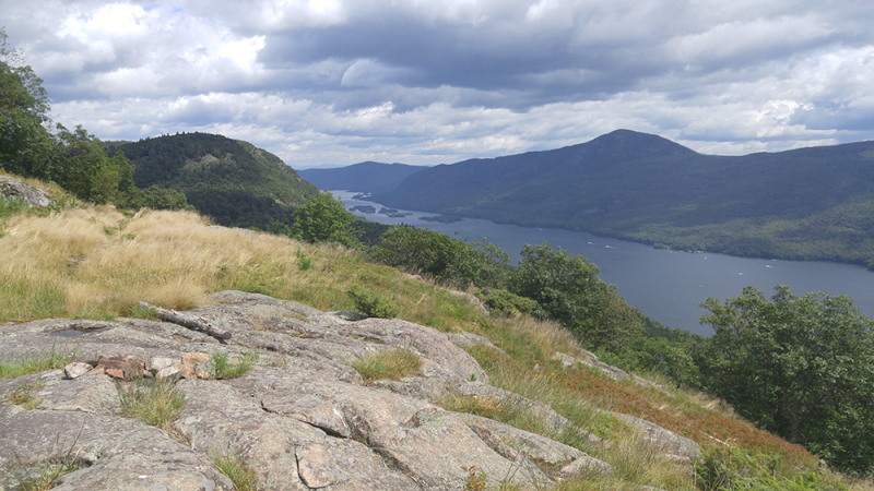
https://en.wikipedia.org/ -
The Yosemite, Kings Canyon, and Sequoia National Parks are all traversed by the John Muir Trail, a long-distance trail in the Californian Sierra Nevada mountain range. The trail's length is 213.7 miles (343.9 km) from its northern terminus at Happy Isles in Yosemite Valley to its southern terminus at the top of Mount Whitney, with a cumulative elevation gain of roughly 47,000 feet (14,000 m). The trail is in the High Sierra backcountry and wilderness regions for practically its entire length.
The John Muir trail is located primarily within wilderness that has been designated. The trail is almost entirely at or above 8,000 feet (2,400 m) in elevation and winds through expansive stretches of alpine and high mountain landscapes. The path, which has been called "America's most renowned trail," sees roughly 1,500 attempts at thru-hiking each year (including Pacific Crest Trail thru-hikers), which is far less than the number of tries on comparable walks like the southern Appalachian Trail or the Way of St. James.This 211-mile journey from Yosemite Valley to Mount Whitney traverses the Sierra Nevada Mountains, and it's legendary for a reason. Every step leads to breathtaking vistas of high passes, alpine meadows, lakes, and sequoias. The route begins with well-known views like Half Dome and Vernal Falls, then climbs through the Ansel Adams Wilderness to the highest point in the contiguous United States. The Pacific Crest Trail's most picturesque portion is blessed with a temperate temperature and plenty of sunshine. Most hikers travel from north to south between July and October to avoid the snow, acclimate to higher altitudes, and get in shape before ascending 14,495-foot Mount Whitney. Since backpacking, camping, and hiking are all fairly popular activities in this region, you can run into other people while doing your exploration.
Length: 338.1 km
Elevation: 14,030 m
Level: Hard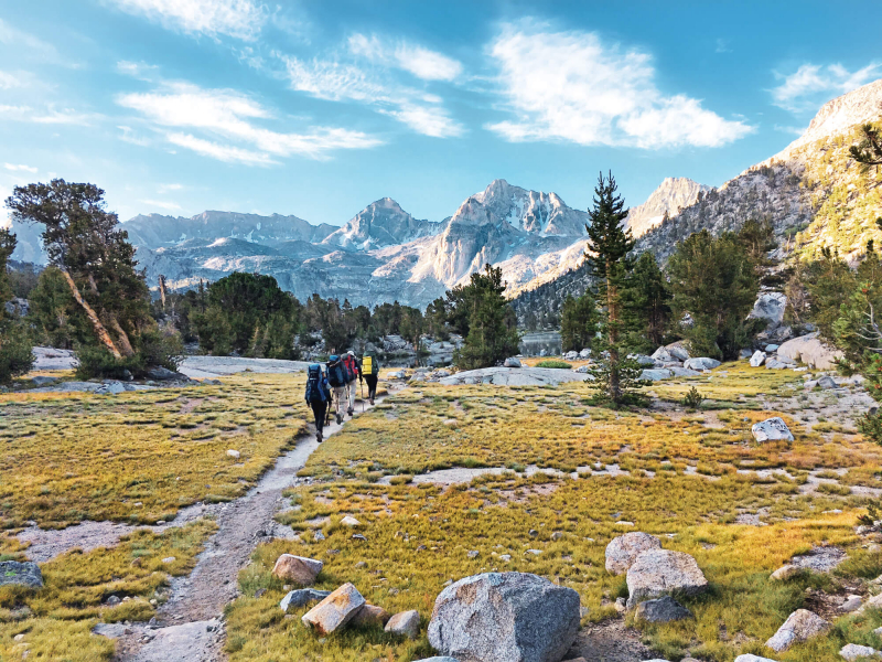
https://www.symg.com/ 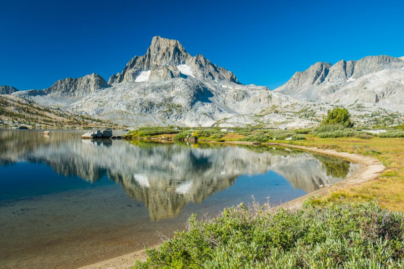
https://www.pcta.org/ -
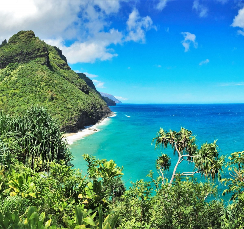
On the Hawaiian island of Kauai's N Pali Coast, there is a trail known as the Kalalau Trail. From Kee Beach to the Kalalau Valley, the trail travels along the island's north shore for about 11 miles (18 km). The route has been hailed as one of the most stunning and hazardous hikes in the country. The N Pali Coast in Kauai, where fluted cliffs tumble into the aquamarine Pacific, can only be reached by land by this breath-taking journey. It is an alien scene with tropical valleys, waterfalls, and mango trees, just like in Jurassic Park.
Expert hikers or trail runners can complete the 22-mile (35-km) roundtrip walk in a single day, but the typical hiker needs at least two days and will camp along the way. Only at the woodland streamside campsite Hanakoa Valley (6 km) and Kalalau Beach is camping allowed. Only Kalalau Beach is eligible for camping licenses, which are only valid for five straight nights. With a valid Kalalau permit, hikers are permitted to camp at Hanakoa Valley for one night. After Hanakapiai Beach, the trail climbs from sea level to 800 feet over a distance of 1 1/4 miles, which is the toughest section of the trek. It's also a really difficult hike, particularly after it rains, which it does frequently. Day hikers stick to the first two miles to Hanakapi'ai Beach because it is already rather spectacular.
Since backpacking, camping, and hiking are all fairly popular activities in this region, you can run into other people while doing your exploration. The route is lovely to explore at any time of the year and is open all year. Dogs must stay at home because this trail is off-limits to them.Length: 35.4 km
Elevation: 1.883 m
Level: Hard
https://www.tripadvisor.com.vn/ 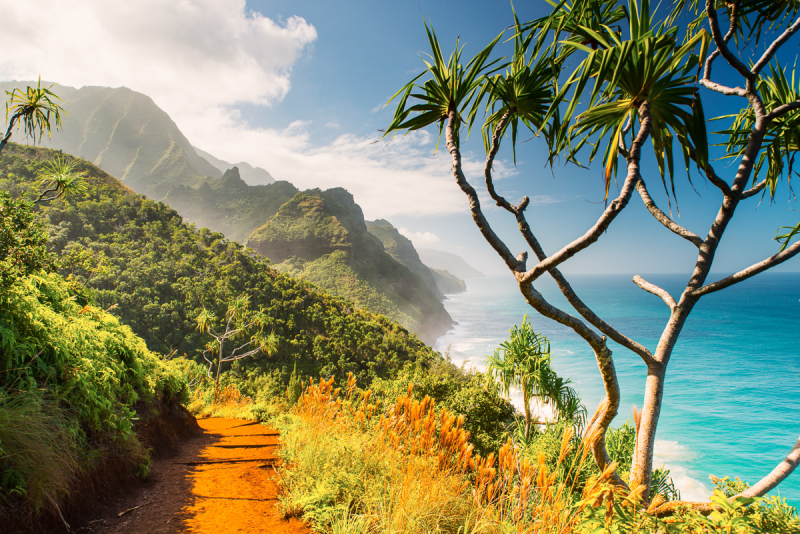
https://www.kalalautrail.com/