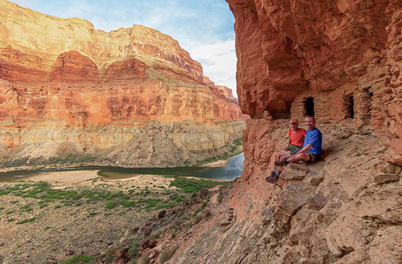
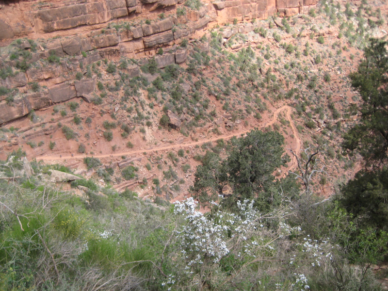
Nankoweap Trail


On the North Rim of the Grand Canyon National Park, which is situated in the U.S. state of Arizona, there is a poorly maintained hiking trail called the Nankoweap Trail. From the trailhead at Saddle Mountain to Nankoweap Creek and then to the Colorado River, the Nankoweap trail travels 14 miles and descends 6,040 feet. The trek into the Canyon is thought to be the toughest one. Since there is no water along the 11 miles between the trailhead and Nankoweap Creek, hikers must carry and store water.
This trail offers jaw-dropping rewards despite being one of the Grand Canyon's toughest walks. It was first built by geologist J.W. Powell in the 1880s and descends 6,000 feet over the course of 14 miles from the north rim to the Colorado River. Switchbacking through sandstone cliffs, steep redwall limestone, and descending yellow shale down to Nankoweap Creek and the river is tough for the faint of heart.
There are plenty of opportunities for birdwatching, camping, and trekking along this trail, and you probably won't run into many other people. With the canyon spreading out before you and echoing with the scream of rapids, this isolated campsite is one incredible place to stay. But then you have to go back and climb those 14 miles. The months of May through October are ideal for hiking this trek.
Length: 13.9 mi (22.4 km)
Elevation: 6,040 ft (1,840 m)
Level: Hard