Top 10 Great Mountain Ranges

Great mmountain ranges exist on every continent. Here are some of the tallest, longest, and most renowned mountain ranges on Earth. Do you enjoy hiking? Come ... read more...then and discover the flora and fauna of seven of the world's principal mountain ranges! Take note of this post!
-
Instead of a single line of intimidating peaks, travelers to the Andes would see a sequence of parallel and transverse mountain ranges, or cordilleras, together with interstitial plateaus and depressions.
They can be found all along South America's western border; they cover a 5,500-mile stretch from the continent's southernmost coast, Tierra del Fuego, to its northernmost coast, the Caribbean Sea (8,900 kilometers). Along with a number of volcanoes that make up the eastern edge of the Pacific "Ring of Fire," the Andes are home to some of the highest peaks in the Western Hemisphere. On the boundary of Chile and Argentina, Mount Aconcagua has the highest summit at 22,831 feet. The availability of plentiful food sources has an impact on all animal life. The upper limit of residence for animals in South America is the permanent snow line. While certain plants and animals can survive at any height, others can only do so.
Along with other animals, the Andes are home to the guemul, puma, vizcacha, cuy (guinea pig), and chinchilla. Beautiful mid-latitude rain forests of the conifer genus Araucaria as well as oak, coigue (an evergreen used for thatching), chusquea, cypress, and larch are typical in the southern Patagonian Andes. Cloud forests can be found in the north and are mostly made up of trees from the Lauraceae, Melastomataceae, and Rubiaceae families. The treeline gradually gives way to grasslands throughout the Andes, many of which are distinctively characterized by a tall, thick-stemmed member of the aster family (Asteraceae), known as Espeletia.
Location: edge of South America
Length of range: 4300 mi
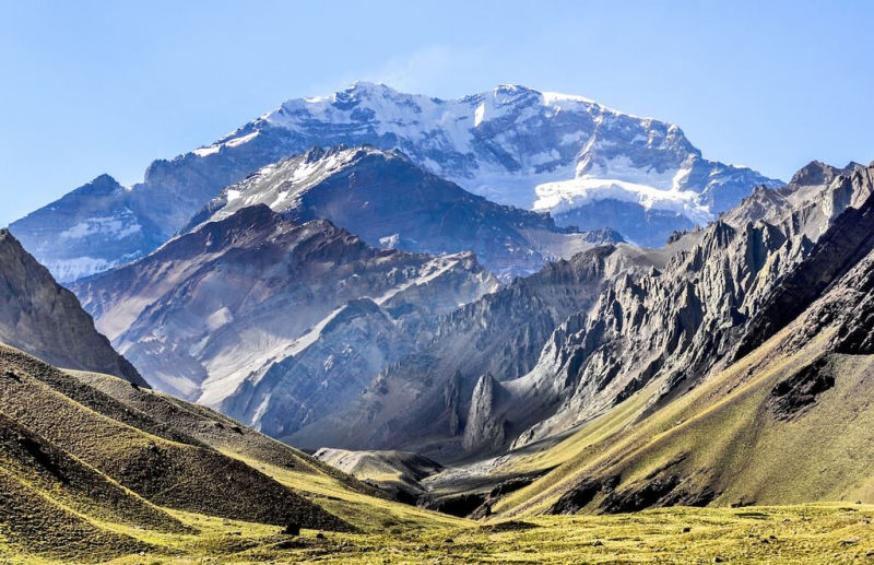
Photo: PeakVisor 
Photo: Voyagers Travel -
The Rocky Mountains, commonly known as the Rockies, are a huge cordillera in western North America that runs from north to south. A cordillera is a system or set of parallel mountain ranges with any intervening plateaux and other characteristics. The Rockies, which cover an area of more than 4,800 km2, extend from New Mexico in the southwestern United States up to the northernmost point of British Columbia in western Canada.
In addition to having more than 100 distinct mountain ranges, this huge mountain system extends from Alberta, British Columbia, and New Mexico. Mount Elbert, which is 14,440 feet high and located in Colorado, is the tallest peak in the Rockies. The Rockies, which run from northern New Mexico and into Colorado, Wyoming, Idaho, and Montana, are home to numerous parks and reservations, including the Glacier, Rocky Mountain, and Yellowstone National Parks in the US as well as Banff, Jasper, and Kootenay National Parks in Canada. Glacier National Park, Lake Louise, and The Icefields Parkway are a few of the best places to view the Rocky Mountains.
A large portion of the mountain range is protected by public parks and forest areas, which are also well-liked tourist destinations, particularly for activities like hiking, camping, mountaineering, fishing, hunting, mountain biking, snowmobiling, skiing, and snowboarding.
Countries: Canada, United States
Lengt of range: 3,000 mi
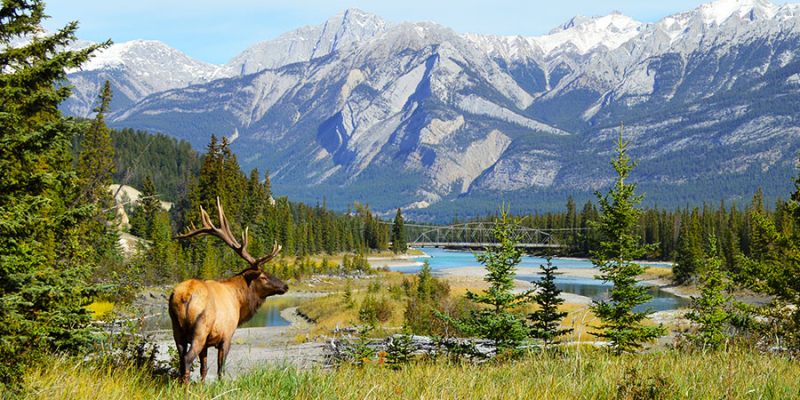
Photo: Vacations By Rail 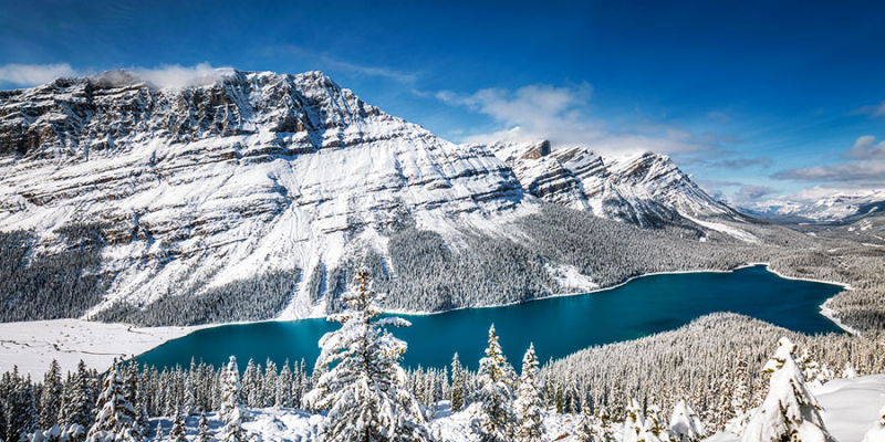
Photo: Vacations By Rail -
The Great Dividing Range in Australia is a chain of plateaus and low mountain ranges that generally line the coasts of Victoria, New South Wales, and Queensland. From the Cape York Peninsula in Queensland to the Grampians in Victoria Bass Strait, which separates Australia and Tasmania, the mountain range stretches for around 2,300 miles (3,700 km). The mountains of Queensland are typically between 2,000 and 3,000 feet (600 and 900 meters) high, but the Lamington Plateau, Bellenden Ker, and McPherson ranges reach elevations of up to 5,000 feet (1,500 meters). Australia's highest mountain, Mount Kosciuszko, is located in a section of the Australian Alps further south, close to the border between New South Wales and Victoria (7,310 feet).
Few mountain-adapted animals may be found in the Great Dividing Range because it is not as high as some other mountain ranges. In the rainforests of the northeast's mountainous region, you can see tree kangaroos and bird-wing butterflies. Australia is home to several bird species, including the galah and the Australian magpie. A large portion of the Great Dividing Range is made up of forested areas with eucalyptus, acacia, and casuarina trees (see photo), along with hummock grasses and flowering plants like banksias in the undergrowth. The majority of the vegetation on the western slopes consists of subtropical or temperate eucalyptus and scrub woods. A "living fossil" called the Wollemi pine was found in Wollemi National Park in 1994.
Country: Australia
Length of range: 2,200 mi
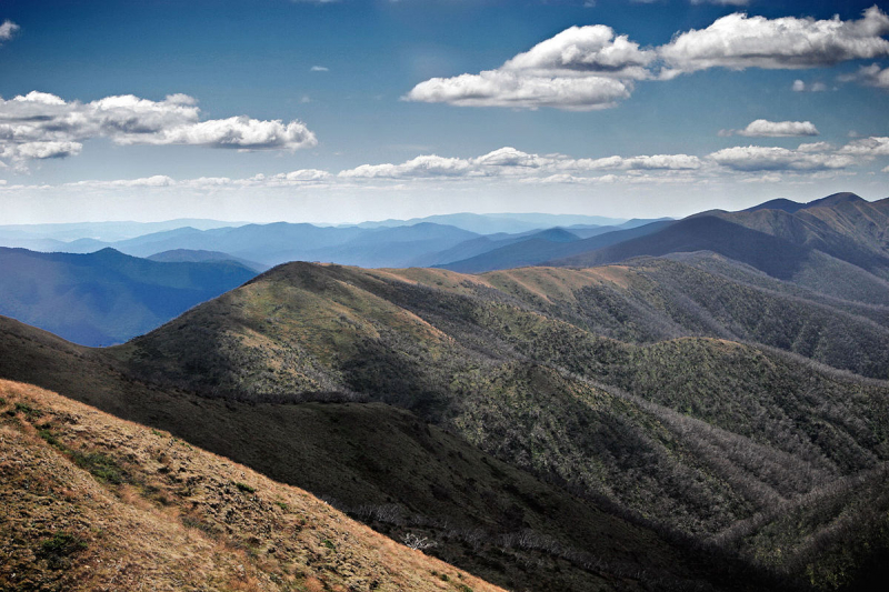
Photo: Wikipedia 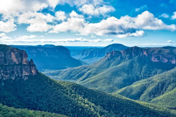
Photo: iStock -
The Transantarctic Mountains are a series of great mountain ranges that divides the Antarctic continent into two sections: East Antarctica and West Antarctica.More than 2,000 miles (3,200 km) of the Transantarctic Mountains extend from Victoria Land to the Weddell Sea's coastlines. They are located in the Queen Maud Mountains and reach a height of 14,856 feet (4,528 meters) at Mount Kirkpatrick. The area they pass through is largely covered by an ice sheet and a network of massive glaciers. The Shackleton, Pensacola, Horlick, Queen Alexandra, Britannia, Prince Albert, Dufek, and Admiralty ranges are further significant sections of the system. There have been discovered extensive coal resources, which are among the greatest reserves in the world, as well as the petrified remains of extinct freshwater amphibians and reptiles. The United States, United Kingdom, and New Zealand have all run research stations along the mountain's base.
Captain James Clark Ross first observed the Transantarctic Mountains while sailing in the Ross Sea in 1841. The range acts as a natural barrier between the Ross Ice Shelf and the South Pole.
Location: across the continent from Cape Adare in northern Victoria Land to Coats Land
Length of range: more than 2,000 mi
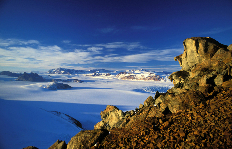
Photo: Wikipedia 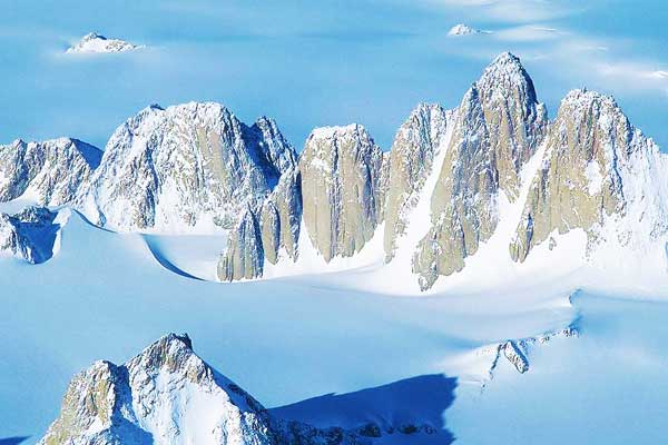
Photo: Mountain IQ -
The world's highest and one of the youngest mountain ranges is this massive mountain chain in Asia. The Himalayas, which include the planet's tallest peaks, were created by a collision between the Indo-Australian and Eurasian tectonic plates that started 50 million years ago and is still going on now. The Third Pole is the name of a massive mountain range that stretches for around 2,400 kilometers and ranges in breadth from 400 kilometers in the west to 150 kilometers in the east. The Himalayas, which span a large portion of central Asia, cut across India, Pakistan, Afghanistan, China, Bhutan, and Nepal. Himalaya is a name created from the Sanskrit words hima (snow) and Alaya (abode).
The Ganges, Indus, and Brahmaputra are three large rivers that are fed by their snowfields. The literature, mythology, and various religions of the people of South Asia, including Buddhism and Hinduism, show the immense significance that this great mountain chain has had for them. The two tallest peaks in the world, Mount Everest at 29,035 feet and K2 at 28,251 feet, are located in these new fold mountains in Asia that divide the Indian subcontinent from the Asian plains. Zanskar Valley, Mount Apharwat, Goecha La, Kaghan Valley, and Kala Patthar are a few of the best locations to see some of the world's tallest mountain ranges.
Location: Bhutan, China, India, Nepal, Pakistan
Length of range: 1,500 mimi
Video: Scenic Scenes 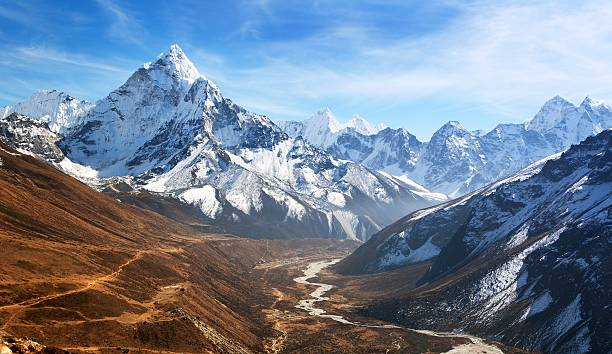
Photo: iStock -
The collision of the African and Eurasian tectonic plates resulted in the formation of this enormous mountain chain, which is found in south-central Europe. The Alps span an area of 192,000 square kilometers, are 1,200 kilometers long, and exceed 201 kilometers in width. The Alps are a folded mountain range that cross eight countries that are located in or near the mountains: France, Switzerland, Monaco, Italy, Liechtenstein, Austria, Germany, and Slovenia. The Mont Blanc mountain range, which is situated on the boundary of France and Italy, is the tallest and largest mountain range system in Europe. It has several hundred peaks and glaciers, several of which are higher than 12,000 feet. Mont Blanc is the highest peak at 15,771 feet.
As the African and Eurasian tectonic plates collided over millions of years, the mountains were created. Marine sedimentary strata rose by thrusting and folding into tall mountain peaks like Mont Blanc and the Matterhorn as a result of the event's extreme shortening.
The Alps, which are recognized as the most notable physiographic region in western Europe, play a significant role in numerous geographic phenomena. Many of Europe's largest rivers, including the Rhône, Rhine, Po, and countless tributaries of the Danube, are among them. Lucerne (Switzerland), Gran Paradiso National Park (Italy), Maggiore (Italy), and Chambéry are some of the best places to see the Alps (France).
Location: France, Switzerland, Monaco, Italy, Liechtenstein, Austria, Germany, and Slovenia
Length of range: 1,500 mi
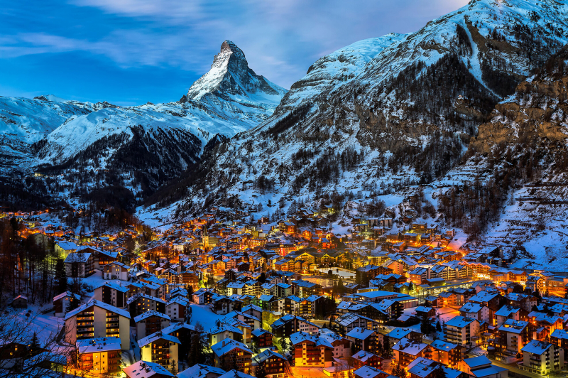
Photo: Culture Trip 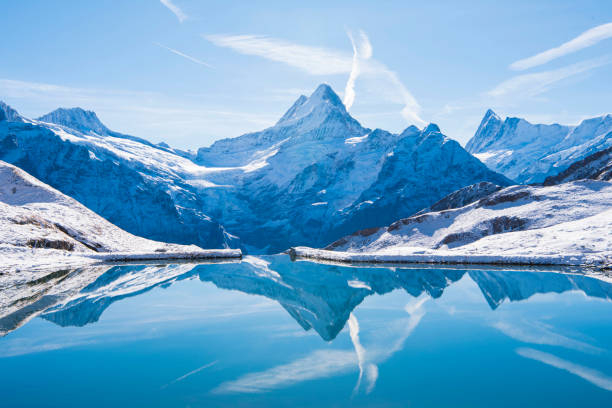
Photo: iStock -
In North Africa's Maghreb region, there is a mountain range called the Atlas Mountains. The mountain range gives rise to the word "Atlantic," which separates the Sahara Desert from the Mediterranean Sea and the Atlantic Ocean. It traverses Morocco, Algeria, and Tunisia for around 2,500 kilometers (1,600 mi). Toubkal, which is located in central Morocco and has an elevation of 4,167 meters, is the highest mountain in the range (13,671 ft). Berber populations predominate in the Atlas Mountains. In various Berber languages, the words for "mountain" are Adrar and adras, which are thought to be cognates of the toponym Atlas.
Only a small portion of the Atlas's forest cover survives, and most of the terrain has been removed for agricultural use. The animal population in the highlands is likewise declining. Only a few jackals, a handful of tribes of monkeys at higher altitudes, and sporadic herds of wild boars can still be found in the oak forests that can be found in the northern half of the range.
The Atlas Mountains have very sparse vegetation due to limited rainfall and high rates of soil erosion. The regions with the most rainfall include damp cork oak forests with carpets of rockrose and lavender, as well as an undergrowth of arbutus (cane apple) and heather shrubs. Green oak and arborvitae (a kind of pine tree), which produce light, dry woods with a thin and bushy undergrowth, are common in dry areas. Although the arid tops are frequently reduced to sporadic patches of green oak and juniper trees, cedar forests predominate at higher elevations.
Location: North Africa's Maghreb region
Length of range: 1,600 mi
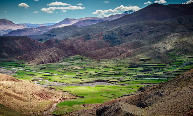
Photo: Lonely Planet 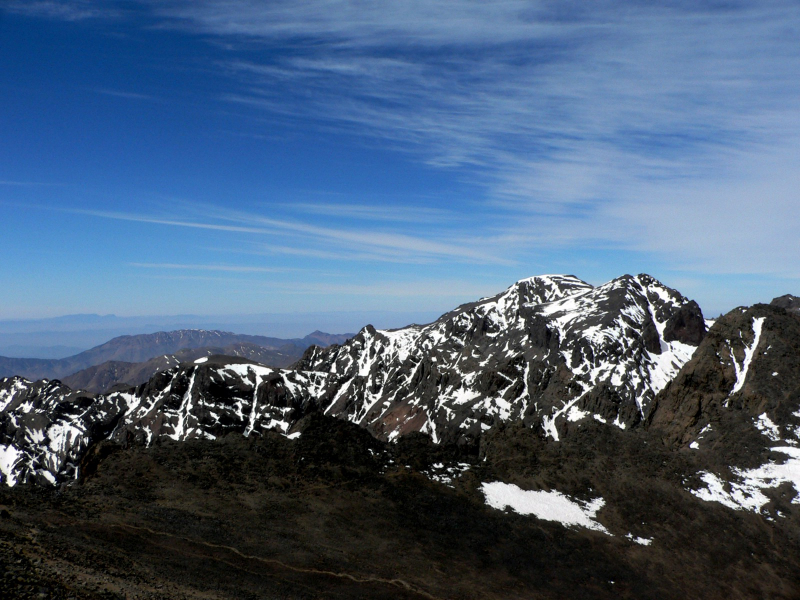
Photo: Wikipedia -
The Ural Mountains, sometimes referred to as the Urals, Uralskie Gory, or Ural, are one of the great mountain ranges in west-central Russia that makes up a significant portion of the traditional physiographic border between Europe and Asia. The mountains make up the majority of the Uralian orogenic belt, which stretches 2,175 miles (3,500 km) from the Aral Sea to the northernmost tip of Novaya Zemlya and stretches 1,550 miles (2,500 km) from the bend of the Ural River in the south to the low, severely eroded Pay-Khoy Ridge, which forms a 250-mile (400-km) fingerlike extension to the northern tip of the Urals proper.
The Mughalzhar Hills, a large, arrowhead-shaped southern extension in northwest Kazakhstan that separates the Caspian and Aral basins, are themselves a part of the Uralian orogenic band. Although the northern and southern courses of the Urals are rather short, ranging in width from from 20 to 90 miles (32 to 145 km), they pass over the enormous latitudinal zones of the Eurasian landmass, from Arctic waste to semidesert. The Urals are also the home of peoples with ancient roots and are a component of a highly developed industrial complex that is linked to the mineral-rich Siberian region.
Location: west-central Russia and the major part of the traditional physiographic boundary between Europe and Asia
Lenth of range: 1,550 mi
Photo: PeakVisor 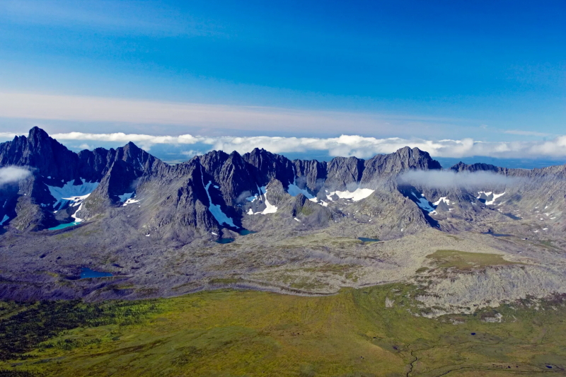
Photo: Depositphotos -
Chinese Tien Shan, a vast mountain range in Central Asia. Its name translates to "Celestial Mountains" in Chinese. It roughly bisects the historic region of Turkistan and stretches 1,500 miles (2,500 km) from west-southwest to east-northeast. It primarily spans the border between China and Kyrgyzstan. Its eastern and western extremities are at times around 300 miles (500 km) broad, but the center is only about 220 miles (350 km) wide.
The Junggar (Dzungarian) Basin in northwest China and the southern Kazakhstan plains encircle the Tien Shan, while the Tarim (Talimu) Basin borders it to the southeast. The Alay, Surkhandarya, and Hisor valleys, along with the Pamirs to the south, form the system's limits as the Hisor (Gissar) and Alay ranges of Tajikistan stretch into a portion of the Tien Shan. The Qarata Range and the Sh-Ile Mountains, which stretch far to the northwest into the plains of eastern Kazakhstan, are also part of the Tien Shan. Within these bounds, the Tien Shan covers a total area of approximately 386,000 square miles (1,000,000 square km).
The Tien Shan mountain range's greatest peaks are located in a core knot-shaped group of mountains, from which ridges spread along the borders of China, Kyrgyzstan, and Kazakhstan.
Location: straddles the border between China and Kyrgyzstan
Lenth of range: 1,500 mi
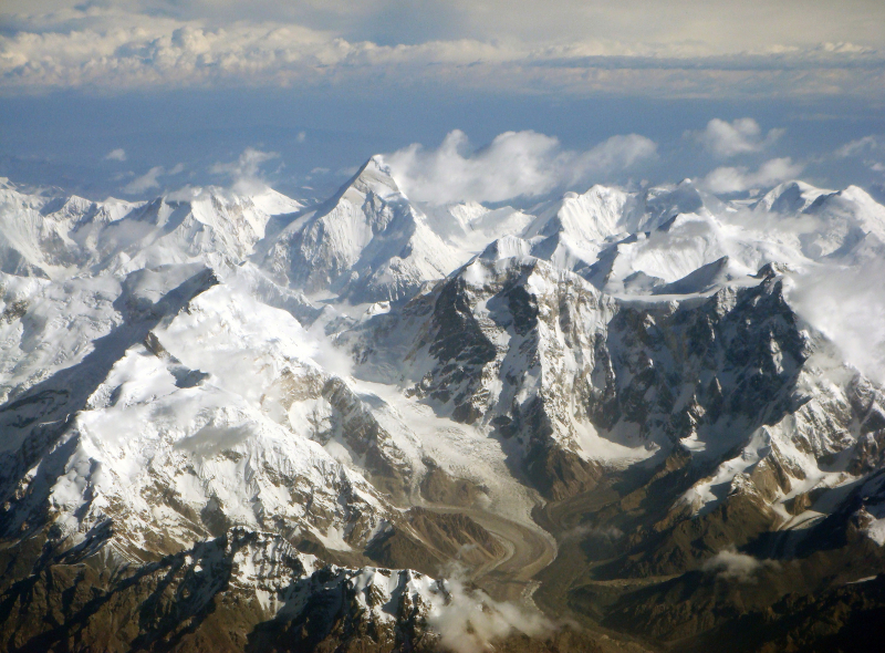
Photo: Wikipedia 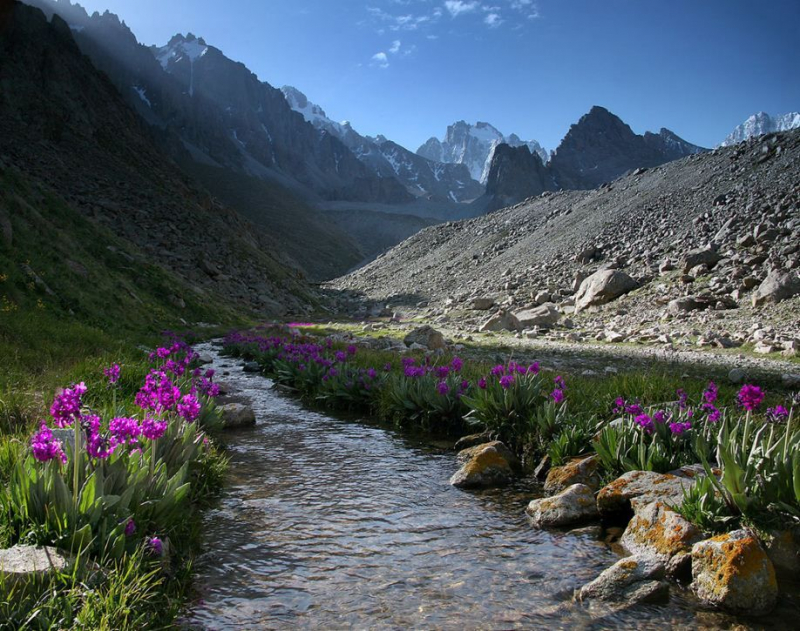
Photo: NativePlanet -
The Caucasus, also known as the Russian Kavkaz, is a mountainous area between the Black Sea in the west and the Caspian Sea in the east that is inhabited by Russia, Georgia, Azerbaijan, and Armenia.
The name Caucasus is a Latinized version of the ancient Greek name Kaukasos, which was used by Greek geographers and historians; it shares this origin with the Russian word Kavkaz. The Hittite name for a people who lived on the southern shore of the Black Sea, KaK-Kaz, is assumed to be the ultimate derivation.
In the area where Europe and Asia meet, the massive Caucasus Mountains rise across the vast isthmus separating the Black and Caspian oceans. The mountains are made up of two ranges, the Greater Caucasus in the north and the Lesser Caucasus (Maly Kavkaz) in the south, and they generally run from northwest to southeast.
The tallest mountain in the Greater Caucasus range is Mount Elbrus, which rises 18,510 feet (5,642 meters). The Greater Caucasus watershed, the system's axis, has long been considered part of the line separating Europe from Asia, but Europe's eastern border has been hotly contested. One widely used theory places the region's northern and southern boundaries along the crest of the Greater Caucasus mountain range, with the former belonging to Europe and the latter to Asia.
Location: lying between the Black Sea (west) and the Caspian Sea (east)
Length of range: 680 mi
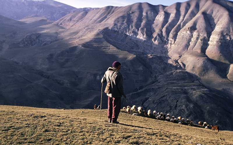
Photo: Institute for Global Change 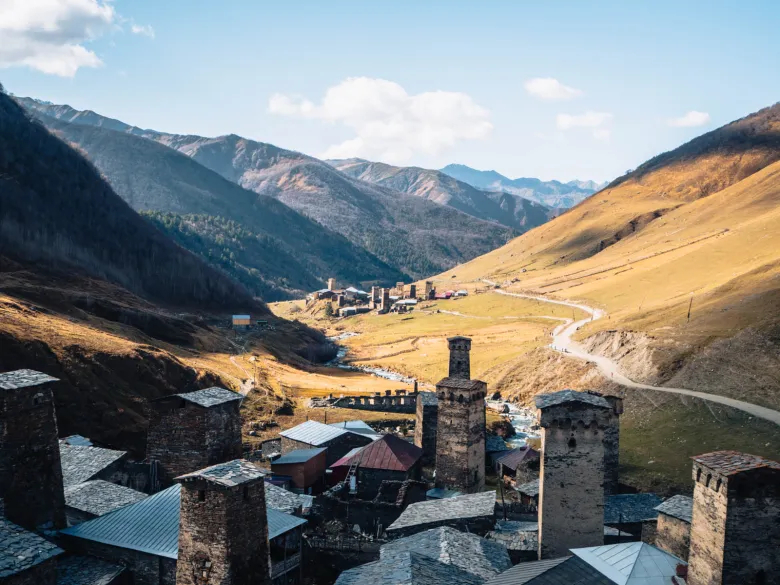
Photo: Beyond Wild Places