Top 14 Most Beautiful Lakes in North Carolina

There are so many beautiful lakes in North Carolina that you may visit! There is bound to be something on this list for everyone, from the breathtaking ... read more...Appalachian Mountains to the west, reaching the Atlantic Ocean to the east. Check out the most beautiful lakes in North Carolina!
-
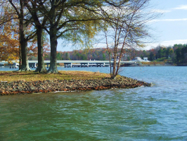
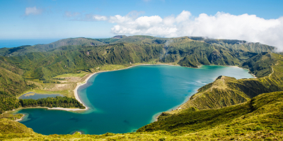
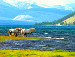
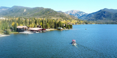
The Catawba River Chain's Cowan's Ford Dam, which was being constructed by Duke Energy, is what gave rise to Lake Norman, the largest artificial lake in our state. This stunning lake spans sections of four counties, with 520 miles of shoreline, and a surface size of more than 32,475 acres. Experiences at Lake Norman include colorful sunsets, waterfront dining, cruises, regattas, and, of course, the possibility of seeing Normie, the Lake Norman Monster! Fishing, boating, skiing, paddle and wakeboarding, swimming, riding, and hiking paths are just a few of the outdoor pastimes available in our inland sea.
The majority of North Carolina, including Lake Norman, has a humid subtropical climate with warm to hot summers and cool to mild winters. The Piedmont region of the Carolinas receives its electricity from Lake Norman. It fuels the hydroelectric plant at Cowans Ford Dam, the coal-fired Marshall Steam Station, and the nuclear power plant at McGuire to cool the reactors while producing the steam that powers the turbines. Lincoln County, Catawba County, Iredell County, Charlotte, and other communities in Mecklenburg County, including Cornelius, Davidson, and Huntersville, all receive water from the lake.
Location: Catawba / Iredell / Lincoln / Mecklenburg counties
Photo: TripAdvisor 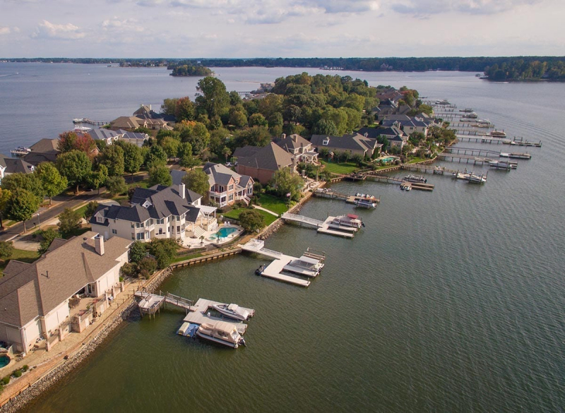
Photo: lakenorman.com -
Conveniently, Raleigh and Durham are both just west and south of Jordan Lake. There are several activities available in this sizable reservoir, which has a surface area of 13,940 acres. Along the lake, there are more than 1,000 campsites, ranging from basic tent camping to complete RV hookups. Seven beaches are also found along the coastline, tucked within 17 miles of hiking paths.
Animals can be found in great numbers near the water due to the lake's booming ecology system in recent years. You can also go to the exhibit hall at the visitor center to find out a little bit more about the nearby wildlife!
A large portion of the land underwent permanent modification during the reservoir's construction. Although it was moved from the New Hope basin to higher land, the Durham and South Carolina Railroad's stations were never restored, and the route itself was soon abandoned. As the project was created, many rural people were evacuated, and several highways in eastern Chatham County were either diverted or shut down. Some of the roads were simply left to flow over rather than being demolished. Many of these roads are still visible when the lake has little water in it, and some of them have even been used as temporary boat ramps.
Location: Chatham / Durham counties
Photo: North Carolina State Parks 
Photo: iStock -
Lake James, a 6,516-acre body of water with 150 miles of shoreline in western North Carolina, lies tucked into the Blue Ridge Mountains. The lake was built by Duke Power between 1916 and 1923 using the Catawba, Linville, and Paddy Creek dams. At 1200 feet above sea level, Lake James is the highest lake in the Catawba River chain. Despite being created by Duke Power to supply the local area with hydroelectric power, Lake James has grown into one of the top tourist attractions in the region. Low-density housing makes up the majority of lake development.
Boating will be at the top of your list of things to do when you visit Lake James. You can opt to zoom around in a powerboat, test the winds in a sailboat, take in the scenery from a pontoon boat, or take your time in a canoe because the lake has no speed or horsepower restrictions. Four boat ramps, a fishing access area, and a canoe and fishing access area are all owned by Duke Power. Two boat access points, Hidden Cove and Canal Bridge, are leased by Lake James State Park from the utility. The North Carolina Wildlife Resources Commission and Duke Power work together to oversee the Bridgewater canoe and fishing area as well as the other two boat access points, Black Bear and Linville. In addition, public boat access is offered by four commercial marinas.
Location: Burke / McDowell counties
Photo: Romantic Asheville 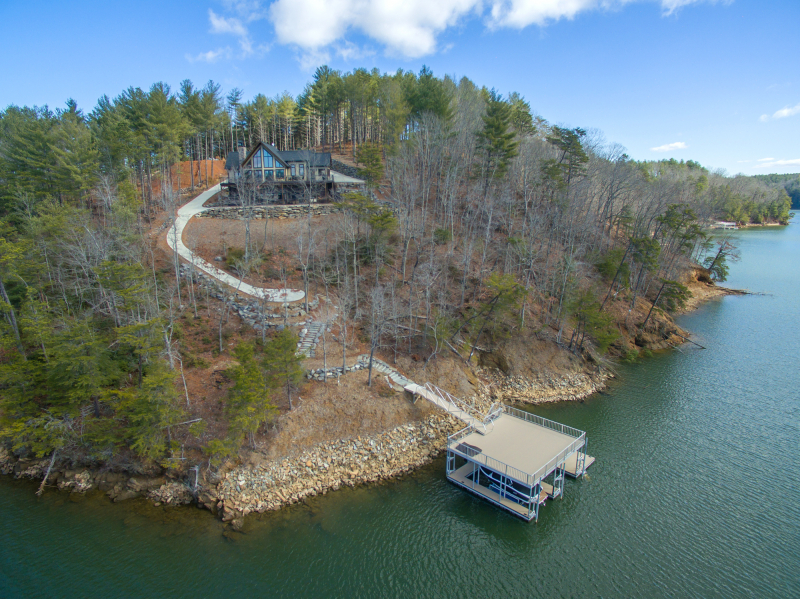
Photo: Flickr -
High Rock Lake is a reservoir situated on the Yadkin River in the counties of Davidson and Rowan in central North Carolina. The Tallassee Power Company, an entirely owned subsidiary of Aluminum Company of America (Alcoa), built the lake in 1926–1927. It is the northernmost of four hydroelectric projects that were planned at the time to power Alcoa's Badin Works, a sizable aluminum smelting facility that was situated 16 miles downstream in the town of Badin. Alcoa maintained its Yadkin hydroelectric facilities after the Badin Works' ultimate closure in 2007 until it sold them to Cube Hydro Carolinas in 2016.
High Rock was one of the largest reservoirs in the country and the largest reservoir in North Carolina at the time of its completion.
One of the most beautiful lakes in North Carolina, top lakes for fishing is High Rock Lake. It frequently hosts other angling contests as well as Bassmaster Tournaments, including the Bassmaster Classic in 1994, 1995, and 1998. The lake is stocked with channel, blue, and flathead catfish as well as crappie and a variety of sunfish, including bluegill and shellcracker. White bass and striped bass hybrids are both widely distributed. Largemouth bass, which are abundant and of high quality and draw anglers from around the country, are the lake's most well-known fish species. This is most likely a result of the lake's relatively shallow depth and the vast variety of habitat that the bass like.
Location: Davidson / Rowan counties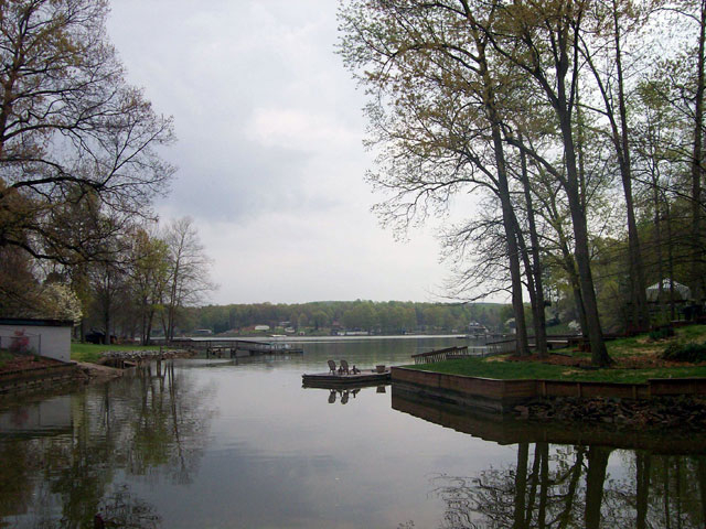
Photo: Wikipedia -
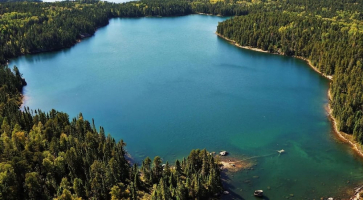
Lake Glenville is a spotless reservoir in Jackson County, only 8 miles from Cashiers. The lake, which has 26 miles of shoreline and is the highest elevation of any lake east of the Mississippi, is situated in a stunning North Carolina mountain rainforest (3,494 feet). There are several outdoor activities available, such as tubing, skiing, paddleboarding, kneeboarding, swimming, and fishing. Western Carolina University is located around 15 miles to the south.
Pontoon boats and other lake sports gear are available for rent at Signal Ridge Marine, which is located on Highway 107. Anytime you want to see a spectacular sunset, or around July 4 when Lake Glenville delivers a fantastic fireworks display, you might want to keep them in mind.
It was created by damming the west fork of the Tuckasegee River in 1941 to supply electricity to a factory constructed to meet wartime demands. It is about eight miles from Cashiers. Its official name from 1951 until 2002 was Thorpe Reservoir, and many modern maps still bear this name. A hiking track leads to High Falls, which is close to the lake's dam. Large amounts of water are periodically discharged from the dam, enhancing the beauty of High Falls and making it difficult for kayakers to navigate the Tuckaseegee River.
Location: Jackson County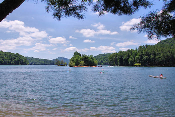
Photo: Romantic Asheville 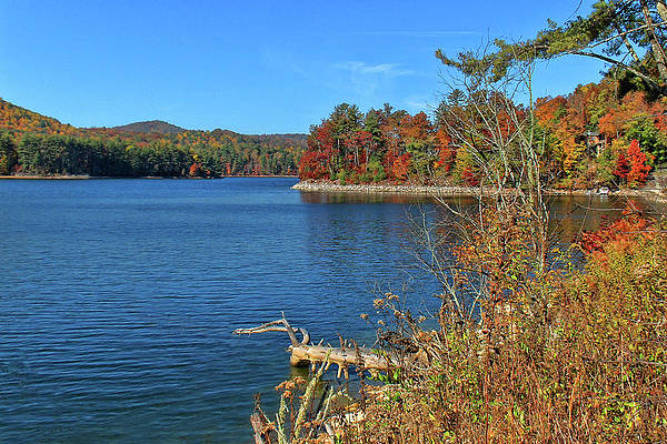
Photo: Fine Art America -
In the Uwharrie Lakes Region of North Carolina, the Yadkin-Pee Dee River was dammed to form a number of lakes, including Badin Lake. The Badin Lake Dam, named for its creator Adrien Badin, was constructed in 1917 to support the nearby Alcoa aluminum smelting facility. In February 2017, the power generation plant was sold to Cube Hydro Carolinas. North Carolina's Piedmont region includes Badin Lake. In the North Carolina town of Badin, Narrows Dam controls it. The lake, which is located within a valley, is exceptionally deep, reaching a maximum depth of 190 feet (58 m). The lake's area is 5,350 acres (22 km2), and its shoreline extends for 115 miles (185 km). The counties of Stanly, Davidson, Montgomery, and Rowan all contain the lake. The Uwharrie National Forest contains a significant portion of the lake's eastern shoreline.
Golf, fishing, boating, hiking, camping, and hunting are just a few of the numerous recreational options available at Badin Lake to both locals and guests.
Largemouth bass, crappie, catfish, spotted bass, white bass, and striped bass are just a few of the game fish found in Badin Lake. Fish don't exist in Badin Lake.Location: Uwharrie Lakes Region
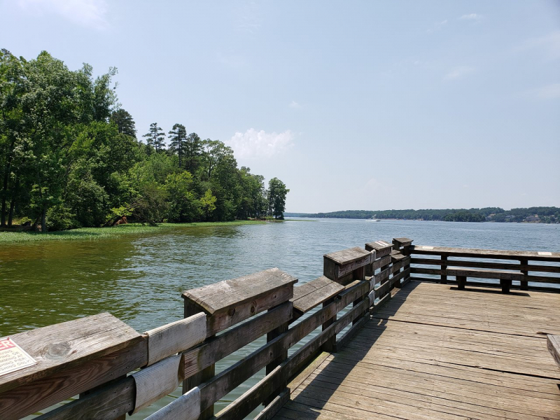
Photo: TripAdvisor 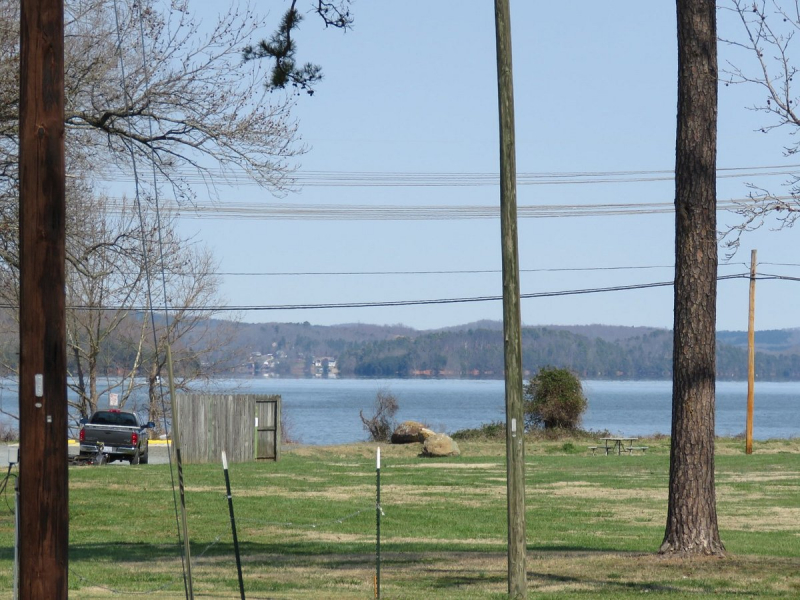
Photo: TripAdvisor -
In the U.S. states of South Carolina and North Carolina, there is a reservoir or artificial lake called Lake Wylie. The 13,400-acre lake has 325 miles of shoreline and a surface size of 13,400 acres.
Residents of adjacent areas including Charlotte, Fort Mill, and Rock Hill frequently travel to Lake Wylie for recreational purposes because of its proximity to both the South Carolina and North Carolina borders. Six open boat access points on the lake are managed by Duke Power. Tega Cay and Lake Wylie are two towns that are situated on Lake Wylie.
The second-oldest lake in the Catawba River Chain, Lake Wylie is one of eleven lakes on the Catawba River. Water is transferred around each lake in the chain system by Duke Power. The lake, which extends from the Mountain Island Dam south of Mountain Island Lake in North Carolina to the Wylie Dam at the lake's southern end, has a surface area of around 13,443 acres and 325 miles of shoreline. The lake is just over twenty feet deep on average.
The Catawba Nuclear Generating Station is situated on the lake's southwest shore and uses lake water for cooling. The lake is also used by Allen Steam Station, which is west of Charlotte and positioned on the lake's northern shore.
Location: York County
Photo: Wikipedia 
Photo: Flickr -
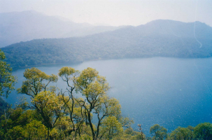
The Nantahala Power Company built Nantahala Lake in 1942 to supply electricity for the war effort. The electricity produced was sent to Tennessee smelters to produce the aluminum needed to make airplanes. The lake is the second-highest lake east of the Mississippi and is situated in the Nantahala National Forest at an elevation of 3,012 feet. The settlement of Aquone, which served as a stagecoach station between Asheville and Murphy, North Carolina, is now covered by the lake.
With 29 miles of shoreline, the lake provides chances for skiing, boating, and swimming. Largemouth bass, smallmouth bass, trout, salmon, catfish, and numerous other species of pan fish may all be found here. Fishing is also very popular.
Nantahala Lake provides water to the Nantahala River. Whitewater rapids are created in the river by releasing water from the Nantahala Dam. The river is quite peaceful while it is not being supplied, but when the water is released from the lake, it is regarded to be "on," and this is when kayaking and rafting take place.
Location: Macon County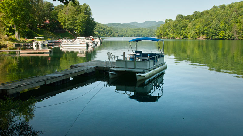
Photo: Nantahala Lake 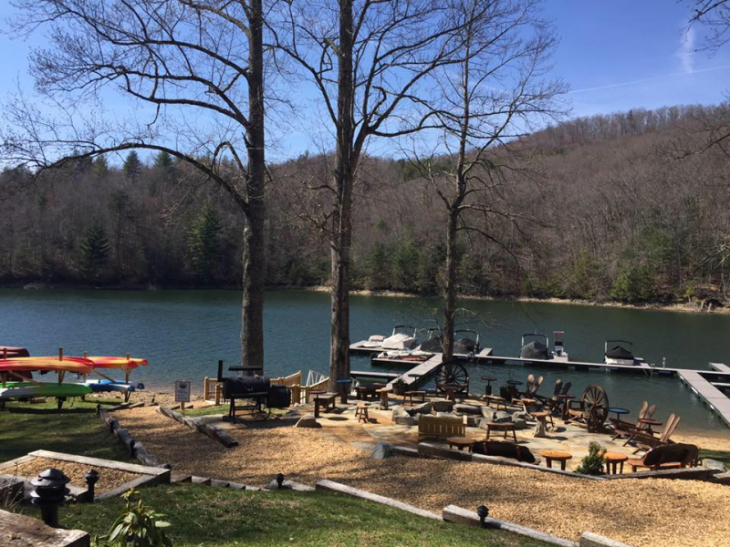
Photo: Lake Nantahala Cabin Rental -
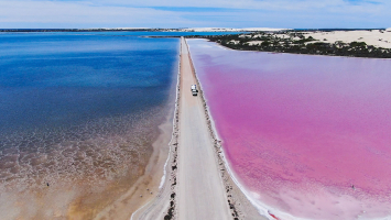
According to Native American mythology, Lake Mattamuskeet was formed when a peat fire burnt, leaving a place that was full of water and fish. The lake has always been shallow, receiving its freshwater supply from creeks, rivers, and rainfall. In 1585, during one of Sir Walter Raleigh's surveying trips, English settlers came upon the Lake. Many colonists thought that the establishment of an Indian reservation was necessary due to the ongoing antagonism between Europeans and Native Americans. The Core, Cotechny, and Mattamuskeet Indian tribes each had one in 1715.
Many people in the 1800s called for draining the tiny lake because of its abundant nutrients. The lake was drained to approximately half its original extent in 1837 while it was owned by the State Literary Board. From the lake's southern end to Wysocking Bay in Hyde County, a seven-mile canal was constructed. There was more cropland available when the lake's size shrank to 55,000 acres.
The lake was emptied three times between 1916 and 1926. The lake was dry for five years after the third. Soon after, in 1932, the New Holland Company stopped pumping because the drainage operations were too expensive and difficult.
The lake was managed by the Mattamuskeet Wildlife Refuge in 1934 and belonged to the United States government. The lake is now a haven for birds making their way up the Atlantic coast and a popular tourist spot, with 50,000 tourists annually. The lake is a well-liked hunting and fishing destination. The number of ducks and geese varies by thousands every year. With a maximum depth of five feet, the lake is still relatively shallow and is popular with conoers.
Location: Hyde County
Photo: Visit NC 
Photo: Pinterest -
Located in Western North Carolina, Fontana Lake is a stunning lake sandwiched between the Great Smoky Mountains and the Blue Ridge Mountains. The lake, which provides more than 10,000 acres of recreational water surface, is the largest lake in Western North Carolina and serves as the southern boundary of the Great Smoky Mountains National Park.
By using NC Highway 28, also known as the Indian Lakes Scenic Byway, one can reach Lake Fontana, which is situated in a relatively rural region of Western, North Carolina.
The lake was created between 1942 and 1945 when Fontana Dam, the highest dam east of the Rocky Mountains at 480 feet tall and 2,365 feet across, was built and the Little Tennessee River was dammed.
The Great Smoky Mountains National Park and the Nantahala National Forest around and protect the lake principally. Numerous spots around the lake offer access to boats and swimming, many of which are reachable from Highway 28. The amount of house boats in the lake is one distinctive aspect of Fontana that most people notice right away. There are thought to be 400 houseboats on the lake, according to a recent count. The image below shows one of the houseboats.
Location: Graham / Swain counties
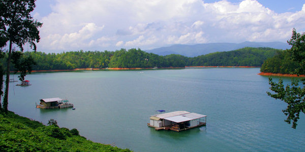
Photo: Blue Ridge Mountain Life 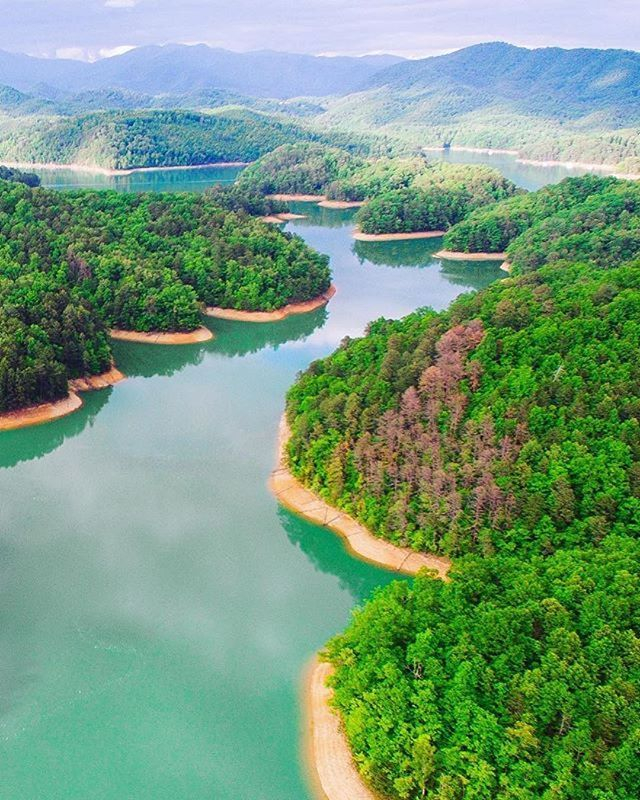
Photo: Pinterest -
Belews Lake may be seen from a high, broad ridge where the house is located, and it is serenely beautiful there. However, the hardwood forests and untainted rivers have their own charm thanks to the variety of native plants, fish, turtles, and birds that they support.
In 1973, Belews Lake entered the annals of time. With a surface area of around 4,000 acres and 88 miles of shoreline, it is one of the most beautiful lakes in North Carolina. It was built as a cooling basin for Duke Energy's Belews Creek Steam Station using the water flow from Belews Creek and a dam at the northern end. Belews Lake, one of the cleanest in North Carolina, has a wealth of healthy and diversified fish populations because to work made in the 1980s to establish a healthy lake environment. Belews was recently dubbed "lake of the month" by Carolina Sportsman and called one of the state's "undiscovered treasures." The Steam Station is presently dual-fuel and is in the process of gradually switching to 100% natural gas as part of Duke Energy's ongoing commitment to environmental quality. Belews Lake should continue to provide crystal-clear waters, excellent fishing, and an abundance of watersports possibilities for many years to come.
Location: Stokes / Rockingham / Guilford / Forsyth counties
Photo: Flickr 
Photo: ColdWater -
North Carolina's Person and Caswell counties contain the reservoir known as Hyco Lake. It is the larger of Person County's two lakes, the other being Mayo Lake, and is the primary location for fishing, boating, water skiing, wakeboarding, and recreational activities. North Hyco Creek, South Hyco Creek, and Cobbs Creek are the lake's three principal tributaries. The lake was created from the Hyco River. Numerous houses with quite high property values have been built along the lake's beaches as a result of interest in buying holiday homes there. Along with the Hyco River, North Hyco Creek, South Hyco Creek, and Cobbs Creek are all tributaries that help keep the reservoir full and provide locals and tourists with a lovely recreational waterway. Around Hyco Lake, more than 1,500 residences have been built, with roughly 800 of them now occupied. The lake flows through the communities of Semora and Leasburg, while Roxboro, NC lies about ten miles to the east of the lake. Hyco Lake, the larger of Person County's two lakes, is the primary location for fishing, boating, water skiing, wakeboarding, and recreational activities.
The Person-Caswell Lake Authority has been in charge of the lake and its leisure area ever since it was founded. The North Carolina Department of Environment and Natural Resources is in charge of controlling the water. Up to 420 feet (130 meters) above sea level, the land surrounding the lake is owned by Duke Energy Progress.Location: Person / Caswell counties
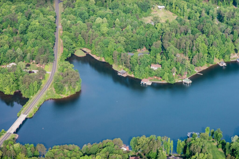
Photo: Hyco Lake Magazine 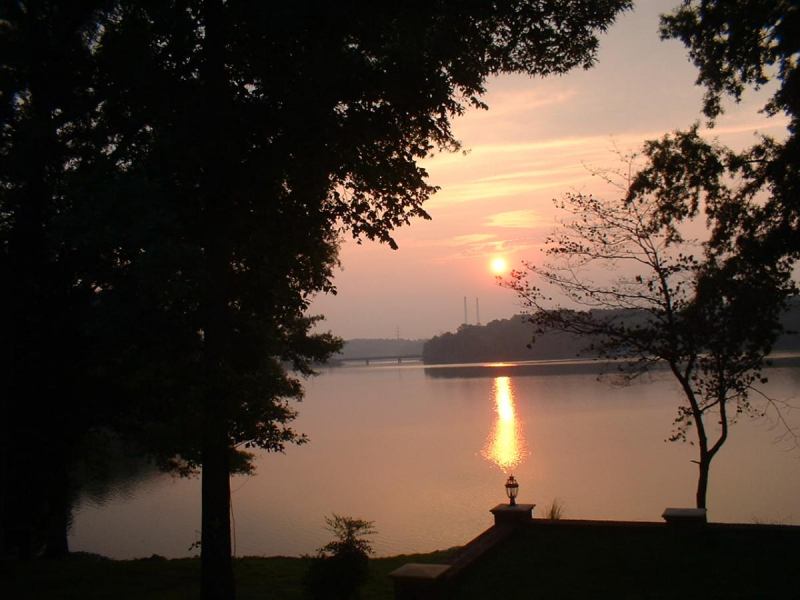
Photo: CampLife -
The newest lake and popular leisure area in North Carolina's Piedmont Region is Randleman Lake. The Randleman Lake Dam's completion in 2004 resulted in the lake's creation. The lake was built to give recreational activities as well as to meet the drinking water demands of the greater Greensboro area for the ensuing 50 years.
There is a lot of excitement about a brand-new, 3000+-acre lake being located so near to the triangle of High Point, Greensboro, and Winston-Salem. Diverse interests have all made an effort to establish themselves in relation to shoreline recreational rights. The PTRWA owns the entire water body, and in order to preserve the water quality, it is strictly prohibited from allowing any access to the shoreline or the water body itself. A 200-foot-wide buffer zone around the lake's perimeter guards against water supply contamination and serves as a healthy habitat for various animals and bird species. Due to much negotiation and collaboration, a viable set of rules and permitted activities have been established for Randleman Lake, which is located in both Randolph and Guilford counties. Near the reservoir's northern end, there is a 500+ acre public park with a dog park, playground, picnic spaces, and trails for bird watching.
Location: Randolph / Guilford counties
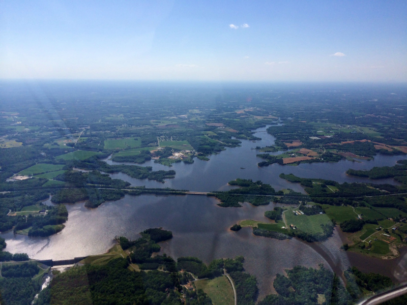
Photo: Pinterest Video: Tom Allen - Randleman Lake- Flying from Branson Davis Rd in Sophia, NC -
Lake Tahoma was established in 1924 by a consortium of regional investors interested in property development. It is situated between Mount Mitchell and the town of Marion. Buck Creek and Little Buck Creek provide the lake with its water, and it was once referred to be a "recreational site of extraordinary attractiveness." Overlooking the lake, a stone structure known as the "casino" was constructed so that summer guests might enjoy dancing to orchestra music played by local and regional ensembles or watching speedboat competitions. Electricity was produced at a power plant and sold to the National Utilities Company, which provides power to the town of Marion.
Cleveland, Ohio resident R. M. Mead and a group of colleagues bought the lake in 1929 with plans to upgrade the casino, construct a hotel, add a golf course, and turn the area into a "sportsman's paradise." The Lake Development Corporation's officers were local citizens, and Mead served as the company's president. However, the Great Depression effectively put an end to the endeavor. Investors lost money, and the hotel along its shores was left unfinished. Duke made the purchase of the power plant. Since A. M. Kinstler was one of the initial investors, the property was sold at foreclosure and joined the Kinstler estate.
Today, privately owned Lake Tahoma and the surrounding land are managed and maintained by a homeowner's association.
Location: between Mount Mitchell and the town of Marion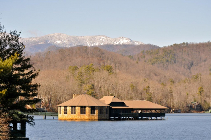
Photo: Lake Tahoma 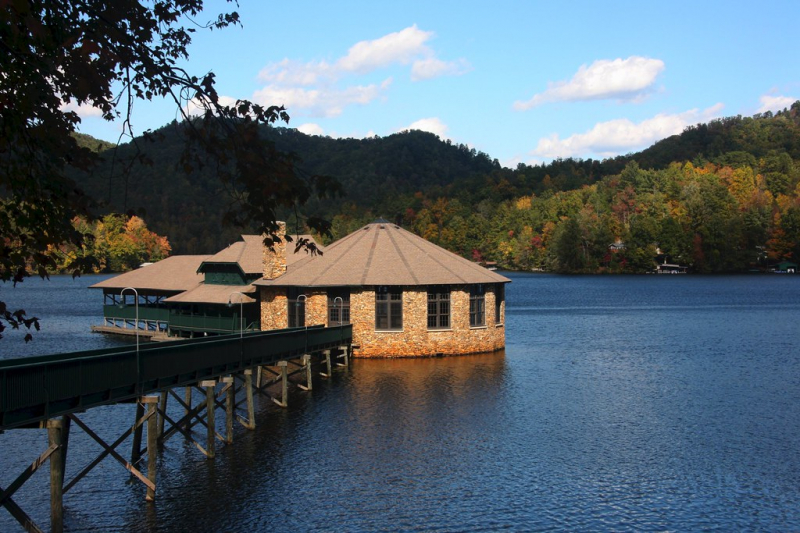
Photo: Flickr