Top 9 Most Beautiful Walled Cities In The World
Many civilizations and cultures have constructed physical barriers around their cities in order to strengthen themselves and keep out intruders or unknown ... read more...threats. Some historic walled cities have grown and spread well beyond their original walled bounds, or the city walls have been demolished, leaving only traces of their history. Here are some most beautiful walled cities in the world we compiled.
-
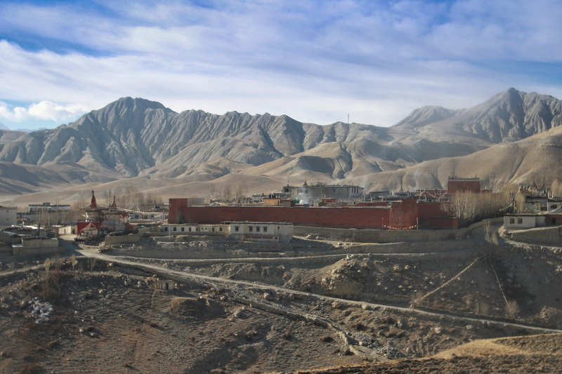
Lo Manthang, the historic capital of the Kingdom of Lo, was built in the 15th century on a plateau 3800 meters above sea level. The hamlet is situated on an old trade route that follows the Kali Gandaki River across the Himalayas. The village is encircled by a 6-meter-high earthen wall with square towers, or dzong, at each corner. A dense settlement of earthen structures exists within the walls.
Lo is the northern two-thirds of Mustang district, which is culturally and linguistically influenced by Tibet, whereas Thak is the southern third, which is home to the Thakali people, who speak a distinct language and have a synthesis of Tibetan and Nepalese culture. At least twelve caverns, ornamented with old Buddhist artwork and placed in sheer cliffs at an elevation of 14,000 feet, were recently discovered north of Annapurna and near the hamlet (4,300 m). The paintings, which date from around the 13th century, have Newari influences and include Tibetan letters in ink, silver, and gold, as well as pre-Christian era pottery fragments.
The Lobas, who live in Lo Manthang, are culturally and ethnically related to the people of Western and Central Tibet. Stupas, decorative art, and paintings representing various forms of the Buddha were discovered by explorers. The Sakyapa traditions of Tibetan Buddhism define the culture to a considerable extent, and many of the ancient festivals, rituals, and ceremonies are still conducted today.Location: Mustang district in Gandaki Province of western Nepal
thelongestwayhome.com 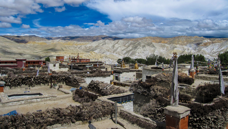
insidehimalayas.com -
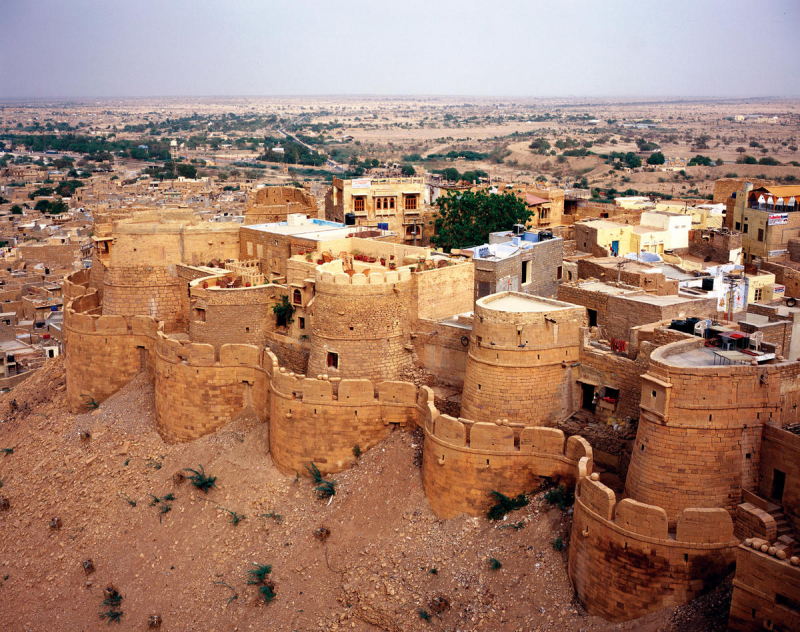
Jaisalmer, one of the most beautiful walled cities in the world, is a city in the Indian state of Rajasthan, 575 kilometers (357 miles) west of the state capital Jaipur. The town is built on a yellowish sandstone ridge and is capped by the old Jaisalmer Fort. This fort houses a regal residence as well as several magnificent Jain temples. Many of the homes and temples of both the fort and the village below are built of highly sculptured sandstone. The town is located in the center of the Thar Desert (the Great Indian Desert) and has a population of approximately 78,000 people, including residents of the fort. It serves as the administrative center for the Jaisalmer District. Jaisalmer was originally the state capital of Jaisalmer. The Jain community has improved Jaisalmer by adorning the city with exquisite temples, most notably those devoted to the 16th Tirthankara, Shantinath, and the 23rd Tirthankara, Parshvanath.
There are seven Jain temples in total within the Jaisalmer fort, which was erected between the 12th and 15th centuries. The most important of these temples is the Paraswanath Temple, followed by Chandraprabhu Temple, Rishabdev Temple, Shitalnath Temple, Kunthunath Temple, and Shantinath Temple. The temples are known for their wonderful works of art and architecture that were prevalent during the medieval era. They are made of yellow sandstone and have detailed engravings on them. Jaisalmer features some of India's oldest libraries, which house some of the most valuable manuscripts and relics from the Jain religion. There are numerous pilgrimage sites near Jaisalmer, including Lodhruva (Lodarva), Amarsagar, Brahmsar, and Pokharan.Location: Rajasthan, India
wmf.org 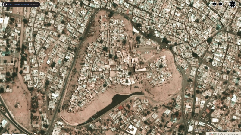
rmaarchitects.com -
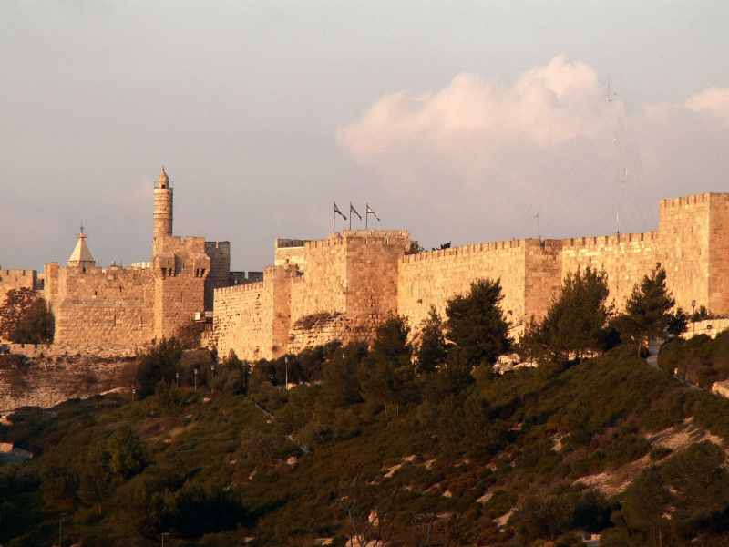
Jerusalem is built on hills and has an elevation of 2,575 feet (785 meters). The modern unified city is the largest municipality in Israel or the West Bank, and it serves as the focal point of an urban agglomeration that extends beyond city limits into nearby areas of both jurisdictions. The Old City, a walled medieval enclosure less than half a square mile (approximately one square kilometer) in size, is in the heart of the modern municipality. Jerusalem is one of the world's oldest cities and a holy city for the three major Abrahamic religions: Judaism, Christianity, and Islam. Old quarters and city walls are broad categories for 226 monuments of all three main religions. The Western Wall is the most important landmark for Jews, the Church of the Holy Sepulchre is for Christians, and the Dome of the Rock is for Muslims.
Jerusalem is fundamental to the three major monotheistic religions' spiritual and emotional perspectives. It is the focus of age-old yearnings for Jews all over the world, living proof of ancient grandeur and independence, and the epicenter of a national renaissance; for Christians, it is the scene of Jesus' agony and triumph; and for Muslims, it is the destination of the Prophet Muhammad's mystic night journey and the location of one of Islam's most sacred shrines. It is a holy city, a pilgrimage site, and a place of devotion for all three faiths.
Location: Israel
en.wikipedia.org 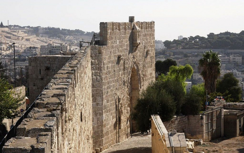
timesofisrael.com -
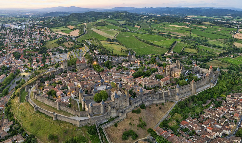
One of the most beautiful walled cities in the world we want to introduce to you is Carcassonne. It is located in southern France, approximately 80 kilometers (50 miles) east of Toulouse. Since the Neolithic era, its strategic location between the Atlantic Ocean and the Mediterranean Sea has been known. The town has an area of roughly 65 km2 (25 sq mi), which is much greater than the department of Aude's numerous minor towns. The Aude, Fresquel, and Canal du Midi rivers all run through town.
Carcassonne has been inhabited since the Neolithic and is located in the Aude plain between old trade routes from the Atlantic to the Mediterranean Sea and the Massif Central to the Pyrénées. The Romans rapidly understood its strategic value and occupied its hilltop until the fall of the Western Roman Empire. It was taken over by the Visigoths, who constructed the city, in the fifth century. Within three centuries, it briefly came under Islamic dominion. Because of its strategic location, successive kings expanded their defenses until the Treaty of Pyrenees in 1659.
The Cité de Carcassonne is a medieval stronghold dating back to the Gallo-Roman period that was renovated in 1853 by thinker and architect Eugène Viollet-le-Duc. Because of the outstanding preservation and restoration of the medieval citadel, it was inscribed to the UNESCO list of World Heritage Sites in 1997. As a result, Carcassonne relies significantly on tourism, although it also has manufacturing and winemaking as key economic sectors.
Location: Occitania, France
en.wikipedia.org 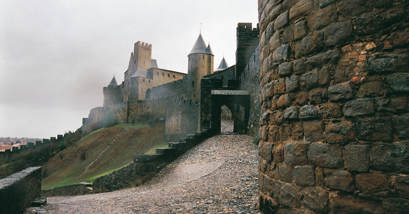
whc.unesco.org -
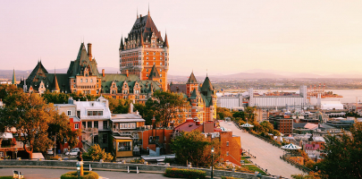
Old Quebec is a historical district in Quebec City, Quebec, Canada. The area, which includes the Upper and Lower Towns, is a UNESCO World Heritage Site. Old Quebec is administratively part of the Vieux-Québec-Cap-Blanc-colline Parlementaire area in the borough of La Cité-Limoilou. The neighborhood is also known as "the Old City" or "Quebec's Old City" in English. It is also known as the Latin Quarter, however, this term applies mainly to the region surrounding the Séminaire de Québec, the original site of Laval University.
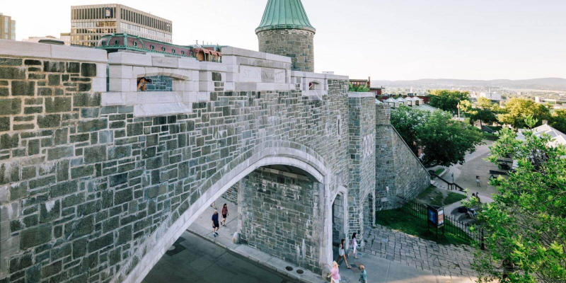
Quebec City is one of North America's oldest European cities. The ramparts that surround Old Quebec are the only intact defensive city walls in the Americas north of Mexico. UNESCO designated this area as a World Heritage Site in 1985 "Old Québec Historic District."
Much of the city's noteworthy traditional architecture can be seen in Vieux-Québec (Old Quebec), within and beneath the fortifications. With its stone buildings and winding lanes dotted with stores and restaurants, this neighborhood has a European atmosphere. The primary gates through the walls from the current area of downtown are Porte Saint-Louis and Porte Saint-Jean; the Kent Gate was a gift to the province from Queen Victoria, and the foundation stone was placed by the Queen's daughter, Princess Louise, Marchioness of Lorne, on 11 June 1879. The Parliament Hill region is west of the walls, while the Plains of Abraham are south of them.
Location: Quebec, Canada
quebec-cite.com 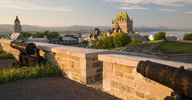
urbanguidequebec.com -
Tallinn, one of the most beautiful walled cities in the world, is Estonia's most populated capital city. Tallinn is administratively located in Harju county in northern Estonia, on the shore of the Gulf of Finland in the Baltic Sea. Tallinn is Estonia's principal financial, industrial, and cultural center. It is located 187 kilometers (116 miles) northwest of Tartu, the country's second-largest city, but only 80 kilometers (50 miles) south of Helsinki, Finland, as well as 320 kilometers (200 miles) west of Saint Petersburg, Russia, 300 kilometers (190 miles) north of Riga, Latvia, and 380 kilometers (240 miles) east of Stockholm, Sweden. Tallinn was known in much of the world by versions of its other historical name Reval from the 13th century until the first half of the 20th century.
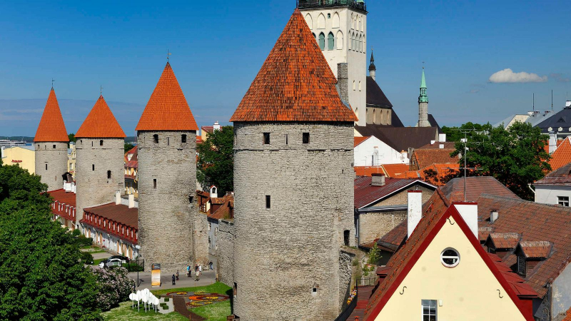
Margaret Sambiria authorized the construction of the first wall around Tallinn in 1265, giving rise to the name "Margaret Wall." This wall was only around 5 meters (16 feet) tall and 1.5 meters (4.9 feet) thick at the base. It has since been expanded and fortified. The walls and numerous gates are still mostly intact today. This is one of the reasons Tallinn's old town was designated as a World Heritage Site. Tallinn's walls were expanded in the fourteenth century, and people were forced to report for guard duty, which included wearing armor and proving their readiness to meet invaders.
Location: Harju, Estonia
visitestonia.com 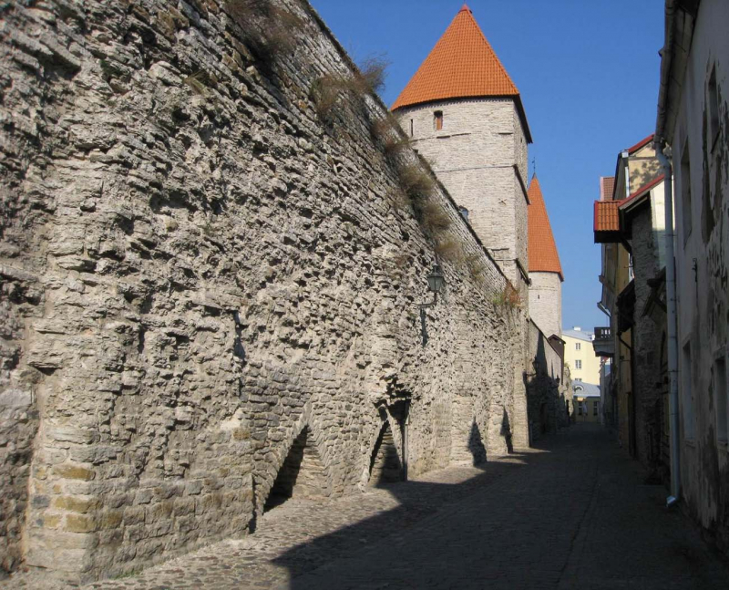
medievalheritage.eu -
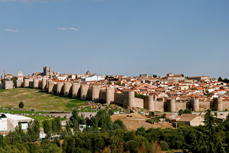
ÁVila is a Spanish city in the autonomous community of Castile and León. It is the capital and the most populated municipality of the Province of Ávila. It is located on the Adaja River's right bank. Located more than 1,130 m above sea level, the city is the highest provincial capital in Spain.
Known for its medieval walls, Ávila is also known as the Town of Stones and Saints, and it claims to have the highest number of Romanesque and Gothic churches per capita in Spain. It features intact and notable medieval town walls erected in the Romanesque style. It features intact and notable medieval town walls erected in the Romanesque style; writer José Martnez Ruiz classified it as the most 16th-century town in Spain in his book El alma Castellana ("The Castilian Soul").
The magnificent Walls of Ávila (11th-14th centuries), which began in 1090, are the city's principal landmark. The enclosed area is 31 hectares (77 acres), with a perimeter of 2,516 meters, 88 semicircular tower blocks, 2,500 merlons, 3 m (9 ft 10 in) thick curtain walls, an average height of 12 m (39 ft), and 9 gates. The walls are the world's largest fully illuminated monument. It is possible to stroll around half of the perimeter of the walls. While some of the walls will never be walked due to their connection with other structures, a significant portion is yet to be made pedestrian-safe. In 1985, UNESCO designated Ávila as a World Heritage Site. The original location included the fortified city and four extra muros churches. Since then, the number of churches on the site has grown.
Location: Spain
en.wikipedia.org 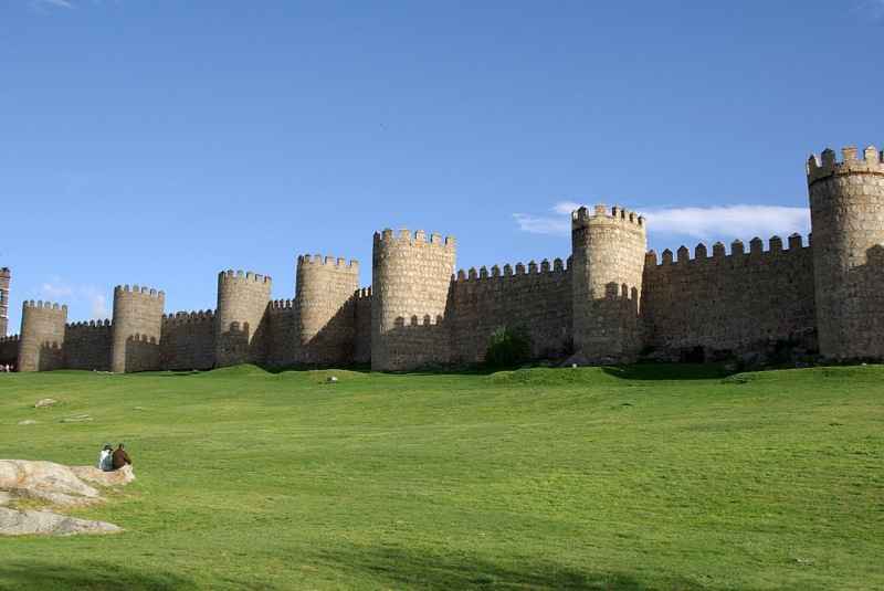
en.wikipedia.org -
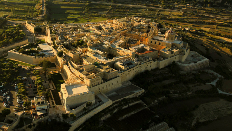
Mdina is a walled city in the Northern Region of Malta that served as the island's capital from antiquity to the medieval period. The city is still surrounded by walls and has a population of little under 300 people, but it is connected to the town of Rabat, which gets its name from the Arabic term meaning suburb.
The city was founded as Maleth by Phoenician inhabitants about the 8th century BC and was later renamed Melite by the Romans. Ancient Melite was larger than modern-day Mdina, and it was shrunk during the Byzantine or Arab occupation of Malta. During this time, the city got its current name, which is derived from the Arabic word medina.
The Mdina fortifications are a complex of defensive walls that surround Mdina, Malta's former capital city. The Phoenicians founded Maleth around the 8th century BC, and it later became part of the Roman Empire under the name Melite. The old city was surrounded by walls, and very few remains of these have survived.
The city walls were restored several times, including by the Byzantine Empire in the early eighth century AD, the Arabs in the early eleventh century, and the Kingdom of Sicily from the medieval period until the fifteenth century. The Order of Saint John constructed the majority of the remaining defenses during the 16th and 18th centuries. Mdina is on the tentative list of UNESCO World Heritage Sites, and it is today one of Malta's most popular tourist destinations.
Location: Malta
en.wikipedia.org 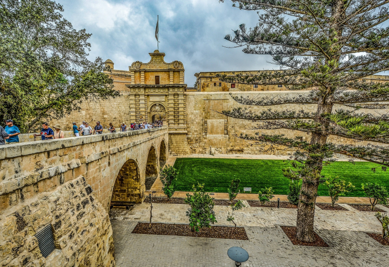
theculturetrip.com -
Chester is the county town of Cheshire, England, and a cathedral city. It is situated on the English-Welsh border on the River Dee. It is the most populous settlement of Cheshire West and Chester and serves as its administrative seat. It is also the historic county town of Cheshire, as well as the county's second-largest settlement after Warrington.
During the reign of Emperor Vespasian, Chester was established in 79 AD as a "castrum" or Roman fort called Deva Victrix. Deva, one of the most important army barracks in Roman Britain, later became a prominent civilian community. King Æthelred of Mercia established the Minster Church of West Mercia in 689, which ultimately became Chester's first cathedral, while the Angles rebuilt and strengthened the city fortifications to protect it against the Danes.
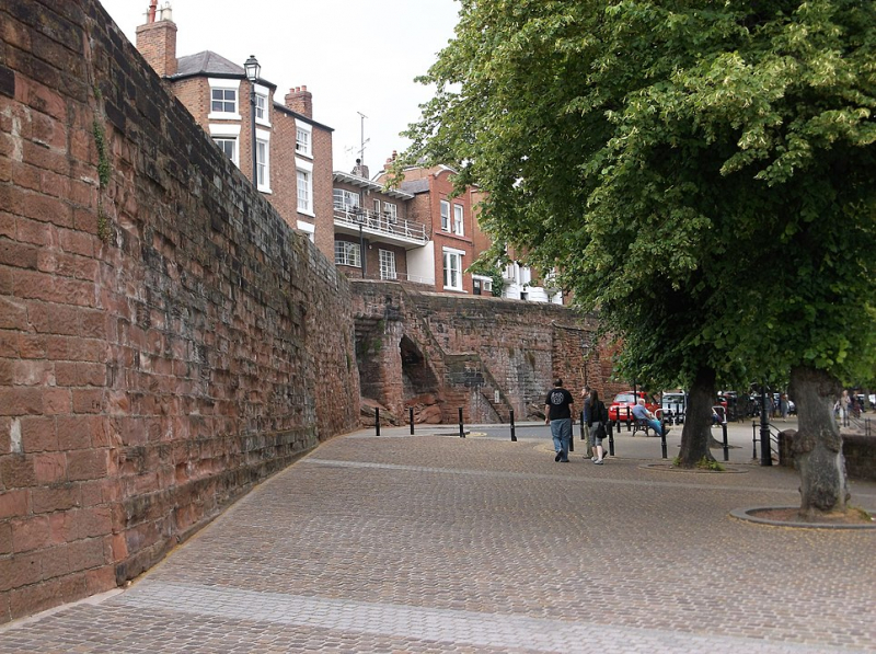
Chester's city walls are among the best maintained in the country, with a Grade I listing. It features a few medieval structures, but the majority of the black-and-white buildings in the city center are Victorian restorations from the Black-and-white Revival movement. Apart from a 100-meter (330 ft) portion, the walls are practically complete. The Industrial Revolution brought railways, canals, and new roadways to the city, which witnessed significant expansion and development; examples of Victorian architecture from this period include Chester Town Hall and the Grosvenor Museum.
Location: United Kingdom
en.wikipedia.org 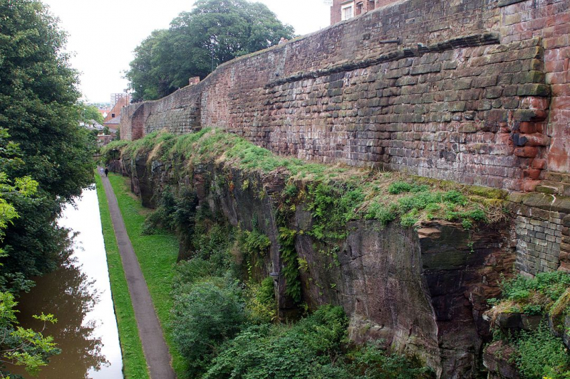
en.wikipedia.org


