Top 15 Most Spectacular Deserts Around The World

Deserts have some of the most beautiful vistas on the planet. The parched region is frequently abandoned yet has a harsh beauty. Deserts can be hot or cold, ... read more...and they encompass almost one-third of the Earth's land surface. Around the world, there are several significant and well-known deserts. If you are fortunate enough to see all of them, you will be exposed to the most diverse landscapes and their immense beauty. So, have a look at this list of deserts worth visiting throughout the world.
-
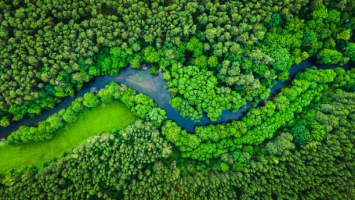
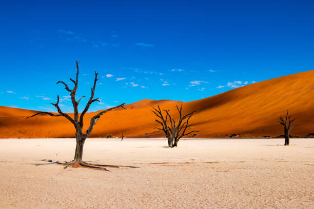
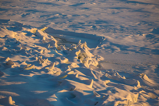
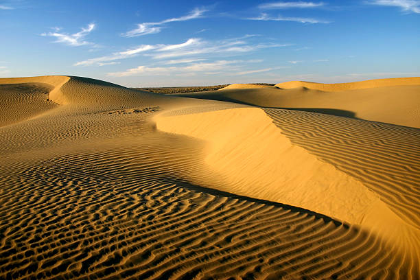
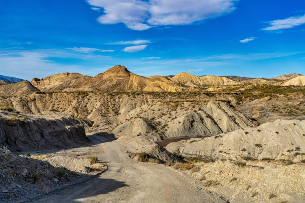
The Namib Desert is a Southern African coastal desert. The word Namib is of Khoekhoegowab origin and means "huge place". The Namib spans for more than 2,000 kilometers (1,200 miles) along the Atlantic coastlines of Angola, Namibia, and South Africa, spreading southward from the Carunjamba River in Angola, through Namibia, and to the Olifants River in Western Cape, South Africa.
The Namib Desert is a wonderful area to take your children since it is harsh, diversified, desolate, and gorgeous. It's just you and the planet in such a distant place. And there's enough to discover in these 1,200 miles of desert along Africa's South Atlantic coast, not just because of the vastness of the environment, but also because the dunes seldom show the same face twice. Wind, like waves on a beach, modifies the dunes' borders and erases tracks—the changing power is enough to cause whole dunes to move dozens of feet each year. A family competition to see who can jump the furthest down a dune face may be a thrilling event, but the traces of which are washed away the next day.
Except for a few tiny villages and indigenous pastoral communities such as the Ovahimba and Obatjimba Herero in the north and the Topnaar Nama in the center, the Namib is almost entirely unoccupied by people. Because of its age, the Namib may have more endemic species than any other desert on the planet. Arthropods and other tiny animals that live on little water make up the majority of desert species, however bigger animals thrive in the northern parts. The chilly ocean water along the coast sustains colonies of brown fur seals and shorebirds, which provide as prey for the Skeleton Coast's lions.
Further north, the Namib-Naukluft National Park, Africa's biggest wildlife reserve, is home to African bush elephants, mountain zebras, and other large species. Although the outer Namib is mostly devoid of flora, lichens and succulents may be found along the shore, and grasses, shrubs, and ephemeral plants flourish along the escarpment. Several tree species may also tolerate the severely dry conditions.
istockphoto 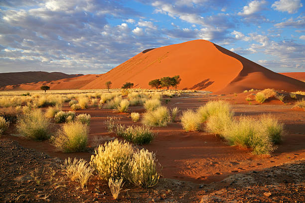
istockphoto -
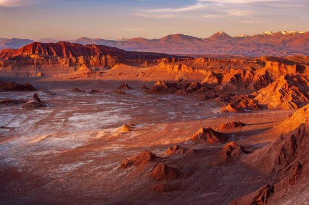
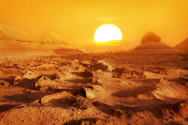
The Atacama Desert is a desert plateau in South America that stretches for 1,600 kilometers along the Pacific coast, west of the Andes Mountains. The Atacama Desert is the world's driest nonpolar desert and the second driest overall, behind only certain very particular locations within the McMurdo Dry Valleys, as well as the only hot genuine desert that receives less precipitation than the polar deserts and the world's biggest fog desert. Both locations have been utilized as test sites for Mars mission simulations on Earth.
The desert owes its high aridity to a continual temperature inversion due to the chilly north-flowing Humboldt ocean current and to the presence of the powerful Pacific anticyclone. The Atacama Desert's most dry region is sandwiched between two mountain ranges (the Andes and the Chilean Coast Range) of sufficient height to preclude rainfall advection from either the Pacific or Atlantic Oceans, creating a two-sided rain shadow. Despite modern perceptions of the Atacama Desert as completely devoid of vegetation, a large flatland area known as Pampa del Tamarugal was a woodland in pre-Columbian and colonial times, but demand for firewood associated with silver and saltpeter mining in the 18th and 19th centuries resulted in widespread deforestation.
Despite the desert's geographical and climatic limitations, a diverse vegetation has emerged. Within the desert's boundaries, over 500 species have been collected. These animals are distinguished by their exceptional capacity to adapt to this harsh habitat. The most prevalent species include herbs and flowers like thyme, llareta, and saltgrass (Distichlis spicata), as well as trees like chaar (Geoffroea decorticans), pimiento tree, and leafy algarrobo (Prosopis chilensis).
istockphoto 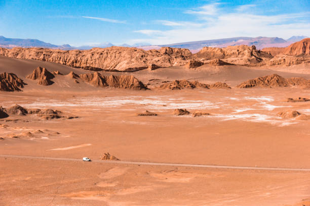
istockphoto -
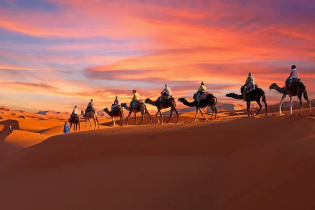
The Sahara Desert, which covers much of northern Africa (about 3.6 million square miles), is the world's third-biggest desert and the largest hot desert. Most people envision the gorgeous sand dunes of the Sahara Desert, but this is only a small piece of what is available in that region of Africa. In Africa, there are two basic types of landscapes: dryland and wet land. In West Africa, the territory is known as the Hamada, and it is mostly made up of rocky plateaus, whereas the remainder of the continent is known as the Sahel. Small pockets of green grassy terrain, desert shrubs, rugged cliffs, snow-capped mountains, and salt flats can be found.
The Sahara Desert supports a diverse range of vegetation and wildlife. It contains foxes, which are found throughout the Sahara. Around 2800 vascular plant species make up the Saharan flora. About a fifth of these are endemic. Approximately half of these species are found in the Arabian desert vegetation.
The middle Sahara is believed to have 500 plant species, which is incredibly low given the vastness of the area. Acacia trees, palms, succulents, spiny shrubs, and grasses have adapted to arid conditions by growing lower to avoid water loss due to strong winds, storing water in their thick stems to use during dry periods, having long roots that travel horizontally to reach the maximum area of water and find any surface moisture, and having small thick leaves or needles to prevent water loss due to evapotranspiration. Plant leaves can completely dry out and then recover.
Human activities are more likely to have an impact on the habitat in locations where there is permanent water (oases) or when water is near to the surface. Local demand on natural resources might be considerable here. Hunting for sustenance and leisure has significantly diminished the surviving populations of big animals. In recent years, development projects in Algeria and Tunisia have begun to use irrigated water drawn from subsurface aquifers. These projects frequently result in soil deterioration and salinization.
istockphoto 
istockphoto -
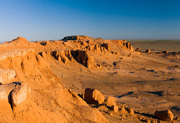
The Gobi Desert is a vast, desolate region with temperatures reaching over 150 degrees Fahrenheit, and it has nothing to do with the cartoon character. The Silk Road was a historic commercial route that connected China to Europe through Central Asia. It is well-known for its significance in the Mongol Empire and as an important station on the Silk Road. One of the most incredible experiences you may have in India is an adventure trip to the Gobi Desert, where temperatures of over 50 degrees Celsius (122 degrees Fahrenheit) are the norm during the summer months. In the winter, temperatures can fall below -20 degrees Celsius (-4 degrees Fahrenheit).
Only around 300 types of plants that thrive in the Gobi Desert contribute to the region's flora. Saxaul, elm, poplar, tamarisk evergreen shrub, and nitraria are drought-tolerant plants that thrive in long-rooted, low-crowned woody, shrubby valleys and streams. Some of the land is even coated with black dirt. You may take a detour to the Dabaozhang fossil site in China. There are prehistoric animal fossils, such as enormous dinosaurs, as well as species such as Bactrian camels, Siberian ibex, and Gobi brown bears.
The Gobi region has a particularly distinct fauna that is suited to the region's temperature, surface, and soil characteristics. The first thing that springs to mind when people think of the Gobi is sand. When the wind blows in the Gobi, very thin grains of sand are swept away, creating a whispering sound that sounds like a song if you listen attentively.
istockphoto 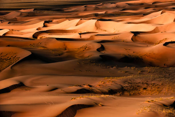
istockphoto -
The Mojave Desert is a desert in the southwestern United States that lies under the rain shadow of the Sierra Nevada mountains. It is called after the Mojave Indians. The Mojave Desert is part of the wider North American Desert, which also includes the Sonoran, Chihuahuan, and Great Basin deserts. The Mojave is the smallest and driest of these. The Mojave Desert has conventional basin and range geography, with a broad pattern of parallel mountain ranges and valleys. It is also the location of Death Valley, the lowest point in North America. The Mojave Desert is sometimes referred to as the "high desert" since the majority of it is between 2,000 and 4,000 feet in elevation. It is home to a wide range of vegetation and wildlife.
The Mojave Desert is rich in minerals and metallic elements. Climate causes a buildup of worn bedrock, fine sand, and silt, with both sand and silt deposits converting to colluvium. The flora of the Mojave Desert includes a number of endemic plant species, including the Joshua Tree, which is both an endemic and an indicator species of the desert. The Mojave Desert has more indigenous plants than practically anywhere else on the planet. Although the plants in the area have developed in isolation due to the physical barriers of the Sierra Nevadas and the Colorado Plateau, Mojave Desert flora is not a vegetation type.
istockphoto 
istockphoto -
Antarctica is experiencing winter darkness, cold, and ice. These are some of the terms that have been used to define this location. Dessert and bread are the finest foods to consume. You may also include dessert on your list of things to eat. Indeed, Antarctica is the world's southernmost continent with insufficient rainfall to be regarded as anything other than a desert. We received a little snow, but it quickly turned to ice and then vanished.
There are no flowers or trees in this location. Everything is built of moss and algae. Orcas, seals, and, of course, penguins will be on display for visitors who wish to see what these wonderful species truly look like. Most Antarctic organisms appear to be descendants of creatures that thrived their millions of years ago. As a result, they must have survived several glacial cycles. The species survived extremely cold climates in isolated milder places, such as geothermal heat or locations that stayed ice-free during the colder season.
Antarctica is administered by around 30 countries, all of which are signatories to the Antarctic Treaty System of 1959. Military action, mining, nuclear explosions, and nuclear waste dumping are all forbidden in Antarctica under the terms of the treaty. The primary human activity in and around Antarctica are tourism, fishing, and research. Approximately 5,000 people live in research stations during the summer, with a dip to roughly 1,000 during the winter. Human activity has a huge influence on the continent, despite its remoteness, through pollution, ozone depletion, and climate change.
istockphoto 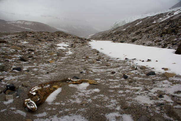
istockphoto -
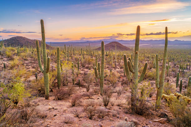
The Sonoran Desert, which stretches over Arizona, California, and Mexico, is a stunning terrain rich in indigenous wildlife and vegetation. The Saguaro and Organ Pipe cactus, as well as the yucca plant, which looks like a big turnip and thrives in the desert, are two of the key attractions. The Sonoran Desert differs from surrounding deserts (such as the Great Basin, Mojave, and Chihuahuan deserts) in that it has subtropical temperature in winter and two seasons of rainfall (as opposed to the Mojave's dry summers and freezing winters). This results in a stark contrast between aridity and wetness. Many plants not only survive but thrive in the Sonoran Desert's severe circumstances.
Many have acquired particular adaptations to the arid environment. The Sonoran Desert has more plant species than any other desert on the planet due to its bi-seasonal rainfall cycle. The Sonoran Desert has plant genera and species from the agave, palm, cactus, and legume families, among others. The Gila monster, bobcat, mule deer, antelope jackrabbit, burrowing owl, greater roadrunner, western diamondback rattlesnake, and elf owl are among the many animals, birds, and other species that call the Sonoran Desert home. The desert area is home to 350 bird species, 20 amphibian species, over 100 reptile species, 30 native fish species, over 1000 natural bee species, and over 2,000 native plant species.
With several Native American tribes residing in the area and towns such as Phoenix and Tucson, Arizona is an ideal destination for a family trip. The Grand Canyon National Park in Arizona, for example, has multiple national monuments and environmental preserves, including the Kaibab National Forest. There are additional deserts, such as the Mojave Desert.
istockphoto 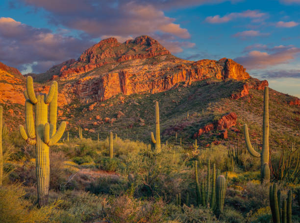
istockphoto -
The Thar Desert, often known as the Great Indian Desert, is a sand desert in northwest India and eastern Pakistan. The Sahara Desert, which encompasses an area of nearly 17 million square kilometers, is the world's most populated desert. It has a population density of 83 persons per square kilometer. Some animal species that are rapidly becoming extinct in other regions of India, such as the blackbuck, chinkara, and Indian wild ass, may be found in huge numbers in the Rann of Kutch. This arid area's native vegetation is classed as northwestern thorn scrub forest, which grows in tiny clusters spread more or less openly. Following an increase in rainfall, the density and size of patches increase from west to east.
The Indian peafowl is a Thar area resident breeder. The peacock is both India's national bird and the provincial bird of Punjab (Pakistan). It may be observed in villages in Deblina sitting on khejri or pipal trees. Because there are no main highways leading into or out of the Badlands National Park, it can only be reached by helicopter, light aircraft, or ATVs. There are, however, miles of hiking paths to explore, and if you're feeling daring, you may drive to other regions of the park. The wildlife around the Vrindavan Temple is astounding. There's a lot to see and do with over 140 bird species, 23 reptile species, and 25 snake species.
istockphoto 
istockphoto -
The Rub' Al Khali, often known as the Empty Quarter, was coined by the Swiss geographer Burckhardt in his 1829 book "Travels in Arabia". It has an area of 225,000 square miles (583,000 square kilometers). Some sections of this fabled desert stretch into the United Arab Emirates, Oman, and Yemen, although the great majority of it is in Saudi Arabia, mostly in the Eastern Province, but also in Najran and Riyadh. You'll discover everything there is to know about this intriguing region of the Arabian Peninsula, including amazing facts and numbers about its history, geology, and climate. The moniker 'Empty Quarter' is apt considering the harsh atmosphere that does not enable anything to develop there. It is crucial to notice, however, that it does not distract from its attractiveness.
Superlatives abound in the Rub' Al-Khali. It is the world's largest contiguous sand desert; it has some of the highest dunes, with some reaching 250 meters; its hyper-arid climate is among the harshest, with typical annual rainfall of less than 3 centimeters; its temperatures reach above 50°C in summer... whereas sub-zero temperatures are common during winter nights! Sabkhas are another deadly characteristic of the Rub' Al-Khali. Sabkhas, which are feared by locals, are plains between large dunes that can be easily crossed in most situations, but in certain areas the ground is so soft that cars would become seriously stuck.
The Rub' Al-Khali was previously home to hippopotamuses, water buffalos, and long-horned animals, and shells may still be discovered on the severely parched land of its enormous plains. Some recent drillings in the Rub' Al-Khali that brought subsurface water to the surface provide a sense of how it could have appeared during more humid eras. It is very tempting to confront the perils of the Rub' Al-Khali in order to appreciate its majestic scenery and live the authentic desert experience, but due to the harsh circumstances of the Rub' Al-Khali, it is strongly advised to travel only with licensed excursions. Exploring it alone or with a single automobile, even if properly prepared, is clearly insane.
istockphoto 
istockphoto -
The Tabernas Desert is recognized as "the sole desert in continental Europe". It is situated in southeastern Spain, about north of Almera. If you want to watch a lot of movies, try visiting the western areas of France and Italy. There are several attractive places to visit, as well as numerous film sites to see. Although not as large as the deserts of the Middle East, this desert is home to a variety of reptiles, amphibians, and birds.
The desert has a lot of flora for a desert. Plants that are on the edge of extinction, such as sea lavender, thrive in the semi-arid habitat of the desert. When the toadflax linaria blossoms in the winter, the desert landscape turns white. There are yellow scorpions, tarantulas, and black widows, however they are not as dangerous as the American black widow. Lesser weevers, such as Echiichthys vipera and Tachinus dracco, reside under the sand in coastal locations. Ladder snakes, spiny-footed lizards, and ocellated lizards are among the desert's reptile inhabitants. The damp regions of the desert are home to marsh frogs, natterjack toads, and terrapins.
Tabernas has been a popular location for filming since the 1950s because to its parallels to deserts in the southwestern United States, northern Mexico, northern Africa, and Arabia. Spaghetti Westerns were filmed at three major studios: Texas Hollywood, Mini Hollywood, and Western Leone. Game of Thrones' sixth season was shot in places ranging from Andalusia to Catalonia, including the desert, which is the Dothraki Sea, a massive steppe in Essos, the biggest continent.
istockphoto 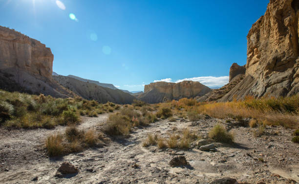
istockphoto -
The Taklamakan Desert in China is the world's second-largest shifting-sand desert. It is located in the heart of the country and encompasses an area of 120,000 square miles (300,000 square kilometers). Taklamakan has a cool desert environment due to its location in the rain shadow of the Himalayas. Given its closeness too cold to freeze air masses in Siberia, severe temperatures are reported in winter, sometimes well below 20 °C (4 °F) and can reach 40 °C (104 °F) in summer. The Taklamakan Desert contains limited water, making it difficult to cross. The prosperous oasis villages served as rest stops for merchant caravans on the Silk Road.
Several academics, notably Xuanzang, a 7th-century Buddhist monk, and the archaeologist Aurel Stein, investigated this desert. According to atmospheric research, dust from the Taklamakan is flown across the Pacific, where it contributes to cloud formation over the Western United States. Furthermore, the flying dust transports minerals from the Taklamakan to the western United States via rainfall. It was close to numerous old civilizations—the Amu Darya valley to the northwest, the Afghanistan mountain passes to Iran and India to the southwest, China to the east, and even ancient settlements like Almaty to the north.
istockphoto 
istockphoto -
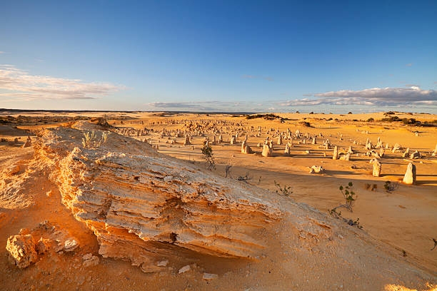
The Pinnacles Desert is made up of thousands of spooky limestone pillars up to 4m tall. The pillars growing out of the harsh desert environment of yellow quartz sand create the moonscape picture. It is a popular photographic subject. The Pinnacles Desert, which was almost unknown to the general public until the late 1960s, is now part of the Nambung National Park. The Pinnacles Desert was added to the Nambung River National Park, which was already there. In the local Aboriginal tribe language, Nambung means crooked. It is a park with a 26-kilometer stretch of gleaming coastline surrounded by undulating old sand dunes that extend inland into banksia forests.
The Nambung River is lined with beautiful red river gum trees until it vanishes into limestone caverns. Massive sand dune fields characterize the Pinnacles Desert region along the shore. The Pinnacles' limestone structures vary in size and shape; some are as little as a mouse, while several are as tall as 3.5m. These oddly formed rocks have been compared to tombstones, termite mounds, and even human digits. The Pinnacles Desert is best viewed at sunrise or sunset, when it casts long, weird shadows across the rippling yellow sand dunes. Although the desert is teeming with species, the majority of it is nocturnal. However, it is not uncommon to see western grey kangaroos, emus and many sorts of reptiles and birds like black-shouldered kites hanging around the strange stones.
There is just one 27-kilometer-long access route into the Pinnacles Desert. Visitors should confirm that their insurance allows them to drive on unpaved roads. Visitors are urged to explore the Pinnacles desert, or to take a two or three hour hike to the Red, White, and Painted Colored Deserts. If you opt to make the walk, bring at least a litre of water for each person and a compass for the lunar-like scenery. Beach and picnic places may be reached by numerous exits from the main access road.
istockphoto 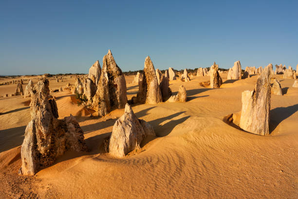
istockphoto -
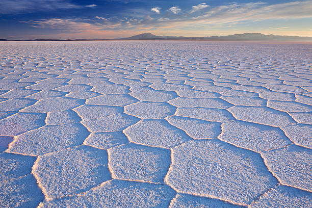
The Salar was produced by transitions between numerous prehistoric lakes that existed around forty thousand years ago but had all evaporated over time. It is presently covered by a few meters of salt crust, which has an unusual flatness with average height fluctuations of less than one meter over the whole Salar. The crust provides salt and protects a pool of brine that is extremely rich in lithium. The Salar is perfect for calibrating the altimeters of Earth observation satellites due to its enormous size, bright sky, and unusual flatness of the land.
The Salar is an important trade route through the Bolivian Altiplano and a popular nesting habitat for various flamingo species. Salar de Uyuni is also a climatological transition zone, since the towering tropical cumulus congestus and cumulonimbus incus clouds that form in the salt flat's eastern part during the summer are unable to penetrate beyond its drier western margins, near the Chilean border and the Atacama Desert. Because Salar de Uyuni is a famous tourist attraction, a number of hotels have been developed in the vicinity. Due to a scarcity of conventional building materials, many of them (walls, roof, furnishings) are nearly entirely made of salt blocks harvested from the Salar.
An antique train graveyard is a popular tourist attraction. It is located 3 kilometers (1.9 miles) outside of Uyuni and is connected by ancient railroad tracks. In the past, the town acted as a distribution point for trains delivering minerals to Pacific Ocean ports. British engineers arrived at the end of the nineteenth century and developed the rail lines, forming a sizable colony in Uyuni.
istockphoto 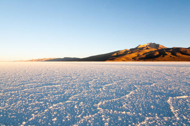
istockphoto -
The Dasht-e Kavir, also known as the Great Salt Desert, is located on the western edge of the Middle East and is noted for its salt marshes (kavirs) and, of course, mud. The Saltmarsh is a unique animal habitat region with a landscape of salt mounds formed when subsurface salt layers made their way to the surface via the mud and rocks. The terrain is perilous since it is tough to escape if you fall in. As a result, save for the hilly portions, the land is largely deserted.
Dasht-e Kavir vegetation is suited to the hot, dry environment as well as the salty soil in which it grows. Common plant species such as shrubs and grasses are only present in a few valleys and on mountain peaks. Mugwort is the most common plant. The Persian ground jay, along with Hairy bustards, larks, and sandgrouse, is a bird species found on desert plateaus.
The intense heat and frequent storms of Dasht-e Kavir produce considerable erosion, making cultivation nearly impossible. The desert is mostly uninhabited and has seen minimal exploitation. Camel and sheep breeding, as well as agriculture, provide a living for the few people that live on the land. Human habitation is limited to oases where wind-blocking dwelling structures are constructed to cope with the extreme weather conditions.
istockphoto 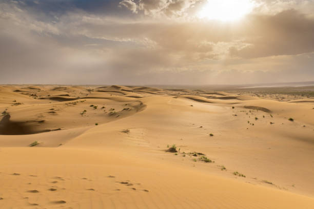
istockphoto -
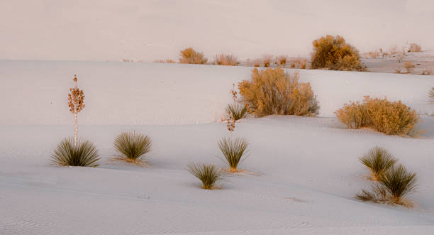
If you've ever traveled down Highway 10, you've seen the breathtaking landscape of the Chihuahuan Desert, North America's biggest desert. It contains some wonderful vegetation and creatures that you should see if you have the opportunity. Both the Arizona rainbow cactus and the grey fox are endemic to Arizona and are frequently spotted together in the wild. If you're searching for a must-see, go no farther than New Mexico's White Sands National Monument, which has white gypsum sand dunes.
It is bounded on the west by the Sonoran Desert, the Colorado Plateau, and the large Sierra Madre Occidental range, as well as the Sierra Madre Oriental range's northern lowlands. Its biggest continuous span is in Mexico, encompassing much of the state of Chihuahua, as well as parts of Coahuila, north-eastern Durango, the extreme northern section of Zacatecas, and tiny western portions of Nuevo León.
The desert is mostly a rain shadow desert because the Sierra Madre Occidental to the west and the Sierra Madre Oriental to the east, respectively, block the majority of rainfall from the Pacific Ocean and the Gulf of Mexico. The desert has an arid, mesothermal climate, with one wet season in late summer and less precipitation in early January, and the mean daily temperature of the coldest month is warmer than 0 °C. The bulk of rain falls during the North American Monsoon, when moist air from the Gulf of Mexico and the Sea of Cortez reaches the region, or, much less commonly, when a tropical storm travels inland and stalls.
istockphoto 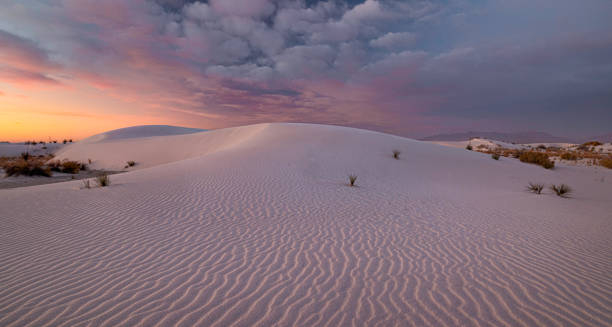
istockphoto