Biobío

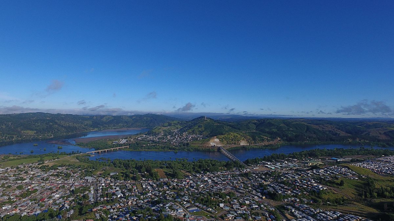
Chile's Biobío River is the second longest river in Chile. It runs 380 kilometers from the Andes' Icalma and Galletué lakes to the Pacific Ocean's Gulf of Arauco (in Spanish). The Malleco and the Laja are two of the river's principal tributaries. The river is Chile's second longest (the longest being the Loa River), and the Biobío basin, after the Loa and Baker basins, is Chile's third largest watershed. With an average width of 1 km, the river is also Chile's widest. The river is crossed by four bridges in Concepción's metropolitan area: the Biobío Railroad Bridge (1889), the Juan Pablo II Bridge (1973), the Llacolén Bridge (2000), and the Bicentennial Bridge (2010).
The river is navigable in its lower reaches, when the water slows as its width widens. Deforestation has had a deleterious impact on the river, resulting in bank erosion and siltation. The Penhuenche people who lived along the river were displaced as a result of the Pangue dam's construction.
The Biobío River starts on Galletué Lake's east bank. The river continues east for a few kilometers until it meets the waters of the nearby Icalma Lake, which it gets via a little stream. It then heads northwest, meandering through a large Andean valley and uniting with a few minor tributaries including the Lonquimay and Rahue. The Lonquimay is fed by Sierra Nevada glaciers and flows through the town of the same name. The upper course of the river—locally known as Alto Bo Bo—begins to travel fast through a narrow valley surrounded by mountains just downstream from the confluence with the Rahue, the channel becoming increasingly sloping. The river is then dammed by Ralco Dam along the lower course of its tributaries in this location. The river traverses a southwestern spur of Callaqui volcano before entering Pangue Reservoir below the dam.
Mapudungun, the Mapuche language, inspired the name "Biobío." During the later stages of the War of Arauco, the Biobío served as the traditional borderline, or "La Frontera," between La Araucana, the southern Mapuche self-ruled lands, and the northern Spanish-ruled Captaincy General of Chile. After the "Pacification of Araucana" battles in the 1880s, the land south of the river was included into the Chilean state.
Length: 380 km (240 mi)


