


Top 6 Longest Rivers In Chile

A number of short rivers flow from the Andean mountains to the Pacific Ocean in Chile. These rivers form water basins that are significant for irrigation and ... read more...domestic needs in the local populations. Despite the fact that most rivers are not navigable, they are commercially exploited for the generation of hydro-electric power, which is used in mines or exported to neighboring nations. Deforestation and damming for hydropower production pose a serious threat to these rivers, resulting in reduced water flow on lower courses and pollution from power plant emissions. The issue jeopardizes riverine communities' access to water. This article provide information to the reader about the top 6 longest rivers in Chile.
-
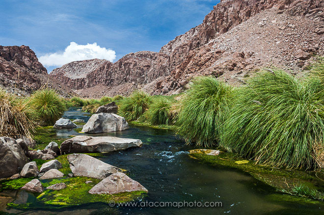
With a length of 440 kilometers, the Loa River is the longest river in Chile (270 mi). The river runs from the Andes to the Pacific Ocean, passing through the Atacama Desert. The Salado River, San Salvador River, and San Pedro de Inacaliri River are all tributaries of the Lao river. The river serves as a vital source of water for riverine towns and is home to a variety of fish species, including shrimp. Pollution of the river by mining corporations has become a major source of concern, as it jeopardizes the water's worth and utility.
The Loa's origins are found on the Andean mountain ranges near the Mio Volcano's foot. The upper Loa basin is bounded on the west by a ridge with altitudes above 4,500 m (14,800 ft), while it is separated from endorheic basins such as Salar de Ascotán on the east by a volcanic range. The river basin's hydrologic regime is dominated by rain. The phenomena known locally as Bolivian Winter causes a rise in its water volume, which happens primarily in January and February.
Its banks have been inhabited since the beginning of time. The numerous geoglyphs, petroglyphs, and pictographs found along its route and in its upper basin are proof of this. The Pukará de Lasana is another reminder of the city's illustrious past.Length: 440 kilometers (270 mi)
https://www.atacamaphoto.com/ 
https://commons.wikimedia.org/ -
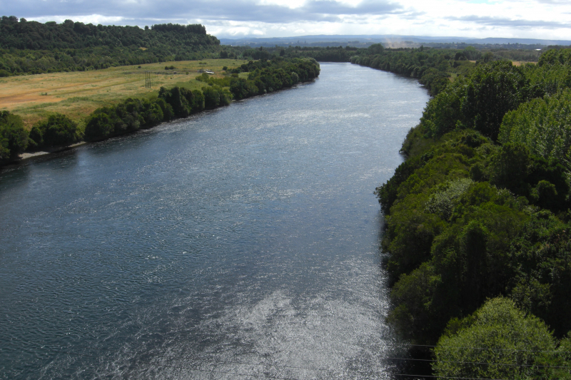
Chile's Biobío River is the second longest river in Chile. It runs 380 kilometers from the Andes' Icalma and Galletué lakes to the Pacific Ocean's Gulf of Arauco (in Spanish). The Malleco and the Laja are two of the river's principal tributaries. The river is Chile's second longest (the longest being the Loa River), and the Biobío basin, after the Loa and Baker basins, is Chile's third largest watershed. With an average width of 1 km, the river is also Chile's widest. The river is crossed by four bridges in Concepción's metropolitan area: the Biobío Railroad Bridge (1889), the Juan Pablo II Bridge (1973), the Llacolén Bridge (2000), and the Bicentennial Bridge (2010).
The river is navigable in its lower reaches, when the water slows as its width widens. Deforestation has had a deleterious impact on the river, resulting in bank erosion and siltation. The Penhuenche people who lived along the river were displaced as a result of the Pangue dam's construction.
The Biobío River starts on Galletué Lake's east bank. The river continues east for a few kilometers until it meets the waters of the nearby Icalma Lake, which it gets via a little stream. It then heads northwest, meandering through a large Andean valley and uniting with a few minor tributaries including the Lonquimay and Rahue. The Lonquimay is fed by Sierra Nevada glaciers and flows through the town of the same name. The upper course of the river—locally known as Alto Bo Bo—begins to travel fast through a narrow valley surrounded by mountains just downstream from the confluence with the Rahue, the channel becoming increasingly sloping. The river is then dammed by Ralco Dam along the lower course of its tributaries in this location. The river traverses a southwestern spur of Callaqui volcano before entering Pangue Reservoir below the dam.
Mapudungun, the Mapuche language, inspired the name "Biobío." During the later stages of the War of Arauco, the Biobío served as the traditional borderline, or "La Frontera," between La Araucana, the southern Mapuche self-ruled lands, and the northern Spanish-ruled Captaincy General of Chile. After the "Pacification of Araucana" battles in the 1880s, the land south of the river was included into the Chilean state.
Length: 380 km (240 mi)
https://en.wikipedia.org/ 
https://artebiobio.cl/ -
The Maipo River is the third longest river in Chile, with a length of 250 kilometers. The Maipo River flows from the Andean range's Maipo volcano, via the Maipo valley, and into the Pacific Ocean. The river serves as the principal source of water for the villages that surround it, which use it for agricultural and domestic reasons. The Maipo's primary tributary is the Mapocho River. The building of the Alto Maipo hydroelectric plant poses the greatest threat to the river and the towns surrounding it.
The Maipo River is a major river in Chile that flows through the Santiago Metropolitan Region and the Valparaiso Region. It is located just south of Santiago, Chile's capital. One of its tributaries is the Mapocho River, which flows through central Santiago.
The river flows as an entrenched torrent through the Andes highlands in its upper reaches. The El Volcán River, the Yeso River, and the Colorado River are three main tributaries. After leaving the Andes, the Maipo flows through the Maipo Valley, which is one of Chile's most important wine-producing regions. The Maipo River flows for 250 kilometers (160 miles) until spilling into the Pacific Ocean near Llolleo, south of San Antonio.Length: 250 km (160 mi)
https://en.wikipedia.org/ 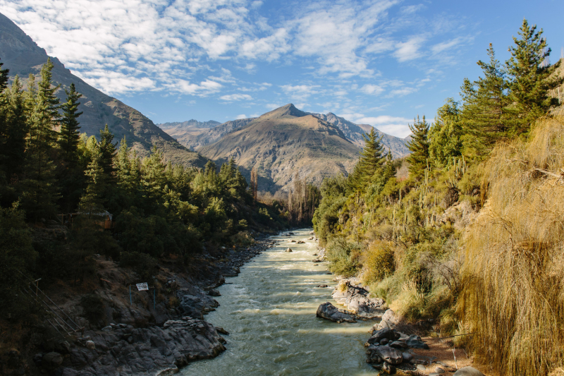
http://dvc.photos/ -
The Maule River, sometimes known as the Ro Maule, is one of the longest rivers in Chile. Agriculture (wine, traditional crops), culture (literature, poetry, folklore), religion, economy, and politics are all inextricably linked to the country's pre-Hispanic (Inca) times, conquest, colonial period, wars of independence, modern history, agriculture (wine, traditional crops), culture (literature, poetry, folklore), religion, economy, and politics. The Inca Empire's southern border was indicated by the Maule River. The region named after the river has produced many great men and women in Chile's history. The river has also given its name to the Valley of Maule, a subregion of the Central Valley, which is one of the country's viticultural areas (also known as appellations).
The river is 240 kilometers long, with a basin area of roughly 20,600 square kilometers. The Andean range encompasses 30% of the basin's area. It was born in Laguna del Maule, Talca Province, at an altitude of 2,200 meters, near the Argentina border. The river continues westward from there, and one of its main tributaries, the Melado River, which originates in Laguna Dial, Linares Province, joins it on its left bank. The Maule is joined on its right bank by the rivers Colorado, Claro, Puelche, and Cipreses as it continues on its upper course.
The Maule River basin is home to a diverse range of Chilean flora and animals. Historically, the Chilean Wine Palm, Jubaea chilensis, was found across the Maule River basin; however, due to the growth of the human population in this area, this endangered tree now only has a limited range that encompasses parts of the northern Maule Region.
The Maule has long been regarded as Chile's literary river of choice. The number of poets, writers, historians, orators, playwrights, journalists, composers, and folk musicians who were born or resided in the Maule Region, which is named after the "river of the fogs," is astounding. The river has played an important role in many Latin American stories as a backdrop or protagonist. Several anthologies, author's dictionaries, and articles have vividly described the region's great cultural wealth around the Maule River.
Length: 240 km (150 mi)
https://en.wikipedia.org/ 
https://www.nuestro.cl/ -
The Baker River, also known as Asquamchumauke (an Abenaki name meaning "salmon spawning spot"), is a 36.4-mile-long (58.6-kilometer) river in New Hampshire's White Mountains. It starts on the south slope of Mount Moosilauke and flows south and east before emptying into Plymouth's Pemigewasset River. Warren, Wentworth, and Rumney are all located along the river. It is a tributary of the Merrimack River.
The Baker River was named after Lt. Thomas Baker (1682–1753), a Northampton, Massachusetts scout who led a party of 34 scouts down the river's valley in 1712 and destroyed a Pemigewasset Indian town. On April 28, 1752, Abenaki warriors captured John Stark and Amos Eastman along this river and transported them to Saint-François-du-Lac, Quebec, near Montreal. William Stark, John Stark's brother, managed to flee, but David Stinson was slain in the ambush.
The river is named "Bakers" River on Thomas Bradford's 1835 map of New Hampshire, and it originates on "Mooshillock Mtn."
Length: 36.4 mi (58.6 km)
https://en.wikipedia.org/ 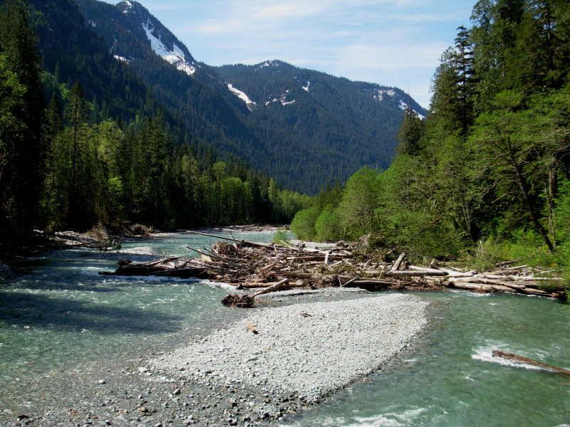
https://en.wikipedia.org/ -
The Bueno River flows across southern Chile. It rises in Ranco Lake and, like most Chilean rivers, flows into the Pacific Ocean at the Valdivian Coastal Reserve's southern edge. The lower flow constitutes the border between the provinces of Osorno and Ranco. It is also the northern limit of the indigenous Huilliche territory of Futahuillimapu, according to legend. The river runs through the commune of Ro Bueno, which is named for the river.
The Pilmaiquén River and the Rahue River, which enter the Bueno River from the south, are its principal tributaries. The former is Puyehue Lake's outlet, while the latter is Rupanco Lake's outlet. Starting upstream, the river has the following settlements: Puerto Nuevo at the source, Ro Bueno, Trumao, Llancacura, and La Barra at the ocean's outflow.
Huenuleufu was the river's original Huilliche name, a mix of huenu "upper" and leufü "river." As a result, Ro Bueno is a hybrid word, with huenu replaced by phono-semantic matching with the Spanish word bueno, which means "good."The Battle of Ro Bueno, fought in 1654 between a Spanish slave-hunting expedition and local Mapuche-Huilliches, took place on the Bueno River. The Spanish forces were clearly defeated in this combat, as their pontoon bridge collapsed, resulting in numerous losses. The river was once again the scene of a Spanish-Huilliche fight on January 27, 1759. The Spanish built a Franciscan mission and a fort near to the river in the years after the conflict.
Length: 130 km (81 mi)
https://en.wikipedia.org/ 
https://things-to-do-in-jamaica.com/


