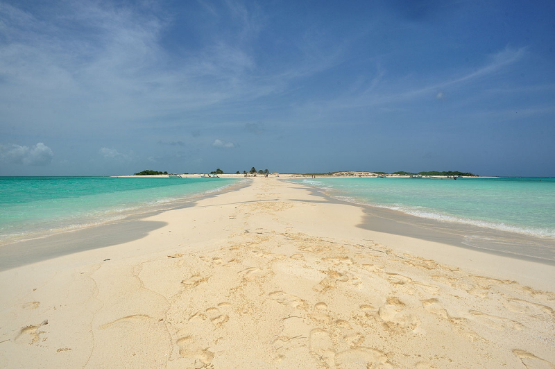
Cayo de Agua Beach


Cayo de Agua is part of the Los Roques archipelago, which is located in the southern Caribbean Sea, about 100 kilometers north of Venezuela's capital, Caracas, and the same distance east of Curacao. This area of the water is one of the most advantageous in the entire sea. There are only a handful well-known storms. And the amount of clear sunny days is among the highest in the world.
From the outside, the Island may appear unfit for living and relaxing. It is almost entirely made up of sands that have become entangled in bizarre shapes in shallow water. There are some rises—about 10 meters above sea level—in several spots. The hills are also made up of sand dunes and are covered in sparse flora, mostly grass.
The island's sand has two distinct hues and compositions. The majority of the land is covered in microscopic white sands derived mostly from sedimentary rocks and coral reef remnants. A trail of red sands with larger grains of sand predominates closer to the eastern extremity. The sea, which is extremely shallow near the coast, is seeded with sand.
The island is part of a tiny archipelago. Large currents and mixing of water, as well as the inflow of cold masses, are prevented by neighboring islands. As a result, the water warms to a temperature of 26 28 degrees Fahrenheit and remains there for virtually the whole year. This year's most unfavorable month is January. Even at this time of year, water rarely gets colder than 25 degrees.
Cayo de Agua is located in the eastern Caribbean Sea that is part of the Los Roques Archipelago and is administered as part of the Federal Dependencies, Venezuela.