Gaia GPS


The Gaia GPS hiking app amazed us with live data while we were trekking - no other app in our review displays you as much information about your trip as the Gaia GPS hiking app does (speed graph, elevation graph, highest point and all other kinds of important information). The software is also incredibly user-friendly and includes a fantastic topographic map. The Gaia GPS app also includes a satellite map and a road map. However, if you are not connected to the internet (free version), these maps will not operate, which is a disadvantage. The program makes it simple to use GPS tracks; simply transfer them to your smartphone's storage and view them with the app. The program also creates a breadcrumb trail on the map while you're trekking.
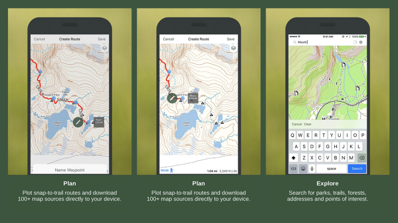
Users may plan routes, record tracks, explore trails, add waypoints, and see virtual topographic maps using Gaia GPS's free plan. Upgrade to Premium for $39.99 a year and gain access to additional features such as offline maps, specialty maps for specific countries, air quality maps, wildfire condition maps, and mountain riding maps. After your trek, the app creates a trip stats report for a more in-depth look at your adventure.
Detailed information:
Device: iOS / Android
Best for: GPS trail mapping
Link: https://www.gaiagps.com/