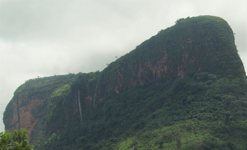
Mount Kakoulima


Kakoulima is a mountain in Guinea's Préfecture de Coyah, Kindia Region. The elevation is 1011 meters above sea level. Other spellings for Kakoulima: Mont Kakulimah, Mont Kakoulima, Mount Kakulima, Kakoulima, Kakoulima, Mont Kakulima, Mont Kakulimah, Mount Kakulima, Kakoulima, Mont Kakulima, Mont Kakulimah, Mount Kakulima.
Its coordinates in DMS (Degrees Minutes Seconds) are 9°46'1" N and 13°26'42" W, or 9.76694 and -13.445. (in decimal degrees). It has the UTM position FR78 and the Joint Operations Graphics reference NC28-12. A mountain is a high elevation that rises above its surroundings, with a tiny peak area, steep slopes, and local relief of 300m or more.
Secondary growth vegetations cover a major portion of its slopes. The fundamental variables that dominate the ecology of these ridges are frequent fogs, periodic edaphic drought, and atmospheric humidity. Mount Kakoulima is a layered solid rock that formed as a result of magma injections during intrusive stages. With a lithological progression from peridotite (dunite) to pyroxenite to widespread gabbro.
Location: Guinea
Elevation : 1,011 m (3,316 ft)