


Top 5 Highest Mountains In Guinea

Guinea, formally the Republic of Guinea, is a West African coastal republic. Guinea is bounded on the west by the Atlantic Ocean, on the northwest by ... read more...Guinea-Bissau, on the north by Senegal, on the northeast by Mali, on the southeast by Cote d'Ivoire, and on the south by Sierra Leone and Liberia. Toplist has compiled a list of some of Guinea's tallest mountains.
-
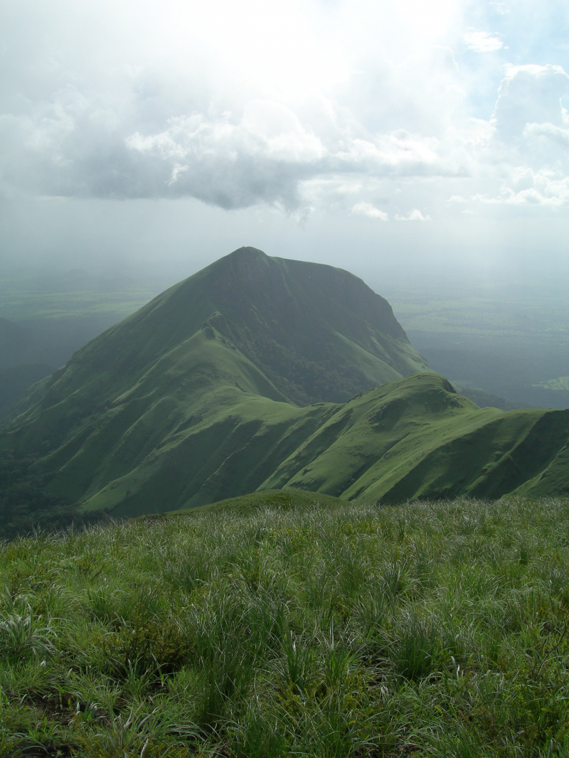
Mount Richard-Molard, commonly known as Mount Nimba, is a peak in West Africa that lies on the boundary between Ivory Coast and Guinea. The mountain is named after Jacques Richard-Molard, a French geographer who died in an accident on the peak in 1951. Previously, it was known as Mount Nouon.
The highest point in both countries in the Nimba Range is 1,752 meters (5,748 ft). The peak is part of the Guinea Highlands, which straddles the boundaries of the two countries as well as Liberia. The nearest major communities are the Liberian town of Yekepa and the Guinean towns of Bossou and N'Zoo.
Iron ore and cobalt are abundant on the mountain. The geological pedogenesis has been defined by a mix of iron-rich quartzite sheets, schists, and granite gneiss. Mount Richard-Molard is located within the Mount Nimba Strict Nature Reserve, which spans the borders of Guinea and Ivory Coast and comprises 17,540 hectares. Mount Nimba Strict Nature Reserve is a site of exceptional universal importance, and it was added to the World Heritage List in 1981. Since 1992, it has been designated as a World Heritage Site in Danger.
Location: Ivory Coast – Guinea
Elevation: 1,752 m (5,748 ft)
wikipedia.org 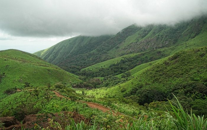
alluringworld.com -
Simandou is a 110-kilometer-long (68-mile) range of hills in southern Guinea's Nzérékoré and Kankan provinces, in the country's mountainous, forested Guinée Forestière area. A major iron ore deposit is currently being developed at the range's southern end. The Simandou Range stretches north and south, east of Banankoro and Kérouané, from the southern Kankan Region to the northern Nzérékoré Region. Pic de Fon, with an elevation of 1,658 m (5,440 ft), is the highest point in the range. Pic de Tibé, at 1,504 m (4,934 ft), is located in the range's middle, and Pic de Going, at 1,431 m (4,695 ft), to the north.
The Simandou Mountains contains a diverse range of habitats, including wet Guinean savanna, Western Guinean lowland forest, montane and gallery forests, and the uncommon and endangered West African montane grassland habitat. The Pic de Fon forest, located at the southern end of the range, is a relatively intact area of approximately 25,600 ha that contains many typical flora and fauna of the Guinean montane forests ecosystem, including endangered species such as the Nimba otter shrew (Micropotamogale lamottei), the West African chimp (Pan troglodytes verus), the Diana monkey (Cercopithecus diana diana), and the Sierra The frog Hylarana fonensis is found nowhere else.
Location: Guinea
Elevation: 1,658 m (5,440 ft)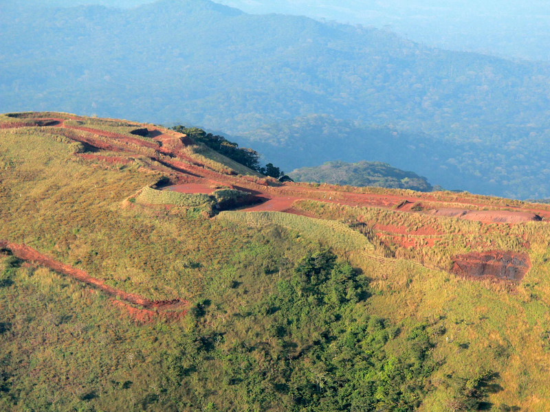
nsenergybusiness.com 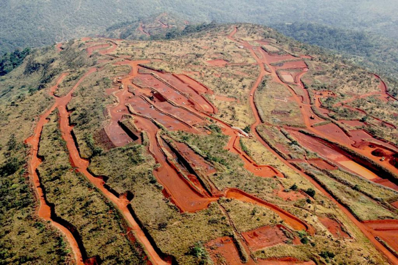
mining.com -
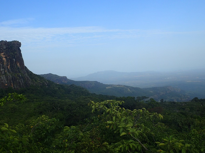
Mount Loura is the highest and northernmost peak in the Republic of Guinea's Fouta Djallon highland region in West Africa. Mount Loura, at 1,573 meters (5,161 feet) above sea level, is part of the larger Massif de Tamgue mountain range. On a clear day, you can see the hills of Senegal and Mali due to the mountain's proximity to their borders.
Nonetheless, the Dame du Mali remains one of the most stunning and spectacular sites in Guinea. Dame du Mali is naturally fashioned to resemble the head of a beautiful woman. The Dame du Mali gets its name from a little town near the mountain Loura in Mali, where the beautiful woman watches over the forested gorges and looks for invaders who want to take advantage of nature and the local community. Nonetheless, as one of the region's most important attractions, it is an enticing location that should be taken into account for greater security.
Location: Guinea
Elevation: 1,573 m (5,161 ft)
alluringworld.com 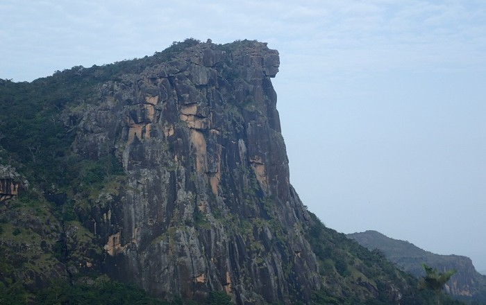
alluringworld.com -
Mount Gangan, rising to 1,117 meters above sea level, is a mountain in Guinea and one of the highest points on the Atlantic side of Maritime Guinea. Mount Gangan is made up of a large stony plateau. The lower slopes of the mountain are covered in raised savanna, while the higher slopes are covered in low woods. Mount Gangan is surrounded by rocky steep slopes and little bogs. From 650 meters, the vegetation consists of a low bush and small trees and bushes, with a maximum height of 5 to 6 meters.
The huge trees are more visible from 700 meters up, although their size diminishes beyond 900 meters. From 1000 meters, the granite pavement stones become more noticeable, covered by more or less dense plant carpets. The view from the summit, at 1117 meters, kisses the horizon, with the city of Kindia and a large military base.
Location: Guinea
Elevation : 1,117 m (3,664 ft)
wikipedia.org 
wikipedia.org -
Kakoulima is a mountain in Guinea's Préfecture de Coyah, Kindia Region. The elevation is 1011 meters above sea level. Other spellings for Kakoulima: Mont Kakulimah, Mont Kakoulima, Mount Kakulima, Kakoulima, Kakoulima, Mont Kakulima, Mont Kakulimah, Mount Kakulima, Kakoulima, Mont Kakulima, Mont Kakulimah, Mount Kakulima.
Its coordinates in DMS (Degrees Minutes Seconds) are 9°46'1" N and 13°26'42" W, or 9.76694 and -13.445. (in decimal degrees). It has the UTM position FR78 and the Joint Operations Graphics reference NC28-12. A mountain is a high elevation that rises above its surroundings, with a tiny peak area, steep slopes, and local relief of 300m or more.
Secondary growth vegetations cover a major portion of its slopes. The fundamental variables that dominate the ecology of these ridges are frequent fogs, periodic edaphic drought, and atmospheric humidity. Mount Kakoulima is a layered solid rock that formed as a result of magma injections during intrusive stages. With a lithological progression from peridotite (dunite) to pyroxenite to widespread gabbro.
Location: Guinea
Elevation : 1,011 m (3,316 ft)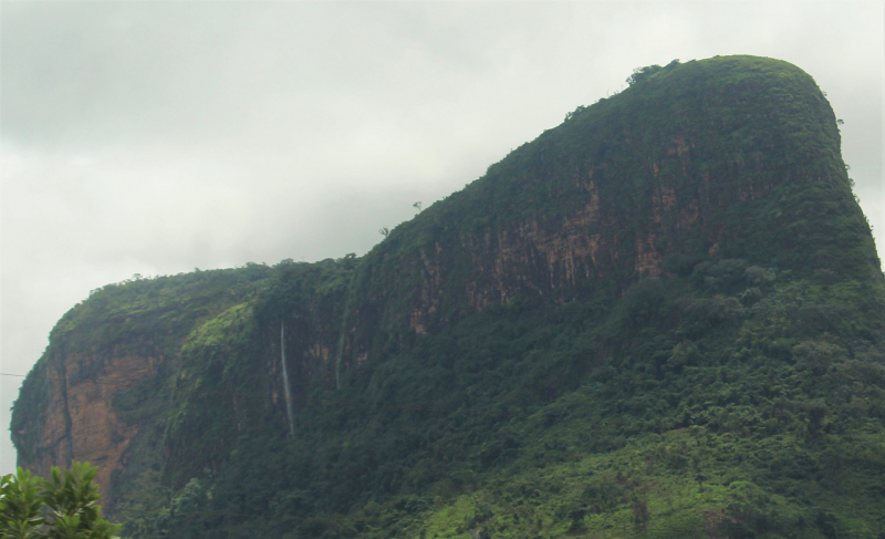
wikimedia.org


