Mount Roraima


Roraima Mountain is the highest peak in South America's Pakaraima chain of tepuis (table-top mountains) or plateaux. The native Pemon people gave the mountain the name Roraima. Roroi means "blue-green" in Pemon, and ma means "great" in Pemon.
Mount Roraima serves as a tripoint between Venezuela, Guyana, and Brazil; 5 percent of its mountain plateau is in Brazil, 10% in Guyana, and the remaining 85 percent is in Venezuela. Venezuela claims the ten percent area that is de facto located in Guyana. It is located on the Guiana Shield, in the southeastern corner of Venezuela's 30,000-square-kilometer (12,000-square-mile) Canaima National Park, and is the highest peak in Guyana's Highland Range. Kukenán-tepui, another major tepui in the national park, is located right next to Mount Roraima. The Brazilian portion of the mountain is home to the Monte Roraima National Park.
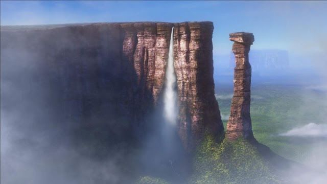
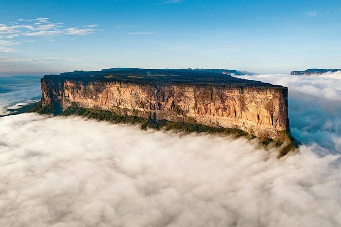
Mount Roraima, which was first described to Europeans by the English explorer Sir Walter Raleigh during his 1595 expedition, is famous for its table-top shape, with the flat plateau bounded on all sides by massive cliffs rising over 400 metres (1,300 ft) that often remains high above the fogs and clouds.
Mount Roraima also has a couple of waterfalls, the most famous of which is Roraima Falls, which leaps off the tepui in four tiered leaps; the waterfall's height is estimated to be around 2,000 feet (610 m).
Location: Guiana Highlands, Brazil
Elevation: 2,810 m (9,220 ft)