


Top 10 Highest Mountains in Brazil

Brazil is a country full of natural wonders, from its beautiful seas to its towering mountains. Brazil is a popular tourist destination because of its stunning ... read more...natural formations. These mountain ranges cover a large portion of Brazil and have an average elevation of around 2000 meters. These mountains in Brazil date back millions of years and continue to stand tall and protect the country. Toplist has compiled the Top 10 Highest Mountains in Brazil in this article.
-
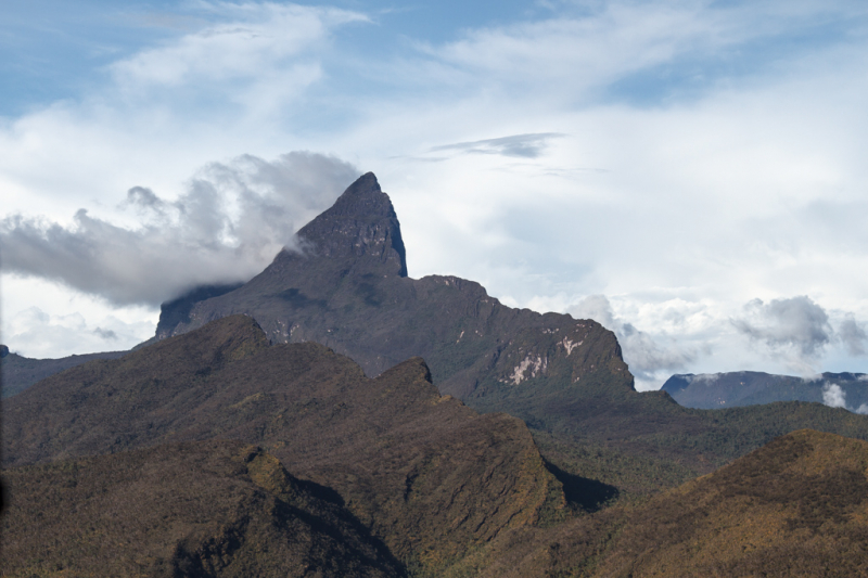
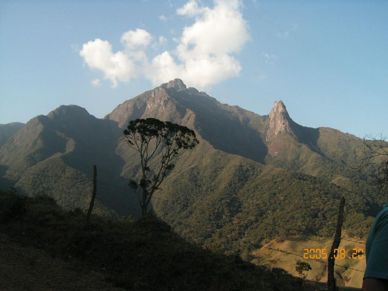
Pico da Neblina is the highest point in Brazil, rising 2,995.3 metres (9,827 feet) above sea level in the Serra da Neblina, part of the Serra do Imeri, a section of the Guiana Highlands on the border between Brazil and Venezuela. A border survey expedition in 1962 determined that its summit, Pico 31 de Março, is just within Brazilian territory, at a horizontal distance of only 687 m (2,254 ft) from the Venezuelan border.
Most of the time, as the name implies, the peak is shrouded in dense clouds. It was first climbed by members of a Brazilian Army expedition in 1965.
Pico da Neblina is officially located in the municipality of Santa Isabel do Rio Negro, state of Amazonas. The closest city is So Gabriel da Cachoeira, which is about 140 km (87 mi) away in a straight line and from which almost all climbing expeditions depart.
The mountain is protected by the Pico da Neblina National Park in Brazil, and its northern slopes are also protected by the Serranía de la Neblina National Park in Venezuela. Together with the neighboring Parima Tapirapecó National Park (Venezuela), the twin parks form a protected area complex of approximately 80,000 km2, possibly the world's largest national park system in tropical rainforests. Pico da Neblina is also located on the reservation of the Yanomami people.
Location: State of Amazonas, Brazil
Elevation: 2,995.30 m (9,827.1 ft)
en.wikipedia.org 
theculturetrip.com -
Pico 31 de Março, or Pico Trinta e Um de Março in full, also known as Pico Phelps, is a mountain on the border between Brazil and Venezuela. It is Brazil's second highest mountain, rising 2,974 metres (9,757 feet) above sea level. It is part of the Neblina massif, and Pico da Neblina, Brazil's highest peak, is only 687 meters (2,254 feet) away. Pico 31 de Março can be thought of as a secondary summit of Pico da Neblina. As a result, it is usually climbed by expeditions whose primary goal is to reach the other peak. The two are connected by a col that can be easily traversed in about an hour.
Pico da Neblina, part of the Pico 31 de Março massif, is the highest point on the Guiana Shield. In both Portuguese and Spanish, the word neblina means "fog." The mountains are protected by the Pico da Neblina National Park in Brazil, and their northern slopes are also protected by the Serranía de la Neblina National Park in Venezuela. Together with the neighboring Parima Tapirapecó National Park (Venezuela), the twin parks form a protected area complex of approximately 80,000 km2, possibly the world's largest national park system on tropical rainforests.
Location: Cerro de la Neblina, a section of Serra do Imeri in the Guiana Highlands, on the Brazil-Venezuela border
Elevation: 2,974.18 m (9,757.8 ft)
en.wikipedia.org 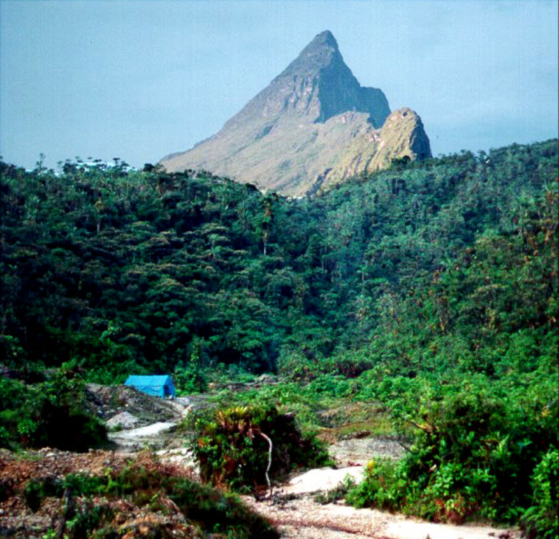
peakvisor.com -
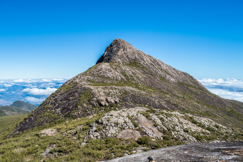
Pico da Bandeira, also known as Bandeira Peak, is the third highest mountain in Brazil, located on the border of the states of Espírito Santo and Minas Gerais. In both states, it is the highest point. It was previously thought to be the highest mountain in Brazil until 1965, when Pico da Neblina and Pico 31 de Março, near the Venezuelan border, were explored, measured, and found to be higher. According to legend, the peak was named after Pedro II, Emperor of Brazil, who ordered a flag to be flown atop it.
Pico da Bandeira is also notable for having the greatest topographic isolation in Brazil: 2,344 km (1,457 miles). This means that there is no other point on the Earth's surface at equal or greater elevation within that distance. Only Aconcagua, Denali, Pico de Orizaba, and Mount Whitney are more topographically isolated than Pico da Bandeira, and there are only 20 more isolated mountains in the world.
It is a major attraction of Caparaó National Park (Portuguese: Parque Nacional do Caparaó), which can be reached from the nearby town of Alto Caparaó. The town and the park's entrance are in Minas Gerais, but the summit of Pico da Bandeira is in Espírito Santo.
The summit is reachable by hikers of all ages, with only minimal fitness requirements. Most vehicles can drive from the park entrance to the summit track [8 km (5.0 mi)], and the summit track itself runs for approximately 9 km (5.6 mi), with an additional 1,000 m (3,280 ft) climb.
Location: Espírito Santo, Minas Gerais, Brazil
Elevation: 2,892 m (9,488 ft)
en.wikipedia.org 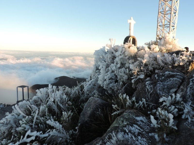
Ice on the summit of Pico da Bandeira (Photo: hikingproject.com) -
Pico do Calçado, with an elevation of 2849 meters, is unofficially Brazil's fourth highest mountain. It is also the unofficial second highest mountain in the states of Espírito Santo and Minas Gerais, which it shares.
The peak is located in the Caparaó National Park, near the municipalities of Ibitirama (Espírito Santo) and Alto Caparaó (Minas Gerais). It is located in the highest block of the Serra do Caparaó, less than 1 km from Pico da Bandeira in a straight line.
Until 2004, the peak altitude was given as 2766 meters, but during the Brazil Summits Project, a more precise GPS measurement confirmed the altitude to be 2849 meters.
The trail begins in Casa Queimada, on the Minas Gerais side, and follows the dividing ridge between the states of Espírito Santo and Minas Gerais, eventually reaching its wide summit via a "climbing" in the rock. The trail then continues on to Pico da Bandeira. With little vegetation and rocks at its summit, the mountain is relatively easy to climb.
Location: Espírito Santo and Minas Gerais, Brasil
Elevation: 2849 m ( 9347 ft)
Pico do Calçado 
pt.m.wikipedia.org -
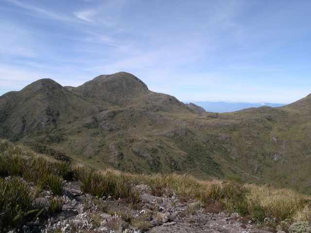
Pedra da Mina is Brazil's fourth highest peak, located in the Serra Fina section of the Mantiqueira Mountains, one of the country's most important mountain ranges. The mountain is located on the northern and southern borders of the states of Minas Gerais and São Paulo, respectively. It is the highest point of the Mantiqueira Mountains and the state of São Paulo, with a height of 2,798 meters (9,180 feet), and the second highest mountain in the state of Minas Gerais.
In addition to being one of the highest Brazilian mountains, Pedra da Mina is notable for its unusual history, as despite its high altitude and proximity to densely populated areas, the mountain was virtually unknown until the turn of the twenty-first century, as was its exact altitude, and its significance was not recognized until very recently, demonstrating that even in the twenty-first century, geographical exploration may still hold surprises. Official statistics and schoolbooks had to be corrected in this case, and a new popular mountaineering and ecotourism destination arose.
Pedra da Mina, like the rest of Serra Fina, is made of highly alkaline nepheline syenite, a type of rock that is easily eroded and, as a result, is rarely found at very high altitudes. Pedra da Mina is thought to be the highest mountain in the Americas, if not the world, made of that type of rock.
In Portuguese, pedra means "rock"; mina usually means "mine," but it can also mean "spring, water source." So the mountain's name means "Water Spring Rock," and it comes from the fact that four small creeks rise from the mountain near the top.
Pedra da Mina is not in a national or state park, but it is within the Mantiqueira Mountains Environmental Protection Area, so it is legally protected to some extent.
Location: Between the towns of Queluz and Lavrinhas (São Paulo), and Passa Quatro (Minas Gerais), Brazil
Elevation: 2,798 m (9,180 ft)
en.wikipedia.org 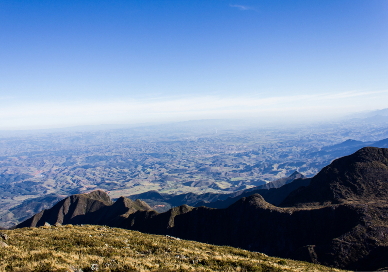
commons.wikimedia.org -
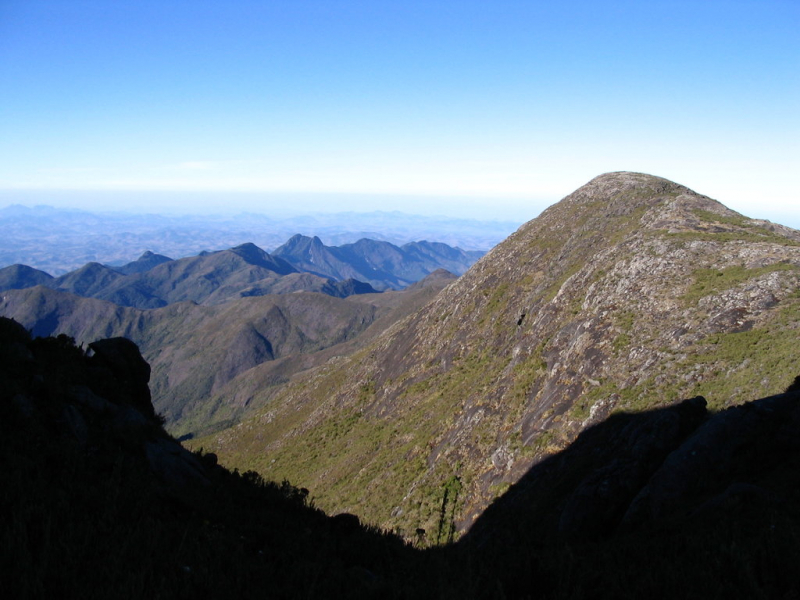
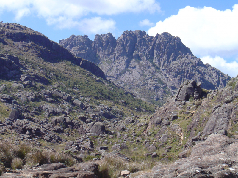
Pico das Agulhas Negras is Brazil's fifth-highest mountain, standing at 2,791 meters (9,157 feet) above sea level, making it one of the highest in the Brazilian Highlands. [3] It's in Itatiaia National Park, in the Serra da Mantiqueira range, on the border of Rio de Janeiro and Minas Gerais. It is the highest point in Rio de Janeiro state, the third highest in Minas Gerais, and the second highest in the Mantiqueira range.
Franklin Massena made the first attempt to reach the summit in 1856. Further attempts were made in 1878 and 1898 by André Rebouças and Horácio de Carvalho, but the summit was not reached until 1919 by Carlos Spierling and Osvaldo Leal.
When driving between São Paulo and Rio de Janeiro on the Via Dutra highway, the Pico das Agulhas Negras can be seen to the northwest of Resende, but only from a few points on the road, because a lower mountain range closer to the road blocks the line-of-sight at most other nearby locations.
Location: City of Resende States of Rio de Janeiro and Minas Gerais, Brazil
Elevation: 2,791 m (9,157 ft)
en.wikipedia.org 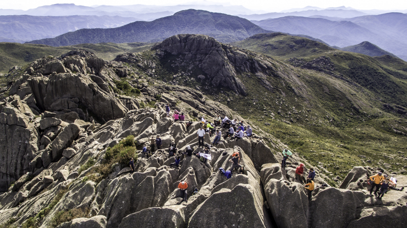
vi.m.wikipedia.org -
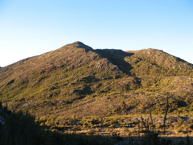
The Cristal peak is the seventh highest peak in Brazil, with 2,769.05 meters of altitude.
It is located at 20o 26' 37" south latitude and 41o 48' 42" west longitude in the Serra do Caparaó, within the Caparaó National Park, in the municipality of Alto Caparaó, State of Minas Gerais. According to Google Earth, the border with Espírito Santo is only 930 meters east of Pico do Cristal, and Pico da Bandeira, the third highest mountain in Brazil and the highest in the Southeast Region, is 1,940 meters to the northeast. The two peaks can be seen from each other.
Pico do Cristal is the highest mountain entirely within Minas Gerais territory, as the state's other highest peaks are on the border with Espírito Santo (Pico da Bandeira), São Paulo (Pedra da Mina), or Rio de Janeiro.
Location: Minas Gerais, Brazil
Elevation: 2,769 m (9,088 ft)
flickr.com 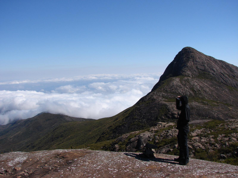
wikiloc.com -
Roraima Mountain is the highest peak in South America's Pakaraima chain of tepuis (table-top mountains) or plateaux. The native Pemon people gave the mountain the name Roraima. Roroi means "blue-green" in Pemon, and ma means "great" in Pemon.
Mount Roraima serves as a tripoint between Venezuela, Guyana, and Brazil; 5 percent of its mountain plateau is in Brazil, 10% in Guyana, and the remaining 85 percent is in Venezuela. Venezuela claims the ten percent area that is de facto located in Guyana. It is located on the Guiana Shield, in the southeastern corner of Venezuela's 30,000-square-kilometer (12,000-square-mile) Canaima National Park, and is the highest peak in Guyana's Highland Range. Kukenán-tepui, another major tepui in the national park, is located right next to Mount Roraima. The Brazilian portion of the mountain is home to the Monte Roraima National Park.
Mount Roraima, which was first described to Europeans by the English explorer Sir Walter Raleigh during his 1595 expedition, is famous for its table-top shape, with the flat plateau bounded on all sides by massive cliffs rising over 400 metres (1,300 ft) that often remains high above the fogs and clouds.
Mount Roraima also has a couple of waterfalls, the most famous of which is Roraima Falls, which leaps off the tepui in four tiered leaps; the waterfall's height is estimated to be around 2,000 feet (610 m).
Location: Guiana Highlands, Brazil
Elevation: 2,810 m (9,220 ft)
pinterest.com 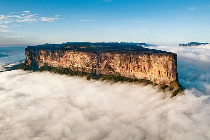
viator.com -
Pico dos Marins is a Brazilian mountain peak located between the cities of Piquete and Cruzeiro in the state of São Paulo. The peak is only about 1 kilometer (0.62 mi) south of the state border with Minas Gerais, but it is entirely within So Paulo territory. It is a short spur of the Mantiqueira Mountains' southwestern section, with an elevation of 2,420.7 meters (7,942 ft). The mountain was climbed for the first time in 1911.
The Marins Massif's main assembly consists of three sharp rocky peaks, all of which are over 2,000 meters above sea level and have hundreds of meters of rocky cliffs. Pico dos Marins, despite being the highest of the three, is the most accessible to climbers due to its less vertical north face. Deep valleys cut by canyons and dense vegetation make it much more difficult to climb than its neighbors. Marins, Maria, and Mariana are the names of the peaks from north to south.
Location: between the cities of Piquete and Cruzeiro in the state of São Paulo.
Elevation: 2.420,7 m (7.942 ft)
en.wikipedia.org 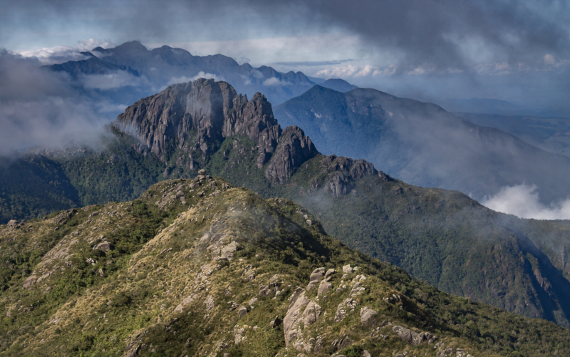
commons.wikimedia.org -
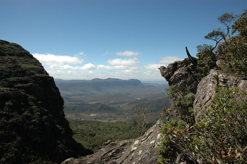
Pico do Barbado is the highest mountain in the Brazilian state of Bahia, as well as the highest in all of Northeastern Brazil, rising 2,033 meters (6,670 feet) above sea level. It is situated within the Chapada Diamantina National Park. The peak can be reached via a trail from Catolés.
From Catolés, there is a trail that leads to the peak. You can drive to the last house on the street, which is at the top, and then climb for two and a half hours to the top. From the top, you can see several peaks, including Itaobira and Pico das Almas, as well as mountains such as the stunning Serra da Tromba. A topographic map of the Barbado region is available for purchase in Lençóis and Mucugê.
Location: Bahia, Brazil
Elevation: 2,033 m (6,670 ft)
flickr.com 
flickr.com


