Pico da Cruz
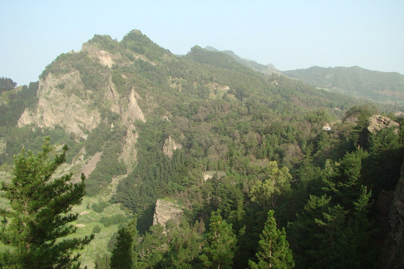
Pico da Cruz (Portuguese for "cross peak") is a mountain on the island of Santo Antão in the eastern half of the island. Its highest point is 1585 meters above sea level. It is located 5 kilometers southwest of Pombas (Paul). The mountain was formed by volcanic activity. Pico da Cruz, the settlement that bears its name, is located a few hundred meters to the west and is part of the municipality of Paul. The municipal boundary between Paul and Porto Novo (as well as the communal and natural park boundaries between Pico da Cruz and Ribeiro Frio) lies roughly 300 meters south.
Pico da Cruz is part of the Cova-Ribeira da Torre-Paul Natural Park, which is a protected area. The Cape Verde Islands dry forests cover a large portion of the region within the peak. Pines, some deciduous trees, and tiny plants, including the endangered Tornabenea insularis, make up the flora.
The Ribeira do Paul, Ribeira da Janela, the east of Porto Novo, the south of the island, and the island of So Vicente and its neighboring islets are all visible from this location.
Elevation: 1,585 m
Location: Santo Antão island


