Top 5 Highest Mountains In Cabo Verde

Cape Verde officially the Republic of Cape Verde, is an archipelago and island country in the central Atlantic Ocean, consisting of ten volcanic islands with a ... read more...combined land area of about 4,033 square kilometers (1,557 sq mi). These islands lie between 600 to 850 kilometers (320 to 460 nautical miles) west of Cap-Vert, the westernmost point of continental Africa. The Cape Verde islands form part of the Macaronesia ecoregion, along with the Azores, the Canary Islands, Madeira, and the Savage Isles. In this article, Toplist will share some information of top 5 highest mountain in Cape Verde.
-
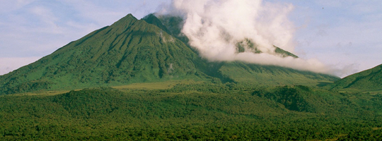
Pico do Fogo, at 2,829 meters (9,281 feet) above sea level, is Cape Verde's and West Africa's highest peak. On the Fogo island, it is an active stratovolcano. The last time the main cone erupted was in 1680, resulting in wholesale evacuation from the island. In 1995, a secondary vent erupted. The only fatal eruption occurred in 1847, when several individuals were killed by tremors.
Fogo (which means "fire" in Portuguese) is a volcanic island with a hotspot. It erupted three times in the last century: in 1951, 1995, and 2014. It is the youngest and most active volcano in the Cape Verde Islands, a short band of volcanic islands produced as the African Plate migrated east across the hotspot, and is generally younger at the western end. Fogo is made up of a single volcano, making it practically spherical with a diameter of 25 kilometers (16 miles). The enormous summit caldera (about 10 kilometers north–south and 7 kilometers east–west) is located in the island's northeastern corner, rather than in the island's center. On the north, west, and south sides, the caldera is surrounded by steep near-vertical fault scarps, but it is breached to the east, allowing lava to flow to the coast. Between 1500 and 1760, north-northeast-trending eruptive cracks emerged along Pico's western flank, which formed inside the caldera. The last time the summit erupted was in 1769. Fogo's current topology, with the caldera open to the sea on the east side, is the result of the volcano's east flank slipping towards the sea.
The mountain's slopes are used for coffee farming, while its lava is used for construction. A caldera at the summit contains a small settlement known as Ch das Caldeiras. Bordeira is the name given to the crater rim, which rises to a height of 2,700 meters.Elevation: 2,829 m
Location: Fogo Island
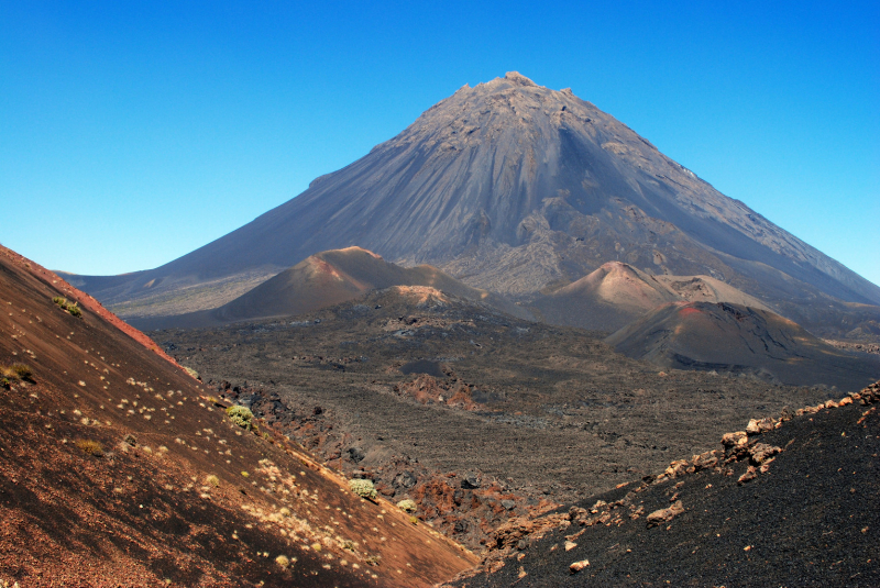
Photo source: Wikimedia Commons 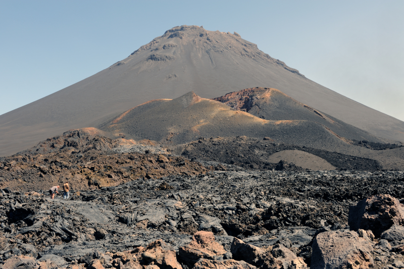
Photo source: Wikipedia -
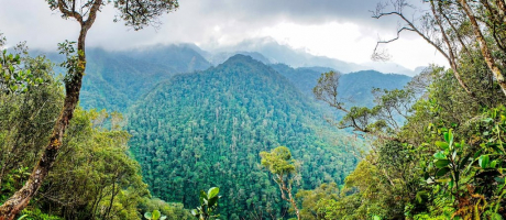
The Tope de Coroa is a mountain on the Cape Verdean island of Santo Antão. It is the island's highest point, standing at 1,979 meters above sea level. It is located in the western portion of the island, 25 kilometers west of Porto Novo, the island's capital. The mountain was formed solely by volcanic activity. Several streams originate in this area, notably the Ribeira de Monte Trigo, which runs westward to Monte Trigo.
The mountain is part of an 84.92-square-kilometer natural park (32.79 sq mi). It is home to 61 percent of Cape Verde's endemic angiosperm plants, 25 percent of which are on the endangered species list, including Periploca laevigata subsp. chevalieri. Free grazing poses a harm to the area's biodiversity. Tope de Coroa is made up of volcanic rock that was formed between 200,000 and 170,000 years ago.
Elevation: 1,979 m
Location: the Cape Verdean island of Santo Antão
Photo source: Wikipedia 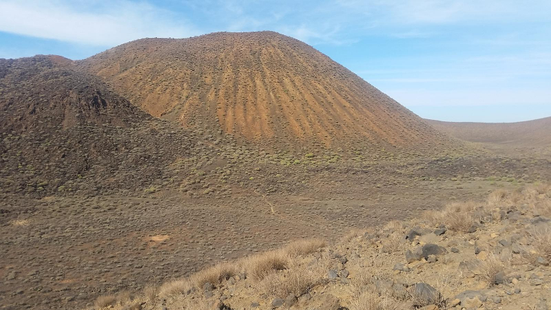
Photo source: Wikiloc -
Pico da Cruz (Portuguese for "cross peak") is a mountain on the island of Santo Antão in the eastern half of the island. Its highest point is 1585 meters above sea level. It is located 5 kilometers southwest of Pombas (Paul). The mountain was formed by volcanic activity. Pico da Cruz, the settlement that bears its name, is located a few hundred meters to the west and is part of the municipality of Paul. The municipal boundary between Paul and Porto Novo (as well as the communal and natural park boundaries between Pico da Cruz and Ribeiro Frio) lies roughly 300 meters south.
Pico da Cruz is part of the Cova-Ribeira da Torre-Paul Natural Park, which is a protected area. The Cape Verde Islands dry forests cover a large portion of the region within the peak. Pines, some deciduous trees, and tiny plants, including the endangered Tornabenea insularis, make up the flora.
The Ribeira do Paul, Ribeira da Janela, the east of Porto Novo, the south of the island, and the island of So Vicente and its neighboring islets are all visible from this location.Elevation: 1,585 m
Location: Santo Antão island
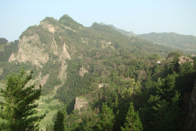
Photo source: Wikipedia 
Photo source: Wikimedia Commons -
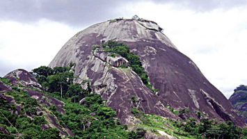
Pico de Antónia is a peak in Cape Verde that is located in the central part of the island of Santiago. It is the highest point on the island, standing at 1,392 meters (4,567 feet). The mountain is part of the Parque Natural da Serra do Pico de Antónia, a protected region. Close to the mountain are the settlements of Picos and Assomada. BirdLife International has designated the Serra do Pico da Antónia as an Important Bird Area.
The municipality of So Salvador do Mundo, So Lourenço dos rgos, and Ribeira Grande de Santiago are all located on the mountain. The Ribeira de Pico da Antónia, a source river of the Ribeira Seca, is located north of the peak.
The Pico da Antónia deposit is volcanic in origin and dates back to the Piacenzian and Gelasian eras between 3.3 and 2.3 million years ago.
Elevation: 1,392 m
Location: the central part of the island of Santiago
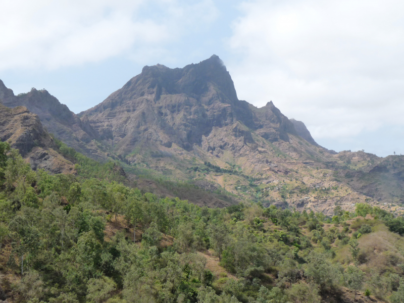
Photo source: Wikipedia 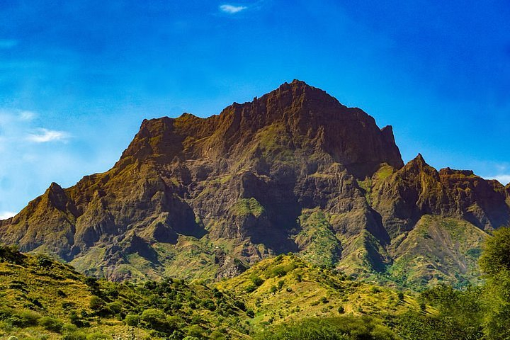
Photo source: TripAdvisor -
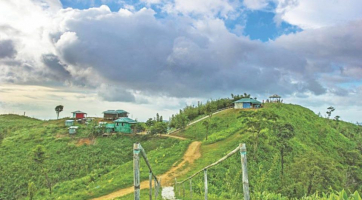
Monte Gordo is a mountain on the Cape Verdean island of So Nicolau. It is the island's highest point, standing at 1,312 meters above sea level. It is located in the western part of the island, 6 kilometers west of Ribeira Brava, the island's capital. The mountain is less than a million years old and was formed by volcanic activity. The mountain serves as the border between the municipalities of Tarrafal de So Nicolau and Ribeira Brava. The Monte Gordo Natural Park includes it.
The Monte Gordo Natural Park was established to safeguard the humid mountain habitat. It was founded on February 24, 2003, and the IUCN has classified it as category V. The park covers 9.52 square kilometers. It is one of Cape Verde's rare areas where the indigenous vegetation has been retained. Some of the highest areas of the site are forested, particularly near Monte Gordo, where the trees are extensively coated with lichens due to the heavy rainfall and often misty weather.
Forests of Pinus, Eucalyptus, and Cupressus species dominate the park's vegetation. Euphorbia tuckeyana, Nauplius smithii, Echium stenosiphon, Sonchus daltonii, Aeonium gorgoneum, and Campanula jacobaea are some of the endemic plant species. The Chioninia nicolauensis, the Cape Verde wall gecko (Tarentola caboverdiana), the Fea's petrel (Pterodroma feae), and the Cape Verde warbler are among the fauna (Acrocephalus brevipennis). BirdLife International has designated the area as an Important Bird Area.Elevation: 1,312 m
Location: the Cape Verdean island of So Nicolau
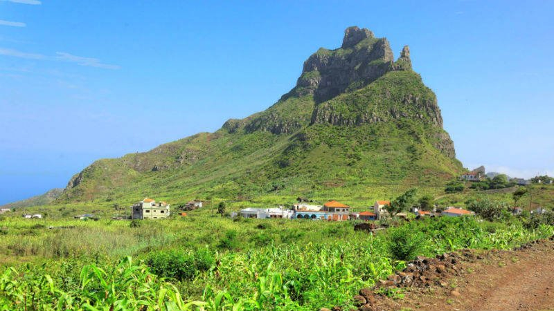
Photo source: Cape Verde 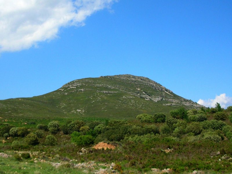
Photo source: Wikipedia