Top 13 Best Lakes to Visit in Indiana

Indiana, the 38th-largest state in the union, is a Midwestern state with a total size of more than 94,000 square kilometers. It is a part of the Great Lakes ... read more...Region, with Lake Michigan forming its northwest border. There are a lot of state parks, lakes, and artificial reservoirs in Indiana. These are the best lakes to visit in Indiana.
-
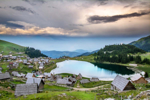
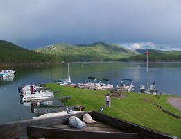
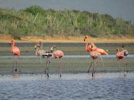
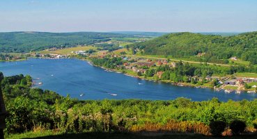
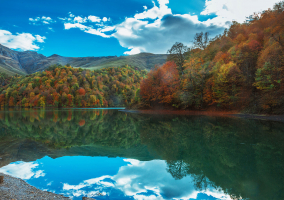
Just over two miles west of the town of North Webster, in north-central Indiana, is where you'll find this sizable glacial lake. With a depth of 123 feet, it is the state's deepest natural lake and a very well-liked recreational location. At Tippecanoe Lake, boating, fishing, and water sports are common activities. The lake's waterfront also has a country club, golf course, resort, and mineral springs in addition to its three marinas. Additionally, it is bordered by opulent homes.
Tippecanoe is not associated with canoes or canoeing in any way. Instead, it is a Native American phrase that has undergone numerous changes throughout the years thanks to French and European explorers who used it on early maps and records.
Tippecanoe Lake receives its primary inflows from the Tippecanoe River via James Lake and from the other lakes in the Barbee chain via Grassy Creek. Boat ramps are available at a number of the lake's public access locations as well as a few of its private ones. Around the lake, there are additional restaurants, eateries, boat servicing facilities, and a swimming beach.
Video: Lakehouse - Lake Tippecanoe 
Photo: www.sustainourlake.com - Tippecanoe Lake -
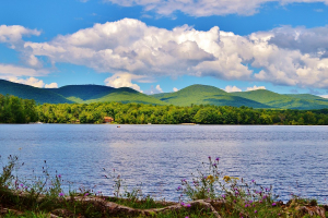
The second-largest natural lake in Indiana is Lake Maxinkuckee, a lively 1,850-acre lake in the state's north central region. The lake's dimensions are 2.6 miles long by 1.6 miles broad. Lake Maxinkuckee was created by glaciers, like many lakes in the north. Summertime activities on the lake include swimming, fishing, sailing, and water skiing. Visitors can enjoy scuba diving at Lake Maxinkuckee for a distinctive experience. The lake is well-liked by ice fishers during the winter. In the area, visitors can play a round of golf or ride a bike around the lake.
The name "Maxinkuckee" is derived from an untranslated Native American term. There are other definitions, such as "diamond lake," "clear water," and "gravelly bottom." Regardless of the exact origin of the lake's name, we do know that glaciers that had retreated some 15,000 years ago helped to create it. These lakes, often referred to as kettle lakes, are depressions in the crust of the earth that remain after partially buried ice blocks melt and fill the depression with water.
A must-visit lake for tourists in Indiana's Northern Tourism Region is Lake Maxinkuckee. This lake is the ideal getaway location for magnificent scenery in a hometown feel because Fort Wayne, where there is airport access, is only less than two hours away.
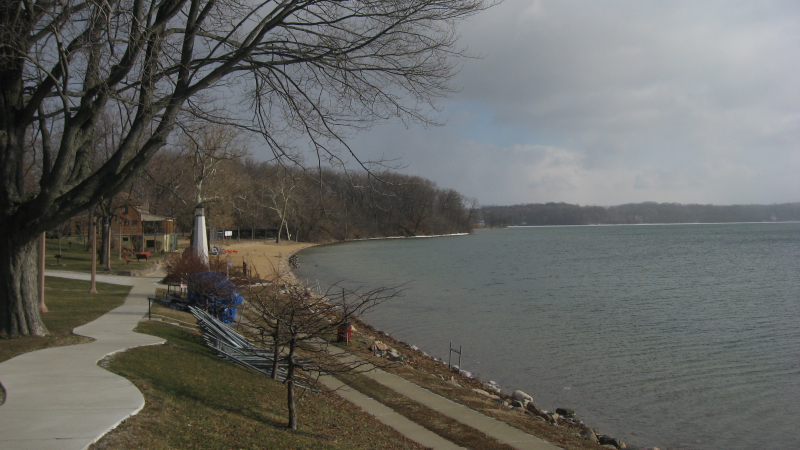
Photo: Wikipedia - Lake Maxinkuckee 
Photo: R&B Bass Circuit - Lake Maxinkuckee 2018 -
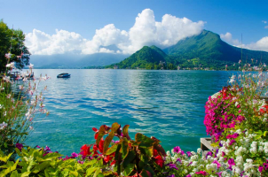
Over 1,000 lakefront houses and condos dot Lake Wawasee's 25 miles of shoreline, Indiana's largest natural lake, and its watery neighbor Lake Syracuse, whose residents enjoy breathtaking views and unrivaled access to the lakes' clean waters. At Lake Wawasee and Lake Syracuse, more than 3,500 acres of pure, freshwater lakes entice visitors who like water sports and adventures. In stunning northern Indiana, you will discover an oasis of amazing leisure options. These lakes offer all the necessities for a great day in the sun and are perfect for any freshwater activity. Both Lake Wawasee and Lake Syracuse have become the Mecca of Indiana's unspoilt natural environment for fans of motor boating, water skiing, sailing, swimming, and fishing.
The "sand bar," which is about 500 yards from the south side of Lake Wawasee, is the ideal location for sunbathers to work on their tans. The two acres of the sand bar, which can only be reached by boat, are in a convenient location and are ideal for cool summer dips and extended naps. Along the beaches of both lakes, there are a great number of parks.
There are numerous methods for locals and guests to enter the lakes' waters. Boaters can use the free public boat ramp on Lake Wawasee's southeast shore or the boat ramps at various nearby marinas on both lakes. Local marinas also offer jet skis, pontoon boats, and fishing boats for rent if you don't own your craft. The two yacht clubs on Lake Wawasee organize a number of regattas that fill the lake with colorful sailboats. The primary canal connects Lake Wawasee and Syracuse Lake, making the transition between them as effortless as the peaceful surfaces of the lakes.
Photo: the Lilly Center for Lakes & Streams - Lake Wawasee Video: Dan Hieb Lake Wawasee in Syracuse, Indiana -
Patoka Lake, the second-largest reservoir in Indiana, is located in the state's southernmost three counties. The reservoir, which was constructed along the Patoka River for flood control purposes, is located above the Patoka Lake Dam. Patoka Lake is a beautiful reservoir where a number of migratory birds and several kinds of fish reside. Though fishing is also very popular here, with the lake being stocked with walleye, bass, crappie, bluegill, and several other species, photography is a very popular activity there.
Patoka Lake, with 26,000 acres of water and land, is a superb illustration of lake ecosystem. A lake with a surface area of 8,800 acres serves as a home for freshwater jellyfish and bald eagle nesting grounds. The DNR reintroduced osprey and river otters to Patoka.One of only two permanent, non-releasable bald eagles in a DNR state park or reservoir resides on the land. In 2013, the eagle was purchased. C52, a previous eagle, spent his entire life at Patoka Lake, from 1988 until his demise in 2009.
The Moery Cabin reconstruction, a non-releasable red-tailed hawk, bald eagle, Eastern screech owl, and other local natural and cultural heritage items are featured in programs and special events put on by the property's Interpretive Services staff. There are also courses on Dutch oven cooking, kayaking, and other outdoor skills available.
Photo: Visit French Lick - Patoka Lake 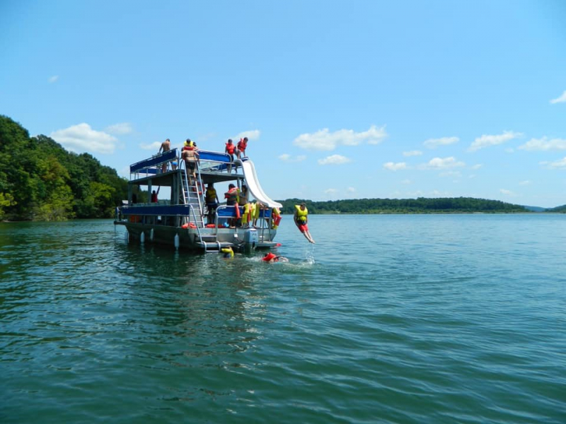
Photo: Only In Your State - Patoka Lake -
Any kind of watercraft will enjoy Monroe Lake as a destination. You may easily bring your own boat down to Bloomington's sandy shoreline thanks to the city's nine launch ramps. Three boat rental establishments can be found near the lake, each of which offers a selection of pontoons, speedboats, jet skis, fishing boats, kayaks, canoes, and paddleboards in addition to tubes, wakeboards, skis, and other watersports equipment. Lessons in windsurfing, stand-up paddling, and kayaking are also available from LT Paddle Sports; however, people with prior experience can only rent the necessary gear.
Three free public beaches are available for use at Monroe Lake. Visit the beaches of the Fairfax State Recreation Area (SRA), Paynetown State Recreation Area, and Hardin Ridge Recreation Area from Memorial Day to Labor Day to cool off or soak up some sun. Swimming, picnics, kite flying, volleyball, sunbathing, sandcastle building, frisbee, and other beach sports are available.
Preparation is the key to a successful trek, so before you leave, make sure you get a route map and bring lots of water. Shoes with closed toes are required for negotiating rough terrain. Know your limits as well; if you feel too exhausted to finish a trek, don't be ashamed to turn back. Don't push yourself beyond what you are able to achieve since the distance you hike in is the distance you must hike out. For curious pet owners: as long as they're on a leash, dogs are welcome.
Photo: TripAdvisor - Monroe Lake 
Photo: Expedia - Lake Monroe -
One of the two reservoirs in the Twin Lakes neighborhood of Monticello, Indiana, is named Lake Shafer. When two dams were constructed on the Tippecanoe River outside of Monticello in the 1920s, they also produced Lake Freeman. It continues to be a well-liked recreational location and contributes to White County's projected $70 million in annual tourism revenue.
The Norway Dam, located at river mile 30.2 above the Wabash River confluence, marked the beginning of the formation of Lake Shafer in 1922. The dam's construction was completed in June 1923, and it is still standing about a mile north of Monticello.
Due in great part to the presence of the Indiana Beach Amusement Park and Camp Resort, , continues to be the most developed of the Twin Lakes. In addition, there are a ton of marinas where you may rent boats as well as villas and homes. Part-timers make up a large portion of Lake Shafer's population, who often visit the lake only on weekends from April through October. Summer weekends saw an upsurge in visitor visitation, which results in a lot of boat traffic on the lake.
Photo: lakeshaferboatrentals.com - Lake Shafer Boat Rentals 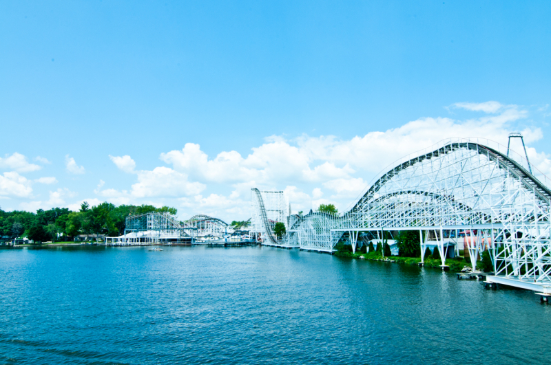
Photo: www.homes-by-network.com - Lake Shafer -
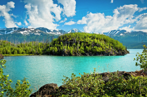
The boundary between Burke and McDowell Counties is shared by the sizable reservoir known as Lake James, which is located in the mountains of western North Carolina. It bears the name of James Buchanan Duke, a tobacco tycoon and supporter of Duke University. The lake is hidden behind a network of four earthen dams, with a surface level of 1200 feet (366 meters). It was built as a hydroelectric facility by Duke Power between 1916 and 1923. It is the uppermost lake on the Catawba River system and continues to produce electricity today.
Lake James is the result of James B. Duke's early 1900s initiative to build a network of dams and reservoirs on the Catawba River in North Carolina's Piedmont with the goal of generating electricity for the area. The Catawba River, which originates in the mountains close to the unincorporated community of Linville Falls (North Fork), as well as on the eastern slope of the Eastern Continental Divide, and the Linville River, which rises on the slopes of Grandfather Mountain and forges the Linville Gorge after plunging over Linville Falls north of the lake, meet at the confluence where the reservoir was built. Paddy's Creek (also known as Paddy Creek), which gives its name to a campsite, boat launch, and a section of Lake James State Park that includes a sandy beach swimming area, is one of the lesser flows that feed the reservoir.
The earthen works that built the reservoir were started in 1916, and they were finished in 1923. The little farming hamlet of Fonta Flora, which was dispersed between the productive river valley and the nearby low hills, suffered some losses as a result of the lake's flooding.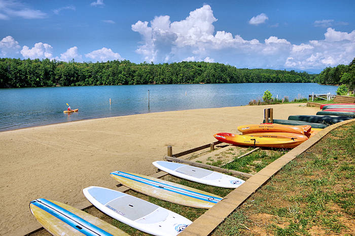
Photo: Romantic Asheville - Lake James 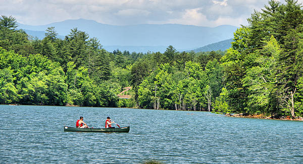
Photo: Romantic Asheville - Lake James -
Cagles Mill Lake-also known as Cagles Mill Reservoir and Cataract Lake-is located on two of central Indiana’s popular outdoor recreational sites: Lieber State Recreation Area and Cataract Falls State Recreation Area.
Lieber State Recreation Area and Cataract Falls State Recreation Area, two of central Indiana's most well-liked outdoor recreation destinations, are where Cagles Mill Lake, also known as Cagles Mill Reservoir and Cataract Lake, is situated.
The Indiana counties of Owen and Putnam both contain Cagles Mill Lake. It is a 1410-acre artificial lake that is renowned for both its natural beauty and its waterfalls. The US Army Corps of Engineers is in charge of the mostly forested area around Cagles Mill Lake. This woodland area, which is home to deer, wild turkeys, and a variety of other local animals, is ideal for lawful hunters and interested onlookers. When Cagles Mill Dam was constructed across Mill Creek, the lake was formed. The dam was developed and built in 1953 by the Louisville District of the U.S. Army Corps of Engineers, and it is still in use today to stop flooding in the Eel and White River Watersheds. The dam is located near Cagles Mill Lake's northernmost point. It is 900 feet long and 150 feet high.
Photo: TripAdvisor - Cagles Mill Lake 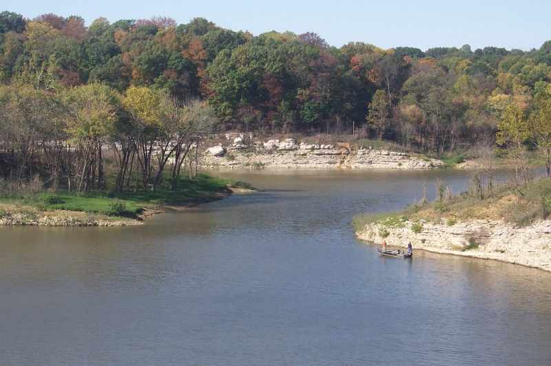
Photo: Flickr - Cagles Mill Lake -
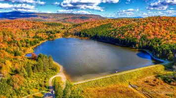
Just 10 miles northeast of Bloomington, Indiana, among the picturesque rolling hills of south-central Indiana, is where you'll find Lake Lemon. Boaters and fishers travel as far as Kentucky and northern Indiana to enjoy the picturesque and serene environment. In order to provide the City of Bloomington's growing population with access to natural resources and a drinking water reservoir, Lake Lemon was constructed in 1953. Up until the late 1960s, Lake Lemon served as the City of Bloomington's main source of drinking water. Currently, Bloomington's backup water supply comes from the reservoir.
With 1,650 acres, 24 miles of shoreline, and an average depth of 9.7 feet, Lake Lemon is the 11th largest lake and 7th largest public reservoir in Indiana. The watershed of Lake Lemon drains an area of around 70 square miles. Due to the financial burden of having a water supply that was not being used, the City of Bloomington Utilities started looking for an organization interested in administering the reservoir in the late 1980s. Lake locals Earl Eberle, Larry Ritter, and Bud Howard spearheaded arduous grassroots efforts that resulted in the creation of the Lake Lemon Conservancy District (LLCD) in 1995.
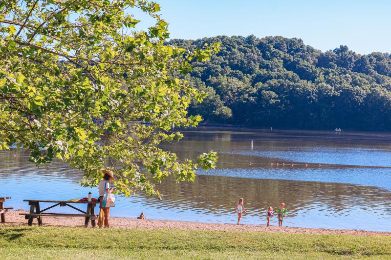
Photo: Visit Bloomington - Lemon Lake 
Photo: Indiana Public Media - Lake Lemon -
In Huntington, Indiana, there is a reservoir called J. Edward Roush Lake. The lake is located at a 748-foot elevation (228 m). To recognize J. Edward Roush's contribution to the community as a member of the U.S. House of Representatives, State Representative, and State Senator for Indiana, the Huntington Reservoir was renamed J. Edward Roush Lake. In 1968, the J. Edward Roush Lake Dam was finished for flood control and recreational purposes. Its greatest capacity is 153,100 acre-feet (0.1888 km3), while its average capacity is 12,500 acre-feet. It is 91 feet (28 m) high and 6,500 feet (2,000 m).
Along with seven other lakes in the state, including Salamonie and Mississinewa lakes, which are close by, the public land at Roush Lake is managed by the Indiana Department of Natural Resources (DNR) in collaboration with the U.S. Army Corps of Engineers. The latter two are referred to as the Upper Wabash Reservoirs, together with Roush. The DNR manages and operates the recreational amenities and wildlife areas at these lands under a lease with the Corps. The immediate vicinity of the dams' recreational facilities and certain dams are managed by the Corps. Lake water levels are also monitored and managed by the Corps.
Boating, camping, fishing, hunting, picnics, and water sports are permitted activities at the lake.
Photo: Wikipedia - J. Edward Roush Lake 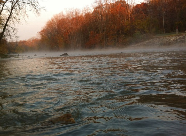
Photo: Visit Indiana - J.E. Roush Lake Fish and Wildlife Area -
Lake Griffy, also referred to as Griffy Reservoir, is a reservoir in Bloomington, Indiana. It's one of the best lakes to visit in Indiana. The reservoir, which was built in the 1920s by building a dam on Griffy Creek, was Bloomington's primary source of drinking water for many years before Lake Lemon and Lake Monroe, which are larger, took over in the 1950s.
The Griffy Lake Nature Preserve is classified as a major portion of the lake's forested watershed (GLNP). With the availability of boating, fishing, and hiking paths, this region is very well-liked by those who enjoy the outdoors. The Griffy Woods sector of Indiana University's Research and Teaching Preserve has a different portion of the watershed. University Lake, a tiny reservoir that is a component of Griffy Lake's watershed and serves as a kind of forerunner to Griffy Lake, may be found in Griffy Woods.
Over 45 different pieces of land have been purchased over the years to safeguard Griffy Lake's water sources, resulting in the 1,180 acres of Griffy Lake Nature Preserve that surrounds the lake today.
Photo: AllTrails - Best Trails in Griffy Lake 
Photo: Press Puzzles- Griffy Lake -
Witmer Lake, which is thought to be a part of the Indian Lakes Chain, is situated in Wolcottville in the renowned LaGrange County.
Witmer, Dallas, Hackenberg, and Messick Lakes are among the five lakes that make up the Indian Lakes Chain. All of these lakes are connected by the Elkhart River. Witmer Lake is larger than some of the other lakes in the chain, at roughly 204 acres. The state lines of Ohio and Michigan are not far from Witmer Lake. The location of the southernmost point of Lake Michigan is very advantageous.
The clear waters of Witmer Lake are perfect for boating, swimming, skiing, kayaking, fishing, and other water sports. On the lake, there is a public boat launch that can be utilized to get to other Indian Chain Lakes lakes.
Bass, bluegill, catfish, crappie, and northern pike are among the fish that may be found in Witmer Lake. Anglers can take in the stunning vistas and lush shoreline of the lake while experiencing the excitement of the catch. Take a picnic in Dallas Lake Park after driving the boat up to the lake. The 140 acres of marshes, prairies, and woods are perfect for riding, walking, bird viewing, swimming, picnics, and other outdoor activities.
Photo: Only In Your State - Visit Witmer Lake In Indiana 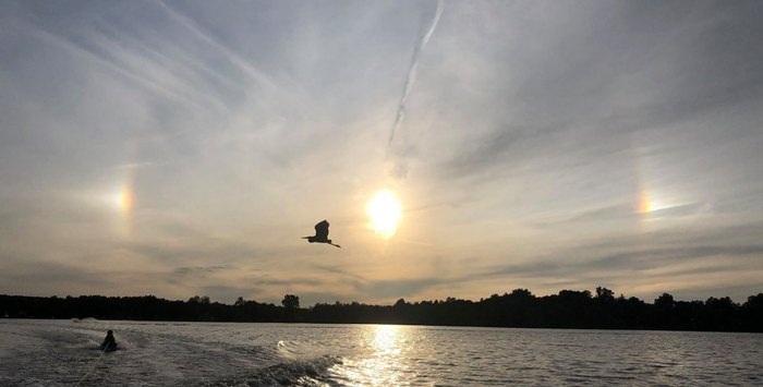
Photo: Only In Your State - Visit Witmer Lake In Indiana -
To close the list of best lakes to visit in Indiana, we want to mention Mississinewa Lake. You might not be aware of it, but Mississinewa Lake is a dam located in Peru, a town in central Indiana. Although it is now a well-liked vacation spot, it was built in 1967 to prevent flooding.
The lake is frequently used for fishing, boating, camping, hiking, and other activities. Additionally, it is surrounded by several homes and cabins and more than 400 campsites. A beach, fishing docks, boat ramps, and marina may all be found at Mississinewa Lake.The Red Bridge State Recreation Area, the Miami State Recreation Area, and the Pearson Mill State Recreation Area are just a few of the lake's surroundings that are well-liked for recreational activities.
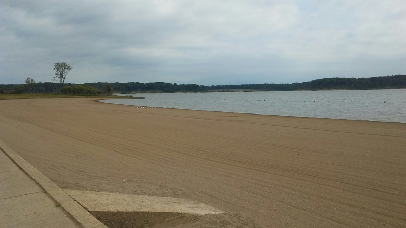
Photo: TripAdvisor - Camping at Mississinewa Lake 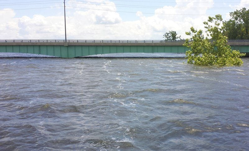
Photo: Wikiwand - Mississinewa Lake