Top 8 Best Tourist Attractions in Panama
Panama offers a diverse range of activities, including cloud-forested highlands, picturesque palm-topped islands, lively indigenous cultures, and riotous ... read more...celebrations. Most travelers' bucket lists include the Panama Canal and Panama City, Central America's most vivacious capital city, but there's also a surprising amount of variation for such a small country. There are many wild and fascinating spots to visit in Panama that are well off the main path.
-
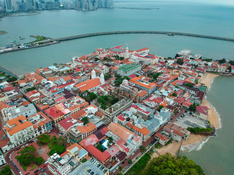
In Panama City's historic center, hip rooftop bars and stylish restaurants dot lush plazas, historical cathedrals, and grand colonial structures, making it one of the country's primary centers of attraction. Visitors to Panama City are naturally drawn to historic Casco Viejo, which was founded in 1673 by the Spanish two years after the first colony, Panama Viejo, was sacked by Welsh buccaneer Henry Morgan.
The region provides upscale boutique accommodations, casual cafés and fine dining, strewn among ancient churches and renovated houses, as well as a rising trendy nightlife scene, and is home to most of the capital's historical landmarks. The only other notable relics from the conquest era are the ruins of Panama Viejo, the first European city to be constructed on the Pacific coast of the Americas, located 8 kilometers (5 miles) northeast of the city center. The Iglesia de la Merced, the Plaza de Catedral, and the Palacio Presidencial are among the sights to see in Casco Viejo, which are best explored on foot.
Location: Panama
en.wikipedia.org 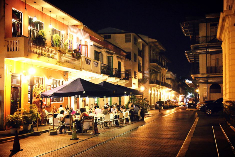
yeudulich.com -
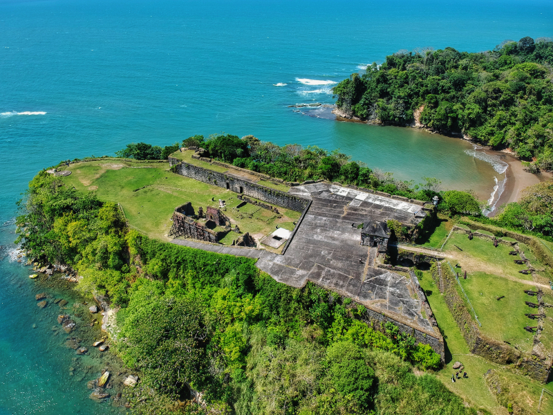
San Lorenzo's crumbling colonial fort is a Panama landmark and a powerful reminder of the fortifications the conquistadors built to defend their looted treasure from invading pirates. It stands sentinel over the mouth of the Ro Chagres from atop a rocky promontory. The well-preserved ruins attest to its importance throughout the Spanish colonial period. Its spectacular location, commanding views of both the brooding river and the glistening Caribbean, combined with its isolation and forest surroundings, make it far more evocative than the more accessible and more visited Portobelo fort, and you can have the place to yourself if you avoid the cruise ship tour groups – especially midweek during the rainy season.
The fort is located within the 120-square-kilometer (46-square-mile) Reserva Protegida San Lorenzo, which is home to a swath of secondary forest and swampland that is ideal for birdwatching. There are 435 species listed, some of which can be seen along the small trails in the woodland off the fort's entry road.
The initial sea-level earth-and-wood fort was built in 1595 to safeguard loot-laden Spanish ships sailing down the Chagres to Portobelo from foreign invasion. Though Francis Drake failed to capture the fort in 1596, one of Henry Morgan's privateers did so in 1670, allowing Morgan and his crew to sail up the river freely and demolish Panama City. In the 1680s, the fort was rebuilt in coral stone on its current cliff-top location, where it was eventually demolished by the British in 1740. The invasion was reportedly in retaliation for the wounding of a British merchant captain called Robert Jenkins by Spanish coastguards in what became known as the War of Jenkins' Ear. The fortifications at San Lorenzo were repaired and strengthened, but they were never actually put to the test again, even though they were employed as part of the US military defenses during World War II — observe the still prominent anti-aircraft platform next to the tower. Cross the drawbridge (not the original one) and enter the fort through the sleek, squat stone-and-brick guardhouse, which serves as the primary entrance.
Location: near the mouth of the Chagres River
artsandculture.google.com 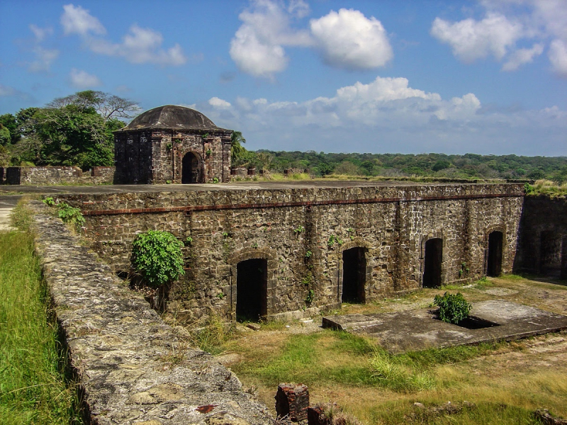
en.wikipedia.org -
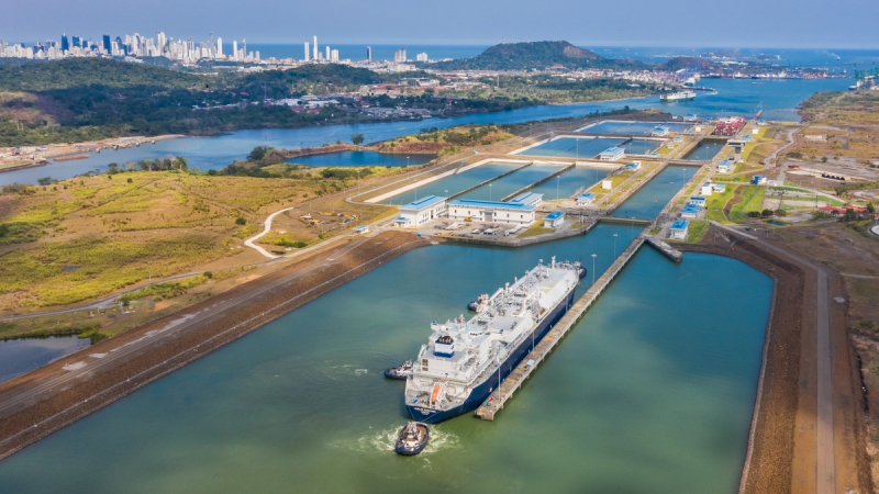
The Panama Canal is without a doubt the most popular tourist destination in Panama. The Panama Canal, which stretches 77 kilometers (48 miles) between the Pacific and Atlantic oceans, straddling the provinces of Panama and Colón, is a massive engineering feat and a triumph of human effort and sacrifice – a truly awe-inspiring sight and justifiably the country's most visited attraction. Furthermore, it is conveniently accessible from Panama City and may be easily explored on a day trip. It travels through beautiful forests and across a big artificial lake, making it one of a kind.
The four national parks of Soberana, Camino de Cruces, Chagres, and Portobelo, which were established to safeguard the Canal's watershed, also provide opportunities to walk along the partially cobbled vestiges of the old Camino de Cruces and the Camino Real. The most accessible of the four is Parque Nacional Soberana, which has some wonderful climbs and possibilities for tropical rainforest birdwatching, while Isla Barro Colorado – located in the midst of Canal – is home to the world-renowned Smithsonian Institute. Both have a high level of biodiversity and are accessible by day from the capital. Various Emberá settlements can be found on the outskirts of Lago Gatn and along the banks of the Ro Chagres, all of which welcome visitors.
Location: Panama
logistician.org 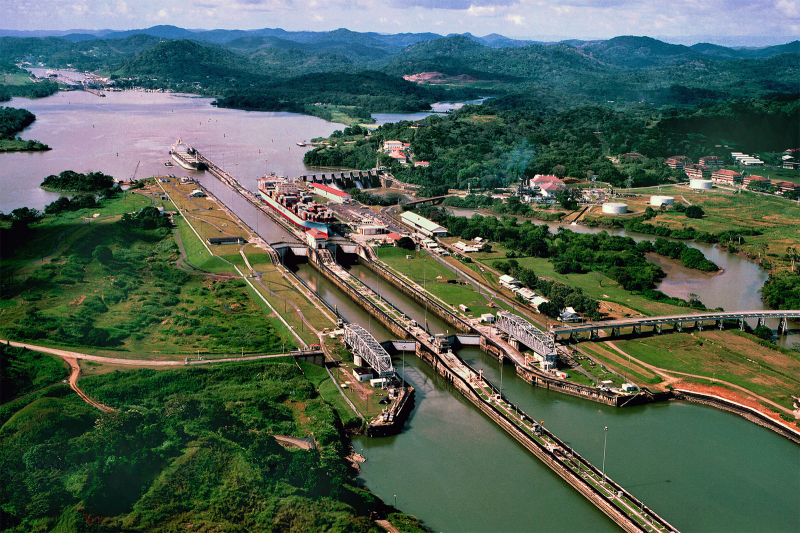
logistician.org -
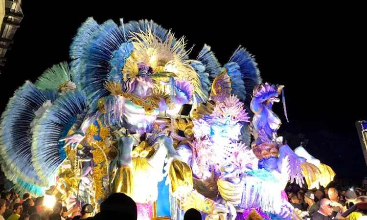
The Azuero Peninsula's revelry is hard to surpass, from the extremely hedonistic Carnavales to pious Corpus Christi celebrations or small-town patronales. Expect bright clothes, lively music and dancing, and plenty of seco, the country's strong spirit, to wash it all down. Traditional folk groups are followed by DJs blaring out reggaeton, bachata, and salsa; and stylized Andalusian-inspired dances such as the tamborito (Panama's national dance) and punto are imbued with African and pre-Columbian rhythms employing drums, gourds, and seed pods.
Every year, about 500 festivals are hosted here. The Desfile de las Mil Polleras in January, a tourist-focused parade of various types of Panamanian polleras in Las Tablas; Carnaval in February (the country's most lavish celebration is held in Las Tablas again); Patronales de San Juan, a five-day costumed extravaganza in June with diablicos sucios, folk dancing, fireworks, and the patron saint paraded from the beach in Chitré; and the Festival de Manito in August in Ocú.
Location: Panama
panamatropic.com 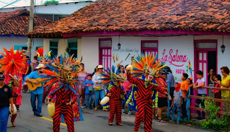
panamatropic.com -
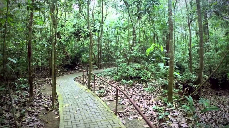
Only a short flight from Panama City, this wildlife haven is home to toucans, parrots, sloths, and monkeys, and is without a doubt one of the country's most popular tourist destinations. It hugs the Canal and encircles Gamboa, stretching north and west from the park office and spanning more than 190 square kilometers (73 sq miles). It includes a stretch of the majestic Ro Chagres, the Canal's lifeblood, which can be explored by boat or kayak; there are also several well-maintained trails on either side of Gamboa, including a section of the historic Camino de Cruces and the Camino del Oleoducto, a world-renowned birding hotspot.
However, the trails are not very close to one another or to the park office, making logistics challenging unless you have your own transportation or are on a tour. Hikes to the Camino de Cruces and the Sendero del Oleoducto are offered by several Panama City agencies, but if one is available, you can hire a ranger from the park office as a guide - a considerably cheaper option that helps support their modest income. However, they are unlikely to be able to communicate in English.
Location: 38FR+P38, Las Cumbres, Panama
Youtube.com 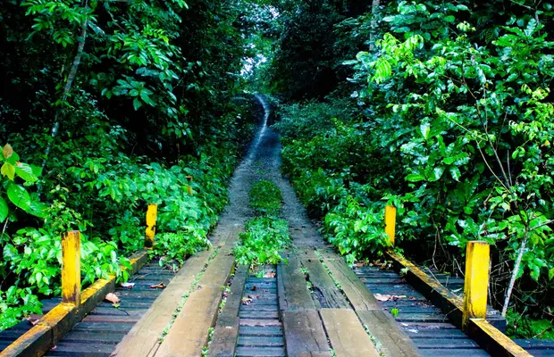
minube.net -
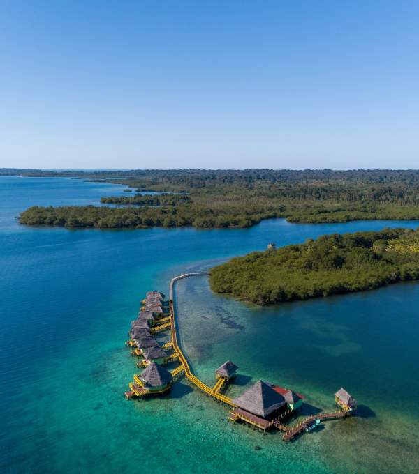
Bocas del Toro is a popular Caribbean destination and one of Panama's best locations to visit, with superb drinking, dining, and dancing, as well as forested islands, water sports, and beaches abounding. The Caribbean archipelago of Bocas del Toro ('Mouths of the Bull') is one of Panama's most picturesque places, located near the Costa Rican border. It's also one of the most remote — the province's mainland is connected to the rest of Panama by a single stunning road that carves its way across the continental divide, frequently blocked by landslides during the worst rains, while the island chain takes a boat voyage to reach.
Most people associate Bocas with the tropical islands of Isla Colón and Bastimentos, which attract more visitors than any other destination outside of Panama City and the Canal. Surfing or lounging on pristine beaches, as well as snorkeling and diving among coral reefs in a maze of tangled mangroves and untouched jungle, are all available.
The Parque Nacional Marino Isla Bastimentos contains a portion of this natural gem. However, some travelers come for the nightlife, which includes cocktails, waterfront dining, and venues to dance till dawn. Despite this, the archipelago makes up only a minor part of the province, which ceded a huge chunk of land to the Comarca Ngäbe-Buglé in the east when it was founded in 1997. The mainland's lowlands, which are typically dismissed as a never-ending swath of banana farms, are home to a couple of famous Panama sites. The magnificent Humedales de San San Pond Sak, the country's biggest refuge for the manatee and a major beach for nesting marine turtles, is accessible from Changuinola, the country's banana capital and the province's main commercial center.Inland, on the banks of the picturesque Ro Teribe, a stay with the Naso, one of the lesser-known indigenous peoples, offers an opportunity for intercultural exchange in a stunning natural setting, with the option of continuing upriver into the inaccessible but spectacular Talamanca mountain range, whose lofty peaks form the backbone of the vast Parque Internacional La Amistad, home to an awe-inspiring array of wildlife.
Location: Bocas del Toro, Panama
tourismpanama.com 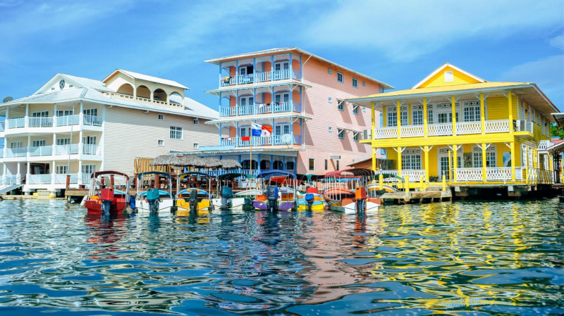
kayak.com -
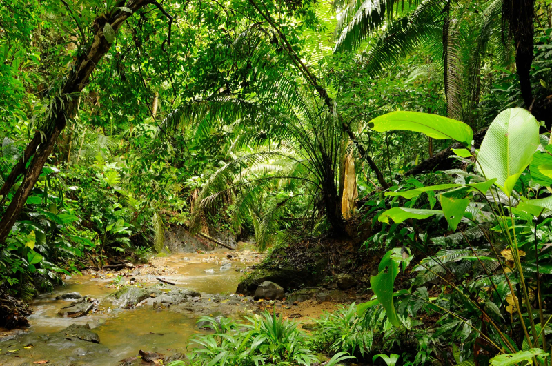
The craggy mountains, towering rainforest canopy, and tremendous wildlife in the country's largest wilderness region - and Unesco World Heritage Site – make the journey worthwhile. Parque Nacional Darién is Central America's largest protected area, covering 5,790 square kilometers (2,235 square miles). It is the largest and most well-known of Panama's national parks, having been established in 1972. Despite this, it is one of the least-visited protected areas in the country because getting there needs a lot of planning.
The awe-inspiring nature, interwoven with rivers and waterfalls and rich in wildlife, makes the effort worthwhile, delivering a genuinely wonderful experience. Now that hiking across the Darién Gap is a thing of the past – though various specialty operators market their multi-day jungle adventures as such – visiting the national park now entails hiring a guide (who will assist with paperwork) and staying at the only permanent camp: Mi Ambiente's bunkhouse at Rancho Fro, which can be reached via El Real.
Location: Panama
tourismpanama.com 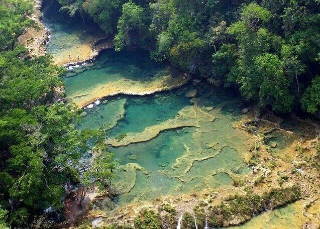
tourismpanama.com -
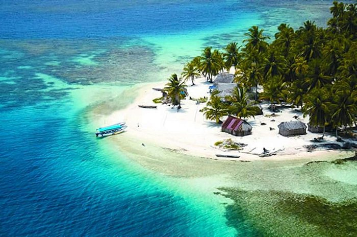
The Comarca Guna Yala runs along the Caribbean coast, home to a slew of palm-topped islands and the indigenous Guna, who have fought outsiders for generations to protect their customs and way of life. Visiting a Guna community has to be one of the most popular activities in Panama. The Guna (pronounced 'Guna' or 'Kuna,' depending on dialect) – or Dule (pronounced 'Dule' or 'Tule,' as they prefer) – are Panama's most well-known indigenous people. They live in a vast semi-autonomous region (or comarca) along the eastern Caribbean coast that stretches 375 kilometers (233 miles) from the Golfo de San Blas to Puerto Obalda and includes nearly 400 islands as well as a swath of land that stretches to the peaks of the Serranas de San Blas and the Darién
Around 33,000 Guna live in the Comarca de Guna Yala, with another 47,000 scattered throughout two smaller inland comarcas in eastern Panama and Panama City, though populations are fluid due to the continual movement between the capital and the comarcas. The majority of the population is concentrated on a chain of 36 low-lying coral outcrops near the shore, with 11 villages on the coast and two further inland.
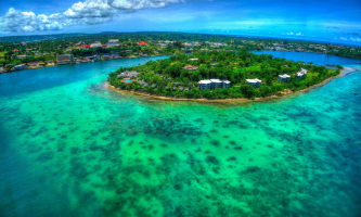
Flooding caused by increasing sea levels has prompted some island-based families to relocate to the mainland in recent years. As it appears more likely that their homes will be permanently buried, plans are in the works for entire communities to join them in the coming years. There are two types of islands that tourists are interested in visiting. The first are the near-deserted islands, which are crowned with coconut trees and flanked by white-sand beaches that stretch into blue waters, where coral reefs offer excellent snorkeling opportunities (diving is prohibited across the comarca). The western archipelago's waters, in particular, are dotted with these pristine islets, which are mostly distinguished by their accommodations, which range from simple cane cabaas with a simple home-made bed to slightly more comfortable lodges, all owned by families or communities from the more densely populated village-islands. In contrast, the communities are packed coral outcrops crammed with cane-and-thatch constructions, cement structures, schools, medical centers, and the occasional shop.
Location: El Porvenir, Guna Yala
vi.topworldtraveling.com 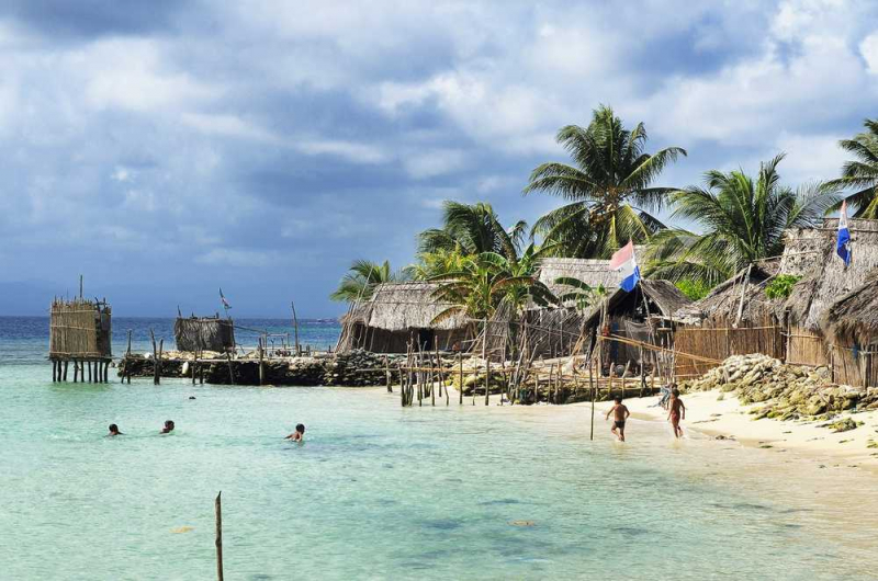
vi.topworldtraveling.com


