Top 5 Highest Moutains In Poland

Poland is a Central European country. Warsaw is Poland's national capital, as well as the country's most important financial and cultural center and most ... read more...populous metropolis. The top five highest mountains in Poland are shown here, along with their elevation in feet. Furthermore, Poland boasts a broad spectrum of natural features, including approximately 70 mountains with elevations of more than 60 feet. The Tatra Mountain in Poland is the country's highest peak, located close to the Slovakian border. In this post, Toplist will look at some of the country's tallest peaks.
-
Mount Rysy is a granitic mountain located on the Polish-Slovak border and is part of the Tatra Mountains. The mountain's three main summits rise to 8,114 feet in the southeast, 8,199 feet in the northwest, and 8,213 feet in the middle. The highest point in Poland is in the northwest, while the other two are on the Slovak side of the border. Rysy is thought to have originated from a succession of ravines on the mountain's slopes and is informally translated as stripes or fissures.
Ede Blasy and his guide Jan Ruman-Driecny made the first documented ascent in the year 1840. Jacob Horvay and Theodor Wundt, on the other hand, made the first winter ascent in 1884. Climbing attracts a large number of tourists and hikers to the mountain. The Polish path is difficult and steep, and many people choose to ride on the Slovak side. The Schengen Agreement, ratified by Poland and Slovakia in 2007, established a border crossing at the foot of the mountain.
Location: the Polish-Slovak border
Elevation: 2,501 m
Parent range: High Tatras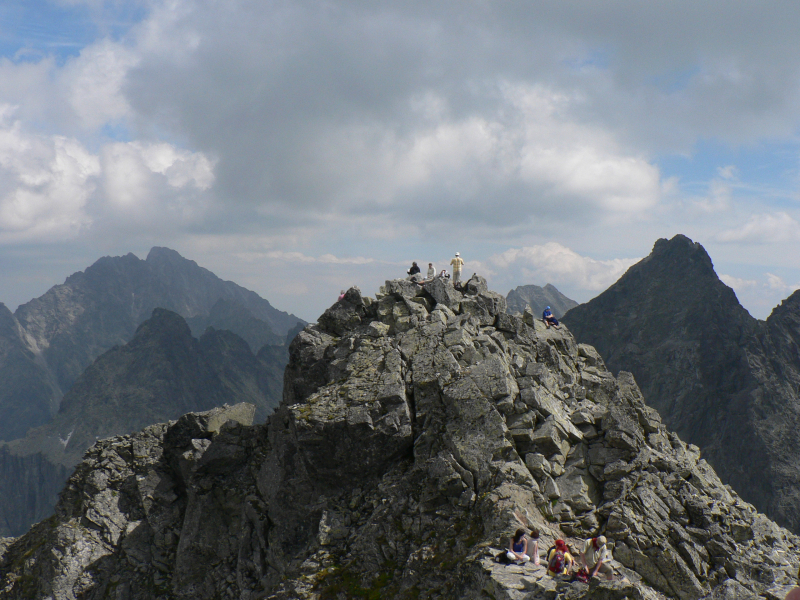
Photo source: Wikipedia 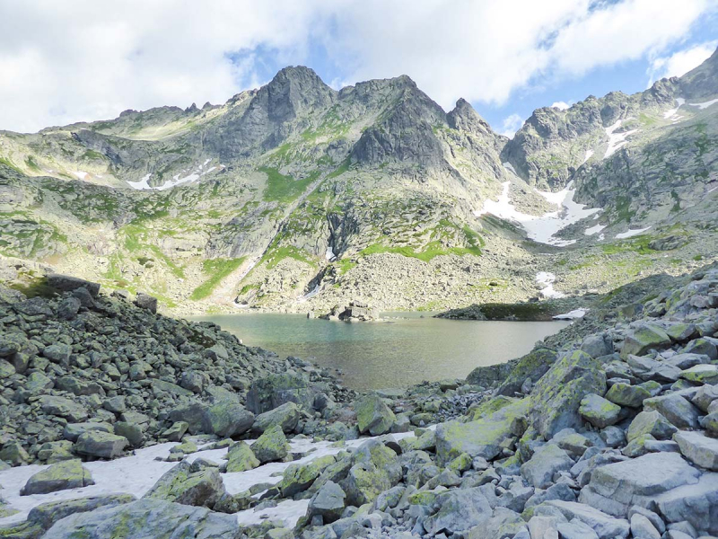
Photo source: 10 Adventures -
The Miguszowiecki Szczyt Wielki, also known as the Miguszowiecki Grand Peak (Slovak: Vek Mengusovsk tt), is a mountain in Poland's Tatra Mountains, near the Slovak-Polish border.
It is the second highest mountain in Poland, after Rysy, and the highest of the three Miguszowiecki Summits (2,503 meters, the highest peak in the Polish Tatras). The peaks were called for the valley whose headwall they create, and the valley was named after the Slovak settlement of Mengusovce, whose residents owned the valley and used it to pasture their livestock before the Tatras became a national park. The adjective 'wielki/vek' means 'excellent' in Polish.
Schronisko PTTK Morskie Oko, located 1809m/5936ft NE of the peak, is the closest mountain hut. The mountain includes several huge walls with numerous technical routes and a prominence of 207 meters.
Location: the Polish-Slovak border
Elevation: 2,499 mParent range: Tatras Mountains
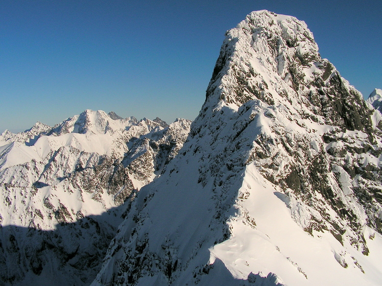
Photo source: Mountain Forecast 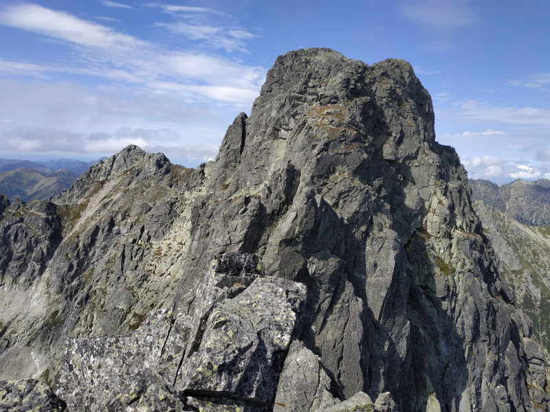
Photo source: Wikimedia Commons -
Mount Svinica is located in the Tatra ranges at an elevation of 7.549 feet. In Poland, it's also known as Mount Swinica, which means "pig" or "pork." The name comes from the peak's appearance, which resembles a pig silhouette, and was first used in the eleventh century. According to another theory, the summit was named because it was difficult to access. Despite the fact that the peak is on the border between Poland and Slovakia, all recognized paths are on the Polish side.
There are some unmarked routes on the Slovak side, and just a few people use them. Climbing routes on the mountain are only open to members of climbing clubs. The location attracts a large number of visitors in the summer because the weather is ideal for trekking. Mount Svinica is used for training Polish mountaineers and rescuers from Tatrzaskie Ochotnicze Pogotowie Ratunkowe (Tatrzaskie Ochotnicze Pogotowie Ratunkowe) in addition to enjoyment.
Location: the Polish-Slovak border
Elevation: 2,301 mParent range: High Tatras
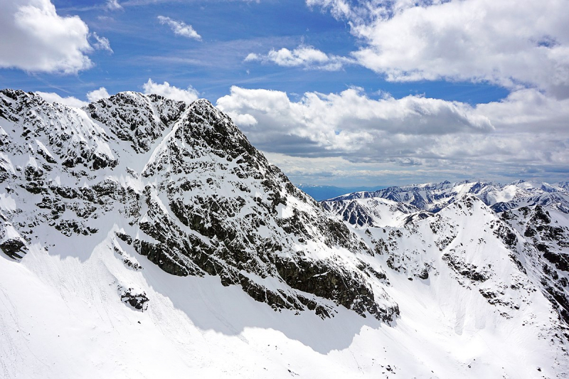
Photo source: Wikipedia 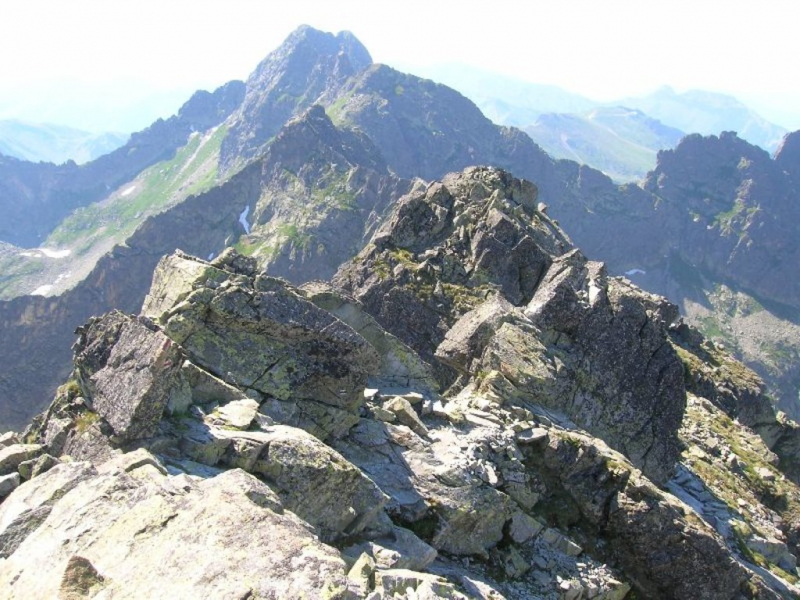
Photo source: PeakVisor -
At an elevation of 7,516 feet above mean sea level, Kozi Wierch is the highest peak in the High Tatras and the highest point fully on Polish soil. Because of the abundant herds of mountain goats that were originally present in the area, the shepherds named the mountain. Eugeniusz Janota and his guide Maciej Sieczka made the first documented ascent in 1867, while Jozef Borkowski and Mariusz Zaruki, on skis, made the first winter ascent in 1907.
Some Highlanders, such as shepherds and hunters, may have scaled the peak earlier, but no documentation exists to support this claim. Tourists, mountaineers, and alpine skiers flock to the mountain, which has a variety of attractions for enthusiasts of the great outdoors. For expert climbers, the North Face 600, the steep granite foot of the mountain, is a great challenge.
Location: between Zamarła Turnia and Czarny Ściana
Elevation: 2,291 m
Parent range: High Tatras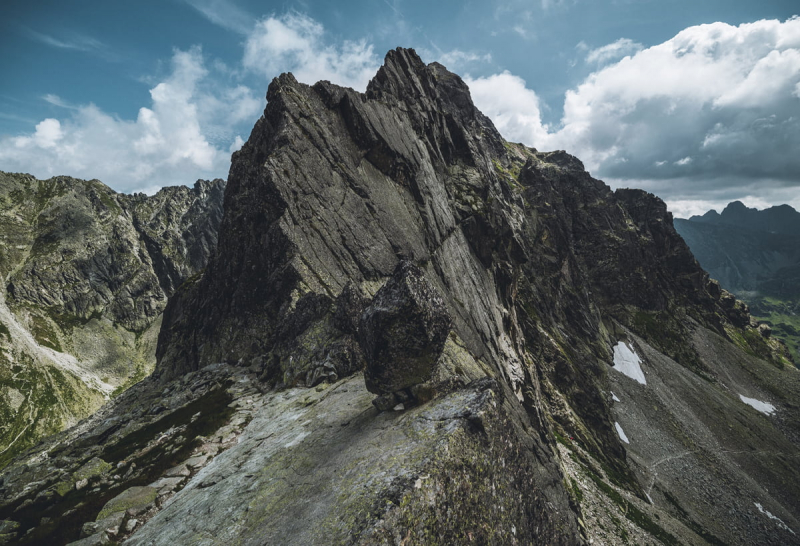
Photo source: Tatromaniak 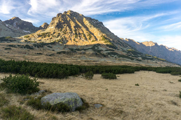
Photo source: iStock -
Miedziane peak (2233) stands over the Rybiego Potoku valley to the east and the valley of the Five Polish Lakes to the west. In Szpiglasowy Wierch summit, the peak is located in a lateral ridge that splits out north from the main Tatra ridge (2176). Both peaks are separated by the Szpiglasowa Przelecz pass(2110). The ridge descends to the large Marchwiczna Przelecz pass(2055) before rising to the ridge's 2nd highest peak, Opalony Wierch(2115), whose northern slopes fall through Swistowka Roztocka stony cirque and Swistowa Czuba precipitous cliffs down to Roztoki valley. The ridge then bends east and terminates in Roztocka Czuba(1426) above Bialki valley near Wodogrzmoty waterfalls, passing via the Opalone area above Roztoki valley.
There are no recognized paths up to the peak of Miedziane, although there are two popular trails that cross the massif: The path via Swistowka that traverses the ridge in its northern portion below Opalony Wierch mountain. Roztocka is the shortest and most direct route between the valley of the Five Polish Lakes and the Morskie Oko lake. Avalanches falling from Opalony Wierch slopes towards neighboring abyss of Roztoki valley have caused the trail to be closed for years for the entire winter, since it is generally significantly endangered by avalanches falling from Opalony Wierch slopes towards nearby abyss of Roztoki valley (several fatal accidents took place there).
From Szpiglasowa pass, the simplest route to reach Miedziane top is to walk along the ridge. It should take no more than half an hour, but be advised that it is prohibited by National Park regulations, and anyone who does it risks being penalized by park guards.
Location: between the Valley of Five Polish Ponds and the Valley of The Fish Stream
Elevation: 2,237 mParent range: High Tatras
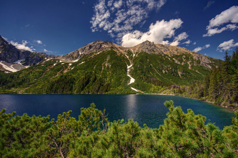
Photo source: PeakVisor 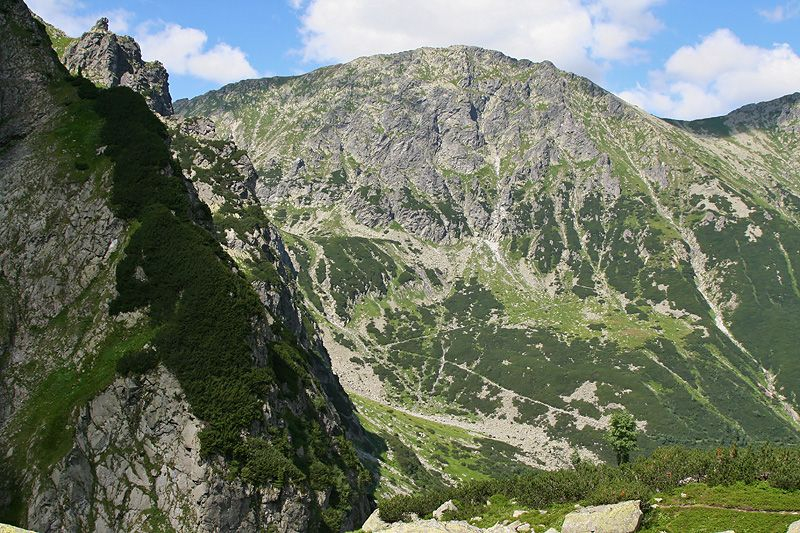
Photo source: e-gory.com