Top 10 Longest Rivers in Poland

Poland's complex of freshwater bodies is comprised of six main rivers and hundreds of lakes. These lakes and rivers are vital to the history and culture of the ... read more...country. The majority of the rivers drain into the Baltic Sea and have been utilized for navigation since prehistoric times. Most major rivers have several tributaries, whereas minor rivers flow into larger rivers. Some of Poland's longest rivers are shared with nations such as the Czech Republic, Germany, Belarus, Russia, Lithuania, and Ukraine. The Longest Rivers in Poland are listed below.
-
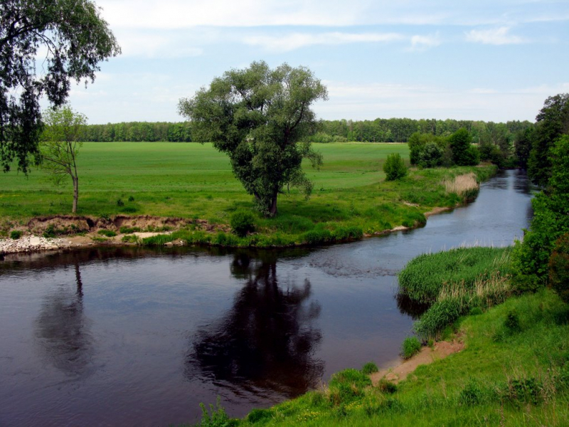
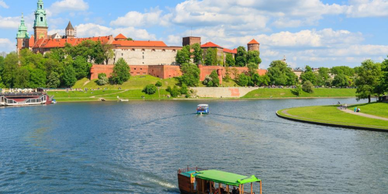
With a length of 651 miles, the Vistula is the Longest River in Poland, and its drainage basin encompasses an area of 75,068 square miles. The drainage basin's greatest portion, 65,000 square miles, is located in Poland, with the remainder divided among Belarus, Ukraine, and Slovakia. The Vistula River originates in southern Poland with the White Little Vistula and the Black Little Vistula. It then runs over the Polish lowlands, passing through Krakow, Plock, Torun, Tczew, and Warsaw. Vistula River flows into Vistula Lagoon and the Baltic Sea's Gdansk Bay. The river is associated with the Quaternary epoch, during which the climate cooled. The river's current shape was formed after the ice sheet that covered the area receded 14,000 years ago. The river runs from the Baltic Sea to Bydgoszcz and can accept small vessels. Over the years, the Vistula River has been one of Poland's key commerce routes, particularly for lumber, salt, and grain.
The Vistula river springs in the southern Silesian Voivodeship near the Czech-Slovak border from two sources: the Czarna ("Black") Wiseka at 1,107 m (3,632 ft) and the Biaa ("White") Wiseka at 1,080 m (3,540 ft). Both are located on the western slope of Barania Góra in Poland's Silesian Beskids.
Total Length: 651 miles
viator.com 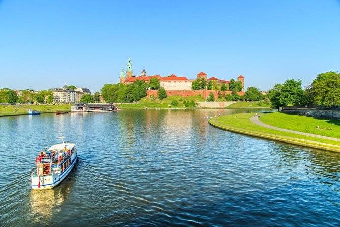
viator.com -
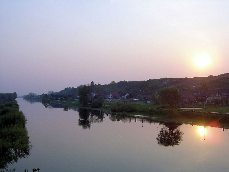
The Oder River originates in the Czech Republic and runs through Poland, establishing a boundary between Poland and Germany. The river has numerous names in different languages, including Oder (English and German) and Odra (Polish and Czech). The Oder runs for 531 kilometers, 70 miles in the Czech Republic and 461 miles in Poland, and drains a total area of 45,892 square miles. Its major branch flows into the Szczecin Lagoon. With the upstream canalization, a substantial portion of the Oder River is navigable, allowing big boats to transit the industrial areas near Wroclaw. After a protracted period of rejection, the river was finally acknowledged as the boundary between Poland and East Germany in 1950. Before the Slavs settled along its banks, the river was a vital commerce route. Dams were erected along its banks, however, to safeguard agricultural land. The Oder is also a significant supplier of domestic water for the majority of cities, including Ostrava, Police, Nowe Sol, Wroclaw, and Wolin.
The Oder is navigable for most of its course, all the way upstream to the town of Kole, where it joins the Gliwice Canal. The upstream section of the river has been canalized, allowing bigger barges (up to CEMT Class IV) to transit between industrial facilities in the Wroclaw region. The river is free-flowing farther downstream, passing through the cities of Eisenhüttenstadt (where the Oder–Spree Canal connects the river to the Spree in Berlin) and Frankfurt am Oder. For smaller vessels, the river Warta forms a navigable link between Pozna and Bydgoszcz downstream of Frankfurt. The Oder–Havel Canal rejoins the Berlin waterways in Hohensaaten.
Total Length: 531 miles
geographical.co.uk 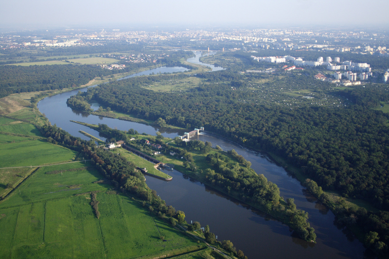
geographical.co.uk -
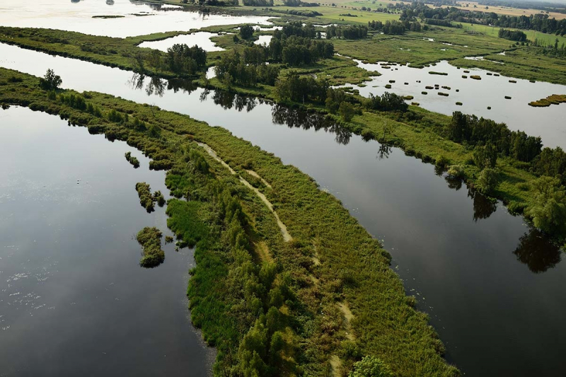
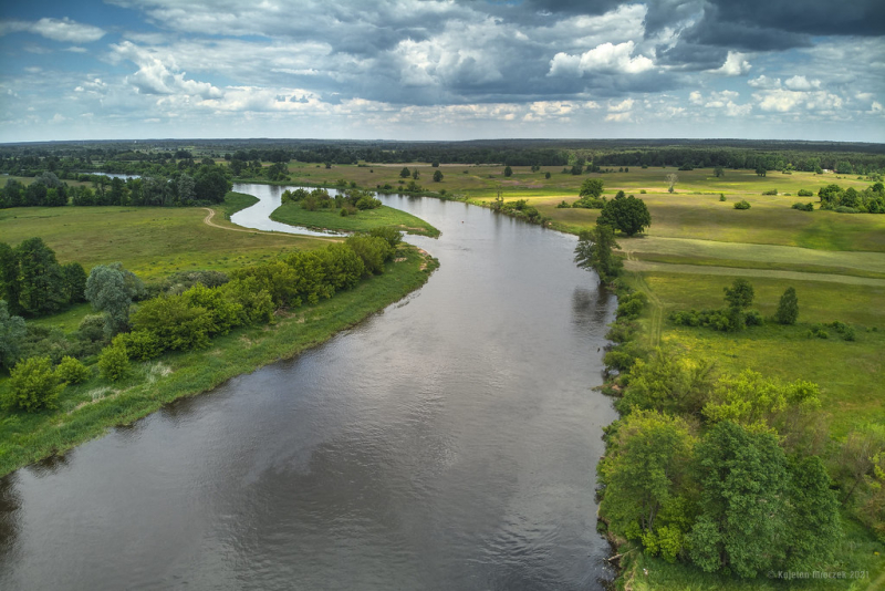
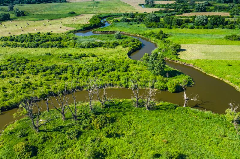
The Warta River runs across west-central Poland. It is a tributary of the River Oder, with a length of approximately 502 kilometers and a basin size of 21,054 square kilometers. The Warta River originates in Krowmolow, passes through Lodz Land, and empties into the Oder near the German border. Warta, Kolo, Konin, Srem, Lubon, Wronki, and Mosin are also cities along the river. The Warta River serves as a vital supply of water for the majority of these cities' residents. It has two major tributaries, the right and left of which are supplied by various minor rivers and streams. The river facilitates a variety of economic activities in the region, including farming and fishing. The Warta River is referenced in the Polish language.
For some years now, the region around the Warta River has thrived throughout the summer. It began with city beaches, which grew popular among both locals and visitors. The recreational opportunities on the Warta River are expanding year after year. This summer, in addition to beaches, there will be a water tram, a municipal marina, and water sports equipment rentals. Summer in Poznan revolves around spending time by the magnificent Warta River.
Total Length: 502 miles
en.wikipedia.org 
en.wikipedia.org -
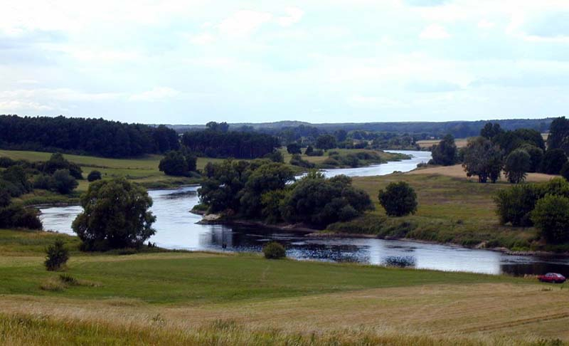
The Bug is a large river in Eastern Europe that flows through Belarus, Poland, and Ukraine. It is 774 kilometers long (481 mi). The Bug, a tributary of the Narew, constitutes part of the Belarus–Poland boundary and part of Poland–Ukraine border, and is the fourth-longest Polish river. It runs between Ukraine and Poland for 185 kilometers (115 mi), and between Belarus and Poland for 178 kilometers (111 km).
The Bug is a Narew tributary to the left. It runs from the Lviv Oblast in western Ukraine northwards through the Volyn Oblast, then into Poland, where it traces part of the boundary between the Masovian and Podlaskie Voivodeships. It merges with the Narew in Serock, a few kilometers upstream of the man-made Zegrze Lake. This section of the Narew between the confluence and the Vistula is occasionally referred to as the Bugo-Narew, but on December 27, 1962, the Prime Minister of Poland's legislation removed the term "Bugo-Narew," shortly after the completion of Zegrze Lake. The westernmost point of Belarus is located on the Bug, a few kilometers from Vysokaye in the Kamenets District of the Brest Region.
Total Length: 480 miles
en.wikipedia.org 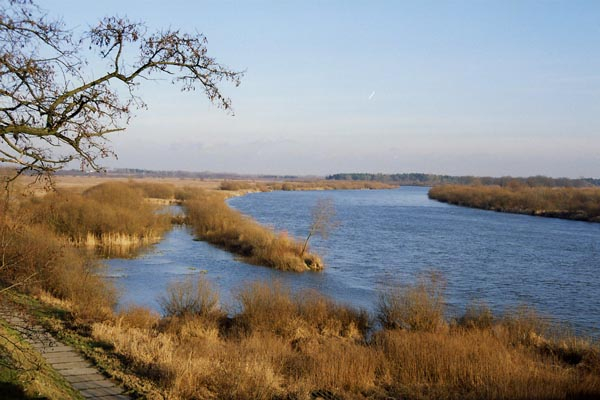
en.wikipedia.org -
The Narew is a 499-kilometer (310-mile) river in north-eastern Poland that is also a tributary of the Vistula. The Narew is one of Europe's few braided rivers, so named because of the twisted courses that resemble braided hair. The river runs in western Belarus for around 57 kilometers (35 miles). The Narew runs through the Wysoczyzny Podlasko – Bialoruskie geographical region of Europe, which includes the Podlaskie Voivodeship and Masovian Voivodeship of Poland, as well as the Hrodna Voblast of Belarus.
The Bugonarew, Narwio-Bug, Narwo-Bug, Bugo-Narew, Narwobug, or Narwobug is another name for the section of the river between the confluence with the Western Bug and the Vistula. The Bug is 1.6x longer, drains a 1.4x bigger basin, and has a slightly higher average discharge at the confluence at Zegrze. As a result, the Bugonarew was frequently regarded a tributary of the Bug, and the Narew was a right tributary of the Bug. Soon after the construction of the Zegrze Reservoir, Prime Minister Józef Cyrankiewicz banned the name Bugonarew on December 27, 1962. Since then, the Bug has been regarded as an official tributary of the Narew, with the Bug being a left tributary of the Narew (by this classification, the River Narew is a right tributary of the River Vistula). However, the term Bugonarew is still used, particularly by residents of nearby towns such as Putusk.
Total Length: 301 miles
flickr.com 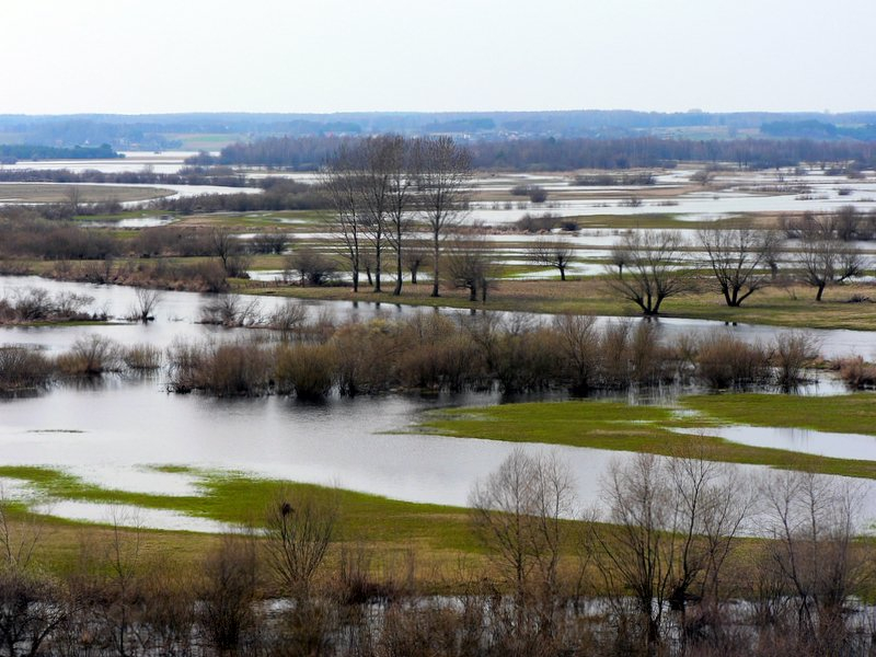
flickr.com -
The San is a river in southeastern Poland and western Ukraine that is a tributary of the Vistula and is one of the Longest Rivers in Poland. It has a length of 458 km and a basin area of 16,877 km2 (14,426 km2 of it in Poland). The San begins in the Carpathian Mountains in the settlement of Sianky, at a height of 900 meters, directly on the Polish-Ukrainian boundary and on the continental watershed, and forms the border between Poland and Ukraine for about 50 kilometers. Lake Solina, Poland's largest artificial lake, was formed by a dam on the San River near Lesko.
As early as the 9th or 10th century, the San valley must have become an important trading route and center of human habitation. [Citation required] Following that, the territory became a part of the Great Moravian state. The Lendians of the area proclaimed their allegiance to the Hungarian Empire following the invasion of Hungarian tribes into the heart of the Great Moravian Empire in 899. Starting about the 9th century, the territory became a source of rivalry between Poland, Kievan Rus, and Hungary. This territory was first documented in 981 (by Nestor) when Volodymyr the Great of Kievan Rus took it over on his route into Poland. It was restored to Poland in 1018, lost to Rus in 1031, and was reclaimed by Casimir III of Poland in 1340.
Total Length: 275 miles
en.wikipedia.org 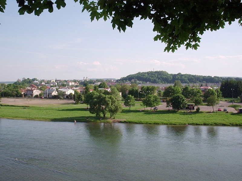
en.wikipedia.org -
Notec is a river in central Poland has a length of 391 kilometers (243 miles) and a basin area of 17,302 kilometers (6,680 sq mi). It is the Warta River's greatest tributary and is entirely within Poland.
It runs through Lake Gopo and the town of Inowrocaw after rising in the Kuyavian-Pomeranian Voivodeship. It reaches the Greater Poland voivodeship in the medieval Pauki area south of Pia. It drains into the Warta at Santok near Gorzów Wielkopolski in the Lubusz Voivodeship. The river is commonly split into two sections: an upper section (Note Górna) that runs from its source to Nako, and a lower section (Note Dolna) that runs from Nako to its mouth into the Warta River. The Bydgoszcz Canal, completed in 1773/74 at Nako, connects the Note River with the Brda River, a tributary of the Vistula, in Bydgoszcz. The lower parts of the Drawa below the mouth (near Krzy Wielkopolski) are part of the larger Toru-Eberswalde Urstromtal. These vast marshes are rarely inhabited, with just two ancient river crossings at Santok and Drezdenko.Total Length: 241 miles
en.wikipedia.org 
en.wikipedia.org -
Pilica is a river in central Poland that is the Vistula's longest left tributary, with a length of 333 kilometers (8th longest) and a basin area of 9,258 km2 (all in Poland).
It runs across the Polish Jura before entering the Central Polish Plains. Pilica runs into the Vistula near the hamlet of Ostrowek in the Central Vistula Valley. In 1974, a dam near Sulejow was erected, culminating in the development of the 2,700-hectare man-made reservoir Sulejow Lake. The territory in the Pilica's basin is known as Nadpilicze, and the river itself forms the border between Lesser Poland and two other historical provinces of the nation, Greater Poland and Mazovia.The Open-air Museum of Pilica River, Poland's first "open-air river museum," is located on the river, and the Blue Springs natural reserve is nearby.
Total Length: 198 miles
modanamazowsze.pl 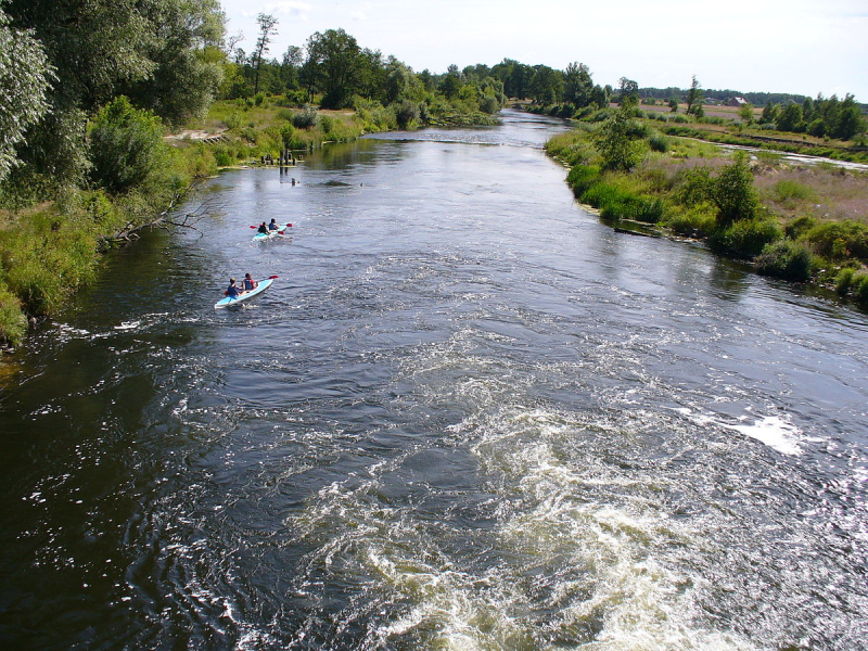
modanamazowsze.pl -
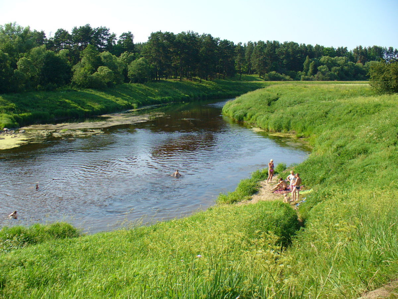
The Wieprz River is a tributary of the Vistula River in central-eastern Poland. It is Poland's eighth-longest river, with a total length of 349 km and a catchment area of 10,497 km2. Its route near the town of Czna contains the protected Wieprz Landscape Park.
The Wieprz River is a tributary of the Vistula River in central-eastern Poland. It is Poland's eighth-longest river, with a total length of 349 km and a catchment area of 10,497 km2. Its route near the town of Czna contains a protected area. The river rises in Lake Wieprz, passes through Wieprzów Tarnawacki near Tomaszow Lubelski, and empties into the Vistula at Dblin. The Wieprz River is linked to another river, the Krzna, by the 140-kilometer Wieprz-Krzna Canal, which was completed between 1954 and 1961. The Wieprz, with its vast valley, offers a rich natural environment since it has not been controlled. Numerous birds, European otters, and Eurasian beavers live in the winding river with its oxbow lakes.
Units of the Polish 4th Army congregated near the Wieprz during the Polish-Soviet War, preparing for the Battle of Warsaw. During the Invasion of Poland in September 1939, the Battle of Tomaszow Lubelski by the Wieprz took place.
Total Length: 188 miles
dreamstime.com 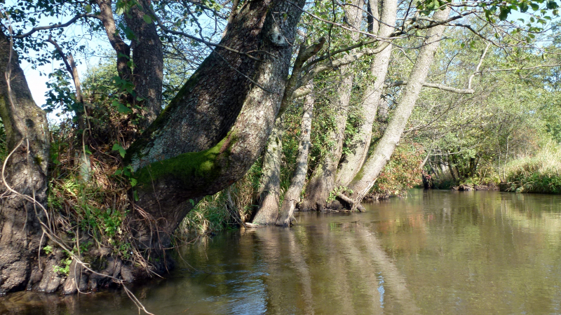
dreamstime.com -
The Šešupė is a 298-kilometer-long river that runs through Poland (27 kilometers), Lithuania (158 kilometers), and Russia (62 km). The river flows for 51 kilometers along the boundary between Russia's Kaliningrad Oblast and Lithuania. The Šešupė begins at the Polish village of Szeszupka, about ten miles from the Polish-Lithuanian border, and flows into the Nemunas near the town of Neman, on the boundary between Lithuania and Kaliningrad Oblast.
Kudirkos Naumiestis, Pilvikiai, Marijampol, and Kalvarija are major towns and cities along the river from the Nemunas to the source. On the other side of the river, there are sections of Kaliningrad and Lithuania, including a tiny island that is largely Russian but includes a Lithuanian portion. It is Lithuania's fourth-longest river.
The name Šešupė's etymology is unclear. In Lithuanian, up means river. There is an association with the word, which means number six in Lithuania, and the river name could be interpreted as "river of six" or simply "six rivers," but the most likely etymology is that part of the name "šeš" is derived from the term list, which means shadow, and the river name itself could be translated as a "shadow river."
Total Length: 185 miles
mapio.net