Top 6 Most Beautiful Historical Sites in Guam

Guam is a US territory in Micronesia, located in the Western Pacific. Tropical beaches, Chamorro settlements, and old latte-stone pillars set it apart. Not ... read more...only that, but Guam also has a plethora of historical sites scattered over the country. And below are the most beautiful historical sites in Guam.
-
Latte Stone Memorial Park, often known as Latte Stone Park, is an urban park in Hagåtña, Guam. It is well known for its collection of eight ancient latte stones, which were transported from their original position in Fena. It was established in the 1950s and is administered by the Guam Department of Parks and Recreation. The park is south of the Plaza de España and runs along the cliff line below the Governor's home in Agana Heights. It is frequently frequented by tourists visiting Hagta's center district. The park also has the entrances of two sets of caves known as the Agana/Hagta Cliffline Fortifications, which were built by forced laborers during the Japanese occupation (1941–1944) and were listed on the National Register of Historic Places in 1991 as well as one of the most beautiul historical sites in Guam.
In Latte Stone Memorial Park, visitors can find figures with the lower half of the stone pillar and the upper part of the semi-circular stone cap. It has the shape of a mushroom. The Latte Stone Park contains eight 2.5-meter-high Latte stone pillars, which are very ancient Guam antiquities. The caps are hemispherical coral capes, while the pillars are made of coral limestone. A status symbol is the quantity of latte stones. The greater the number, the higher the house owner's social rank. As a result, there is no need to inquire. The village's latte stones have silently told you which house is the chief's.
Location: Hagåtña
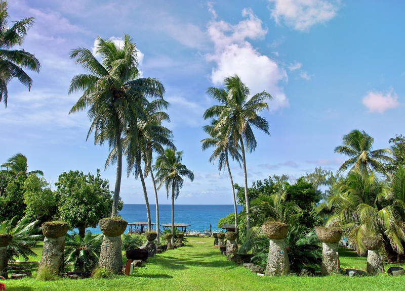
Photo: Trip.com 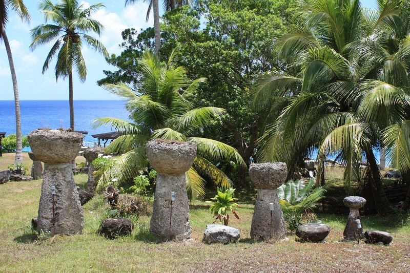
Photo: Amusing Planet -
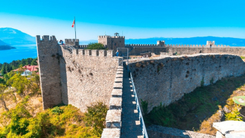
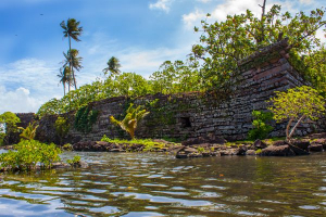
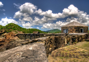
Several fortifications were built to defend Spain's interests in Guam and its Pacific trading routes. The majority of these fortifications were open batteries with embrasures for guns to fire through. And one of which is regarded as one of the most beautiful historical sites in Guam named Fort Soledad. The fortress of Fort Nuestra Señora de la Soledad is located near Umatac, Guam. It was the fourth of four defenses built by the Spanish between 1802 and 1819 to secure an anchorage for galleons sailing between Acapulco, Mexico, and the Philippines, a route that was abandoned in 1815 when Mexico gained independence.
The Fort Soledad was placed eighty varas, or approximately 224 feet, above the bay and faced the sea. The esplanade was partially encircled by a low parapet made of mamposteria, stone, and mortar, and was paved with flagged coral stones. The fort had enough room for seven cannons to be fired on a fixed line over the parapet. The sentry post of the fort, which looks out over the beautiful bay, has become a symbol of the island's beauty and the days of the Spanish galleon trade. The park is becoming one of Guam's most popular tourist destinations. Restoration efforts were done to the area's stonework in the mid-1990s, and the community has since undertaken many beautifying projects to improve the historic site.
Location: Umatac
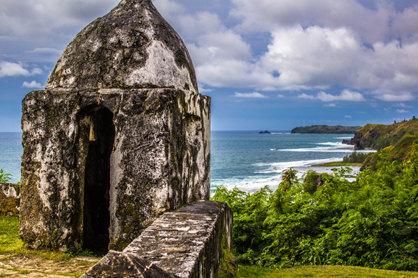
Photo: The Guam Guide 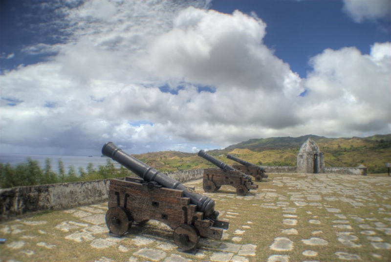
Photo: Mapio.net -
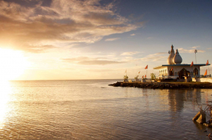
Situated in northeastern Guam, the Haputo Beach Site is an ancient village site. Standing latte stones, as well as rock shelters and caves with traces of human use, can be seen on Naval Computer and Telecommunications Station Guam territory near a sheltered bay. The main route passes through the Navy's Haputo Ecological Preserve, therefore entrance to the site requires military authorization. In 1974, the site was added to the National Register of Historic Places.
Haputo was established as an ecological reserve in 1984, with 252 acres of coral reef and limestone woodland. The Guam and National Registers of Historic Places both list Haputo. The settlement of Haputo or Apoto was burned down by Spanish soldiers in 1678, according to historical chronicles. The remaining occupants of Haputo and all of Guam's northern villages were forced to relocate to Hagta in 1680. Despite the fact that the settlement had been abandoned, it was nevertheless named and located on early European maps of Guam.
While Guam has thousands of stunning and pristine beaches along its coastlines, one beach is on another level entirely. It's a wonder it hasn't gotten more attention. Haputo Beach is naturally maintained by Mother Nature herself, with soft white sand, no rocks, and plenty of trees to settle behind. It would find no competition from Tumon Bay beaches, or any other for that matter.
Location: Dededo
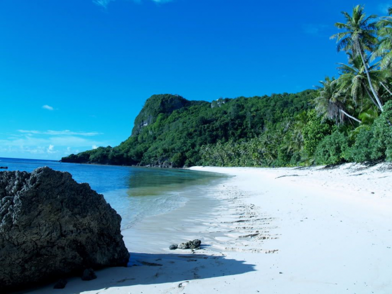
Photo: Pinterest 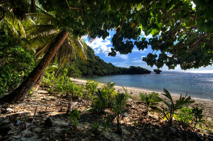
Photo: Pinterest -
Another fort counted in the list of the most beautiful historical sites in Guam is Fort Apugan. Fort Apugan or Santa Agueda, located on Guam Highway 7 in Hagåtña, Guam, dated from around 1800, during the Spanish governor Manuel Moro's term (1784-1802). It was an open-air fort with a mamposteria (coral stone and lime mortar) parapet that rose about 3 meters over a steep hillside. It is the only intact fortification from the Spanish Era in Hagta, and it is listed on the National Register of Historic Places in the United States. In 1960, it was designated as a park, and in 1974, it was added to the National Register of Historic Places.
Fort Apugan is located atop the Agana Heights area and offers a spectacular view over Guam's central region. It was originally constructed as a Spanish fort to safeguard the capital settlement of Agana. It was also a great place to keep an eye on the horizon for threats to Spanish interests on Guam, which were largely centered on the lucrative Acapulco-Manila galleon trade system, which saw gold and silver from South America traded with Chinese merchants in the Philippines for a variety of exotic Orient treasures.
An officer of an American whaling ship mentioned the fort in 1802 when he wrote that it had seven guns and ten soldiers, and that it fired a salute as the governor entered a new church in Agana. In 1817, Russian Otto von Kotzebue wrote that it only had a few guns. By 1887, it had completely collapsed. It was utilized as a signal station by the Americans until 1933, and the Japanese occupants converted it to a gun position during World War II.
Location: Hagåtña
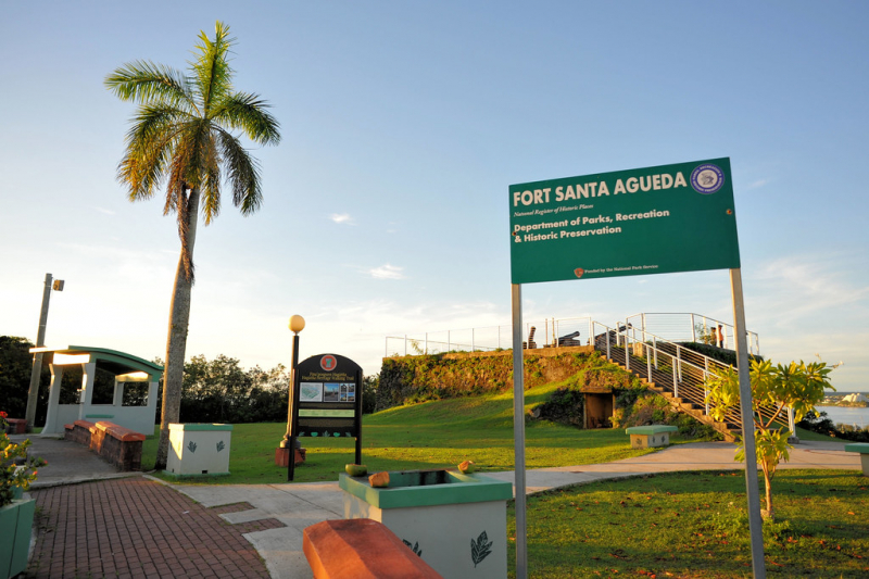
Photo: Flickr 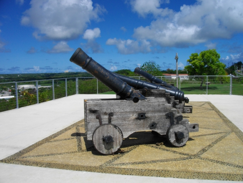
Photo: cityseeker -
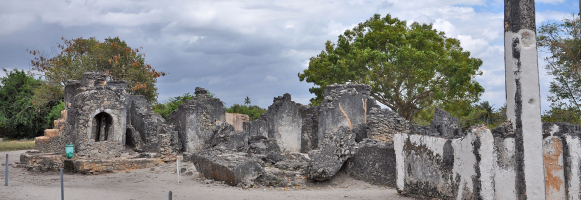
During the long Spanish occupation of the island, the Governor's Palace was located in the Plaza de España (Spain Square). During the reconquest of Guam in World War II, the majority of the palace was damaged by shelling. The three-arch gate to Almacen (Arsenal), the azotea or back porch, and the Chocolate House are the only structures left surviving. In 1974, the plaza was added to the National Register of Historic Places.
The Plaza de Magalhães (Governor's Plaza) was the initial name of the complex, which was eventually changed to Plaza de España. Its appearance has also evolved over time. Governor Don Enrique Solano renovated the previous palace with a new structure in 1885. When Guam became an American property after the Spanish–American War in 1898, the Plaza became the American administration's headquarters and the official residence of the Naval Governor.
The shelling of Hagta during the retaking of Guam in World War II damaged the majority of the palace. The following historical structures from the Plaza de Espana have survived until the twenty-first century: the Garden House, the Chocolate House, the Azotea and inner court which are the only visible structures remaining of the Spanish palace. The historic entrance to the palace storage, which eventually became an armory, is still visible, as are portions of the original flooring. The remnants of the fortifications built under Governor Muro's rule are still visible, including the nine-foot walls behind the Azotea and the low walls behind the Plaza de Espaa ruins.
Location: Hagåtña
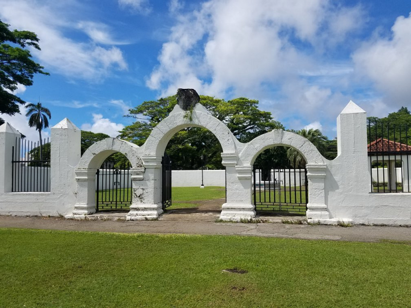
Photo: TripAdvisor 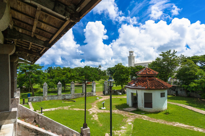
Photo: Frank Travelbox -
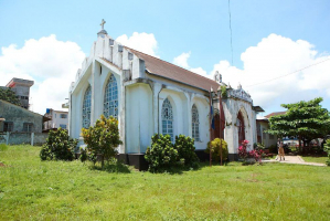
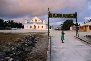
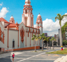
The Catedral Basilica del Dulce Nombre de Maria (Spanish: Catedral Basílica del Dulce Nombre de Mara) is a Roman Catholic cathedral in Guam. The Archbishop of the Roman Catholic Archdiocese of Agana has his seat here. It stands on the site of the island's first Catholic church, which was built in 1669 under Padre San Vitores' supervision. The current structure towers over the palm palms and is a well-known landmark in Hagta. The image of Santa Marian Kamalen, Guam's Patroness, is enshrined in the church.
Despite the fact that the physical structure has altered numerous times over the ages, the faith of people who come to pray has not. The faithful of Guam and the Marianas Islands worship at the Mother Church of the Archdiocese of Agana. Despite the fact that this parish is older than most modern cultures, we thank God for the joyous, youthful, and invigorating atmosphere that pervades our midst. It is widely considered as one of the most beautiful historical sites in Guam.
Location: Hagåtña
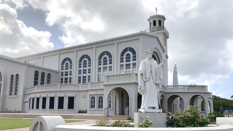
Photo: aganacathedral.com 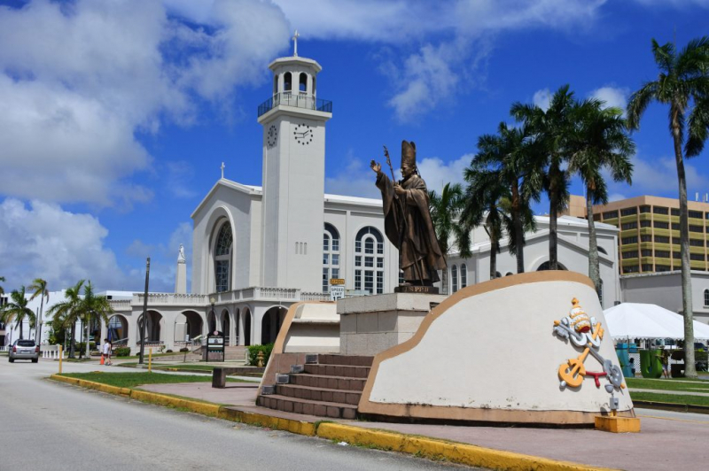
Photo: japarenguam.com