Top 6 Most Beautiful Historical Sites in Sudan
Sudan is a country in Northeast Africa. Its official name is the Republic of Sudan. It is bordered to the southwest by the Central African Republic, to the ... read more...west by Chad, to the north by Egypt, to the northeast by Eritrea, to the southeast by Ethiopia, to the northwest by Libya, to the south by South Sudan, and to the Red Sea. Sudan is rich in natural resources, animals, ethnic groups, and historic landmarks and locations. These historic landmarks vary in terms of their historic era and the type of landmark itself. You can see that there are landmarks from the ancient, medieval, and industrial ages; some of them are being used today, while others are mainly tourist attractions. Here are the 6 most beautiful historical sites in Sudan.
-
Naqa or Naga'a is a ruined ancient city in modern-day Sudan of the Kushitic Kingdom of Mero. The ancient city is located approximately 170 kilometers northeast of Khartoum and approximately 50 kilometers east of the Nile River. Smaller wadis meet the Wadi Awateib, which flows from the Butana plateau region's center, and farther north at Wad ban Naqa, where it joins the Nile.
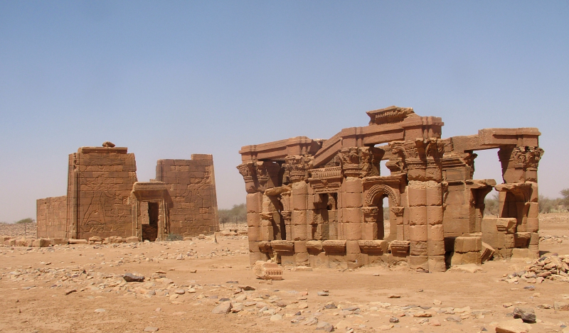
Naqa is one of the country's largest ruined ruins, indicating that a significant ancient metropolis once thrived in the area. It was one of the centers of the Kingdom of Mero, which acted as a link between the Mediterranean and African worlds. The site is famous for two temples, one dedicated to Amun and the other to Apedemak, both of which have a Roman kiosk nearby. It is known as the Island of Meroe, along with Mero and Musawwarat es-Sufra, and was designated a UNESCO World Heritage Site in 2011.
Naqa is home to a number of Meroitic temples spanning from the fourth century BC to the fourth century AD. The remnants of several temples have been discovered, but the Amun and Apedemak temples, also known as the Temple of the Lion, are the two largest and most notable temples of Naqa. Both are still in good condition. King Natakamani erected the Amun temple of Naqa, which is 100 meters long and has various statues of the king. The temple has an east-west axis and is composed of sandstone that has been somewhat worn by the wind. The temple is built in Egyptian architecture, with an outside court and ram colonnade reminiscent of the Temple of Amun at Jebel Barkal and Karnak, leading to a hypostyle hall enclosing the interior sanctuary. Relief carvings may be found on the temple's main entrances and walls.
In 1999, a German-Polish archaeology team investigated the temple's interior sanctuary. The stela's reverse and sides feature undeciphered Meroitic hieroglyphs and are regarded as one of the best examples of Meroitic art discovered to date by the finding team. After more than a decade of excavation, restoration, and measuring of the Amun Temple, the Sudanese government reclaimed control on December 1, 2006, delegating the duty to the Ministry of Culture.
Another Amun temple, Naqa 200, has been excavated since 2004 on the slope of the neighboring Gebel Naqa, the mountain overlooking the Naqa village. It was erected by Amanikhareqerem and is similar to the Temple of Natakamani. It was erected by Amanikhareqerem and is similar to the Temple of Natakamani. It is dated to the 2nd or 3rd century AD, though some artifacts do not conform to the precise dating, further complicating Nubian chronology.
The temple of Apedemak is located to the west of the Amun temple (or the Lion Temple). Apedemak was a Nubian warrior god with a lion's head. The god served as the deceased hereditary chief, prince, or king's sacred guardian. This Apedemak was thought to curse anyone who touched the chief's grave. The temple is regarded as a model of Kushite architecture. The temple's front is a large doorway with Natakamani and Amanitore on the left and right wielding divine power over their inmates, metaphorically with lions at their feet. Although it is unclear who the prisoners are, historical records show that the Kushites frequently clashed with invading desert clans. Fine images of Apedemak, who is symbolized as a snake emerging from a lotus flower, may be found around the margins. On the sidewalls of the temple are images of the gods Amun, Horus, and Apedemak keeping the king company.
The Roman kiosk is a tiny temple adjoining the larger temple building with Hellenistic influences. The entrance to the kiosk is Egyptian, with a lintel topped by a row of the sacred uraeus (cobras), but the sides are Roman, with columns with florid Corinthian capitals and arched windows. Recent excavations at the site revealed that it was most likely dedicated to Hathor worship. The goddess Isis was known to have absorbed some characteristics of Hathor.
Location: Naqa, River Nile, Sudan
en.wikipedia.org 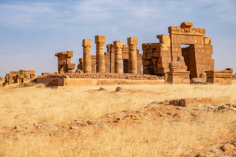
journeyofanomadicfamily.com -
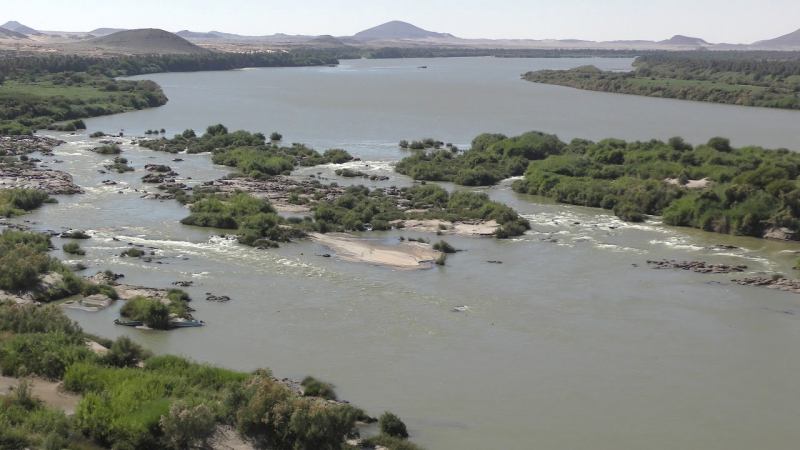
The Nubian Swell has shifted the river's flow to the west, keeping its depth shallow and causing cascades to occur. Even as the river bed erodes, the land mass lifts, leaving parts of the river bed exposed. Because of these distinguishing characteristics of the river between Aswan and Khartoum, the stretch is often referred to as the Cataract Nile, while the downstream segment is occasionally referred to as the "Egyptian" Nile. The geological difference between these two sections of the river is significant.
The geological difference between these two sections of the river is significant. North of Aswan, the river bed is not stony but is instead formed of sediment, and far from being a shallow river, it is believed that the bedrock was once eroded to be several thousand feet deep.
When Nasser Lake was formed, the water overwhelmed the first and second cataracts. The third Cataract contains some really fascinating rocky formations. It is located north of Kerma, the ancient capital of the Kingdom of Kush, which endured over 1.000 years before falling under Egyptian rule due to the natural protection provided by the cataract itself. When the 18th New Monarchy dynasty arrived, it established a border between the Egyptian Empire and the Nubian kingdom.
The fourth Cataract is located north of Karima. The Nile rushes among the rocky granite cliffs, generating many rapids that used to make navigation impossible. Most cataracts were submerged by the water of the new artificial lake in 2008, thanks to the new Merowe Dam. The 5th Cataract is located north of Atbara, near the confluence of the same river with the Nile. The lovely and delightful sandy beaches are the main feature of this one. The sixth and final Cataract is around 50 kilometers north of Khartoum. The Nile flows through a stunning granite canyon and round stone formations before flowing into the desert and forming kilometers-long gorges known as "Sabaloka."
Location: The Nile River, Sudan
youtube.com 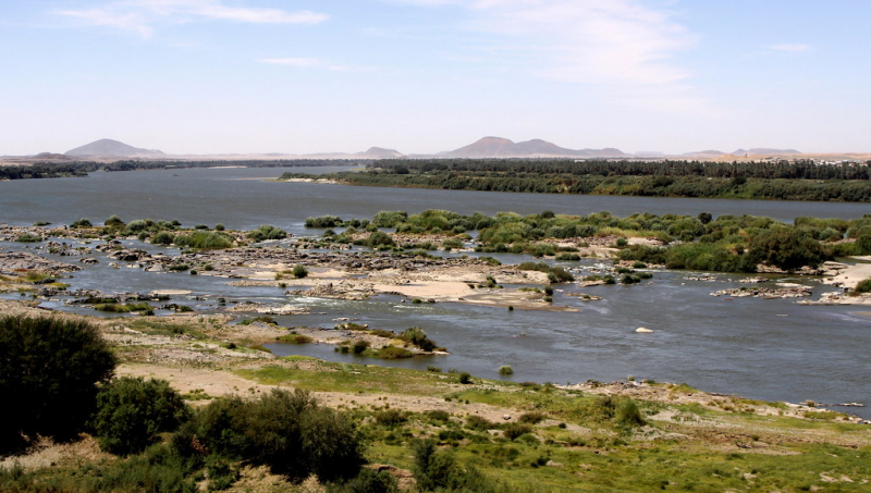
flickr.com -
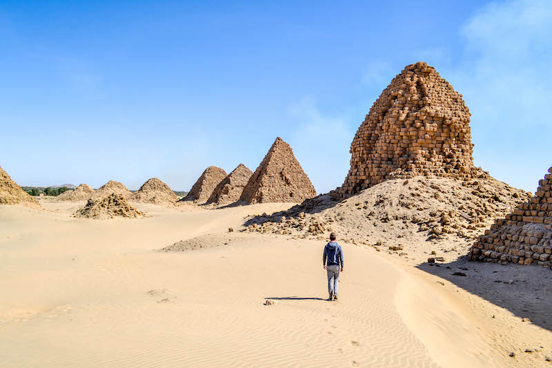
Nuri is a town in contemporary Sudan on the Nile's west bank, near the Fourth Cataract. Nuri lies around 15 kilometers north of Sanam and 10 kilometers from Jebel Barkal.
At Nuri, which functioned as a royal necropolis for the ancient city of Napata, the first capital of the Nubian Kingdom of Kush, more than 20 ancient pyramids belonging to Nubian kings and queens are still standing. It is likely that at its peak, Nuri had 80 or more pyramids commemorating royal burials. The Nuri pyramids were constructed during a three-century period, beginning around 670 BCE with the oldest (the Taharqa pyramid) and ending around 310 BCE (the pyramid of king Nastasen).
King Taharqa built the first known pyramid at Nuri, which is 51.75 meters square by 40 or 50 meters high. The Taharqa pyramid was built so that when viewed from Gebel Barkal at daybreak on Egyptian New Year's Day, the start of the yearly flooding of the Nile, the sun would rise directly over its tip.
Tantamani, Taharqa's successor, was buried at el-Kurru, but all Napatan kings and many of their queens and children until Nastasen were buried here, along with around 80 royals. The Nuri pyramids are generally smaller than the Egyptian pyramids and are typically badly damaged (due to both human and natural causes), yet they frequently still preserved considerable elements of the burial equipment of the Kushite rulers who were buried here. A church was built here during the Christian era. The church was built in part from recycled pyramid stones, including many stelae from the pyramid chapels.
George Reisner explored the pyramids in the early twentieth century. In 2018, a fresh archaeological expedition led by Pearce Paul Creasman began excavating at the site.
Since 2003, the Nuri pyramids and other constructions in the Gebel Barkal region have been listed on the UNESCO list of global cultural heritage sites.
Location: Northern State, Sudan
germanbackpacker.com 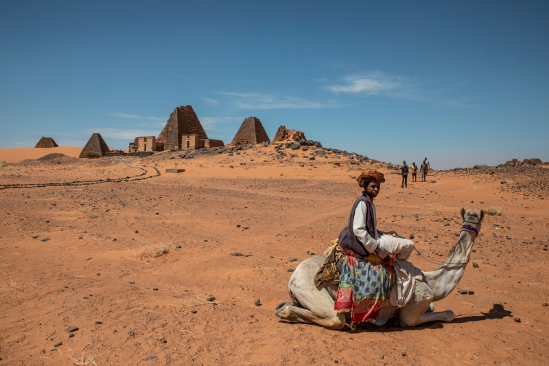
nytimes.com -
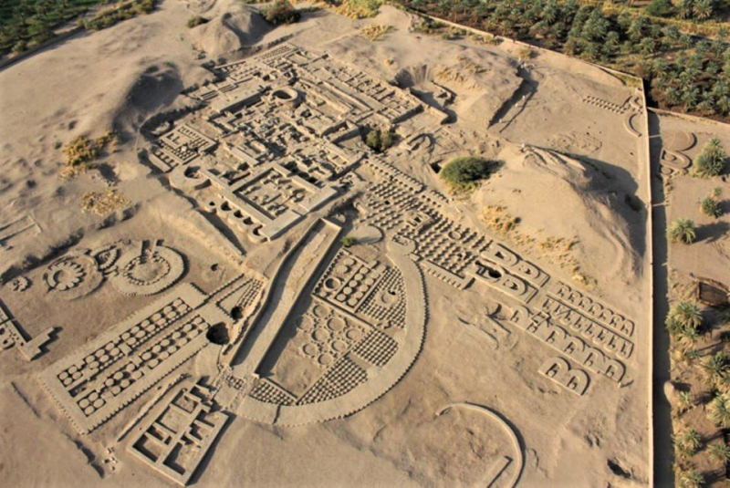
Kerma was the capital city of the Kerma civilization, which existed at least 5500 years ago in present-day Sudan. Kerma is one of ancient Nubia's most important archaeological sites. Decades of excavations and research have resulted in thousands of cemeteries and tombs, as well as the residential quarters of the major city surrounding the Western/Lower Deffufa.
A cultural tradition originated around Kerma circa 3000 BC. As one of the most beautiful historical sites in Sudan, Kerma was a huge urban center constructed around the Western Deffufa, a colossal adobe temple. As the capital city and site of royal graves, it sheds light on the society's intricate social structure.
Kerma had a population of at least 10,000 individuals by 1700 BC. Kerma's artifacts differ from those of ancient Egypt in theme and composition and are distinguished by vast amounts of blue faience, for which the Kermans created techniques independent of Egypt, as well as their work with glazed quartzite and architectural inlays.
Kerma has a cemetery with more than 30,000 burials. Larger tombs are surrounded by lesser ones in the cemetery, implying socioeconomic stratification. The site has burial mounds on its southern edge, four of which are 90 meters (300 feet) in diameter. These are thought to be the penultimate monarchs' burials, with some containing motifs and artwork depicting Egyptian deities such as Horus. In general, Egyptian influence can be shown in many burials, particularly in material evidence like pottery and grave items. Second Intermediate Egyptian ceramics from Avaris, such as Tell el-Yahudiyeh Ware, have been unearthed in Kerma tombs, for example. Furthermore, scarab seals and amulets are abundant, showing widespread trade with ancient Egypt as well as an exchange of cultural ideas. Following the fall of Kerma, the cemetery was used to house the rulers of the Kingdom of Kush's 25th or "Napatan" dynasty from Upper (Southern) Nubia.
Location: Nubia, Sudan
thearchaeologist.org 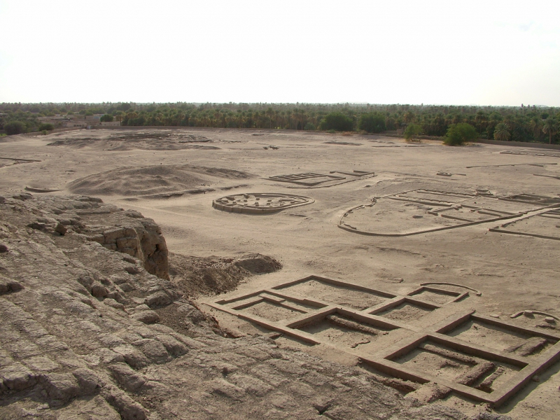
en.wikipedia.org -
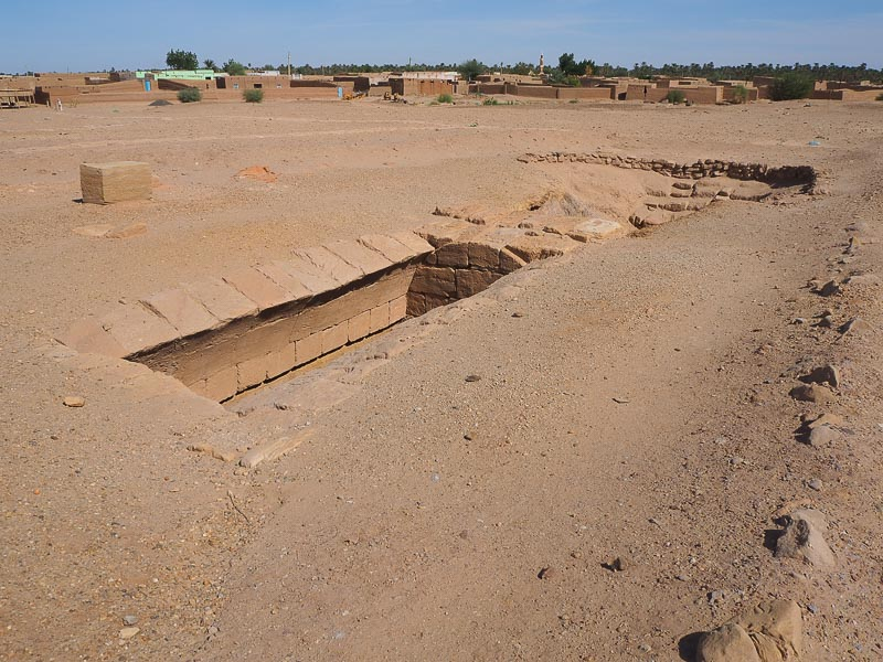
El-Kurru was one of the royal graves utilized by Egypt's 25th Dynasty and the Nubian royal line of Kush. El-Kurru, one of the most beautiful historical sites in Sudan, is now located in the Northern state. The majority of the royal Nubian pyramids excavated by George Reisner date from the early Kushite period, from Alara of Nubia (795-752 BC) until King Nastasen (335-315 BC).
Two wadis divide the land into three halves. The middle area appears to be the earliest, with seven tumulus-type graves dating back to the Kingdom of Napata. Tum.1, according to Reisner, goes back to the period of Pharaoh Sheshonq I of Ancient Egypt (c. 850 BC) and precedes the Kingdom of Napata by about 200 years. Scholars (Kendall, Hakem, Totok) currently believe the early cemetery dates back to the Ramesside period and dates the earliest burials to the end of Ancient Egypt's Twentieth Dynasty (c. 1070 BC), though Kendall has reversed his position and now adheres to a dating closer to the one proposed by Reisner.
Four tumulus tombs can be seen on the cemetery's highest point. Tum. 6 is located to the north, across the northern wadi. A row of at least eight pyramids stands to the east of the tumuli. One of them intrudes partially on a tumulus grave. Kashta (probably) and his wife Pebatjma own the southernmost pyramid in this row. Another row of pyramids precedes this one, including those of Piye, Shabaka, and Tanutamani.
To reach the southern pyramids, one must cross the southern wadi to the south of the Pebatjma pyramid. These are the Queens' pyramids: Naparaye, Khalsa, Qalhata, and Arty.
El-Kurru was a walled settlement in the medieval period when the territory was part of the Christian kingdom of Makuria, and it operated until around 1200. During this time, Christian Nubians carved a variety of graffiti into pyramid Ku. 1, including monograms, Christian symbols, and, most notably, a slew of boats, possibly commemorating some type of river procession.
Location: Northern State, Sudan
travelwithbrothers.com 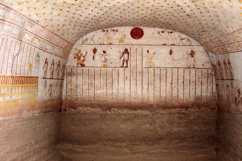
flickr.com -
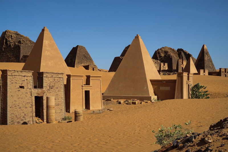
The rulers of the ancient Kushite kingdoms built the Nubian pyramids. During antiquity, three Kushite kingdoms ruled over the Nile valley region known as Nubia, which is located in the northwestern part of modern-day Sudan. Kerma (2500–1500 BCE) was the first civilization's capital. Napata (1000-300 BCE) was the focus of the second. Mero was the center of the third kingdom (300 BCE-AD 300). Granite and sandstone were used to construct the pyramids.
Nubian rulers, heavily influenced by the Egyptians, erected their own pyramids thousands of years after Egyptian burial practices had evolved. Pyramids were created for the first time in Nubia at El Kurrn in 751 BC. The Nubian-style pyramids were modeled after a type of Egyptian private elite family pyramid popular in the New Kingdom. There are twice as many Nubian pyramids as Egyptian pyramids still standing today. In the 1830s, an Italian treasure hunter named Giuseppe Ferlini partially toppled forty of the pyramids. As one of the most beautiful historical sites in Sudan, the Nubian pyramids have been recognized as a World Heritage Site by UNESCO.
The Nubian pyramids were constructed over a few hundred years to serve as graves for the kings and queens of Napata and Mero, as well as wealthy inhabitants. The first three locations are in Lower Nubia, near the contemporary town of Karima, near Napata.
The first of these, which included the graves of King Kashta and his son Piye, as well as Piye's successors Shabaka, Shabataka, and Tanwetamani, was built at the site of El-Kurru. For their queens, fourteen pyramids were built, with several of them being famed warrior queens. This is in comparison to the approximately 120 much larger pyramids that were built in Ancient Egypt over a 3000-year period.
At Nuri, you may see the pyramids of Nubian rulers Aspelta, Aramatle-qo, and Amaninatakilebte. Later, the Napatan pyramids were built at Nuri, on the opposite bank of the Nile, 10 kilometers (6.2 miles) north. Anlami and Aspelta were among the 21 kings and 52 queens and princes buried in this necropolis. These kings' remains were entombed in massive granite sarcophagi. Aspelta's weighed 15.5 tons and had a four-ton cover. The Napatan king and Twenty-fifth Dynasty pharaoh Taharqa's pyramid is the oldest and largest in Nuri.
Location: Sudan
sworld.co.uk 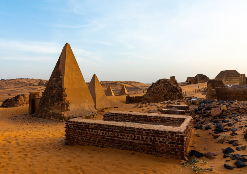
dailysabah.com


