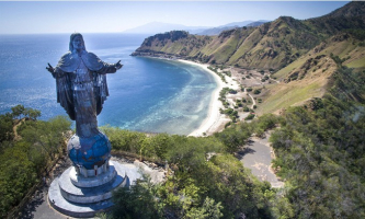
Top 12 Most Beautiful Valleys

Mother Nature never ceases to astound us with her splendor and geographical wonders. When spring arrives, the world's most beautiful valleys burst into bloom, ... read more...with a splattering of verdant greenery and flora. Here are some enchanting valleys around the world to quench the thirst of nature lovers who go off the beaten path to witness the exquisiteness of nature.
-
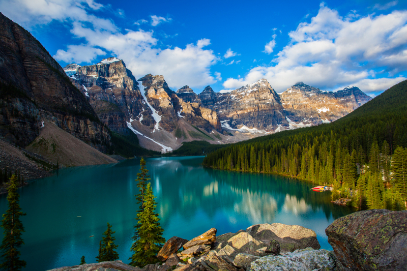
Valley of Ten Peaks, one of the most stunning valleys, provides you with some incredible and fantastic views. Sitting with Moraine Lake in the middle and ten different mountain peaks surrounding you is like being in mother nature's lap. The ten peaks, which are 180 kilometers west of Calgary in Alberta's Banff National Park and encircled by the Canadian Rockies, reflect their angular shadows into the crystal-clear blue waters of Moraine Lake, which they overlook. From the viewpoint of the valley, one can also see numerous hanging glaciers, which furthers the picturesque setting. The 10 peaks that stand above are reflected in the milky-blue, glacial water of Moraine Lake, which fills the valley floor. Take the Rockpile Trail around the Lake, named after the grey boulders on the shoreline, before the slopes turn into pea-green pine forest; the view from the top of this trail is known as the 'Twenty Dollar View,' because it was featured on the back of Canadian $20 bills between 1969 and 1979.
The best time to visit is between May and August, but keep in mind that a pass is required to enter the park. The region is rich in flora and fauna, but high traffic has had a negative impact on it, from the introduction of invasive species to the running over of animals crossing the highway.Each year, 3,927,557 tourists travel to Banff National Park, many of whom throng to Moraine Lake in the summer for what has been called a once-in-a-lifetime experience. The Trans-Canada Highway runs through the park, making it easily accessible from Banff, and the Moraine Lake Road connects the park's interior to the valley. The location is ideal for hiking, climbing, canoeing, sightseeing, and wildlife watching, with many choosing to camp right at the site. The views of the emerald crystal-clear waters glistening against the peaks, which contain the third highest of the Rockies, make the location perfect for these activities as well. Cross-country skiers frequently travel through the area in the winter.
Shutterstock 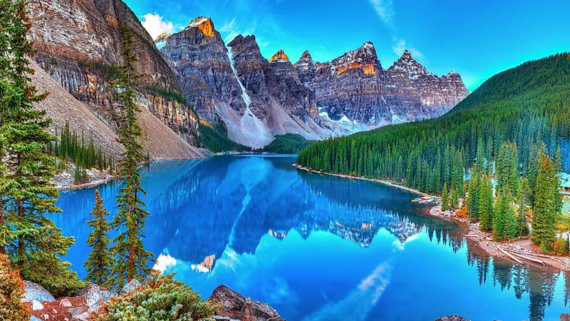
Shutterstock -
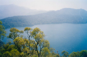
The Makalu Barun National Park encompasses the entire Barun Valley in the Himalayas. It is situated at the foot of Mount Makalu in the district of Sankhuwasabha in Nepal, an Asian country. The Makalu is the world's fifth-highest mountain, and its presence is visible along the route.
You'll have a lot of the trail to yourself as you hike for days through pristine landscape because the Barun Valley trek is still largely unknown to most tourists visiting Nepal. The Barun Valley is undoubtedly a place of natural beauty, with its tall, lush forests, peaks covered in snow, and gushing waterfalls. Wild orchids and rhododendrons bloom across lush meadows in the Barun Valley, which is known for its variety of wildlife, while snow leopards prowl along the cliff tops. Even though the trek along the valley can be challenging, it is well worth it for the stunning Himalayan views and the opportunity to explore caves like the revered Shiva Dhara.
We notice stark contrasts all around us in the Barun Valley, with tall waterfalls, lush rocks rising from lush green forests, and colorful flora beneath snow-white peaks. Alpine flowers bloom in vast fields of rock at higher elevations.
Because it is a well-established area for super cool trekking guides, the best adventures begin in the heart of the Makalu-Barun Valley National Park. Much of the route is completely uninhabited, necessitating tent camping. Sleeping outside in the shade of the Himalayas adds a new dimension of adventure. You will have a more personal encounter with Mother Nature. Recognize that you are not separate from nature, but rather coexist with it.
As the trail climbs, the landscape changes from broadleaf forest to hilly brush and grassland. You will discover more about the incredible diversity of plants and animals in the Barun Valley as you travel on this journey. Take pleasure in one of the roughly 3,000 flowering plants. Watch out for some of the 440 bird species, the critically endangered snow leopard, red panda, musk deer, warthog, and many other animals. The scientific community has listed the distinctive species of this area as a "indispensable living laboratory for scientific research."
The Yangle Kharka (3,600 meters), an alpine meadow decorated with fluttering prayer flags, is nearby. There are some hostels nearby, or you can opt to sleep outside in the moonlight and stars.
Hiking is possible all year in these areas. However, the weather is better in the spring (March to May) and fall (September to November). There is a little more color in the spring, and the rhododendrons bloom and the skies are clearer in the fall.
This exceptional biodiversity, combined with the valley's outstanding beauty, earned it a prominent place in Buddhist folklore as a spiritual place where no one grows old. In the event of a catastrophe, it will be one of only seven places on Earth where life will survive.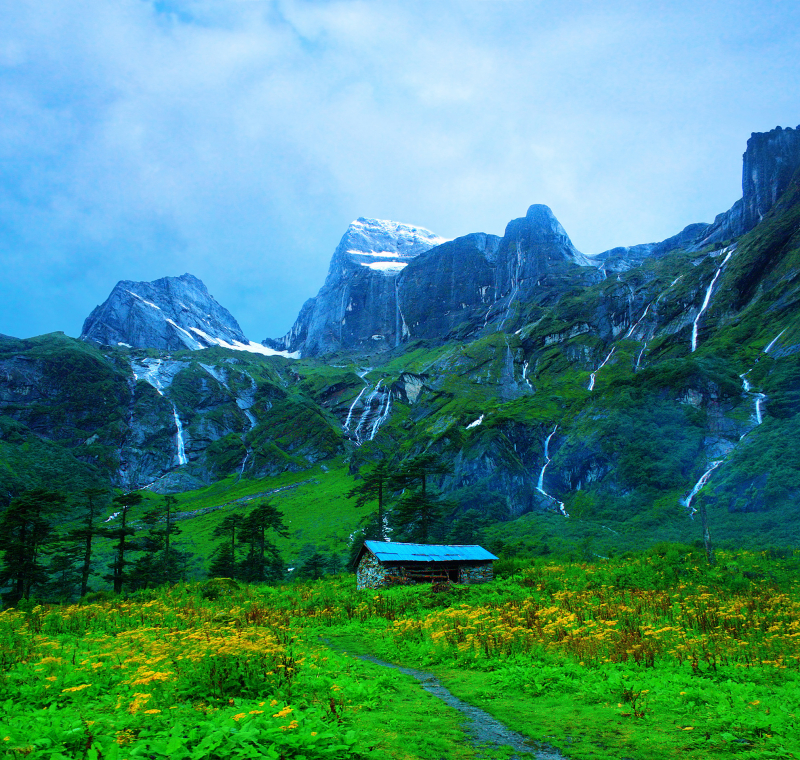
ixigo.com 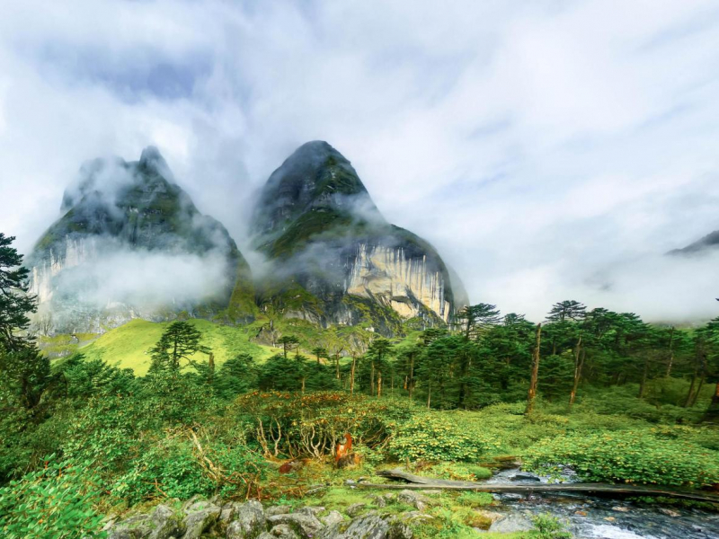
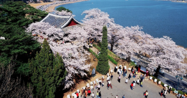
In Barun Valley, rhododendron forests and statuesque orchids seem to float amid the clouds - booking.com -
With 72 waterfalls cascading over the vertical limestone cliff faces, the valley that inspired Johann Wolfgang von Goeth's poem "Song of the spirits over the waters" is known as "Lauterbrunnen," which translates from Swiss literally as "loud sources." It is one of Switzerland's largest nature reserves, completely covered and lined with alpine meadows and wooden houses. The Staubbach Waterfall, one of the most famous in the world, is located in the Lauterbrunnen Valley, on the stream of the same name, whose water falls from a height of 300 meters from the valley and flows into the river Lütschine, a river in the Rhine basin. The Staubbachfall is a very distinctive monument!
The Swiss Alps' Lauterbrunnen Valley is so completely bewitching that J.R.R. Tolkien, who wrote The Lord of the Rings, got the idea for Rivendell while hiking here as a young man. There are wooden, alpine chalet hotels in the valley, which was created by three retreating glaciers. In addition, the Eiger, Monch, and Jungfrau peaks surround the area, providing views of snow-capped mountains. You can experience some of the freshest air imaginable while walking through wildflower meadows along the Valley floor and taking in the calming sound of water tumbling over rocks.
There is no doubt that the Lauterbrunnen Valley is one of Switzerland's largest reserves. Lauterbrunnen is known for being one of the most impressive U-shaped valleys in the world, with huge rock walls, towering peaks, dramatic waterfalls, cozy wood-paneled corners, colorful mountain meadows, and mountain lodges for the ideal romantic getaway.
Lauterbrunnen is specifically located in the administrative district of Interlaken-Oberhasli. This Swiss commune includes the towns of Eigergletscher, Gimmelwald, Isenfluh, Mürren, Stechelberg, and Wengen, the majority of which are known for their winter sports resorts. Several stages of the Alpine Ski World Cup, for example, have been held in Wengen. The valley commune is located near the historic city of Interlaken in the Bernese Oberland region. The communes of Saxeten, Wilderswil, Gündlischwand, and Lütschental border it to the north, Grindelwald to the east, Blatten (Lötschen) (VS) and Fieschertal (VS) to the south, and Kandersteg, Reichenbach im Kandertal, and Aeschi bei Spiez to the west.
The Trümmelbachfälle waterfalls, which are concealed by towering rock walls inside the "Schwarzer Mönch" mountain, provide another audible natural spectacle. The ten glacial waterfalls, which have a combined height of about 200 meters, fall up to 20.000 liters of water into it every second and are only visible during the summer months from the tunnel cable car. Unquestionably one of the most stunning valleys on the planet!
Shutterstock 
Unsplash - Riciardus -
Hawaii is not only known for its world-class surf and beaches with snow-white sand; this tiny archipelago is also a mountainous natural paradise. Since a large portion of the island of Kauai is covered in rainforest, it is referred to as the "Garden Isle." On Hawaii's Kaua'i Island, Kalalau Valley is regarded as the island's cathedral and is tucked away along the N Pali Coast. It is arguably one of the planet's greatest natural wonders and features a secluded beach encircled by towering peaks.
The valley has been valued for its beauty almost since its inception, as a historically highly populated place with a large thriving community living there until the twentieth century, after which only those with permits were allowed to occupy the "unspoiled" land. With a 90-day pass, one can see the esteemed valley if they are prepared to show some athleticism by trekking a few days-worth 11-mile hike inclusive of camping overnight(s) from Ke'e Beach.
The most rewarding way to get there is probably by hiking the Kalalau Trail, where you'll first see its steep, flower-covered cliffs that seem to be ridged like draped cloth as they descend to the royal-blue ocean. The beachfront Hanalei Colony Resort is close to some of the island's top snorkeling locations and the Kalalau Trail.
Hiking two miles to Hanakapi'ai Beach, where one must cross the Hanakapi'ai Stream, which is known for causing flash floods due to rapidly rising waters. The "Crawler's Ledge," a mountain-embracing narrow footpath that drops steeply off into a vast chasm with the tumultuous sea, begins at mile seven. Only those with cat-like grace and instincts who want to commune with nature, self-reflect, and unwind from the city should set out in good weather. Wandering through hidden paths in the rainforest, relaxing by the ocean, and sleeping under the stars make for an unforgettable trip. Everyone else can take a tour by boat or helicopter.
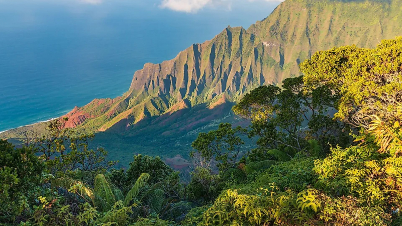
Spectacular landscape of the Kalalu Valley in Hawaii. - Shutterstock 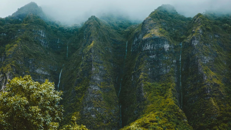
Unsplash - Jakob Owens -
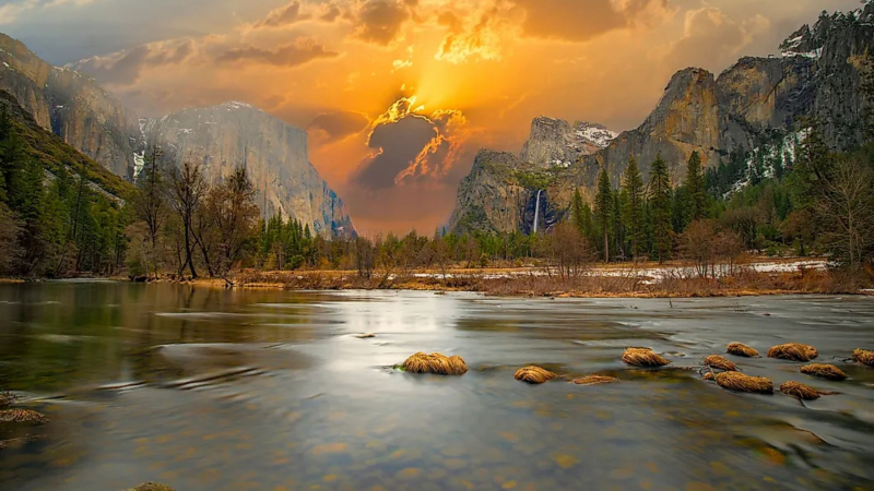
This 4,000-foot-deep glacially carved valley is a natural wonder and one of the top landmarks in the United States. The sheer cliff walls, which tower majestically along the edges, include glacially sculpted, polished rock, which is considered the true jewel in the crown of Yosemite National Park. No photograph can do Yosemite Valley justice. The incredibly sheer granite cliffs were licked smooth by glaciers over 30 million years, making them the ultimate challenge for rock climbers - especially the vertical precipice of monolith El Capitan, which rises nearly a thousand meters above the ground.
Its nickname, "Incomparable Valley," is well-deserved; particularly in the morning mist and at sunset, when the fabled Half Dome is bathed in an unforgettable rosy glow. An hour's drive away, at The Glacier Point, you can see the 7,214-foot granite peak towering over the valley as well as the nearby High Sierra peaks of Clouds Rest, Liberty Cap, Vernal, and Nevada Falls.
Follow the Merced River through the Valley floor meadows, with the Sierra Nevada mountains in the distance between Yosemite's massive rock formations. Then, through pine-scented forests, hike up to Bridalveil or Yosemite Falls (the latter being the highest waterfall in the United States) to be rewarded with panoramic views of the surrounding national park. When the sun sets at the end of a clear day, the rock faces turn an icy blue color as they are cast into shadows, and the golden light is spectacular. Red Tail Ranch is a lovely farmhouse only 20 minutes from Yosemite's main entrance.
Who among athletes has never heard of or read about Yosemite Valley in California? Up until the middle of the 19th century, various indigenous tribes lived in the Yosemite region. In 1890, it was officially designated as a National Park, ranking it among the top ten in the world.
Yosemite Valley is currently renowned throughout the world for its massive granite stone slopes and steep waterfalls. In 1984, the area, which has a total area of more than 3,029 square km and an elevation range of 600 to 4,000 meters, was designated as a World Heritage Site. Approximately four million people visit it each year, but only a small number are climbers.
Its fauna and flora are privileged, as are its panoramic views, waterfalls, glacial lakes, granite rock formations, and iconic giant sequoias, making it a popular tourist destination, particularly for adventurers and rock climbers (Big Wall Climbing).
Climbers of all levels will find a home in Yosemite, from the most inexperienced to the most experienced. So don't be concerned; there's something for everyone! Sign up for the Yosemite Mountaineering School and Guiding Service, which offers hands-on classes for beginners, intermediates, and advanced riders who have never climbed Yosemite before. There, you can rent all of the necessary equipment as well as attend informative seminars. There are more advanced rocks for more experienced adventurers. Yosemite is home to some truly enormous granite rock formations that require several days to climb. El Capitan, Half Dome, Yosemite Falls, and Glacier Point are the most difficult vertical rocks to climb despite the effort-intensive preparation and gorgeous summit.
Without a doubt, the most impressive granite mecca among these great walls of California is Yosemite Valley. This location has become a benchmark for rock climbing, as well as a great place to set new records and watch new climbers develop. Every climber who travels to Yosemite comes with the goal of completing the climbing route they have always wanted to try. It has become an initiation rite for many, and an annual tradition for others. Feel free to visit and be inspired.
The goregous Yosemite Valley in California, the United States. - Shutterstock 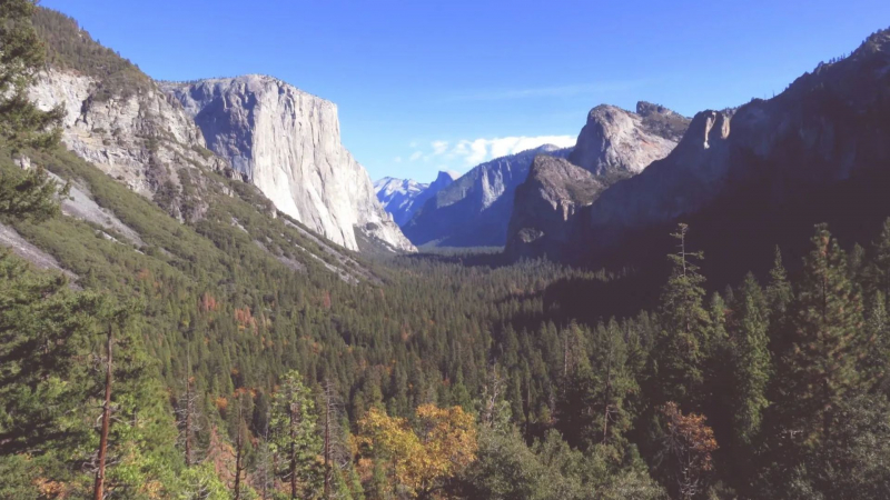
Julianna Barnaby -
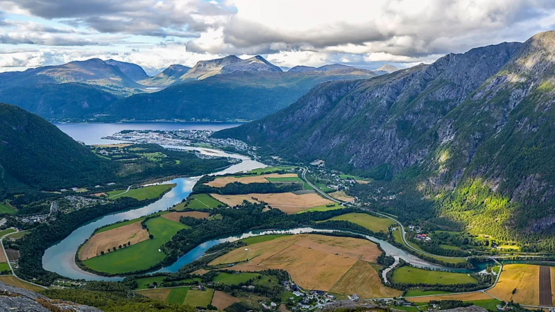
We already know how stunning Norway and its northern lights are; the breathtaking valleys of the nation are merely the cherry on top. Romsdalen Valley is traversed by a serene and lovely river, and it is encircled on all sides by formidable mountain ranges. These mountains can reach heights of 1,500 meters.
One of the most photographed natural scenes in the country is the view of this beautifully wild valley with a vegetated floor within the long and narrow granite-walled gorge encompassing a foaming salmon-abundant Rauma River. The majestic mountains contain Trollveggen, Europe's tallest vertical overhanging rock face, at 1,000 meters. After passing through a 30-40 meter-deep gorge in the village of Verma, the river falls into the Slettafossen waterfall, which is surrounded by fences and has a bridge for a perfect view of the spectacle.
Mountain peaks like the 1,555 m-tall Romsdalshorn, Kongen, Dronningen, and Bispen can be seen across the valley. Scandinavian rock climbing originated in the Romsdal Mountains, home to some of the most difficult climbs in the world. A picnic area, a cafeteria, a gift shop, restrooms, a children's play area, and Trollveggen Beskssenter are all conveniently located by the E 136 road and offer breathtaking mountain views at the foot of the Trollveggen.
Shutterstock 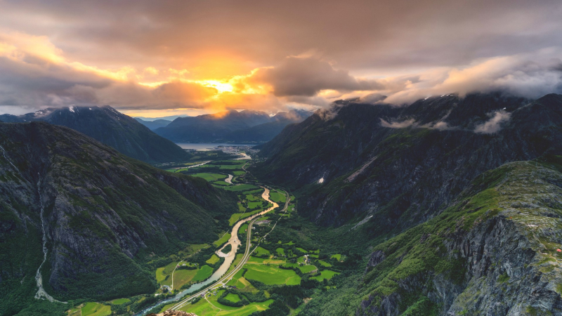
Windows 10 Spotlight Images -
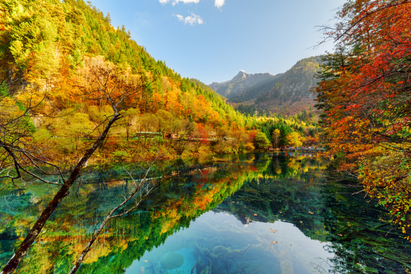
Jiuzhaigou Valley is a superb work of nature with its enchanted landscape and vast nature reserve. The valley is given a dreamlike eloquence that is unmatched anywhere else by its blue lakes, mountains, and lush forests.
Jiuzhaigou, a UNESCO World Heritage Site since 1992 and a World Biosphere Reserve since 1997, is a jagged 72,000-ha valley in northern Sichuan Province, with the highest peaks in the southern Minshan Mountain reaching 4,800 m. It has incredible landscapes with narrow conic karst land forms, limestone terraces, multi-level waterfalls, blue-, green-, and purple-hued lakes and pools, caves, and snowy peaks. Locals believe that the Goddess Semo dropped a mirror made of Dago's wind and clouds, shattering it into the hundreds of lakes that dot the valley. Five Flower Lake, a brilliant cyan-colored pool flowing over numerous downed, ancient tree trunks, is a must-see location in the Jiuzhaigou valley. Around 140 different bird species can be found in the region's diverse forest ecosystems, in addition to a number of critically endangered species of plants and animals like the giant panda and the Sichuan takin.
The well-preserved quaternary glacial remnants add to the scenic and aesthetic majesty of the Jiuzhaigou Valley. Unfortunately, the region's beautiful nature has suffered as a result of forestry activities, with many initiatives being undertaken to restore the lost precious materials through tree planting and strict management and protection of water quality, air quality, and forests. Although it is recommended that human interception in the area be limited in order to preserve the valley's precious natural life, the breathtaking views are not yet prohibited, though one must seriously consider the consequences of the ecological footprint.
Shutterstock 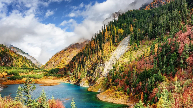
Jiuzhaigou, a UNESCO World Heritage Site in China - Worldatlas -
One of the most breathtaking natural vistas you will ever see is in Indonesia's West Sumatra, where you can find Harau Valley. You will see a lot of mountains and rock formations, along with forests and rice fields, when you visit this valley. On the highway that connects Pekanbaru and Bukittinggi, it is situated. The valley is easily accessible on foot, and convenient homestays are readily available all around the valley to minimize inconvenience.
You can get there by taking a bus from Bukittingi to Payakumbuh and then another bus to the town of Harau. From there, you can take a taxi or a motorcycle directly to your accommodation and then go for a stroll around the neighborhood.
It is small enough to explore on foot or cycle through to see the Harau Valley's picturesque canyons and rock formations, as well as waterfalls off the cliffs. Aka Bearayun and Sarasah Bunta are two well-known waterfalls. Sarasah Bunta is more attractive and natural-looking than Aka Berayun. Hiking in the mountains, renting a bike and enjoying the views, and bathing in the hidden waterfalls are among the activities available.
If you want to eat out, the gastronomic experience in this town is also excellent. However, keep in mind that there are some small shops and restaurants near the valley's entrance, but nothing further into the rural roads. It is best to prepare food ahead of time.
It's one of those experiences that can only be described if you go, so... We invite you to enjoy the world and visit one of the world's most beautiful valleys!! Tell us when you're going to return!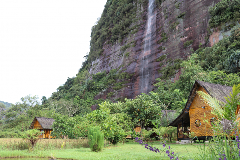
Synergi Ravelino Tours & Travel 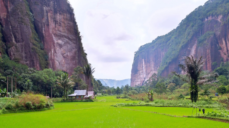
Indonesia Travel -
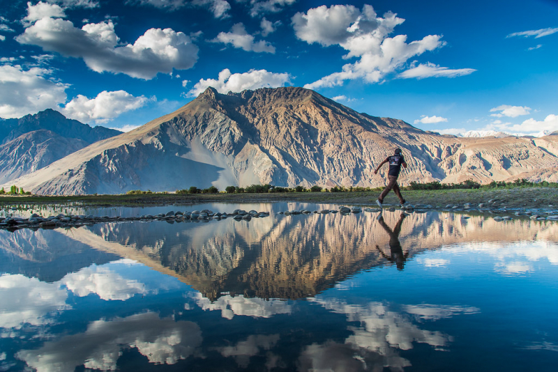
The Nubra Valley (Valle Nubra) is one of the world's most beautiful valleys. It is located in northern India, approximately 150 kilometers north of Leh, the capital city of Ladakh. Khardung La is accessible from Leh via the Shyok Valley. To reach the Nubra Valley, cross the Shyok River via a small bridge and pass through a military checkpoint. Keep in mind that a pass for the "Internal Line" that allows access to this region is required.
The Nubra Valley is home to a number of small towns with a lot of picturesque atmosphere that give the valley life. Examples include the villages of Sumur, which has a Buddhist gompa, and Panamik, which is notable for its hot springs.
Shyok Valley has two villages that are accessible to foreigners: Diskit and Hundar. Diskit has a very active gompa in a prominent location, and Hundar has its own attractions, including the exotic Bactrian camels, dunes, mountains, and snowy peaks. Ladakh, also known as the "Land of High Passes," is one of the most spectacular areas of the Indian Himalayas. It forms the eastern part of the disputed state of Jammu and Kashmir, and is located between Pakistan, Tibet, the Chinese province of Xinjiang, and the Indian state of Himachal Pradesh. The Nubra Valley, a lock of dirt on the very scalp of India, lies to the north of Leh, the "capital" of Ladakh. It is a remote enclave of stark beauty, cradled by rugged mountains.
The area, as we previously discussed, is made up of two valleys: Nubra and Shyok. Its two rivers emerge from the Karakoram Range's remote peaks and heavily glaciated valleys. The Nubra flows into western Pakistan to join the powerful Indus after joining the Shyok in the region's center, close to Diskit. A wonder to discover and be inspired by! On the bare slope of Diskit Monastery, a small watchtower with prayer flags overlooks the wide Shyok River valley.
The distant villages and their patchy fields add a human touch to the muscular landscape and immense views as you enter the Shyok Valley through the village of Khardung. Large and very nice houses can be found nestled between poplar groves and barley fields! Nubra's settlements are all built on ledges of land above rivers. What lies ahead for us in that valley? A couple of ancient Buddhist monasteries, a herd of mostly feral camels grazing on a strip of dunes at the valley's bottom, walking and hiking trails, and a long drive through the Shyok Valley can easily fill several days of exploration.
HikerWolf 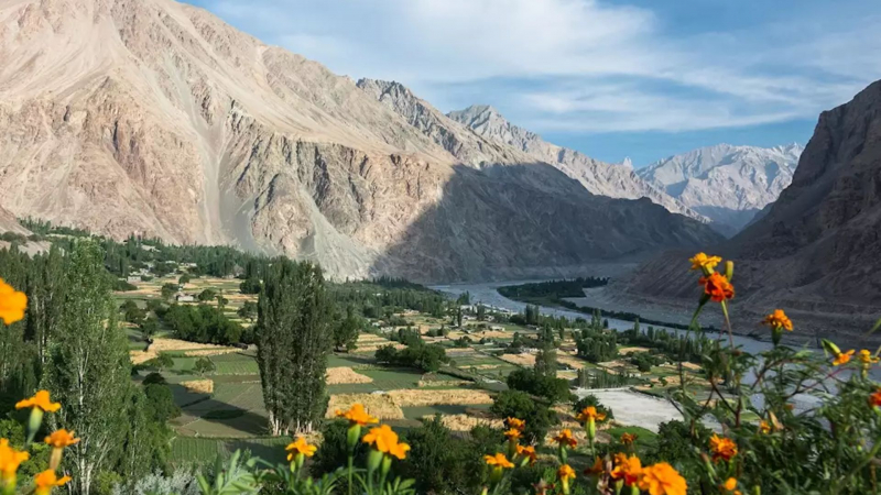
Audley Travel -
The magnificent views of Kaghan Valley, which is well-known for its stunning lakes, waterfalls, and streams, leave visitors in awe. It is abundant with natural beauty and is probably where the fairies live. Forests of fir and pir are draped over the lofty mountains.
The Babusar Pass, located in the Kaghan Valley, is at a height of 4,171 meters, covering a distance of 116 kilometers. Beautiful lakes and roiling mountain streams are scattered throughout this valley. The Kunhar River's waters, which are teeming with trout, curve through the Kaghan Valley. There are a number of towns, including the popular Naran, tucked away in the pine forests.
You will frequently see locals leading a trail of cattle up toward the higher pastures while exploring the Kaghan Valley.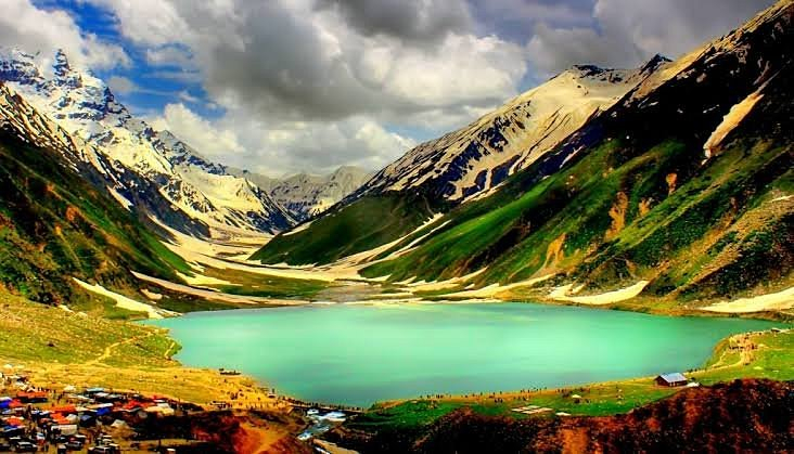
Tripadvisor 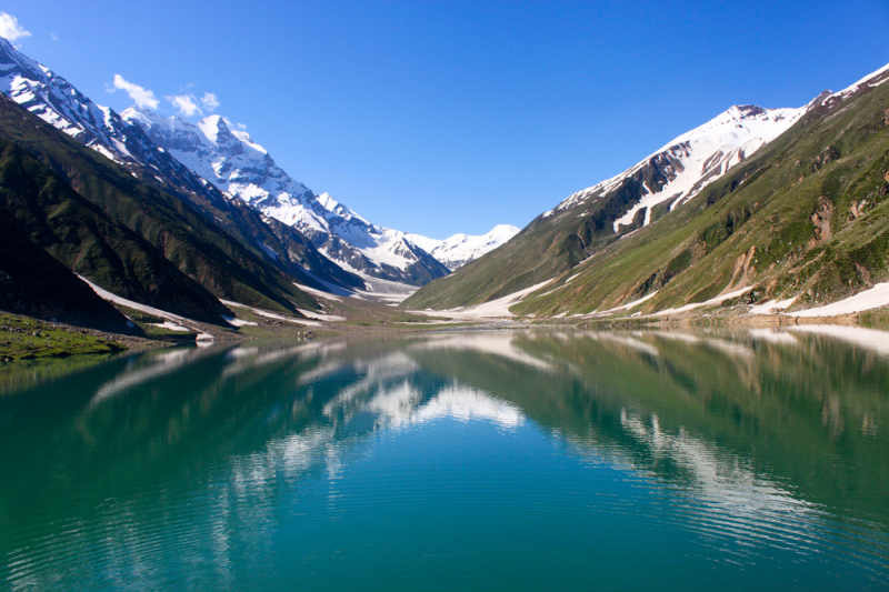
Shutterstock -
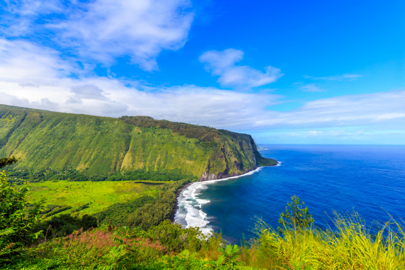
The Valley of Waipi'o is found in Hawaii's Hamakua district. Waipi'o is Hawaiian for "curved water." The valley, known as the 'Valley of Kings,' was once the sacred site of the Hawaiian kings. As the valley experiences a good rainy season, it is adorned with beautiful spells of rainfall.
The Waipi'o Valley is without a doubt one of the most beautiful valleys in the world with its dense, green forests, gushing waterfalls, and a shimmering black sand beach.
Even though it may be challenging to reach the Waipi'o Valley, the challenging descent into its interior is well worth the effort. Alternatively, you can take the Muliwai trail, which will lead you along the cliffs surrounding the Waipi'o Valley and give you a chance to see the lovely waterfalls that emerge from the Waipi'o River.
Shutterstock 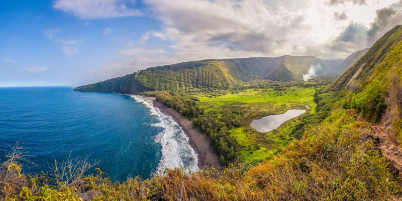
Big Island Guide -
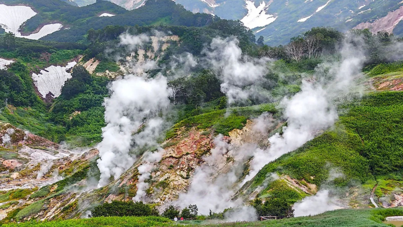
Valley of Geysers, the only geyser reservoir in Eurasia, is well-known throughout the world for its steaming lakes and geysers. The area has earned a reputation as an unusual destination thanks to its remote location.
The Geysernaya River Valley is 180 km northeast of Petropavlovsk-Kamchatsky and was only recently discovered by reserve worker T.I. Ustinova and lab assistant A.P. Krupenin on July 25, 1941. It is located close to a volcanic belt known as the East volcanic belt. A few months earlier, the first gazer was found. More than 40 geysers and numerous thermal springs are located within a 6 km radius of this canyon, which is 400 m deep and measures 4 km by 8 km with the Geysernaya River.
In the center, there is also a warm-ground ecological path where you can see the constantly pulsing boiling springs, hot lakes, geysers, mud pools, mud volcanoes, and vapor streams. The erupting geysers must be large and require specific thermodynamic conditions, which are only found in five places on the planet.
When the steep slopes of the Vodopadny (Waterfall) brook failed, breaking off in major water, snow, blocks, and other fragments sliding at 35–40 km/h and uprooting trees along the way, the greatest historical landslide in Kamchatka, which covered many beautiful waterfalls, thermal grounds, and geyser constructions, began on June 3, 2007, at 2.20 pm. Within the following three minutes, the second "dry" portion of the event occurred when the head of the brook split off, sending more massive materials tumbling down to create a dam in the river and a 150 m by 800 m wall, with the debris stretching for 1.7 km.
Legendary Valley of Geysers, Kamchatka, Russia - Worldatlas 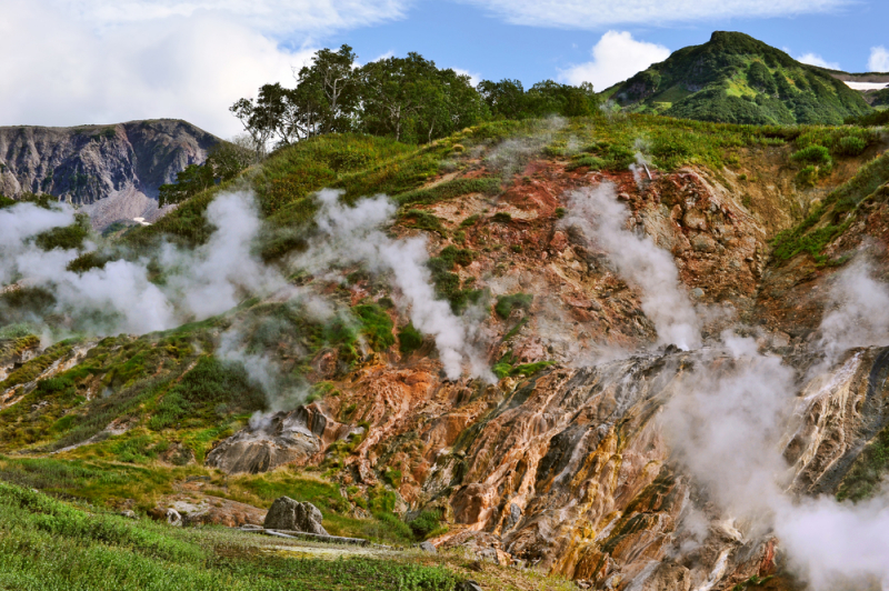
Shutterstock