Top 7 Most Beautiful Islands In Federated States of Micronesia
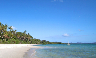
The Micronesian Islands are a group of islands in the Pacific Ocean surrounded by crystal clear blue waters and home to some of the world's best diving spots. ... read more...These islands have the most beautiful beaches, a rich history and tradition, warm people, fantastic animal and plant species, a tranquil environment, and everything else needed to make your vacation the best it can be. Here are brief descriptions of the most beautiful islands in Federated States of Micronesia.
-
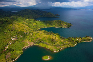
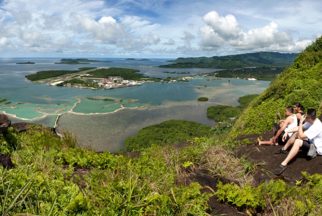
Pohnpei is ranked first on the list of the most beautiful islands in the Federated States of Micronesia. This is the largest island in the state of Pohnpei, and it is also the location of the state's capital. Pohnpei is worth visiting because it is the largest and most populous island in the Federated States; therefore, if you want to learn about Micronesian culture, this is the place to go.
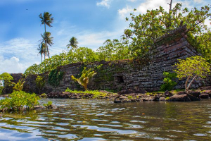
Nan Madol, or Nanmadol, is a group of 92 prehistoric artificial platform islands built in the lagoon on the eastern coast of Pohnpei and surrounded by man-made canals. Ruins of a town and ceremonial center from the early second millennium CE include tombs of former kings, according to legend, of the Sau Deleur dynasty, which once ruled the entire island.
Though whalers and traders frequented Pohnpei, it wasn't until the mid-nineteenth century that Christian missionaries established schools there. After 1898, the Spanish administration was replaced by German occupation. The Germans promoted copra production. Following World War I, Japan was given a League of Nations mandate over Micronesia, with Pohnpei serving as one of the administrative centers. During World War II, the Japanese garrison on Pohnpei was bypassed and isolated by the Allies prior to its surrender. From 1947 until the Trust Territory's dissolution in 1986, the island was part of the United Nations Trust Territory of the Pacific Islands.
Pohnpei produces a diverse range of tropical products such as copra, breadfruit, taro, trochus shells, and cacao. Rice is grown, pigs and chickens are raised, and fish is caught. Kolonia, Madolenihmw, and Rohnkiti are the main coastal villages. Pohnpei is home to the College of Micronesia-FSM and has an international airport. The capital of the Federated States of Micronesia is Palikir, which is located near Kolonia. 129 square miles total land area (334.1 square km). The island's population in 2010 was 36,196 people.
Location: the eastern Caroline Islands, Federated States of Micronesia, western Pacific Ocean.
traveltourxp.com 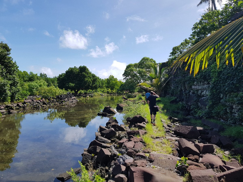
tripadvisor.com -
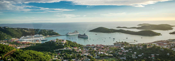
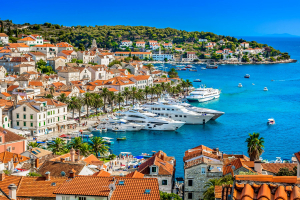
Yap Islands, formerly Guap, is an archipelago of the Federated States of Micronesia's western Caroline Islands. This island is in 2nd place on the list of the most beautiful islands in the Federated States of Micronesia. Within a coral reef, the archipelago consists of the islands of Gagil-Tamil, Maap, Rumung, and Yap (also known as Rull, Uap, or Yapa). Yap has a central range of hills that rise to Taabiywol, 568 feet (173 meters) above sea level, and is densely forested. Temperatures remain relatively stable throughout the year. The average monthly temperature is in the low 80s Fahrenheit (about 28 °C), and the annual rainfall is around 120 inches (3,000 mm). Yap state's capital, Colonia, is located on Yap Island's east coast.
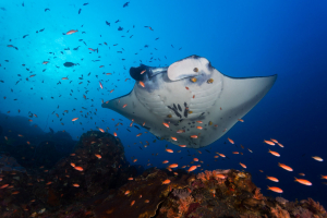
Yap is a scuba diver's paradise for those looking to see some rare (and sometimes dangerous) marine life. The island is notable for the abundance of manta rays in its waters. Kayaking and deep-sea fishing are also popular activities, and there are numerous shops selling souvenirs and artwork. Another attraction that visitors should see is the Yap Living History Museum. The museum not only displays objects from the island's past but also features live reenactments and traditional dancing performances.
Yap's culture is also fascinating, with stone money being one of its distinguishing features (huge circular rocks weighing up to several tons). The stone money is no longer produced, but everyone knows which stone belongs to whom. For centuries, stone money, or Rai, was widely used as a form of currency in the area. They were not relocated; only the owner changed, and oral history recorded the transaction.
Have you decided which Micronesian island is your favorite? Or would you like to see them all? It's worth noting that not many airlines fly to the federal states, but United Airlines does, with flights from Hawaii and Guam.Location: the western Caroline Islands, Federated States of Micronesia

cruisemapper.com 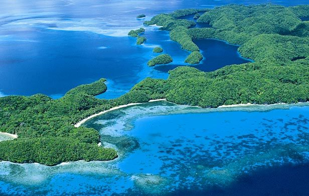
pinterest.com -
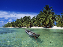
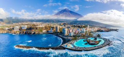
Palau is a group of islands in Micronesia known as the "Island of Natural Wonders." It is made up of over 200 pristine islands surrounded by turquoise blue waters and breathtaking scenery. Diving, like on the other Micronesian islands, is the most popular activity. Aside from diving, snorkeling, kayaking, mountain biking, hiking, and other activities are popular here. The island experience will be completely magical.
With an annual mean temperature of 82°F (28°C), Palau has a tropical climate all year. Rainfall can fall at any time of year, with an annual total of 150 inches (3,800mm). The average humidity for the year is 82 percent, and while rain falls more frequently between July and October, there is still plenty of sunshine. Typhoons are uncommon in Palau because it is located outside of the main typhoon zone.
If you have your own marine transport, such as an ocean-going yacht, the South West islands of Palau are worth a visit. Sonsorol, Fana, Meriil, Hatohobei, and Helen Reef are all conservation areas. If you visit Meriil, make sure to bring mosquito repellent because its local name is a dancing island. You'll find out why if you go there! If you plan to visit any of these islands, it is a good idea to meet the governors at their offices in Koror. If you're lucky, you might be able to take a trip on the Atoll Way, an island supply vessel. Sleeping on a hard wooden platform with other souls who are either returning to their home islands or the doctor from Peleliu island hospital who is making a routine visit to check on the islanders' health.
Location: the western Caroline Islands, Federated States of Micronesia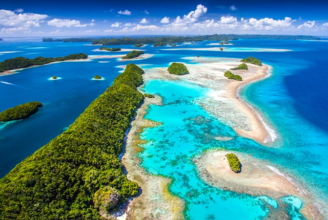
traveltourxp.com 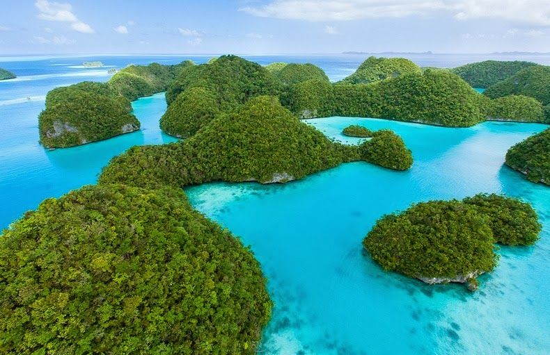
pinterest.com -
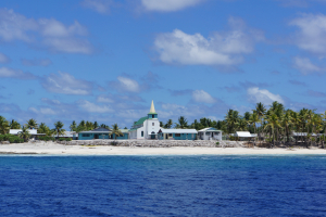
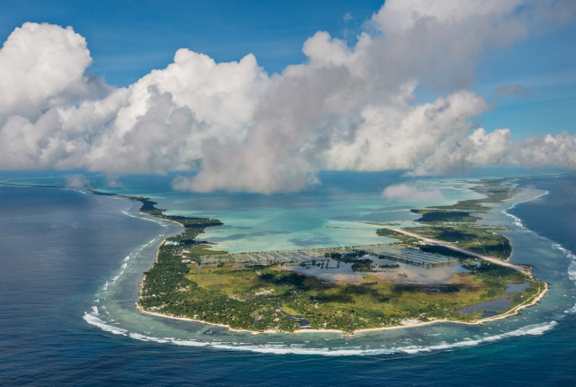
Kiribati is a Micronesia country made up of 33 islands divided into three major island groups. Kiribati stretches 1,800 miles (2,900 km) eastward from the 16 Gilbert Islands, where the majority of the population resides, to the Line Islands, three of which are inhabited. In between are the Phoenix group of islands, which have no permanent population. 313 square miles is the total land area (811 square km).
A few of the islands are densely packed with fringing reefs, but the majority are atolls. Kiritimati (Christmas) Atoll in the Line group is the largest (and one of the largest in the world), with a land area of 150 square miles (388 square kilometers) and accounting for nearly half of the country's total area. Kiritimati was used for nuclear weapons testing by the United States and the United Kingdom in the 1960s; it now has a large coconut plantation and fish farms, as well as several satellite telemetry stations.
The islands rise above the sea, surrounded by turquoise blue waters and pristine nature. The islands are an excellent location for world-class diving, fishing, and bird watching. Native peoples continue to live in groups and build their own homes out of natural materials, carrying on a rich tradition. Dance and handicrafts are an important part of life on this island.
Location: Federated States of Micronesia
traveltourxp.com 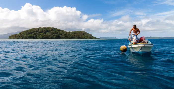
climatelinks.org -
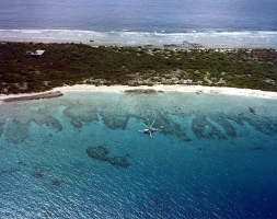
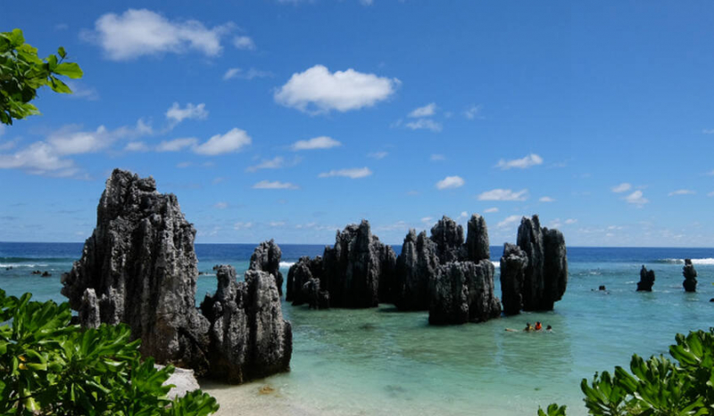
Nauru is a 21-square-kilometer (8.1-square-mile) oval-shaped island in the southwestern Pacific Ocean, 55.95 kilometers (34.77 miles) south of the equator. The island is surrounded by a coral reef that is visible at low tide and is dotted with pinnacles. The presence of the reef has prevented the establishment of a seaport, through channels in the reef provide access to the island for small boats. Inland from the beach is a fertile coastal strip 150 to 300 m (490 to 980 ft) wide.
Nauru's central plateau is surrounded by coral cliffs. The plateau's highest point, known as the Command Ridge, is 71 meters (233 feet) above sea level. Nauru's only fertile areas are along its narrow coastal belt, where coconut palms thrive. Bananas, pineapples, vegetables, pandanus trees, and indigenous hardwoods such as the tamanu tree grow on the land surrounding Buada Lagoon. Nauru was one of three great phosphate rock islands in the Pacific Ocean, the others being Kiribati's Banaba (Ocean Island) and French Polynesia's Makatea. Nauru's phosphate reserves are now almost completely depleted. Phosphate mining on the central plateau has left a barren landscape of jagged limestone pinnacles up to 15 meters (49 feet) tall. Mining has stripped and devastated approximately 80% of Nauru's land area, rendering it uninhabitable, as well as the surrounding exclusive economic zone; silt and phosphate runoff is estimated to have killed 40% of marine life. In Nauru, there are few natural sources of fresh water. Rainwater is collected in rooftop storage tanks. The islanders rely heavily on three desalination plants operated by Nauru's Utilities Agency.Nauru is a small island with a rich history and hospitable people. The island with the fewest people is rich in natural beauty and breathtaking views. Some of the island's highlights include deep-sea fishing, green cliffs, shipwrecks, mining infrastructure remnants, scuba diving, fascinating animals and plant species, and tropical weather.
Location: southeastern Federated States of Micronesia.
burgerliner.com 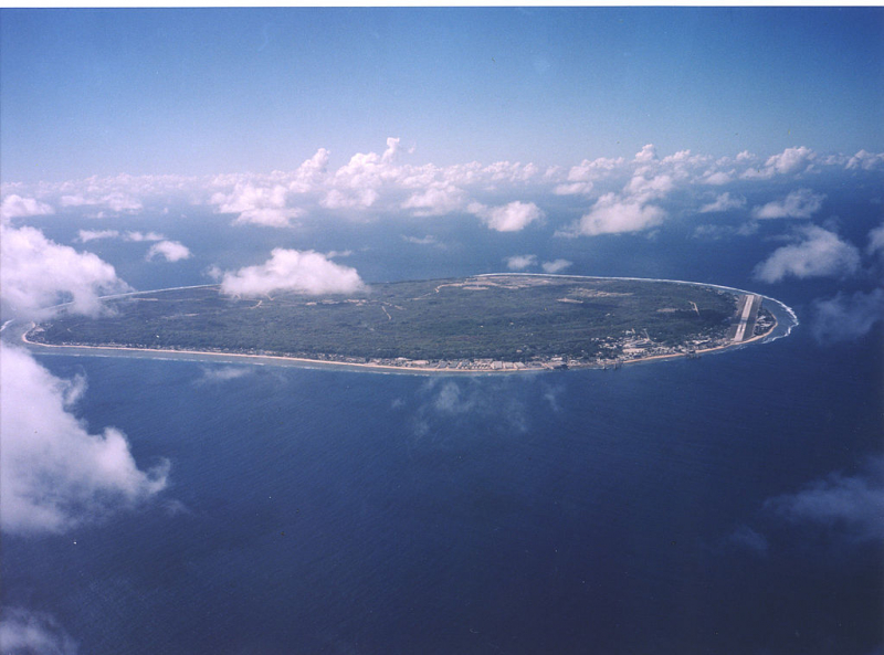
wikipedia.org -
Chuuk is in 6th place on the list of the most beautiful islands in the Federated States of Micronesia. This massive atoll contains several islands that are endowed with natural beauty. The lush vegetation on the islands attracts a variety of migratory birds. The rugged terrain of these islands is home to wild orchids and other beautiful floras. Kayaking from one island to another is an incredible way to explore and enjoy Chuuk. The outer reefs are home to a diverse range of fish, both reef-dwelling and pelagic. In the beautiful lagoon, which is also a WWII shipwreck, you can enjoy sailing and windsurfing.
The Chuuk Lagoon, the archipelago's main touristic area, is home to the majority of the Chuuk people. It has stunning mountainous islands and clear blue waters. Tourists should be aware that there is no public transportation in the area, so they must rely on rental cars, scooters, and taxis to get around. Walking, exploring the natural wonders and culture, and participating in water sports are among the best things to do on the islands. Wreck diving is still one of the most exciting activities. Truk Lagoon is one of the best places in the world for wreck diving, with some stunning – albeit sad – wrecked ships.
Tol is the largest island in Chuuk state, and while there are many other islands to visit in the area, Tul is the best place to start your explorations. It has several nice resorts and regular transportation to the surrounding islands with interesting tourist attractions.
Location: Federated States of Micronesia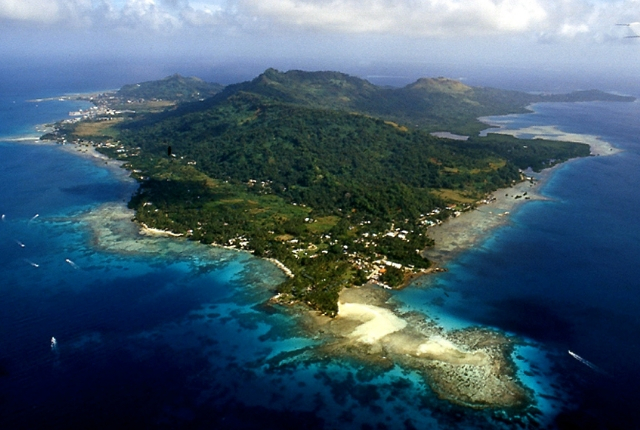
traveltourxp.com 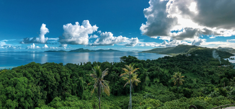
southern.edu -
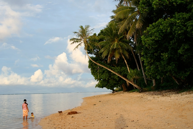
Kosrae is the last island on the list of the most beautiful islands in the Federated States of Micronesia. This island, the largest and only island in Kosrae state, is densely populated in comparison to other islands in Micronesia, with over 6000 residents. Kosrae is a high, relatively pristine island. It is quickly becoming a popular site for scuba divers and hikers. The coral reefs that encircle the island are kept in immaculate condition by an extensive mooring buoy system, which was erected and maintained by concerned expat diving operators with the assistance of the government's Marine Resources agency. The reefs are mostly unspoiled and feature kilometers of hard corals, some of which are said to be thousands of years old.
Despite its popularity as a tourist destination, Kosrae's natural attractions remain unspoiled. Kosrae has many attractions, not the least of which is the cuisine, but it is primarily a destination for nature lovers. However, there are some places you should visit. For archaeology buffs, the ruins of Lelu Village are a true wonder. The stone structures of the area have been built for centuries and are a Neolithic architectural wonder.
The Menke Ruins predate Lelu and were once home to a sacred site. The ancient basalt walls, dwelling quarters, and places of worship transport you to Kosrae's past. Nature enthusiasts will like the Finkol Hiking Trail, a 2,000-foot trail that leads up to the mountain and through tropical flora and mist. Visit the James Palsis Marine Park to learn about Micronesia's ecosystems and even have a tropical BBQ.
Location: easternmost of the Caroline Islands, Federated States of Micronesia
traveltourxp.com 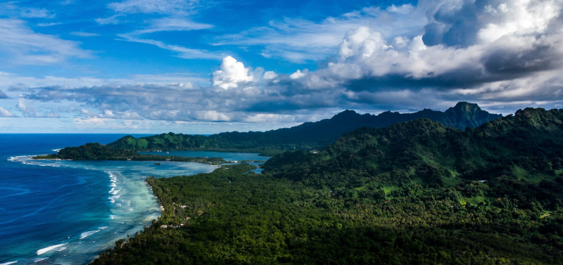
oceanographicmagazine.com


