Top 11 Most Famous Historical Sites in Nigeria

Nigeria has around 250 local languages, making it a culturally varied country. These diverse cultures have rich histories and backgrounds, and the locals are ... read more...extremely proud of their past. To name a few examples of heritage, there are ancient places of worship, artifacts, old towns, and monuments. These are the 11 most famous historical sites in Nigeria.
-
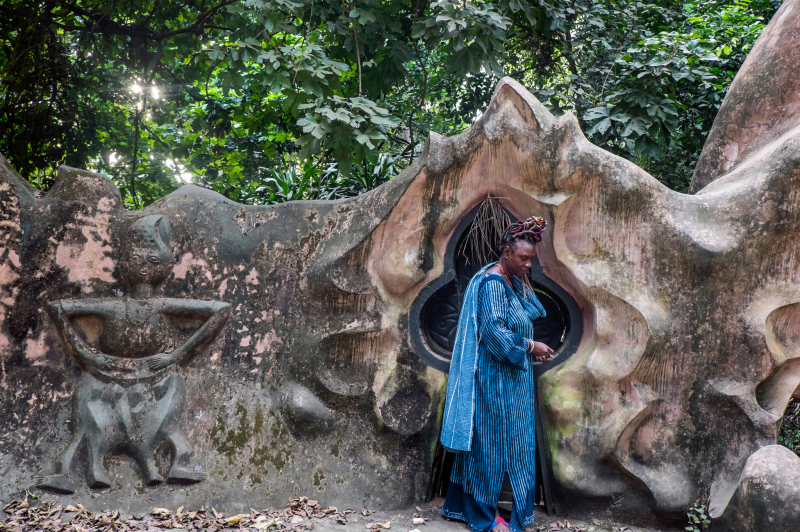
The Osun-Osogbo Sacred Grove, also known as the Osun-Osogbo Sacred Grove, is a sacred grove located on the banks of the Osun River, just outside the city of Osogbo, Osun State, Nigeria.
The Osun-Osogbo Sacred Grove dates back several centuries and is one of the last of the sacred woodlands that previously surrounded most Yoruba communities before heavy urbanization. The Sacred Grove was designated a UNESCO World Heritage Site in 2005 in recognition of its global significance and cultural worth.
The Osun-Osogbo Forest was desecrated in the 1950s when shrines were neglected and priests abandoned the grove as traditional responsibilities and sanctions lessened. Prohibited activities such as fishing, hunting, and tree felling occurred in the Grove until an Austrian, Susanne Wenger, assisted in restoring traditional protections.
Wenger formed the New Sacred Art movement to challenge land speculators, repel poachers, protect shrines, and begin the long process of bringing the sacred place back to life by reestablishing it as the sacred heart of Osogbo with the encouragement of the Ataoja and the support of the local people. Wenger was eventually given the title Adunni Olorisha in recognition of her custodial work and consistent devotion to the gods of the grove.
Location: Osogbo, Nigeria
nytimes.com 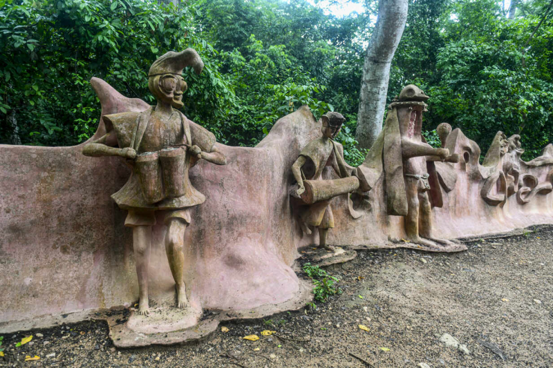
westend61.de -
As one of the most famous historical sites in Nigeria, the Idanre Hill, also known as Oke Idanre, is located in Idanre, Ondo State, southwestern Nigeria.
The landscape of Idanre Hill is well-known. Its many cultural assets, including 'Owa's Palace,' shrines, The Old Court, Belfry, Agbooogun footprint, thunder water (Omi Apaara), and burial grounds, have earned the location fame and a candidate for the UNESCO World Heritage Site shortlist. It is about 3000 feet (914.4 meters) above sea level and is home to a unique ecology into which the cultural landscape has been integrated.
Idanre Hills is situated atop a 500 million-year-old Precambrian igneous batholith that is pierced by multiple huge cracks that generate deep valleys inside the rocks.
On October 8, 2007, this site was added to the UNESCO World Heritage Tentative List in the Cultural category. The historic hamlet of Idanre has lived on the hill since antiquity, but the Western culture was introduced to the ancient city in 1894 when a band of missionaries led by Rev. Gilbert Carter came. The missionaries established the first primary school in 1896, and the clay structure still stands today.
Location: Idanre, Ondo State, Nigeria

commons.wikimedia.org 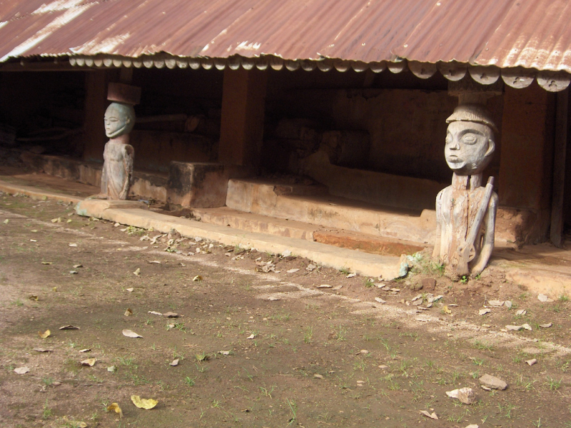
experiencingnaija.com -
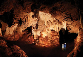
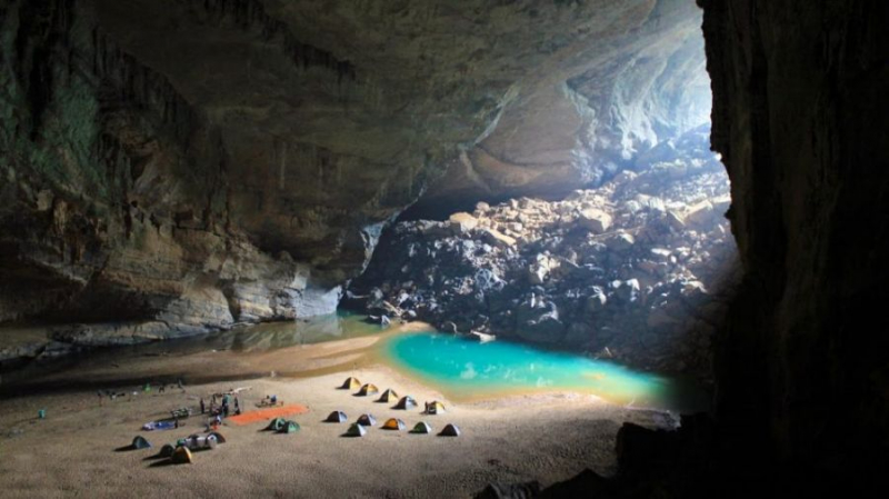
Ogbunike Cave, located in a valley blanketed by tropical rainforest, has been used for ages by local people who hold special spiritual value. This spiritual significance is still evident since the "Ime Ogba" ceremony is held every year to honor the caverns' discovery.
A long path of around 317 steps descends into the valley where the caverns are located and is claimed to have been built by the Anambra State Government in the mid-1990s.
The main cave is a gigantic structure with a large open chamber at the entrance that is roughly 5m high, 10m wide, and 30m long. The main room contains ten tunnels that lead in various ways. There are large chambers and other tunnels of varied lengths within the tunnels, some of which are interconnected. A vast colony of bats of all sizes lives in the caves. Streams and bodies of water can be found in a variety of locations. A stream emerges from one of the tunnels and runs into a fast-flowing river (River Nkissa). The warm water from the caves and the chilly river water converge at the river and stream's confluence.
A tableland of about 5 X 5 square meters is located along this section of the river and is utilized as a relaxation area by visitors to the caverns. The immediate surroundings of the caverns, up to roughly 200 meters radius, are dense tropical rainforest flora. The place has enough limits (20 hectares) to protect its values from direct human invasion.
As is customary, visitors must remove their shoes before entering the caves. And women who are on their monthly cycle are unable to go. There is little doubt that the Ogbunike Cave has significant tourist potential, owing to its history, novelty, and the myriad mysteries that lay within its dark depths.
Location: Ogbunike, Anambra State, Nigeria
pulse.ng 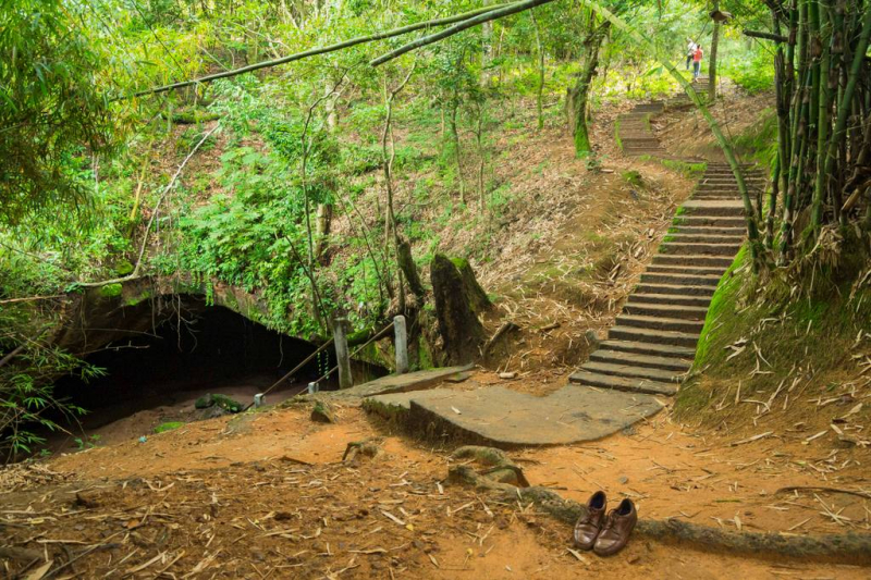
en.wikivoyage.org -
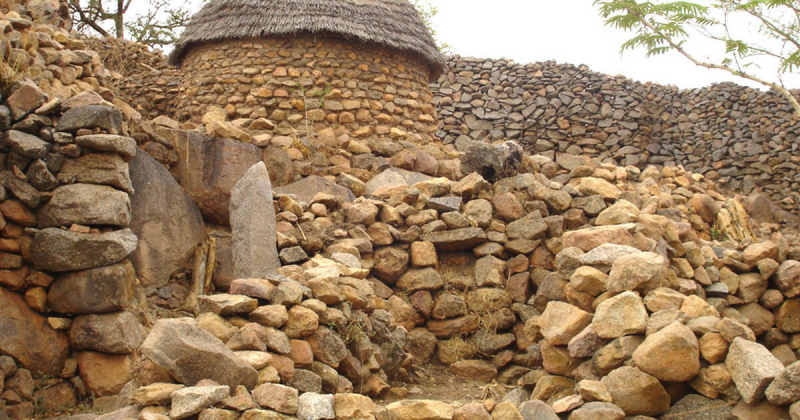
Sukur, also known as the Sukur Cultural Landscape, is a UNESCO World Heritage Site located on a hill above the settlement of Sukur in Nigeria's Adamawa State. It is located in the Mandara Mountains, close to the Cameroonian border. Its UNESCO listing is based on cultural heritage, material culture, and naturally terraced fields. Sukur is Africa's first cultural landscape to be included on the World Heritage List.
Iron Age remains discovered at the site in the form of furnaces, ore, and grindstones have been proven to be pre-Sukur. There are also some neolithic discoveries. The most recent history can be traced back to the 17th century Dur dynasty. The Dur established the region as a key provider of raw materials for iron manufacturing to northeastern Nigeria, a position it held until the first decade of the twentieth century. Sukur was devastated by the raids of Hamman Yaje, the Fulbe Lamido (chief) of Madagali, from 1912 to 1922. These wars caused a drop in iron smelting until 1960 when people began to migrate to the plains to the north and south of Sukur. The British colonization of the region, which began in 1927, had no effect on the cultural styles of this colony.
Its inscription by UNESCO in 1999 was based on the cultural legacy of the Hidi's Palace complex and town, material culture, and the natural terraced fields, which are still in good shape. Sukur's cultural landscape bears eloquent witness to a strong and enduring cultural history that has lasted for generations. Sukur is one of two UNESCO World Heritage Sites in the country.
Location: Madagali, Nigeria
whc.unesco.org 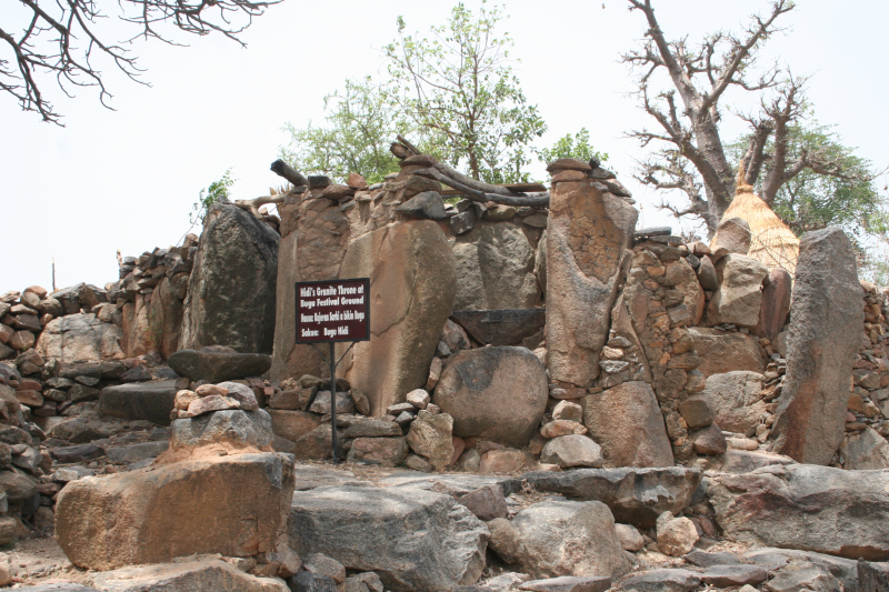
whc.unesco.org -
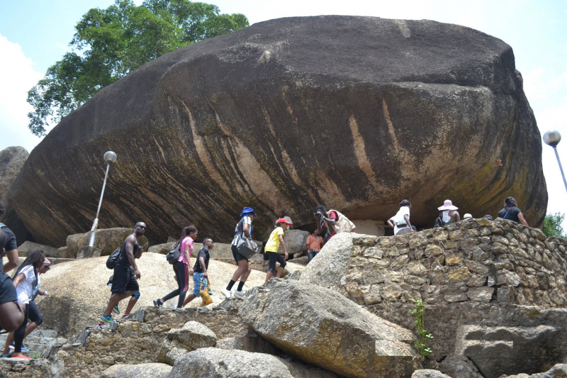
The Olumo Rock mountain range is located in southwestern Nigeria. It is located near Abeokuta, Ogun State, and was traditionally used as a natural stronghold during inter-tribal fighting in the nineteenth century. Its patron spirit is known as an orisha in Yoruba religion. The name olumo is made up of two words: "olu," which means "god/deity," and "mo," which means "moulded."
Olumo Rock is situated in Abeokuta, Ogun State. Historically, during inter-tribal fighting in the nineteenth century, the rock served as a natural fortress for the Egbas. It provided protection to the Egba people when they needed it, and is now held in high esteem by the members of the clan. The mountain, one of the most popular tourist destinations in Nigeria, sits in the heart of Abeokuta – a name which means “Under the rock” in the Yoruba language; it has a height of 137 meters above sea level. Abeokuta was originally inhabited by the Egbas, who the rock provided with sanctuary and gave a vantage point to monitor the enemy’s advance, leading to eventual triumph in war. The town of Abeokuta eventually grew as these new settlers spread out from this location.
Abeokuta is about an hour's drive from Lagos's lively metropolitan center, allowing easy access to a variety of hotels, restaurants, clubs, casinos, and other evening activities. The Murtala Muhammed International Airport, located in Lagos, is also the closest airport to Abeokuta. Gateway Hotel and Olumo Guest House are two hotels in Abeokuta that are only a few minutes drive from the rock.
The villagers are extremely polite and would frequently offer tourists and visitors informal tours of the dyeing regions if asked. Local beads, bracelets, sculptures, and musical instruments such as the sekere and talking drum are all popular goods to look out for.
A visit to Olumo Rock often begins with a trek up the man-made stairs etched into the rock. Climbs on variously sized rocks (or ladders, which are now supplied) go via a tiny passage to the top of the rock. Along the route, look for rock sculptures, cowrie-studded statues, and the ancient residence of the mountain deity's priestesses, who dwell in rock huts.
Location: Abeokuta, Ogun State
propertypro.ng 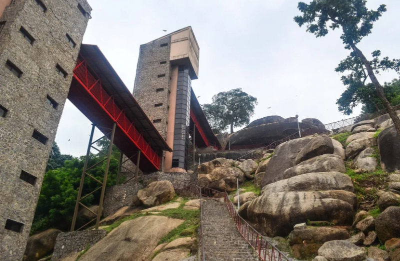
weafrique.com -
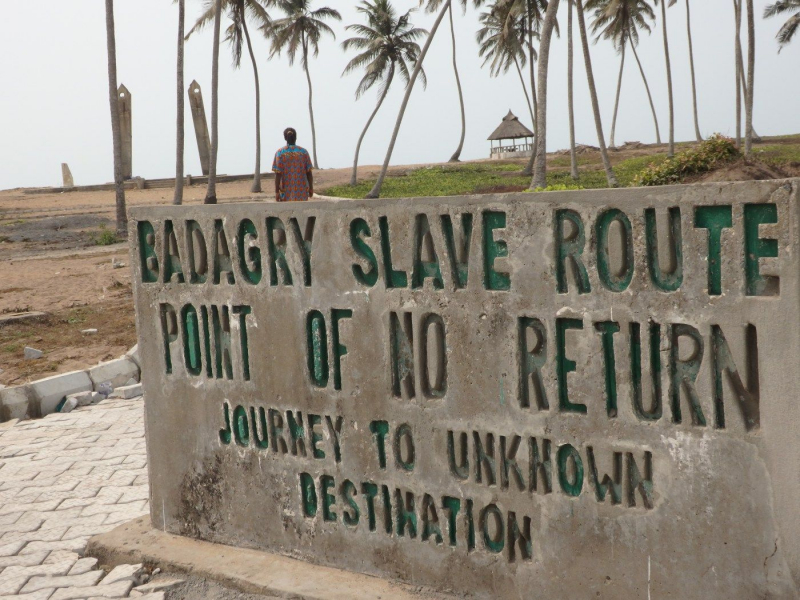
Badagry is a coastal town and Local Government Area (LGA) in the Nigerian state of Lagos. It is located on the north bank of Porto Novo Creek, an inland waterway that connects Lagos (Nigeria's largest city and economic powerhouse) to Benin's capital of Benin (Porto-Novo). The same road connects Lagos, Ilaro, and Porto-Novo, and it borders the Republic of Benin. The municipality has a population of 241,093 according to provisional 2006 census estimates.
Between 1736 and 1851, Badagry evolved as a commercial city on the West African coast, serving as a lagoon and an Atlantic port. Its navigable lakes, creeks, and inland lagoons served as both a means of trade and a security barrier for residents. During the Trans-Atlantic slave trade, the town served as a link between European traffickers on the coast and dealers from the interior.
Badagry is located on Nigeria's southwest coast, flanked to the south by the Gulf of Guinea. It is 43 miles southeast of Lagos and 32 miles west of Seme, a border town in the Benin Republic. It, like Lagos Island, is located on the bank of inland lagoons, a network of creeks, and waterways navigable to Lagos and Porto Novo. The distance between the lagoon and the ocean varies throughout the coast, but it is around a mile in Badagry.
Though the town had a horrible past, it is now a major tourist attraction with monuments, areas of interest, beaches, resorts, slave trade artifacts, and antiquities. The Black Slavery Museum, Gberefun Island (Point of No Return), and the velekete slave market are the top attractions in Badagry. The Badagry Festival, which takes place every August, also allows travelers to learn about the rich culture of the Badagry people.
Location: Lagos State, Nigeria
pinterest.com 
travelwaka.com -
Yankari National Park is a major wildlife park located in Bauchi State, Nigeria's northeastern region. It has an area of around 2,244 square kilometers and is home to various natural warm water springs as well as a diverse range of flora and fauna. Its location in the center of the West African savanna offers it a one-of-a-kind opportunity for tourists and vacationers to observe wildlife in its native habitat. Yankari was established as a game reserve in 1956 before being declared Nigeria's largest national park in 1991. It is the most popular tourist attraction in Nigeria, and as such, it plays an important role in the growth and promotion of tourism and ecotourism in Nigeria. It is also one of West Africa's most prominent eco-tourism locations.
Many global environmental organizations and assistance agencies now advocate ecotourism as a platform for sustainable development. It encourages biological diversity conservation through safeguarding habitats, and its main attractions are the local culture, flora, and animals. Yankari National Park meets these requirements.
Yankari National Park welcomed approximately 20,000 visitors from over 100 countries in 2000. This makes it Nigeria's most popular tourist attraction, and if properly managed, it has the potential to play a big role in the growth and promotion of tourism throughout the country. It is one of West Africa's last surviving locations where wild animals are protected in their native habitats.
Yankari National Park is located in the Sudan Savannah's southern region. It is mostly savannah grassland with some well-developed wooded sections. It is also a region of rolling hills, generally between 200 and 400 meters in elevation. Kariyo Hill, at 640m, is the highest point. During the dry season, the park's greater fauna relies on the Gaji River and its tributaries for survival. This river is the park's only watershed and divides it in two. Marshall calculated that elephants use around 40 square kilometers of the Gaji River Valley during the dry season. This improves the likelihood of spotting elephants during this time of year.
The park's main entrance is located near Mainamaji village, approximately 29 kilometers from Dindima. It is situated in the districts of Duguri, Pali, and Gwana of Alkaleri LGA, Bauchi State. This LGA has a total land area of 7,457.78 square kilometers and a population of 208,202 people.
Location: Bauchi State, Nigeria
allroundafrica.com 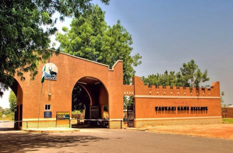
kaynuli.com -
The Ikogosi Warm Springs is a tourist attraction in Ikogosi, a town in Ekiti State, Nigeria's southwestern region. Another cold spring flows alongside the warm spring and meets it at a confluence, each retaining its thermal qualities. These characteristics make spring a popular tourist destination in Nigeria.
Rev. John S. McGee, a Southern Baptist missionary, traveled from his mission center in the nearby Ekiti town of Igede to the source of the hot and cold springs that he had heard about from the Ikogosi people in 1952. He was initially deterred from doing so because of the custom he had heard from the locals. However, with the increased interest in Royal Ambassador work and youth engagement, he felt it would be better employed by constructing a Youth Camp. He raised the issue with the Ekiti Association, and we decided to construct a camp for our R.A.s and G.A.s.
The original buildings were designed and built in the following order by the Baptist Mission architect, Rev. Wilfred Congdon (located at the Baptist Mission in Oshogbo): the swimming pool, fed by the warm springs; a combination dining hall, large kitchen, and storage areas; eight small cabins, each of which could house sixteen people, with sleeping, bath, and toilet facilities; and a Baptist Mission residence.
By 1972, all of the buildings at the original Nigerian Baptist Convention camp had been built, and the camp was being visited on a regular basis by groups of Baptist adolescents and adults, as well as missionaries and other people on vacation/"local leave."
Location: Ekiti State, Nigeria
guardian.ng 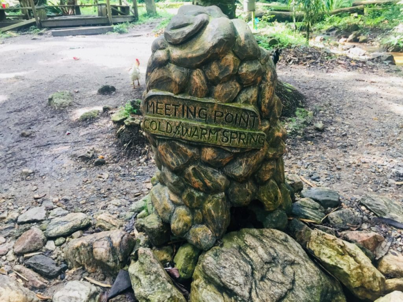
diusorodiakosa.com -
The Erin-Ijesha Waterfall (also known as Olumirin Waterfall) is in Erin-Ijesha. It is a tourist attraction in the local government area of Oriade, Osun State, Nigeria. One of Oduduwa's daughters discovered the waterfalls in 1140 AD. The Nation, on the other hand, claims that "Olumirin waterfall was found by hunters in 1140 AD." According to another story, the tourist site was discovered during the migration of Ife people to Erin-Ijesa by a woman named Akinla, the founder of Erin-Ijesha town and the granddaughter of Oduduwa.
Erin Ijesha (Olumirin) is a seven-step waterfall in the Nigerian state of Osun. Each step of the cascade features a flowing fountain, emphasizing the mystical character of the location. Olumirin is in Osun state's Erin-Ijesha, Oriade local government. The cliff, which is tall, is located within the Erin-Oke, Erin-Ijesha, and Erinmo community axes.
Erin Ijesha Waterfalls is one of the most famous historical sites in Nigeria. During the annual Osun-Osogbo Festival and Culture, Olumirin waterfall attracts guests from all over the world. The waterfall is revered by the locals as a spiritual spot and a means of cleaning their souls. Previously, festivals and sacrifices were held at the location. The water level remains consistent throughout the year. The crisp air and fresh atmosphere, the tranquility and calm, and the excitement of climbing and finding are just a few of the reasons why Olumirin waterfall is a popular tourist destination.
Location: Osun State, Nigeria
pulse.ng 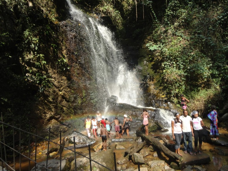
howng.com -
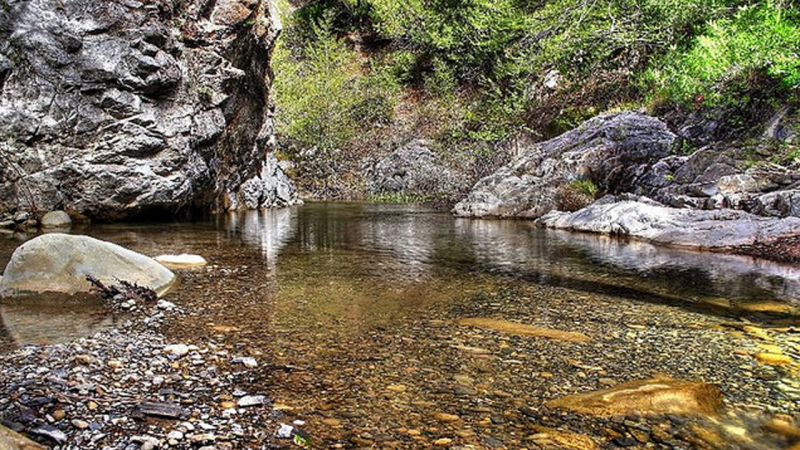
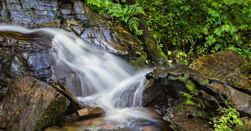
Gurara Waterfall is in Gurara, a local government area of Niger State, in North Central Nigeria. The waterfall is around 30 meters tall and is located on the Gurara River along the Suleja-Minna Road.
According to oral history, Gurara Waterfall was discovered in 1745 by a Gwari hunter named Buba before being discovered by Europeans in 1925 as a vacation resort. Prior to the European discovery of the waterfalls, Gurara Waterfall was revered by the people who lived in the surrounding settlements. According to oral legend, the Gurara Waterfalls and the Gurara River were named after two deities named Gura and Rara.
Despite its troubled history, Gurara Waterfall is a popular tourist destination in Nigeria. There have recently been plans to develop it into a resort, complete with a recreation center and a seven-star hotel.
Regarded as one of the most famous historical sites in Nigeria, Gurara Waterfall is popular with both foreigners and Nigerians who come to swim, picnic, and go bird watching. The waterfall reaches its highest point between April and November, and its lowest point between January and March. Swimming in the river is most safe during the dry season, which runs from January to March when the water is clear and calm.
Location: Gurara, Niger State, Nigeria
commons.wikimedia.org 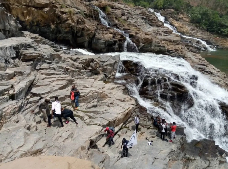
sagetravels.com -
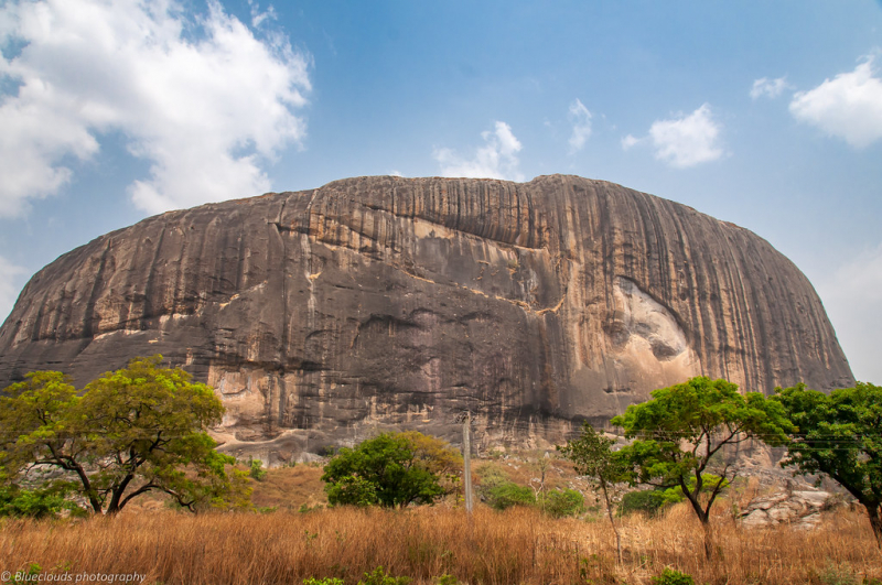
Zuma Rock is a large natural monolith, or inselberg, in Niger State, Nigeria, formed by an igneous intrusion of gabbro and granodiorite. It is located immediately west of Nigeria's capital Abuja, on the main road from Abuja to Kaduna near Madala, and is known as the "Gateway to Abuja from Suleja". Zuma Rock towers over its surroundings by approximately 300 meters (980 feet).
Zuma Rock is quite tall by Nigerian geography standards. It is more than four times taller than NECOM House (Lagos' highest building in 1979) and taller than Aso and Olumo rocks combined.
Zuma Rock appears on the 100 naira note. During intertribal warfare, the Gbagyi people used it as a defensive retreat against invading neighboring tribes. The Zuba people regard the distance between Zuma Rock and other rocks as a kind of respect shown by the other mountains to Zuma Rock for its regal presence in the area.
Tourists can visit Zuma Rock all year because the weather is pleasant and warm. If you want to experience the stunning Zuma Rock fire, which only happens during rain, the best time to visit Zuma Rock is between April and October. This has remained one of the wonders to behold over time.
Location: Niger State, Nigeria
flickr.com 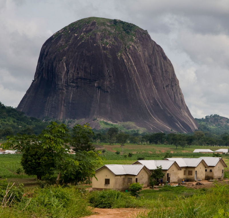
traveloffpath.com