Top 10 Most Mysterious Underwater Buildings

A world lies deep beneath the sea's surface, waiting to be explored. So far, less than 10% of the ocean floor and less than 1% of the ocean itself have been ... read more...explored. Many civilizations developed and vanished with the passage of time. They are sometimes submerged on purpose as a result of engineering operations. In other cases, natural events such as earthquakes submerge them underwater. However, archaeologists continue to discover monuments, inscriptions, and buried underwater constructions. Find out with Toplist the most mysterious underwater buildings discovered.
-
One of the most mysterious underwater buildings we would like to introduce to you is the Yonaguni Monument. It (Japanese: 与那国島海底地形, "Yonaguni Island Submarine Topography"), also known as the "Yonaguni (Island) Submarine Ruins," is a submerged rock formation off the coast of Yonaguni, Japan's southernmost Ryukyu Islands. It is located about a hundred kilometers east of Taiwan.
Masaaki Kimura, a marine geologist, believes the formations are man-made stepped monoliths. These assertions have been labeled as pseudoarchaeological. Neither the Japanese Agency for Cultural Affairs nor the Okinawa Prefecture government considers the features as important cultural assets, and neither government agency has conducted research or preservation work on the site. Kimura first calculated that the monument was at least 10,000 years old, dating it to a time when it would have been above water, and so concluded that the site could represent a vestige of the mythological lost continent of Mu. He amended this estimate and dated it to 2,000 to 3,000 years ago in a study submitted to the 21st Pacific Science Congress in 2007 because the sea level was near to current levels at the time. He proposed that after construction, tectonic action sank it below sea level. This, according to archaeologist Richard J. Pearson, is implausible. Kimura claims to be able to recognize a pyramid, castles, roads, monuments, and a stadium. He further indicated that he believes the structures are Yamatai cultural relics.
Supporters of artificial origin, such as Graham Hancock, claim that, while many of the traits visible at Yonaguni can be found in natural sandstone formations all over the world, the concentration of so many unusual structures in such a small region is exceedingly implausible. They also point to the lack of loose blocks on the formation's flat parts, which would be expected if they were generated entirely by natural erosion and fracturing. According to Robert M. Schoch, who believes the monument was constructed geologically, the rocks are scoured by strong currents.
Location: Japan
Depth: 26m
Dating: nearly 10,000 years old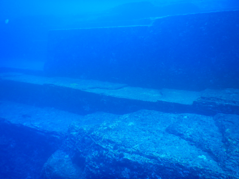
en.wikipedia.org 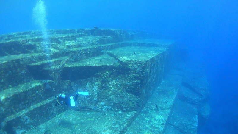
davemillscontinentaldrift.com -
Shī Chéng (Chinese: 狮城, meaning 'Lion City') is an ancient underwater city located beneath Qiandao Lake in China's Zhejiang Province. The Chinese government flooded the city in 1959 for the purpose of industrialization after a hydroelectric dam was necessary for the province of Zhejiang. According to the evidence discovered, the lost city was inhabited for centuries but is now mostly used by tourists and diving specialists as an underwater tourist attraction.
On government directives, Shī Chéng was purposefully flooded to make room for a hydropower dam. As a result of the project, approximately 300,000 people were relocated. The former residents were linked to the Lion City by genealogy and culture. Shī Chéng was said to be the most important Chinese city that has been well preserved. Being 131 feet underwater saved much of its dwellings, temple structures, and paved roadways. It was so shielded from wind, rain, and sun harm. The city has five entrance gates rather than the typical four. Stone architecture may be traced back to the Ming and Qing eras. The streets of Shī Chéng have 265 archways with preserved stonework dating from 1777, while the city walls date from the 16th century. When the city was rediscovered in 2001, the Chinese government prepared an expedition to study the ruins of the vanished metropolis. The Chinese National Geography issued images and graphics in 2011, sparking curiosity among the general public and researchers to investigate.
Location: Qiandao Lake, Zhejiang, China
Depth: 26 to 40m
Dating: nearly 1,400 years old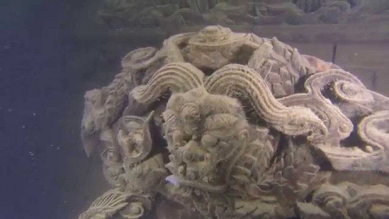
thearchaeologist.org 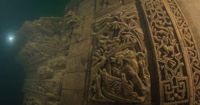
thearchaeologist.org -
Dwarka, an ancient Indian city, is revered in Hindu culture as the great and beautiful city of Krishna. Today, Dwarka is one of Hinduism's seven sacred places, with pilgrims flocking there each year to adore Krishna. Dwarka, an ancient Indian city, is claimed to have sunk into the Arabian Sea. Underwater archaeologists are now searching for the foundations of its city walls in order to verify its existence.
The hunt for the underwater portion of the island began in the 1930s, with the first archaeological excavation taking place in 1963. During the second dig, led by an underwater archaeologist, numerous ancient relics were discovered, as well as the submerged remnants of the ancient Dwarka. Excavations in the Dwarkadhish Temple Complex in 1979 discovered three temple remains. At Dwarka, eight settlements can be identified. The first settlement was established in the 15th century B.C. The first one, made in the 10th century B.C., was submerged or washed away, as was the second one. After a long absence, the third village was established in the first century B.C./A.D. as the Red Polished Ware and copper coins known as Karshapanas imply.
Underwater archaeological explorations in Dwarka, Bet Dwarka, and Somnath seas were conducted virtually every year between 1983 and 1992. Subsequent underwater investigations off Dwarka in water depths ranging from 4 to 12 meters have revealed the presence of a number of submerged stone building blocks such as remains of walls, pillars, and bastions, as well as stone anchors of various types such as three-holed, prismatic, and triangular.
Dwarka has an area of around 9,80,000 sq. m area was examined off Samudranarayana Temple, with sea depths ranging from 3 to 12 m. The Late Indus type seal, chert blades, an inscribed votive jar, 3-holed stone anchors, a stone mold, an Olpin with loop handle, and a sprinkler-neck in pottery are all essential antiquities for dating and defining the cultural sequence of the sunken towns of Dwarka and Bet Dwarka. The proposed chronological sequence based on antiquities is supported by various ceramic wares.
Location: on the western shore of the Okhamandal Peninsula
Depth: 3 to 12m
Dating: 3,000 to 6,000 years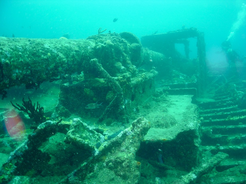
theyucatantimes.com 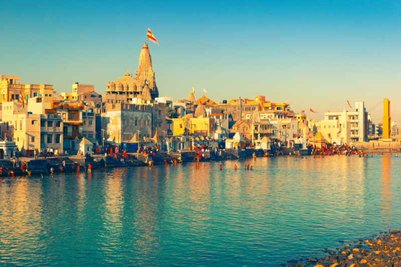
The Dwarakadhish temple at Dwarka -macrotraveller.com -
One of the most mysterious underwater buildings is the Cuban Underwater City. When a team of explorers was on an exploration and survey mission off the western coast of Cuba about two decades ago, their sonar equipment picked up a strange collection of stone structures lying some 650 meters below the surface. The constructions appeared to be symmetrically ordered stones suggestive of urban development and appeared to be completely similar to the barren 'desert' of the ocean floor.
According to Avis Lee (a Mysteries Unsolved writer), the ADC team was studying the Cuban waters with modern Sonar equipment when they found unusual boulders and granite formations on the seafloor. The objects were symmetrical and geometrical stone shapes, unlike what you'd expect to see among urban civilization remnants. The search area was 2 square kilometers in size, with depths ranging from 2000 to 2460 feet.
The researchers despatched an underwater visual robot to re-record photographs of the structures in higher quality and clarity for a closer look. The latest images revealed somewhat pyramidal and circular formations formed of large smooth stones that resembled hewn granite. Pyramids supposedly measured 8 feet by 10 feet in height and width. Some rocks were stacked on top of each other, whereas others were not and were located much further away. Sonar pictures of symmetrical and geometric stone structures resembling an urban complex were originally obtained in early 2001, encompassing an area of 2 square kilometers (200 hectares) at depths ranging from 600 meters (2,000 ft) to 750 meters (2,460 ft). The finding was reported by Pauline Zalitzki, a maritime engineer, and her husband Paul Weinzweig, proprietors of Advanced Digital Communications, a Canadian company working on an exploration and survey mission with the Cuban government. The team returned to the site using an underwater remotely controlled vehicle, which captured sonar photos of numerous pyramids and circular structures constructed of enormous, polished chunks of stone that resembled hewn granite. Zalitzki stated "It's a really wonderful structure which really looks like it could have been a large urban center. However, it would be totally irresponsible to say what it was before we have evidence."
Location: Pinar del Río, Cuba
Depth: 700m
Dating: 6,000 years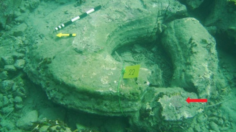
cnn.com 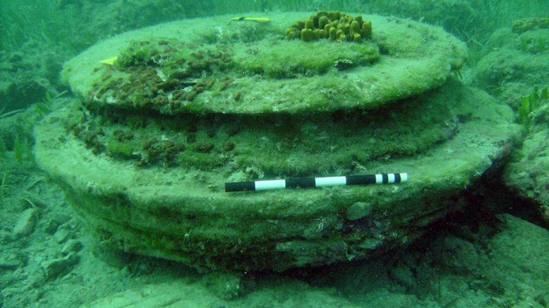
science.org -
Another mysterious underwater building is the underwater city of Port Royal. Port Royal is a village in southern Jamaica located at the end of the Palisadoes, near the mouth of Kingston Harbour. It was founded by the Spanish in 1494 and was once the greatest city in the Caribbean, serving as the center of shipping and commerce in the Caribbean Sea by the late 17th century. It was destroyed by an earthquake and tsunami on June 7, 1692, resulting in the development of Kingston, which is currently Jamaica's main metropolis. Severe hurricanes have frequently wreaked havoc on the region. Unlike any other historical landmark that underwent construction, remodeling, abandonment, and collapse, Port Royal was carefully preserved in the waters exactly as it was on the day of the earthquake.
After the earthquake on June 7, 1692, it flooded, drowning two-thirds of the city. On June 7, 1692, a massive earthquake struck the city, destroying most of its northern sector as well as many of the town's residences and other structures. Many of the forts were also destroyed; Fort Charles survived, but Forts James and Carlisle collapsed into the sea, Fort Rupert became a massive body of water, and Morgan's Line was severely damaged.
The earthquake liquefied the sand beneath Port Royal, causing it to spill into Kingston Harbour. The water table was generally only two feet down before the impact, and the settlement was built on a layer of water-saturated sand 65 feet (20 meters) thick. This type of terrain did not give a solid foundation for constructing a complete community. Scientists and underwater archaeologists now agree that the earthquake was severe and that liquefaction caused much of the damage at Port Royal.
Location: Jamaica, Kingston
Depth: 15m
Dating: from 1692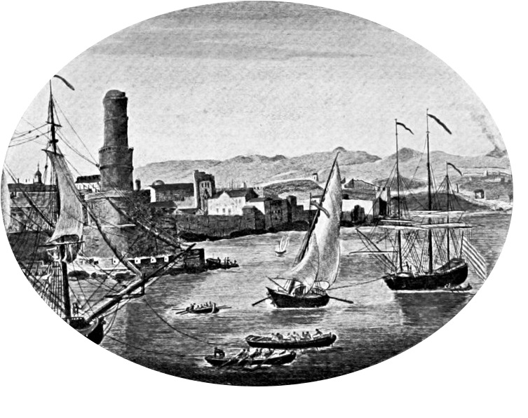
An illustration of pre-1692 Port Royal -en.wikipedia.org 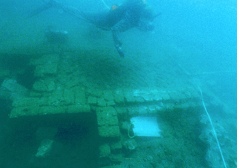
sci.news -
One of the most mysterious underwater buildings is the Ancient “Stonehenge” under Lake Michigan. Lake Michigan is one of North America's five Great Lakes. After Lake Superior and Lake Huron, it is the second-largest Great Lake by volume (4,900 km3) and the third-largest by surface area (58,030 km2). To the east, its basin joins Lake Huron's through the 3+1⁄2 miles (5.6 kilometers) wide, 295 feet (90 meters; 49 fathoms) deep Straits of Mackinac, giving it the same surface height as its eastern counterpart; the two are essentially one lake. The only one of the Great Lakes that is entirely within the United States is the largest of the Great Lakes. Located south of Lake Superior, it is linked to Lake Huron via the Mackinac Strait, as well as the Mississippi River system via the Chicago Canal. Hydrographically, Michigan, and Huron form a single system, although geographically, they are considered different lakes.
Underwater archeologist Mark Holley was searching for shipwrecks on the bottom of Lake Michigan's Grand Traverse Bay in 2007, according to Brianna Randall (a discover magazine author). Instead, he came across a series of stones supposed to have been built by ancient humans, including one with what appeared to be a mastodon carving. The subsequent press presentation generated buzz about a "Stonehenge-like structure" discovered beneath Lake Michigan.
According to Space (an Earth Chronicles News writer), they believe that this edifice, comparable to Stonehenge, is about 9000 years old, but there is an amazing engraving in the shape of the mastodon, which went out more than 10,000 years ago, on one of the stones. The exact coordinates of the discovery are still unknown; this restriction was imposed by local Indian tribes that do not want visitors and curious on their land.
Great sheets of glacial ice extended south from the North Pole at the time these stone constructions were created, and water levels were much lower than they are today. The Great Lakes were up to 300 feet deeper than they are now, revealing miles more land than we see today.
Location: Lake Michigan, United States
Depth: 12m
Dating: 9000 years old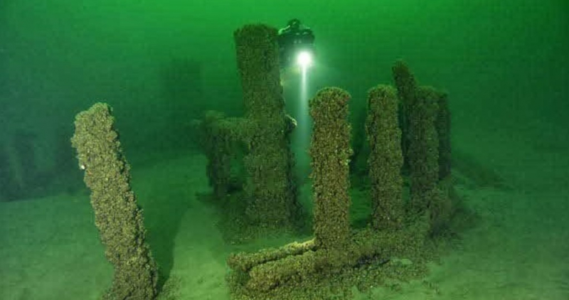
themorbidlibrary.com 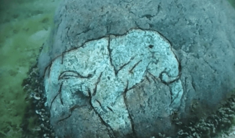
tinhhoa.us -
Another mysterious underwater building we would like to introduce to you is the Mound in the sea of Galilee. Scientists found the discovery by mistake in 2003 when surveying the lake's bottom with sonar, but their findings were only recently published. Israeli researchers led by Prof. Shmulik Marco of Tel Aviv University discovered a third-century BCE stone mound in the Sea of Galilee, which was recently described in the Journal of Nautical Archaeology (Lake Kinneret to Israelis).
Israeli archaeologists are perplexed by a massive cone-shaped structure sunk beneath the waves of the Sea of Galilee, writes Faisal O'Keefe in Cities from Greenprophet. A mystery cone-shaped building on the bottom of the Sea of Galilee, twice the diameter of Stonehenge and weighing more than ten elephants, is defying archaeologists to determine its purpose and antiquity.
"We just bumped into it," says Shmuel Marco, a Tel Aviv University geophysicist who worked on the research. They said that usually, the bottom of the lake was quite smooth. They were surprised to find a large mound. Initially, they hadn't realized the importance of this but they consulted with a couple of archaeologists, and they said it looked like an unusually large Bronze Age statue.
“The shape and composition of the submerged structure do not resemble any natural feature. We, therefore, conclude that it is man-made and might be termed a cairn,” the researchers write, implying that the subaquatic bulge may have designated a burial location. The researchers compare their find to other ancient, megalithic structures discovered near the Sea of Galilee, such as the monumental site of Khirbet Beteiha, which is located 19 kilometers northeast of theirs. That structure is made up of three concentric stone rings, the largest of which measures 184 feet in diameter. If their assumption about a third-millennium BCE date is right, this structure would lie about a mile north of an ancient city called "Bet Yerah" or "Khirbet Kerak."
Location: the Sea of Galilee in Israel
Depth: 9m
Dating: 2,000 - 12,000 years old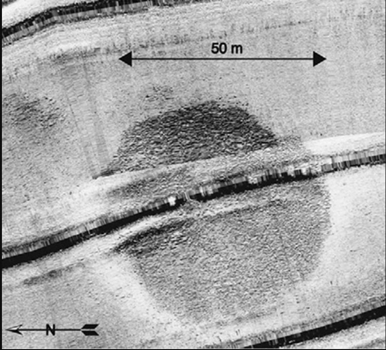
greenprophet.com 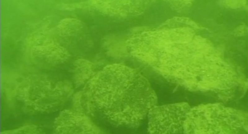
israel21c.org -
The Bimini Road, also known as the Bimini Wall, is an underwater rock formation off the coast of North Bimini Island in the Bahamas. The Road is a 0.8-kilometer-long (0.50-mile-long) northeast-southwest linear feature made up of roughly rectangular to subrectangular limestone blocks. There have been several assertions that this feature is a wall, road, pier, breakwater, or other man-made construction. However, convincing evidence or justifications for such an origin are absent.
On September 2, 1968, Joseph Manson Valentine, Jacques Mayol, and Robert Angove were diving in three fathoms (5.5 meters or 18 feet) of water off the northwest coast of North Bimini island when they came across an extensive "pavement" of what were later discovered to be noticeably rounded stones of varying size and thickness. This stone pavement was discovered to create a northeast-southwest linear feature known as the "Bimini Road" or "Bimini Wall." Geologists, amateur archaeologists, professional archaeologists, anthropologists, marine engineers, many divers, and others have visited and examined the Bimini Road. In addition to the Bimini Road, researchers discovered two other "pavement-like" linear features parallel to and shoreward the Bimini Wall.
The Bimini Wall and two shoreward linear features are made up of flat-lying, tabular, rectangular, subrectangular, polygonal, and irregular blocks. The uniformity and rectangularity of the blocks constituting these characteristics are substantially exaggerated in descriptions of the Bimini Road seen in numerous books and articles. The largest of the three linear features, the Bimini Road, is 0.8 km (0.50 mi) long and has a northeast/southwest trend with a prominent hook at its southwest end. It is made out of stone blocks ranging in size from 3-4 meters (9-12 feet) horizontally to 2-3 meters on average (6-9 feet). The larger blocks have complementary edges, which the smaller blocks do not. The two narrower and shorter, roughly 50 and 60 m (160 and 200 ft)-long linear structures lying shoreward of the Bimini Road are made up of smaller tabular stone blocks with maximum horizontal breadths of only 1-2 m (3-7 ft). The bricks that make up these pavements have rounded corners and resemble giant loaves of bread. The blocks are made of "beach rock," which is a limestone consisting of carbonate-cemented shell hash. "Beachrock" is indigenous to the Bahamas. The very rounded structure of the blocks that make up the Bimini Road shows that biological, physical, and chemical processes have eroded a significant thickness of their original surface. Given the extent to which these blocks have been eroded, it is exceedingly unlikely that any original surface features, like tool marks and inscriptions, would have survived.
Although it is usually thought to be a naturally occurring geological feature, others claim that the formation is the remains of an ancient road, wall, or other purposely created feature due to the odd arrangement and shape of the stones. Others who believe the Bimini undersea creation is man-made rather than natural beachrock include naturalist Joseph Manson Valentine, linguist Charles Berlitz, psychologist Greg Little, anthropologist R. Cedric Leonard, and French marine engineer Dimitri Rebikoff.
Location: near North Bimini island in the Bahamas
Depth: 5.5m
Dating: 2000-4000 years old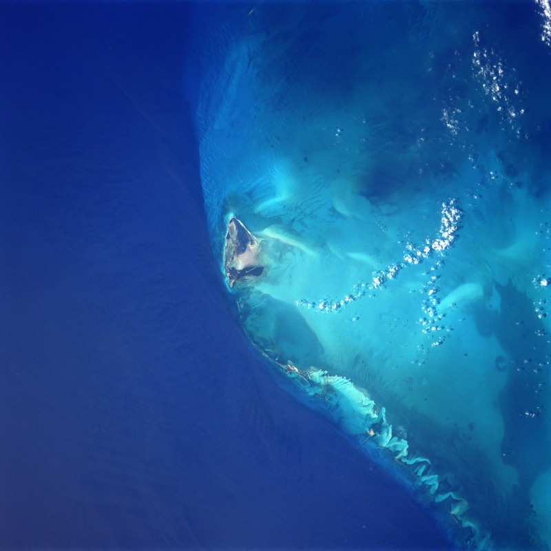
Satellite picture of North Bimini Island -en.wikipedia.org 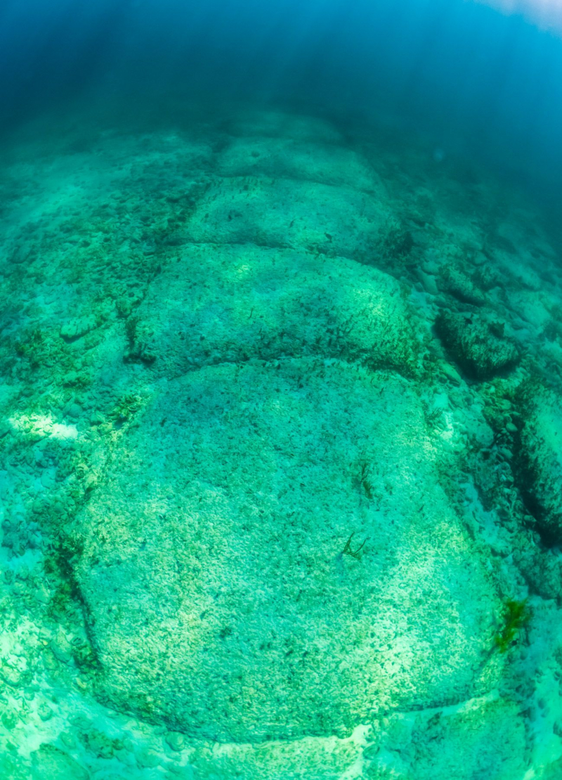
sandals.com -
Pavlopetri, an underwater city off the coast of southern Laconia in Peloponnese, Greece, is roughly 5,000 years old, making it one of the oldest submerged lost towns in the Mediterranean. Pavlopetri is rare in that it has an almost complete town plan, complete with streets, buildings, and tombs.
Pavlopetri, discovered in 1967 by Nicholas Flemming and mapped in 1968 by a team of archaeologists from Cambridge, is located on the Peloponnese peninsula between the islet of Pavlopetri and the Pounta coast of Laconia. On the island of Elafonisos, the location lies northeast of the village. The archeological site, as well as the islet and surrounding sea area, are located in the municipality of Elafonisos, on the former "Onou Gnathos" peninsula.
The ruins were originally dated to the Mycenaean period, 1600-1100 BCE, but subsequent studies revealed an older habitation date of no later than 2800 BCE, so it also includes early Bronze Age, Middle Minoan, and transitional material. The village was believed to have been flooded in 1000 BCE by the first of three earthquakes that struck the area. Because the land never re-emerged, it was never built on or damaged by agriculture. The settlement plan has not changed over the centuries, despite being eroded. Boats dragging anchors, as well as tourists and souvenir hunters, pose a threat to the monument.
The 2009 fieldwork was extensive in order to map the site. It is the first three-dimensional digital survey of a submerged community. Recent work has benefited from sonar mapping techniques developed by military and oil exploration groups. At least 15 buildings in the city are buried in 3 to 4 meters (9.8-13.1 ft) of water. Only the most recent findings in 2009 span 2.2 acres.
Pavlopetri is part of UNESCO's underwater cultural heritage, as specified in the UNESCO Convention on the Protection of the Underwater Cultural Heritage. The UNESCO Convention on the Protection of Underwater Cultural Heritage protects all evidence of human existence underwater that are one hundred years or older. The purpose of this convention is to prevent the damage or loss of historic and cultural information, as well as looting. It provides an international legal framework to assist state parties in protecting their undersea cultural assets.
Location: the coast of southern Laconia in Peloponnese, Greece
Depth: 4m
Dating: 5000 years old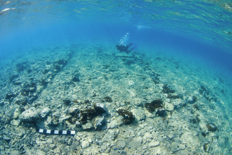
researchgate.net 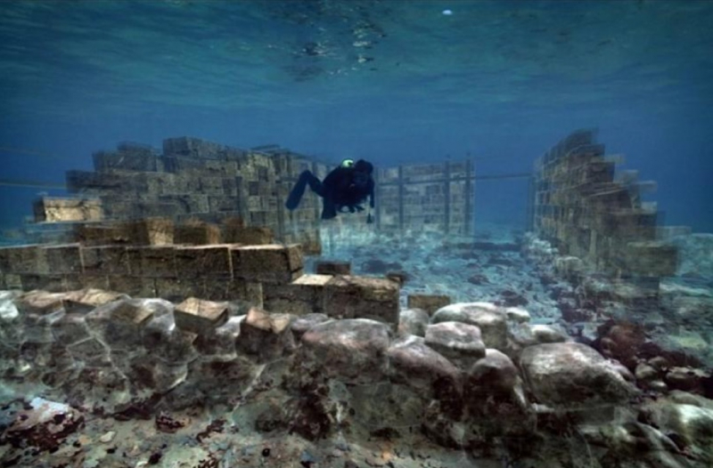
secret-greece.com -
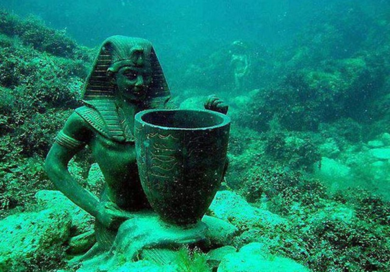
Heracleion, also known as Thonis in Egyptian and sometimes referred to as Thonis-Heracleion, was an ancient Egyptian port city located near the Canopic Mouth of the Nile, approximately 32 kilometers (20 miles) northeast of Alexandria on the Mediterranean Sea. It was swamped, and its remnants are now lying in Abu Qir Bay, 2.5 kilometers (1.6 miles) off the shore, beneath 30 feet (9.1 meters) of water, near Abukir. Heracleion housed the shrine of Neith of Sais. A stele discovered on the site suggests that the city was known by both its Egyptian and Greek names at some point in its history. Heracleion's legendary beginnings date back to the 12th century BC, and it is recorded by ancient Greek historians. Its significance developed especially during the last days of the pharaohs.
Many antiquity chroniclers, including Herodotus, Strabo, and Diodorus, mention Thonis. According to Herodotus, Paris, and Helen of Troy visited the city before the Trojan War began. They sought safety there in their retreat from the jealous Menelaus, but were turned down by Thonis, the Nile's watchman. A large temple was built on the site where Heracles originally arrived in Egypt, according to Herodotus. The myth of Heracles' arrival led to the Greeks naming the city Heracleion rather than its original Egyptian name Thonis.
Heracleion was initially developed on two adjacent Nile Delta islands. It was crossed by canals that led to a multitude of bays and anchorages. Ferries, bridges, and pontoons connected its wharves, temples, and tower-houses. The city was an emporium (trading port), and by the Late Period, it had become the country's major port for international trade and tax collection. It had a sister city, Naucratis, which was a trading port 72 kilometers (45 miles) up the Nile.
The city was weakened throughout time by a mix of earthquakes, tsunamis, and rising sea levels. The ground on which the center island of Heracleion was built succumbed to soil liquefaction at the end of the second century BC, most likely as a result of a catastrophic flood. The firm clay dissolved quickly, and the buildings fell into the river. A few residents remained during the Roman era and the commencement of Arab domination, but by the end of the seventh century AD, Heracleion had vanished beneath the water.
egypttoday.com 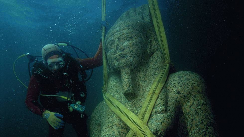
weather.com