Top 10 Rivers That Flow Through Europe’s Capital Cities

Most of the world's major cities were built on or around areas of freshwater. Ancestors chose to settle near these areas as rivers were a means of supplying ... read more...drinking water for their families and beasts, as a food supply, used for irrigating crops and as a means of transport in order to aid commerce. Shown below is a list of the rivers that flow through Europe's capital cities.
-
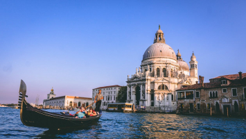
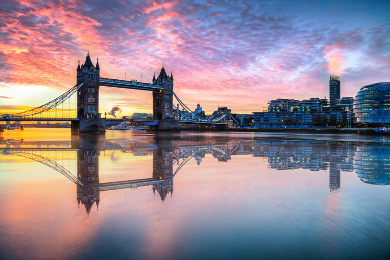
One of the most fascinating and beautiful rivers in the world is the Thames. From springs in Gloucestershire, via rural and urban regions, to London, and then along the massive tidal estuary into the North Sea, its 215 miles run from source to sea. The River Thames runs through London, and many of the city's top sights, including Big Ben and Westminster Palace, the Tower Bridge and Tower of London, and the London Eye, are located right along the river's banks.
From a tiny trickle at the source to an estuary several miles wide, the River Thames has varying characteristics and offers a wide range of scenery and experiences. The Thames has been divided into five sections, three non-tidal and two tidal. About Upper Thames, the first 88 miles from the source to Mapledurham, near Pangbourne, Berkshire. In Middle Thames, a stretch of 38.5 miles includes Reading, Henley-on-Thames, and Windsor. From Old Windsor to Teddington, the final 17.3 miles in which the river widens as it passes through Staines and Walton-on-Thames before the final lock at Teddington. About the upper Tideway, a short stretch (11 miles) of the tidal river passes through the heavily populated London Boroughs of Richmond and Hammersmith & Fulham as far as Putney Bridge. In Central Tideway and Estuary, probably the most famous 60 miles from Putney passing the Houses of Parliament, Tower Bridge, London Docks, and London Gateway before entering the North Sea.
Location: London, England
Park Grand London Lancaster Gate 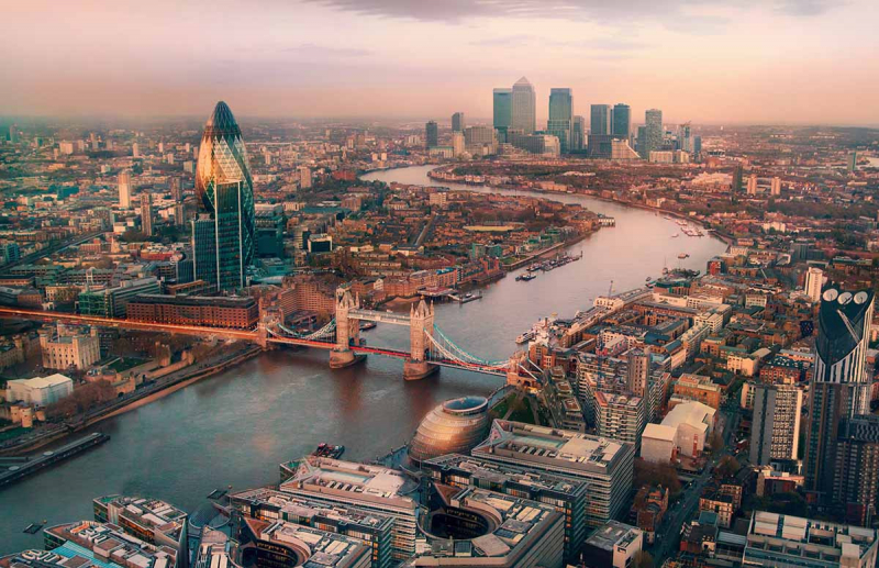
London x London -
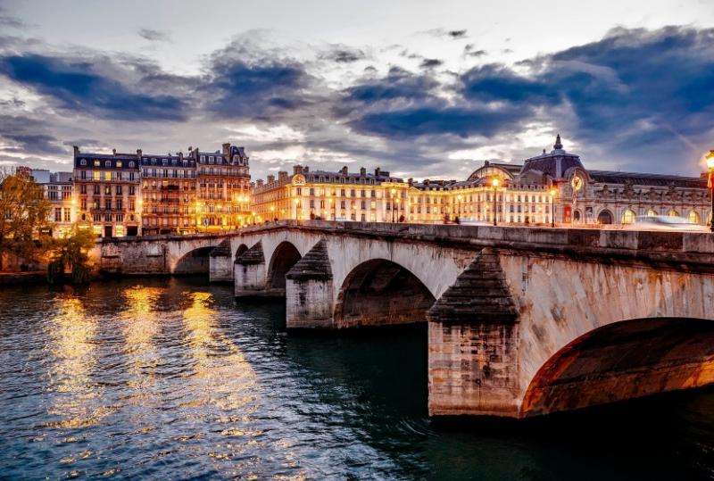
Running through the very heart of Paris, the Seine is the beating heart of the City of Light. Browse the bouquinistes along its banks or simply enjoy the views from its many beautiful bridges. The Seine is a 777-kilometer-long (483 mi) river in northern France. Its drainage basin is in the Paris Basin (a geological relative lowland) covering most of northern France. It rises at Source-Seine, 30 kilometers northwest of Dijon in northeastern France in the Langres plateau, flowing through Paris and into the English Channel at Le Havre. It is navigable by ocean-going vessels as far as Rouen, 120 kilometers from the sea. Over 60 percent of its length, as far as Burgundy, is negotiable by large barges and most tour boats, and nearly its whole length is available for recreational boating; excursion boats offer sightseeing tours of the river banks in the capital city, Paris.
The two banks of the Seine are referred to as La Rive Gauche (the Left Bank) and a La Rive Droite (the Right Bank). Both banks are listed as UNESCO World Heritage Sites and they each offer their own distinct flavor of the Parisian experience.
Location: Paris, France
Avalon Waterways Blog 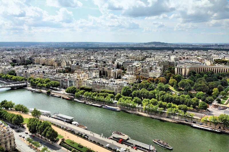
Britannica -
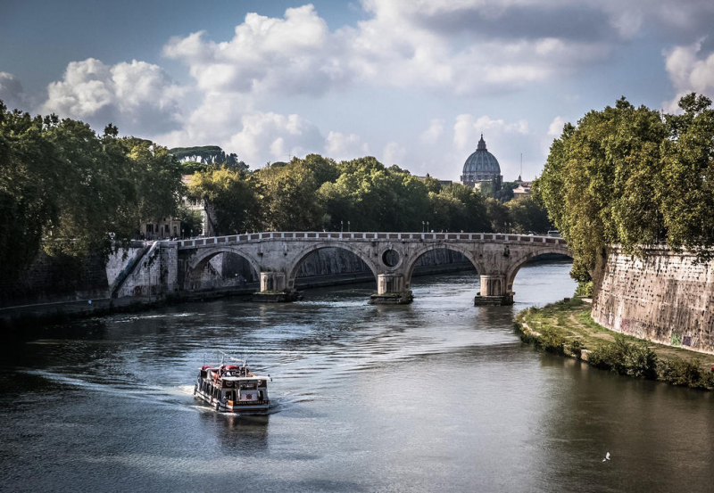
Northwest Italy's Apennine Mountains are the source of the Tiber River. Before draining into the Tyrrhenian Sea on Italy's west coast, it winds south over the heart of the peninsula, through Rome, and continues farther south where it joins the Aniene River.
Two different springs on Mount Fumaiolo, 1,268 miles above sea level, which drain water from a subterranean aquifer, are the river's source. The Tiber is the third-longest river in Italy with a length of 252 miles. Its basin is 6,709 square miles in size. The river's depth ranges from 7 to 20 feet. Rome is located around 15 miles inland from the Tiber River's mouth at the Tyrrhenian Sea.
Today, the river still provides Rome with fresh water, and there are many walking and biking trails along the riverbanks. Water has always been a strong connecting point for Romans for its cleansing and renewing properties. In fact, many Romans dive into the river as a New Year's Day tradition.
Location: Rome, Italy
Spotter Travel 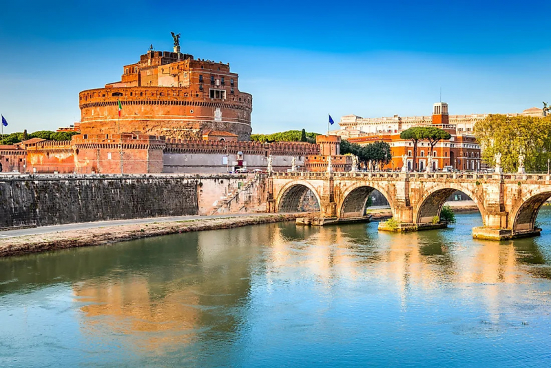
World Atlas -
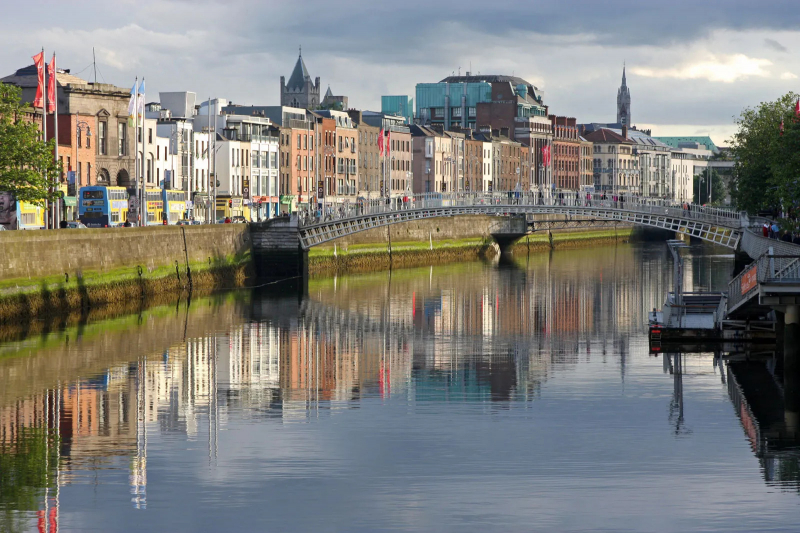
The River Liffey is a river in eastern Ireland that ultimately flows through the center of Dublin to its mouth within Dublin Bay. Its major tributaries include the River Dodder, the River Poddle, and the River Camac. The river supplies much of Dublin's water and supports a range of recreational activities.
The Liffey rises in the Liffey Head Bog between the mountains of Kippure 742 meters and Tonduff 642 meters in the northern section of the Wicklow Mountains, forming from many streamlets near the Sally Gap. It flows for 132 km through counties Wicklow, Kildare, and Dublin before entering the Irish Sea at its mouth at the midpoint of Dublin Bay, on a line extending from the Baily lighthouse to the Muglin Rocks. It crosses from County Wicklow into County Kildare at Poulaphouca and from County Kildare into County Dublin at Leixlip, with the greatest part of its length being in Kildare.
The Liffey system includes dozens of smaller rivers and more than 100 named streams. Early tributaries include the Ashdown Brook, Shankill River, Ballylow Brook, Brittas River, and Woodend Brook. The substantial King's River, which formerly joined the Liffey near Blessington, and may in fact have held the larger flow, now merges in within Poulaphouca Reservoir. Great to walk on either side taking in the atmosphere of pubs, cafes, restaurants, and shops. Lots of Bridges to choose from crosses and great architecture.
Location: Dublin, Ireland
Britannica 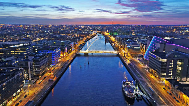
iStock -
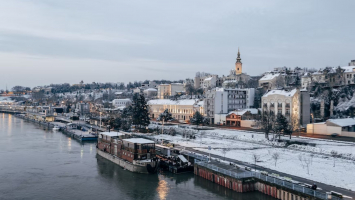
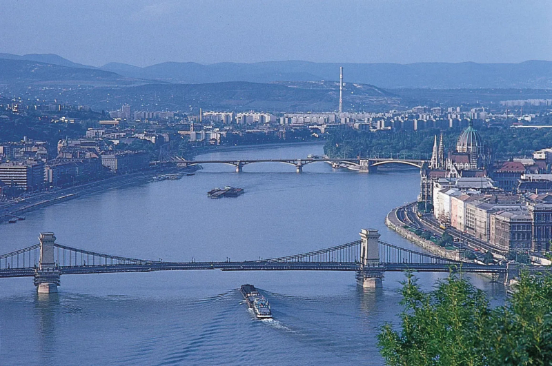
The Danube originates in the Black Forest of Germany, at the confluence of the Brigach and Breg rivers. The Danube basin is measured from the region of Donaueschingen where the two rivers mentioned above meet. The river is 2850 km long, flows through many countries of Central and Eastern Europe, and empties into the Black Sea.
The Danube flows through the following countries: Germany, Austria, Slovakia, Hungary, Croatia, Serbia, Bulgaria, Romania, Moldova, and Ukraine. The Danube originates 1.4 Km east of the durch from Donaueschingen and is joined by the Brigach and Breg rivers. The Danube played a vital role in the settlement and political evolution of central and southeastern Europe. Its banks, lined with castles and fortresses, formed the boundary between great empires, and its waters served as a vital commercial highway between nations. The river’s majesty has long been celebrated in music. In its middle course, the Danube looks more like a flatland river, with low banks and a bed that reaches a width of more than one mile.
Location: Budapest, Hungary
Britannica 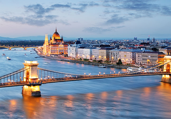
Riviera Travel -
Moskva is the largest river in the capital, sharing its name with the city. Its source is close to the town of Mozhaysk in the Moscow Region. It then flows through Moscow and into the Oka river. It stretches to 473 kilometers in length, with over 80 kilometers flowing through the capital. There are over 40 berths inside the city on the Moskva river.
The Moskva is a river running through western Russia. It rises about 140 km west of Moscow and flows roughly east through the Smolensk and Moscow Oblasts, passing through central Moscow. About 110 km southeast of Moscow, at the city of Kolomna, it flows into the Oka, itself a tributary of the Volga, which ultimately flows into the Caspian Sea. There is a fleet of river ice-breaker cruisers that ply routes from moorings at the Hotel Ukraine and Gorky Park to the Novospassky Monastery and back. The duration of trips ranges from 1.5 to 3 hours.
Location: Moscow, Russia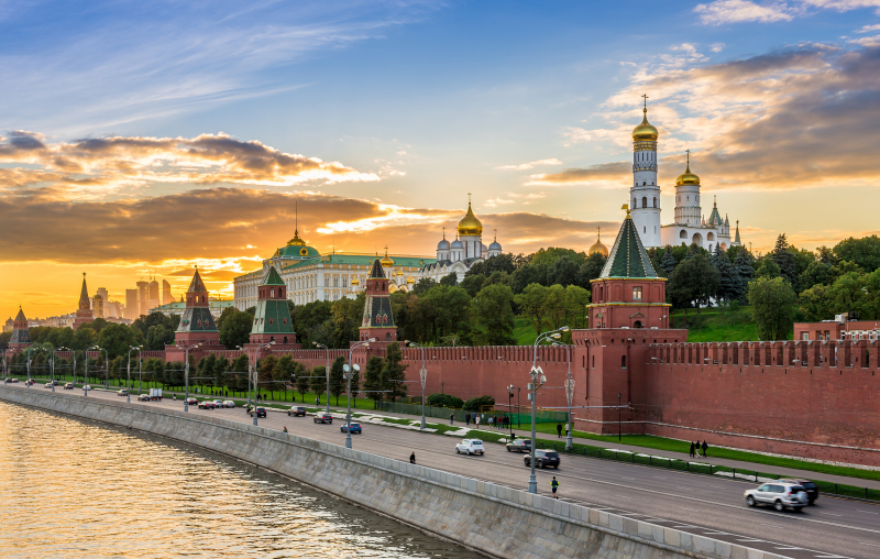
Trip.com 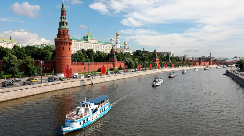
Russia Beyond -
The Amstel River has played a significant role in the Netherlands since the Middle Ages, and for more than 800 years, it has provided water and transportation to Amsterdam.
Although the river flows through Dam Square today, where it was suppressed into a slower stream that fed into the river Ij, the river once ran directly through the city's heart, around which is the city's famous canal belt. Large underground pipes were constructed beneath the area in the early 20th century to channel the water.
The river’s winding banks and rustic farmlands have inspired many Dutch artists. Rembrandt used his skills to capture the river on an overcast evening and painted an outstanding landscape that dramatically illuminates rural Noord-Holland with an interplay of light and shadow. In his early years, Mondrian also depicted the river, with a vivid post-impressionist style oil painting.
A nationally televised concert is held on the river every year on Liberation Day. The rowing races Head of the River Amstel and Heineken Roeivierkamp are held on the river annually. The river also forms part of the route of the Canal Parade, Amsterdam's annual floating gay pride parade.
Location: Amsterdam, the Netherlands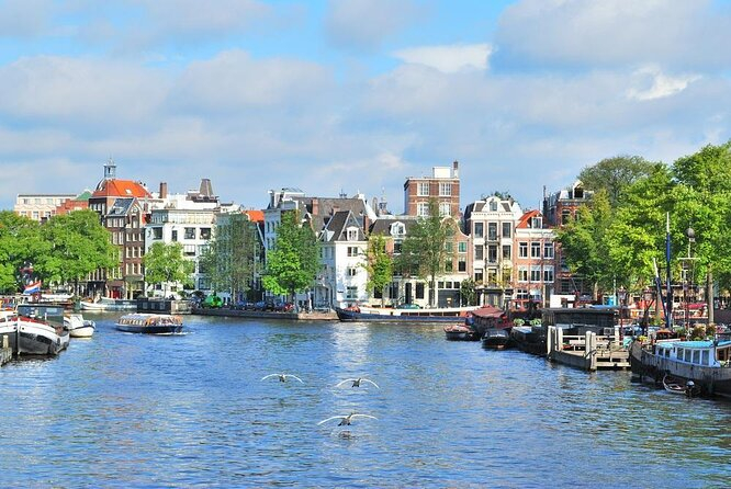
Viator 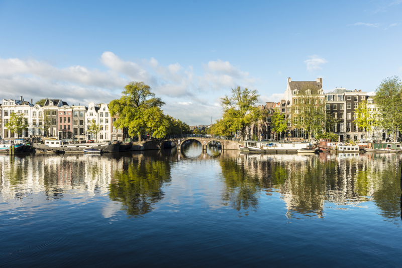
Travel.Earth -
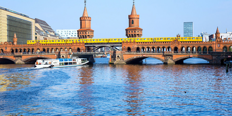
The Spree with a length of approximately 400 kilometers (250 mi) is the main tributary of the River Havel. It rises in the Lusatian Mountains and flows north through Bautzen and Spremberg. The final reach of the Spree is where it is best known. It flows through the city center of Berlin to join the River Havel in Spandau, one of Berlin's western boroughs, which itself ultimately merges with the Elbe to enter the sea in Cuxhaven, after flowing through Hamburg. On its route through Berlin, the river passes Berlin Cathedral (Berliner Dom), the Reichstag, and the Schloss Charlottenburg. The renowned Museum Island (Museumsinsel), with its collection of five major museums, is an island in the Spree.
The Spree drains an area of 3,900 square miles (10,100 square km). A considerable portion of the Spree Forest is now cultivated (market gardening) and also serves as a popular excursion area for Berliners. The Spree River is connected with neighboring rivers by canals. Visitors should take a trip on the River Spree to enjoy the most exciting places that the river passes on its way through the heart of the city: Many sights side by side creates unique scenery for an exciting trip.
Location: Berlin, Germany
Berlin.de 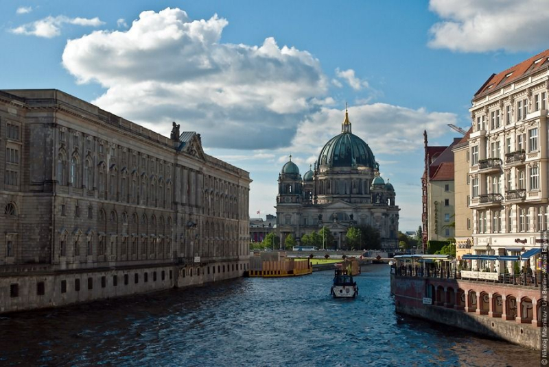
Pinterest -
The Vltava river is the longest river in the Czech Republic, running southeast along the Bohemian Forest and then north across Bohemia, through Český Krumlov, České Budějovice and Prague, and finally merging with the Labe at Mělník. It is commonly referred to as the "Czech national river". In Prague, it flows under Charles Bridge – one of the most famous bridges in the world, and just a short walking distance away from the river is the Old Town Square in Prague, one of the most famous city squares in the world.
For two breathtaking vistas of the city, tourists to Prague should consider taking a river cruise after having a leisurely stroll across the bridge. Eating at a riverbank restaurant, some of which have lovely terraces overlooking the water, is another way to take in the beauty of Prague's river environment.
Even in the heart of Prague, the Vltava River is surrounded by nature. Other birds soar through the air before diving down to capture fish, whereas swans float about looking for food. The Petrin wooded hillside may be seen from the river near Charles Bridge.
Location: Prague, Czech Republic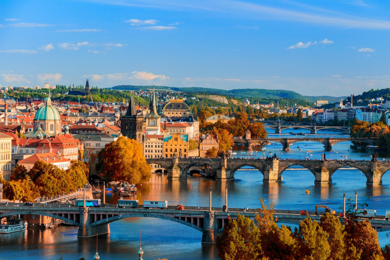
Wikipedia 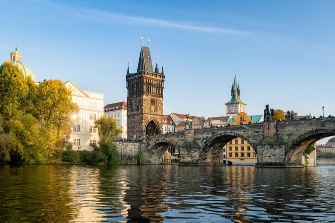
Viator -
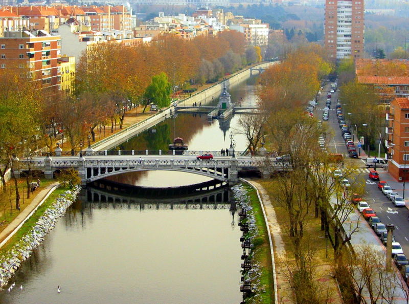
The Manzanares is a river in the center of the Iberian Peninsula, which flows from the Sierra de Guadarrama, passes through Madrid, and eventually empties into the Jarama river. The Manzanares has their sources in the southern slope of the Cuerda Larga, a branch of the Sierra de Guadarrama. Wikimedia Commons flows in a south-eastern direction from its sources and passes through the medieval town of Manzanares el Real where it is dammed to form the Santillana reservoir, one of the most important water supplies for the capital. The river then takes a southern direction and enters the Monte de El Pardo, an ecologically valuable area on the edge of Madrid.
The river Manzanares, although small and relatively unimportant geographically, has had great historical importance due to its close relation to the city of Madrid, which was founded by the Moors as a citadel overlooking the river in the ninth century.
The river is also featured in many paintings of the late 18th to early 19th-century painter Francisco de Goya, which show traditionally dressed Madrileños in activities like dancing or having picnics next to the river.
Location: Madrid, Spain
Wikimedia Commons 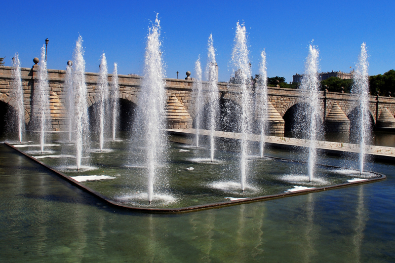
Gardenvisit.com