Top 9 Longest Rivers in Myanmar

Rivers have an important role in Burmese culture. Much of their culture is based on the major rivers that they rely on for food and transportation. The ... read more...majority of river settlements have a flourishing boating industry and travel hundreds of kilometers to transfer commodities or fish. Some sections of these rivers are revered by these communities and can only be approached in specific ways. Burma's rivers are home to a wide range of flora and animals, including fish, reptiles, and huge mammals. The following are some of Myanmar's longest rivers.
-
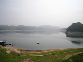
The Mekong, often known as the Mekong River, ranks first among Myanmar's longest rivers. It is a trans-boundary river that runs through East and Southeast Asia. It is the twelfth longest river in the world and Asia's third-longest. Southeast Asian countries that share the Mekong River include Cambodia, Thailand, Vietnam, China, Laos, and Myanmar. With a total length of 2,703 miles, it is the longest river in the region, Asia's seventh longest, and the world's twelfth longest. The Mekong River drains 795,000 square kilometers of land. The river rises in the Tibetan Plateau and runs to the Vietnamese delta, dumping 457,000 cubic kilometers of water every year. Over 60 million people rely on the Mekong for their livelihood.
The river's name comes from Thai and Lao and means "Mother of Water". The river serves as a food source, a mode of transportation, and a water source. After the Amazon, the Mekong has the world's second-largest aquatic biodiversity. The river also has cultural significance for the communities that live along its banks, such as the Akha, Shan, and En peoples.
Total length: 2,703 miles (shared with 5 other countries)
https://www.instagram.com/veronicaweffer/ 
https://www.instagram.com/sunrise.l.a/ -
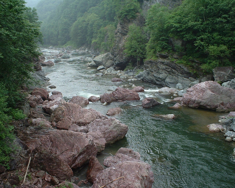
The Salween is a 3,289-kilometer-long Southeast Asian river that flows from the Tibetan Plateau to the Andaman Sea. The Salween River flows largely through southwest China and eastern Myanmar (Burma), with a brief stretch constituting the Myanmar-Thailand boundary. It winds through rocky mountain canyons for the majority of its journey. Despite its length, only the last 90 kilometers of the river are navigable, when it forms a small estuary and delta at Mawlamyine. Along its course, the river is known by many names, including Thanlwin in Burma and Nu River in China. The word "Salween" is an anglicization of the Burmese name that dates back to 19th-century British maps.
The Salween basin is regarded one of the most ecologically varied locations in the world, with an estimated 25% of the world's terrestrial animal species and thousands of plant species due to its wide range of elevation and latitude combined with geographic isolation. The Salween, especially in the delta region, provides water for agriculture and sustains vast fisheries. Several ethnic minority groups live in the Salween basin, with origins primarily from the Tibetan Plateau and northwest China. People began migrating south along the river around 5,000 years ago, forming minor kingdoms and city-states along the way.
Total length: 1,491 miles (shared with Thailand and China)
https://www.instagram.com/pheniciadup/ 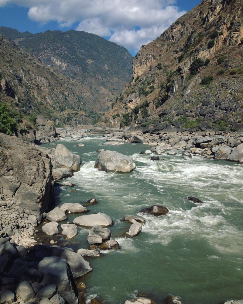
https://www.instagram.com/pheniciadup/ -
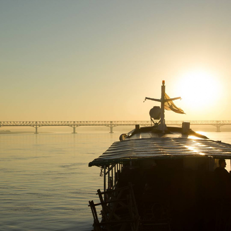
The Irrawaddy is a river in Myanmar that travels from north to south (Burma). It is the largest river in the country and the most important commercial waterway. It rises at the junction of the N'mai and Mali rivers and travels north-south before draining into the Andaman Sea through the Irrawaddy Delta in the Ayeyarwady Region. Its 404,200-square-kilometer drainage basin encompasses a substantial portion of Burma. It is sometimes referred to as 'The Road to Mandalay' after Rudyard Kipling's poem.
The river has been used for trade and transportation since the sixth century. After the British Empire colonized Burma, the river became vital to the British Empire because of its enormous network of irrigation canals. The river is still important today, as it transports a significant amount of commodities and traffic. Rice is grown in the Irrawaddy Delta and irrigated with river water.
The term "Irrawaddy" comes from the Pali language. In Hinduism, the elephant mount of Sakka and Indra is known as Irvat or Airvat. Elephants were commonly employed as a metaphor for water in Buddhism, and the name Saka was used for several other rivers, including the Achiravati.Total length: 1,348 miles
https://www.instagram.com/vickyvixvick/ 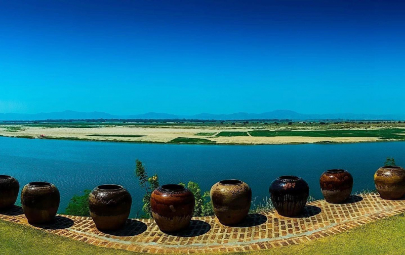
https://www.instagram.com/ruanruanraox/ -
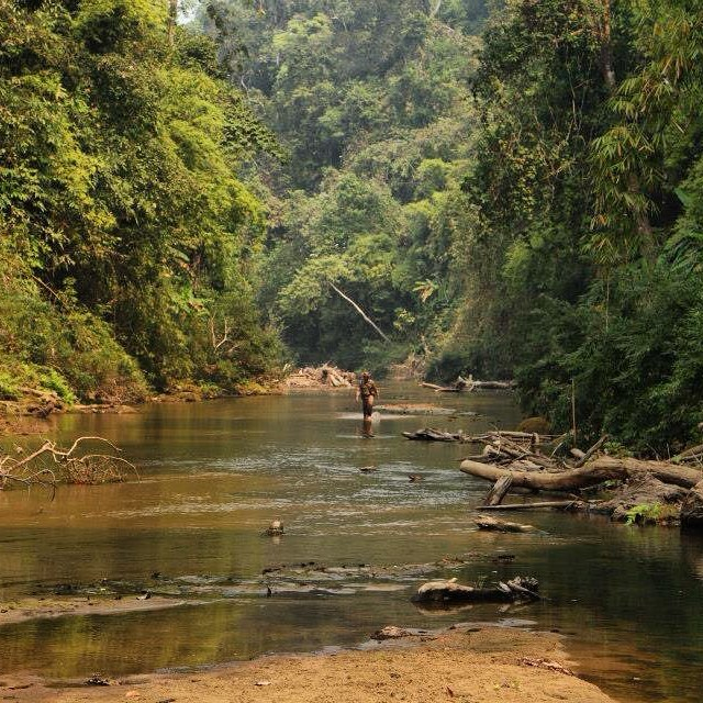
The Chindwin River is the largest tributary of Myanmar's river system, the Ayeyarwady, and flows wholly through Myanmar. Chindwin is another spelling of its official name.Regular river-going vessels serve the Chindwin up to the town of Homalin. Since ancient times, the teak forests within its drainage region have been a vital resource. Burmese amber can be found in abundance in the Hukawng Valley. There are jade deposits along the river, but Hpakant, in the Uyu river's headwaters, is the only spot in the world where the best jade, known as jadeite or imperial jade, may be found, as well as a plethora of fish.
Chindwin's path passes across mountain ranges and woodlands for the most part. Much of it has remained untouched due to the difficulties of access. Within the Hukawng Valley, the Burmese government recently established a vast refuge for the endangered tiger. The culture of western Burma is greatly influenced by the Chindwin River. The languages of Central Sino-Tibetan (which includes Meithei) arose along the river's valleys. The river is the largest tributary of Myanmar's river system, the Ayeyarwady, and flows wholly through Myanmar. Chindwin is another spelling of its official name.
Total length: 750 miles
https://www.instagram.com/drpatrickavery/ 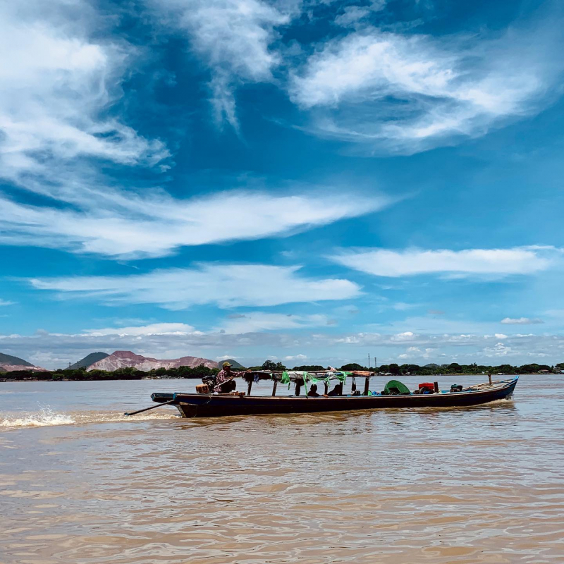
https://www.instagram.com/paung_291/ -
The N'Mai River, also known as the N'Mai Hka, is a river in Myanmar's northwestern region (Burma). The N'Mai River, which flows parallel to Mali, originates in the Himalayan glaciers of eastern Tibet at about 28 degrees north latitude. Due to strong currents, it is not navigable. In Kachin State, the N'mai River comes to a halt at its confluence (Myit-son) with the Mali River, where the two rivers join to form the Ayeyarwady River. At this point, the construction of the Myitsone Dam had commenced.
Myanmar's government signed a contract with China Power Investment Corporation in 2007 to build dams on the Ayeyarwady, Mali, and N'Mai rivers. Up to five dams on the N'Mai, one on Mali, and one near the confluence have been proposed. The greatest of the seven dams, this one would completely obliterate the confluence. Construction began in 2008, and a local protest against one of the dams in Chibwe was suppressed by the authorities.
Total length: 298 miles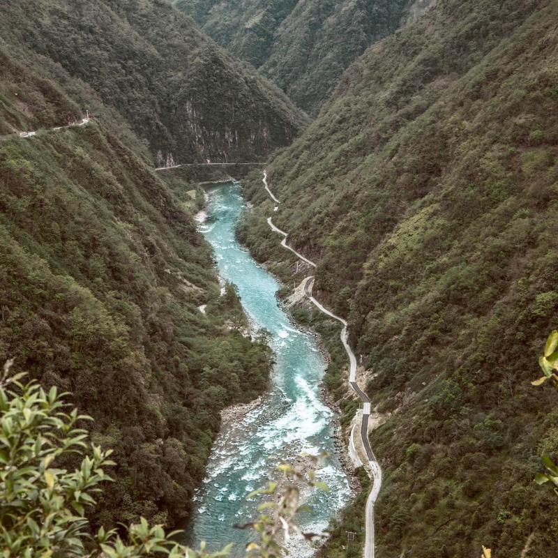
https://www.instagram.com/lensinmyhands.tw/ 
https://www.instagram.com/nigga_fishing/ -
The Sittaung River was once a river in Bago Division, Myanmar's south central region. The Pegu Range separates the Irrawaddy's basin from the Pegu's. The river begins southeast of Mandalay, near the edge of the Shan Hills, and runs south to the Gulf of Martaban. It has a length of 420 kilometers and a typical annual discharge of 50 cubic kilometers.
The Sittaung River, despite flowing through relatively level territory, has a severe tidal bore near its mouth, which has prevented all but the smallest craft from traversing the river. The river may be navigated for 40 kilometers all year and 90 kilometers for three months of the year.
The river is mostly utilized to transport timber south for export. The river's currents make it even less useful as a mode of transportation in eastern Burma. Because there is no soil pouring down from the Shan Hills, its basin does not have the same agricultural potential as the Irrawaddy.
Total length: 261 miles
https://photocontest.smithsonianmag.com/ 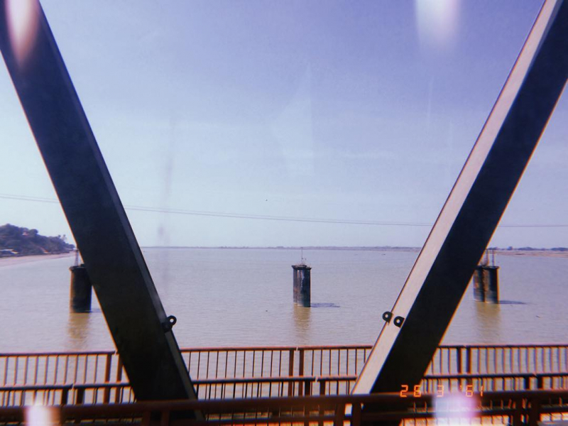
https://www.instagram.com/min_tarr/ -
The Ruak is one of Myanmar's longest rivers. It is a Mekong tributary on the right bank. The Ruak river's mouth is on the Thai-Burma border, directly across from Laos, and is known as the "Golden Triangle" a renowned tourist destination. The name "Golden Triangle" was created by the CIA to describe an area of approximately 950,000 square kilometers that covers the mountains of three neighboring countries. For a true jungle experience, take a long-tail boat tour of the river and its forested banks, accompanied by a camp team.
The Ruak River rises in the Daen Lao Range in Shan State (Burma) and meets the Mae Sai River near Thailand's northernmost tip, where it becomes the border river between Thailand and Burma. It then flows eastward till it reaches Ban Sop Ruak, Tambon Wiang, Chiang Saen District, Chiang Rai Province, where it drains into the Mekong River. The river's boundary part is 26.75 kilometers (16.62 miles) long.
Total length: 203 miles (shared with Thailand)
https://www.facebook.com/FourSeasonsTentedCampGoldenTriangle 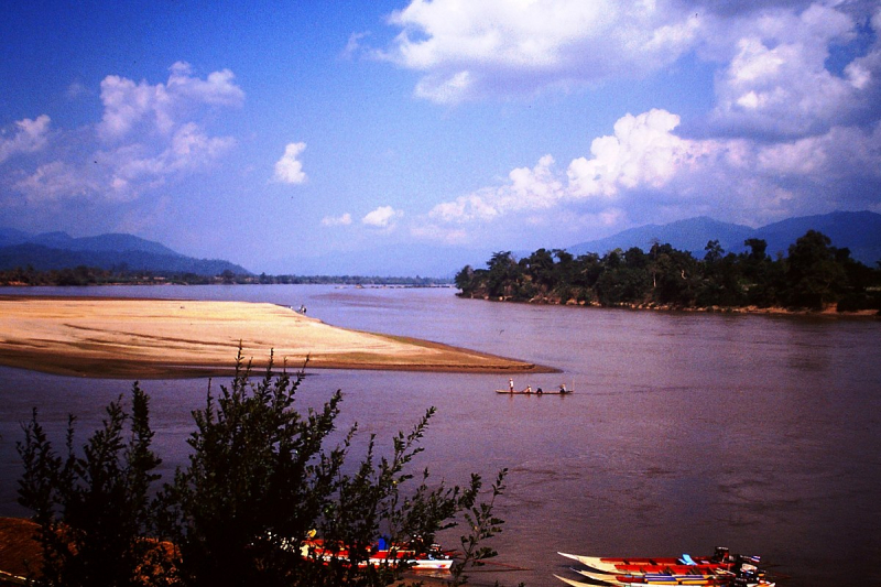
https://commons.wikimedia.org/ -
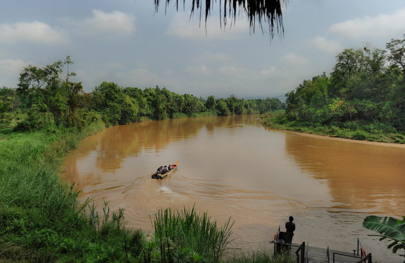
The Kok river is a tributary of the Mekong River that flows through the northern Thai provinces of Chiang Rai and Chiang Mai. The river originates in Myanmar's Shan State, in the Daen Lao Range. It runs eastward across the Myanmar–Thailand border, passing through Tha Ton, Thailand's border town. It runs into Chiang Mai Province's Mae Ai District. The river travels through Chiang Rai Province for the majority of its course, passing through Mueang Chiang Rai District before bending northeastwards and flowing through Mae Chan, Wiang Chai, and Chiang Saen districts.
The Fang and the Lao Rivers are the Kok River's main tributaries, with the latter's source in the Phi Pan Nam Range. As part of their Burma Special in October 2013, the cast and crew of the British television show Top Gear built a bridge over the Kok. The bridge was supposed to be erected over the River Kwai, but it was "accidentally" chosen over the River Fang, which feeds into the Kok. On March 9 and 16, 2014, the show aired in two parts.
Total length: 177 miles (shared with Thailand)
https://theblogofdimi.com/ 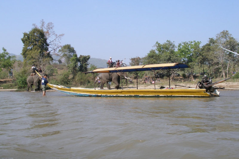
https://www.justgola.com/ -
The Mu river is a tributary of Myanmar's main river, the Ayeyarwady, in upper central Myanmar. Between the Ayeyarwady to the east and its major tributary Chindwin River to the west, it drains the Kabaw valley and part of the Dry Zone, flows north to south for about 275 kilometers, and reaches the Ayeyarwady west of Sagaing near Myinmu.
It has a catchment area of 12,355 square kilometers above the Kabo weir. River flow and rainfall are seasonal and unpredictable, with the lowest levels from January to April, the highest levels from August to October. The Mu receives little summer monsoon rainfall, with a total streamflow of 350 millimetres, because it is located in the Dry Zone, under the rain shadow of Rakhine Yoma. Ma myinbu, Mu myit htin, as a common Burmese saying goes. Some people refer to it as Mu Chaung rather than Mu Myit (river).
The Kadu and Kanan minorities live in the wooded upper Mu valley, whereas the lush lower Mu valley is part of the Bamar ethnic majority's heartland.Total length: 171 miles
https://en.wikipedia.org/ 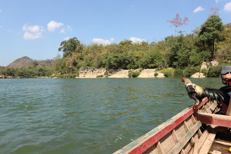
pinterest.com/pin/839851030503598744/