Hec-RAS and ArcGIS for Hydrologic Engineering


This hands-on course starts from zero and is built step by step, with real-world activities, so you can learn the principles of managing Hec-RAS. You may perform flood studies and identify flood zones using Hec-RAS, combining it with land planning and urban planning.
The Hec-RAS and ArcGIS for Hydrologic Engineering course uses the experience gained from more than 10 years of conducting such studies for administrations, private promoters, or research projects to give a detailed and straightforward description of all the steps to follow from the time they want to start a flood study until its final presentation, in contrast to other courses that only concentrate on explaining technical knowledge.
WHAT YOU WILL LEARN:
- Perform hydraulic studies of natural or artificial channels.
- Evaluate areas of flooding of rivers and streams.
- Plan the territory based on areas of flooding or hydraulic public domain.
- Perform simulations of channels or hydraulic structures.
- Incorporate the use of Geographic Information Systems (GIS) to facilitate and improve hydraulic studies.
Rating: 4.4/5
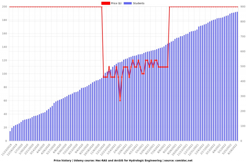
Enroll here: udemy.com/course/modeling-and-floods-with-hec-ras-arcgis/