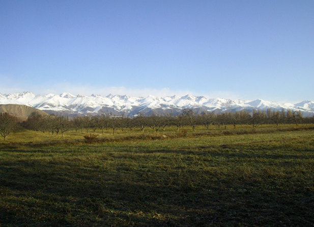
Küngöy Ala-Too Range (Chok-Tal Peak)

The Kungey Alatau, also known as Kungoy Ala-Too or Kungey Alataw, is a mountain range that joins the Zailiyskiy Alatau to form the Northern Tien Shan. The word "Alatau" or "Ala-too" means "variegated mountains," a description of a prominent high-altitude zone of mountains that is partially white due to snow and partly dark in areas where there is no snow. "The side (of the mountain) facing south," as "Kungey" or "Kyungei" denotes.
The ridge extends east–west and is 275 kilometers (171 miles) long in a straight line. From the north, it forms a border with the basin in which Lake Issyk-Kul is located (the same basin bounded by the Terskey Ala-Too ridge from the south). The ridge's highest point has a width of around 30 kilometers (19 mi). From the north, the Zailiysky Alatau runs parallel to the ridge. The valleys of the Chon-Kemin, the main tributary of the Chu River, and the Chilik, a tributary of the Ili River, separate the Kungey and Zailiysky Alatau in the west and the Chilik, a tributary of the Ili River, in the east. The Chon-Kemin and Chilik valleys are separated by the Chilik-Kemin Bridge, which connects the two ridges. The western boundary of Kazakhstan and Kyrgyzstan runs along the Zailiysky Alatau ridge, passing via the Chiliko-Kemin Bridge and onto the Kungey Alatau mountain. Thus, the ridge to the west of the bridge is in Kyrgyzstan, while the ridge to the east of the bridge crosses the Kyrgyz-Kazakhstan border.
The range originates in the west, near the Chu River's Boom Gorge, where it meets the Kyrgyz Ala-Too. The Kungey Alatau rises abruptly in an easterly direction, reaching a height of 4,000 meters in the area of the upper reaches of the Dure river (13,000 ft). The ridge's tallest core section begins here. Chok-Tal is the highest point at 4,771 meters (15,653 feet), with the Boztyri mountain (4,323 meters (14,183 feet) to the east. The Kumbel ridge branches off in a southeasterly direction from here. Chon-Ak-Suu, the major river on the southern slope of the Kungey Alatau that falls into Issyk-Kul, begins at this place and runs easterly, so that the northern slope of its valley is the Kungey Alatau's main ridge and the Kumbel's southern ridge. The Chon-Ak-Suu valley then bends south, entering the Semyonovsky gorge. The Chiliko-Kemin Bridge extends north-west from the Keminsky peak massif (4,643 m (15,233 ft). The ridge dips and goes into the city east of Tchaikovsky peak (4,687 m (15,377 ft).
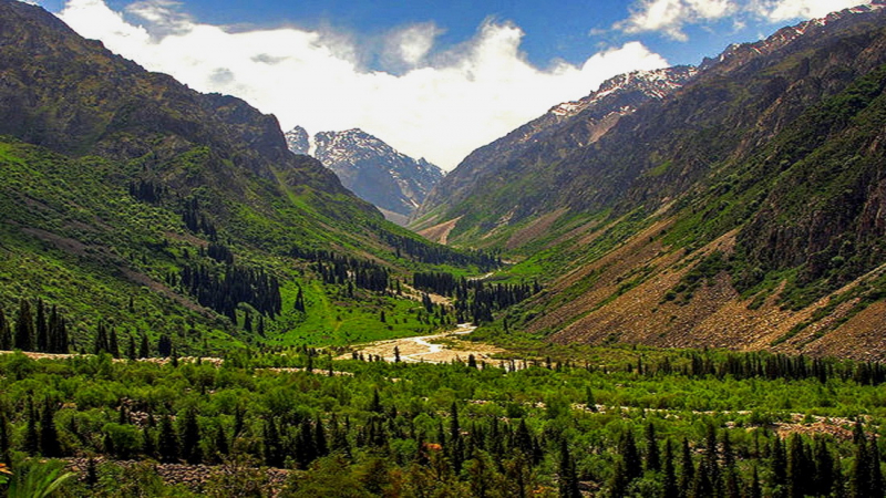
The Northern Tien Shan has a continental climate. January is the coldest month, and July is the hottest. There is a forest (primarily Tien Shan spruce) at low levels, and then a subalpine zone between 2,800 and 3,600 meters (9,200 to 11,800 feet), and even higher — glaciers. In the gorges of the Kolsay and the Kaindy, there are four of Almaty's most famous and visited lakes: three Kolsay lakes and Lake Kaindy.9
Location: in the North Tien-Shan, Kyrgyzstan
Elevation: 4,771 m (15,653 ft)