


Top 6 Highest Mountains in Kyrgyzstan

In Kyrgyzstan, there are approximately 88 major mountain ranges, the majority of which compose the Tian Shan - the Celestial Mountains. In this post, Toplist ... read more...has listed the top 6 highest mountains in Kyrgyzstan.
-
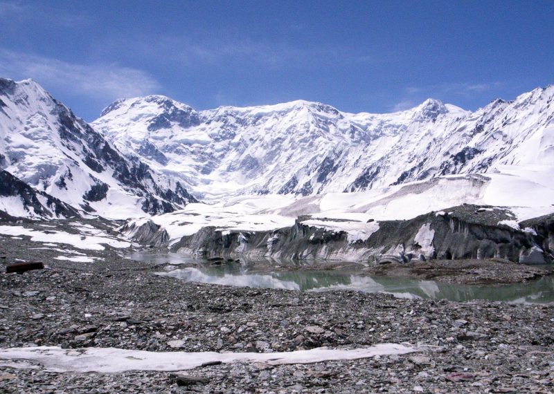
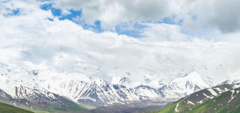
Jengish Chokusu, at 7,439 meters, is the highest peak in the Tian Shan mountain range (24,406 ft). It is located between the Ak-Suu District in the Issyk-Kul Region of far Eastern Kyrgyzstan and Wensu County in Xinjiang, China, on the Kyrgyzstan–China border. It is located southeast of Lake Issyk Kul and is part of the Kakshaal Too, the highest portion of the Tian Shan.
The mountain's Kyrgyz name is Jengish Chokusu, which translates to "Victory Peak," and its Russian name is Pik Pobedy (or Peak Pobeda), which translates to "Victory Peak." It is known as Tömür in Uyghur, which is also the Chinese name for the mountain. Tuōmù'ěr Fēng is a mixture of the Uighur tomur, which means 'iron,' and the Chinese feng, which means 'peak.'
Jengish Chokusu is a massif with a long ridge and multiple summits. Only the main summit rises above 7,000 meters. It's 16 kilometers (9.9 miles) southwest of Khan Tengri (7,010 meters / 22,998 feet), separated by the South Engilchek glacier, which serves as a base camp for both climbs.
The massif runs perpendicular to the glaciers that flow from it into three alpine valleys in Kyrgyzstan's north, all of which eventually lead to the Engilchek Glacier, the Tian Shan largest. The Zvozdochka (Russian for "small star") glacier, which is tinted red with rocks from Jengish Chokusu, is commonly used to reach the main summit.
The Chinese side of the mountain is in Wensu County of the Aksu Prefecture of the Xinjiang Uyghur Autonomous Region, while the Kyrgyzstan side is in the Ak-Suu District of the Issyk-Kul Region.
Location: Ak-Suu, Issyk-Kul, Kyrgyzstan
Elevation: 7,439 m (24,406 ft)
vi.wikipedia.org 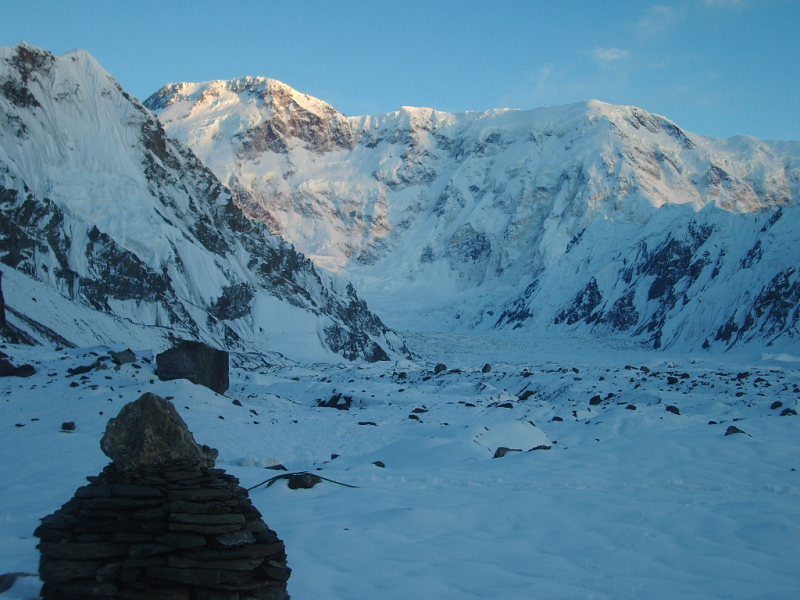
en.wikipedia.org -
Lenin Peak, also known as Ibn Sina (Avicenna) Peak, is the second-highest point in both Tajikistan and Kyrgyzstan, rising to 7,134 meters (23,406 feet) on the border of Tajikistan and Kyrgyzstan in Gorno-Badakhshan (GBAO). It is one of the easier 7,000 m summits to climb in the world, and it has by far the most ascents of any 7,000 m or higher peak on the planet, with hundreds of mountaineers reaching the top each year. Lenin Peak is the tallest mountain in Central Asia's Trans-Alay Range, and it is only surpassed by Ismoil Somoni Peak in Tajikistan's Pamir Mountains (7,495 m). It was assumed to be Tajikistan's highest point until 1933, when Ismoil Somoni Peak (then known as Stalin Peak) was climbed and discovered to be more than 300 meters higher. Kongur Tagh (7,649 m) and Muztagh Ata (7,546 m), both in China's Pamirs, are higher than the Tajik summits.
The first exploration of this section of Central Asia took place between 1774 and 1782. The involuntary journey of the slave Filipp Efremov (an ethnic Russian) who escaped from slavery in Bukhara is arguably the first recorded travel through the region. He crossed the Fergana valley, then went to Kashgar through Osh, the Chigirik Pass, and Terekdavan Pass, before crossing the Karakorum. The first European to cross the Alai Mountains was him.
The Trans-Alai (Zaalayskiy) Range and its main peak were found by Alexei Pavlovich Fedchenko in 1871, and scientific excursions to the Alai Mountains began in 1872. Nikolai Leopol'dovich Korzhenevskiy's expedition was arguably the first to come closest to the foot of the eventual Lenin Peak in the early twentieth century.
Location: Kyrgyzstan–Tajikistan border
Elevation: 7,134 m (23,406 ft)
explore-share.com 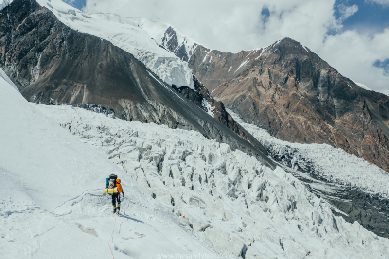
thesandyfeet.com -
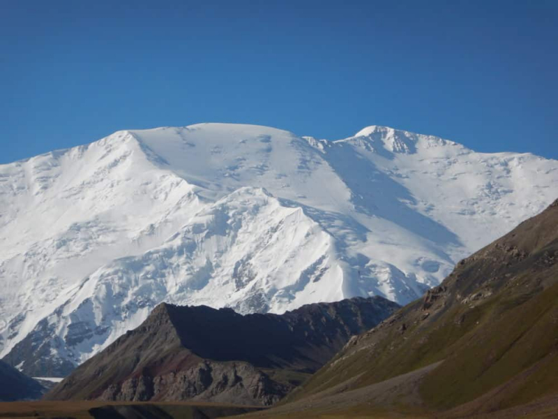
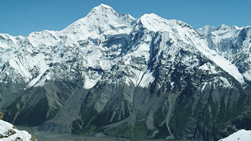
Kurumdy Mountain is located in Central Asia's Pamir Mountains, in the Trans-Alay Range's eastern part. Kurumdy (Kurumdy I peak) is located on the international border between Kyrgyzstan and China, at an elevation of 6,614 meters (21,699 feet) above sea level.
Kurumdy is located in the Pamir Mountains of Central Asia, in the eastern part of the Trans-Alay Range. It's 22 kilometers east of Kyzyl-Art Pass. The East Kyzilsy Glacier, with a length of 3,7 km and an area of 69,4 km2, flows on the northern side. The Kurumdy Glacier, with a length of 17.2 kilometers (10.7 miles) and a surface area of 60.6 kilometers (23.4 square miles), is located on the south side and flows west. It has been the three-state summit between Kyrgyzstan, Tajikistan, and China since territorial changes in 2011.
Regarding the initial ascension, there is some skepticism. In 1932, an ascent from the south by E. Timashev and his party appear to have reached the main summit. Other reports, however, claim that this group only made it to Kurumdu West (6,154 m). Michael Mihajlov and Vitaliy Akimov climbed a large north ridge to the summit of Kurumdy I on October 1, 2001. If the 1932 ascent was simply to Kurumdu West, this would be the first ascent.
Markus Gschwendt and Katharina Pfnaisl of Austria completed the first crossing (East-West, 15 days) in summer 2015. This was the main summit's second ascent (6,614 m, 5 August 2015). They continued on to 6,000 m summits, at least two of which were unclimbed at the time. They selected a fairly steep slope east of the Kurumdy east peaks for the ascent (6,384 m, Peak Kathi 6,259 m). They descended by passing the west summits (6,554 and 6,283 meters) and then following a north ridge to Golova Orla (5,440 meters), where they arrived at Basecamp (3,770 m)
Location: Kyrgyzstan–China border
Elevation: 6,614 m (21,699 ft)
gettyimages.dk 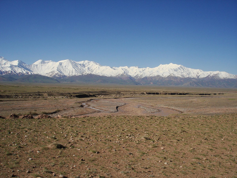
Trans-Alay Range (Photo: en.wikipedia.org) -
The Peak of Nansena is one of Kyrgyzstan's most impressive summits. The highest point of the mountain is 5,697 meters above sea level. To the south of the Enelchek valley, the mountain is found in the Central Tien Shan.
In 1937, the peak was first scaled. A. Letaveta was in charge of the mission. A spectacular peak, framed in armor of ice and snow, flowing with diamonds in the sun's rays, presented a mesmerizing sight to the climbers.
The road to Pik Nansena's conquest is not easy, and it demands thorough physical preparation as well as adequate ammunition. Climbers from all over the world are drawn to the challenge, and no one can deny that climbing Nansena's Peak is difficult. The reward is a true revelation in the form of mountains carved out of icebergs that are unlike any other mountain on the planet.
Location: in the Central Tien-Shan, Kyrgyzstan
Elevation: 5,697 m (18,691 ft)
baibol.kg 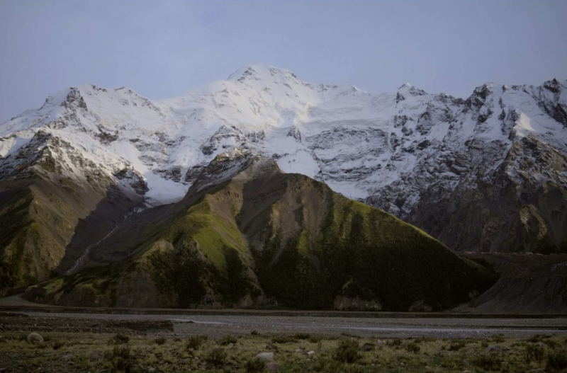
novastan.org -
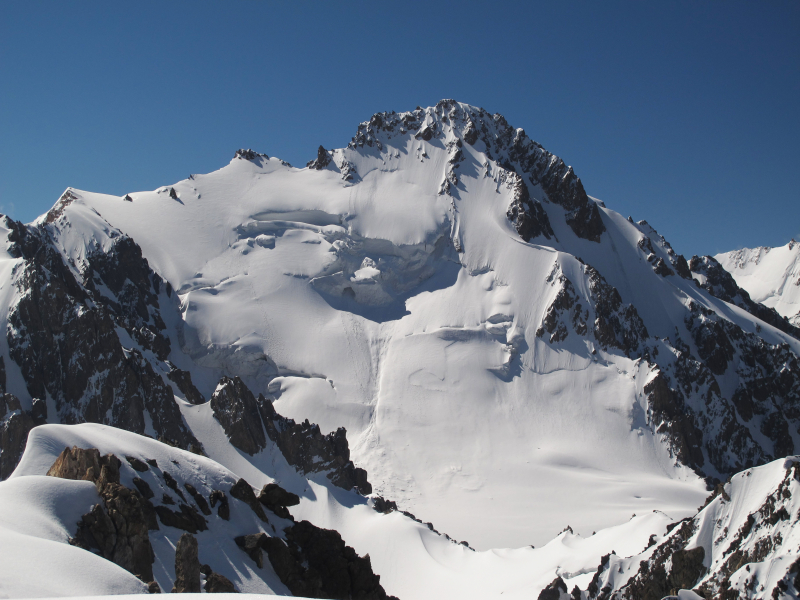
Semenov-Tian-Shansky Peak is a mountain in the Tian Shan's Kyrgyz Ala-Too Range. It is found in Kyrgyzstan's Ala Archa National Park. It is the highest peak in the Kyrgyz Ala-Too Range, with a prominence of 2,231 meters. Between the Ala-Archa River to the west and the Alamedin River to the east, the mountain is located. The coordinates of Semenov-Tian-Shansky Peak are 42°31′16″N 74°34′18″E.
The mountain is named after Peter Semenov-Tian-Shansky, a Russian geographer.
Location: in the Kyrgyz Ala-Too Range, Tian Shan, Kyrgyzstan
Elevation: 4,895 m (16,060 ft)
en.wikipedia.org 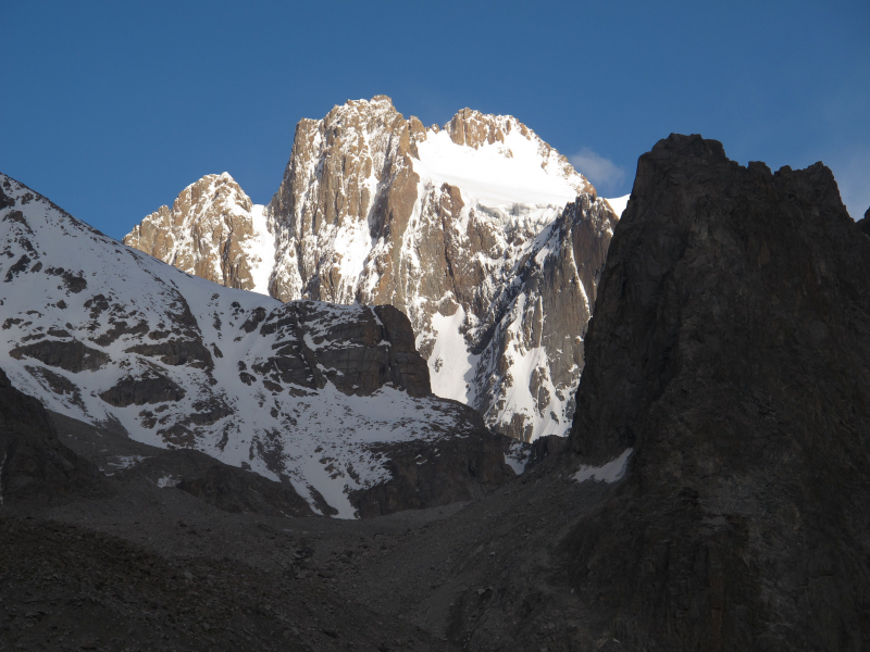
mapcarta.com -
The Kungey Alatau, also known as Kungoy Ala-Too or Kungey Alataw, is a mountain range that joins the Zailiyskiy Alatau to form the Northern Tien Shan. The word "Alatau" or "Ala-too" means "variegated mountains," a description of a prominent high-altitude zone of mountains that is partially white due to snow and partly dark in areas where there is no snow. "The side (of the mountain) facing south," as "Kungey" or "Kyungei" denotes.
The ridge extends east–west and is 275 kilometers (171 miles) long in a straight line. From the north, it forms a border with the basin in which Lake Issyk-Kul is located (the same basin bounded by the Terskey Ala-Too ridge from the south). The ridge's highest point has a width of around 30 kilometers (19 mi). From the north, the Zailiysky Alatau runs parallel to the ridge. The valleys of the Chon-Kemin, the main tributary of the Chu River, and the Chilik, a tributary of the Ili River, separate the Kungey and Zailiysky Alatau in the west and the Chilik, a tributary of the Ili River, in the east. The Chon-Kemin and Chilik valleys are separated by the Chilik-Kemin Bridge, which connects the two ridges. The western boundary of Kazakhstan and Kyrgyzstan runs along the Zailiysky Alatau ridge, passing via the Chiliko-Kemin Bridge and onto the Kungey Alatau mountain. Thus, the ridge to the west of the bridge is in Kyrgyzstan, while the ridge to the east of the bridge crosses the Kyrgyz-Kazakhstan border.
The range originates in the west, near the Chu River's Boom Gorge, where it meets the Kyrgyz Ala-Too. The Kungey Alatau rises abruptly in an easterly direction, reaching a height of 4,000 meters in the area of the upper reaches of the Dure river (13,000 ft). The ridge's tallest core section begins here. Chok-Tal is the highest point at 4,771 meters (15,653 feet), with the Boztyri mountain (4,323 meters (14,183 feet) to the east. The Kumbel ridge branches off in a southeasterly direction from here. Chon-Ak-Suu, the major river on the southern slope of the Kungey Alatau that falls into Issyk-Kul, begins at this place and runs easterly, so that the northern slope of its valley is the Kungey Alatau's main ridge and the Kumbel's southern ridge. The Chon-Ak-Suu valley then bends south, entering the Semyonovsky gorge. The Chiliko-Kemin Bridge extends north-west from the Keminsky peak massif (4,643 m (15,233 ft). The ridge dips and goes into the city east of Tchaikovsky peak (4,687 m (15,377 ft).
The Northern Tien Shan has a continental climate. January is the coldest month, and July is the hottest. There is a forest (primarily Tien Shan spruce) at low levels, and then a subalpine zone between 2,800 and 3,600 meters (9,200 to 11,800 feet), and even higher — glaciers. In the gorges of the Kolsay and the Kaindy, there are four of Almaty's most famous and visited lakes: three Kolsay lakes and Lake Kaindy.9
Location: in the North Tien-Shan, Kyrgyzstan
Elevation: 4,771 m (15,653 ft)
en.m.wikipedia.org 
baibol.kg


