Pungwe River


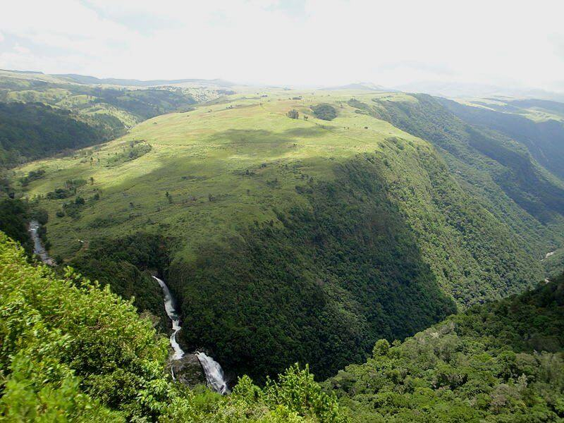
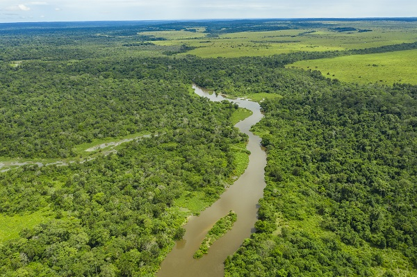
The Pungwe River runs through Zimbabwe and Mozambique for 400 kilometers (250 miles).It rises beneath Mount Nyangani in Zimbabwe's Eastern Highlands and flows southeasteastward through Mozambique's Manica and Sofala provinces. The Pungwe River flows into the Urema Valley, the southernmost portion of the Great Rift Valley, and forms the southern boundary of Gorongosa National Park. The Urema River joins it, and the river flows southward along the rift valley. In the rift valley section, large seasonal wetlands form around the Pungwe and Urema rivers. At Beira, it empties into the Mozambique Channel, forming a large estuary.It is one of Mozambique's major rivers, and it frequently floods.
From upstream to downstream, the main left tributaries are the Nhazonia, Txatola, Vinduzi, and Nhandugue-Urema. The Honde and Muda are the appropriate tributaries.
Administratively, the Pungwe Basin encompasses parts of Mozambique's Sofala and Manica provinces, as well as a large portion of Zimbabwe's Mutasa District. In Zimbabwe, a small portion of the basin is located in the Nyanga District.Mozambique's population in the basin was estimated to be around 1,104,000 people in 2003, while Zimbabwe's population was estimated to be 96,000 people.
Length: 400 km (250 mi- shared with Zimbabwe)