


Top 10 Longest Rivers in Mozambique

Mozambique is a South African country that borders Tanzania to the south. Mozambique has a plentiful supply of rivers, the majority of which are shared with ... read more...neighboring countries. These rivers are home to a variety of amphibian species and provide water for domestic and commercial purposes such as hydroelectric power generation. River systems and basins support ecosystems that are critical to the survival of various plant and animal species. Toplist has compiled the longest rivers in Mozambique in this article.
-
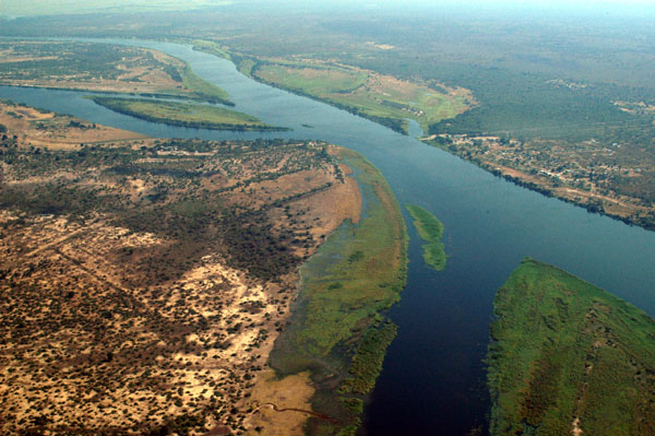
The first one in Top 10 Longest Rivers in Mozambique that Toplist would like to introduce to you is Zambezi. The Zambezi River (also spelled Zambeze and Zambesi) is Africa's fourth-longest river, its longest east-flowing river, and its largest river flowing into the Indian Ocean from Africa. Its basin is 1,390,000 square kilometers (540,000 square miles), which is slightly less than half the size of the Nile's. The river begins in Zambia and flows through eastern Angola, along Namibia's north-eastern border and Botswana's northern border, then through Zambia and Zimbabwe to Mozambique, where it crosses the country to empty into the Indian Ocean.
Victoria Falls is the most well-known feature of the Zambezi. Other notable falls include the Chavuma Falls on the Zambia-Angola border and the Ngonye Falls near Sioma in Western Zambia.
The river has two major hydroelectric power sources: the Kariba Dam in Zambia and Zimbabwe, and the Cahora Bassa Dam in Mozambique, which supplies power to Mozambique and South Africa. In Zambia, there are two smaller power stations along the Zambezi River, one at Victoria Falls and the other near Kalene Hill in Ikelenge District.
Length: 2,574 km (1,599 mi- Zambia, Zimbabwe, Angola, Namibia and Botswana)
vi.wikipedia.org 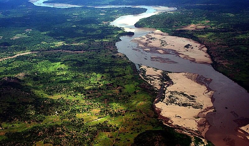
pinterest.com -
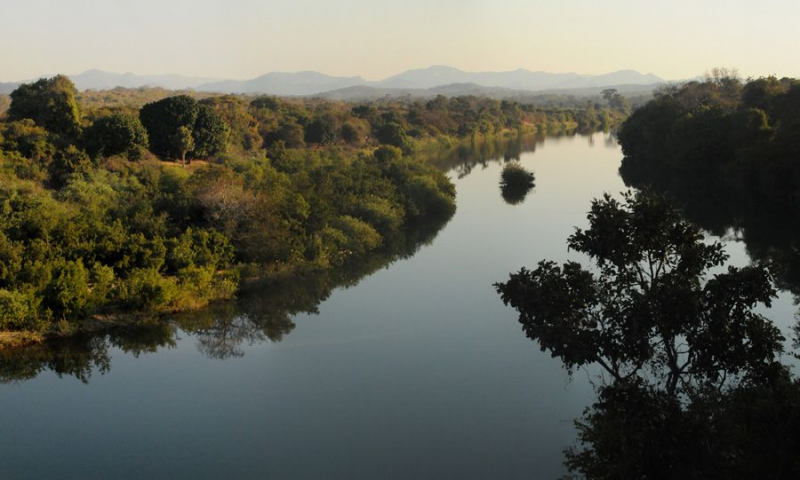
The second one in Top 10 Longest Rivers in Mozambique that Toplist would like to introduce to you is Limpopo River. The Limpopo River originates in South Africa and flows generally eastward to the Indian Ocean through Mozambique. The name Limpopo comes from Rivombo (Livombo/Lebombo), a group of Tsonga settlers led by Hosi Rivombo who settled in the surrounding mountains and named the area after their leader. The river is about 1,750 kilometers (1,087 miles) long, with a drainage basin that is 415,000 square kilometers (160,200 square miles). At its mouth, the average discharge over a year is 170 m3 (6,000 cu ft; 170,000 l; 44,900 US gal).After the Zambezi, the Limpopo River is Africa's second largest river that flows into the Indian Ocean.
Vasco da Gama was the first European to see the river, anchoring off its mouth in 1498 and naming it the Espirito Santo River. St Vincent Whitshed Erskine explored its lower course in 1868–69, and Captain J F Elton traveled down its middle course in 1870.
The Limpopo River's drainage area has shrunk over geological time. The upper course of the Zambezi River drained into the Limpopo River until the Late Pliocene or Pleistocene.The drainage divide shifted due to epeirogenic movement that uplifted the surface north of the present-day Limpopo River, diverting water into the Zambezi River.
Length: 1,750 km (1,090 mi- shared with South Africa, Zimbabwe and Botswana )
en.wikipedia.org 
southworld.net -
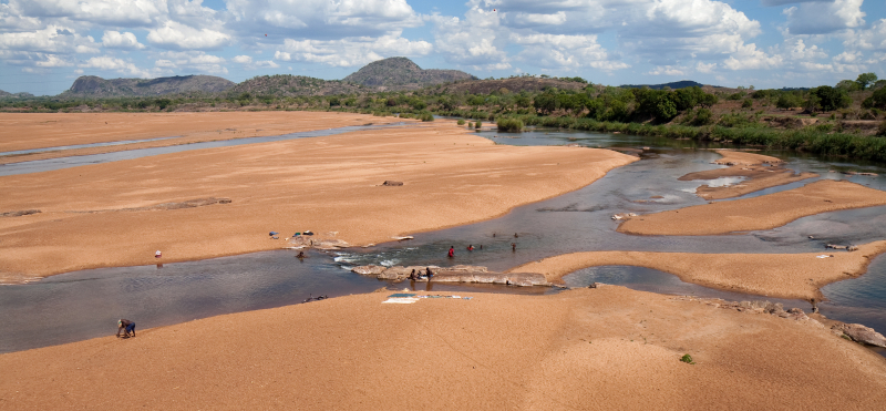
The third one in Top 10 Longest Rivers in Mozambique that Toplist would like to introduce to you is Ruvuma River. The Ruvuma River, also known as the Rovuma River, is a river in Africa's Great Lakes region. It forms the border between Tanzania and Mozambique for the majority of its length (in Mozambique known as Rio Rovuma). The river is 800 kilometers (497 miles) long, with a drainage basin measuring 155,500 square kilometers (60,000 square miles). At its mouth, its mean annual discharge is 475 m3/s (16,774 CFS).
The lower Ruvuma river is formed by the confluence of two nearly equal branches at 11° 25' S., 38° 31' E., the longer of which, the Lujenda, comes from the south-west and the other, which still bears the name Ruvuma, from the west. Its head-stream flows due west before turning south and east on an undulating plateau 1,000 m (3,300 ft) high, immediately to the east of Lake Nyasa, at 10° 45' S., 35° 40' E.
The Ruvuma flows eastward near the base of an escarpment of an arid sandstone plateau to the north, from which direction the streams that have cut deep channels in the plateau edge have almost all short courses.
The opposite bank of the Ruvuma receives, in addition to the Lujenda, the Msinje River and the Luchulingo River, which flow in broad valleys from south to north. The Lujenda rises near Lake Chilwa, in the small Lake Chiuta (1,700 ft), with the swamps to the south separated from Chilwa by a narrow wooded ridge. The stream that emerges from Chiuta flows through a swampy valley into the narrow Lake Amaramba, from which the Lujenda River emerges as an 80-yard-wide stream.
Lower down, the width varies greatly, with many parts containing long wooded islands that rise above the flood level and are frequently inhabited. During the dry season, the river can be crossed in many places. It is about a mile wide at its mouth.
The lower Ruvuma, which is often a half-mile wide but generally shallow, flows through a swampy valley flanked by plateau escarpments that contain several small river backwaters. The mouth is located near 10° 28' S., 40° 30' E., with the parallel of 10° 40' forming the boundary near the coast. The Ruvuma is approximately 500 miles long (800 km).
Length: 800 km (500 mi- shared with Tanzania)
flickr.com Video: Onocha's Youtube Channel -
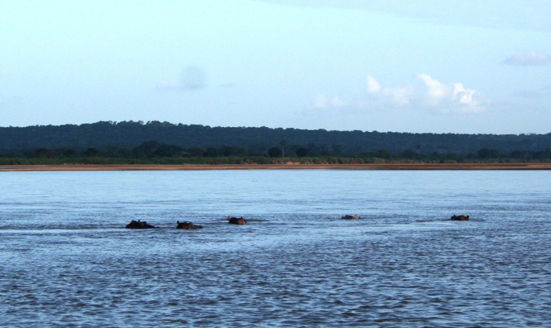
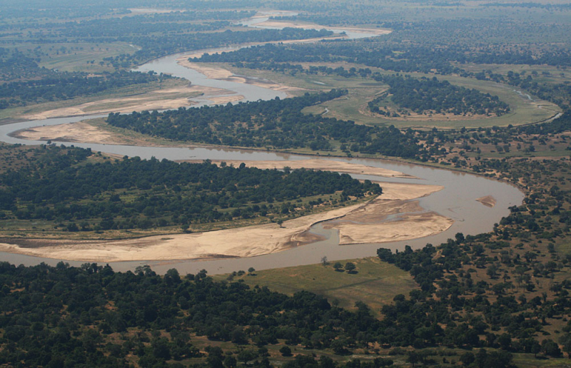
The fourth one in Top 10 Longest Rivers in Mozambique that Toplist would like to introduce to you is Luangwa River. The Luangwa River is a major tributary of the Zambezi River and one of Zambia's four largest rivers. The river usually floods during the rainy season (December to March) and then drops significantly during the dry season. It is one of the largest unaltered rivers in Southern Africa, and the surrounding valley of 52,000 square kilometers (20,000 square miles) is teeming with wildlife.
The Luangwa River rises in the Lilonda and Mafinga Hills in north-east Zambia, near the borders with Tanzania and Malawi, and flows southwesterly through a broad valley. It has dropped to an elevation of about 690 m about 150 kilometers from its source and has become a meandering river with a flood-plain several kilometers wide. Over the next 300 kilometers, the meanders become more numerous, with numerous oxbow lakes and abandoned meanders. The river's elevation has dropped to around 520 meters near Mfuwe, the flood plain is about 10 kilometers wide, and the valley reaches about 100 kilometers wide, with a north-west escarpment (Muchinga Escarpment) about 700 meters high and a south-western escarpment about 450 meters high. During the dry season, some sections, particularly in the upper reaches, completely dry out, leaving isolated pools.
The upper and middle reaches of the valley are home to Zambia's North Luangwa and South Luangwa National Parks, which are among the best in Africa. The river itself is home to large hippopotami and crocodile populations. The Luangwa Valley is home to the world's largest concentration of hippos. During the dry season, they are restricted by the shrinking river and pools and can be seen easily, particularly in isolated pools.
At 600 kilometers, the river abruptly enters a narrow valley between hills rising 200 meters above the valley floor, forming a gorge. The Luangwa River merges with its tributary, the Lukusashi River, about 700 kilometers from its source, after the latter has merged with the Lunsemfwa River coming from the opposite direction, and turns due south through a steep narrow valley: this is its exit from the Luangwa Rift Valley (see following section). After only 20 kilometers, it emerges from the hills into the broad Zambezi valley and meanders over 1.5-kilometer-wide sandy flats in a 3–5-kilometer-wide flood plain. At Luangwa town, it joins the deeper Zambezi. The river's lower course forms the border between Zambia and Mozambique.
Length: 770 km (478 mi- shared with Zambia)
zambiawatchdog.com 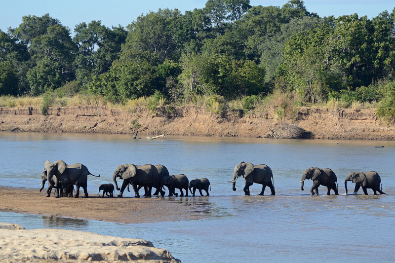
commons.wikimedia.org -
The fifth one in Top 10 Longest Rivers in Mozambique that Toplist would like to introduce to you is Save River. The Save River, also known as the Sabi River, is a 400-mile-long (644-kilometer) river in southeastern Africa that flows through Zimbabwe and Mozambique. The river originates in Zimbabwe, approximately 80 kilometers (50 miles) south of Harare, and flows south and then east from the Zimbabwean highveld to its confluence with the Odzi River. It then flows south, over the Chivirira ("Place of Boiling") Falls, and down the western side of Zimbabwe's Eastern Highlands, forming a dry river valley in the rain shadow of these mountains. At the Mozambique border, it is joined by the Runde River or Lundi, forming a dramatic confluence at Mahenya. It then flows through Mozambique before entering the Indian Ocean at about 21° South.
The Save River was originally used to irrigate sugar plantations, but it is now used to grow citrus, cotton, rice, and wheat. It also serves as a source of small-scale fishing for the locals.
The Save River delta contains mangrove forests that stretch for about 100 kilometers (62 miles) along the Indian Ocean coast. The mangrove forests are used by villagers in the delta basin for timber and as a place for small-scale fishing. Cyclones, flooding, erosion, and sea level rise have all had an impact on the ecology of the lower Save River basin.
Historically, it was a route for gold and trade goods between the coast and the hinterland occupied by the Great Zimbabwe civilisation in the 13th and 14th centuries AD.
Length: 644 km (400 mi)
clubofmozambique.com 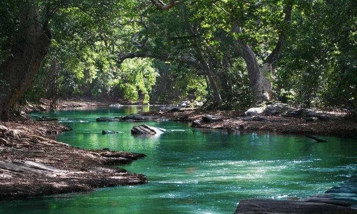
ishaoutreach.org -
The Lúrio River flows through northeastern Mozambique. It flows south of the Ruvuma River and empties into the sea near Pemba Bay.The river is distinguished by seasonal flows and is surrounded by swamps.Along the river, there is a notable waterfall.
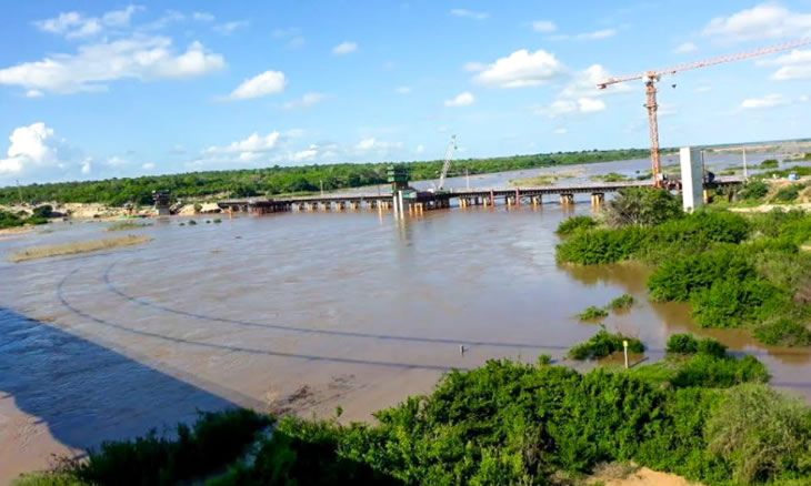
The Mozambican government intends to construct a 120-megawatt hydroelectric plant on the river to supply power to the neighboring provinces of Nampula and Cabo Delgado. The Cahora Bassa hydroelectric dam in Tete province currently supplies electricity to the provinces of Nampula and Cabo Delgado. The new plant is intended to meet an expected increase in electricity demand in the region, where natural resource prospecting and future exploration projects are underway. The conference also discussed other investment plans for the Lrio River by the provincial governments of Nampula and Cabo Delgado, as well as the question of whether the river could support all of the proposed projects.
Length: 620 km (385 mi)
commons.wikimedia.org 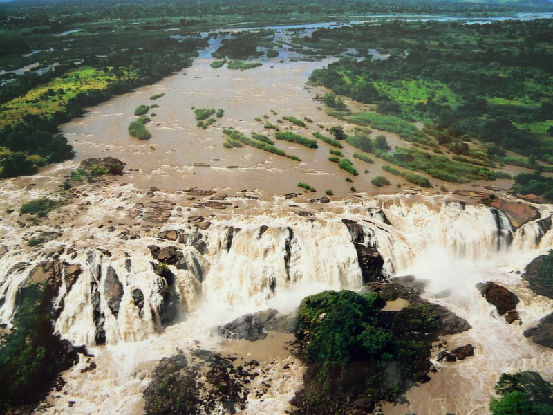
pinterest.com -
The Messalo is a major river in northeastern Mozambique.It flows through Niassa and Cabo Delgado provinces, passes near Chai, and empties into the Indian Ocean's Mozambique Channel at Quiterajo beach at 11°40′25′′S 40°26′25′′E. The Messalo River is 530 kilometers (330 miles) long, and the Messalo River Basin is 24,000 kilometers (9,300 square miles) in size.During the Mozambique flood of 2000, the river overflowed its banks.
The Messalo River is crossed by the 247 highway. Natulo and Marere are two of the river's major settlements (on the coast).
The Messalo River drains a 24,000-square-kilometer catchment area (9,300 sq mi). It is the eighth largest river in Mozambique's 18 major river basins.
The Mesalo River, the second largest river in northern Mozambique's Cabo Delgado Province, delimits the coastal area in the Macomia District to the south, along the Indian Ocean coastal belt; other coastal area boundary limits are set by the Diquide to the south and the coast line to the east. The estuary contains 5,000 hectares (12,000 acres) of pristine mangrove forests that have not been harmed by anthropogenic intervention.
Length: 530 km (330 mi)
Video: Correio da manhã moz's Youtube Channel Video: Televisão de Moçambique TVM's Youtube Channel -
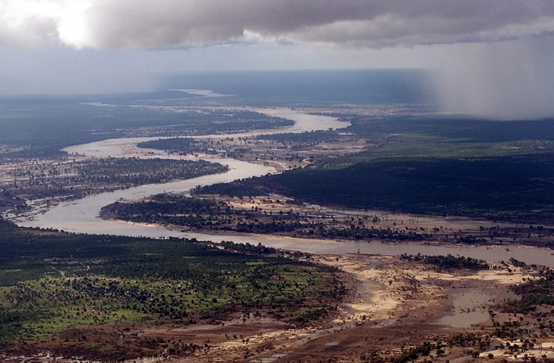
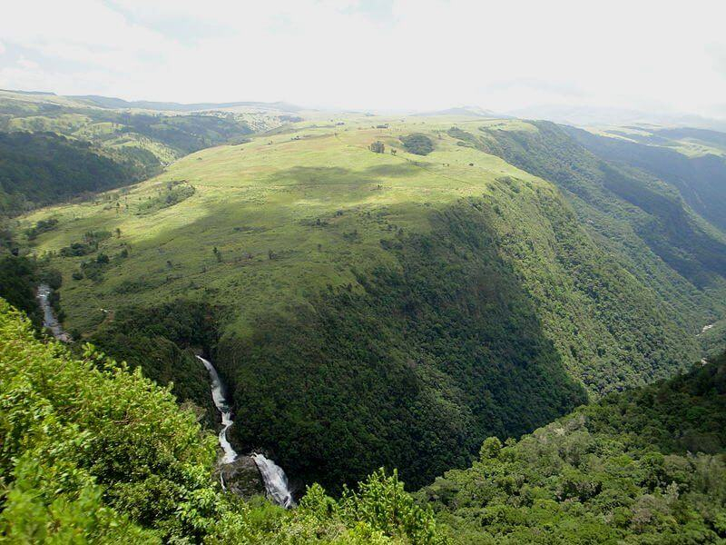
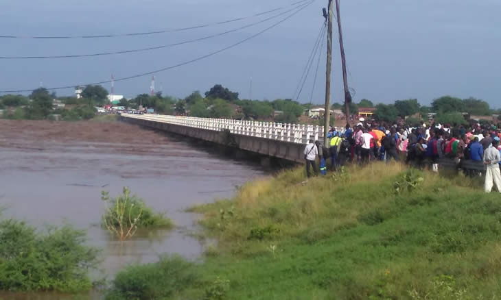
The Pungwe River runs through Zimbabwe and Mozambique for 400 kilometers (250 miles).It rises beneath Mount Nyangani in Zimbabwe's Eastern Highlands and flows southeasteastward through Mozambique's Manica and Sofala provinces. The Pungwe River flows into the Urema Valley, the southernmost portion of the Great Rift Valley, and forms the southern boundary of Gorongosa National Park. The Urema River joins it, and the river flows southward along the rift valley. In the rift valley section, large seasonal wetlands form around the Pungwe and Urema rivers. At Beira, it empties into the Mozambique Channel, forming a large estuary.It is one of Mozambique's major rivers, and it frequently floods.
From upstream to downstream, the main left tributaries are the Nhazonia, Txatola, Vinduzi, and Nhandugue-Urema. The Honde and Muda are the appropriate tributaries.
Administratively, the Pungwe Basin encompasses parts of Mozambique's Sofala and Manica provinces, as well as a large portion of Zimbabwe's Mutasa District. In Zimbabwe, a small portion of the basin is located in the Nyanga District.Mozambique's population in the basin was estimated to be around 1,104,000 people in 2003, while Zimbabwe's population was estimated to be 96,000 people.
Length: 400 km (250 mi- shared with Zimbabwe)
zimbabwetourism.net 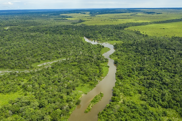
hydrophil.at -
The Mazowe River (previously known as the Mazoe River) flows through Zimbabwe and Mozambique which is the ninth longest river in Mozambique. The river begins north of Harare and flows north and then northeast, where it forms part of Zimbabwe's border with Mozambique and joins the Luenha River, a tributary of the Zambezi River. The Mazowe has a catchment area of approximately 39,000 square kilometers (15,058 sq mi).The Mazowe Dam was built on the river forty kilometers north of Harare in 1920 to irrigate citrus farms. It was primarily constructed to provide irrigation for the Mazoe citrus estates. The dam also housed the Hunyani Rowing Club and previously served as a facility for the St. Georges, Prince Edward, Arundel, and other rowing clubs. It is the Mazowe River's only major dam.
The Mazowe River and its tributaries are popular for gold panners and small placer operations, but during the wet season, the Mazowe turns into a raging torrent, frequently breaking its banks and causing damage to local communities and farms.
Length: 400 km (249 mi)
pinterest.co.uk 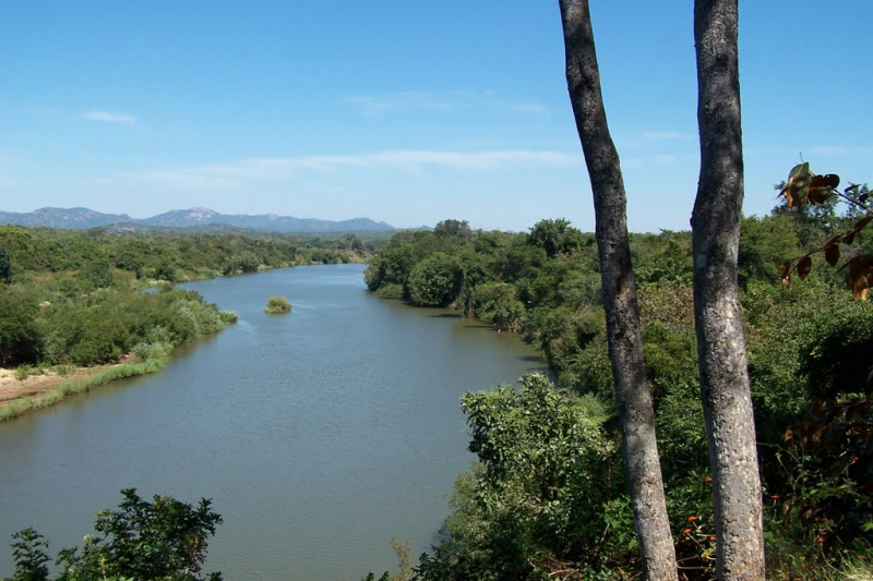
mapio.net -
Revúboé River is the tenth longest river in Mozambique. The river is a significant perennial tributary of the Zambezi.
The Revúboé River rises in the highlands near Mozambique's northern border with Malawi and flows south for several hundred kilometers through rugged terrain. On its way south, the river is fed by a number of smaller rivers, the most notable of which are the Ponfi and Condedezi.The Revuboe River empties into the Zambezi River near Tete on the left bank.
The Revúboé River flows near some of Mozambique's largest coal and coke reserves; as a result, several large mining projects draw water from the river for use in mining operations.
The delivery of water and nutrients from the north of the country by the river stimulates agriculture along its course.Historically, the lands near the river's mouth were fertile farmlands, but government-sponsored farmer relocation (done to clear land for mining projects) in the 2010s resulted in a decline in agricultural activity.
Length: 302.48 km (187.95 mi)
clubofmozambique.com 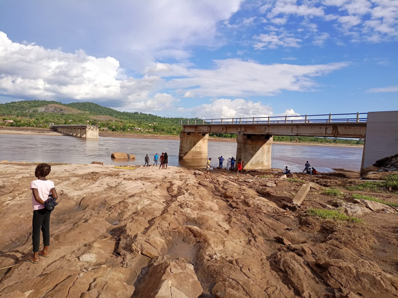
Photo: Emissor Provincial Tete's Facebook


