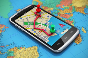
Top 9 Best Android Navigation Apps

The majority of navigation applications operate in the same manner. You enter your directions and follow them to your destination. Google Maps comes to mind ... read more...when we think of a navigation app. It is the one that the majority of people suggest. It also receives periodic upgrades. Google has been at the forefront of navigation, particularly in the last few years. If you don't want to use Google Maps, there are lots of other solutions. Toplist will look at the top navigation applications for Android in this list!
-
Google Maps is a desktop and mobile GPS mapping service that includes street maps, satellite images, 360° panoramic views, route planning, and real-time traffic updates. Other modules in Google Maps include Business View, Street View, Aerial View, Latitude, Ride Finder, and others. Google Maps will let you navigate your world more quickly and easily. Over 220 nations and territories have been mapped, as well as hundreds of millions of companies and locations. Get real-time GPS navigation, traffic, and transit information, as well as explore local communities by knowing where to eat, drink, and go - no matter where you are on the globe.
Users of Google Maps may click anywhere on a map to access details and information about a location or company. Calculate the distance between two sites and obtain instructions by vehicle, foot, bus, bicycle, or taxi. Users may get extensive traffic, transportation, bike, and terrain information, as well as bus arrival schedules. Users may search for a certain location or kind of company, as well as examine a list of recent results for easy recall. When using Google Maps to locate a company, store, or retail outlet, customers may browse opening hours, contact information, and customer reviews.
Detailed information:
Price: Free
Best for: Street View
Website: https://www.google.com/maps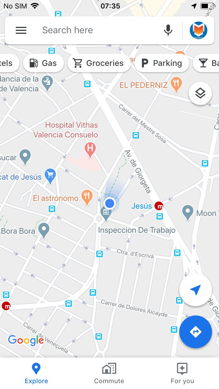
Google Maps 
Google Maps -
HERE WeGo is an online mapping and navigation service created by Nokia and maintained by Here Technologies. As a redesigned version of Nokia Maps, HERE Technologies published this web mapping application for Windows Phone and the World Wide Web in 2013. HERE Technologies published the HERE Maps app for Android on December 10, 2014, and for iOS on March 11, 2015. In July 2016, the business renamed the product Here WeGo.
HERE WeGo is a free navigation tool that advises local and international travelers on both familiar and unfamiliar travels. The app now features a new, modern look as well as cleaner, easier-to-use navigation. Enjoy more carefree travel and effortlessly arrive at your goal, whatever you need to get there. Get there on foot by following the easy-to-follow stroll instructions. Take public transportation in over 1,900 places worldwide. Alternatively, you may travel by automobile and use turn-by-turn voice navigation with correct driving directions. You may even discover parking near your location and be directed there. Do you go to the same areas all the time? Save them in a collection to keep them organized and easy to find. Alternatively, utilize shortcuts to acquire instructions to them with a single click.
Detailed information:
Price: Free
Best for: Offline Maps & DirectionsWebsite: https://wego.here.com/

HERE WEGO MAPS & NAVIGATION 
HERE WEGO MAPS & NAVIGATION -
Waze is a Google company that offers satellite navigation software. It is compatible with cellphones and other GPS-enabled devices. While downloading location-dependent information via a mobile telephone network, it gives turn-by-turn navigation information as well as user-submitted journey times and route specifics. Waze app is described as a community-driven GPS navigation program that is free to download and use.
If you drive, Waze is an app that you should install. It’s for free. But for it to work, you need to turn our phone’s GPS or location service and have a working mobile data connection. It is quite simple to use. To get someplace, choose to navigate and search for the address of the destination you want to visit. It allows you to save areas you often visit, such as work and home, to make routine commutes easier. Reporting traffic incidents is very simple if you have a decent mobile Internet connection. Because it is free and simple to use, the Waze app is an excellent way to cope with traffic in a city like Cebu. Closed-circuit cameras, which the city is implementing not only for traffic but also for criminal monitoring, can only do so much and aren't as useful on the phone.
Detailed information:
Price: Free
Best for: Current Road Updates
Website: https://www.waze.com/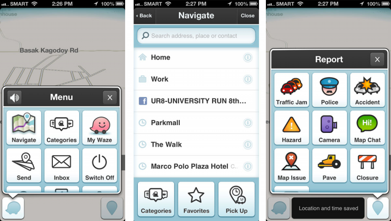
Waze 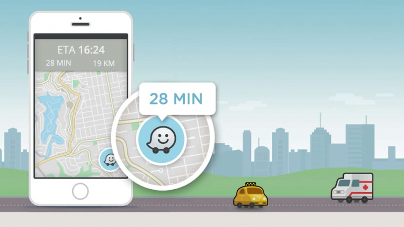
Waze -
Maps.me is an Android, iOS, and BlackBerry software that delivers offline maps based on OpenStreetMap data. It was previously known as MapsWithMe. It was bought by Mail.Ru Group in November 2014 and became part of its My.com brand. The app was open-sourced in September 2015, and a free and open-source software version was also made available on F-droid until the application was sold to the payment processor Daegu Limited, part of Parity.com, which changed the application user interface and content, prompting the free software community to develop an ad and tracker free fork in response.
It includes offline maps, turn-by-turn directions, and maps that are updated using OpenStreetMap. There is also location bookmarking, offline searching, traffic statistics (where available), and global support. It's as close to a Google Maps rival as you can get. Most individuals should be able to use it most of the time. Some people have noticed a few difficulties here and there, but nothing too concerning. The software is 100% free and does not require any in-app purchases. There are some advertisements, but they aren't distracting.
Detailed information:
Price: Free
Best for: Simplicity
Download: https://play.google.com/store/apps/details?id=com.mapswithme.maps.pro&hl=en
Website: https://maps.me/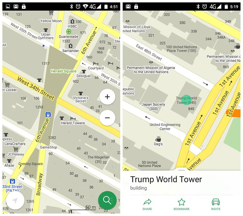
MAPS.ME 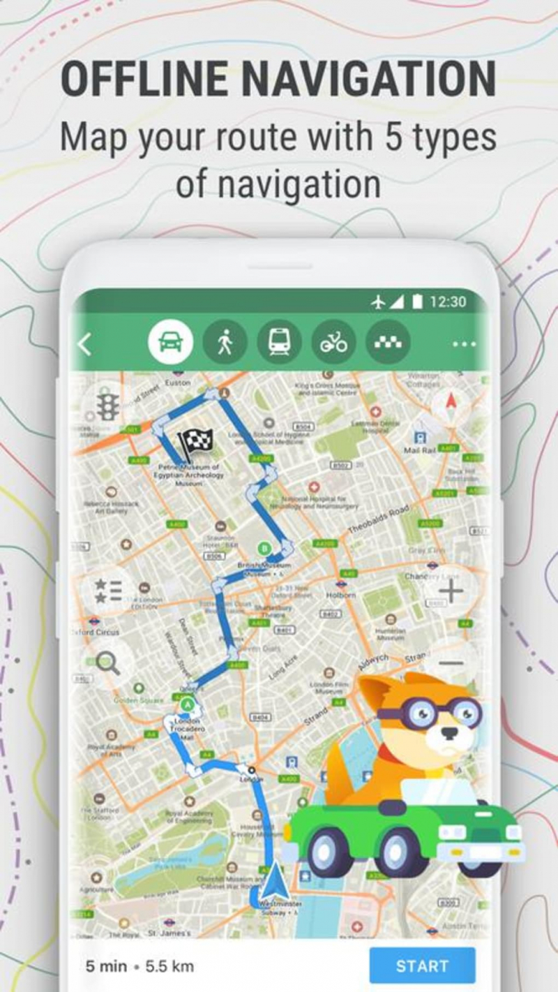
MAPS.ME -
MapFactor Navigator is a free GPS navigation program that includes free offline OpenStreetMaps maps (incl. free monthly maps update). Navigate in over 200 countries without an internet connection. Voice navigation with turn-by-turn directions, speed restrictions, camera alerts, and other handy features. MapFactor specializes in professional driver guidance and dispatcher-driver communication.
The free program contains offline OpenStreetMaps that are frequently updated for accuracy, voice-guided GPS navigation, speed restrictions and camera alerts, nearby areas of interest, and the opportunity to bookmark your favorite routes for quick reference. MapFactor Navigator CAR Pro includes a slew of extras, such as professional TomTom standard maps, live HD traffic, and remote controls. For most individuals, the free edition provides all the functionality they want, albeit it does feature some non-intrusive advertisements.
Detailed information:
Price: Free with In-App Purchases
Best for: DirectionsWebsite: https://www.mapfactor.com/
MapFactor 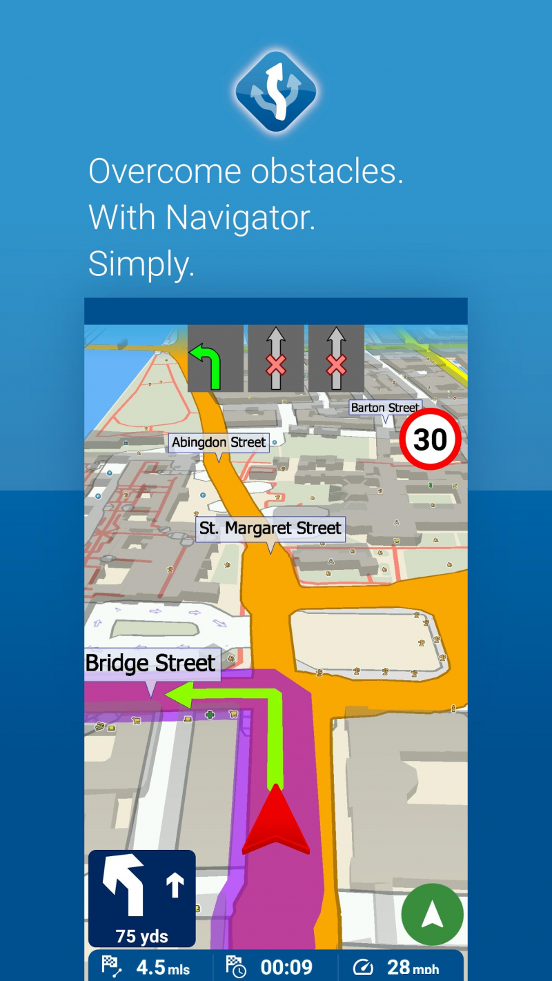
MapFactor -
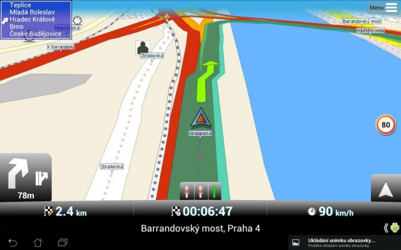
Sygic is a global vehicle navigation system provider for mobile phones and tablets based in Slovakia. The firm was created in 2004 and is based in the Slovakian capital of Bratislava. It was the first firm to provide navigation for the iPhone, and it was the second to do so for Android. Sygic's navigation app surpassed a milestone of 100 million downloads in 2015.
With a top-down 2D view or a smart-looking 3D display, accurate live-traffic warnings, and a better-looking UI than other GPS applications for road trips, this navigation software has all it needs to be a terrific alternative for road trips. The driving directions are precise and timely. It's usually simple to reroute if you miss a turn. Speed camera location information, photo-navigation (to navigate to places you've taken pictures of), a heads-up display (to limit distractions while driving), a dashcam feature (that records the view out your windshield), and celebrity voices - including Homer Simpson and Snoop Dogg - are just a few of the features that set this app apart. Some of these capabilities, however, require a paid membership.
Detailed information:
Price: Free + in-app purchases
Best for: Street View, Several view options
Website: https://www.sygic.com/what-is/offline-maps
Sygic GPS Navigation & Offline Maps 
Sygic GPS Navigation & Offline Maps -
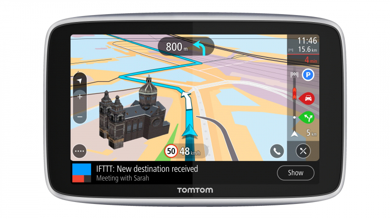
TomTom N.V. is a global company based in the Netherlands that develops and manufactures location technology and consumer devices. TomTom was founded in 1991 and is based in Amsterdam. Its first generation of satellite navigation devices hit the market in 2004. As of 2019, the firm employs approximately 4,500 people globally, with operations in 29 countries across Europe, Asia, and the Americas.
TomTom Go Navigation App allows you to personalize the map for your prospective automobile excursions and is available offline and compatible with Apple CarPlay. This software provides real-time traffic updates that are updated weekly, allowing you to avoid traffic delays (such as closed lanes and road construction sites) on your daily commute.
To guarantee a comfortable driving experience, this navigation software provides an exceptionally exact ETA and even displays you which lane is yours and which exit to take. The app is free to download, but if you need to use it for more than 50 miles each month, you'll have to pay a membership charge for traffic and speed camera data.Detailed information:
Price: Free + in-app purchases
Best for: Street View, Several view options
Website: https://www.tomtom.com/en_gb/navigation/mobile-apps/go-navigation-app
TomTom Go 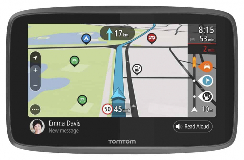
TomTom Go -
AllTrails is a fitness and travel smartphone app that is used for outdoor enjoyment. Hiking, mountain biking, climbing, and snow sports are all popular outdoor activities that use AllTrails. The program provides users with access to a trail map database that includes user-generated evaluations and photographs. These materials can be utilized both online and offline, depending on a user's subscription status.
Alltrails helps you select the right walk, bike ride, or trail run by providing road, satellite, and topographic map views. With categories like length, rating, and difficulty level, you can choose the right route for you using hand-curated trail maps given by a community of sports fans. You may also seek pathways that are suitable for dogs or children. You may download maps for offline navigation and other extra features with an AllTrails Pro membership ($29.99/year), which needs an internet connection.
Detailed information:
Price: Free + in-app purchases
Best for: Street View
Website: https://www.alltrails.com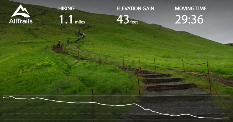
Alltrails 
Alltrails -
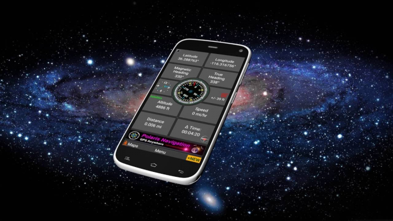
Polaris GPS Navigation is mostly used as an off-road hiking, nautical, and trail GPS app, but it has a wealth of features that may help you get the most out of your outdoor adventure while staying safe. Polaris may not be the greatest choice for a first-time user of a GPS app for outdoor activities due to the high learning curve and the overwhelming number of capabilities on the main screen.
If you know how to navigate with a compass and find latitude, longitude, altitude, and other information helpful, or if you value features like sunset/sunrise tracking and satellite tracker, then this GPS software for Android is the ideal option for you. Just bear in mind that most of these functions need access to the internet.Detailed information:
Price: Free with In-App Purchases
Best for: Directions
Download: play.google.com/store/apps/details?id=com.discipleskies.android.polarisnavigation&hl=en_US&gl=US
Website: https://www.polaris.com/en-us/off-road/technology/ride-command/
Polaris GPS Navigation 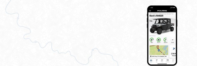
Polaris GPS Navigation