Top 10 Best Hiking Trails in France

From the snowcapped peak of Mont Blanc to the deep blue seas of the Mediterranean, France has a striking range of scenery. Every location has a variety of ... read more...inspiring hiking trails to choose from. Let's check out some of the Best Hiking Trails in France below!
-
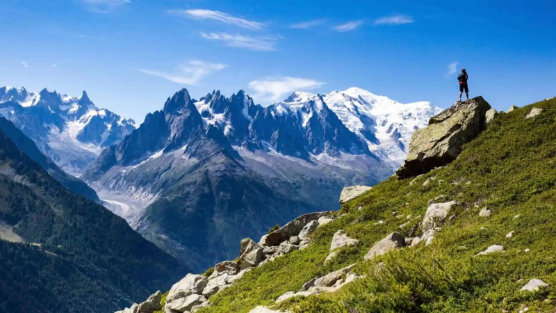
The Tour du Mont Blanc is a 170-kilometer hiking trail that goes through France, Italy, and Switzerland. It is one of the world's classic multi-day journeys, circumnavigating Western Europe's tallest peak, Mont Blanc, and is on every serious hiker's bucket list.
At 4,810 meters above sea level, the renowned Mont Blanc is Europe's highest peak. Ascending to the top is exceedingly difficult and requires exceptional fitness as well as the assistance of a guide. Mont Blanc, on the other hand, is not just for mountain climbers. Short hikes may be taken through the moderate sections of Mont Blanc. The Tour du Mont Blanc is a 170-kilometer network of hiking trails with many starting points, including Courmayeur, Les Houches, and Chamonix. Hikers can relax and get refreshments at mountain refuges (mainly dormitory-style accommodations) along the way, or recharge with a good meal and stay overnight in pleasant Alpine lodgings.
Tour du Mont Blanc 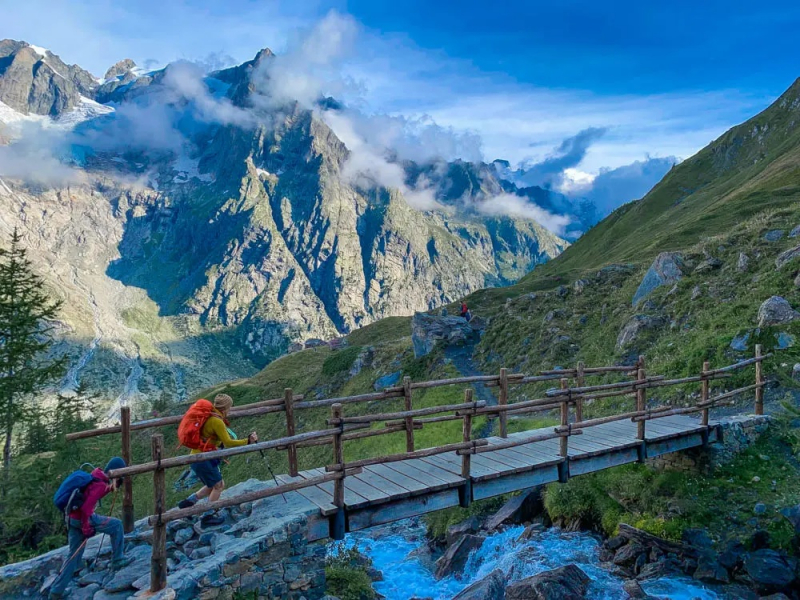
Tour du Mont Blanc -
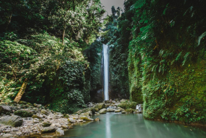
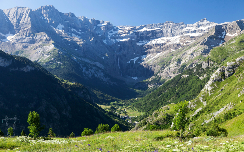
The Cirque de Gavarnie is a UNESCO World Heritage Site that is accessible to most people. It is a highlight of the Parc National des Pyrénées (National Park of the Pyrenees Mountains) and one of the top attractions in the French Pyrenees region.
An easy loop walk begins in Gavarnie's little town, passing the Hôtel du Cirque and horse stables before following the stream up to the valley's head. This trail is more of a stroll than a trek because it has practically no incline. Glacier-formed limestone rock cliffs rise 1,700 meters in the distance and encircle the small valley, giving the impression of a natural cathedral. Numerous rushing waterfalls fall from the snow-dusted tops, adding to the dramatic magnificence (over 3,000 meters in altitude). The Grande Cascade is the most magnificent, with a drop of over 400 meters, making it Europe's tallest waterfall.
Gentle Nature Walk at the Cirque de Gavarnie 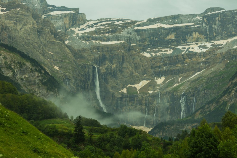
Gentle Nature Walk at the Cirque de Gavarnie -
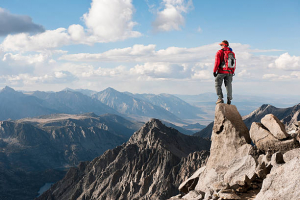
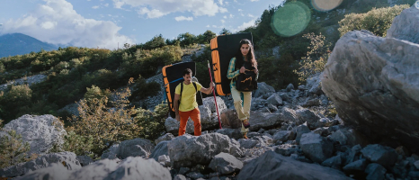
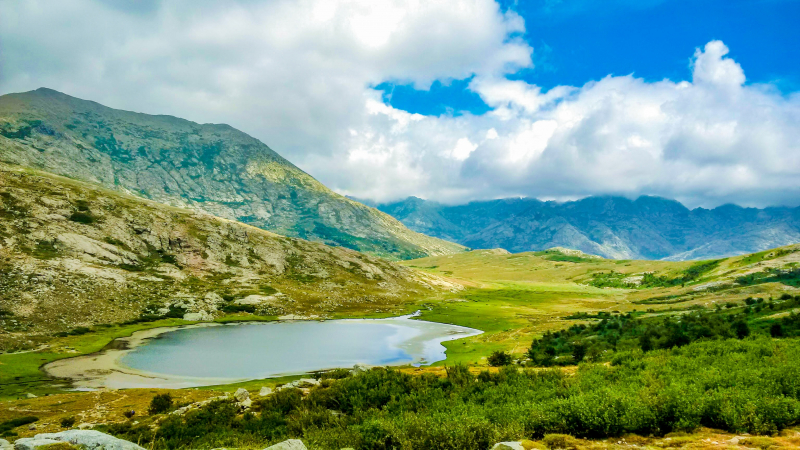
The GR20 hiking trail in Corsica is one of Europe's most well-known and difficult long-distance hikes. It is a legendary long-distance hiking trail that runs diagonally from Calenzana in the north to Conca in the south on the island of Corsica.
The 200-kilometer path follows the granite backbone of the island's mountains, many of which rise beyond 2000 meters. This renowned trail is popular with advanced hikers because of its stunning canyons and rugged mountains. The sun-drenched trail runs from north to south across the whole island of Corsica, winding through a landscape of rocky mountains and wild gorges. The trail is not only a test of physical endurance, but it is also in remote terrain, which adds a psychological challenge. The hike should only be tried by those who are well-prepared. Mountain houses called "refuges" or gîtes may be seen along the trail. The quality and cost of rooms and food vary for each refuge. Hikers are allowed to pitch tents near the refuge, but not along the trail.
The Legendary GR20 Trail in Corsica 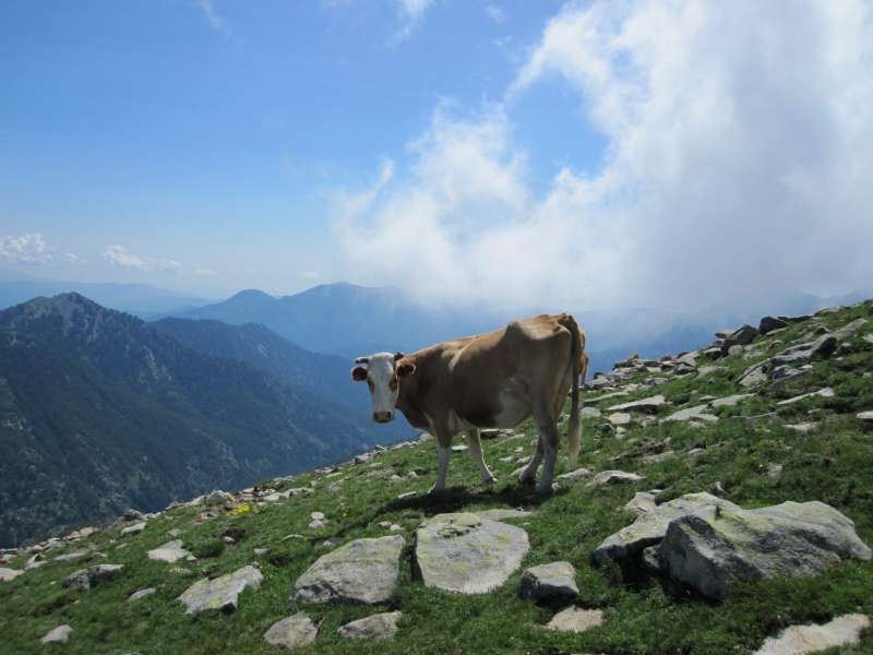
The Legendary GR20 Trail in Corsica -
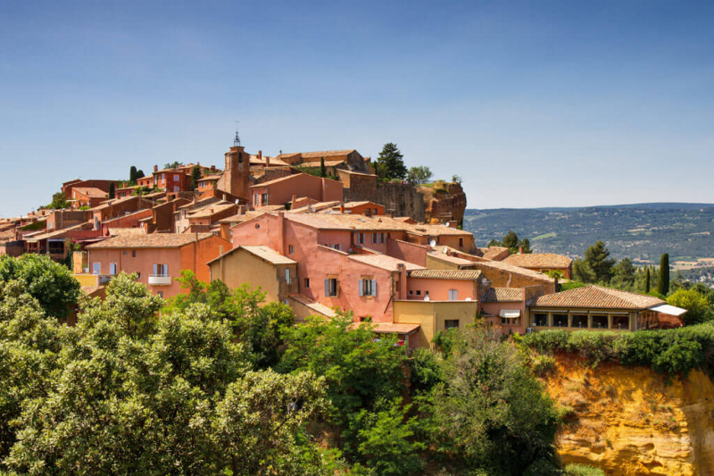
The spectacular mountain known as the Luberon, nestled inside the famous Vaucluse Provence to the south, is right in the heart of one of France's most coveted regions. The Parc Naturel Régional du Lubéron is a UNESCO-listed natural reserve in Provence that is off the main path and breathtakingly gorgeous. Hiking trails and walking paths connect Luberon's charming communities.
Gordes to Roussillon is a fantastic hike. The 10-kilometer hike begins in Gordes, a medieval hilltop village, and continues through gorgeous roads until reaching Roussillon, a remarkable village perché (perched village) perched on an ochre cliff overlooking a breathtaking panorama. From Roussillon to Lourmarin, one of France's Plus Beaux Villages is a beautiful all-day hike. This 25-kilometer trail leads to Lourmarin, a protected valley of olive trees and orchards at the base of the Luberon Mountains, through country roads and footpaths.
Hikes to the Most Beautiful Villages in the Luberon Mountains 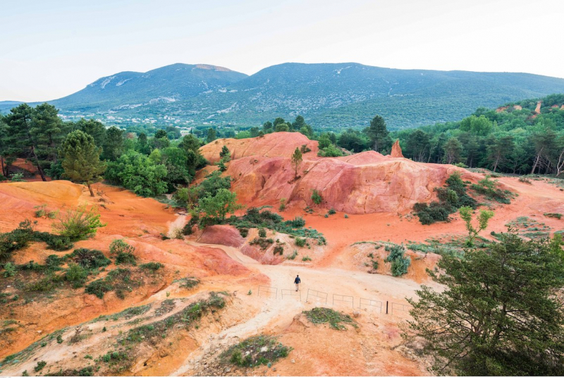
Hikes to the Most Beautiful Villages in the Luberon Mountains -
Alsace's picture-perfect countryside is dotted with fairy-tale towns, adorable small hamlets, and ancient Free Imperial Cities of the Holy Roman Empire, as well as lush vine-covered hills and valleys. The Parc Naturel Régional des Vosges du Nord, a UNESCO World Heritage Site, covers the entire region.
Bergheim to Riquewihr is a moderate eight-kilometer hike in this region. Bergheim is known for its charming winding lanes and flower bedecked buildings, which are surrounded by medieval town walls. Walking paths stretch from Bergheim to Riquewihr across a picturesque terrain. When approaching Riquewihr, hikers may note the church steeple, which is listed as one of the Plus Beaux Villages of France. From Riquewihr, a pleasant three-kilometer stroll leads to Mittelwihr, a small hamlet nestled in a patchwork of almond orchards and vine-covered fields at the foot of forested rolling hills. Around the village, there are several hiking trails. A magnificent hike from Mittelwihr to Kaysersberg, which is accessible by a six-kilometer country road into the Weiss Valley, completes the tour.
Paths through Rolling Hills to Picturesque Alsatian Villages 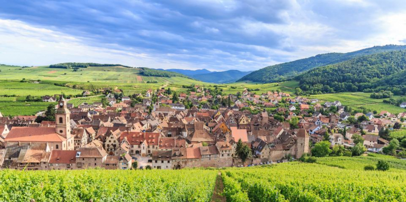
Paths through Rolling Hills to Picturesque Alsatian Villages -
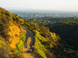
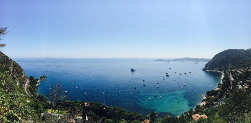
On the French Riviera, the Nietzsche Path is a challenging hillside hike with spectacular sea views. This challenging trail follows in the footsteps of the well-known German philosopher. It begins at Eze, a medieval hilltop village known as the "nid d'aigle" (eagle's nest) because of its height of 400 meters above sea level.
The Nietzsche Path, which is shaded by oaks and olive trees, offers views of the Mediterranean coastline and the Saint-Jean Cap Ferrat peninsula in the distance. Locals have dubbed the route "Le Chemin de Nietzsche" because it offers gorgeous beach views, green forest trails, and spectacular mountain vistas. Despite the beautiful landscape, the hike is difficult, with incredibly steep stone stairs winding through the overgrown mountainside. The hike takes around 1.5 hours and ends in Eze-sur-Mer, which has a pine-tree-lined beach (excellent for swimming and sailing), cafés, restaurants, hotels, and a railway station.
The Nietzsche Path from Eze Village to Eze Beach 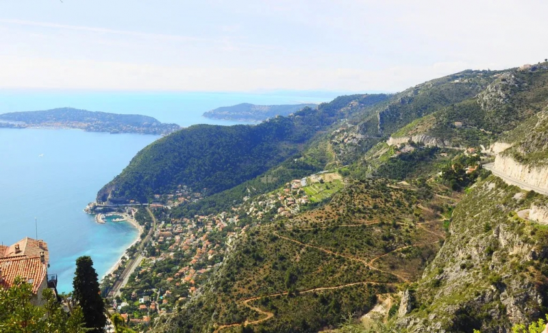
The Nietzsche Path from Eze Village to Eze Beach -
In medieval Europe, the Camino de Santiago was the most prominent pilgrimage route. Pilgrims traveled for months to reach Santiago de Compostela, Spain, which is known for housing the tomb of Saint James the Apostle, which was moved from the Holy Land.
The Camino de Santiago, also known as the Chemin de Compostelle or the Way of Saint James, is still popular among pilgrims and hikers nowadays. Some hikers spend weeks or months finishing portions of the trail or even the entire journey. Route Napoléon is one of the most difficult sections of the Camino de Santiago. The hike starts at Saint-Jean-Pied-de-Port, a classic Basque town with cobblestone streets and red-shuttered buildings. Hikers will go across the Pyrenees Mountains over 25 kilometers, climbing 700 meters in altitude. This trail shows you unspoiled countryside landscapes, charming villages and small towns that makeup Wallonia.
Route Napoléon on the Camino de Santiago 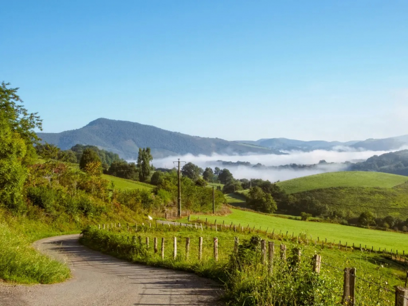
Route Napoléon on the Camino de Santiago -
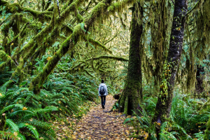
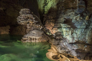
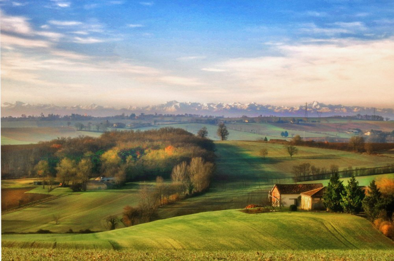
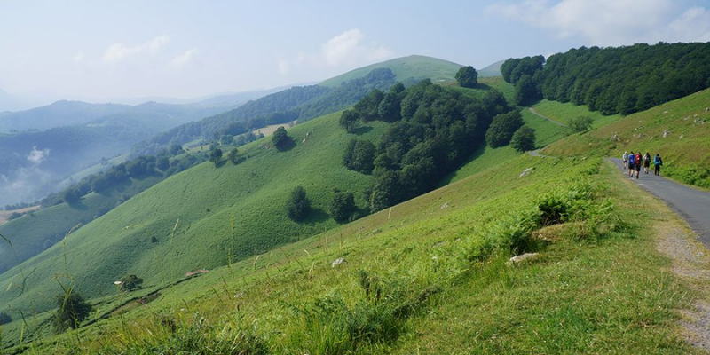
Béarn is a historic and cultural area in southwestern France that includes the mountainous Pyrénées-Atlantiques département and the former province of Béarn.
The ancient Béarn region, one of the top attractions in the French Pyrenees, is a beautiful rural area of rolling hills and mountains around 40 kilometers from Lourdes. A short two-lane country road leads up to the Montagnes Béarnaises (Béarn Mountains), a beautiful mountainous area with deep wooded groves, ravines, crystal-clear rivers, and rushing waterfalls, just outside of Jurançon. Small farms and pastures where goats graze are dotted throughout the woodland. Hiking trails wind their way across the woods and valleys.
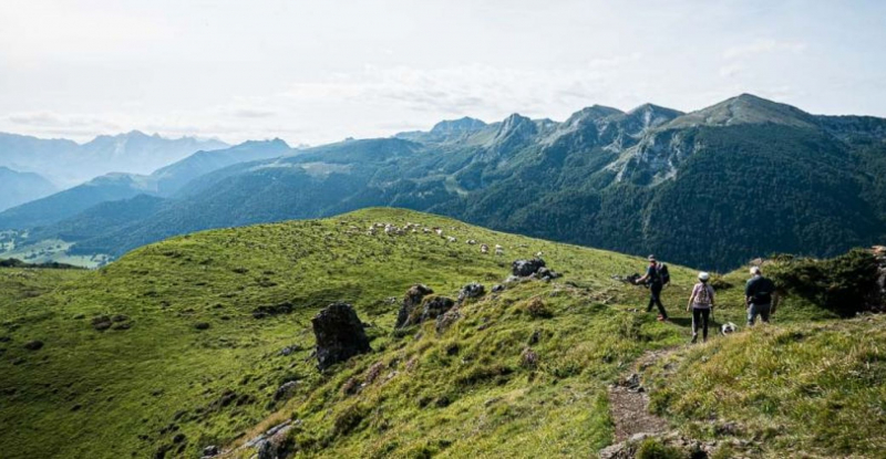
Hikes through Forests and Farmlands in the Béarn Mountains 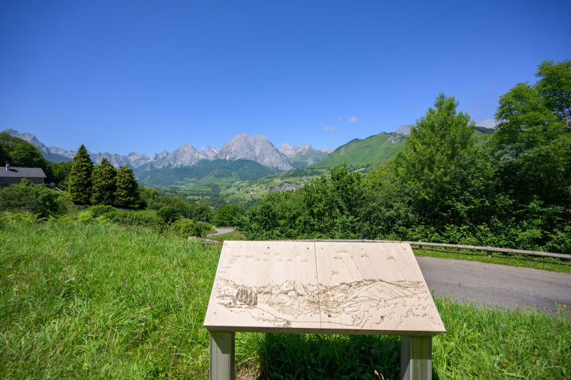
Hikes through Forests and Farmlands in the Béarn Mountains -
The Bassin d'Arcachon is a protected natural area in southwest France, approximately 72 kilometers from Bordeaux. Arcachon Bay is a popular summer vacation destination with seven kilometers of sandy beaches, oyster ports, fishing piers, and the Atlantic Ocean's largest marina.
Begin your stroll along the shore at Arès at the Bassin d'Arcachon. The Réserve Naturelle des Prés Salés is a marshland nature reserve with a 12-kilometer loop trail. This beautiful pedestrian route is ideal for bird viewing. The Dune du Pilat (12 kilometers south of Arcachon) is a spot of serene natural beauty that charms visitors with its breezy and exhilarating seaside environment. The 2.7-kilometer-long sandbank is constantly changing shape due to wind and tides. The scenery may be enjoyed by walking up the top of the Dune du Pilat. The top of the 100-meter-high dune is reached through a staircase. The panoramic views of the bay and ocean from this vantage point are breathtaking.
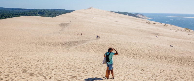
Coastal Walk in Bassin d'Arcachon or on the Dune du Pilat 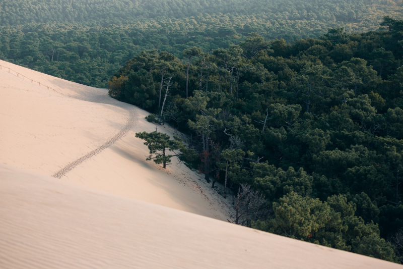
Coastal Walk in Bassin d'Arcachon or on the Dune du Pilat -
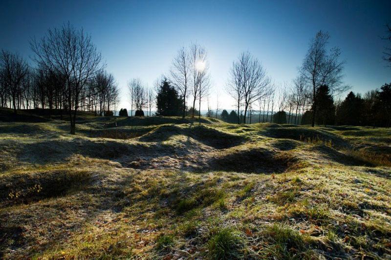
The Remembrance Circuit (also known as the Remembrance Trail) is a well-marked trail between Péronne and Albert. Battlefields, WWI cemeteries, museums, and memorials, such as the Australian National Memorial in Villers-Bretonneux, are all along the way.
A self-guided walking tour of the Remembrance Trail is possible. There are 48 walking paths to choose from. Information for hiking the Remembrance Circuit is available from the tourism offices in Péronne, Albert, and Corbie. Visitors can sign up for guided tours at tourist information centers and museums. Hikers will be rewarded with the beautiful sight of bright red poppies blossoming in the fields if they arrive in late April. The red poppy is an excellent symbol of sacrifice as well as remembrance.
Somme Battlefields Remembrance Circuit 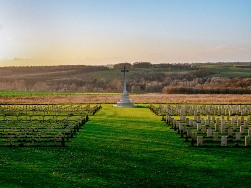
Somme Battlefields Remembrance Circuit