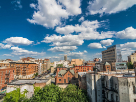
Top 11 Best Bike Trails In L.A.

You've completed all of the best hikes in Los Angeles and want to travel further on wheels, but a leisurely drive along the coast sounds a little too lazy. So ... read more...it's time to ride the nicest bike trails in the city. The streets of Los Angeles are gradually becoming more bicycle-friendly, while the untamed countryside that surrounds the city offers countless options for mountain biking. The nicest parks in Los Angeles are visited while traveling along paved roads and approved trails that are located somewhere in the middle. The best bike trails in Los Angeles are located along these routes, so don your helmet, grab a snack, and go peddling.
-
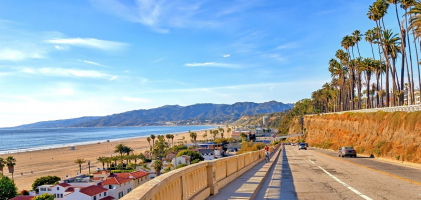
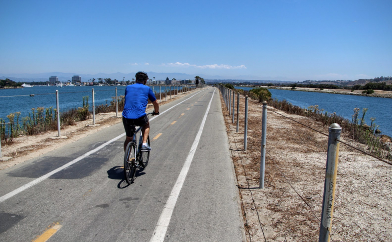
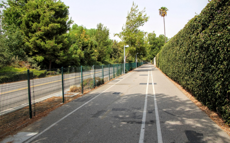
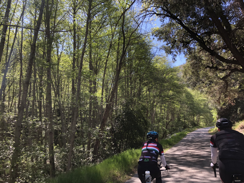
The 22 miles of the Marvin Braude Coastal Bike Trail are a bicycle rider's delight along the Pacific coast. This is one of the Best Bike Trails In L.A.The trail connects to the Ballona Creek Path between Will Rogers State Beach in Pacific Palisades and Torrance Beach, allowing you to ride from Culver City to Palos Verdes if you have the time and the energy. The route begins at Will Rogers State Beach, goes among luscious homes in Santa Monica, Venice, and Manhattan Beach, and then descends to Torrance County Beach, better known to locals as "the Strand."
While there are certain sections of the trail that must be shared with people, the vast majority is bike-only. To avoid Marina del Rey, the paved road swings into Washington Boulevard after you pass Venice. The rest of the trip, which takes you back to the shore all the way to the Palos Verdes Peninsula, is on the sand. Although the trail can become congested and sandy, especially on weekends and in the sections that pass through Santa Monica and Venice, riding conditions are typically calm. Summer evenings on weekdays are ideal. Along this path, numerous facilities are spaced often. Even a useful map is provided by L.A. County.
The path is interrupted twice along the coast: once in Marina del Rey, where it circles the marina and you ride briefly in a bike lane along Washington Boulevard, and once in Hermosa Beach, where you can choose between riding along The Strand (which is frequently congested on the weekends) or Hermosa Avenue (very chill).
Length: 22.3 mi (35.9 km)
Difficulty: Moderate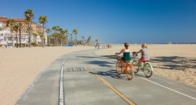
https://www.californiabeaches.com/ 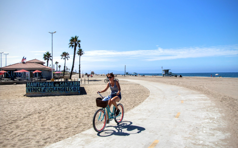
https://www.spinlister.com/ -
Only a few blocks from the Culver City Expo Line, this seven-mile walk follows Ballona Creek all the way to the Pacific Ocean. You can either join the trail at one of the dozen controlled entries along the way and bike the full route at your leisure. This is one of the Best Bike Trails In L.A.
The Pacific Ocean in Marina Del Rey and Culver City are connected by the Ballona Creek Bike Path, which runs parallel to Ballona Creek. In the south, the trail joins a beach path that goes on to Redondo Beach; in the north, Dusquesne Avenue joins the bike path with the Park to Playa Trail's eastern sections. Access to the Ballona Creek Bike Path is available from a number of streets that are close to the path.
Cycling, running, strolling, and skating are common activities on the trail and bike route, especially on weekends. The Mountains Recreation and Conservation Authority is a significant player in various programs to increase the bike path's accessibility and appeal while enhancing the ecosystem along the stream. This is done in collaboration with federal, state, county, and nonprofit partners.
Keep in mind that when there is a chance of significant rain, the entrances to the bikepath are locked. Rainstorms cause the stream to rise quickly and dangerously, which could cause some of the bike route to be submerged.Length: 6.7 mi (10.8 km)
https://www.spinlister.com/ 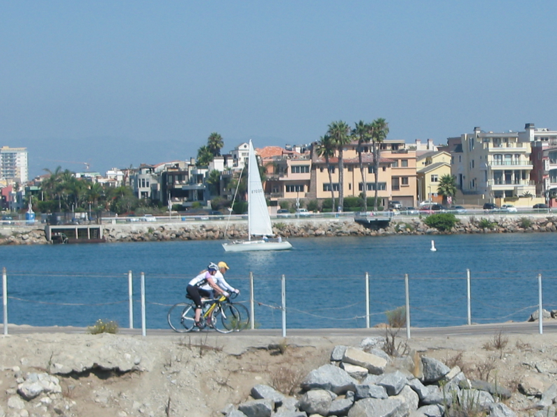
https://ballonacreek.org/ -
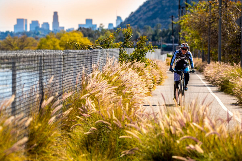
The Los Angeles River cycling path, also known as the Glendale Narrows, is a Class I bike and pedestrian way in the Greater Los Angeles area that runs from north to east along the Los Angeles River via Griffith Park. The Elysian Valley Bicycle & Pedestrian Path is the name of the 7.4-mile segment of bikeway that passes through the Glendale Narrows. Additionally, a bike route connects Vernon, California, with Long Beach, California. The Los Angeles River Bikeway is the name of this stretch.
The LA River Trail's bike path connects the largest open space in the area, making it a crucial non-motorized route through the second-largest urban area in the country. The walk traverses the distinctive Glendale Narrows section of the river, providing opportunity to see riparian environment and a variety of bird species, stop at nearby parks, and take in the famed artistic river gates.
Along the 51 miles of the Los Angeles River, there are a number of disjointed, paved routes, some of which are longer than others. Although there are nice trails from Canoga Park to the Port of Los Angeles, the Glendale Narrows/Elysian Valley Bicycle Path, which runs through the increasingly bustling Frogtown, is where you'll find the majority of biking activity. It has several notable entry sites, including Lewis MacAdams Riverfront Park and Rattlesnake Park, and extends from Victory Boulevard and Riverside Drive to Egret Park in Elysian Valley.Length: 7.00 miles
https://la.curbed.com/ 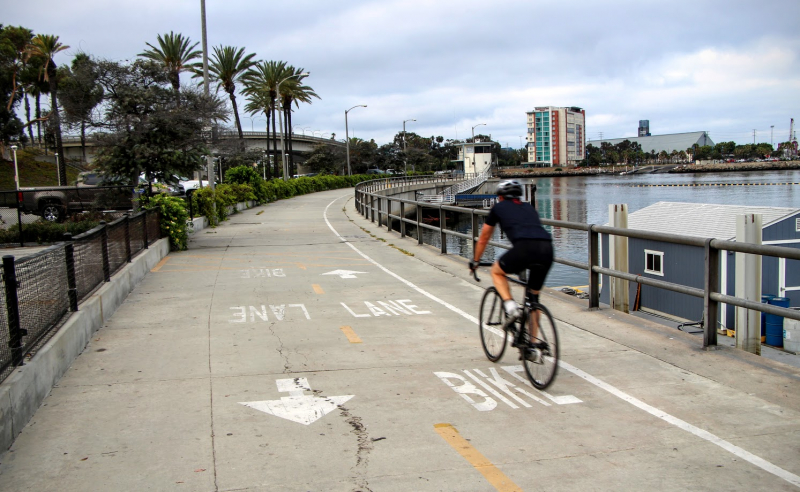
https://www.spinlister.com/ -
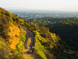
A 9.0 km out-and-back trail may be found close to Burbank, California. The Chandler Bikeway is generally regarded as a simple route; it requires 1 hour and 37 minutes to complete. Even though this is a popular trail for road biking, hiking, and birdwatching, you can still find some peace and quiet during the slower periods of the day. The route is lovely to explore at any time of the year and is open all year. Dogs are permitted, but they must be leashed.
The Chandler Bikeway is a welcome exception to the pattern as typically breaking up railroad tracks indicates that the car will continue to govern society. Initially transformed into a concrete bikeway and sidewalk in 2004, Chandler Boulevard in Burbank runs for a few kilometers from Mariposa Street to the North Hollywood Metro stop. The railroad rails that passed through Burbank were transformed into the Chandler Bikeway. It has paved lanes for bicyclists, pedestrians, and other wheeled modes of transportation. The odd sculpture or work of street art livens up the area, but the Verdugo Mountains seen from the trail is the true lure.
It is a lovely cycling path with substantial landscaping and public art scattered along its length. The path is well-marked and has distinct lanes for bikes and pedestrians. The bikeway connects to numerous bike trails throughout the metro region, including the Los Angeles Bike Path, for those who are more daring.Length: 2.8 miles
https://www.traillink.com/ 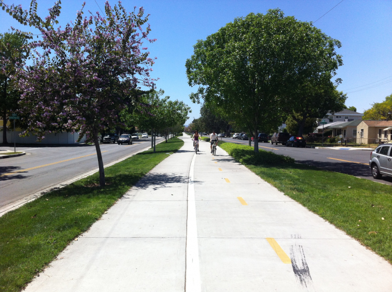
https://www.spinlister.com/ -
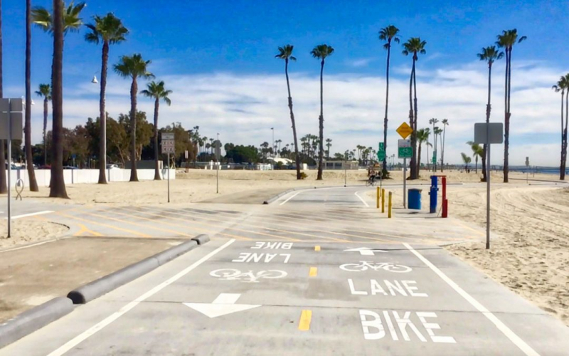
This is one of the Best Bike Trails In L.A. Use the main beach to glide, bike, or walk along the water's edge from Alamitos Bay to Shoreline Village. From Alamitos Avenue in the west to 54th Place in the east, this 3.1-mile bike path is a 17-foot-wide concrete trail that runs along the shore. There are two six-foot cycling lanes and one five-foot pedestrian lane. At Alfredos on the west end, you may hire skates, bikes, umbrellas, and beach chairs. Contact 434-6121 for further details.
Starting in Shoreline Village in Long Beach, this paved path travels down the city's sandy beachfront, passing the Long Beach Museum of Art, Belmont Brewing, and Rosie's Dog Beach. The designated path finally comes to an end near Bay Shore Avenue, but if you travel north on that street, you'll arrive at the entrance of the picturesque Naples canals.
Citizens who wished to connect a 29-mile bike path network started the Shoreline Pedestrian/Bicycle Path. A grant from the Los Angeles County Transportation Commission matched funding from the city for capital improvements. In January 1988, this cycling path was built.
The City of Long Beach's limits include four additional significant Class I bike pathways (off-road distinct bike paths) totaling more than 60 miles. The city also features a large number of Class III paths connecting bike routes with shared use of the road with automobiles and Class II paths, which are marked lanes on the road.Length: 4.1 miles
https://visitgaylongbeach.com/ 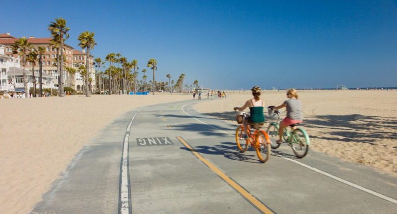
https://www.californiabeaches.com/ -
The Northeast Los Angeles area of Los Angeles County, California, has a Class I bicycle path called the Arroyo Seco Bicycle Path that runs along the Arroyo Seco river channel for about two miles (3.2 km). In the canyon, it runs parallel to the Arroyo Seco Parkway (CA Route 110). The cycling path links the communities of Highland Park at Sycamore Grove Park, Montecito Heights at Sycamore Grove Park, Hermon at Hermon Park and Ernest E. Debs Regional Park, and Hermon at Ernest E. Debs Regional Park with the city of South Pasadena at the Arroyo Seco Stables. Tall California sycamore and California oak trees provide shade for the pathway.
Through chain-link fence, the 0.25-mile (0.40-km) section of the trail that faces southwest extends along the top of the canal and provides a view of the Arroyo Seco. For the remainder of the journey, it then dips into the Arroyo Seco flood control channel's bed. A small and constant uphill grade in the northeastern/upstream direction, following the channel hydraulics, is present, with certain sections under overpasses having significantly steeper slopes.
Hermon Park/Arroyo Seco Park, Sycamore Grove Park, Ernest E. Debs Regional Park, and the Montecito Heights Recreation Center all have parking and access. A pedestrian bridge crossing the Arroyo Seco is the only way to get to Sycamore Grove Park. Along the way, the trail passes under numerous other automotive and pedestrian bridges.
If you're alright with pedaling down some residential streets, you can make your way all the way up to the Rose Bowl, where you'll find a loop of protected lanes, but the designated path is right at where York Boulevard merges into Pasadena Avenue.
Length: 2.1 miles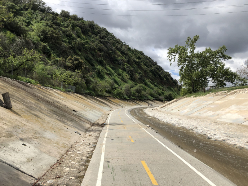
https://www.thisboundlessworld.com/ 
https://www.google.com/ -
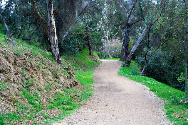
As you walk through Griffith Park's mixture of native chaparral and groomed trails, it's simple to forget that you're still in Los Angeles. Where else in the center of a city might you find canyons, caves, and coyotes? Biking is by far the most effective way to explore the 4,310 wild acres of the park. For a flat ride, stay on the perimeter and the L.A. River Bike Path; for a slight ascent, divert onto Crystal Springs Drive; or, for a truly challenging ascent up Mt. Hollywood Drive.
This is one of the Best Bike Trails In L.A. Griffith Park, arguably the nicest urban park anywhere, provides a wide range of choices for various riding styles. Take a spin around Crystal Springs Drive and Zoo Drive for a leisurely, calm ride. Add Griffith Park Drive to the loop to make it a little more challenging. These two routes are straightforward, well-paved, and feature roomy lanes or shoulders for riders to use. Although there is rarely any traffic, the park can grow crowded on the weekends.
Griffith Park includes a lot of hills, especially Mount Hollywood, which is crisscrossed with a number of rideable roads, allowing you to raise your body and heart rate while getting a good workout. A nice way to complete a round of the park is to ascend Commonwealth Avenue to the Griffith Park helipad, cross Mount Hollywood, and then descend to Vermont Canyon. There are two climbs on this course, separated by flat sections and descents. Don't forget to stop by the Observatory while you're out and about.
You should already be familiar with Griffith Park's location. In the entire park, parking is free and frequently allowed on the side of the road. Start pedaling after parking near the destination. There's always the option of riding to the park.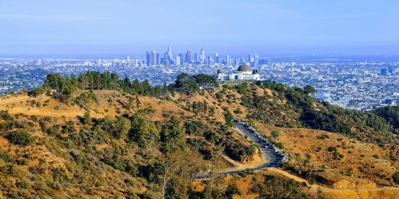
https://griffithobservatory.org/ 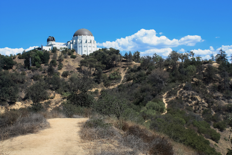
https://www.zocalopublicsquare.org/ -
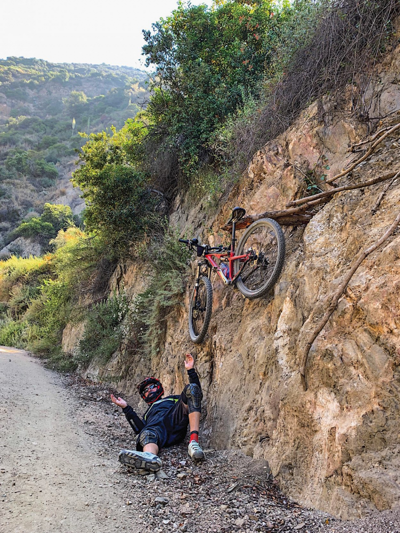
The stunning 7.5-mile Devils Canyon Dam Truck Trail is located in the San Gabriel Mountains above Azusa. One of Southern California's most picturesque rides is the easy ascent from Highway 39 to the Cogswell Dam.
A little but constantly audible creek that is supplied by the upriver dam runs parallel to the road itself. The road offers drivers a nice, calm ride because it is frequently shaded by trees and mountains. There is no mobile service in this area. The San Gabriel Mountains, a trickling brook, you, and your bike are all that are present. There are several picnic tables along the route, so you may stop and eat or just enjoy the view. Keep in mind that you are in the Angeles National Forest and must pack out any rubbish you bring in.The hill between Highway 39 and the dam is a challenge. Before you turn around and find you're moving quicker, you probably won't even notice the grade. The first 7 miles of the road are the primary draw, but there is a short, steep hill if you wish to go up to the dam itself. Bring the kids because this is a simple, low-intensity ride.
Apart from the fact that it is hauntingly beautiful, no public vehicles are allowed on the route. Public works workers may be driving a car or truck that you pass, but they are polite and aware of the needs of hikers and cyclists. The first mile or so might have a lot of pedestrian traffic, particularly on weekends. It feels as though you are the only one in the forest as you pass the main fishing and recreation sites.
You'll need a car because you're going into the mountains for this one. A 210 freeway exit is available at Azusa Avenue/Highway 39. Drive with the direction of north in your car. Approximately 20 minutes from the freeway, just past the intersection of Highway 39 and East Fork Road (you'll see a bridge), is where you'll find the road you're searching for. Here is a Google Maps link that shows where the dam road is located specifically. You have two parking options: on the side of the road or at a lot a quarter-mile away from Highway 39.Length: 7.4 miles
https://joechoosehappiness.com/ 
https://www.freepik.com/ -
The Arroyo Seco, meaning dry creek in Spanish, a sizable watershed flowing out of the San Gabriel Mountains, is where the Rose Bowl is located. The Arroyo Seco has dug canyons into the mountains that are 1,000 feet deep and starts on the Mt. Wilson flanks at 5700'. But in Pasadena, a half-mile-wide and 200-foot-deep gully has been created by decades of erosion.
You'll have plenty of company even though the ride isn't particularly scenic at the Rose Bowl. The Rose Bowl Loop encircles the stadium, its parking lots, and a golf course in a 3-mile round. The loop is used by both joggers and cyclists for fundamental training.
This is one of the Best Bike Trails In L.A. This is an excellent place to get in shape even though it's not as thrilling as some other rides. The loop's gentle incline lets you practice ascending and descending hills. Given that there are plenty other bikes and runners around, the traffic is calm and courteous. Since you're riding a bike, it's polite for you to stay to the left of the painted barriers that separate the sidewalk from the areas designated for runners and walkers. Additionally, restrooms and drinking fountains are located close to the stadium.
There is never a terrible time to bike at the Rose Bowl unless there is a special event. Even at night, there are several people present, and the majority of the roads are well-lit. Make sure your front and back lights are in functioning order if you are riding at night.
Drive as you typically would to the Rose Bowl, and park anywhere. When there isn't a special event, parking is free. If you're riding around the stadium, a dirt lot next to 176 West Drive in Pasadena is the best place to leave your vehicle.Length: 3.3-mile loop
https://www.pasadenanow.com/ 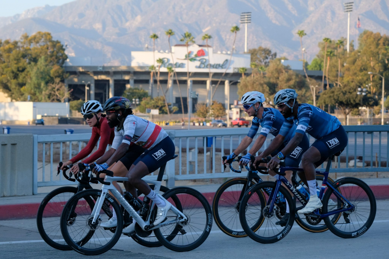
https://roadbikeaction.com/ -
Despite being only ten minutes from downtown Los Angeles, this park is frequently underutilized and empty. It's simple to locate a peaceful area in the park, even on the weekends. Since the roads were recently repaved, you are traveling on gripping, smooth asphalt. Although it is L.A.'s oldest park, it is not the ideal location to go if you haven't been on a bicycle in a while. It offers a buffet of transplanted tree species mixed with fantastic vistas of downtown.
There are many hills in Elysian Park. Although none of the hills are especially tall or steep, you will undoubtedly be climbing them. A ride in Elysian Park requires roughly the same amount of work as the Wisdom Tree Hike to the summit of Mount Hollywood or even to the Hollywood Sign (to which you may also ride your bike!). However, cycling and hiking are not the same thing.
The best technique to climb a bicycle when you're just starting out is to spin swiftly and in an easy gear. It's likely that your legs will feel like they are burning, but that just means you're doing it correctly. You won't have to climb any of the hills in Elysian Park for very long, and there are enjoyable downhills as well. Toilets and drinking faucets may be located all across the park.Length: 3.7 km
https://modernhiker.com/ 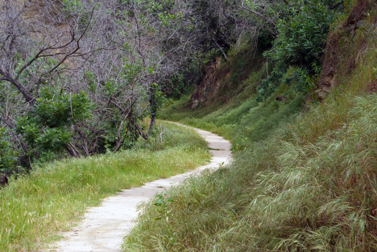
https://res.filmla.com/ -
Explore the San Gabriel Mountains if you've been riding a lot and are getting tired of Elysian Park, Griffith Park, and the beach. A fantastic way to get acquainted with the sizable Angeles National Forest is to ride to the top of Mount Wilson. The distance from the base of the Angeles Crest Highway to the summit of Mount Wilson is approximately 19 miles, with a climb of 4,500 feet.
By any standard, it's a difficult climb. The distance from the base of the Angeles Crest Highway to the summit of Mount Wilson will take you two to three hours to ride. Both the ranger station at Clear Creek Junction and the Mount Wilson Road turnoff provide water. The reward is a stunning panorama over the greater Los Angeles region. After that, indulge at the Mt. Wilson Observatory's Cosmic Cafe.
Although it normally doesn't get very busy on weekends, traffic does. Excellent times to exercise are weekday middays, weekend mornings, and evenings. Avoid rush hour as fast-moving Palmdale commuters who don't want to wait on the 14 Freeway use Angeles Crest.
Once more, the directions are ambiguous. Near the start of the route, there is a ton of unrestricted home parking. Additionally, the Angeles Crest Highway and the Gold Line are in close proximity. From the Memorial Park station, a 30-minute trip will take you to the base of Angeles Crest.Length: 14.5 miles
https://mbaction.com/ 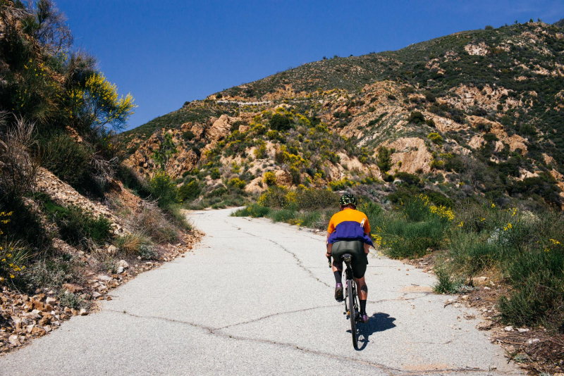
https://theradavist.com/