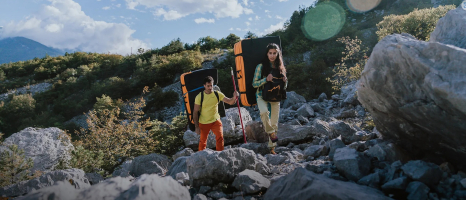
Top 10 Best Hiking Trails in Olympic National Park

Olympic is one of the country's most diverse national parks. On the Olympic Peninsula in western Washington, it covers roughly a million acres. It's a true ... read more...choose-your-own-adventure destination, with glacier-packed peaks, ancient forests, and a rugged coastline. Let's check out some of the Best Hiking Trails in Olympic National Park below!
-
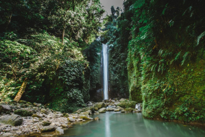
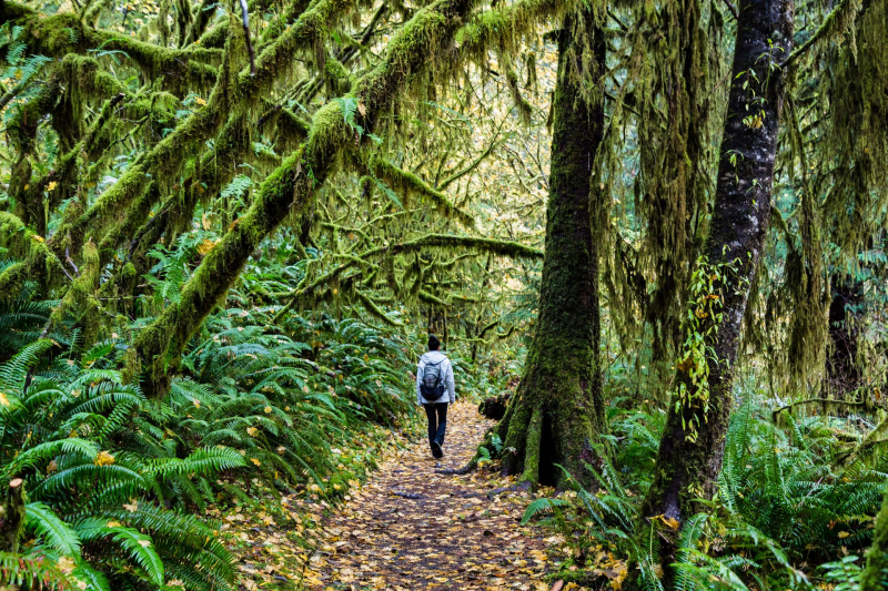
The Hoh Rain Forest is one of the most beautiful and unique temperate rainforests in the United States. It's also one of the park's most popular attractions. It's a 30-mile drive from Forks in the southwest area.
Each year, the Hoh Rain Forest receives around 12 feet of rain, with the biggest rains falling between October and April. The result is a lush, forested landscape with ferns, mosses, and practically every shade of green on the spectrum. There's a wide range of canopies of giant Sitka spruce and western hemlock trees, which rise more than 300 feet into the air. The 17.4-mile Hoh River Trail is one of many great ways to see the Hoh Rain Forest. This iconic hiking track follows the banks of the Hoh River, suitable for both day hikes and overnight adventures. The first 13 miles are relatively flat as the path meanders through the rainforest's sights. Visitors on day hikes can go as far as they like on this stretch of the trail before returning.
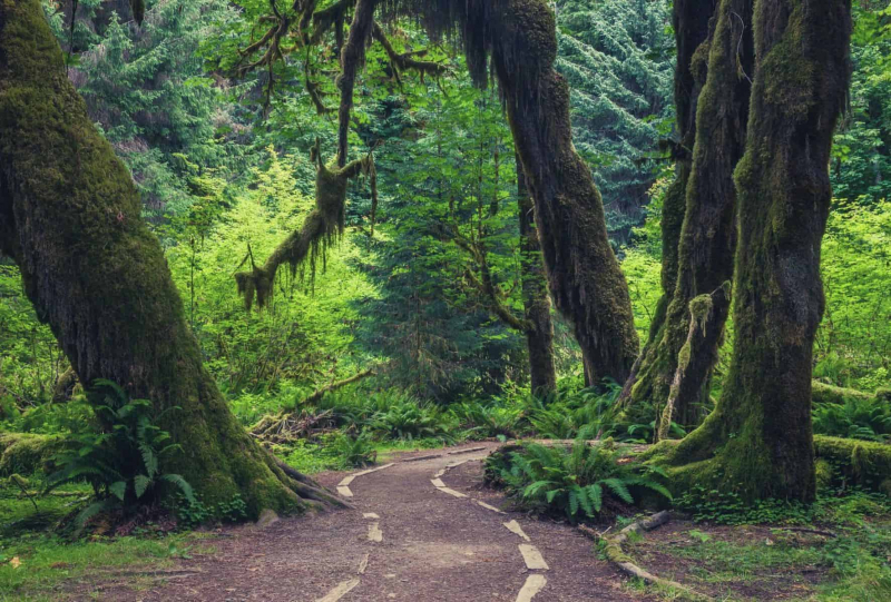
Hoh River Trail, Hoh Rain Forest 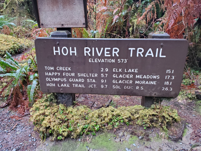
Hoh River Trail, Hoh Rain Forest -
Rialto Beach provides the best drive-up access to the Olympic Wilderness Coast, as most other beaches require a short hike. It is one of the most popular destinations in the Olympic National Park
Rialto's pebbly beach is lined with massive driftwood, leading to some of the country's most spectacular coastal features. A beachside parking area provides easy access to the beach. Much of the time spent on Rialto Beach is characterized by sea stacks, sea birds, and a rocky beach. Several backcountry campsites line the trees opposite the beach, making it a popular camping stretch along the coast. Head 1.5 kilometers north on Rialto Beach to the Hole-in-the-Wall rock formation for a really unforgettable trip. Tides pools and sea stacks abound here, making for excellent photography. Low tide is the optimum time to see this stunning natural tunnel and the surrounding tide pools.
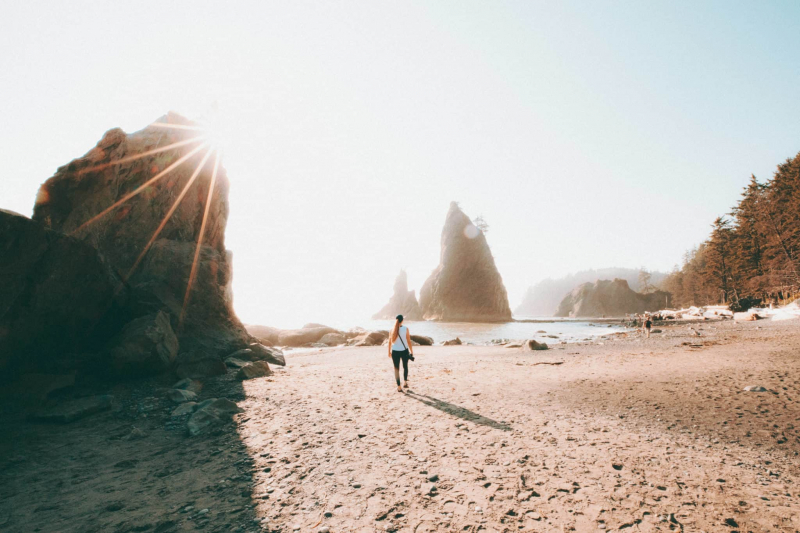
Rialto Beach Trail, Mora 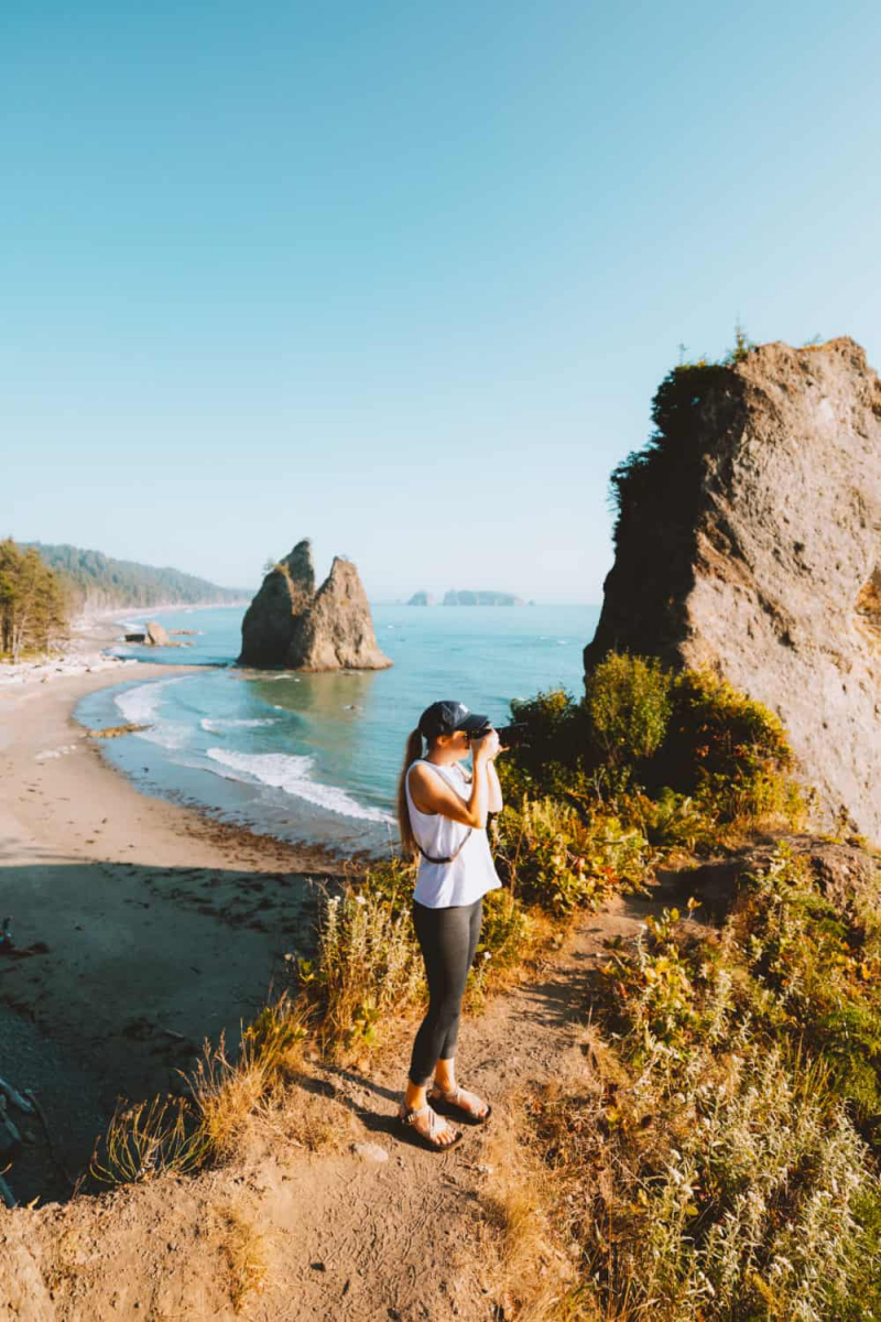
Rialto Beach Trail, Mora -
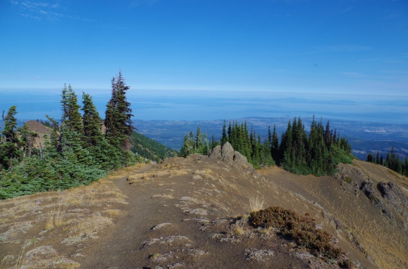
Many Olympic experiences are characterized by the view from the Hurricane Ridge Visitor Center. The Hurricane Hill trail is a family-friendly hike worth checking out if you want to get a closer look at this breathtaking horizon line. The Hurricane Hill trail is 1.6 miles long and climbs 700 feet in elevation from the visitor center. Its wide, paved path welcomes the summer crowds and gives plenty of room to stop and admire the surrounding mountain scenery.
Before reaching the top of Hurricane Hill, the trail passes through open forests with great views the entire way and navigates three moderate switchbacks. Before turning back, take some time to admire the panoramic landscape, which includes distant views of Vancouver Island on clear days.
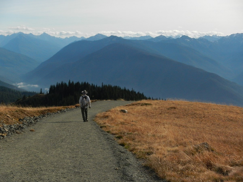
Hurricane Hill Trail, Hurricane Ridge 
Hurricane Hill Trail, Hurricane Ridge -
Marymere Falls is a family-friendly waterfall adventure located near the wonderfully gorgeous Lake Crescent on the park's northwest side. The Storm King Ranger Station is the most popular starting point for hikers. It's just about a mile from here to the 90-foot Marymere Falls, which are located in an old-growth forest.
A boardwalk wraps around the opposing rock formation, giving visitors different views of the falls. This high vantage point gives you several photo opportunities and lots of time spent exploring the surroundings. Hikers can take the Moments in Time Nature Trail back to the ranger station and parking lot instead of returning on the same trail. This trail also connects to Lake Crescent Lodge and its spectacular beachfront.
Marymere Falls Trail 
Marymere Falls Trail -
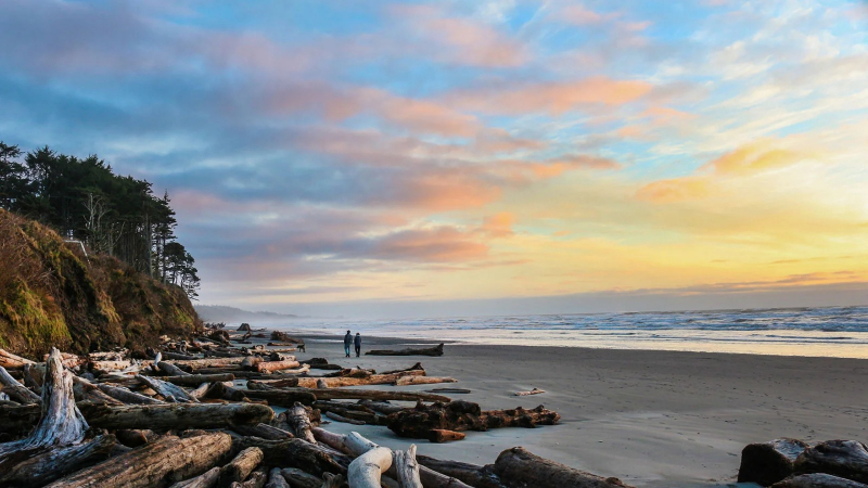
On the southern Wilderness Coast, Ruby Beach represents the rugged Washington coastline. Ruby Beach offers several miles of beach exploration, with unique rock formations and swirling sun-bleached driftwood. The trail from the parking lot is steep and paved, but the first accessible view of Ruby Beach is breathtaking.
Starting at the parking lot trailhead, walk down to the beach for about a quarter-mile, navigating over driftwood to get to the beach. Choose your own excursion along the beach from here. To the north, walk for about three miles through numerous massive sea stacks and cliff faces until you reach the waters of the great Hoh River. During low tide, a three-mile hike to Steamboat Creek to the south may be possible, with views of Destruction Island and its lighthouse to the west. This wild and rugged beach is a dream come true for anybody who appreciates long hikes by the sea. Ruby Beach's sunset is also nothing short of spectacular due to its western position.
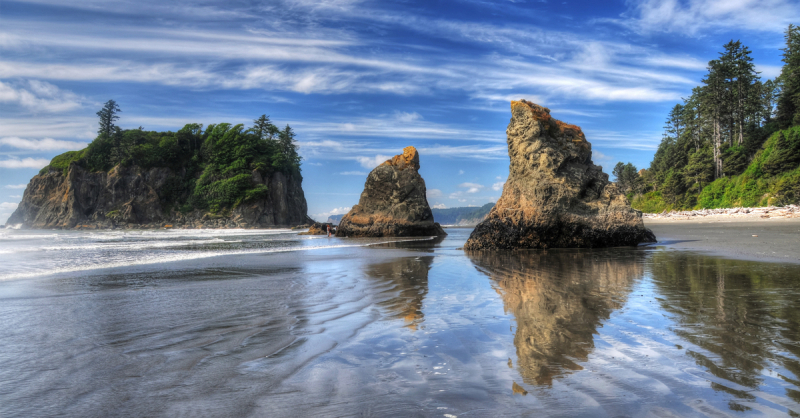
Ruby Beach Trail, Kalaloch 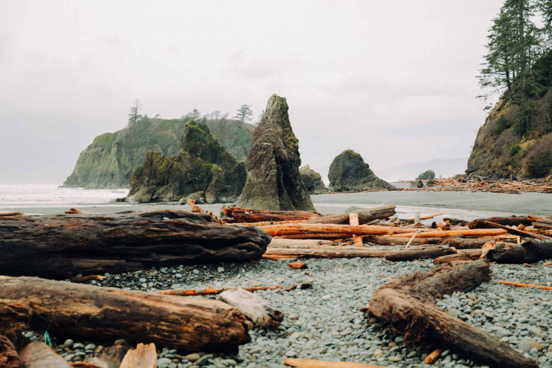
Ruby Beach Trail, Kalaloch -
Sol Duc Falls, located on the park's northwest edge and accessible from the Lake Crescent area, is a popular hike. The fact that the trailhead is only a mile away adds to the popularity of the fall. Its natural beauty, however, draws a lot of attention as a churning example of the fast-changing Olympic environment.
The trailhead for Sol Duc Falls is just beyond the Sol Duc Hot Springs Resort's and campground's attractive facilities. Both of these locations are a 12-mile drive from Lake Crescent. The short path goes through a lush forest filled with tall trees and many shades of green. The falls are a beautiful sight to see, and the boardwalk and viewing area offers various viewpoints. The falls are an excellent place to stop for an easy day hike, however, hikers are free to travel as far as they want. The path finally reaches the renowned Seven Lakes Basin, where overnight travel requires a permit.
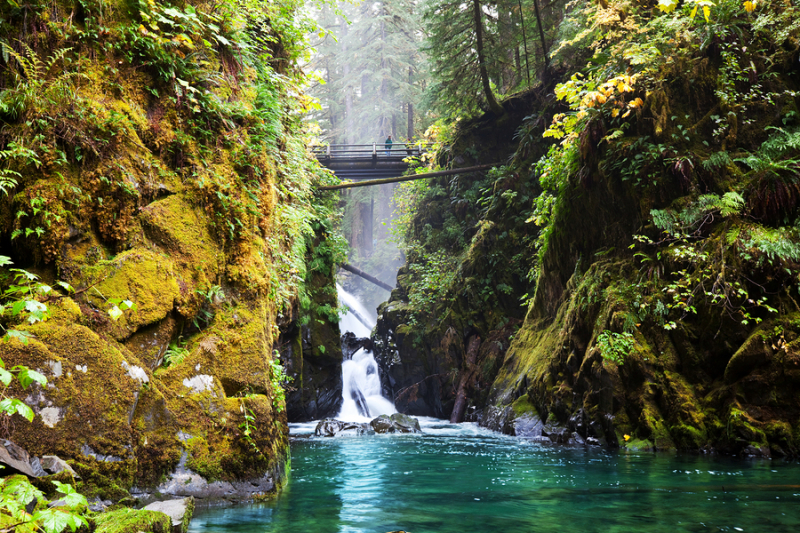
Sol Duc Falls Trail, Sol Duc 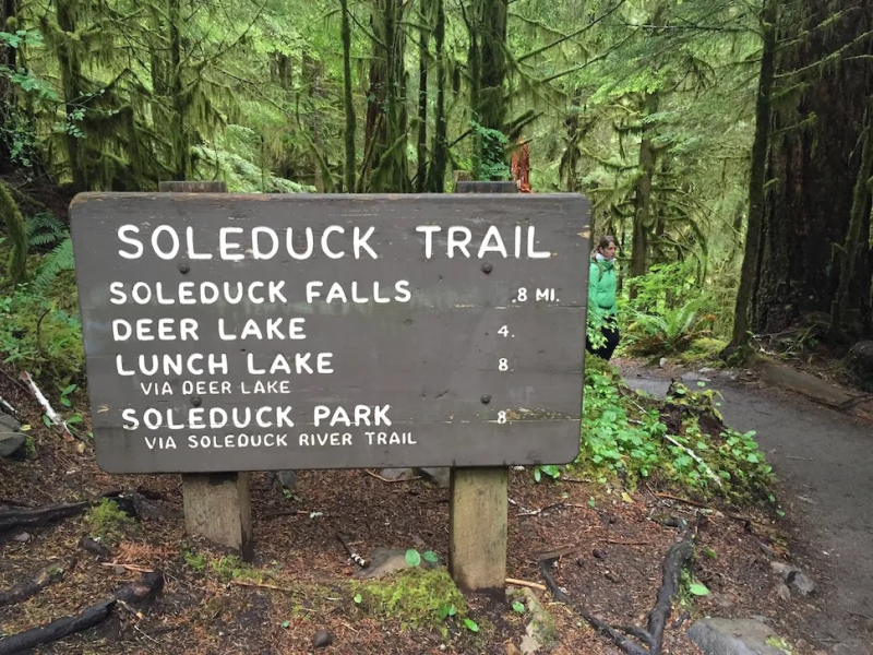
Sol Duc Falls Trail, Sol Duc -
The Quinault rainforest's beauty is something you must experience for yourself. No matter your ability level, there are plenty of fantastic hikes surrounding Lake Quinault. Whether you have small children or are a novice hiker, Quinault hikes provide stunning views of the area's natural beauty with little effort.
This gently sloping trail passes through magnificent old-growth boreal trees, rich understory vegetation, and an emerald carpet of mosses, ferns, and lichens. The trail is a half-mile circle with colorful signs describing the temperate rainforest of the Olympic Peninsula. It's a simple low-elevation hike (250 feet elevation). The Nature Trail connects to the broader Quinault National Recreation Trail System in the area, which includes portions along the scenic Lake Quinault shoreline. The journey around Lake Quinault is also a spectacular excursion. If you are unable to hike, consider driving around the lake instead.
Quinault Rain Forest Nature Trail, Quinault 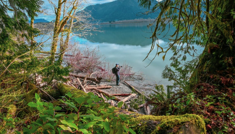
Quinault Rain Forest Nature Trail, Quinault -
A short half-mile hike, the Rain Shadow Loop takes you to the top of Blue Mountain. The Rain Shadow Loop, which is accessible from the Deer Park Campground and Deer Park Road (open seasonally), is a gently sloped half-mile hike that puts tourists on top of the world.
The Rain Shadow Loop is an ideal jumping-off point for longer hikes into the Olympic interior for hikers looking to extend their explorations. The loop begins with a climb and then levels off at the top of Blue Mountain. There are so many beautiful sights all around you, so bring your camera. At your feet are cities, islands, mountain ranges, and river valleys, as well as broad views of the water. Keep a watch out for wildflowers and deer and wild rabbit sightings as you get closer in.
Rain Shadow Loop 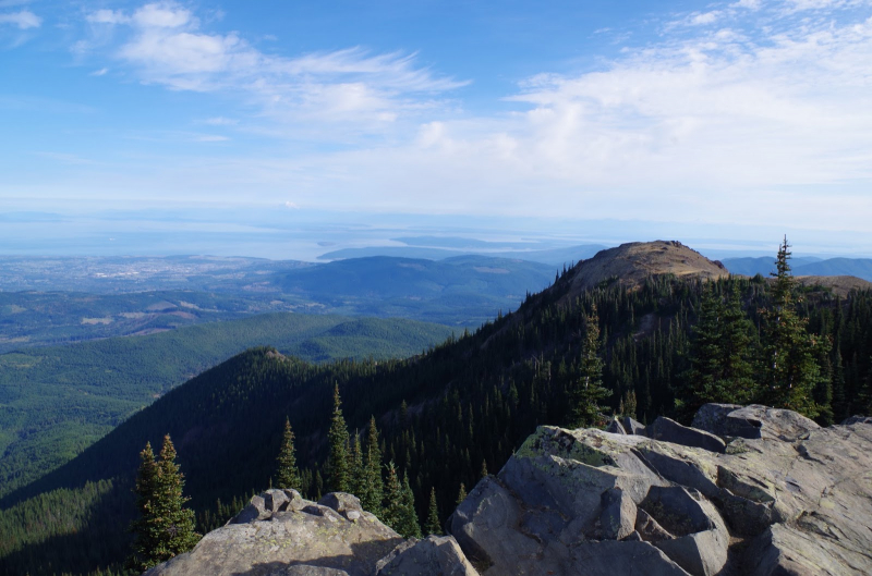
Rain Shadow Loop -
Head to the Wilderness Coast's Kalaloch area for a memorable beach trip. Several kilometers of sand tempt both small and big adventures. The beach is most commonly accessed from the Kalaloch Campground, which offers day-use parking. The beaches of Kalaloch (Beach 1, 2, 3, & 4) extend to the north for what seems to be an endless adventure.
Easy beach walks may be found along the Kalaloch coast at Beach 1 and Beach 2, especially during low tide when the beach is very wide. It's a great stretch for families and anyone who wants to see the coast without going too far. Take some time to look for the Tree of Life at the campsite along this section. Beaches 3 and 4 are more adventurous. When the ocean is out, these beaches offer a more rocky terrain with colorful tide pools to explore. Beyond Beach 3 and 4, a hidden gem known as Beach 6 offers even more fun. The campsite is about four miles up the coast from Beach 6.
Kalaloch Coastal Hiking 
Kalaloch Coastal Hiking -
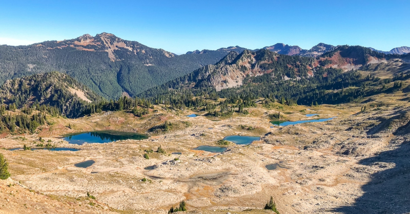
One of the most popular backpacking trails in the park is the Seven Lakes Basin Loop. It's on the park's north side, and the most common way to get there is by Sol Duc Falls. This 19-mile loop features a great variety of backcountry campsites and also features connections to the Hoh River Trail and to Appleton Pass (Elwha).
The route climbs into the Olympic Mountains, finally reaching Bogachiel Peak's peak (5,474 feet). If the clouds allow, a stunning vista of Mount Olympus and Blue Glacier will reward the overnight trip. Even if the clouds hang around, the route is lined with glistening lakes that provide gorgeous views regardless of the weather. The plentiful meadows along the route are also known to be home to black bears.
High Divide Trail (Seven Lakes Basin Loop) 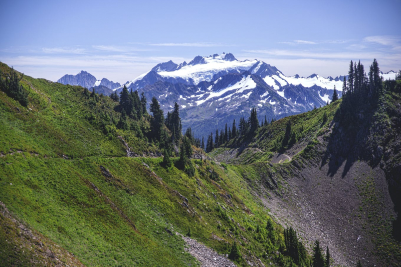
High Divide Trail (Seven Lakes Basin Loop)