Top 6 Best Hiking Spots in L.A. for Dramatic City Views

Los Angeles is fortunate to have nearly year-round sunny weather and a location that makes it possible to visit some of the state's top beaches and mountains ... read more...in the same day. Yes, there are many outdoor activities here, but hiking is one that tops the lists of many Angelenos. So the next time you want to see the city from a gorgeous vantage point, don't go to a rooftop bar; instead, lace up your hiking boots and head out onto the trail. Whether you prefer to take in the cityscapes or the ocean, Toplist has the trek for you on this list of the best hiking spots in L.A. for dramatic city views.
-
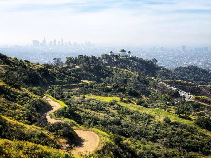
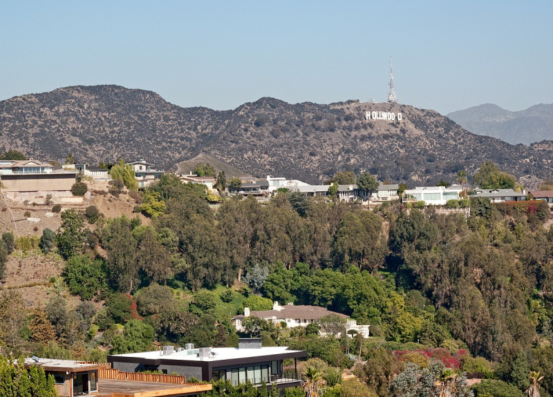
You can get a bird's-eye crash course in Los Angeles geography at the top of Mount Hollywood, which is the hill behind the Griffith Observatory and is not to be confused with Mount Lee, which is adorned with the Hollywood Sign. From the Verdugo Mountains to the Pacific Ocean, its 360-degree views provide a glimpse of everything (on a rare, smog-free day, at least).
Pick up the trail on the north side of the Observatory parking lot to ascend Mount Hollywood, Griffith's highest peak. The path quickly enters the hills and winds deeper and higher until, after about 15 minutes, the Hollywood Sign can be seen to the left. The path initially begins among scrubby evergreens. You'll arrive at the top, where there is a sizable, dusty clearing with picnic tables, after about a good 40 minutes of walking. It's an excellent vantage point for viewing expansive views of the Los Angeles basin, the edge of the San Fernando Valley, the misty hills to the west, the skyline of Downtown Los Angeles with the Observatory in the foreground, and the prize: a view of the Hollywood Sign at eye level across the canyon.
- Address: 2800 E Observatory Ave
- Hours: Parking lot 5am–10pm. Hiking trails close at sunset.
- Parking: Snag a spot in the lot next to the Griffith Observatory. If that lot is too hectic, look for street parking along Observatory Avenue. Both cost $8–$10 per hour. Alternatively, a DASH bus runs up Vermont Avenue daily from 10am–10pm for only 50 cents (35 cents with a TAP card).
- Pets? Dogs allowed on leashes.
- Length: ~3 miles
- Time: 90 mins
hikingproject.com 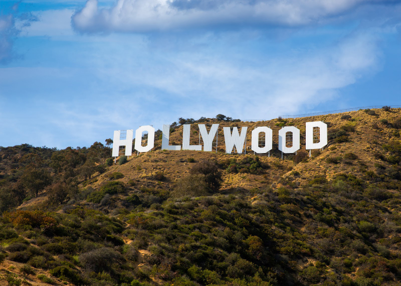
bartush.com -
A haven for athletes in the Hollywood Hills, Runyon's is the place to see the toned bodies and even toner houses that are typical of this region of Los Angeles. There are countless opportunities to pause and exclaim, "This is so L.A.," especially during the hectic after-work rush hour when people-watching is at its height. The packed dirt path takes hikers, runners, yoga practitioners, and roving weightlifters on a loop around the canyon.
The loop can be accessed from either the east (Fuller Avenue) or west (North Vista Street) side of the canyon. In either case, the ascent is mainly gradual, with the exception of a perilously narrow and steep section near the top of the eastern canyon wall. The trail levels off along a ridge at the top, providing views of the Hollywood Hills' eclectic architectural style—solar panels, pools, and decks on stilts—downtown Hollywood and the Capitol Records building, the manicured neatness of WeHo's grid, and the maze of high-rises along Miracle Mile. You can also cheat a little and go on a shorter hike from Mulholland Drive.
The southern entrance is at the end of Fuller Avenue in Hollywood; the northern entrance is off the 7300 block of Mulholland Drive. Runyon Canyon is definitely one of the best hiking spots in L.A. for dramatic city views.
- Address: 2001 N Fuller Ave
- Hours: Dawn to dusk
- Parking: Street parking. Franklin Avenue is a good place to find a two-hour spot. You can enter the park on North Fuller Avenue or North Vista Street. Watch out for permit-parking only blocks in this neighborhood.
- Pets? Dogs are welcome (encouraged, really), with much of the trail allowing off-leash roaming.
- Length: ~1.5 miles with possibilities to extend
- Time: 30–60 mins
wikipedia.org 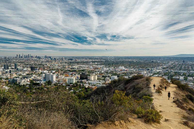
-
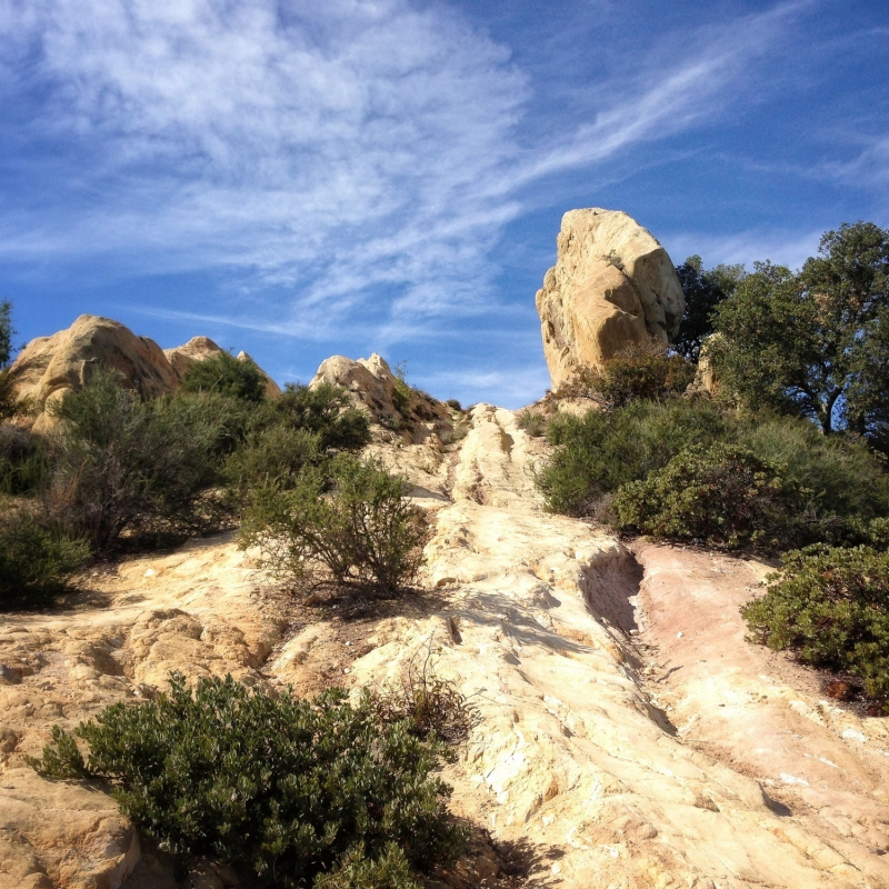
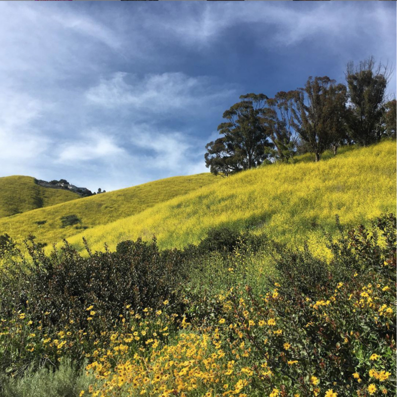
It's difficult to make a mistake when looking for the ideal views where mountains and the ocean converge. The raw nature of Malibu's Corral Canyon, which can be explored on a 2.4-mile, relatively easy, and startlingly deserted (on a weekday afternoon) hike, stands out. It features coastal sage scrub and willows clinging to parched hills (lush with wildflowers after a wet winter), as well as the occasional bunny or lizard.
As the trail begins, the noise of PCH and the sea breeze follow you up. However, on this trail without any shade, things quickly calm down and warm up. At the first fork, hang left so that you can descend facing the ocean. The packed dirt path takes you on switchbacks along the east side and top of Corral Canyon, passing through wild fennel and rust-colored grasses. Wide-ranging views of the Santa Monica beaches from Point Dume all the way down to the ocean can be seen as you descend toward the water.
- Address: 25623 Pacific Coast Hwy, Malibu
- Hours: Dawn to dusk
- Parking: Plenty on PCH by Malibu Seafood; or pay $12 in the lot at the trailhead, just east of the restaurant.
- Pets? Dogs allowed on leashes.
- Length: ~2.5 miles
- Time: 60–90 mins
mtbproject.com 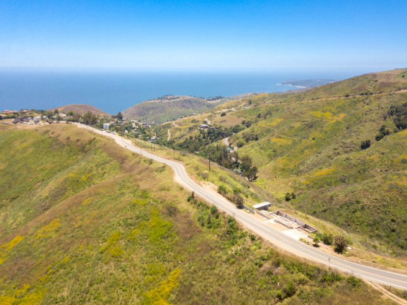
malibuluxuryrealty.com -
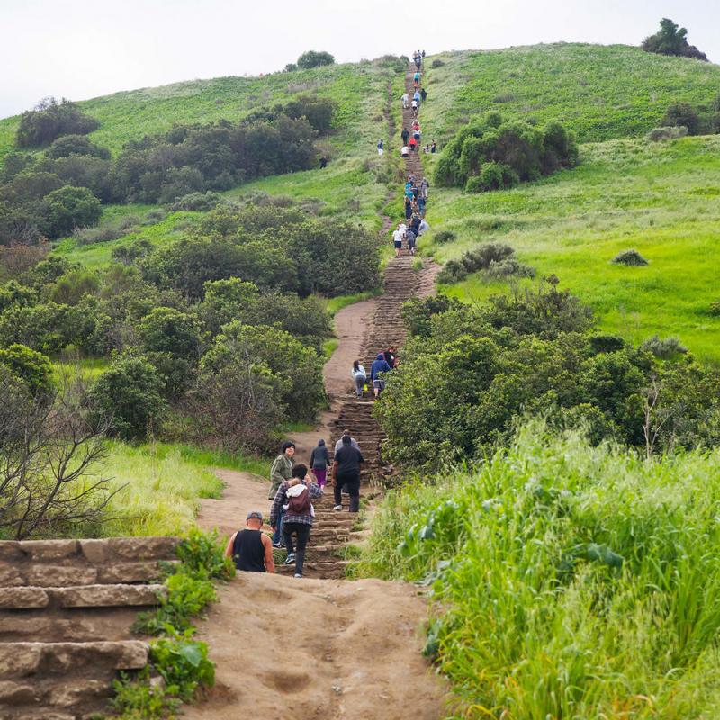
An odd location for a state park is a hill dotted with oil rigs on the outskirts of Culver City's industrial area. But all of that adds to the urban overlook's subtle charm. The park's main draw for exercisers south of the 10 Freeway are the steps: more than 260 stone slabs that carry hikers to the top in under 20 minutes while leaving them breathless and sore.
Don't look back if it's your first time until you get to the top. By doing so, you'll get the most out of this view of Los Angeles' east-to-west spine from the north, which is much less well-known than the Hollywood Hills postcard photo but just as worthwhile. Look eastward at the skyline of Downtown and the expanse of South Los Angeles. With the Santa Monica Mountains providing a smoky backdrop, Century City's skyscrapers and Westwood's Mormon temple cut imposing figures to the north and west. A no-frills workout scene takes off during happy hour, and people continue to pour into the park until it closes at dusk (and after). The hill’s central location and low-key crowd make you feel like you’re above the city, and within it, all at the same time.
- Address: 6300 Hetzler Rd, Culver City
- Hours: 8am to sunset. The visitor center is open occasionally, usually mornings and afternoons in the later half of the week.
- Parking: Look for parking on Jefferson Boulevard or drive to the top and pay $2 per hour or $6 per day.
- Pets? No dogs allowed (sorry!).
- Length: Less than 1 mile, but very steep
- Time: 30 mins
fotospot.com 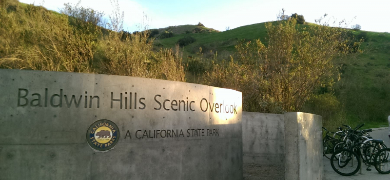
ladateideas.com -
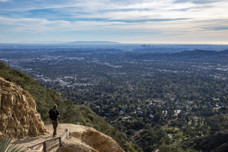
The trek to Echo Mountain is a great hike in the lower San Gabriels to incredible vistas, forested mountain canyons, and the ruins of a turn-of-the-century mountaintop resort. This route also has bonus enjoyment for history buffs, in the form of plaques and markers placed along the ruins and the route of an old railroad through the mountains.
One of the first things you’ll see on the trail is a marker placed by the Altadena Historical Society, marking the entrance to the former Cobb Estate, and the Echo Mountain trailhead. You will see many more plaques along the way.
The trail crosses a flood control area and begins zigzagging its way up the southwest base of Echo Mountain. This section of the trail is very heavily-traveled but is in excellent shape. The path is very well maintained with only a few pieces of trail trash on the way up. The trail gets more rugged the further along you hike, but nothing’s too bad on this stretch. If you’re hiking in the morning, you’ll get plenty of shade while climbing the west side of the ridge — otherwise, you’re not getting much of any shade.- Address: E Loma Alta Dr at Lake Ave, Altadena
- Hours: Part of the Angeles National Forest, the trail doesn’t officially close and is popular with night hikers.
- Parking: Look for free street parking by the entrance.
- Pets? Dogs allowed on leashes.
- Length: 5 miles
- Time: 2.5–3.5 hrs
latimes.com 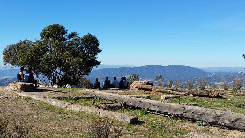
hikinggirlwithdog.com -
Portuguese Bend Reserve, one of the best hiking spots in L.A. for dramatic city views, is a 399-acre park with a maze of trails, and almost every one of them offers a stunning, expansive view of the Pacific Ocean with Catalina Island in the background. These trails are part of a Nature Preserve with lots of wildflowers and wildlife to see.
Start by walking down Burma Road from the street into the park, past the Dr. Ibrahim El-Hefni Vista Point. After turning left onto Eagle's Nest Trail, continue traveling along it for almost two miles until it intersects with Burma Road once more. Here, you have the option of returning up the hill or continuing on the lower loop by turning right down Toyon Trail. When you reach the end of Toyon Trail, turn right onto Peppertree Trail and continue on the left.
Following a literal fence, keep going on this trail and turn left to ascend Klondike Canyon Trail. At a fork in the trail, you can choose either direction, but stay on the left for the simpler route. Once you reach Burma Road, turn left after continuing up Barn Owl Trail. You will reach the lower loop's closure as a result of this. Instead of turning around and returning the way you came, take a right at the intersection with Toyon Trail and continue on Ishibashi Trail. This will take you back to Burma Road, where you will turn right and proceed back to the trailhead. Get lost? You won't get lost because all of these trails will take you back to your starting point.
- Address: Crenshaw Blvd and Burrell Ln, Rancho Palos Verdes
- Hours: One hour before sunrise to one hour after sunset.
- Parking: Look for limited street parking, available by a prohibitive reservation system only, along Crenshaw. Shuttle service also available.
- Pets? Dogs and horses allowed.
- Length: 5.15 miles (a shorter, 3-mile hike is possibile by ommitting lower loop).
- Time: 2.5–3.5 hrs
annaboudinot.com 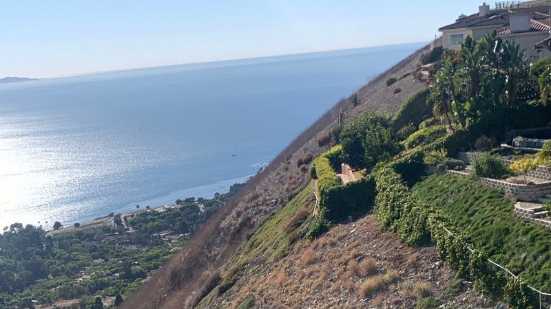
discover.events.com