Top 11 Best Lakes To Visit in ArKansas

The lakes are the ideal summer destination for those who want a place to relax and cool off without descending to cramped beach destinations. In the vast ... read more...region of Arkansas, there is no shortage of beautiful lakes. Let's join Toplist to discover the best lakes to visit in Arkansas!
-
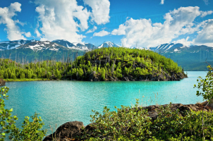
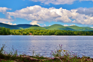
A dam built over the White River created Beaver Lake, a man-made reservoir in the Ozark Mountains of Northwest Arkansas. There are 784 kilometers of shoreline around Beaver Lake. It is a well-liked tourist site because of its tall limestone bluffs, natural caves, and a variety of plants and flowering shrubs. Northwest Arkansas gets its drinking water from Beaver Lake, which Beaver Water District also manages, treats, and sells. Beaver Lake is one of the best lakes to visit in Arkansas.
There are also constructed picnic spaces, boat launches, and hiking trails close to the lake. Along the lake's edge, a number of businesses operate marinas and hire boats. The enormous limestone bluffs that cover a large portion of Beaver Lake's shoreline provide a special aesthetic attraction.
The most well-liked pastime at Beaver Lake is fishing. Beaver Lake offers a range of fishing activities with over 28,000 acres of water to explore. Perhaps the most popular type of fishing at the lake is bass fishing, where prize fish are frequently retrieved from the water. You should head to creek mouths like War Eagle Creek and Rambo Creek if you want to catch your own.
Location: Ozark Mountains, Benton / Carroll / Washington County, Arkansas
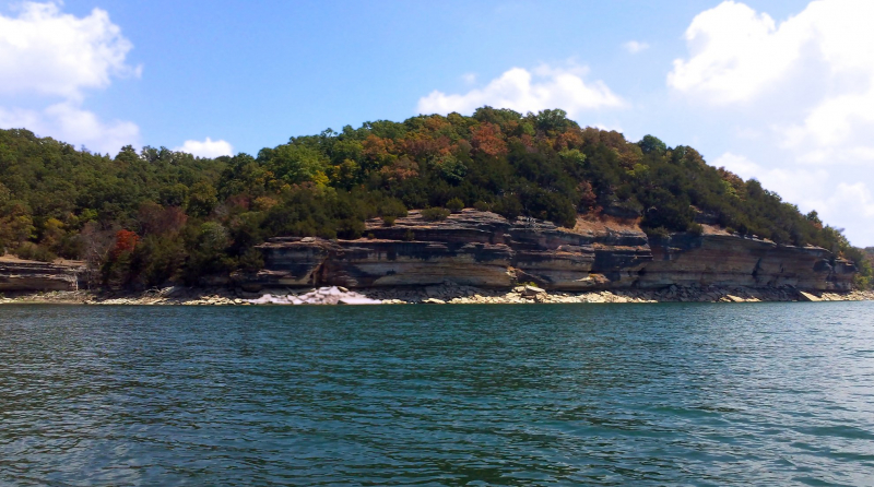
Photo: wikipedia 
Photo: wikipedia -
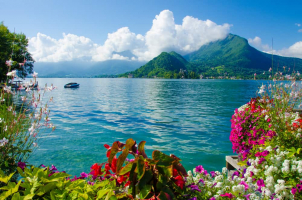
A census-designated place (CDP) called Lake Hamilton is located in the American state of Arkansas' Garland County. The Hot Springs Metropolitan Statistical Area includes it. In 2010, there were 2,135 people living there. It has the name of Lake Hamilton, a man-made lake in the region.
Lake Hamilton, located in the Ouachita Mountains on the southern fringe of Hot Springs, is incredibly picturesque. The Carpenter Dam on the Ouachita River formed this lake, which is more than 7,400 acres in size. It is surrounded by a number of commercial, residential, and public spaces. On the water, boating and fishing are common activities, and a number of close-by marinas offer boat rentals, boat launches, and live bait.
Garvan Woodland Gardens, located on the lake's eastern bank, is one of the most beautiful places to visit. You can travel to this lakeside botanical area by boat or paved road. Hill Wheatley Park, which has a public swimming beach and a boat launch, is a pleasant place to enjoy the water on the lake's northernmost point. Rentable lodging options in Lake Hamilton include a number of lakefront cabins.
Location: Garland, Arkansas
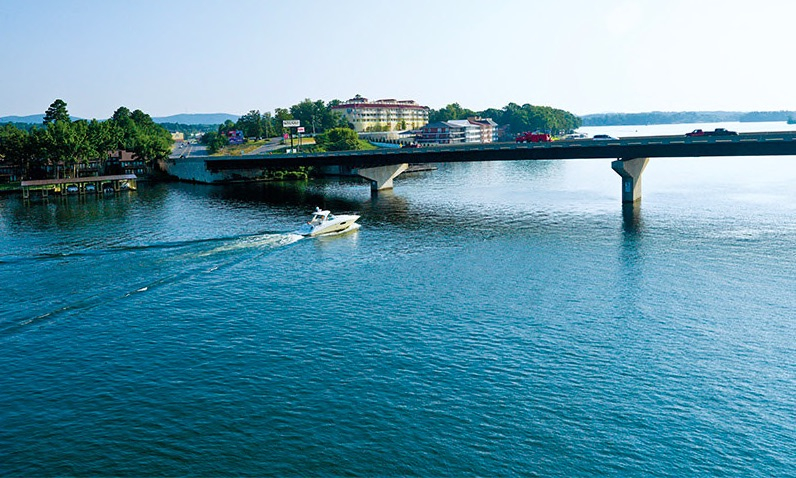
Photo: arkansas.com Video: https://www.youtube.com/watch?v=FL8UsBhFumc -
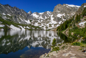
This large reservoir is located in the North Central Ozark Mountains of Arkansas and has a shoreline of over 550 miles. Boating, fishing, and water skiing are just a few of the outdoor pursuits that are supported by the lake. Scuba diving and spearfishing are popular but less conventional pastimes. 8,900 acres and more than 890 kilometers of shoreline make up Norfork Lake. On the lake, there are 19 recreational parks with areas for water skiing, swimming, boating, hiking, and picnics. Commercial docks on Norfork Lake offer access to the lake as well as boats, motors, diving gear, and guides.
The White River was dammed to form Norfork Lake, and the reservoir's expansive arms are lined with public access sites. At the lake, the Army Corps of Engineers provides a number of campgrounds with hiking paths and open-to-the-public beaches. Around the lake, there are also commercial outfitters that offer marinas and locations to hire boats.
From every aspect, Norfork Lake's surroundings in the Ozark Mountains provide breathtaking views. The lake's crystal-clear water enhances its natural beauty and increases the allure of diving and fishing. Divers from all over the world come to Norfork Lake to scuba and skin dive in these crystal-clear waters and look for a variety of sunken treasures.
Location: Baxter County, Arkansas
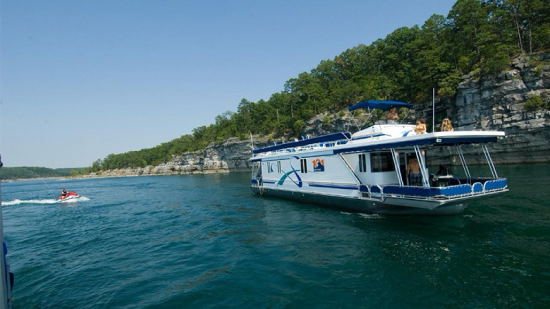
Photo: arkansas.com 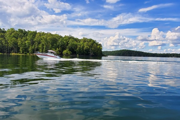
Photo: ozarkmountainregion.com -
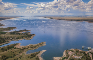
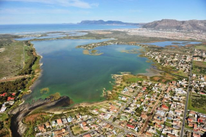
A lake close to the Mississippi River is called Lake Chicot. This lake is one of the best lakes to visit in Arkansas. The lake is situated in Chicot County, Arkansas, on the east side of Lake Village. The Mississippi River's meandering 300 years ago created the largest natural lake in Arkansas as well as the largest oxbow lake in all of North America.
An unusual oxbow lake called Lake Chicot once served as the Mississippi River's main channel. Since then, Lake Chicot's waters have been diverted, resulting in Arkansas's largest natural lake. This freshwater lake is popular with anglers who want to catch bluegill, catfish, and largemouth bass. Due to the lake's proximity to the Mississippi Flyway, birds also swarm to or rather fly over, the lake in large numbers. Bird enthusiasts should bring their telephoto lenses and binoculars.
Lake Chicot State Park is a well-liked location to enjoy the water on the northern shore. 122 campsites and more than a dozen cabins are available for overnight stays in the campground at Lake Chicot State Park. Additionally, the state park has a marina, fishing piers, and public boat docks.
Location: Chicot County, Arkansas
Video: https://www.youtube.com/watch?v=8-yeo6mV2Jk 
Photo: heartoflouisiana.com -
Blakely Mountain Dam's damming of the Ouachita River resulted in the creation of Lake Ouachita, a reservoir. Blakely Mountain Dam's downstream side as seen from the river on July 25, 2009. The United States Army Corps of Engineers constructed Blakely Mountain Dam between 1948 and 1953 for hydroelectric electricity, recreation, water supply, and wildlife preservation. The largest body of water in the entire state of Arkansas, this vast reservoir is an impoundment of the Ouachita River. The lake has 970 miles of undeveloped shoreline surrounded by the beautiful trees of the Ouachita National Forest. Because of its unspoiled surroundings, Lake Ouachita is a calm area to appreciate the water.
Watercraft of all kinds are dispersed around this 40-mile-long lake, from kayaks to houseboats and fishing rigs. The lake is lined with commercial marinas and outfitters that provide boat rentals and guided trips. Swimming is a well-liked activity at Lake Ouachita in locations like Crystal Springs Recreation Area. The lake is recognized across the world for its bass fishing.
Camping and hiking are available at Lake Ouachita State Park, which is located on the lake's eastern arm. The 93 campsites at the state park include a few that are waterfront. The state park's four-mile Caddo Bend Trail is a beautiful stroll with breathtaking lookouts over the ocean. The marina at Lake Ouachita State Park offers mooring space, boat rentals, and fishing supplies.
Location: Garland and Montgomery counties, Arkansas
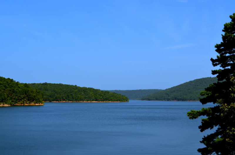
Photo: lake-ouachita.com Video: https://www.youtube.com/watch?v=Qx4h49c3jL8 -
The 8,900-acre Lake Maumelle is a man-made body of water in Pulaski County, central Arkansas, in the United States. It serves as one of Little Rock, Arkansas's main sources of drinking water. The lake was built in the late 1950s; work to dam the Big Maumelle River started in 1956, and water started flowing into the system in 1958. There are trails you can stroll around the lake to get a perspective of it from land, and the 8,900-acre lake has a 70-mile shoreline. Highway 10 has a few of these trailheads.
Central Arkansas's primary source of drinking water is this artificial lake. Although swimming is prohibited in Lake Maumelle, boaters and anglers enjoy the spotless water. On the south and west shores of the lake are the two public boat launches. Among the most often caught fish are bass, crappie, and catfish. Lake Maumelle is one of the best lakes to visit in Arkansas.
Every year, sailing competitions are held at the Grand Maumelle Sailing Club. The Ouachita National Recreational Trail crosses the lake's northern end and provides breathtaking lake vistas. There are many more paths to explore at the nearby Pinnacle Mountain State Park.
Location: Pulaski County, central Arkansas
Video: https://www.youtube.com/watch?v=adYaWRmAAcw 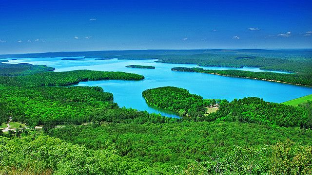
Photo: pinterest.com -
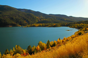
Greers Ferry Lake, an American Army Corps of Engineers dam in Northern Arkansas, creates Greers Ferry Lake as its reservoir. It's about 100 kilometers north of Little Rock.
Numerous upscale neighborhoods were constructed all around the lake during the 1970s and are still being constructed. The public can participate in a variety of activities, including swimming, cliff jumping, boating, fishing, scuba diving, camping, and other water sports that are popular with both locals and visitors. The Little Red River, in the chilly water coming from under the dam, has recently become well-known for rainbow trout and has since become a year-round fishing destination. There are numerous boat docks and ramps that provide direct access to the river. Along the Little Red River, homes and even small neighborhoods have been constructed.
Greers Ferry Lake is located 90 miles from Little Rock and is a popular getaway location for residents. Heber Springs is a fantastic base camp from which to enjoy the lake. A hike up Sugar Loaf Mountain, located east of Heber Springs, offers a breathtaking view of the lake.
Location: Cleburne / Van Buren counties, Arkansas
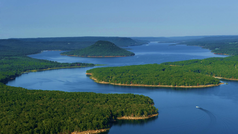
Photo: facbook.com 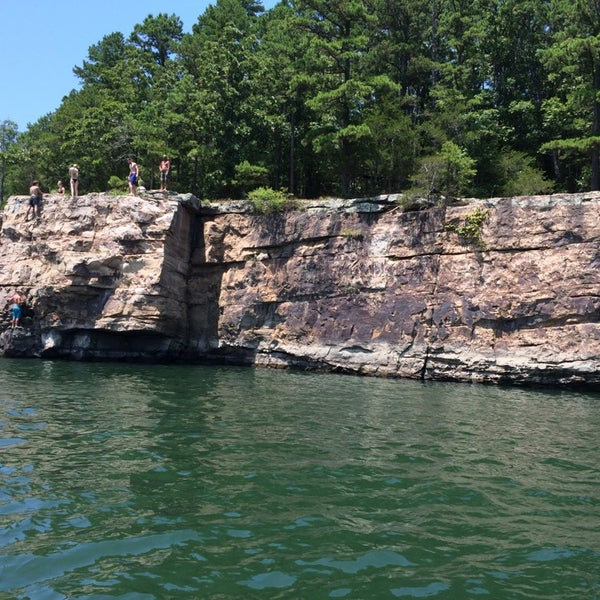
Photo: foursquare.com -
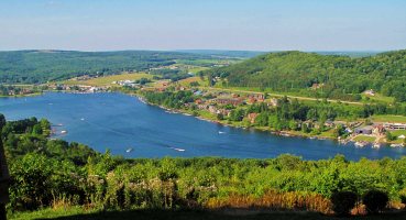
The McClellan-Kerr Arkansas River Navigation System (MKARNS), which enables barge traffic from the Mississippi River to the Tulsa Port of Catoosa in northern Oklahoma, includes Lake Dardanelle, a significant reservoir on the Arkansas River in Arkansas, USA. In 1971, MKARNS' entire length was put into operation.
The nearby Mount Nebo (Arkansas) offers visitors picturesque views of the lake. There are several mountain springs and leisure areas in the Ozark and Ouachita Mountains, which also feature beautiful scenery. There is a wide variety of fauna in the Ouachita and Ozark mountains. This region is frequently used by bald eagles to overwinter. Here, eagle sightings are possible from late fall to early spring.
Known for its breathtaking sunsets and more than 300 miles of shoreline, Lake Dardanelle is a well-liked getaway from Little Rock and Fort Smith. The lake is situated on the I-40 corridor between these two cities as well as the Ozark and Ouachita National Forests. Boating, fishing, and bald eagle watching are all popular pastimes at this reservoir.
On the eastern coast, Lake Dardanelle State Park is close to Russellville. A marina, swimming area, and boat launch are available at the state park. With 57 available campsites, the state park also offers camping amenities. The state park visitor center has freshwater aquariums with fish from the lake and the surrounding area that holds over 7,000 gallons of water.
Location: Arkansas River, Arkansas
Photo: wikipedia 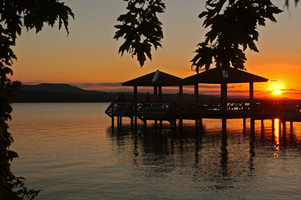
Photo: encyclopediaofarkansas.net -
The United States Army Corps of Engineers built DeGray Lake, a reservoir on the Caddo River in Arkansas, 8 miles (13 km) from Arkadelphia. On the eastern side of the lake, Arkansas Scenic Byway 7 offers accommodations as well as views of the lake. In order to promote tourism and enjoyment on DeGray Lake, DeGray Lake Resort State Park was established in 1974.
The one and only Arkansas State Park Resort are located in DeGray Lake. At the Resort State Park, a lakeside lodge has over 90 rooms, many of which have water views. The Shoreline Restaurant and a day spa that accepts only appointments are other resort facilities.
Fantastic views of the water may be seen on the 18-hole professional golf course in the resort state park. There are multi-use paths in the vicinity for equestrian riders, mountain bikers, and hikers. Tennis, basketball, and swimming are additional sports available to visitors at DeGray Lake State Park Resort.
DeGray Lake's lakeside lodge is not the sole lodging option; the resort state park also offers roomy campsites for tents and RVs. Along the 13,000-acre lake, there are numerous other campgrounds. The lake is particularly well known for the large bass that is frequently plucked from the water.
Location: Clark / Hot Spring counties, Arkansas
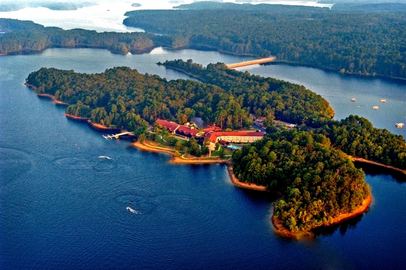
Photo: hotsprings.org 
Photo: commons.wikimedia.org -
An artificial lake or reservoir called Bull Shoals Lake can be found in the Ozark Mountains of northern Arkansas and southern Missouri. One of the best lakes to visit in Arkansas is Bull Shoals Lake. Boating, water sports, swimming, and fishing are popular activities on its hundreds of kilometers of lake arms and coves. Around the coastline, 19 developed parks include marinas, boat launches, swimming places, and camping.
Bull Shoals Lake, also known as "The Caribbean of the Midwest," features pristine water that is ideal for scuba diving. The lake is well-known for fishing and other sports like water skiing because of its translucent quality. Bull Shoals Lake hosts a number of professional fishing competitions each year, and many more prize fish have been caught there.
In northern Arkansas, close to the state line with Missouri, is Bull Shoals Lake. The most active region of the lake is Bull Shoals-White River State Park, which is located close to the Bull Shoals Dam on the southern shore. The state park has a marina along the river and more than 100 campsites. A contemporary visitor center with an exhibition hall and a theater is another amenity of the state park.
Location: Ozark Mountains of northern Arkansas
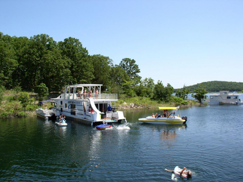
Photo: houseboating.org 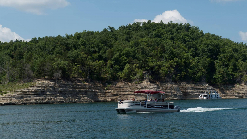
Photo: mississippirivercountry.com -
A reservoir called Lake Greeson is located on the Little Missouri River, about 10 kilometers (six miles) north of the Arkansas city of Murfreesboro. It is bordered by 15 parks that are known for their scenic beauty and recreational options, including camping, fishing, boating, biking, and swimming. Narrows Dam, which gets its name from the "Narrows" neighborhood where it is built, creates the lake. Martin White Greeson, a developer, is honored with the name Lake Greeson. Daisy State Park is also located near the lake.
There is 72 km of public hiking, biking, and wildlife paths at Lake Greeson. There is a nature walk trail at the Parker Creek Recreational Area that allows you to explore the surrounding beauty and wildlife of an ancient Cinnabar Mine. Before the lake was created in 1950, the Cinnabar Mine was a well-liked mine during the 1930s and 1940s. Riders can travel 50 kilometers (31 miles) around the lake on the Bear Creek Cycle Trail. Riders travel through a pine-covered forest and naturally rolling hills on the trail.
The little community of Murfreesboro, which is close to the Crater of Diamonds State Park, is located next to Lake Greeson. There are many leisure areas in the Murfreesboro area. The Kirby Landing Campground in the lake's eastern arms has more than 100 campsites available. In addition, a marina, swimming beach, and boat ramp are available at this recreation facility. The lake is an excellent place to observe bald eagles flying close to the shore during the winter.
Location: Pike County, Arkansas
Photo: mboroarkansas.com 
Photo: pinterest.com