Top 7 Best Mountains In Sri Lanka

There are numerous mountains in Sri Lanka that not only takes away the breath of travelers but also satiate the thirst of adventure amidst the thrill seekers. ... read more...Take a look at this list of top mountains that one should definitely conquer when traveling to the Pearl of the Indian Ocean, Sri Lanka.
-
Pidurutalagala is the island country's lone ultra-prominent summit. This is also one of just 1,515 super conspicuous peaks in the planet. This mountain has a forest reserve in the surrounding area that was severely damaged by a forest fire five years ago. More than three acres of forest land had been lost as a result of the fire. However, with the passage of time and the support of the Sri Lankan people, much of the damage has been restored and is continuing to improve every day. The communications array of the Sri Lankan government and armed forces is based on the mountain summit of Pidurutalagala.
Due to the secrecy of the activities in the area, it is designated as an ultra-high-security zone. In contrast to the lush green surroundings, which include forests with a vast diversity of rare and indigenous plant and animal species, these are Sri Lanka's best mountains. A perfect vista can be seen from the mountain summit, which offers a view of Sri Lanka's gorgeous country.
Location: Nuwara Eliya
Height: 2,524 m (8,281 ft)
pinterest.com 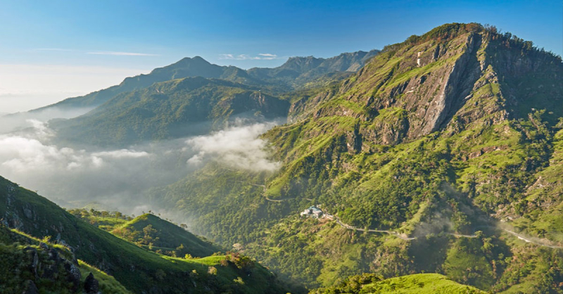
lovidhu.com -
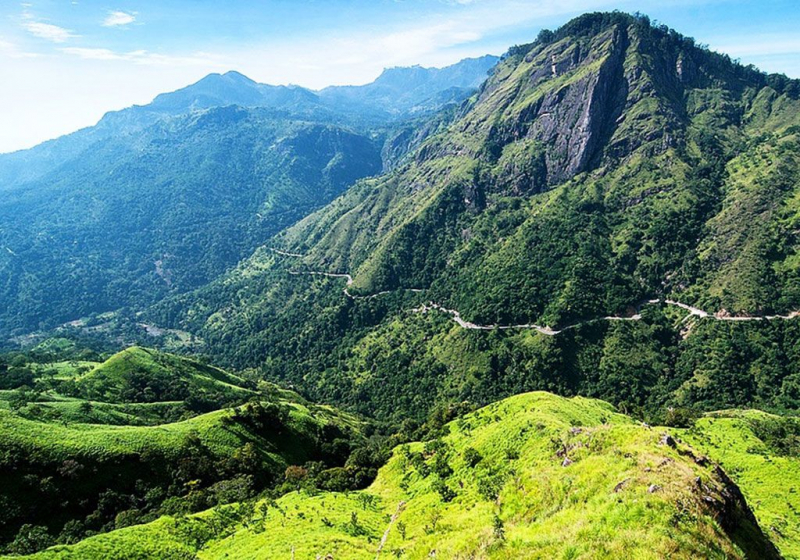
After Pidurutalagala, Kirigalpoththa is Sri Lanka's second tallest mountain. With a peak elevation of 2,388 meters above sea level, it is one of the highest mountains in the world. Kirigalpoththa is the highest peak in the Horton Plains National Park, as well as the highest peak that is accessible to the general public. This 7-kilometer (one-way) journey will take about 5 1/2 hours of trekking, hiking, and mountaineering. Kirigalpoththa should only be attempted by the most daring adventurers, as the terrain and weather can be dangerous. One person in every eight who has reached the peak has never reached the summit.
Through grassy meadows, cloud forest, bog, and eventually sheer rock surfaces, a solitary and slightly overgrown route snakes. The largest wild animals you might see are the Sri Lankan Leopard and Sambur; if you're lucky, you might even see a few endemic bird species.
Location: Sri Lanka
Height: 2.388 m (7.835 ft)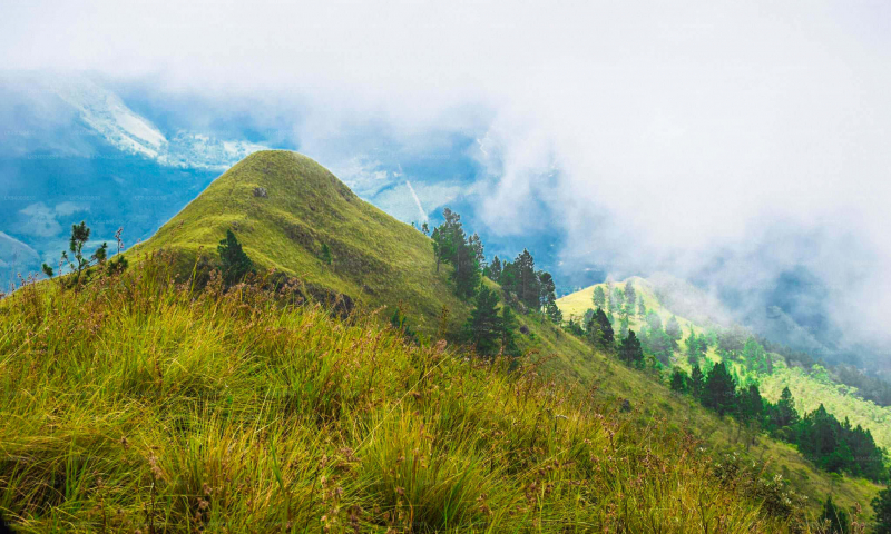
lakpura.com 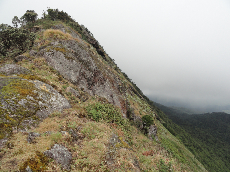
commons.wikimedia.org -
Totapolakanda (also Thotupolakanda or Thotupola Kanda) is Sri Lanka's third tallest peak, rising 2,357 meters (7,733 feet) above sea level in the Nuwara Eliya region. The Horton Plains National Park contains the mountain. A two-kilometer walk to the top of the mountain begins just a few meters from the Horton Plains National Park's Pattipola entrance. The majority of the mountain's surface is covered in bushes that have adapted to Horton Plains National Park's chilly and windy climate. Among these are Strobilanthes, Osbeckia, and Rhodomyrtus species cultivated as bushes.
Totapolakanda is a Sinhala word that means "Landing Site" and refers to a Rama and Ravana narrative. Rama, the King of India, and his lovely wife Sita lived in exile in the woods, according to mythology. Ravana once abducted Rama's wife Sita and fled to Sri Lanka. The plane first landed in Totapolakanda, which means landing spot, on its way to Sri Lanka.
Location: Nuwara Eliya
Height: 2,357m (7,733 feet)
deepintosrilanka.com 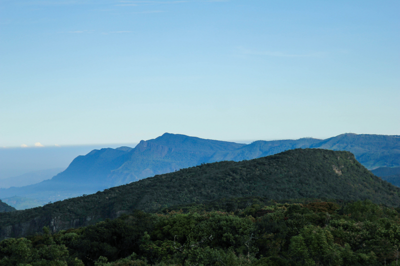
deepintosrilanka.com -
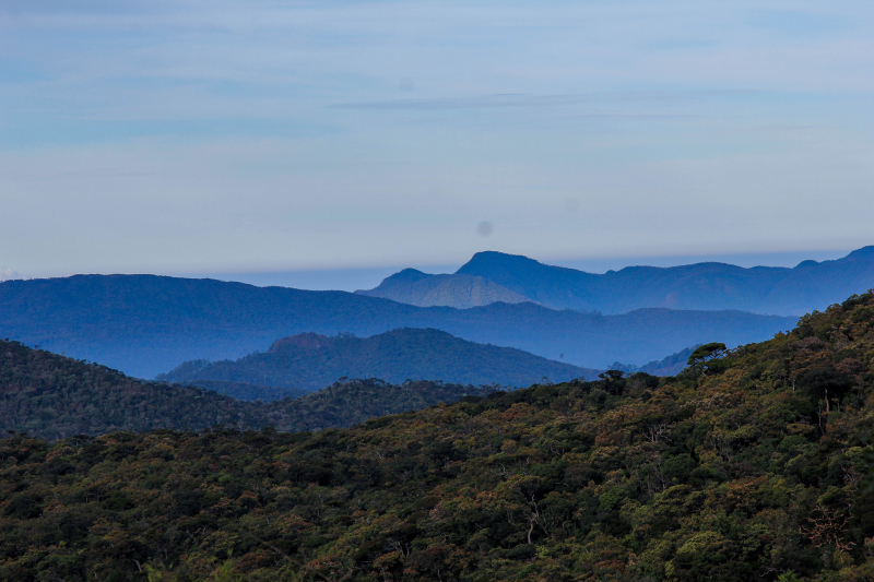
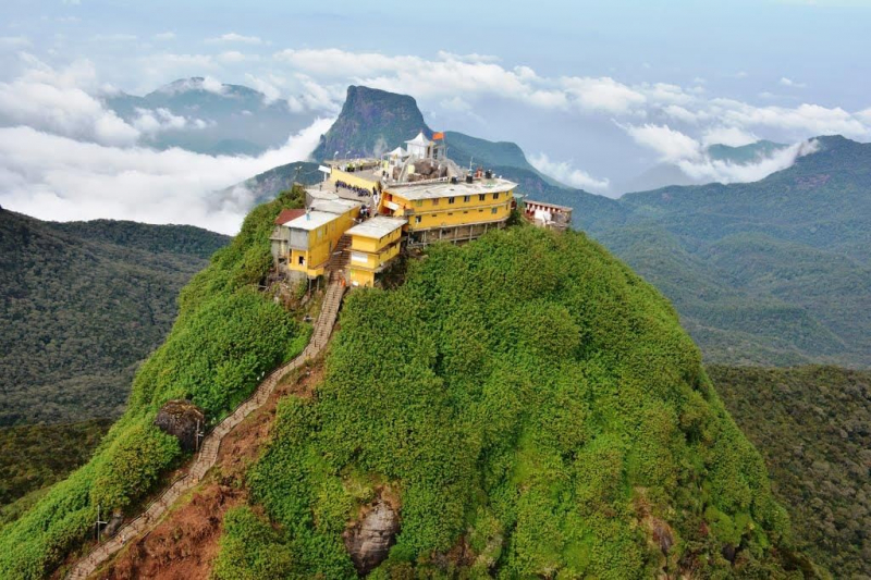
As previously stated, Sri Lanka's Sri Pada is well-known for Buddhist pilgrimage. Sri Pada, also known as the sacred footprint, is a 1.8-meter rock structure near the 2,243-meter peak of Adam's Peak. This mountain is the meeting point of several religions, including Buddhism, which believes it is the footprint of Buddha, and Hinduism, which believes it is the footprint of Lord Shiva. This imprint is regarded as Adam's or Saint Thomas' in Islam and Christianity, respectively. Adam's Peak, one of Sri Lanka's most beautiful mountains, is located on the outskirts of the central massif in the Ratnapura district. Wilderness of the Peak is the name given to the surrounding group of mountains in this area, which is large in comparison to the majority of other mountains.
The mountain is located in the southern portions of the Central Highlands, in the Sabaragamuwa Province and Central Province, in the Ratnapura District and Nuwara Eliya District, around 40 kilometers (25 miles) northeast of Ratnapura and 32 kilometers (20 miles) southwest of Hatton. There are no mountains of equal scale in the immediate vicinity, hence the surrounding area is mostly forested hills. The area around the mountain is a wildlife reserve, home to a diverse range of animals, from elephants to leopards, as well as a number of rare species. As a watershed, Adam's Peak is significant. The districts to the south and east of Adam's Peak produce precious stones such as emeralds, rubies, and sapphires, which have made the island famous and earned it the name Ratnadvipa.
Location: Sri Lanka
Height: 2,243 m (7,359 ft)
pinterest.com 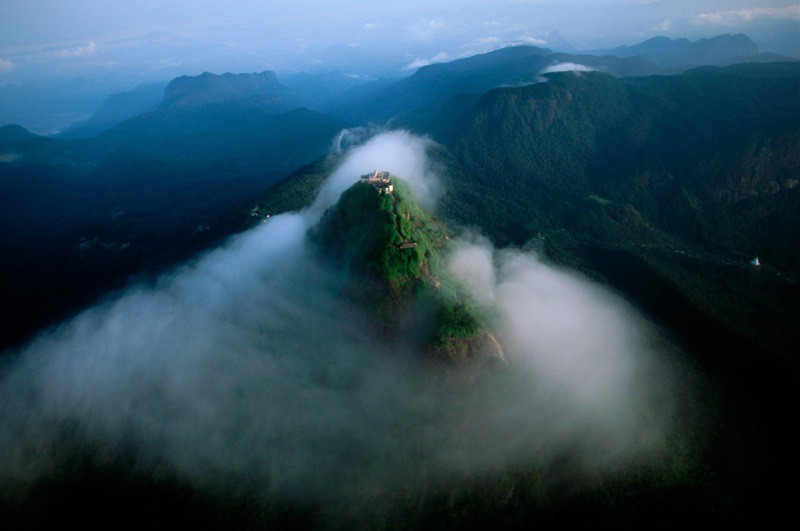
kienthuc.net.vn -
With a height of 2,212 meters, Great Western Peak is the 5th tallest mountain in Sri Lanka, located in Nuwara-Eliya, Central Province. The Great Western Mountain is a beautiful paradise hidden behind one of the hill country's most beautiful railway stations. When passing through Peradeniya-Badulla highway from Nuwara-Eliya, take the first exit into Badulla Road. Then turn left at the Pundalu Oya junction and go another 2.4 kilometers to the mountain destination. The most convenient option is to take a train to Great Western station, where the mountain hiking path is only 5 kilometers away. The mountain is about a kilometer long and can be climbed from both ends.
Hiking on Great Western Mountain is regarded as a difficult endeavor; as a result, you should exercise extreme caution while determining whether to ascend. Typically, the walking routes are slick and muddy, which you must climb with the help of branches or other people, and on a rainy day, you may find it more difficult to walk, and on a foggy day, you will be unable to see anything. The Great Western mountain features a high incline and a shady trail. While rising, you'll come upon a 70-year-old tiny Hindu Kovil, which is thought to have been built by a hiker who got lost and was helped by Paththini Amma Goddess to find his way out. With its diverse biota, the mountain is environmentally beneficial. Hiking in Great Western Mountain requires being prepared with the basic essentials and obtaining a guide.
Location: Nuwara-Eliya, Central Province
Height: 2,212 m
http://larryprescott.blogspot.com/ 
http://larryprescott.blogspot.com/ -
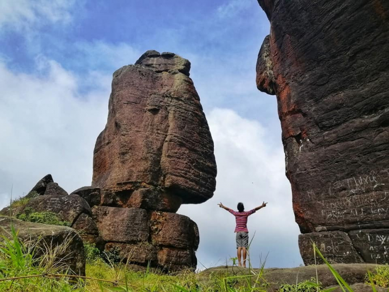
An odd-shaped peak, 1438m high, on the northwest ridge is known as Rassagala, and has various titles due to its peculiar shape. Locals name it Kinihira, Paththini Amma Kanda, and Wangedi Molgas Gala because it resembles the enormous mortar and pestle used in Sri Lankan kitchens from certain perspectives. This hard caprock top appears from afar to be an ancient castle intended to control its surrounds, which is why the mountain is known as Rakshagala, or "Rock of the Rakshasas."
It is said to have been been a stronghold of Ravana, the island's mythological Raksha king who kidnapped Rama's wife Sita and first hid her at Rakshagala in the Ramayana epic, and that a bed of gold still lies concealed someplace on the mountain. Raksha Gala's flat top, on the other hand, has its own forest, floating like an isolated green island shut off from the rest of the earth by vertical cliffs, like a lost world. Choose a dry day for this effort because the jungle is swarming with leeches during the rainy season. If you make it to the top of the lost planet, Sita's golden bed and a lengthy afternoon snooze may be waiting for you.
Location: Eastern Province, Sri Lanka
Height: 1438m
facebook.com 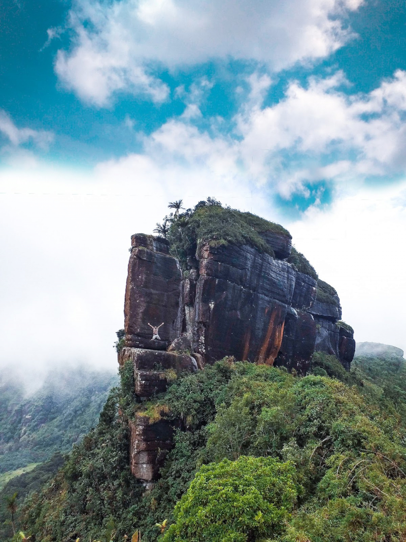
facebook.com -
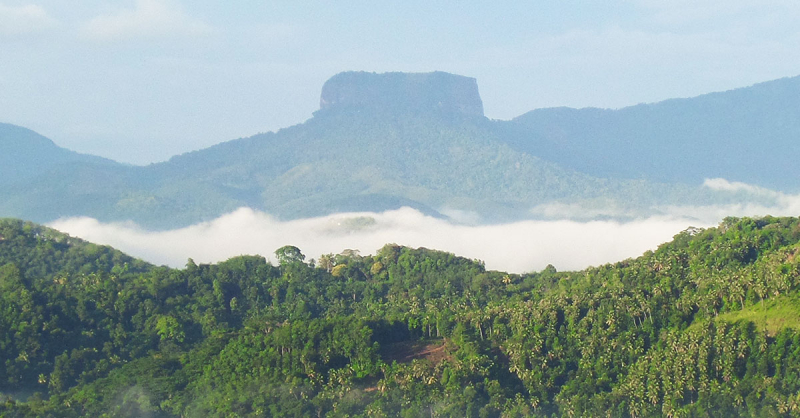
The Bible Rock, also known as "Bathalegala," is a rock formation that is quite similar to the world-famous castle of Sigiriya. It is located in the district of Kandy, close to Aranayake, with a height of 797.7m and a breath of 710m. The Sinhala name for it is Bathalegala, and the name Bible Rock comes from the fact that the terrain's surface resembles that of a book. It has a flat surface that resembles the more well-known Sigiriya citadel to the north. When traveling through Kadugannawa on the Kandy road, you can notice it beautiful and lofty.
When viewed from the Kandy road, this rock resembles a book and is thus named after the British. According to legend, when the Kandyan Kingdom was threatened by the Portuguese, residents stationed men on the highest hills around Kandy to keep an eye out for trespassers. Bathalegala was one of these lookout points, offering a panoramic view over the Kadugannawa pass and the Kegalle valley. Furthermore, the villagers claim that this majestic rock is located just below the earth's magnetic field line, making it dangerously vulnerable to lightning strikes, which can occur in the dozens each day! During the rainy season, it is highly recommended that you avoid hiking.
Location: district of Kandy, close to Aranayake
Height: 797.7m
lovidhu.com